
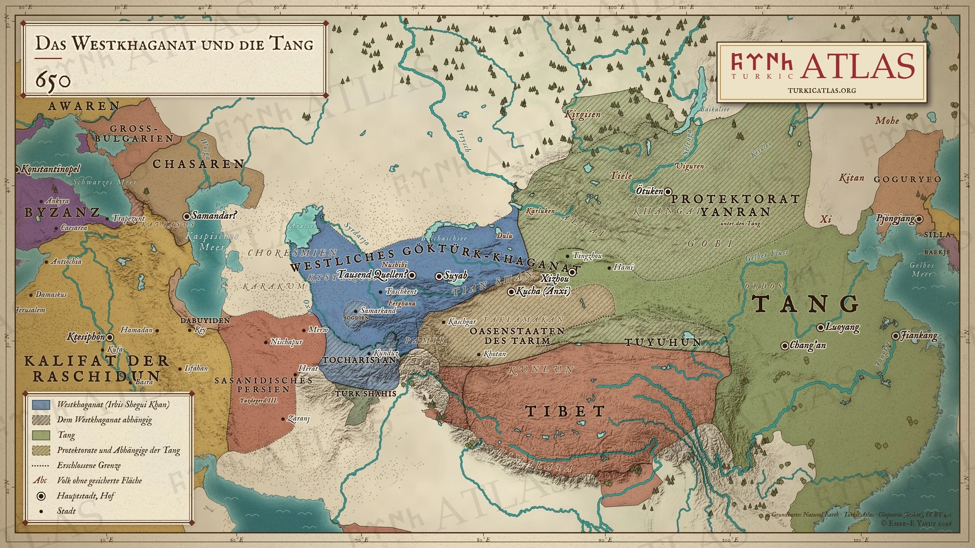
Wer regierte
Und jenseits der Steppe
- China Tang Gaozong 649–683
- Iran Sasanian Yazdegerd III 632–651 · Rashidun Uthman 644–656
- Korea Goguryeo Bojang 642–668
- Byzanz Heraclian Constans II 641–668
Östliche Steppe
-
Umwelt · Spätantike Kleine Eiszeit: die Kältephase, die die Baumringe des Altai von 536 bis etwa 660 bestimmen (536–660)
Climate and the steppe empires · First Göktürk Khaganate · Avars
Das kälteste Jahrzehnt im Altai sind die 540er Jahre
-
Umwelt · Der Telmen-See steht 4,8 Meter über seinem heutigen Spiegel, eine feuchte Phase vor der folgenden Austrocknung (600–700)
China
-
Wirtschaft · Die Reiterei der Tang wächst von fünftausend Pferden auf mehr als siebenhunderttausend, geliefert von den Göktürken (618–650)
Kaukasus und Krim
-
Die Chasaren treten nach den Göktürken an die Spitze der westlichen Steppe; bis in die 670er Jahre haben sie die Bulgaren geschlagen

