
- 400
- 500
- 600
- 700
- 800
- 900
- Rouran 400–554
- First Göktürk 552–630
- Tang rule 630–682
- Second Göktürk 682–744
- Uyghur 744–840
- Kirghiz 840–924
- Huns 370–469
- Western Göktürk 552–659
- Türgesh 699–766
- Karluk 766–800
- Khazar 650–969
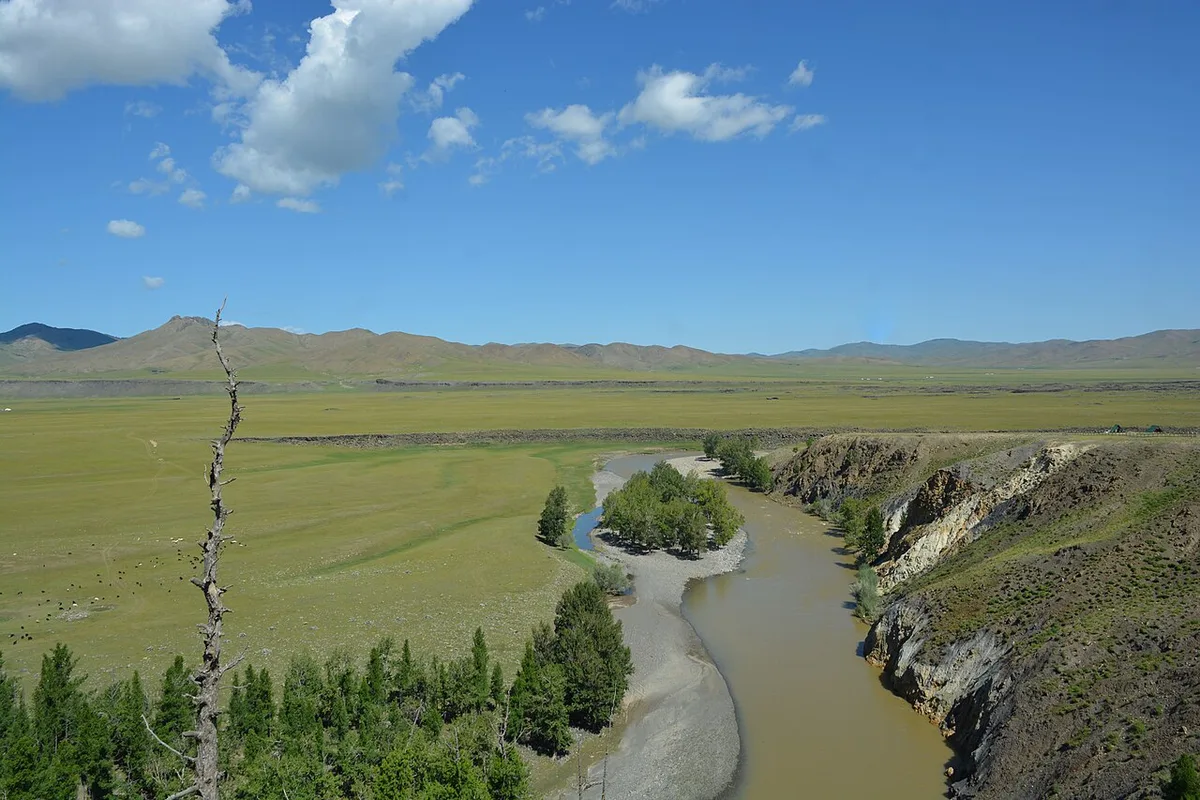
The Orkhon runs north for over a thousand kilometres through central Mongolia. Its upper valley is the region the Göktürks called Ötüken. The Xiongnu, the Rouran, the Göktürks, the Uyghurs and the Mongols each kept their seat there. The Kül Tegin and Bilge Khan monuments stand in the valley. The Uyghur and Mongol capitals were built in it.
The river is 1,124 kilometres long. Its valley has waterfalls and volcanic plateaus.
The lake of Telmen, west of the Khangai, records the valley’s climate at one remove. The record shows a humid climate from 1200 BC to about 700 AD and a drier one from 700 to 1300, with a high stand of the lake between 600 and 700. The climate article gives the record and its interpretations.
Advantages of the valley
The valley is not the largest grazing country in Mongolia, and it is not the most defensible. What it has is the combination that a steppe capital needs. It has reliable water from a large river. Winter and summer pasture lie within a short move of each other. The valley also sits at the centre of the routes that cross the eastern steppe. Every empire that held the eastern steppe held this valley, and none of them held the steppe without it.
The inscriptions state the same fact as a political argument about Ötüken. The Kül Tegin monument tells its audience that the place to sit is the Ötüken forest. It says that a people who leave it come to grief. This is the one piece of explicit territorial doctrine anywhere in the runiform corpus.[1]
Monuments
The valley holds the densest concentration of written monuments in the steppe world. The Kül Tegin and Bilge Khan stelae stand there, at Khöshöö Tsaidam, cut in 732 and 735 for the two men who restored and held the Second Göktürk Khaganate.[2] A century later the Uyghurs set their own capital in the same valley. They also set their own stele in it, the trilingual Karabalghasun inscription. Its Chinese, Sogdian and Old Turkic faces record the conversion of the khan to Manichaeism.[3]
The Uyghur city was the first walled capital in the valley. Bayanchur Khan’s own inscription at Šine-Usu says he built it and the palace in it.[4] The two Göktürk khaganates had ruled the same ground from camps.
The end of the sequence
In 840 the Kirghiz came down from the north. They killed the Uyghur khan and burnt the court. The valley ceased for four centuries to be the seat of an empire.[5] The city was already a ruin when the stele in it was found again in 1889.[3]
The monuments today
The monuments of Kül Tegin, Bilge Khan and Tonyukuk were placed under state protection in 1971 and fenced with iron.[6] A joint project of Mongolia and Turkey for their conservation and restoration received official support in 1996.[6] Work began in April 1997.[6] A Japanese restoration firm was commissioned that year to strengthen the Kül Tegin monument.[6] The monuments have had guards since 1998.[7] Grazing animals, herders, wind and frost have damaged them.[7]
References
- ^ Kül Tegin inscription
- ^ Kül Tegin inscription; Tekin 1968, p. 10
- ^ a b Karabalghasun inscription
- ^ Šine-Usu inscription
- ^ Jiu Tangshu (Old Book of Tang), juan 195
- ^ a b c d Oyunbileg 2000, p. 288
- ^ a b Oyunbileg 2000, p. 288–289
Sources
- Kül Tegin inscription
- Karabalghasun inscription
- Šine-Usu inscription
- Jiu Tangshu (Old Book of Tang), juan 195
Literature
- Emre-E. Yavuz, The Gokturk Empire: 2nd Edition (2025)
- Julian Struck; Marcel Bliedtner; Paul Strobel; William Taylor et al., Central Mongolian lake sediments reveal new insights on climate change and equestrian empires in the Eastern Steppes (2022)
- Colin Mackerras, The Uighur Empire According to the T'ang Dynastic Histories (1972)
- Peter B. Golden, An Introduction to the History of the Turkic Peoples (1992)
- Talât Tekin, A Grammar of Orkhon Turkic (1968)
- Z. Oyunbileg, Orhun Vadisindeki Tarihî ve Kültürel Anıtların Şu Anki Durumu ve Gerçek Sorunları (2000)
What links here18
- Persons
- Abaoji · Külüg Bagha
- Conflicts
- Uyghur–Kirghiz War
- Battles & Events
- Abaoji's campaign to the Orkhon (924) · Huaixin's campaign against the Kirghiz · The fall of Ordu-Balık, 840
- Places
- Khöshöö Tsaidam · Minusinsk Basin · Ordu-Balık · Ötüken · Tola
- Institutions and Titles
- Chinese Craftsmen at the Orkhon Monuments
- Religions
- Sacred Mountains · Stone Figures
Cite this article
Yavuz, Emre-E. “Orkhon valley.” Turkic Atlas, revised 8 November 2026. https://turkicatlas.org/places/orkhon-valley/
Last revised: 8 November 2026


