
Who ruled
And beyond the steppe
- China Tang Taizong 626–649
- Iran Sasanian Yazdegerd III 632–651 · Rashidun Uthman 644–656
- Korea Goguryeo Bojang 642–668
- Byzantium Heraclian Constans II 641–668
Eastern steppe
-
Environment · Late Antique Little Ice Age: the cold phase the Altai tree rings define from 536 to about 660 (536–660)
Climate and the steppe empires · First Göktürk Khaganate · Avars
The coldest decade in the Altai is the 540s
-
Environment · Lake Telmen stands 4.8 metres above its present level, a humid phase before the drying that follows (600–700)
Tarim and Sogdiana
-
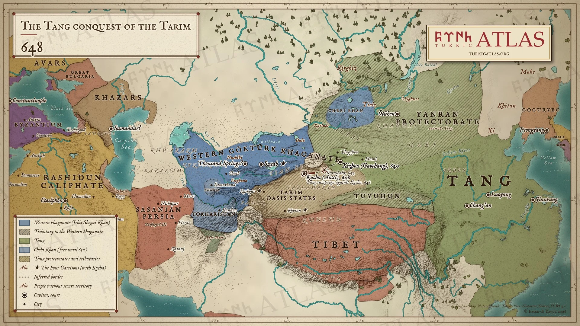
Ashina Helu, driven from his yabgu's command on the Duoluosi, submits to the Tang with several thousand tents and guides the campaign against Kucha
Ashina Helu · Tarim Basin · Tang
The Xin Tang Shu ties the submission to the Kucha campaign, which the Tang annals date to 648
China
-
Economy · The Tang cavalry grows from five thousand horses to more than seven hundred thousand, supplied by the Göktürks (618–650)
-
second month · Shiboqu Azhan, the chief of the Kirghiz, comes in person to Taizong's court and is made governor of the Jiankun command under the Yanran protectorate
Kirghiz embassy of 648 · Yenisei Kirghiz · Shiboqu Azhan
Also dated 647 (the Tongdian): the Tongdian puts the coming of the chief in the twenty-first year of Zhenguan.
The first contact of the Kirghiz with the Tang court, in the twenty-second year of Zhenguan

