
Atlas · Plate VII
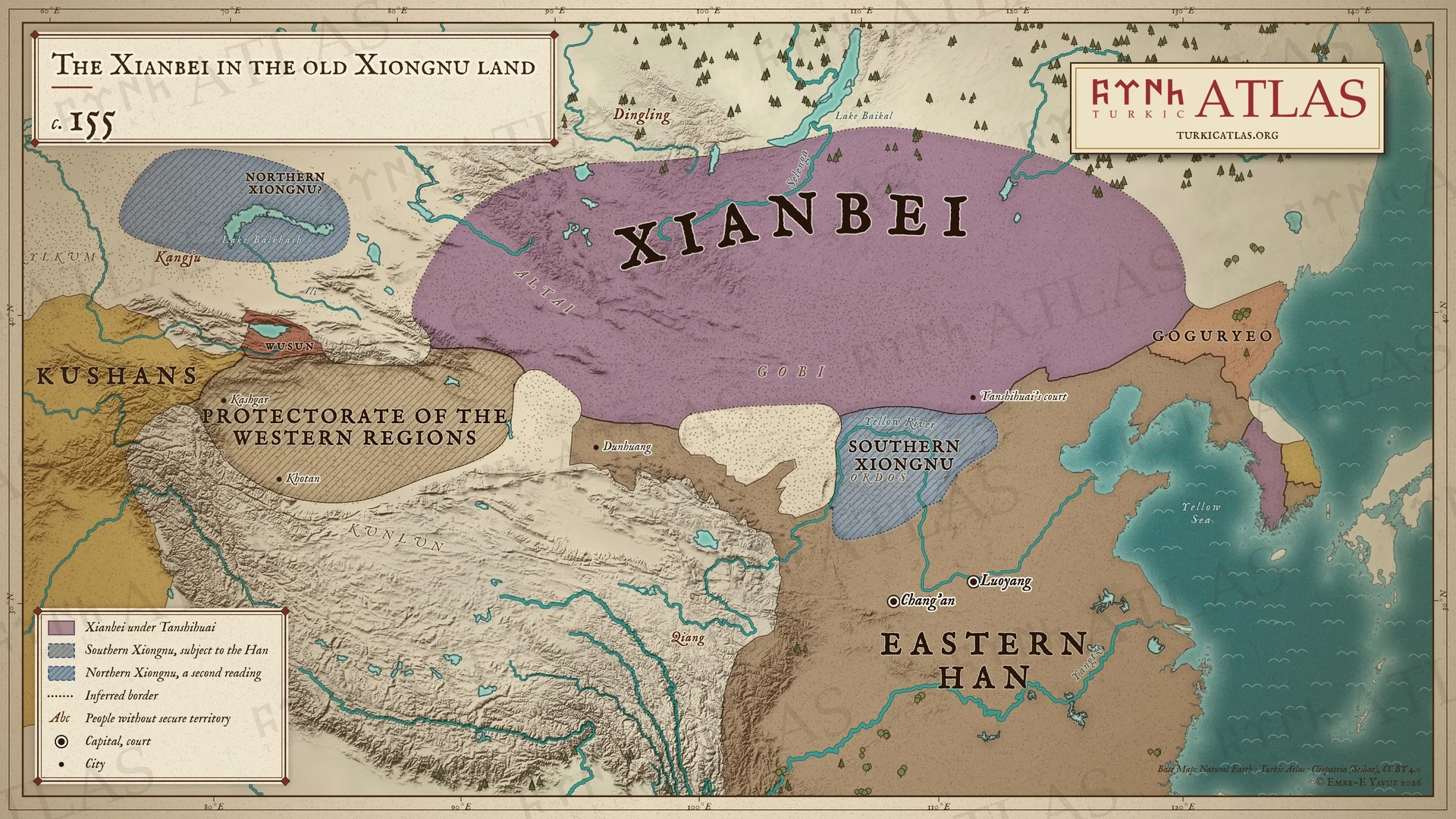
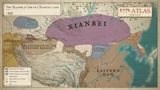
The Xianbei in the old Xiongnu land
c. 155
 © Emre-E Yavuz 2026
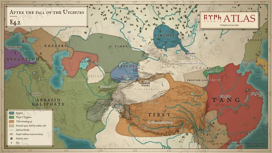
c. 155: Under Tanshihuai the Xianbei hold the old land of the Xiongnu in the Mongolian steppe. The Southern Xiongnu live inside the Han frontier, and the Han govern the oases of the west through the protectorate of the Western Regions. A second reading places Northern Xiongnu north-west of Kangju. Modern map; the borders in the steppe are approximate.
The arrow keys turn the plates.
Articles with this map
Years
Plate VII · The Xianbei in the old Xiongnu land c. 155
Drag to move. Wheel, two fingers or a double click to zoom.
-
 I
-
 II
-
 III
-
 IV
-
 V
-
 VI
-
 VII
-
 VIII
-
 IX
-
 X
-
 XI
-
 XII
-
 XIII
-
 XIV
-
 XV
-
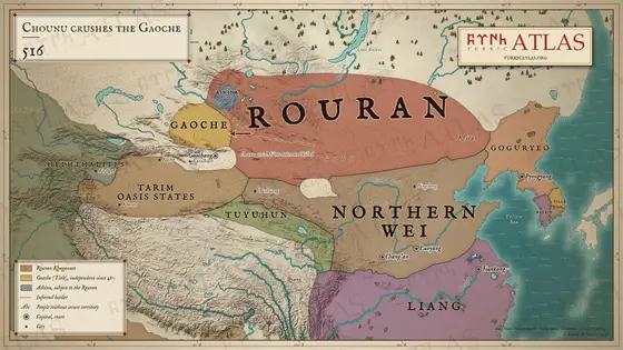 XVI
-
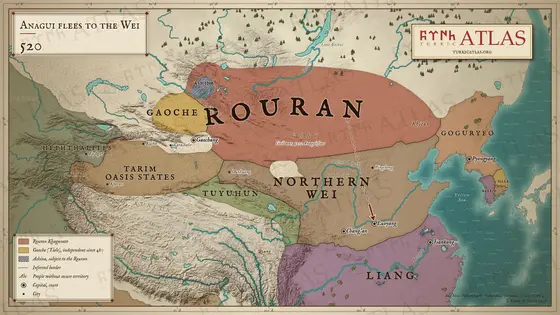 XVII
-
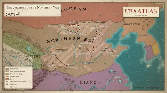 XVIII
-
 XIX
-
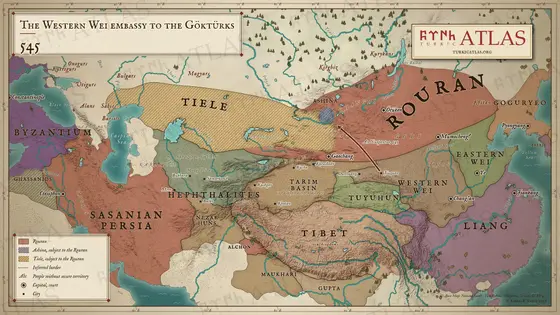 XX
-
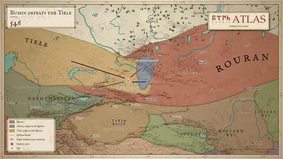 XXI
-
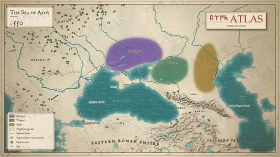 XXII
-
 XXIII
-
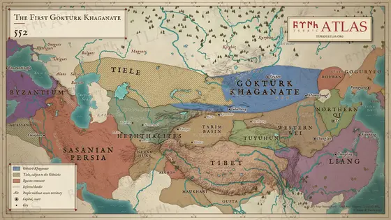 XXIV
-
 XXV
-
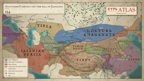 XXVI
-
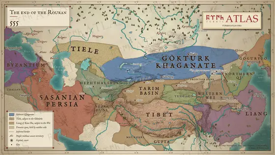 XXVII
-
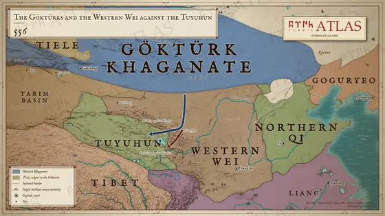 XXVIII
-
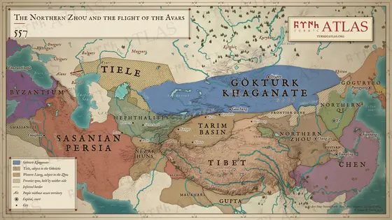 XXIX
-
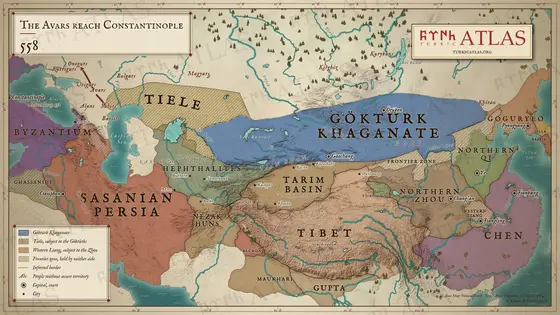 XXX
-
 XXXI
-
 XXXII
-
 XXXIII
-
 XXXIV
-
 XXXV
-
 XXXVI
-
 XXXVII
-
 XXXVIII
-
 XXXIX
-
 XL
-
 XLI
-
 XLII
-
 XLIII
-
 XLIV
-
 XLV
-
 XLVI
-
 XLVII
-
 XLVIII
-
 XLIX
-
 L
-
 LI
-
 LII
-
 LIII
-
 LIV
-
 LV
-
 LVI
-
 LVII
-
 LVIII
-
 LIX
-
 LX
-
 LXI
-
 LXII
-
 LXIII
-
 LXIV
-
 LXV
-
 LXVI
-
 LXVII
-
 LXVIII

