
Atlas · Plate III
The Xiongnu at their height
176–174 BC
 © Emre-E Yavuz 2026
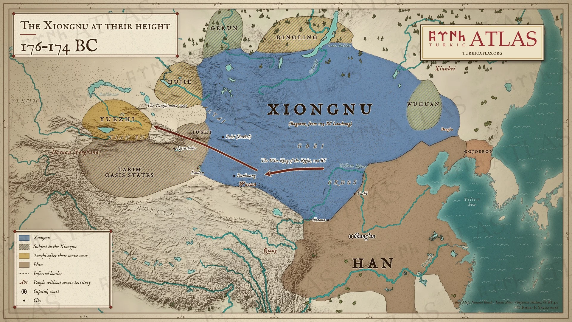
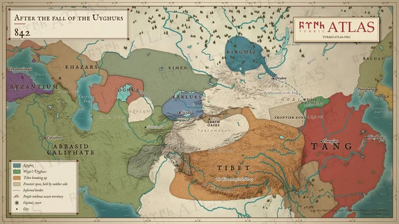
176–174 BC: In a letter of 176 BC Bagatur (Modu Chanyu) tells the Han court that the Wise King of the Right has destroyed the Yuezhi, and that Loulan, the Wusun, the Hujie and twenty-six states around them have all become Xiongnu. The Yuezhi move west to the Ili. In 174 BC Bagatur dies and his son Laoshang succeeds him. Modern map; no source describes the northern edge of the realm, and the borders in the steppe are approximate.
The arrow keys turn the plates.
Articles with this map
Years
Plate III · The Xiongnu at their height 176–174 BC
Drag to move. Wheel, two fingers or a double click to zoom.
-
 I
-
 II
-
 III
-
 IV
-
 V
-
 VI
-
 VII
-
 VIII
-
 IX
-
 X
-
 XI
-
 XII
-
 XIII
-
 XIV
-
 XV
-
 XVI
-
 XVII
-
 XVIII
-
 XIX
-
 XX
-
 XXI
-
 XXII
-
 XXIII
-
 XXIV
-
 XXV
-
 XXVI
-
 XXVII
-
 XXVIII
-
 XXIX
-
 XXX
-
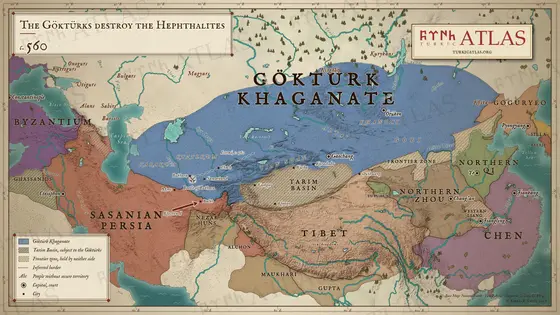 XXXI
-
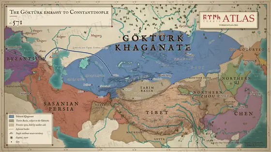 XXXII
-
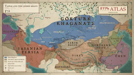 XXXIII
-
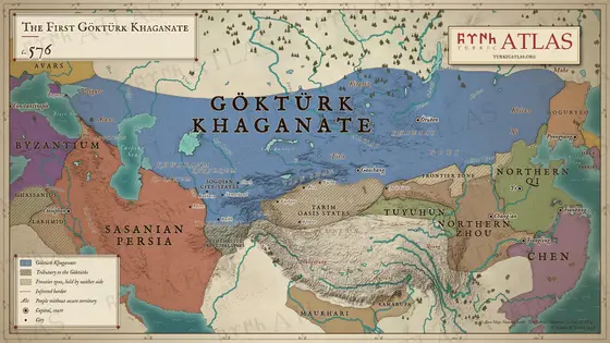 XXXIV
-
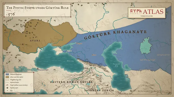 XXXV
-
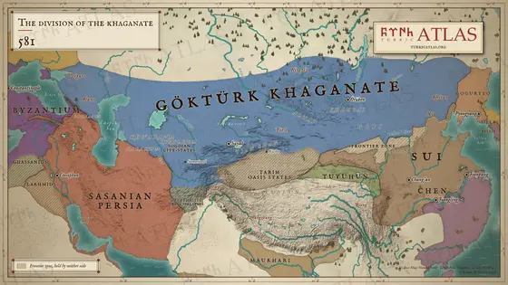 XXXVI
-
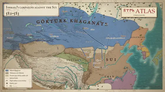 XXXVII
-
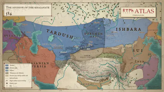 XXXVIII
-
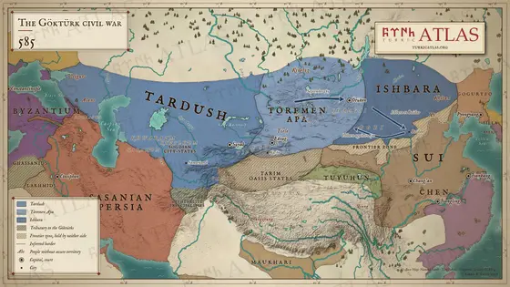 XXXIX
-
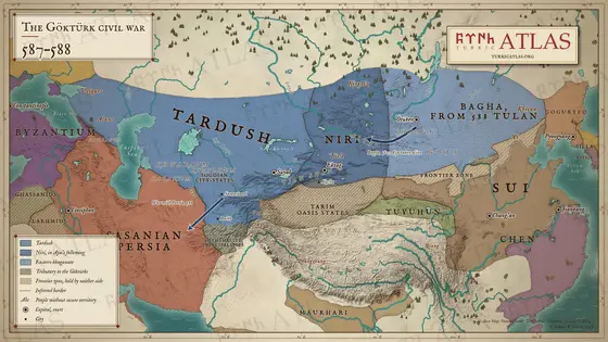 XL
-
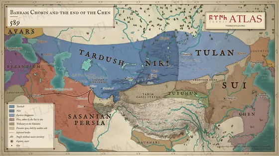 XLI
-
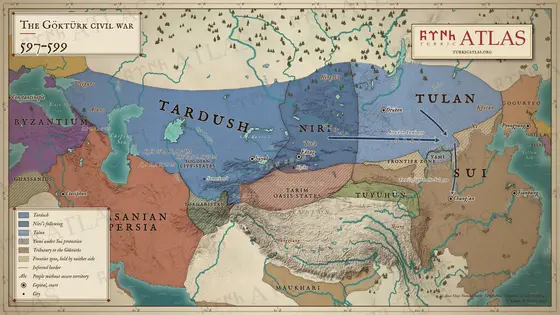 XLII
-
 XLIII
-
 XLIV
-
 XLV
-
 XLVI
-
 XLVII
-
 XLVIII
-
 XLIX
-
 L
-
 LI
-
 LII
-
 LIII
-
 LIV
-
 LV
-
 LVI
-
 LVII
-
 LVIII
-
 LIX
-
 LX
-
 LXI
-
 LXII
-
 LXIII
-
 LXIV
-
 LXV
-
 LXVI
-
 LXVII
-
 LXVIII

