
Atlas · Plate V
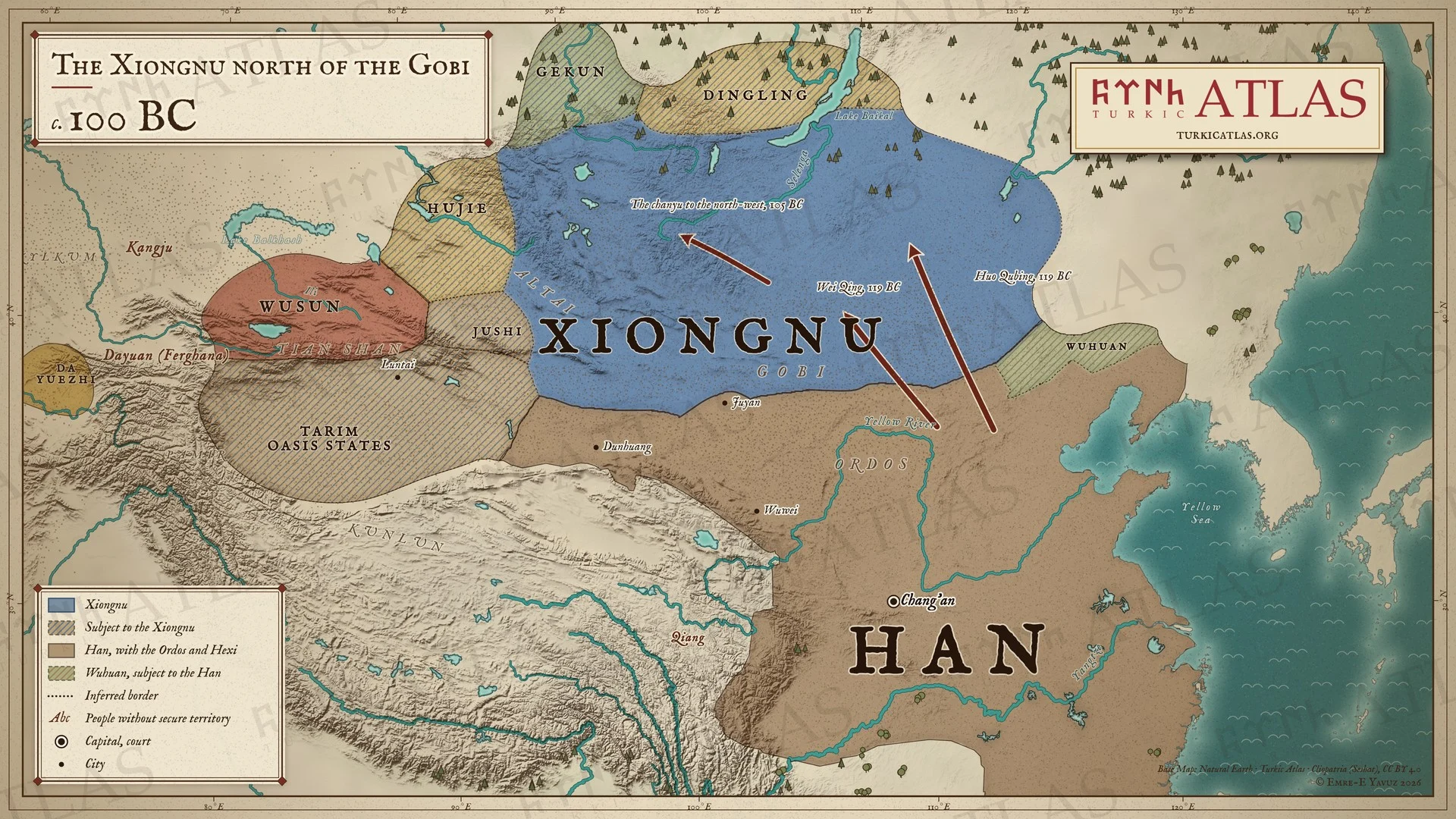
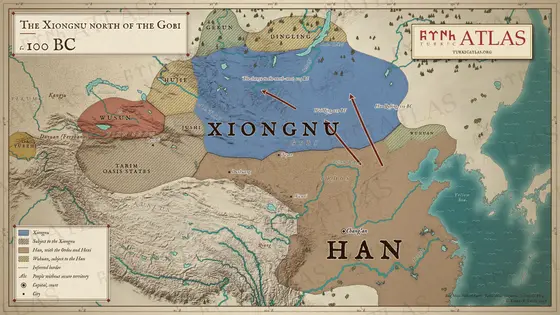
The Xiongnu north of the Gobi
c. 100 BC
 © Emre-E Yavuz 2026
c. 100 BC: After the campaigns of Wei Qing and Huo Qubing in 119 BC there is no royal court of the Xiongnu south of the Gobi. The Han hold the Ordos and the Hexi corridor from Wuwei to Dunhuang, and the Wuhuan watch the Xiongnu for them; by 105 BC the chanyu has moved further north-west. The oasis states of the Tarim and the peoples of the north are still subject to the Xiongnu. Modern map; the roads are drawn, and the borders in the steppe are approximate.
The arrow keys turn the plates.
Articles with this map
Years
Plate V · The Xiongnu north of the Gobi c. 100 BC
Drag to move. Wheel, two fingers or a double click to zoom.
-
 I
-
 II
-
 III
-
 IV
-
 V
-
 VI
-
 VII
-
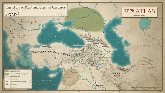 VIII
-
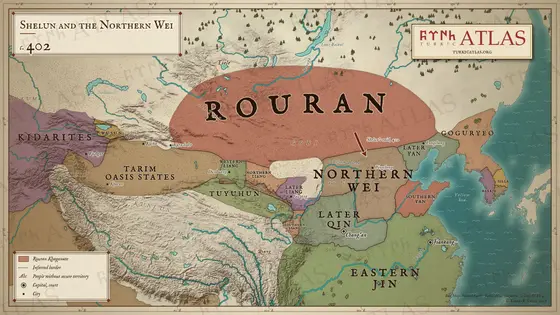 IX
-
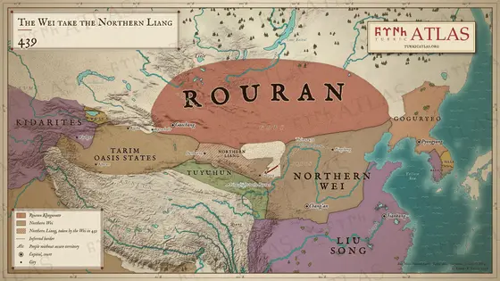 X
-
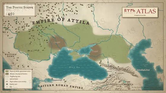 XI
-
 XII
-
 XIII
-
 XIV
-
 XV
-
 XVI
-
 XVII
-
 XVIII
-
 XIX
-
 XX
-
 XXI
-
 XXII
-
 XXIII
-
 XXIV
-
 XXV
-
 XXVI
-
 XXVII
-
 XXVIII
-
 XXIX
-
 XXX
-
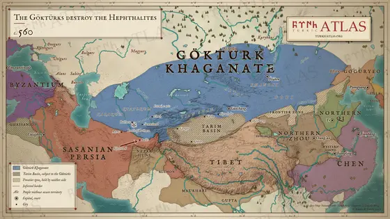 XXXI
-
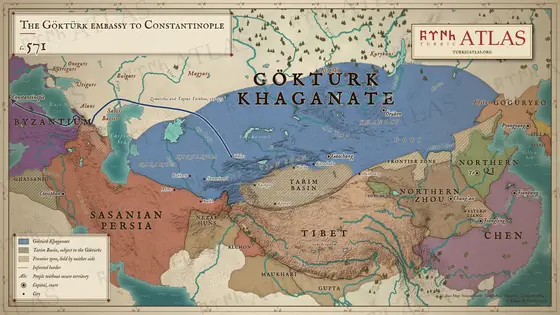 XXXII
-
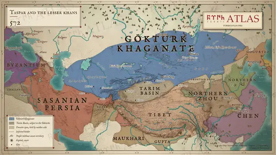 XXXIII
-
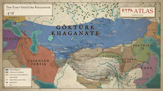 XXXIV
-
 XXXV
-
 XXXVI
-
 XXXVII
-
 XXXVIII
-
 XXXIX
-
 XL
-
 XLI
-
 XLII
-
 XLIII
-
 XLIV
-
 XLV
-
 XLVI
-
 XLVII
-
 XLVIII
-
 XLIX
-
 L
-
 LI
-
 LII
-
 LIII
-
 LIV
-
 LV
-
 LVI
-
 LVII
-
 LVIII
-
 LIX
-
 LX
-
 LXI
-
 LXII
-
 LXIII
-
 LXIV
-
 LXV
-
 LXVI
-
 LXVII
-
 LXVIII

