
Atlas · Plate L
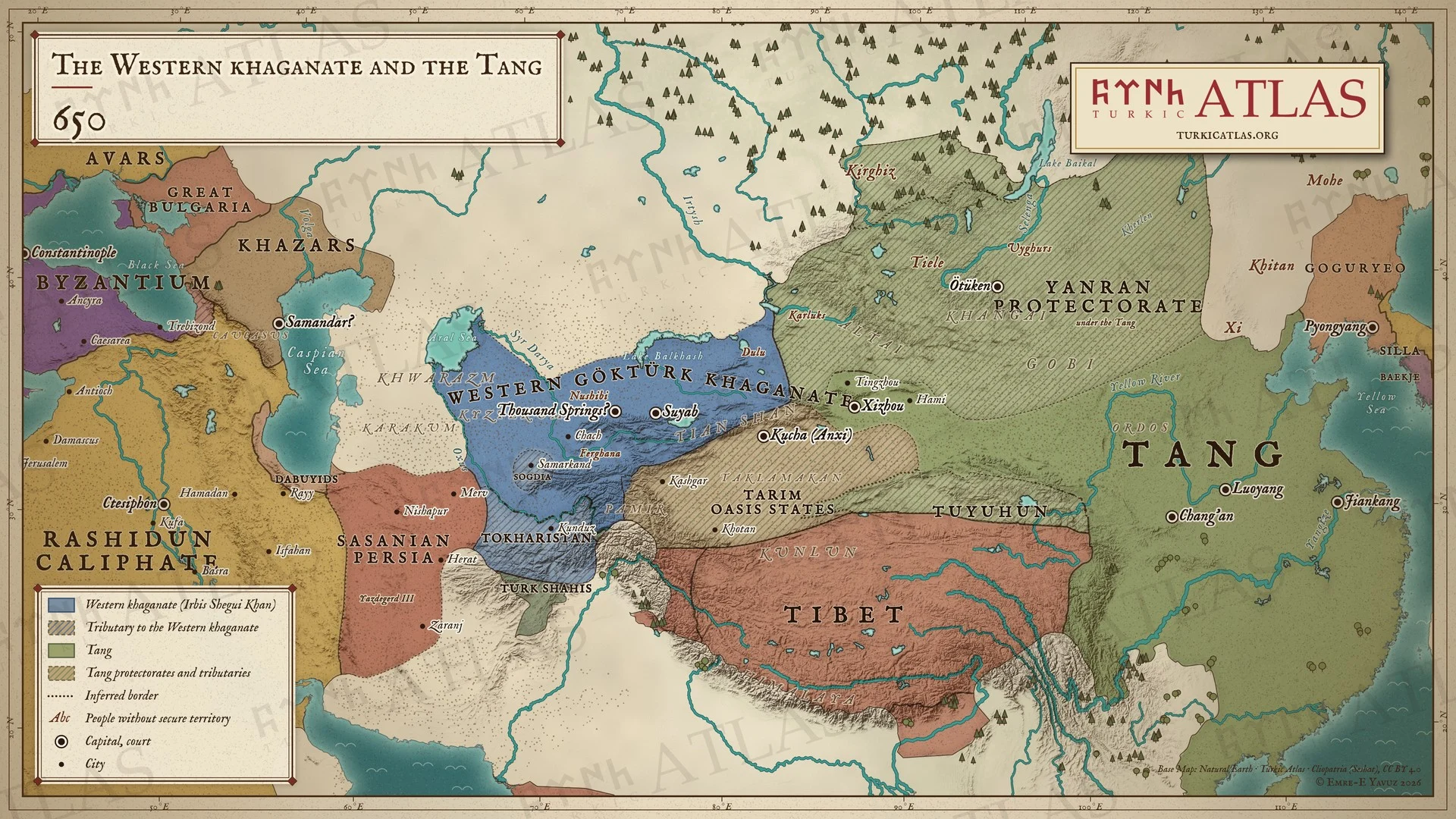
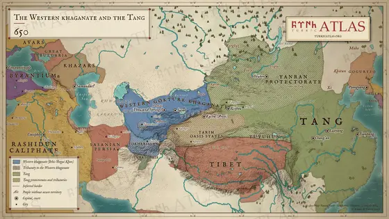
The Western khaganate and the Tang
650
 © Emre-E Yavuz 2026
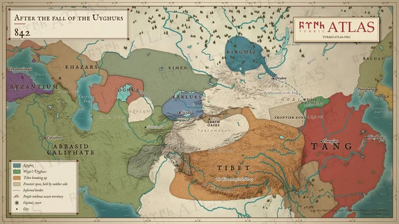
Asia in 650: the Western Göktürk Khaganate under Irbis Shegui Khan reaches from the Tarbagatai to the Oxus, with Sogdia and Tokharistan as dependants. In the east the Tang rule the steppe through the protectorate of Yanran; the Kirghiz and the oasis states of the Tarim pay them tribute, and Anxi sits at Kucha. In the west the Caliphate has taken Iraq and western Iran, and Yazdegerd III holds only Khorasan and Sistan. Modern map; the edges of the khaganate and the protectorates are approximate.
The arrow keys turn the plates.
Articles with this map
Years
Plate L · The Western khaganate and the Tang 650
Drag to move. Wheel, two fingers or a double click to zoom.
-
 I
-
 II
-
 III
-
 IV
-
 V
-
 VI
-
 VII
-
 VIII
-
 IX
-
 X
-
 XI
-
 XII
-
 XIII
-
 XIV
-
 XV
-
 XVI
-
 XVII
-
 XVIII
-
 XIX
-
 XX
-
 XXI
-
 XXII
-
 XXIII
-
 XXIV
-
 XXV
-
 XXVI
-
 XXVII
-
 XXVIII
-
 XXIX
-
 XXX
-
 XXXI
-
 XXXII
-
 XXXIII
-
 XXXIV
-
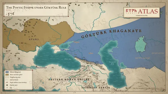 XXXV
-
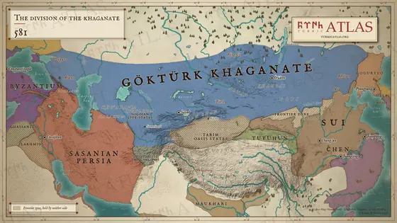 XXXVI
-
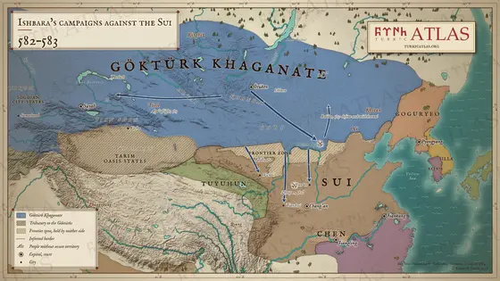 XXXVII
-
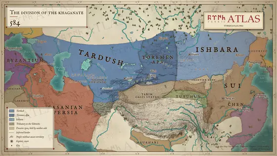 XXXVIII
-
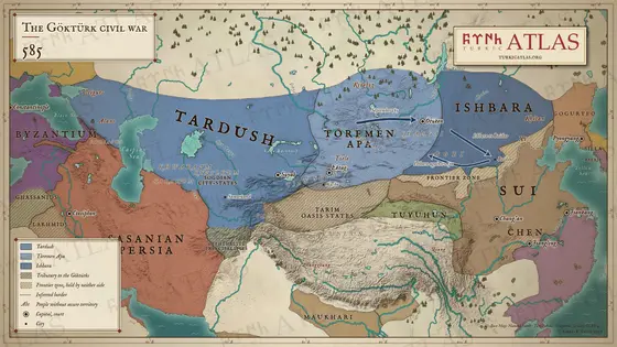 XXXIX
-
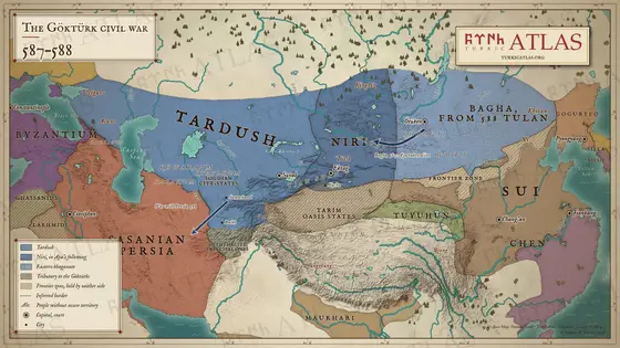 XL
-
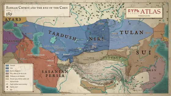 XLI
-
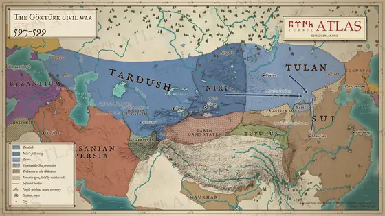 XLII
-
 XLIII
-
 XLIV
-
 XLV
-
 XLVI
-
 XLVII
-
 XLVIII
-
 XLIX
-
 L
-
 LI
-
 LII
-
 LIII
-
 LIV
-
 LV
-
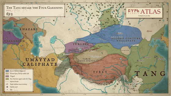 LVI
-
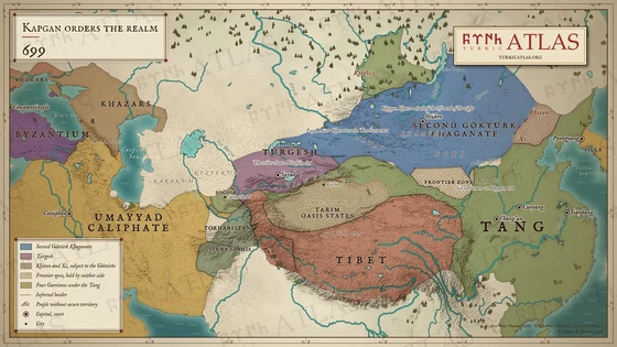 LVII
-
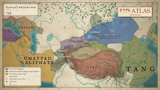 LVIII
-
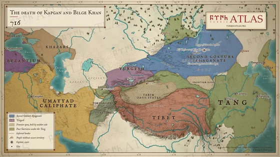 LIX
-
 LX
-
 LXI
-
 LXII
-
 LXIII
-
 LXIV
-
 LXV
-
 LXVI
-
 LXVII
-
 LXVIII

