
Atlas · Plate XLIV
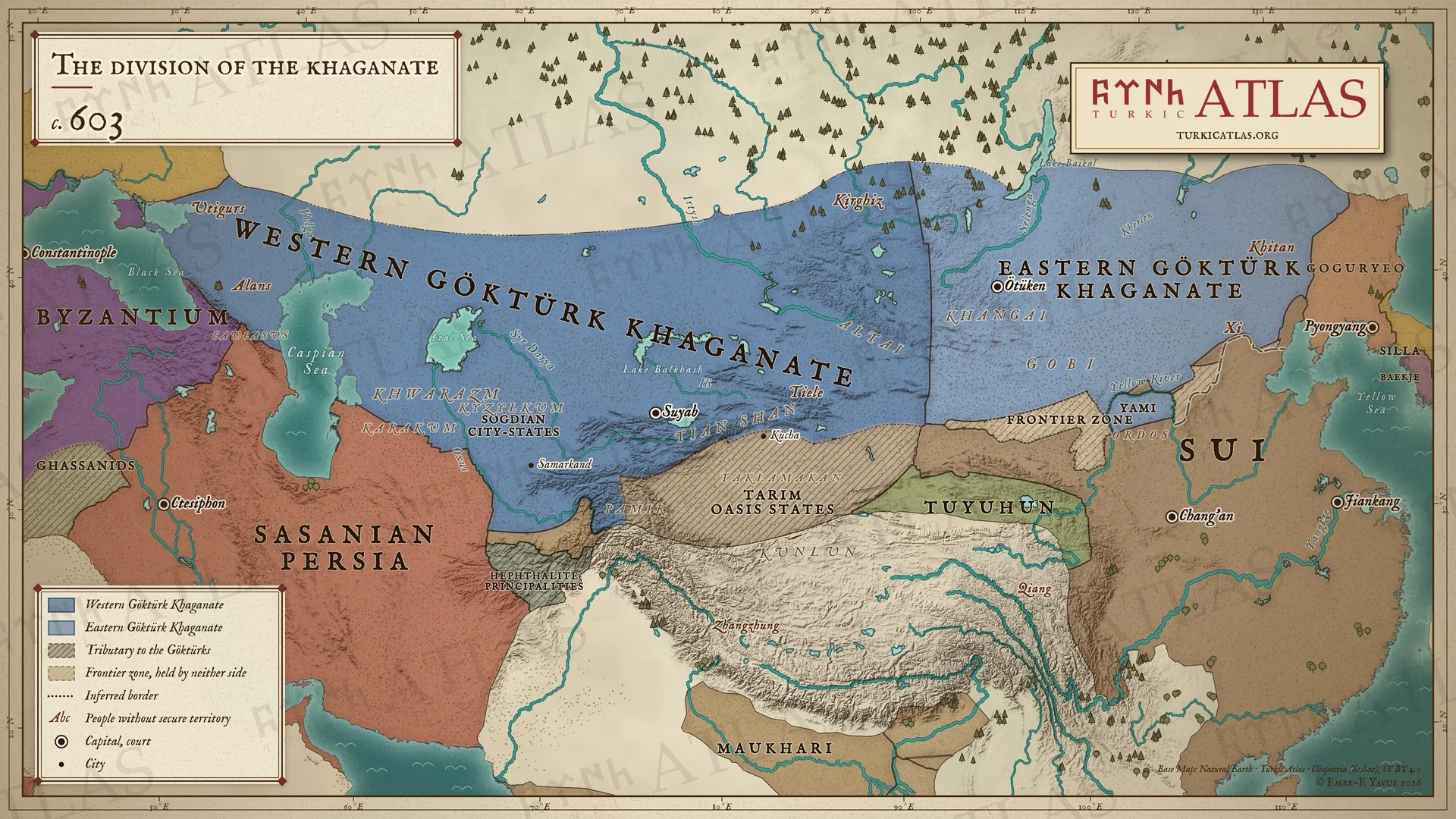
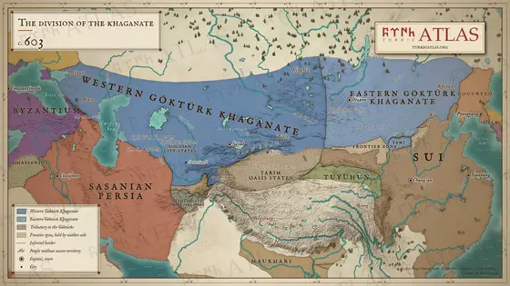
The division of the khaganate
c. 603
 © Emre-E Yavuz 2026
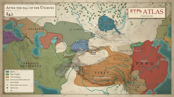
The khaganate divided around 603: the Western Göktürk Khaganate from the Black Sea to the Tian Shan and the Eastern Göktürk Khaganate from the Khangai to the Khitan, beside the Sui, now ruling all of China, Sasanian Persia and the Eastern Roman Empire. Between the steppe and China stand the wall of the Northern Qi (556) and a frontier zone held by neither side. The Baidao plain belongs to the Göktürks, and the north of the Ordos is Yami's pasture. Modern map; the line between east and west is approximate.
The arrow keys turn the plates.
Articles with this map
Years
Plate XLIV · The division of the khaganate c. 603
Drag to move. Wheel, two fingers or a double click to zoom.
-
 I
-
 II
-
 III
-
 IV
-
 V
-
 VI
-
 VII
-
 VIII
-
 IX
-
 X
-
 XI
-
 XII
-
 XIII
-
 XIV
-
 XV
-
 XVI
-
 XVII
-
 XVIII
-
 XIX
-
 XX
-
 XXI
-
 XXII
-
 XXIII
-
 XXIV
-
 XXV
-
 XXVI
-
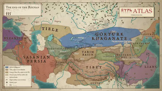 XXVII
-
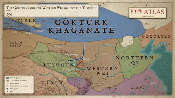 XXVIII
-
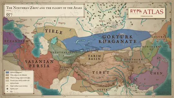 XXIX
-
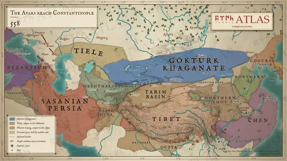 XXX
-
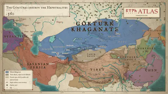 XXXI
-
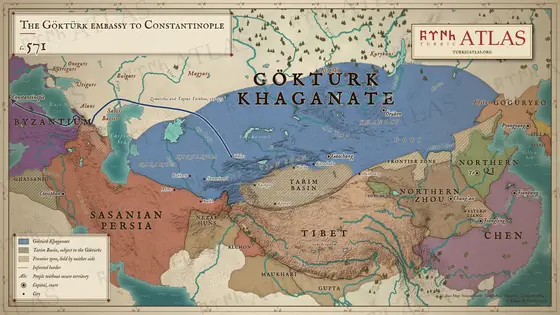 XXXII
-
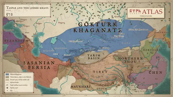 XXXIII
-
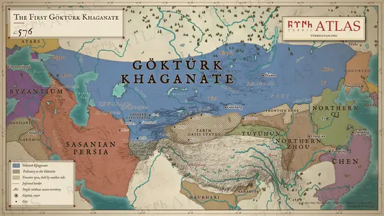 XXXIV
-
 XXXV
-
 XXXVI
-
 XXXVII
-
 XXXVIII
-
 XXXIX
-
 XL
-
 XLI
-
 XLII
-
 XLIII
-
 XLIV
-
 XLV
-
 XLVI
-
 XLVII
-
 XLVIII
-
 XLIX
-
 L
-
 LI
-
 LII
-
 LIII
-
 LIV
-
 LV
-
 LVI
-
 LVII
-
 LVIII
-
 LIX
-
 LX
-
 LXI
-
 LXII
-
 LXIII
-
 LXIV
-
 LXV
-
 LXVI
-
 LXVII
-
 LXVIII

