
Wer regierte
- First Göktürk Khaganate Yami Khan 603–609
- Western Göktürk Khaganate Tardush 576–603 · Niri Khan 587–603 · Heshana Khan 603–611
Und jenseits der Steppe
- China Sui Emperor Wen 581–604
- Iran Sasanian Khosrow II 591–628
- Korea Goguryeo Yeongyang 590–618
- Byzanz Phocas 602–610
Östliche Steppe
-
Umwelt · Spätantike Kleine Eiszeit: die Kältephase, die die Baumringe des Altai von 536 bis etwa 660 bestimmen (536–660)
Climate and the steppe empires · First Göktürk Khaganate · Avars
Das kälteste Jahrzehnt im Altai sind die 540er Jahre
-
Umwelt · Der Telmen-See steht 4,8 Meter über seinem heutigen Spiegel, eine feuchte Phase vor der folgenden Austrocknung (600–700)
-
Yami zieht mit Truppen der Göktürken und der Chinesen in den Ötüken ein
Westliche Steppe
-
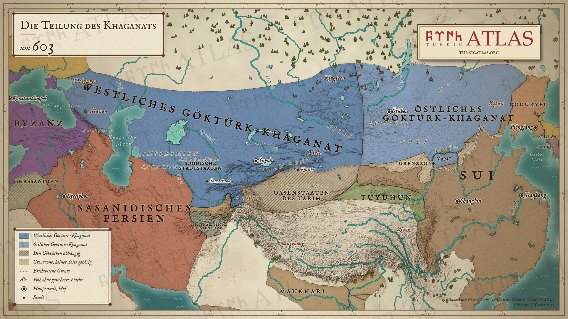
Ein Aufstand der Tiele treibt Tardush ins Exil, wo er stirbt; das Reich ist endgültig geteilt
Tardush · Tiele · First Göktürk Khaganate · Western Göktürk Khaganate · The Göktürk Civil War · Heshana Khan · Fall of Tardush (603)
Eine Lesart lässt Tardush zu den Tuyuhun fliehen und verschwinden; eine zweite lässt ihn im Exil im nördlichen Tibet sterben

