
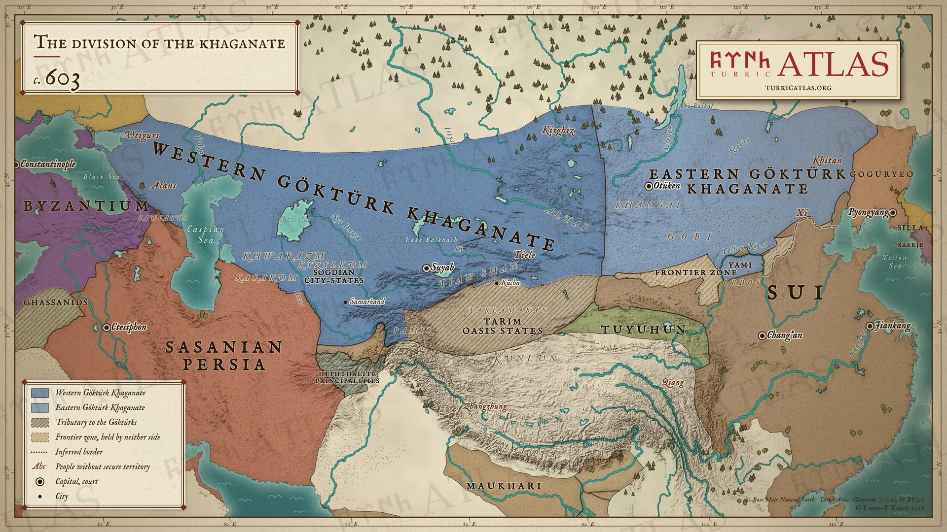
Quién gobernaba
- First Göktürk Khaganate Yami Khan 603–609
- Western Göktürk Khaganate Tardush 576–603 · Niri Khan 587–603 · Heshana Khan 603–611
Y más allá de la estepa
- China Sui Emperor Wen 581–604
- Irán Sasanian Khosrow II 591–628
- Corea Goguryeo Yeongyang 590–618
- Bizancio Phocas 602–610
Estepa oriental
-
Entorno · Pequeña Edad de Hielo de la Antigüedad Tardía: la fase fría que los anillos de los árboles del Altái delimitan de 536 a hacia 660 (536–660)
Climate and the steppe empires · First Göktürk Khaganate · Avars
La década más fría en el Altái es la de 540
-
Entorno · El lago Telmen está 4,8 metros por encima de su nivel actual, una fase húmeda antes de la desecación que sigue (600–700)
-
Yami entra en Ötüken con tropas göktürk y chinas
Estepa occidental
-
Un levantamiento tiele empuja a Tardush al exilio, donde muere; el reino queda dividido definitivamente
Tardush · Tiele · First Göktürk Khaganate · Western Göktürk Khaganate · The Göktürk Civil War · Heshana Khan · Fall of Tardush (603)
Una lectura hace huir a Tardush a los tuyuhun y desaparecer; una segunda lo hace morir en el exilio en el norte del Tíbet

