
Who ruled
- First Göktürk Khaganate Yami Khan 603–609
- Western Göktürk Khaganate Tardush 576–603 · Niri Khan 587–603 · Heshana Khan 603–611
And beyond the steppe
- China Sui Emperor Wen 581–604
- Iran Sasanian Khosrow II 591–628
- Korea Goguryeo Yeongyang 590–618
- Byzantium Phocas 602–610
Eastern steppe
-
Environment · Late Antique Little Ice Age: the cold phase the Altai tree rings define from 536 to about 660 (536–660)
Climate and the steppe empires · First Göktürk Khaganate · Avars
The coldest decade in the Altai is the 540s
-
Environment · Lake Telmen stands 4.8 metres above its present level, a humid phase before the drying that follows (600–700)
-
Yami marches into Ötüken with Göktürk and Chinese troops
Western steppe
-
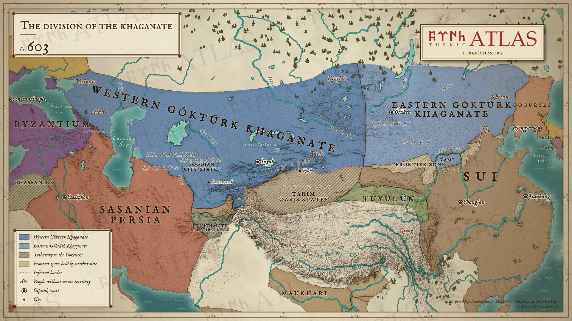
A Tiele rising drives Tardush into exile, where he dies; the realm is finally divided
Tardush · Tiele · First Göktürk Khaganate · Western Göktürk Khaganate · The Göktürk Civil War · Heshana Khan · Fall of Tardush (603)
One reading has Tardush flee to the Tuyuhun and disappear; a second has him die in exile in northern Tibet

