
誰が治めていたか
- First Göktürk Khaganate Yami Khan 603–609
- Western Göktürk Khaganate Tardush 576–603 · Niri Khan 587–603 · Heshana Khan 603–611
草原の外では
- 中国 Sui Emperor Wen 581–604
- イラン Sasanian Khosrow II 591–628
- 朝鮮 Goguryeo Yeongyang 590–618
- ビザンツ Phocas 602–610
東方草原
-
環境 · 古代末期小氷期:アルタイの年輪が536年からおよそ660年までと定める寒冷期 (536–660)
Climate and the steppe empires · First Göktürk Khaganate · Avars
アルタイで最も寒い十年は540年代である
-
環境 · テルメン湖の水位が現在より4.8メートル高い。これに続く乾燥化の前の湿潤期 (600–700)
-
ヤミがギョクテュルクと中国の兵を率いてウテュケンに入る
西方草原
-
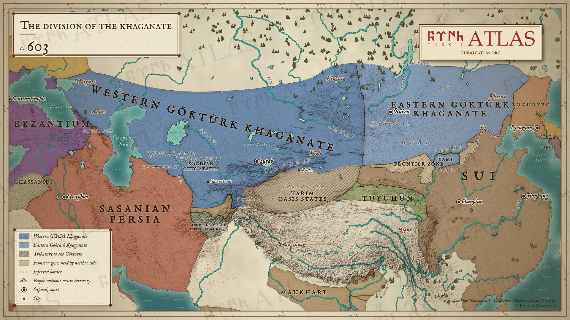
鉄勒の蜂起がタルドゥシュを亡命に追いやり、彼はそこで没する。国は最終的に分かれる
Tardush · Tiele · First Göktürk Khaganate · Western Göktürk Khaganate · The Göktürk Civil War · Heshana Khan · Fall of Tardush (603)
ある読みではタルドゥシュは吐谷渾のもとへ逃れて姿を消し、第二の読みでは北チベットで亡命のうちに没する

