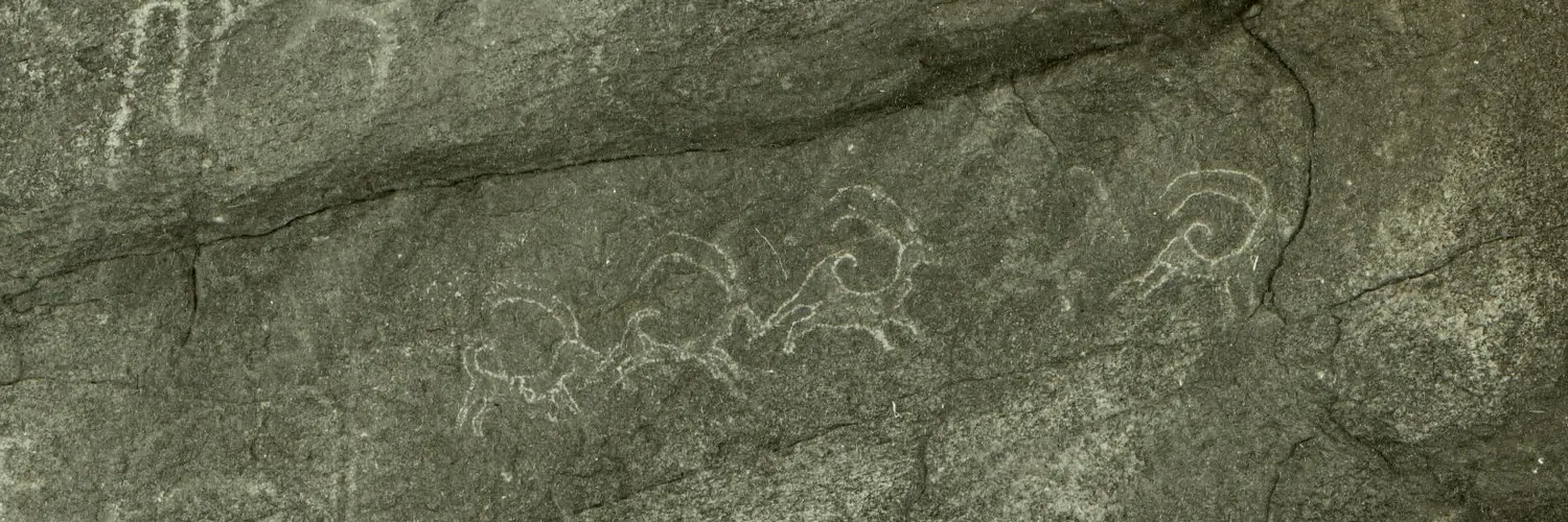
画像と地図
メディア
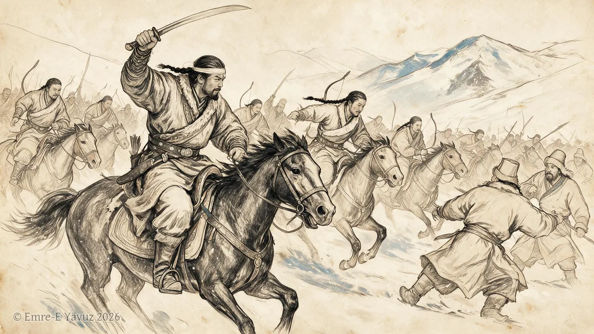
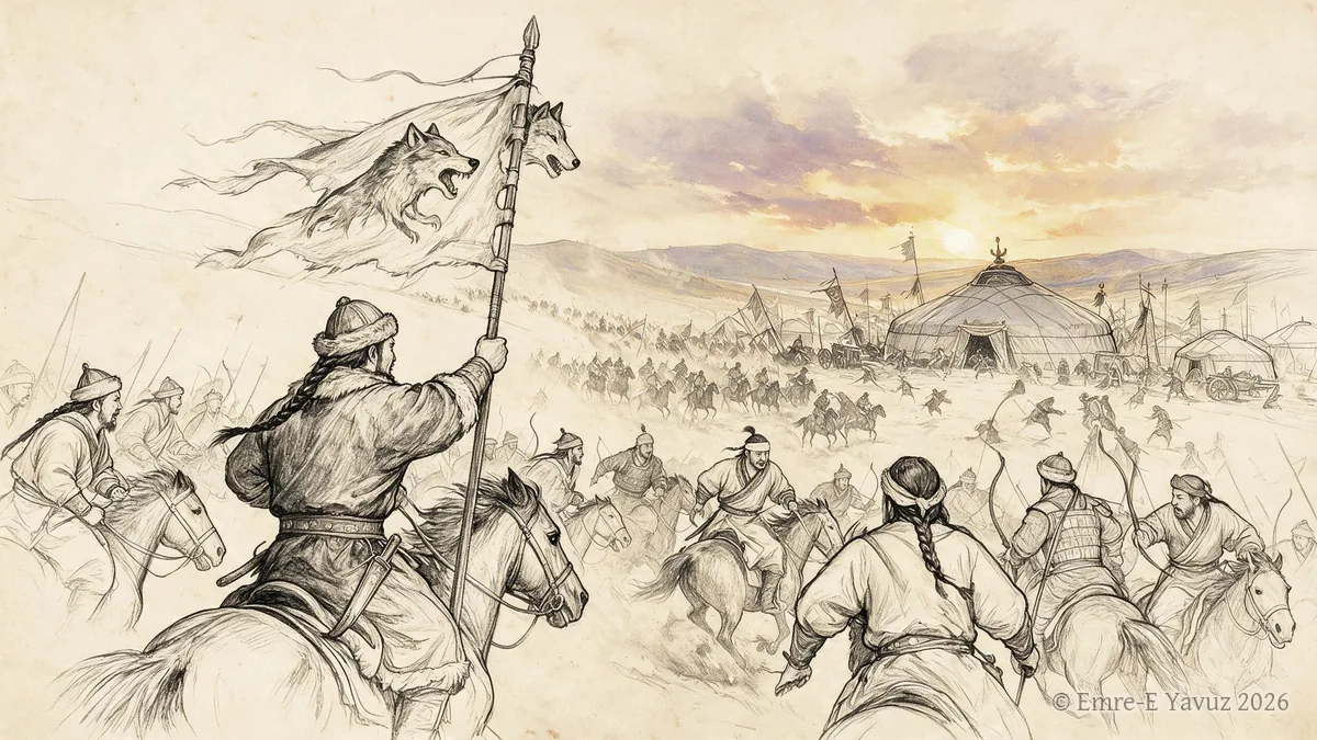
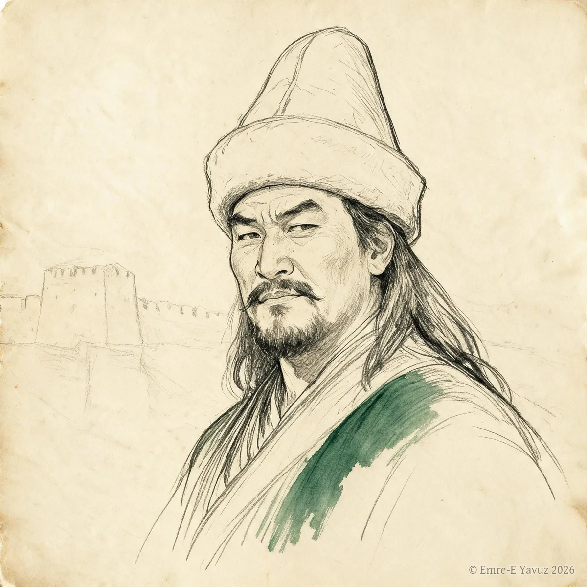
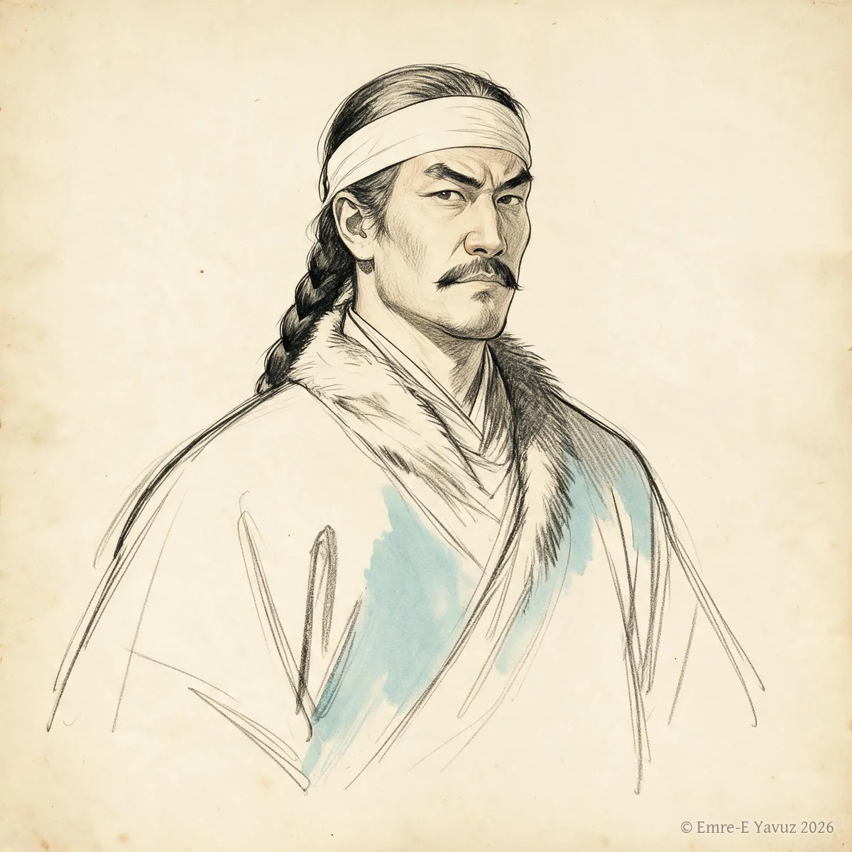
アトラスの項目やページに載っているすべての画像を、ここに集めています。最初の列は写真と歴史的な図像です。壁画、石碑、貨幣、出土品、風景。地図は最初に、独立して掲げています。二番目の列は現代の描写です。挿絵、復元図、絵画。各カードには画像が載っている項目が示され、クリックすると説明文とともに大きく表示されます。
このページとメニューは日本語です。項目の一部は日本語でもお読みいただけます。残りは英語で、その旨を表示します。
地図
草原の帝国とその隣国の地図です。それぞれに時間断面を示しています。地図は史料と研究が許す範囲を示し、説明文にそうある場合、境界と範囲はおおよそのものです。
-
c. 215 BCc. 215 BC: Qin takes the Ordos
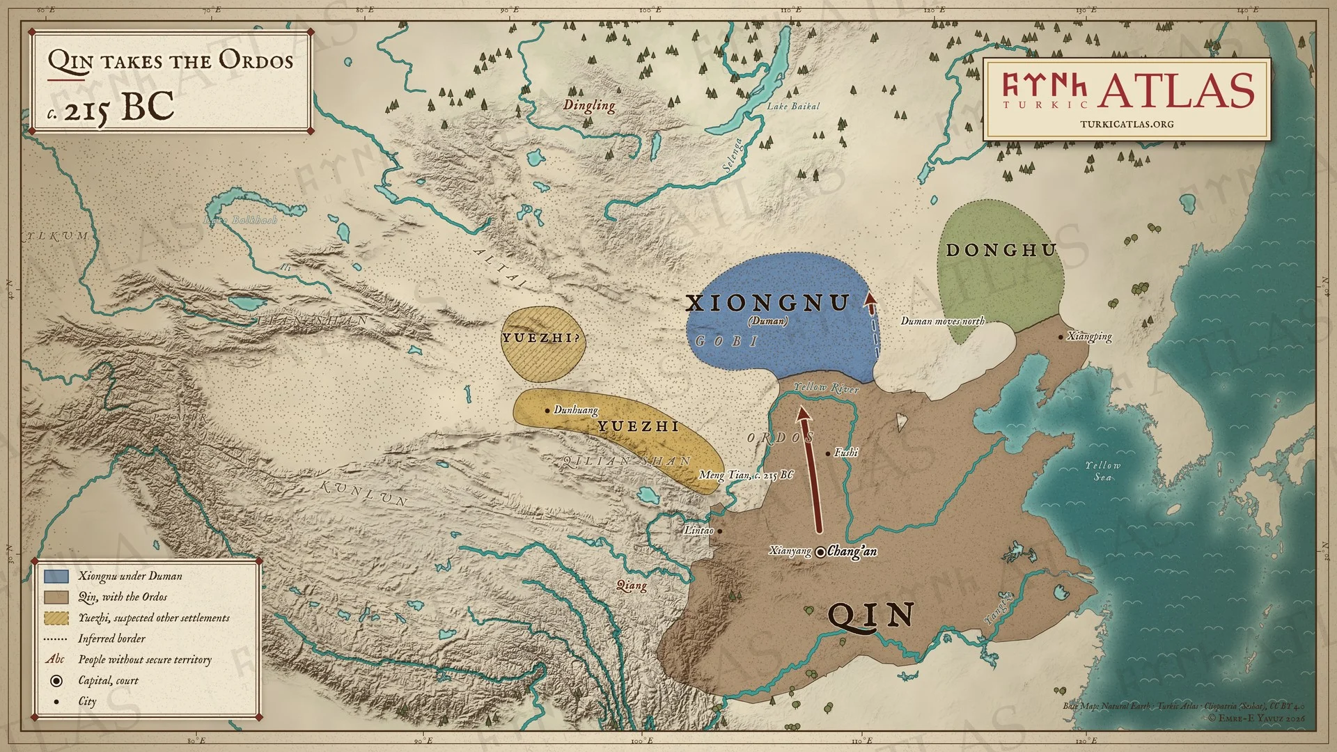 © Emre-E Yavuz 2026
紀元前215年ごろ。秦の始皇帝が蒙恬を北へ送る。蒙恬は黄河の大屈曲部の内側のオルドスを取り、黄河を境とする。匈奴の頭曼単于は北へ退くが、どこまで退いたかは史料に記されない。東には東胡、敦煌と祁連山のあいだには月氏がいる。別の読みでは月氏を天山に置く。現代の地図で、草原の境はおおよそのもの。 地図 掲載先: -215年, Duman (Touman), 匈奴
-
209–200 BC209–200 BC: Bagatur unites the steppe
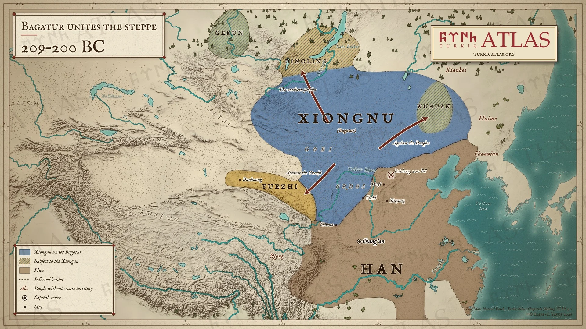 © Emre-E Yavuz 2026
紀元前209〜200年。冒頓単于は父の頭曼を殺して単于となる。東胡の王を滅ぼし、月氏を退け、蒙恬が奪った地を朝那と膚施まで取り戻し、丁零、鬲昆など北方の諸族を従える。烏桓は貢物を納める。紀元前200年、平城近くの白登で漢の高祖を包囲する。現代の地図で、進路は描画によるもの、草原の境はおおよそのもの。 地図 掲載先: -209年, Bagatur (Modu Chanyu), 漢と匈奴の戦争
-
176–174 BC176–174 BC: The Xiongnu at their height
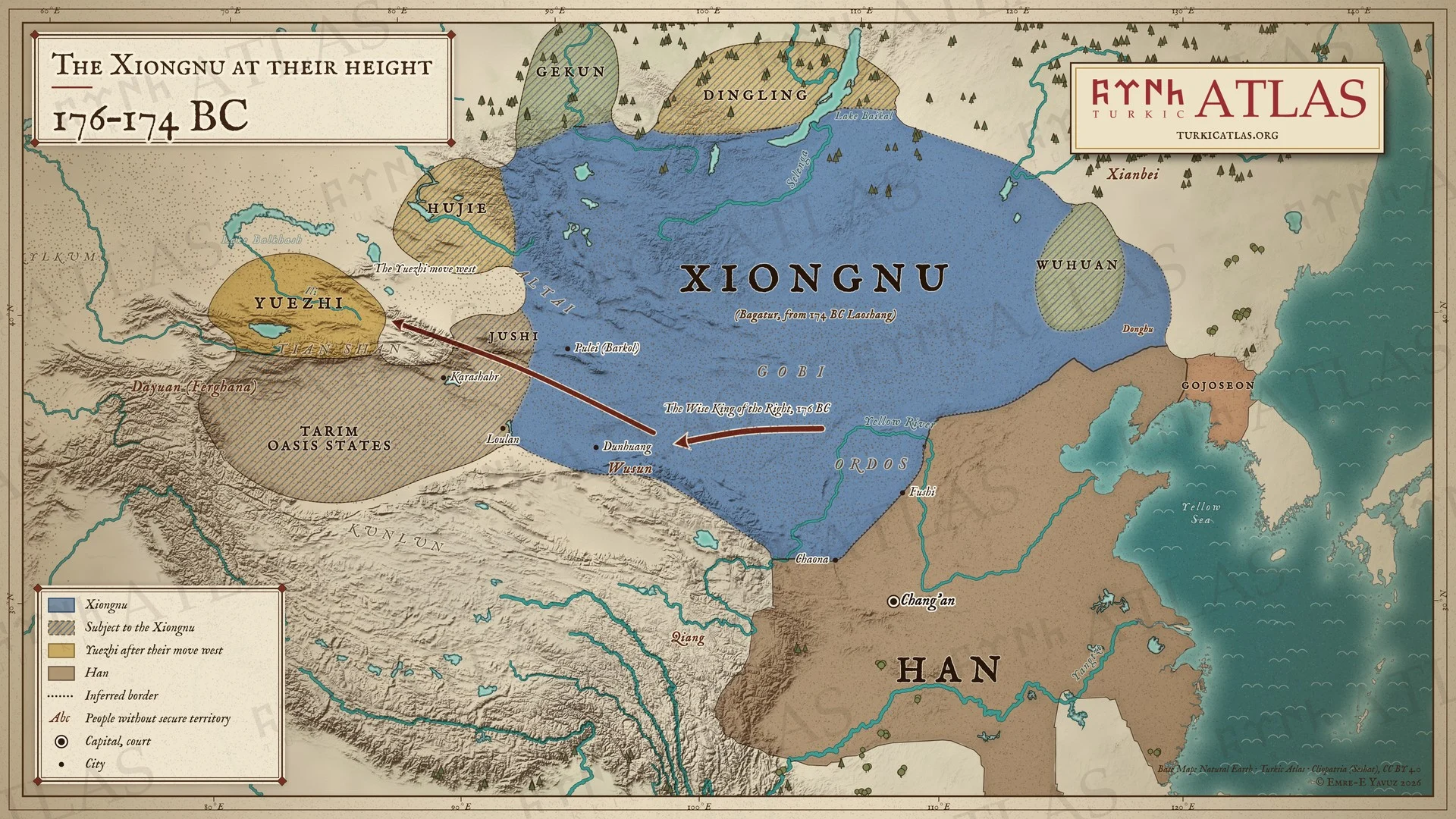 © Emre-E Yavuz 2026
紀元前176〜174年。紀元前176年の書簡で、冒頓単于は漢の朝廷に、右賢王が月氏を滅ぼし、楼蘭、烏孫、呼掲とその周囲の二十六国がことごとく匈奴となったと伝える。月氏は西へ移り、イリに至る。紀元前174年に冒頓単于が没し、子の老上単于が継ぐ。現代の地図で、国の北の境を記す史料はなく、草原の境はおおよそのもの。 地図 掲載先: -177年, Bagatur (Modu Chanyu), History of the Turkic peoples
-
133 BC133 BC: The Mayi ambush
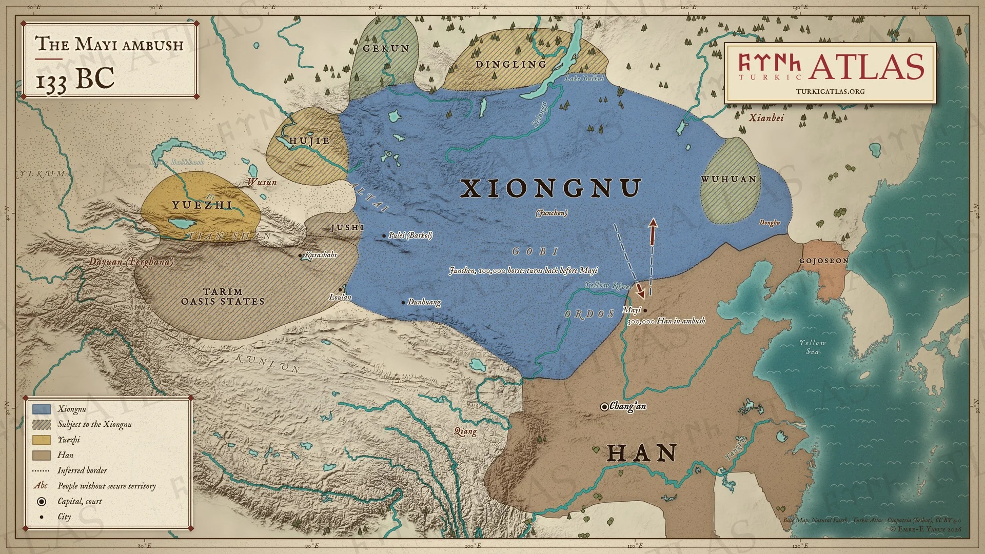 © Emre-E Yavuz 2026
紀元前133年。漢は辺境の町馬邑の周囲に三十万の兵を伏せ、町を軍臣単于に差し出すと持ちかける。単于は十万騎で国境を越えるが、町の百里手前で家畜が番人もなく草を食むのを見て、捕らえた役人から伏兵を知り、引き返す。和親の取り決めは終わり、六十年にわたる公然の戦争が始まる。現代の地図で、単于の道は描画によるもの、草原の境はおおよそのもの。 -
c. 100 BCc. 100 BC: The Xiongnu north of the Gobi
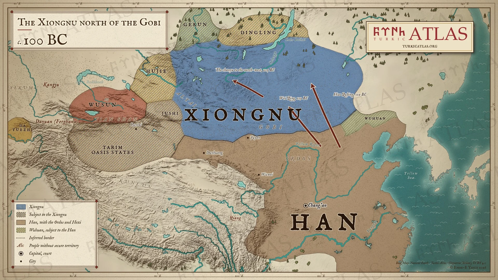 © Emre-E Yavuz 2026
紀元前100年ごろ。紀元前119年の衛青と霍去病の遠征ののち、ゴビの南に匈奴の王庭はなくなる。漢はオルドスと、武威から敦煌までの河西回廊を押さえ、烏桓が漢のために匈奴を見張る。紀元前105年までに単于はさらに北西へ移る。タリムのオアシス諸国と北方の諸族はなお匈奴に服している。現代の地図で、進路は描画によるもの、草原の境はおおよそのもの。 -
8989: Dou Xian’s campaign against the Northern Xiongnu
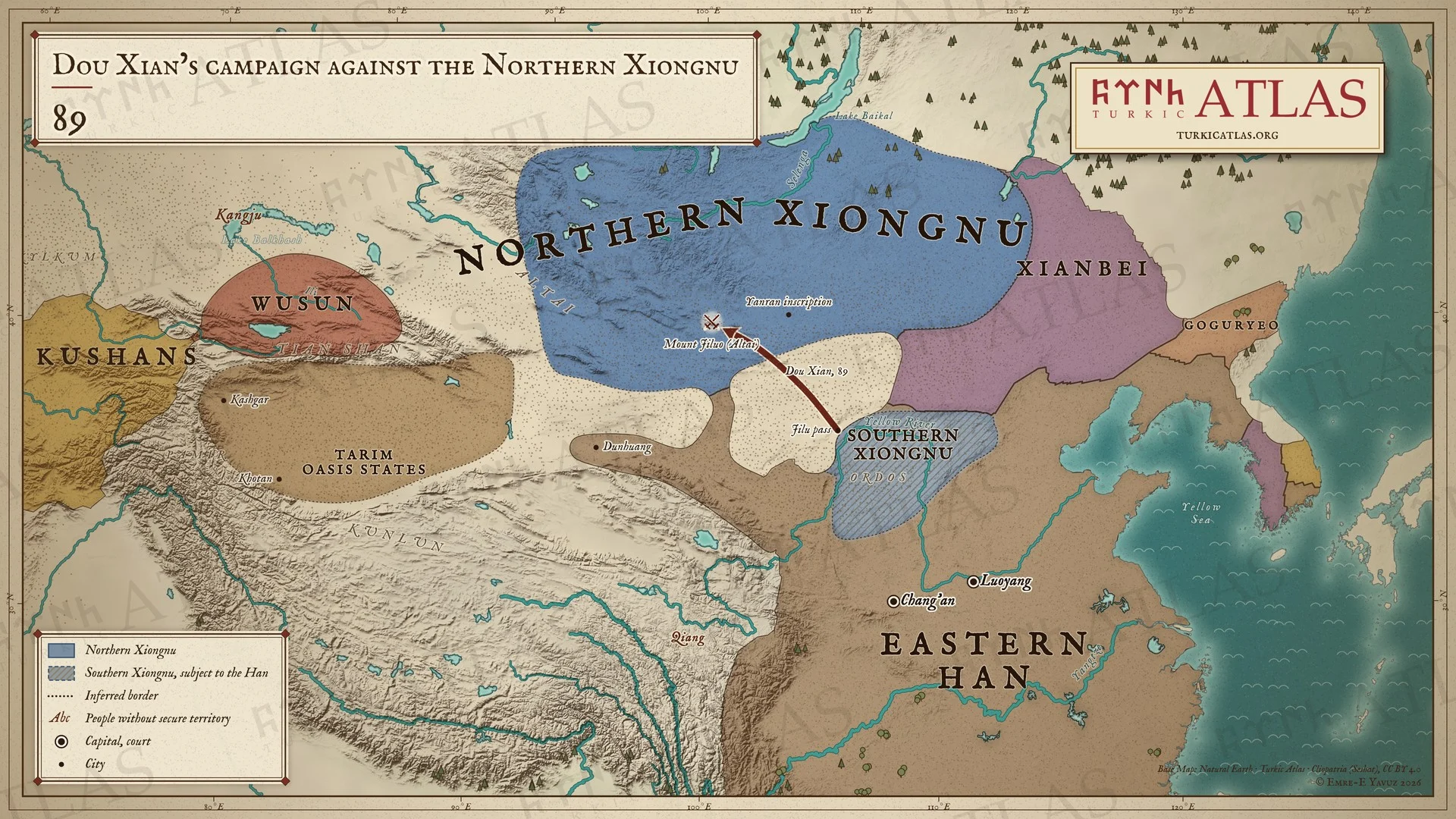 © Emre-E Yavuz 2026
89年。竇憲が南匈奴とともに鶏鹿塞から出撃し、アルタイの稽落山で北単于を破る。燕然山の銘がこの勝利を記す。南匈奴は漢に服し、東方には鮮卑がいる。現代の地図で、道は描画によるもの、草原の境はおおよそのもの。 地図 掲載先: 89年, 匈奴, Han campaigns against the Northern Xiongnu, 漢と匈奴の戦争
-
c. 155c. 155: The Xianbei in the old Xiongnu land
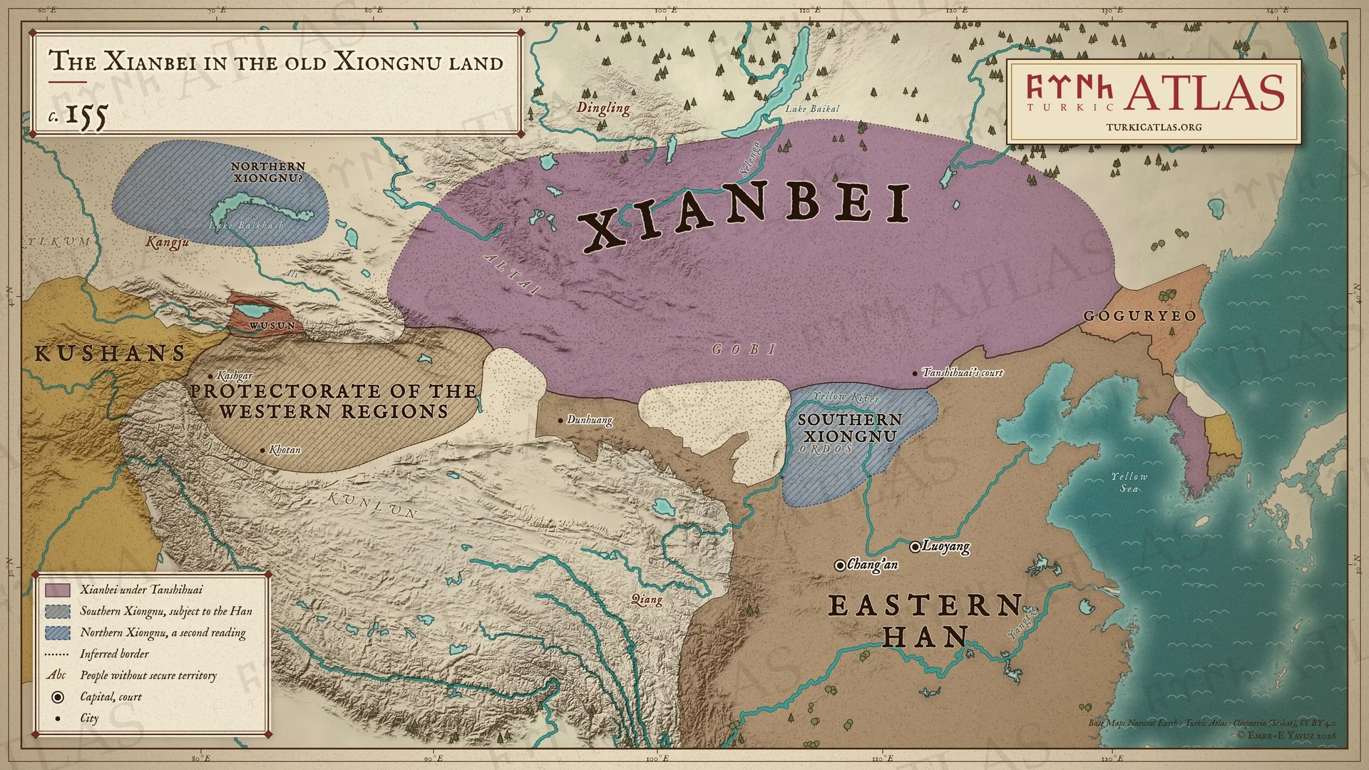 © Emre-E Yavuz 2026
155年頃。檀石槐のもとで鮮卑がモンゴル草原の匈奴の故地を押さえる。南匈奴は漢の国境の内側に住み、漢は西域都護府を通じて西方のオアシスを治める。第二の解釈では、北匈奴は康居の北西にいる。現代の地図で、草原の境はおおよそのもの。 地図 掲載先: 155年, Tanshihuai
-
395–396395–396: The Hunnic raid through the Caucasus
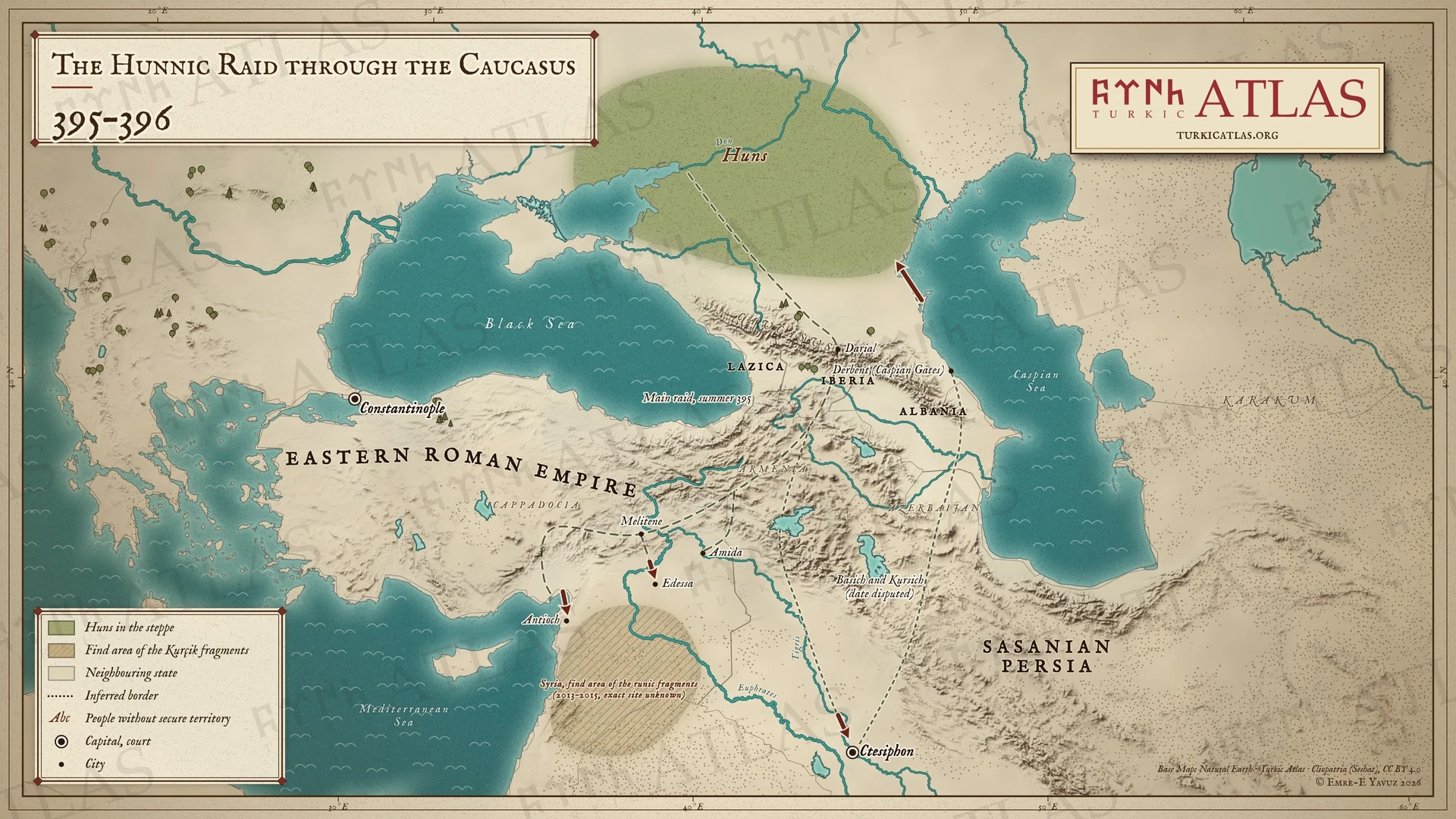 © Emre-E Yavuz 2026
395–396年。フン人がカフカスを越え、アルメニア、メリテネ、アンティオキア、エデッサに侵入する。バシクとクルシクはティグリス川を下ってクテシフォンに至り、カスピの門を通って戻る。その年代には異説がある。シリアのルーン文字断片の発見地域を斜線で示す。現代の地図で、道は描画によるもの。 地図 掲載先: 395年, フン族の侵攻(395年)
-
c. 402c. 402: Shelun and the Northern Wei
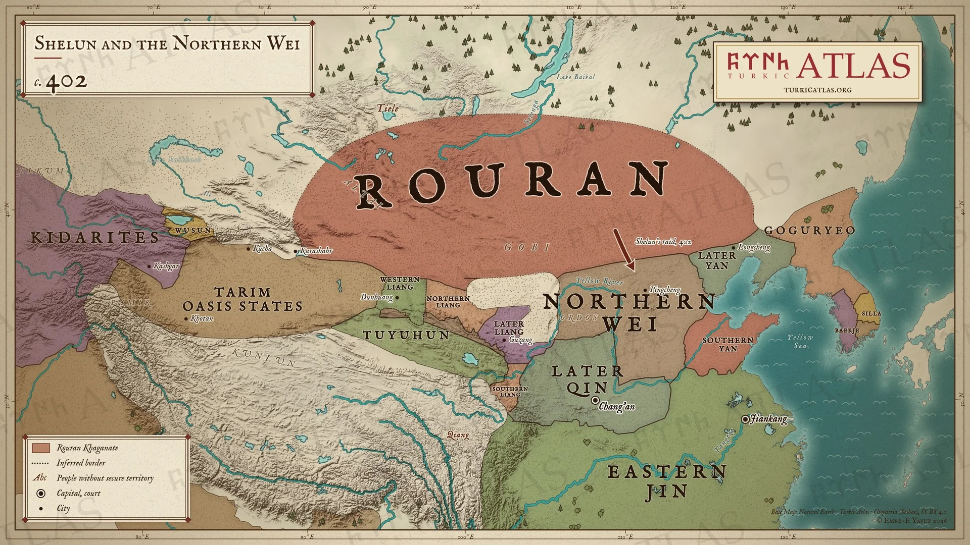 © Emre-E Yavuz 2026
402年頃。社崙が焉耆から高句麗にまで及ぶ柔然を率い、北魏の辺境に侵入する。南方では北魏、後秦、涼の諸国、燕の諸国、東晋が中国を分け合う。現代の地図で、草原の境と中国の一部の境はおおよそのもの。 地図 掲載先: 402年, Shelun Khan, 柔然可汗国, History of the Turkic peoples
-
439439: The Wei take the Northern Liang
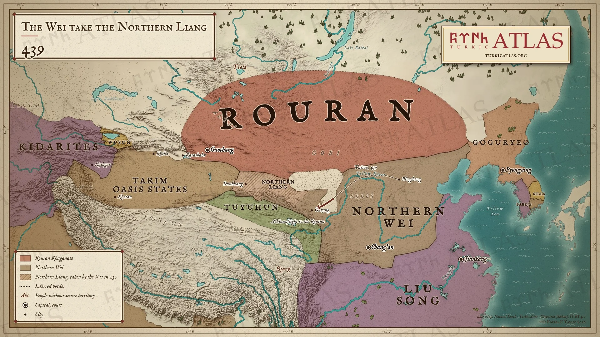 © Emre-E Yavuz 2026
439年。北魏が姑臧へ進み、北涼が降伏する。阿史那氏は五百家を率いて柔然のもとへ逃れる。柔然はゴビの北の草原を押さえ、北魏の南には劉宋がある。現代の地図で、北魏の道は描画によるもの、草原の境はおおよそのもの。 地図 掲載先: 439年, 柔然可汗国, 阿史那氏の逃亡(439年)
-
450450: The Pontic steppe
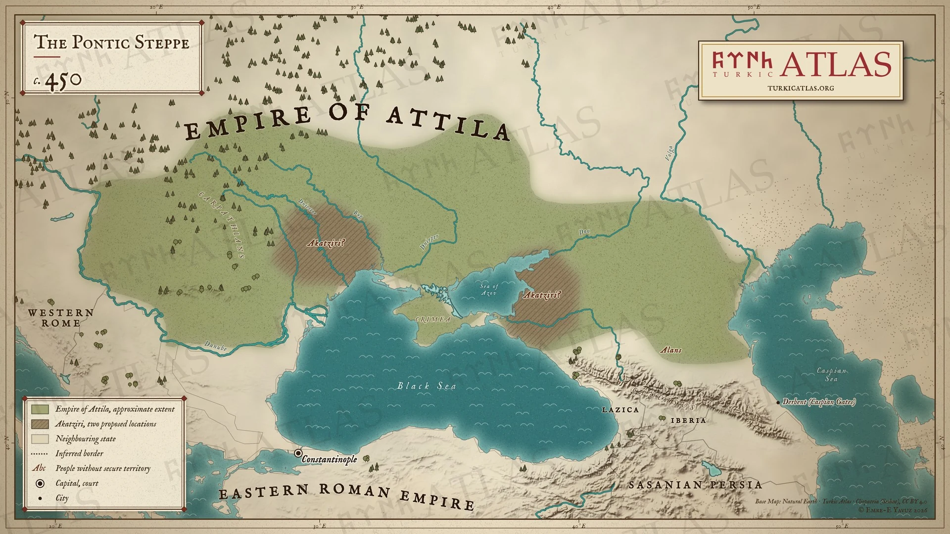 © Emre-E Yavuz 2026
450年頃。アッティラの国はドナウ川から草原に広がる。アカツィル人は黒海北西岸とアゾフ海岸の二つの推定地に示す。現代の地図で、国境を記す史料はない。 -
453453: The Hunnic Empire at Attila’s death
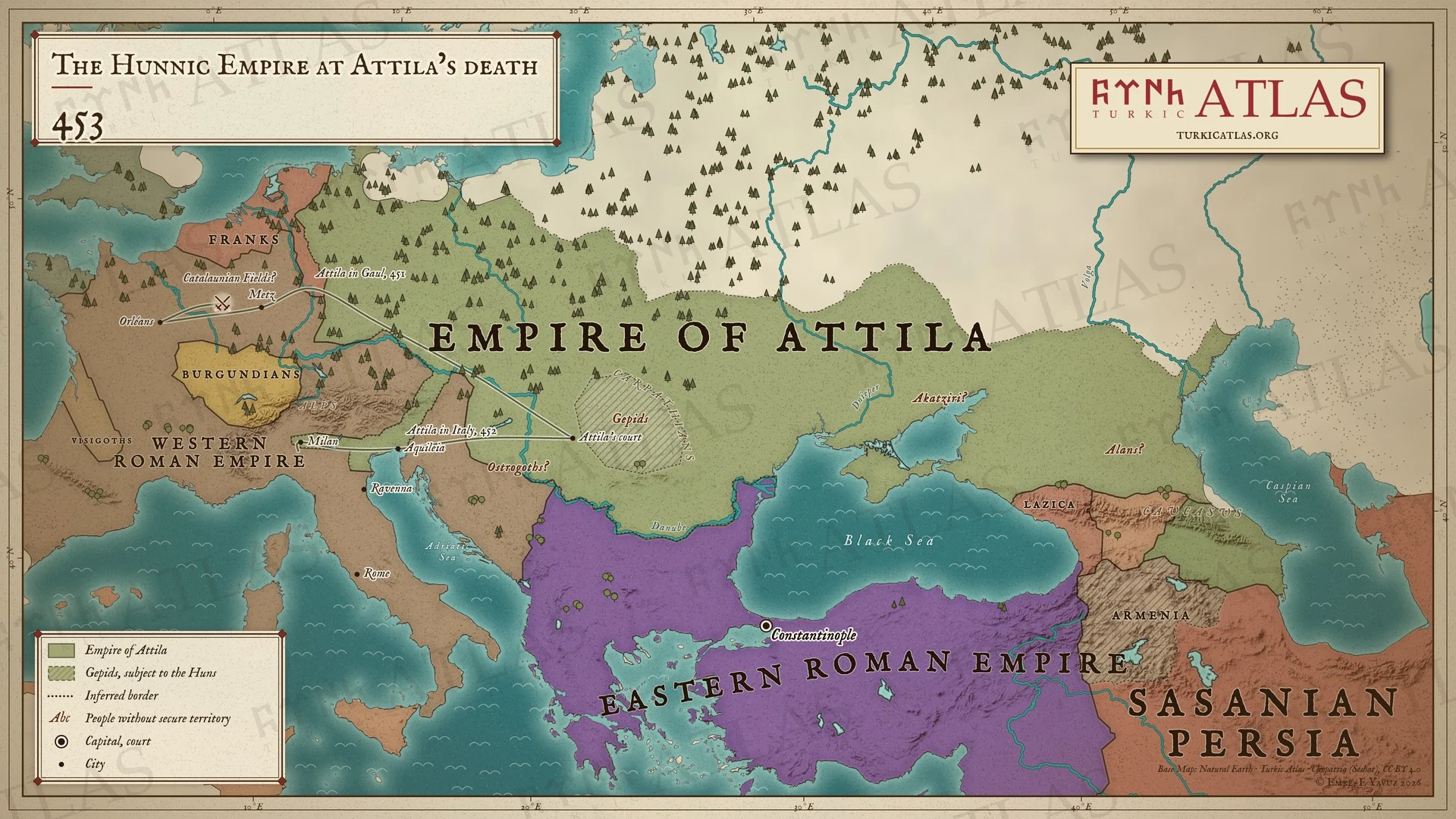 © Emre-E Yavuz 2026
453年。アッティラが没したとき、フン帝国はライン川からカスピ海まで広がり、ゲピド族などの諸族がフンに服している。細い線はアッティラの451年のガリア遠征と452年のイタリア遠征を示す。現代の地図で、帝国の境はおおよそのもの、カタラウヌムの野の位置は議論がある。 地図 掲載先: 453年, アッティラ, History of the Turkic peoples
-
c. 460c. 460: The Ashina in the Altai
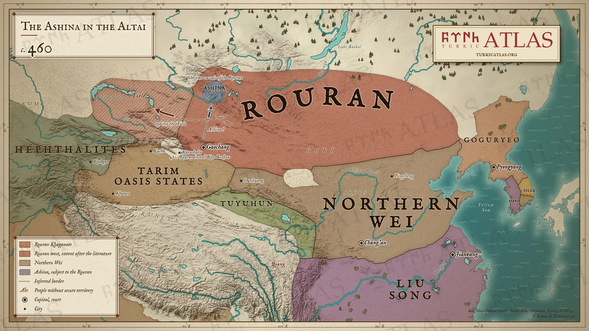 © Emre-E Yavuz 2026
460年ごろ。阿史那氏の五百家が柔然の臣下としてアルタイの南麓に住む。西方で柔然は鉄勒を服属させ、460年には闞伯周を高昌王に立てる。ゴビの南には北魏と劉宋がある。現代の地図で、阿史那氏の道は一つの復元、草原の境はおおよそのもの。 -
463463: The chain of expulsions
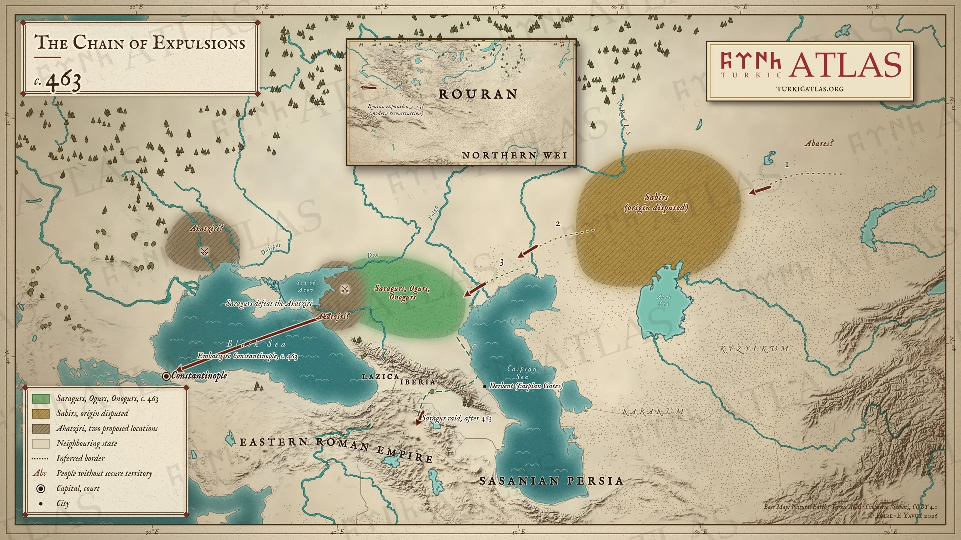 © Emre-E Yavuz 2026
463年頃。アバル人がサビル人を追い、サビル人がサラグル、オグル、オノグルを西へ押し出す。サラグルはアカツィル人を破り、コンスタンティノープルに使節を送る。のちにカフカスを越えて侵入する。現代の地図で、矢印は復元である。 -
466–469466–469: The end of Attila's sons
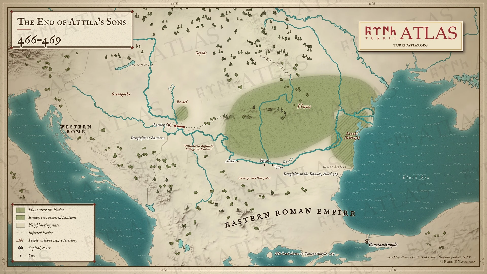 © Emre-E Yavuz 2026
466–469年。デンギジクがバッシアナへ進む。エルナクはティサ川河口とドブルジャの二つの推定地に示す。エムネツルとウルツィンドゥルはドナウ河畔の町を保つ。デンギジクは469年に倒れ、その首はコンスタンティノープルで晒される。現代の地図で、戦死の地は記録されていない。 -
516516: Chounu crushes the Gaoche
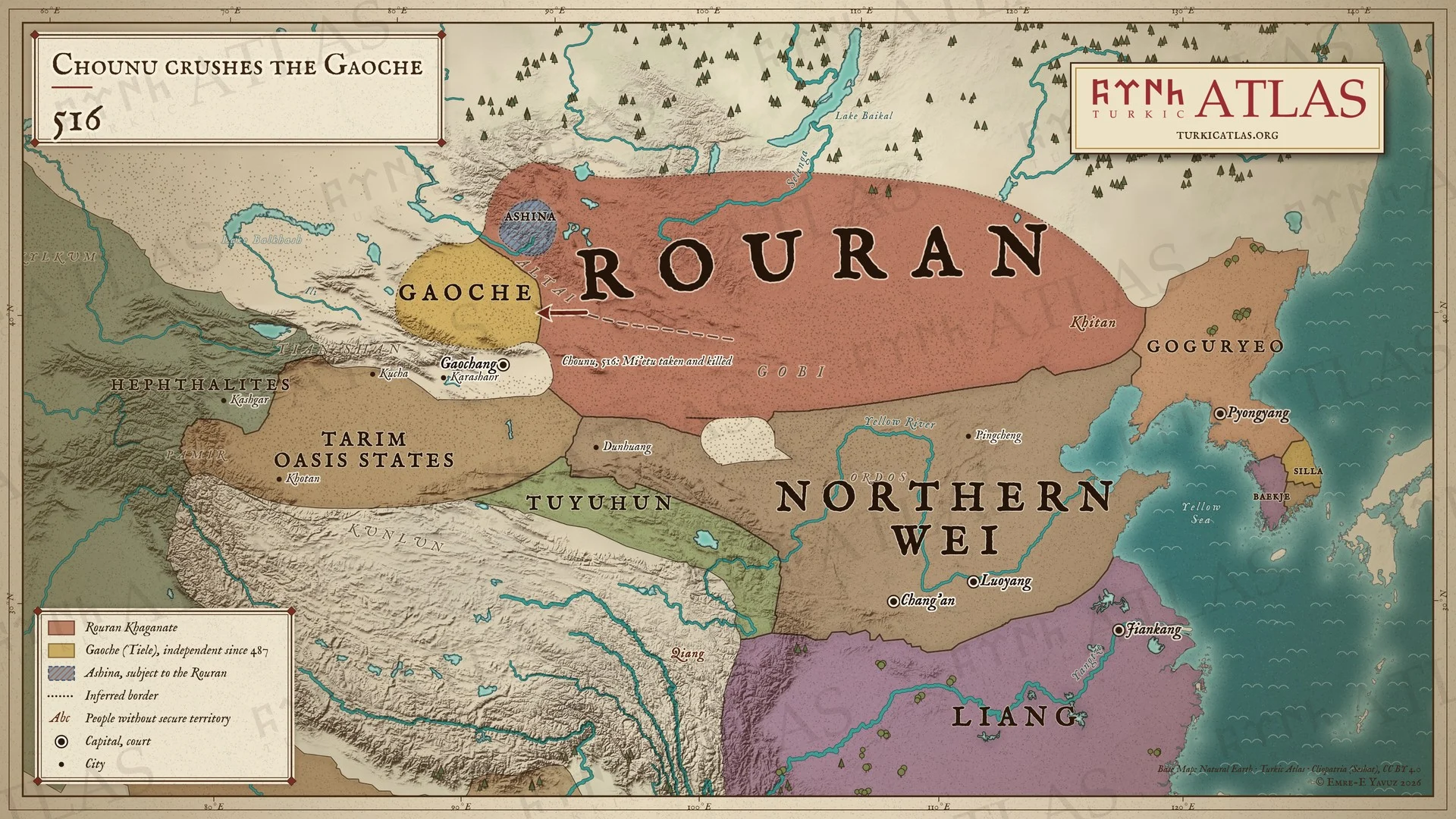 © Emre-E Yavuz 2026
516年。柔然の醜奴可汗が西へ進み、高車を破って王の彌俄突を捕らえて殺す。アルタイの阿史那氏は柔然に服している。現代の地図で、道は描画によるもの、戦いの場所は記録がなく、草原の境はおおよそのもの。 地図 掲載先: 516年, Chounu Khan, 柔然可汗国
-
520520: Anagui flees to the Wei
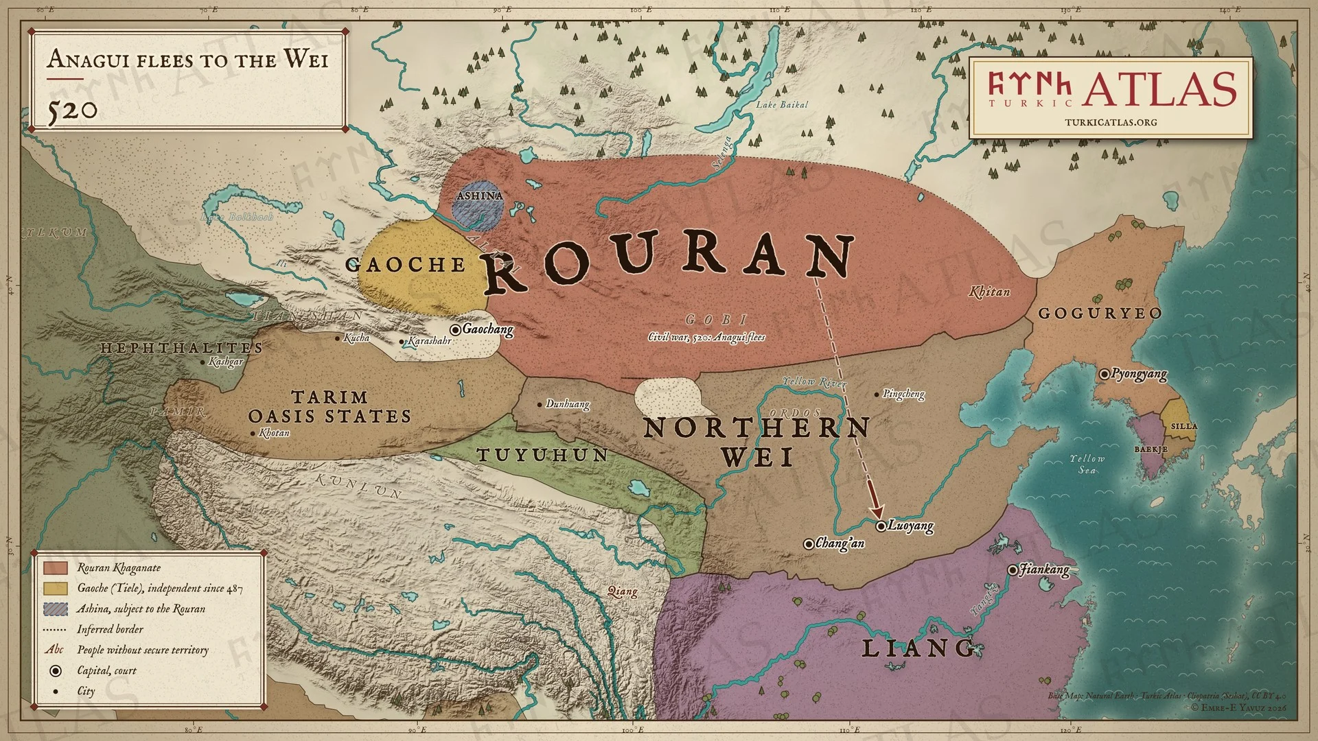 © Emre-E Yavuz 2026
520年。醜奴が殺され、内乱が柔然を分ける。阿那瓌は追われて洛陽の北魏へ逃れる。高車は独立を保つ。現代の地図で、道は描画によるもの、草原の境はおおよそのもの。 -
523–528523–528: The uprisings of the Northern Wei
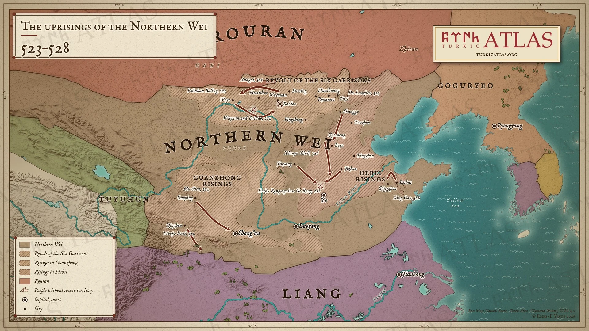 © Emre-E Yavuz 2026
523〜528年。北魏の北辺の鎮が破六韓抜陵のもとで蜂起し、524年に五原と白道で魏軍を破る。525年、柔然の可汗阿那瓌が魏のために反乱を鎮める。戦いは関中と河北に移り、528年に爾朱栄が鄴で葛栄を破るまで続く。現代の地図で、網掛けは反乱の広がった範囲を示し、境界ではない。 -
c. 542Asia around 542: Bumin becomes yabgu of the Ashina
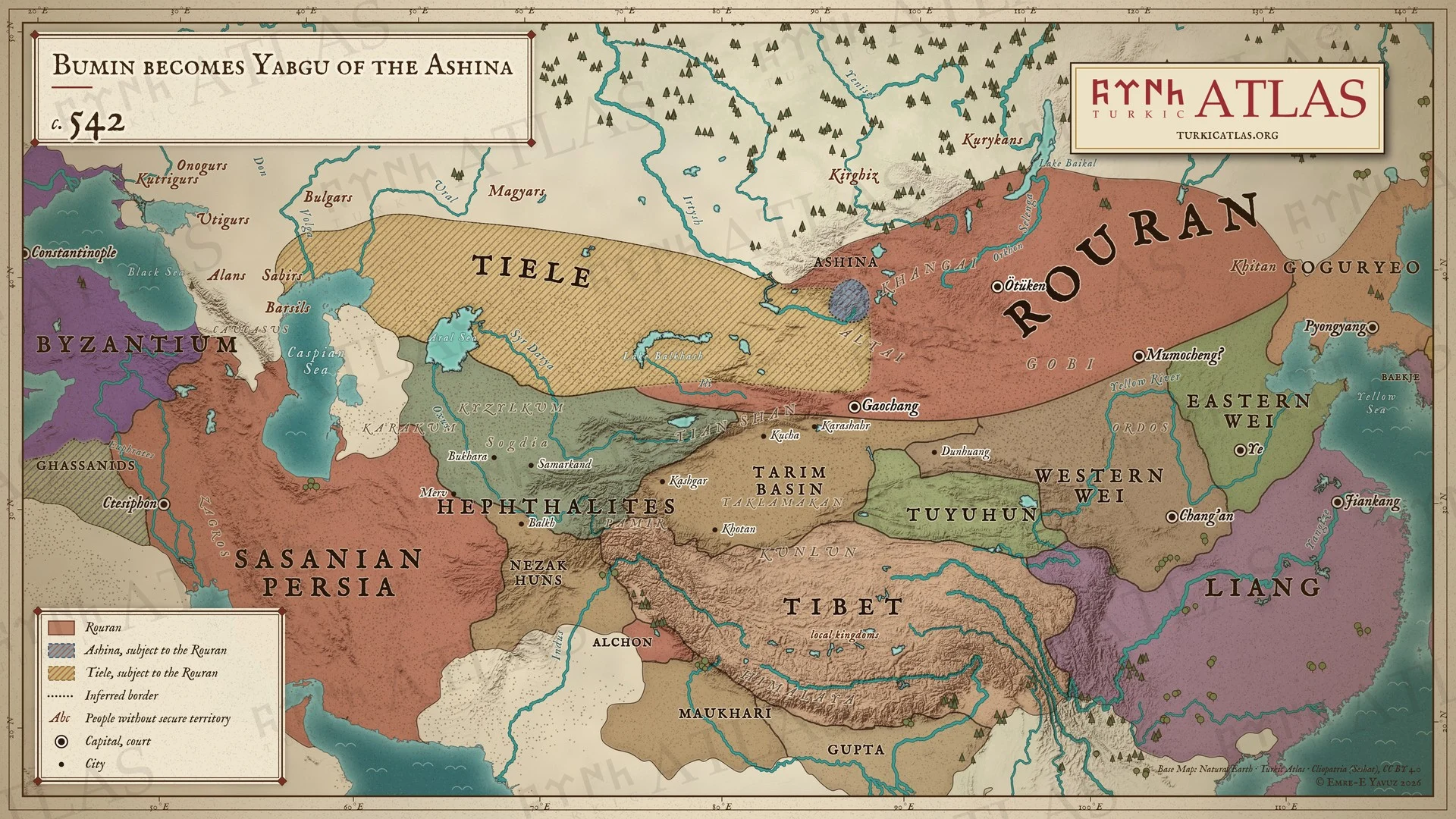 © Emre-E Yavuz 2026
542年ごろ、ブミンが阿史那氏の葉護となった年のアジア。東部草原を支配する柔然と、その臣下であるアルタイの阿史那氏と鉄勒、そして西魏と東魏、梁、吐谷渾、エフタル、サーサーン朝、東ローマ帝国。現代の地図で、境界はおおよそのもの。 地図 掲載先: 542年, 伊利可汗(ブミン), 第一ギョクテュルク可汗国, 阿史那氏
-
545545: The Western Wei embassy to the Göktürks
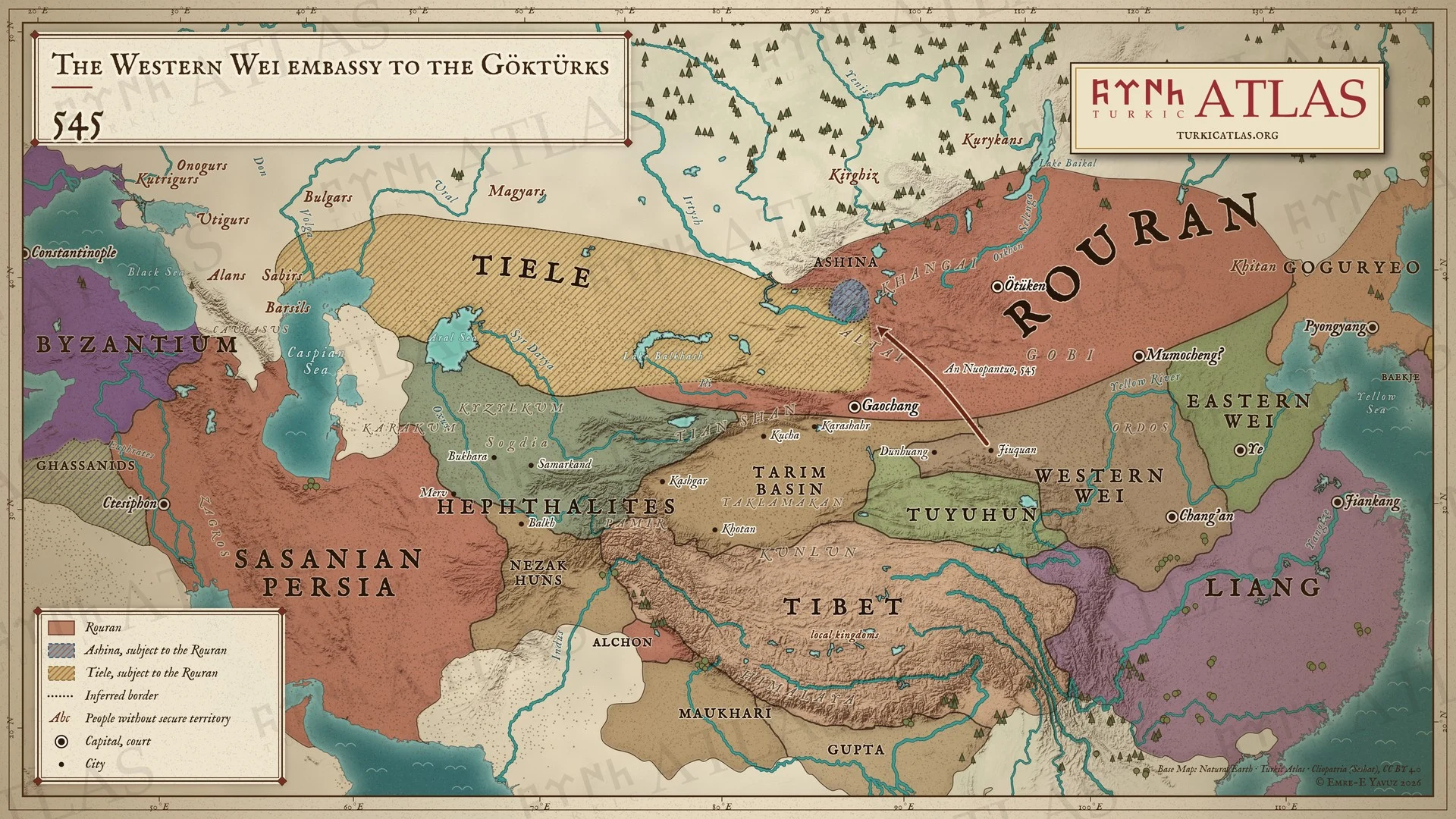 © Emre-E Yavuz 2026
545年、西魏の宇文泰は、酒泉のソグド人安諾槃陀を、なお柔然に服していたアルタイのギョクテュルクのもとへ遣わす。中国の国家が阿史那氏に送った最初の使節である。現代の地図で、道は描画によるもので、史料は経路を記さない。 地図 掲載先: 545年, 阿那瓌(アナグイ), 伊利可汗(ブミン), 東魏, 西魏, 柔然によるテュルク諸族の支配, 545年の西魏の使節
-
546546: Bumin defeats the Tiele
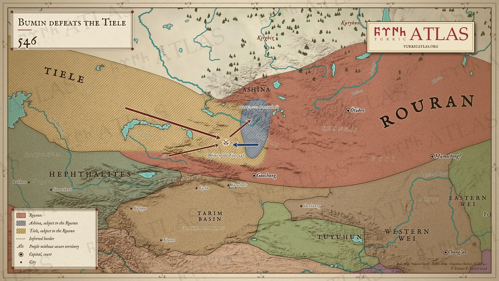 © Emre-E Yavuz 2026
546年、鉄勒が柔然に向けて動き、土門(ブミン)はその行軍を途中で迎え撃って破り、五万余落の鉄勒が彼に降る。なお柔然の臣下である阿史那氏は、アルタイと南のトゥルファン方面の地を保つ。現代の地図で、経路と戦いの場所は描画によるもの。 地図 掲載先: 546年, 鉄勒の敗北(546年)
-
550550: The Sea of Azov
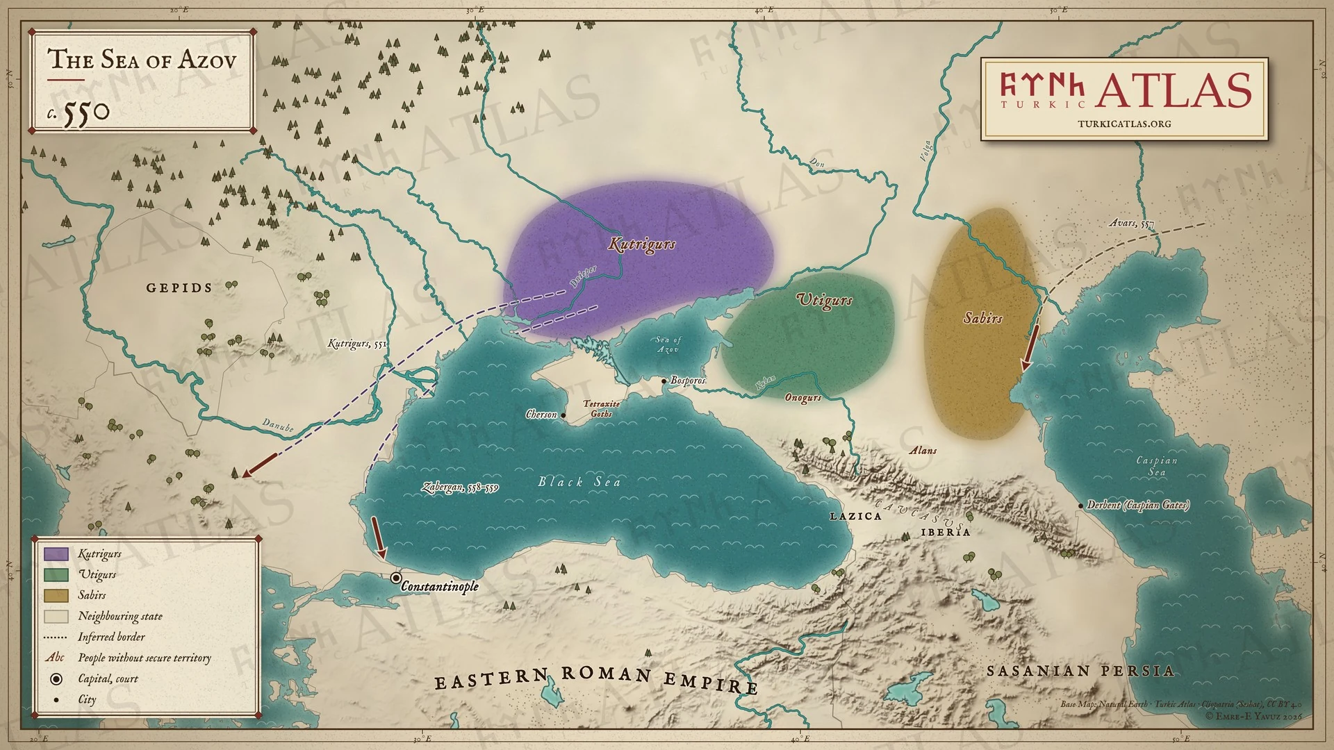 © Emre-E Yavuz 2026
550年頃。クトリグルはドン川とアゾフ海の西に、ウティグルは東に住み、サビルとオノグルはカフカスの北にいる。クトリグルは551年に侵攻し、558–559年にはザベルガンのもとでコンスタンティノープルに達する。アヴァール人は557年に到来する。現代の地図で、道は描画によるもの。 -
551–552551–552: The Göktürk–Rouran war
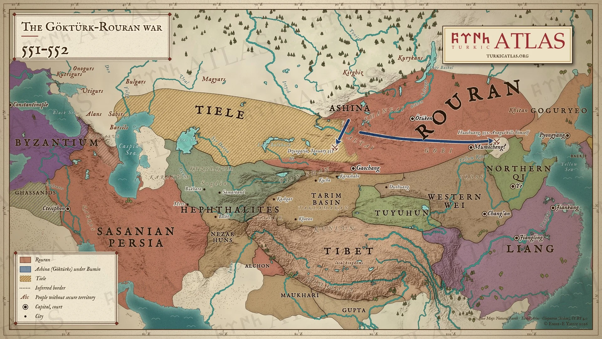 © Emre-E Yavuz 2026
551〜552年、ブミン率いるギョクテュルクが柔然に対して立ち上がる。552年1月にジュンガリアで柔然の一軍を破り、続いて懐荒の北で柔然の主力を壊滅させ、阿那瓌は自ら命を絶つ。現代の地図で、経路とジュンガリアの戦いの場所は描画によるもの。 地図 掲載先: 551年, 柔然可汗国, ギョクテュルク・柔然戦争, History of the Turkic peoples
-
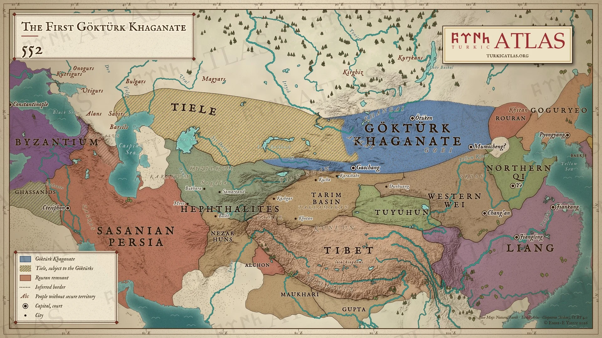
552552: The First Göktürk Khaganate
 © Emre-E Yavuz 2026
552年、柔然に勝利したブミンは可汗の称号を名乗り、その故地に第一ギョクテュルク可汗国を建てる。鉄勒はその臣下となり、柔然の残党は東方でなお抵抗する。現代の地図。 地図 掲載先: 552年, 伊利可汗(ブミン), 第一ギョクテュルク可汗国, 北斉, ブミン可汗の即位(552年)
-
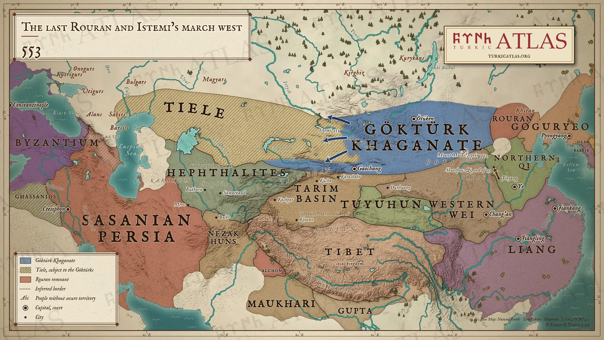
553553: The last Rouran and Istemi’s march west
 © Emre-E Yavuz 2026
553年。乙息記可汗(イッスク)が木頼山で鄧叔子の柔然を破る。年末には北斉がギョクテュルクを朔州まで追う。西方ではイステミがアルタイから出発する。大遠征の始まりである。現代の地図で、道は描画によるもの、木頼山の位置は議論がある。 地図 掲載先: 553年, 柔然可汗国, 木頼山の戦い(553年)
-
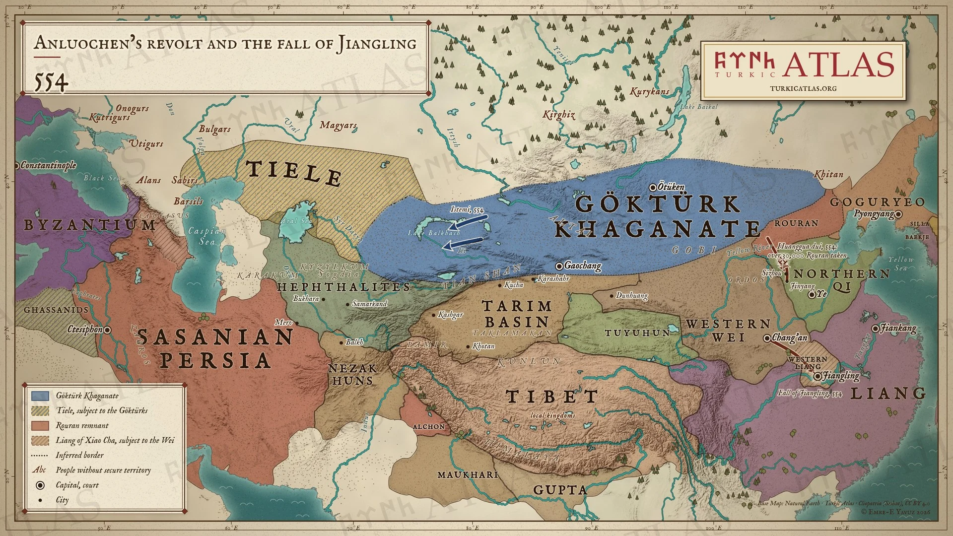
554554: Anluochen’s revolt and the fall of Jiangling
 © Emre-E Yavuz 2026
554年。庵羅辰が北斉に背く。柔然が肆州に侵入し、北斉の皇帝は晋陽から黄瓜堆まで追撃して三万余人を捕らえる。南では西魏が江陵を取り、蕭詧を西魏に従属する梁の主に立てる。現代の地図で、道は描画によるもの。 -
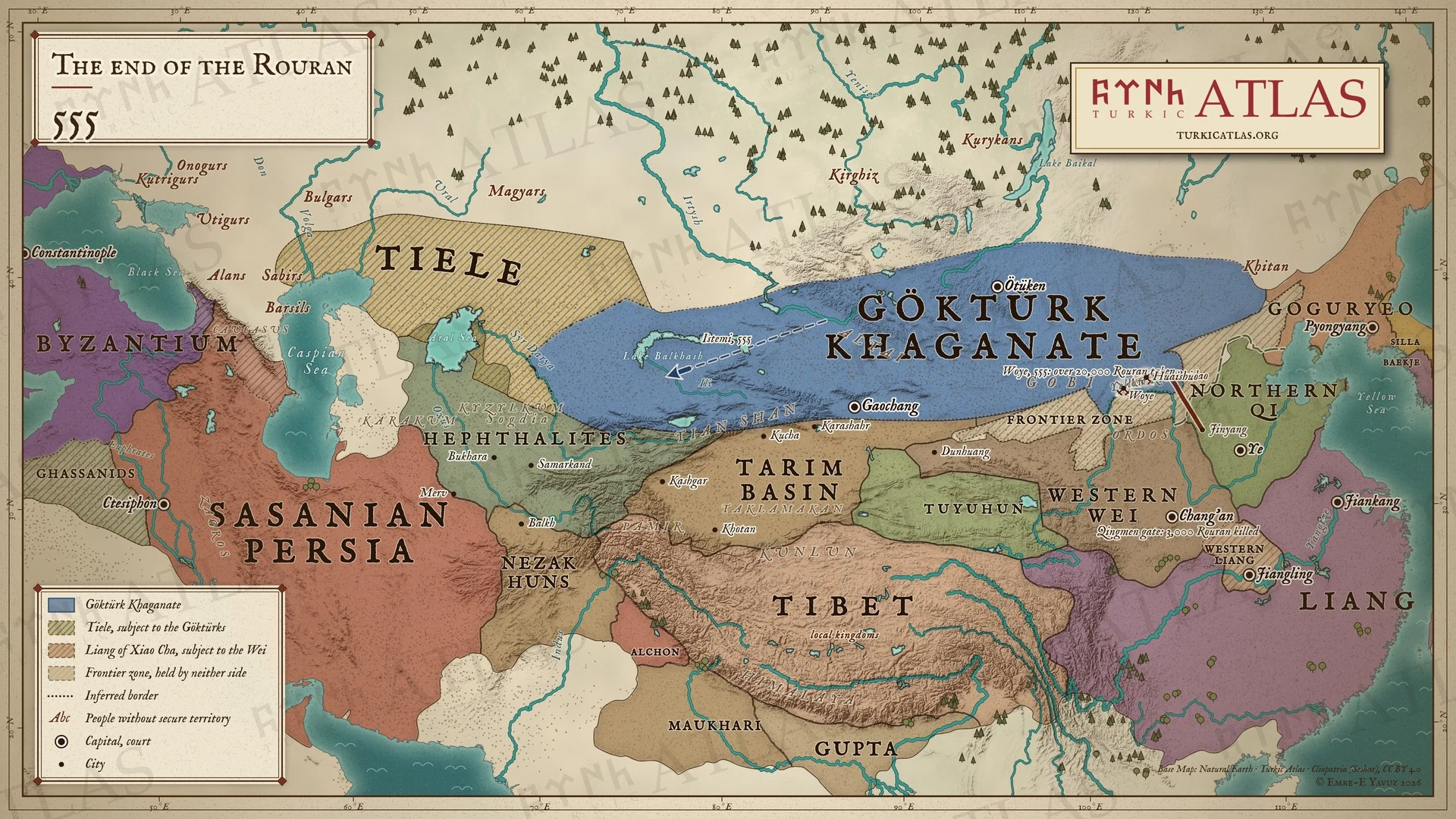
555555: The end of the Rouran
 © Emre-E Yavuz 2026
555年。北斉の皇帝は白道に輜重を残し、軽騎五千で懐朔と沃野において柔然を破り、二万余人を捕らえる。長安では西魏が鄧叔子と柔然約三千人をムカンの使者に引き渡し、使者は青門の外で彼らを殺す。西方ではイステミが一説によればバルハシ湖に達する。現代の地図で、道は描画によるもの。 地図 掲載先: 555年, 柔然可汗国, 青門の処刑(555年)
-
556556: The Göktürks and the Western Wei against the Tuyuhun
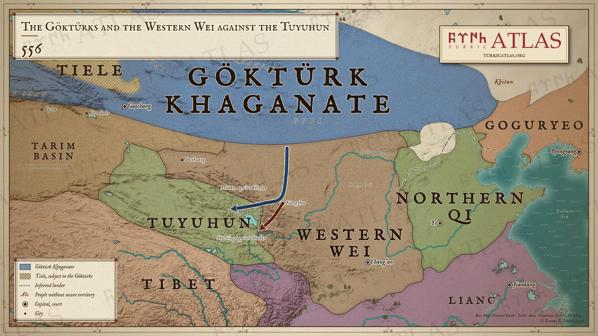 © Emre-E Yavuz 2026
556年。木杆可汗が涼州に来て、西魏の将軍史寧とともに青海湖へ進む。木杆は北道から賀真を、史寧は樹敦を取る。555年に築かれた斉の長城が北斉の北辺を守る。現代の地図で、道は描画によるもの、遠征の年が555年か556年かは議論がある。 地図 掲載先: 556年, ギョクテュルクと西魏の吐谷渾遠征(556年)
-
557557: The Northern Zhou and the flight of the Avars
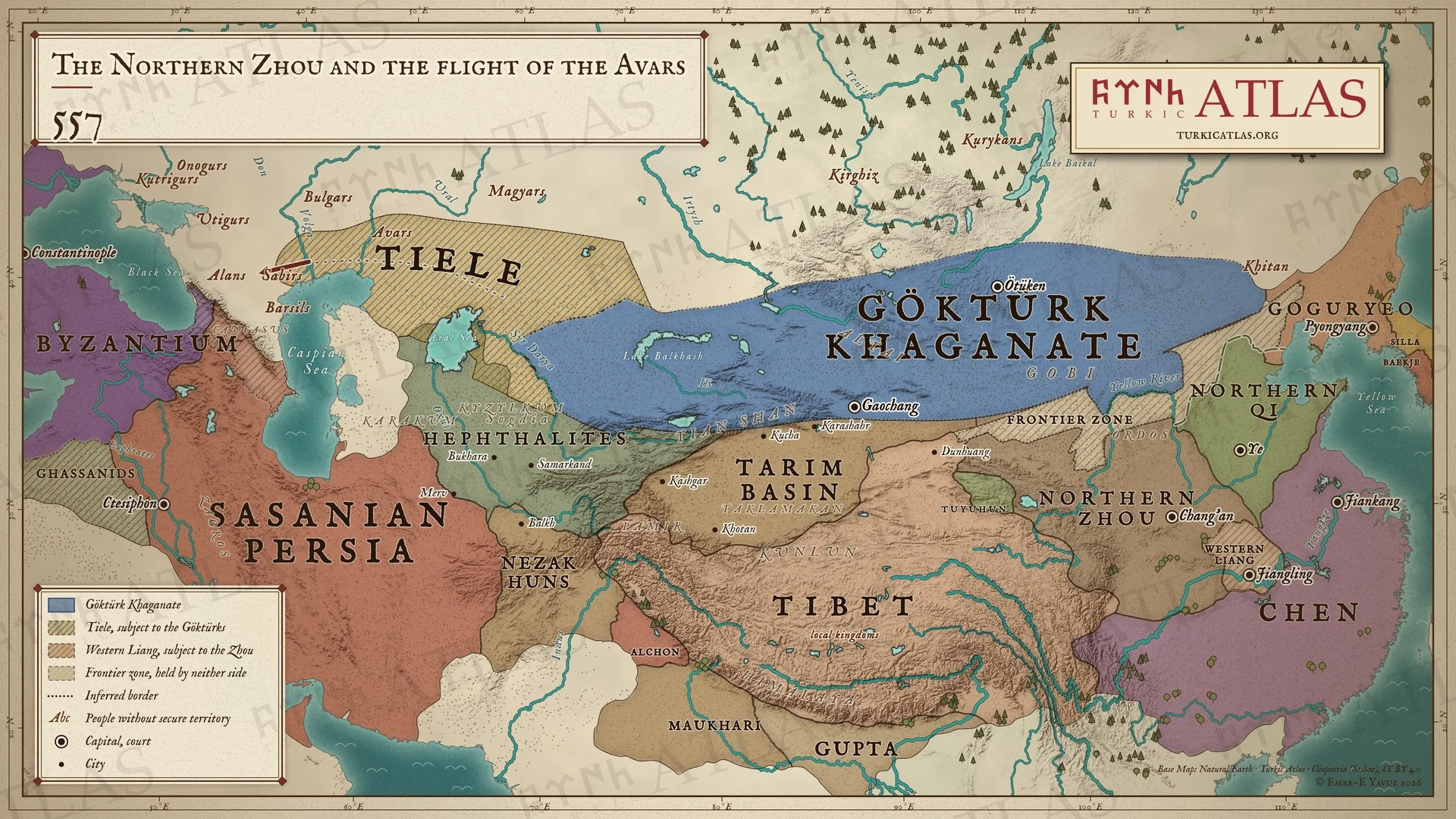 © Emre-E Yavuz 2026
557年。北周が西魏に代わり、陳が梁の帝位に就く。西方ではアヴァール人がギョクテュルクを逃れて西へ向かい、カフカス北方のアラン人のもとに至る。その道筋は記録されていない。現代の地図で、アヴァール人の道は現代の復元である。 地図 掲載先: 557年, 北周, アヴァールの逃走(557年)
-
558558: The Avars reach Constantinople
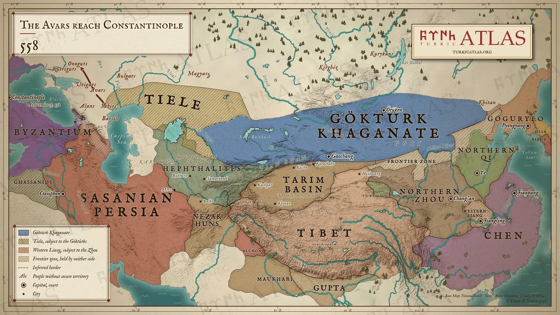 © Emre-E Yavuz 2026
558年。アヴァール人の最初の使節がアラン人とラジカを経てコンスタンティノープルに至る。その後アヴァール人はオノグルを破り、サビルを滅ぼす。現代の地図で、使節の道は描画によるもの、戦いの場所は記録されていない。 地図 掲載先: 558年, アヴァールの逃走(557年), Avars, Sabirs
-
c. 560c. 560: The Göktürks destroy the Hephthalites
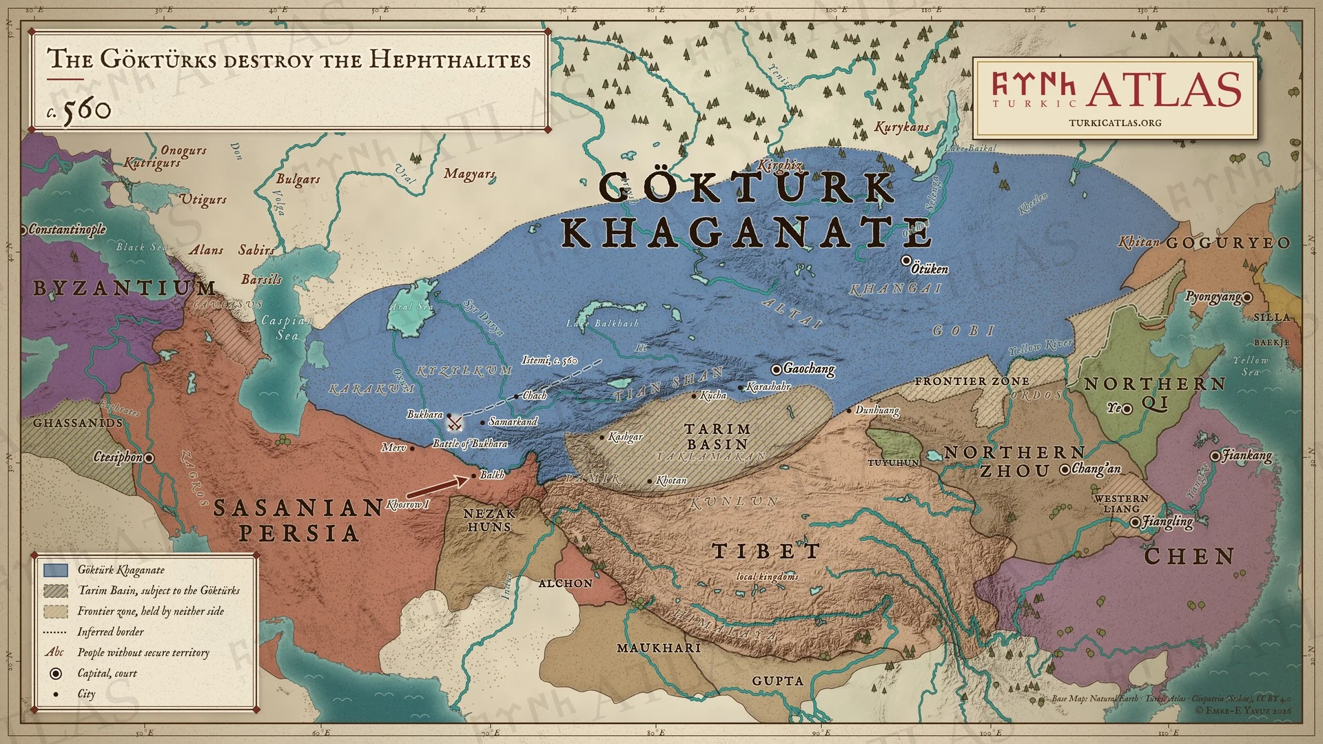 © Emre-E Yavuz 2026
560年ごろ、イステミはチャーチを経てソグディアナに進み、ブハラの戦いでエフタルを滅ぼす。ホスロー1世はオクソス川以南のエフタルの地をバルフまで取る。オクソス川がギョクテュルクとペルシアの境となる。現代の地図で、イステミの進路は描画によるもの。 地図 掲載先: 560年, 室点蜜(イステミ), 木杆可汗(ムカン), 第一ギョクテュルク可汗国, 北周, ブハラの戦い, Hephthalites, History of the Turkic peoples
-
c. 571c. 571: The Göktürk embassy to Constantinople
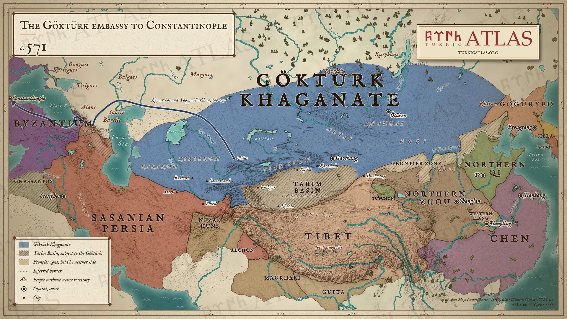 © Emre-E Yavuz 2026
569〜571年、ゼマルコスはタグマ・タルカン率いるギョクテュルクの使節団とともにイステミのもとから帰還する。タラスからカスピ海北方の草原を越え、ウグル人とアラン人の地を通り、ダレイネの道を経て黒海に出て、571年末にコンスタンティノープルに着く。現代の地図で、宿駅はメナンドロスによるもの、その間の道は描画によるもの。 地図 掲載先: 571年, ゼマルコスの使節、569年
-
572572: Taspar and the lesser khans
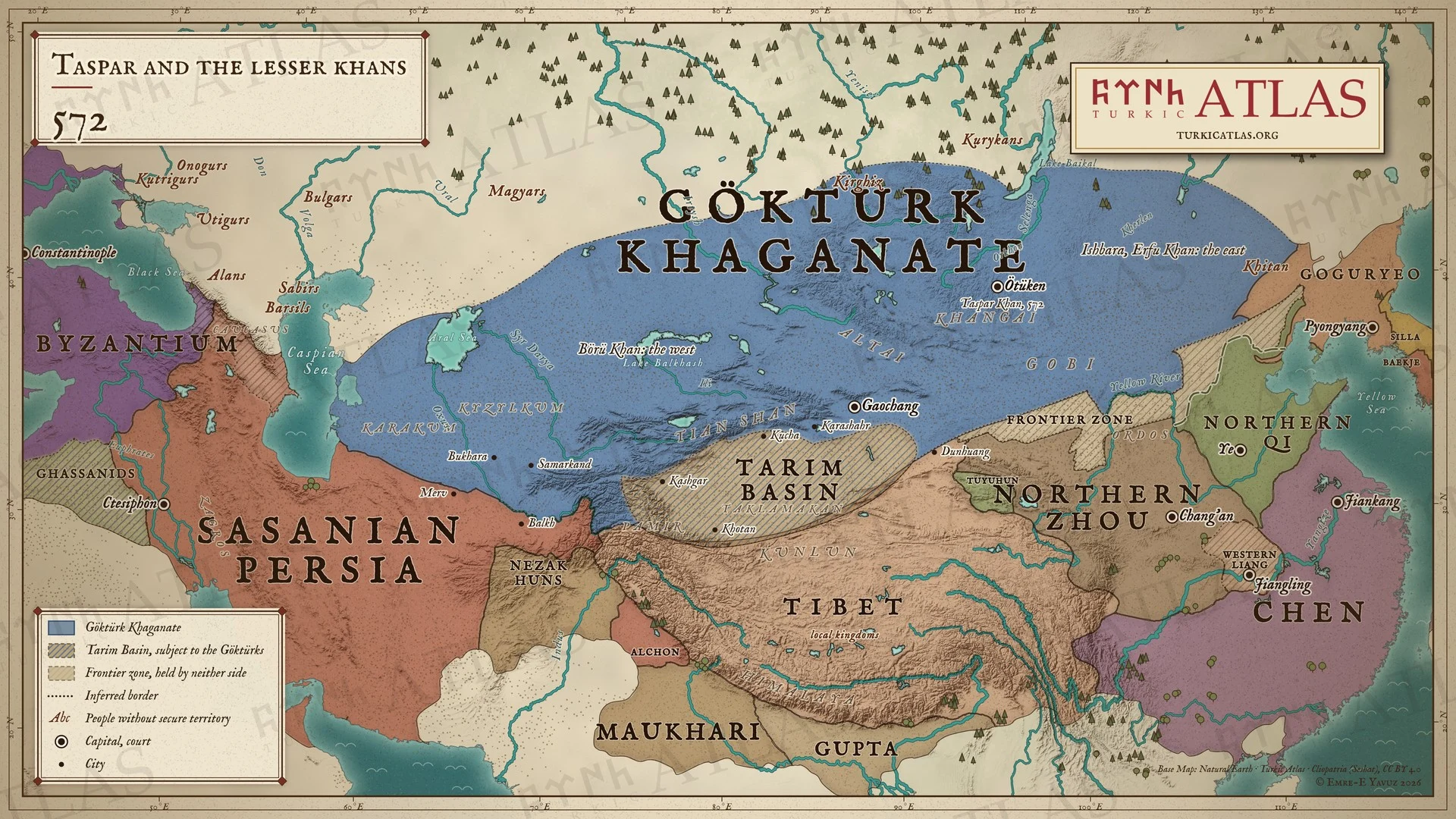 © Emre-E Yavuz 2026
572年。他鉢可汗(タスパル)が木杆可汗を継ぎ、二人の小可汗を置く。甥のイシュバラを爾伏可汗として東方に、褥但可汗の子の歩離可汗(ボリュ)を西方に置いた。地図は二人の名だけを示す。現代の地図で、可汗国の境はおおよそのもの。 地図 掲載先: 572年, 佗鉢可汗による小可汗の任命(572年)
-
576576: The Pontic steppe under Göktürk rule
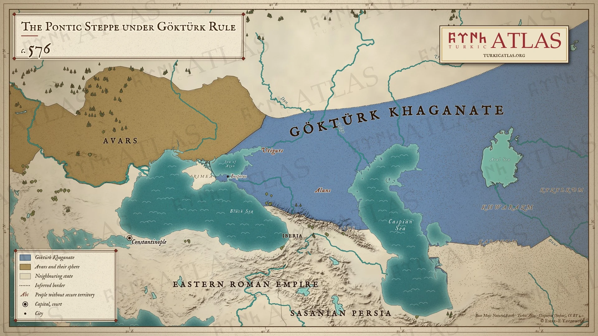 © Emre-E Yavuz 2026
576年頃。ギョクテュルクはアゾフ海から東の草原を支配し、ボスポロスを取る。ウティグルとアラン人はその支配下にある。ドン川の西にはアヴァール人とその勢力圏が広がる。現代の地図で、西の境界は解釈である。 地図 掲載先: 576年, ヨーロッパのテュルク系諸部族
-
c. 576The First Göktürk Khaganate, c. 576
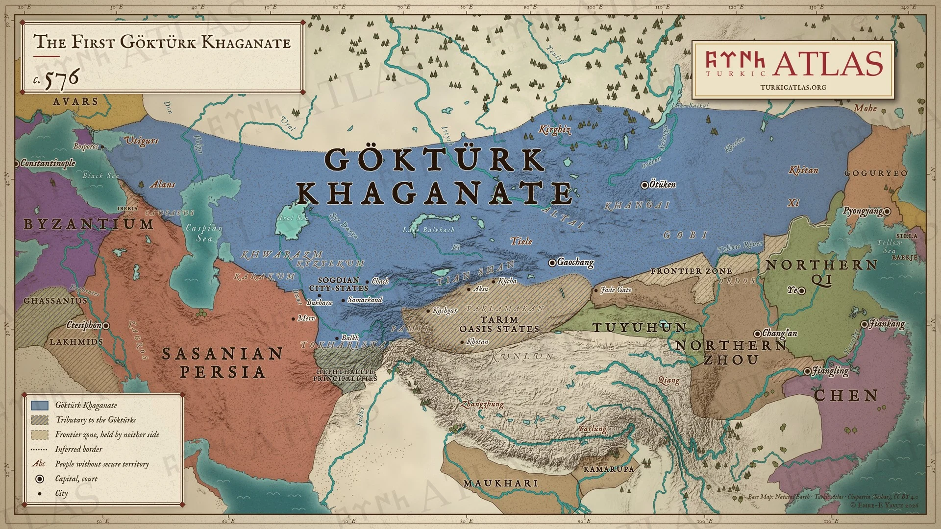 © Emre-E Yavuz 2026
576年ごろ、イステミが没した年の第一ギョクテュルク可汗国。黒海から契丹までの領域に、朝貢するタリム盆地のオアシス国家とエフタルの諸侯国、そして東ローマ帝国、サーサーン朝、北周、北斉、陳。草原と中国のあいだには北斉の長城(556年)と、どちらにも属さない境界地帯がある。現代の地図で、西の境界は推定、境界はおおよそのもの。 地図 掲載先: 576年
-
581The division of the khaganate, AD 581
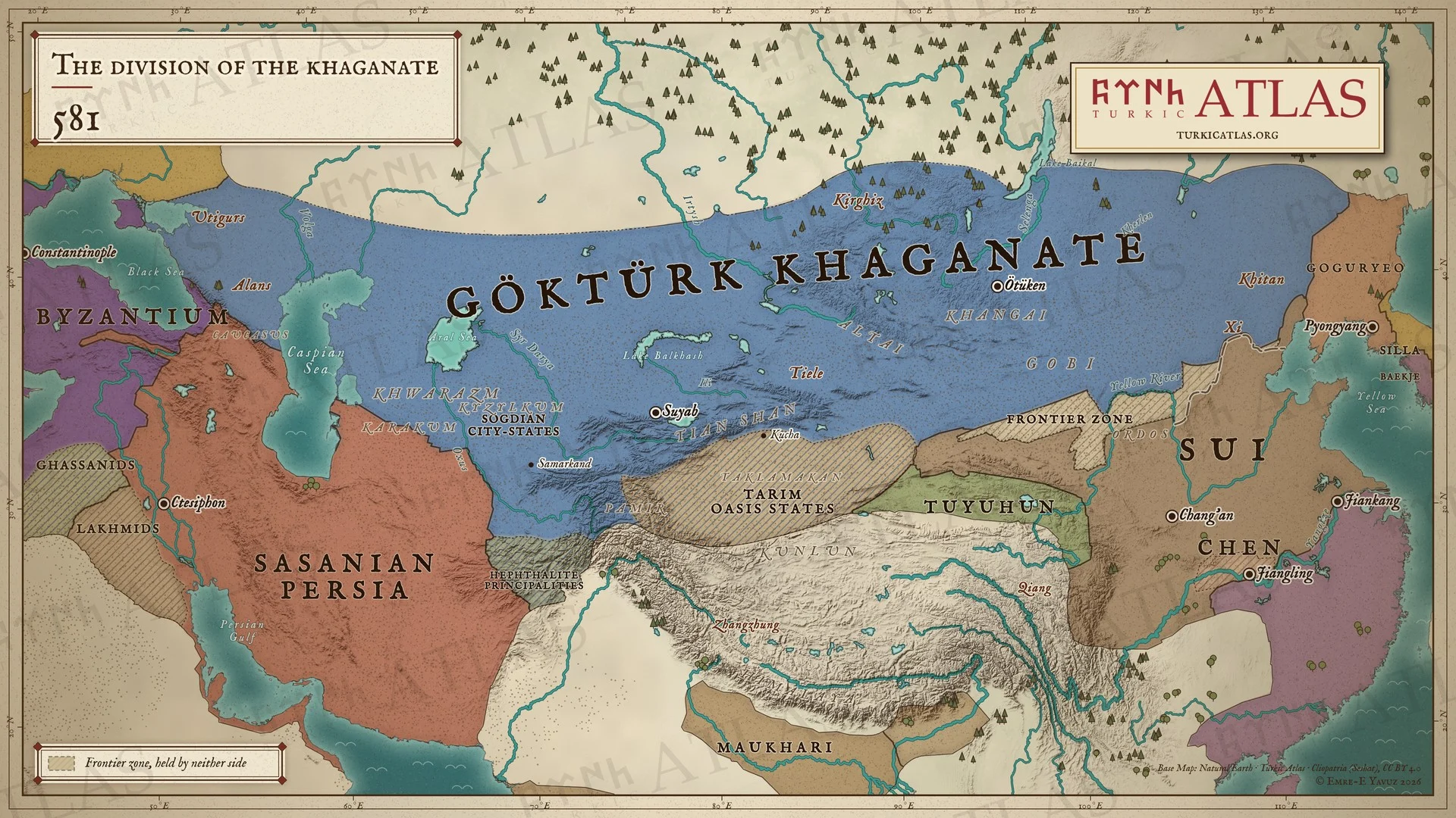 © Emre-E Yavuz 2026
581年、タスパルが没した年のギョクテュルク可汗国。黒海から契丹まで、まだ分かれておらず、宮廷はウテュケンにある。そばには、この年に支配を始めた隋、陳、サーサーン朝、東ローマ帝国。草原と中国のあいだには北斉の長城(556年)と、どちらにも属さない境界地帯がある。現代の地図で、境界はおおよそのもの。 地図 掲載先: 581年, 佗鉢可汗(タスパル), ギョクテュルク継承危機(581年)
-
582–583582–583: Ishbara's campaigns against the Sui
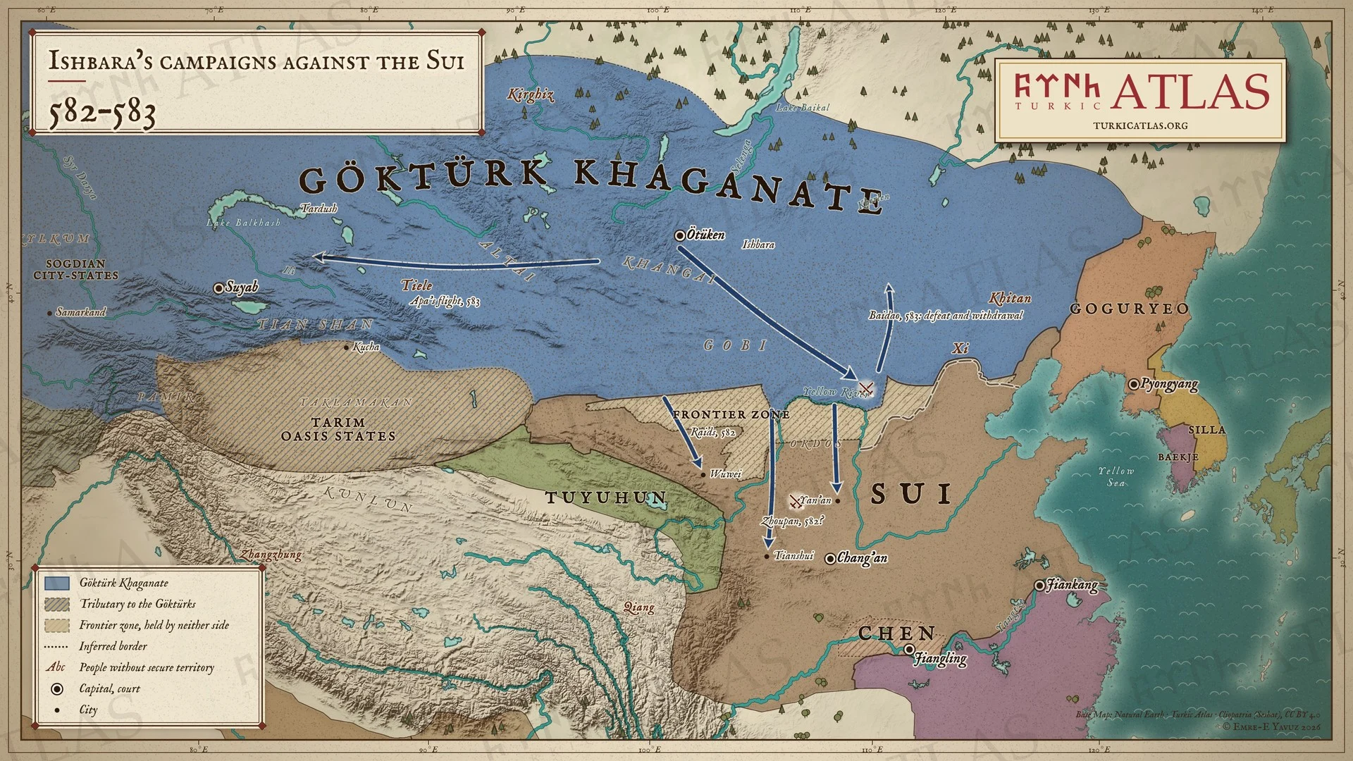 © Emre-E Yavuz 2026
582〜583年。582年、沙鉢略可汗(イシュバラ)率いるギョクテュルクは長城を越え、武威から延安まで隋の辺境を略奪する。583年、イシュバラはウテュケンから白道へ進むが敗れて退き、阿波可汗(アパ)は西の達頭可汗(タルドゥシュ)のもとへ逃れる。現代の地図で、略奪の道は描画によるもの。 地図 掲載先: 582年, 沙鉢略可汗(イシュバラ), ギョクテュルク・隋戦争(582〜603年)
-
584The division of the khaganate, AD 584
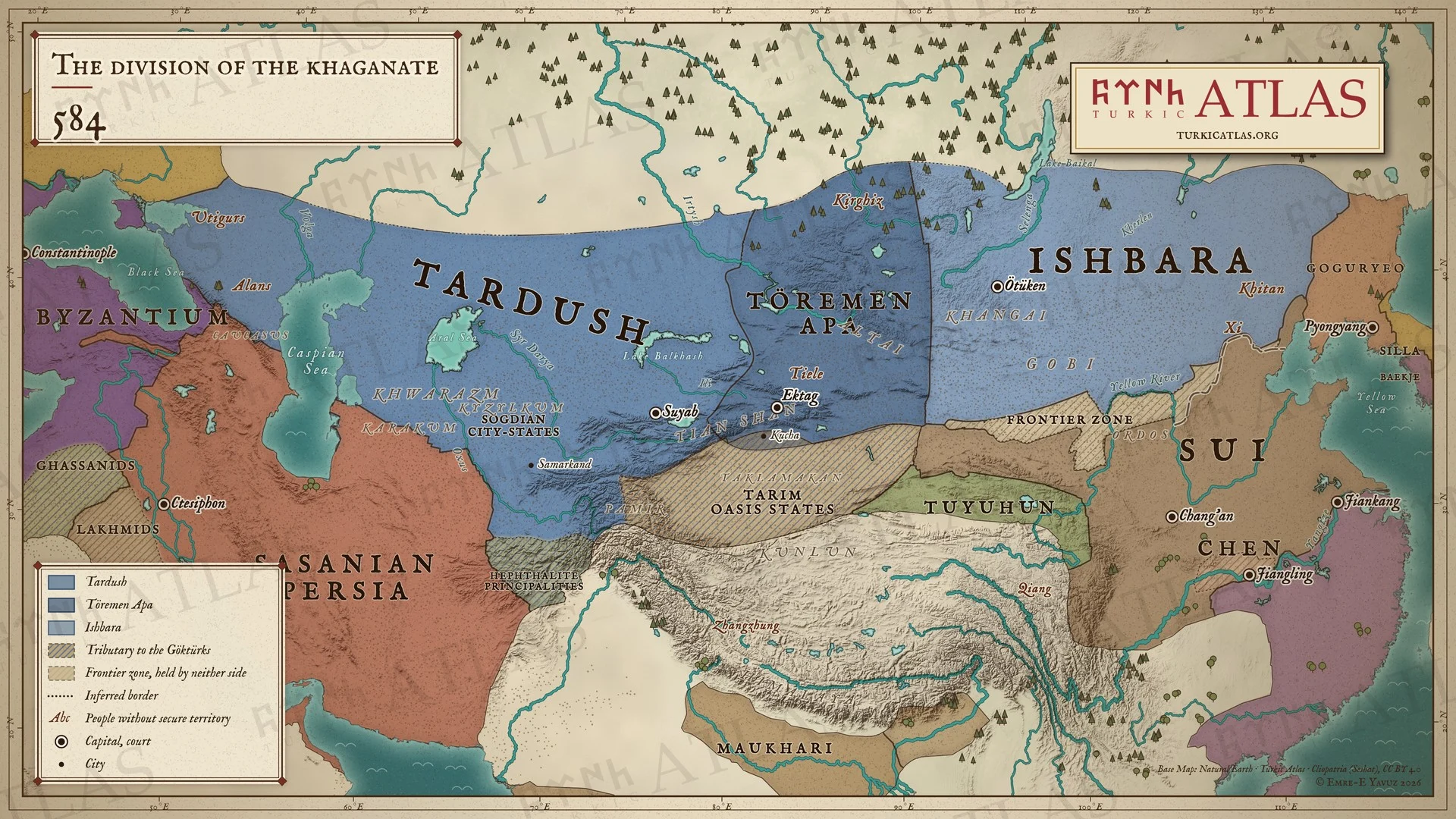 © Emre-E Yavuz 2026
内戦が始まった584年のギョクテュルクの領域。西にタルドゥシュ、中央にテョレメン・アパ、東にイシュバラ、そして隋、陳、サーサーン朝、東ローマ帝国。草原と中国のあいだには北斉の長城(556年)と、どちらにも属さない境界地帯がある。現代の地図で、勢力圏はおおよそのもの。 地図 掲載先: 584年, 達頭可汗(タルドゥシュ), 阿波可汗(テョレメン・アパ), 第一ギョクテュルク可汗国, ギョクテュルク内戦
-
585585: The Göktürk civil war
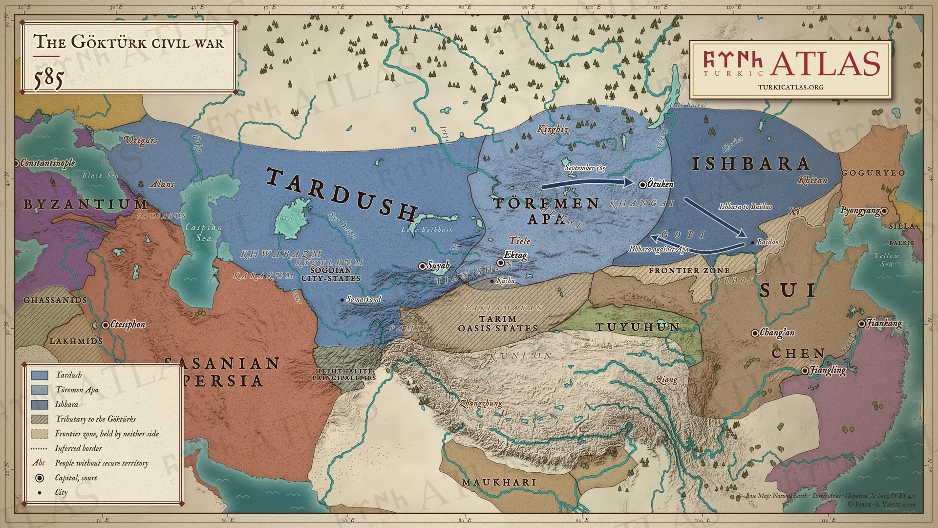 © Emre-E Yavuz 2026
585年。9月、西方の軍がウテュケンへ進む。沙鉢略可汗(イシュバラ)は隋の保護のもと白道へ退き、そこから阿波可汗(アパ)に反撃する。現代の地図で、道は描画によるもの、可汗国内の区分はおおよそのもの。 地図 掲載先: 585年, 沙鉢略可汗(イシュバラ), 阿波可汗(テョレメン・アパ), ギョクテュルク内戦
-
587–588587–588: The Göktürk civil war
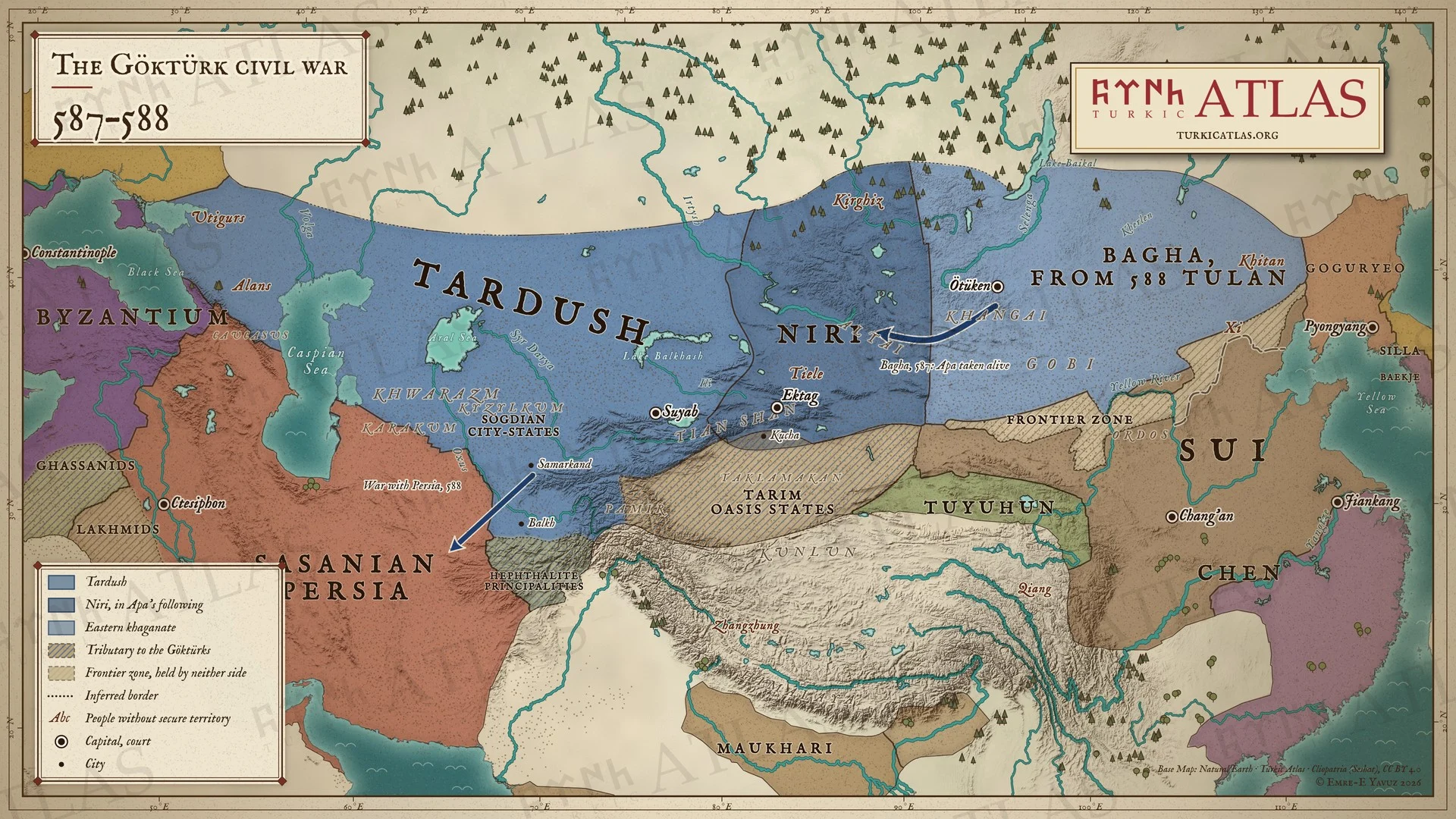 © Emre-E Yavuz 2026
587〜588年。沙鉢略可汗(イシュバラ)が没し、東方では莫何可汗(バガ)が継ぐ。バガは西へ進んで阿波可汗(アパ)を生け捕りにし、泥利可汗(ニリ)がその配下を率いる。588年にバガが没して都藍可汗(トゥラン)が継ぎ、そのころ西方はペルシアと戦っている。現代の地図で、道は描画によるもの、可汗国内の区分はおおよそのもの。 地図 掲載先: 587年, 莫何可汗(バガ), 阿波可汗(テョレメン・アパ), 都藍可汗(トゥラン), ギョクテュルク内戦
-
589589: Bahram Chobin and the end of the Chen
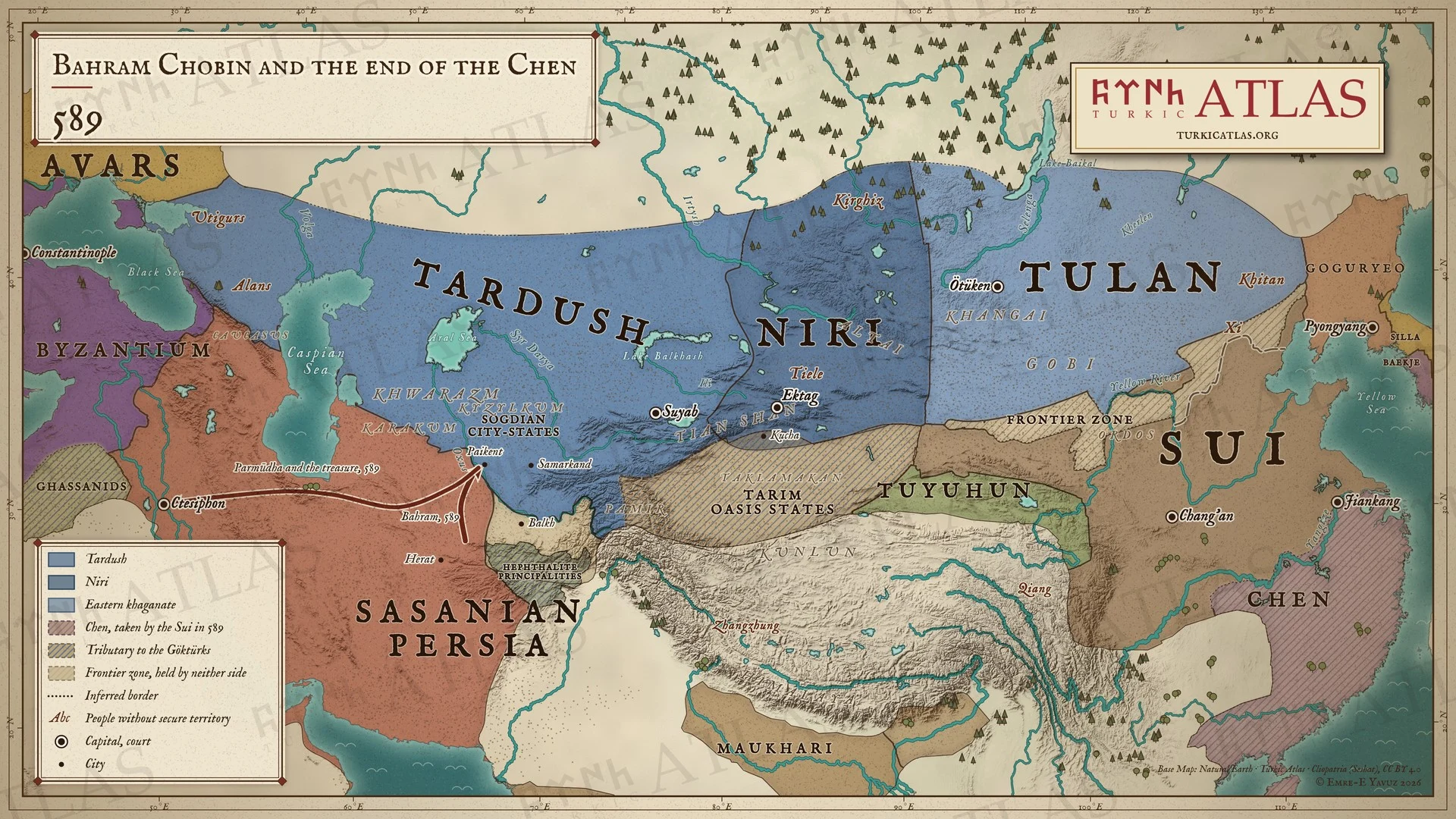 © Emre-E Yavuz 2026
589年。バフラーム・チョービンがヘラートを奪い返し、オクサス川を越えてパイケントに至る。パルムーダと財宝はクテシフォンへ送られる。同じ年に隋が陳を取り、中国を統一する。現代の地図で、道は描画によるもの、可汗国内の区分はおおよそのもの。 地図 掲載先: 589年, Bahram Chobin
-
597–599597–599: The Göktürk civil war
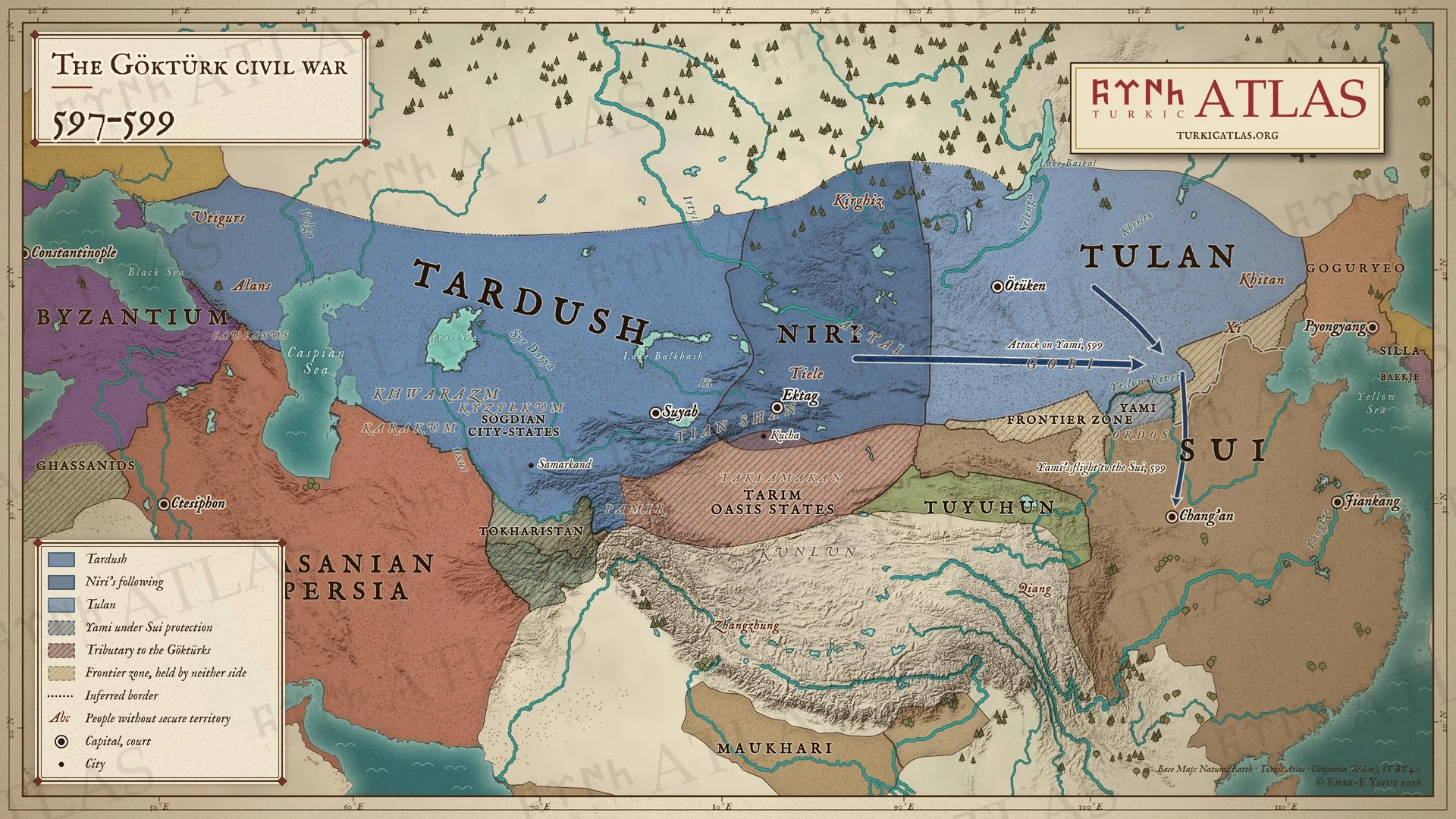 © Emre-E Yavuz 2026
597〜599年。隋の公主を娶ったヤミは、599年、長城の下で都藍可汗(トゥラン)と達頭可汗(タルドゥシュ)に襲われる。彼は長安の隋の宮廷へ逃れて啓民可汗に立てられ、隋はその民にオルドスの牧地を与える。現代の地図で、道は描画によるもの、可汗国内の区分はおおよそのもの。 地図 掲載先: 597年, 達頭可汗(タルドゥシュ), 都藍可汗(トゥラン), Yami Khan, ギョクテュルク内戦
-
600600: Tardush and the Sui
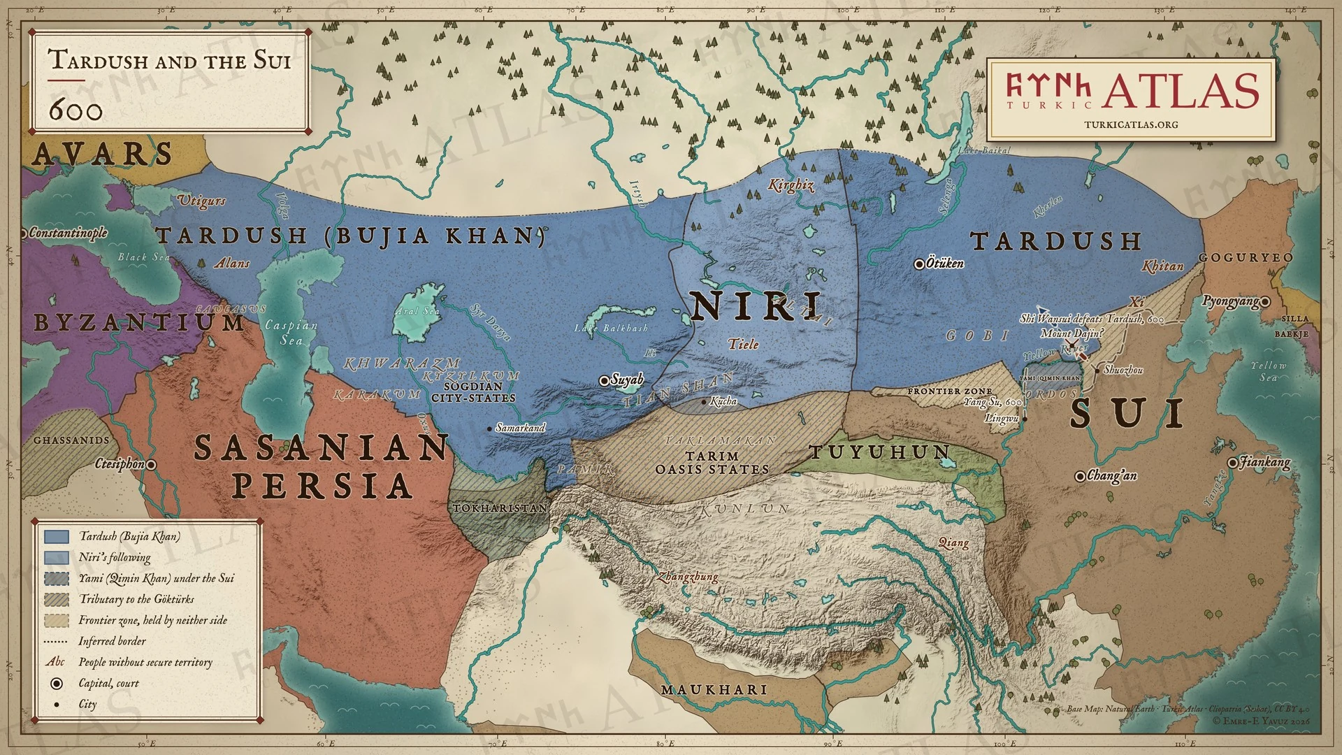 © Emre-E Yavuz 2026
600年。歩迦可汗となったタルドゥシュが草原全体を支配する。ヤミは隋のもとで啓民可汗としてオルドスを治める。大斤山でタルドゥシュは史万歳の前から戦わずに退く。現代の地図で、山の位置と道筋は描いたもので史料にはない。 地図 掲載先: 600年
-
c. 603The division of the khaganate, c. AD 603
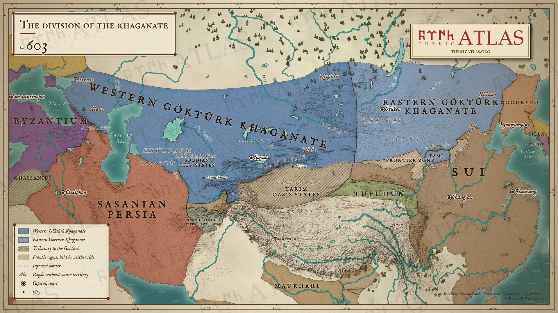 © Emre-E Yavuz 2026
603年ごろ、分裂した可汗国。黒海から天山までの西ギョクテュルク可汗国と、ハンガイから契丹までの東ギョクテュルク可汗国、そして中国全土を治めるに至った隋、サーサーン朝、東ローマ帝国。草原と中国のあいだには北斉の長城(556年)と、どちらにも属さない境界地帯がある。白道の平原はギョクテュルクに属し、オルドスの北はヤミの牧地である。現代の地図で、東西の境はおおよそのもの。 地図 掲載先: 603年, 達頭可汗(タルドゥシュ), Yami Khan, ギョクテュルク内戦
-
627627: The Caucasus campaign and the revolt of the Tiele
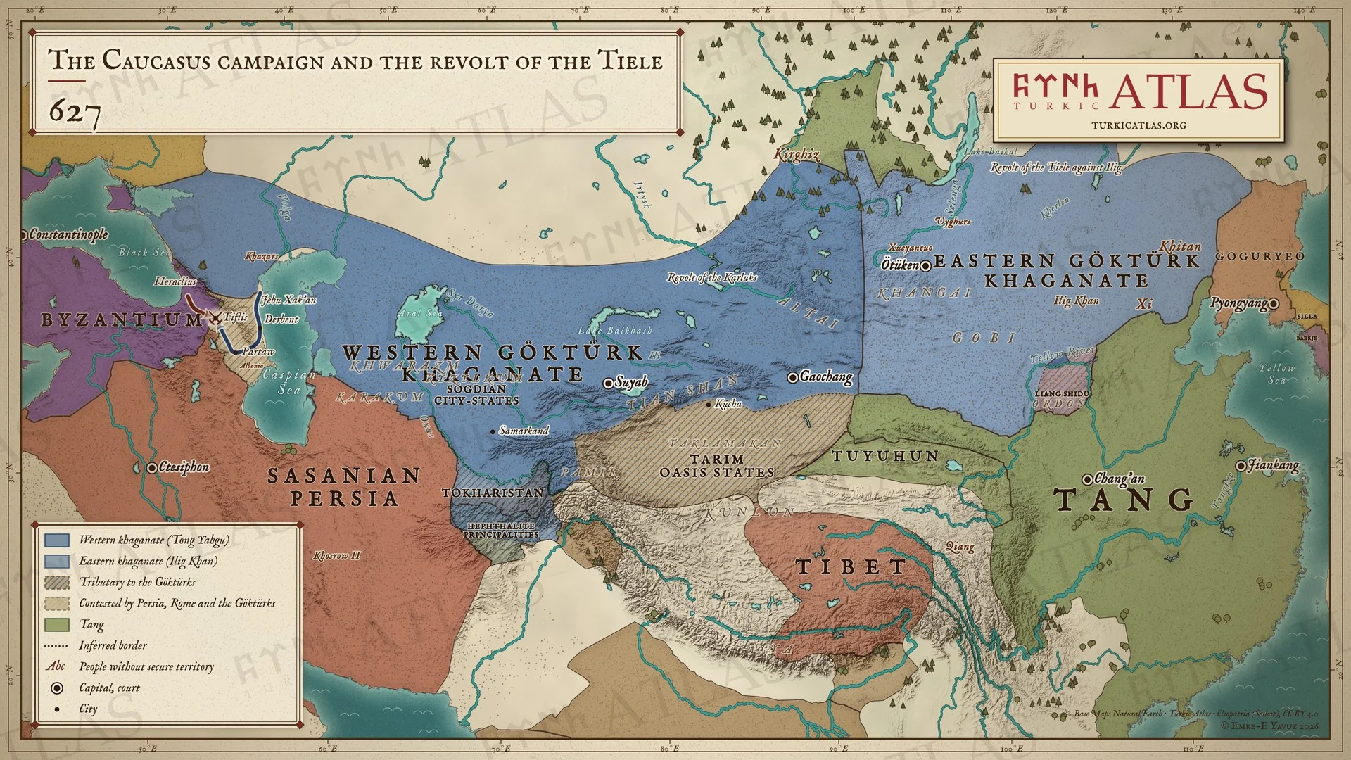 © Emre-E Yavuz 2026
627年。西方では統葉護の軍がデルベントを破り、ティフリスの前でジェブ・ハカンが皇帝ヘラクレイオスと会う。東方では鉄勒が頡利可汗に背き、大雪がその民の家畜を死なせる。現代の地図で、草原の境はおおよそのもの。 地図 掲載先: 627年, 統葉護可汗(トン・ヤブグ)
-
628628: The murder of Tong Yabgu and the secession of the Tiele
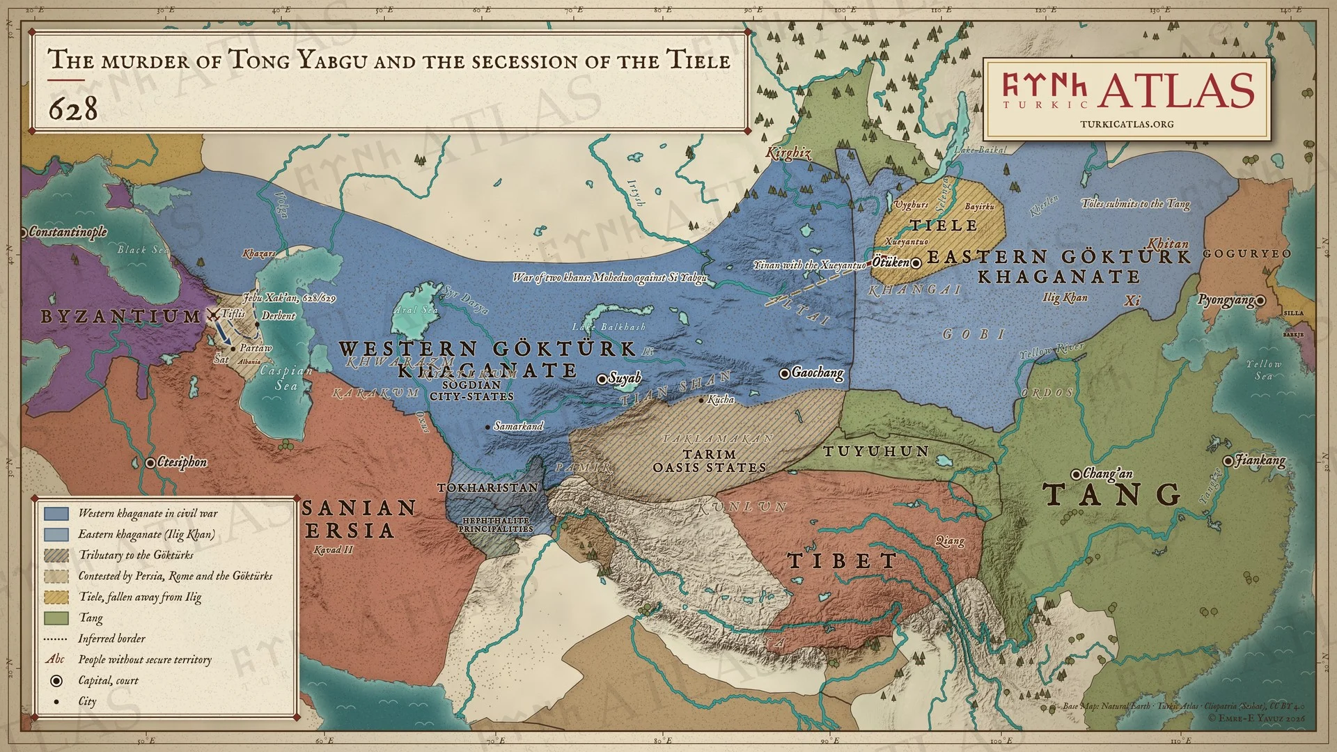 © Emre-E Yavuz 2026
628年。西方では統葉護が叔父に殺され、二人の可汗が国を争う。夷男は薛延陀を率いてアルタイから東へ移る。東方では鉄勒が頡利可汗から離れ、トレスが唐に服属する。カフカスではジェブ・ハカンが628年か629年にティフリスを攻め落とす。現代の地図で、草原の境はおおよそのもの。 地図 掲載先: 628年, 薛延陀可汗国, 統葉護可汗の暗殺(630年)
-
630630: The fall of the eastern khaganate
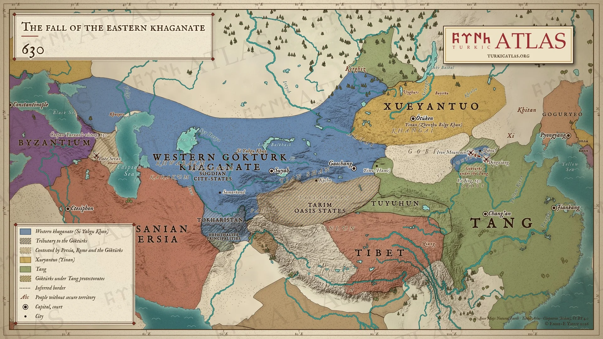 © Emre-E Yavuz 2026
630年。李靖が夜に定襄を襲い、鉄山で東可汗国を滅ぼす。ギョクテュルクは黄河沿いの唐の羈縻のもとに置かれる。ゴビの北では薛延陀が草原を握り、伊吾は唐に降る。西方では肆葉護可汗が治め、カフカスでは北の軍がセヴァン湖で勝つ。現代の地図で、草原の境はおおよそのもの。 地図 掲載先: 630年, 唐による東可汗国の征服(626〜630年), History of the Turkic peoples
-
638638: The western khaganate divided
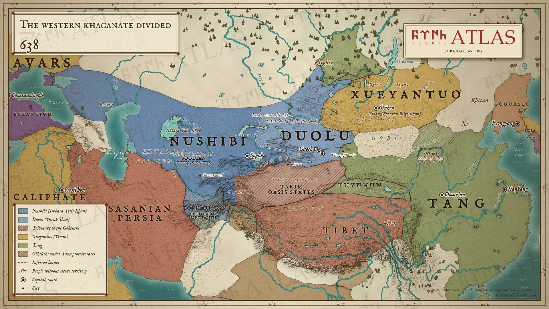 © Emre-E Yavuz 2026
638年。咄陸の諸部がイシュバラ・トリスに対して欲谷設を可汗に立てる。西突厥はイリ川で分かれ、西に弩失畢、東に咄陸が立つ。現代の地図で、川から離れた境界は描いたもので史料にはない。 地図 掲載先: 638年
-
648648: The Tang conquest of the Tarim
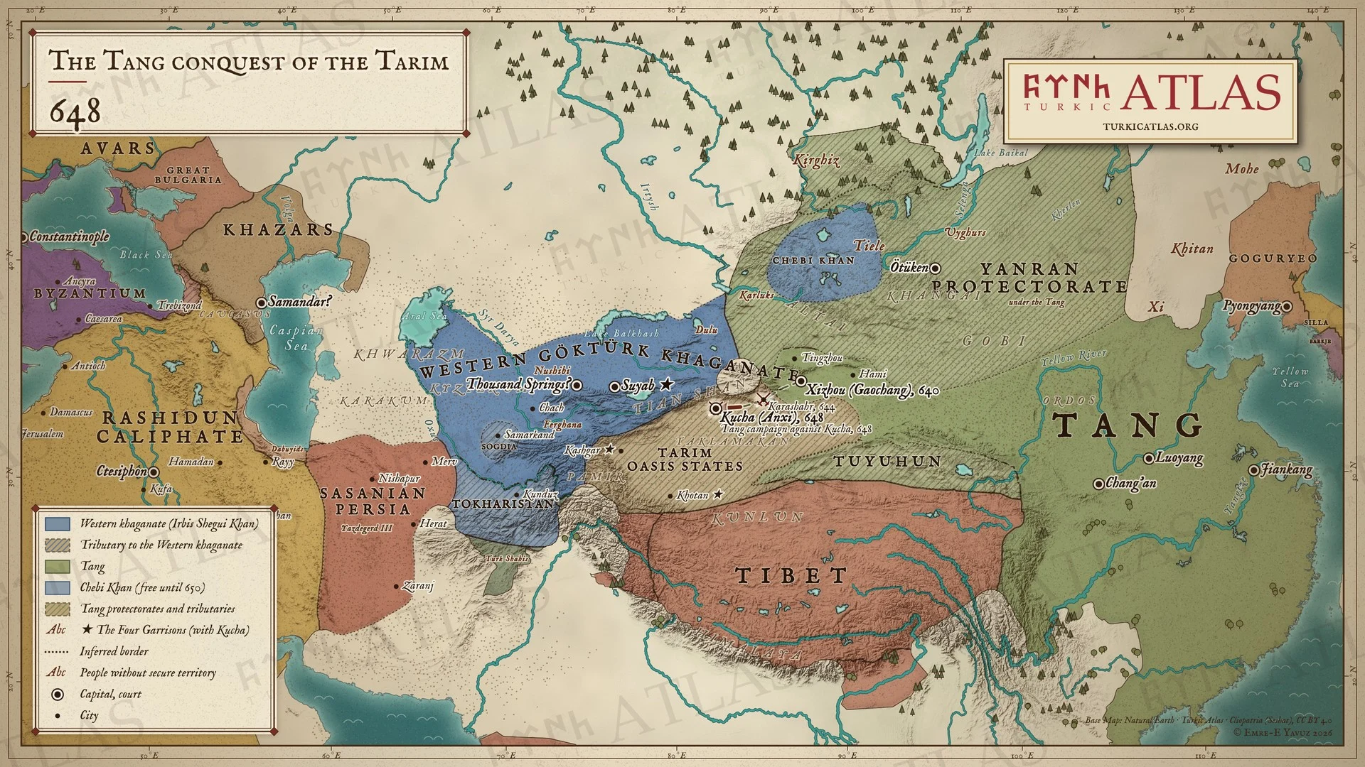 © Emre-E Yavuz 2026
648年。唐はタリムを一歩ずつ取る。640年に高昌、644年に焉耆、648年に亀茲を取り、安西都護府はいま亀茲に置かれる。亀茲・于闐・疏勒・砕葉が四鎮となる。天山の北では西可汗国が射匱可汗のもとで持ちこたえ、アルタイでは車鼻可汗がなお自立している。現代の地図で、草原の境はおおよそのもの。 地図 掲載先: 648年, The Tang conquest of the western Khaganate, 640–659, クチャ
-
650The Western khaganate and the Tang, AD 650
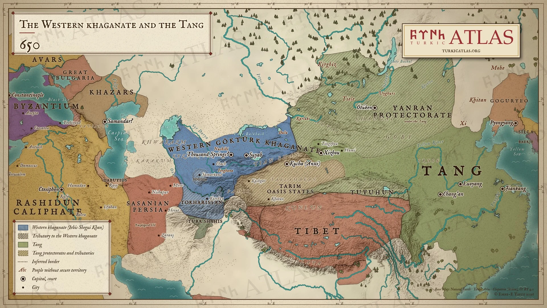 © Emre-E Yavuz 2026
650年のアジア。イルビス・シェグイ・カンの西ギョクテュルク可汗国はタルバガタイからオクサス川まで広がり、ソグドとトハリスタンがこれに従う。東では唐が燕然都護府を通じて草原を治め、キルギスとタリムのオアシス諸国が唐に朝貢し、安西都護府は亀茲に置かれる。西ではカリフ国がイラクとイラン西部を取り、ヤズデギルド3世の手にはホラーサーンとスィースターンだけが残る。現代の地図で、可汗国と都護府の境はおおよそのもの。 地図 掲載先: 650年, Irbis Shegui Khan, History of the Turkic peoples
-
657657: The end of the western khaganate
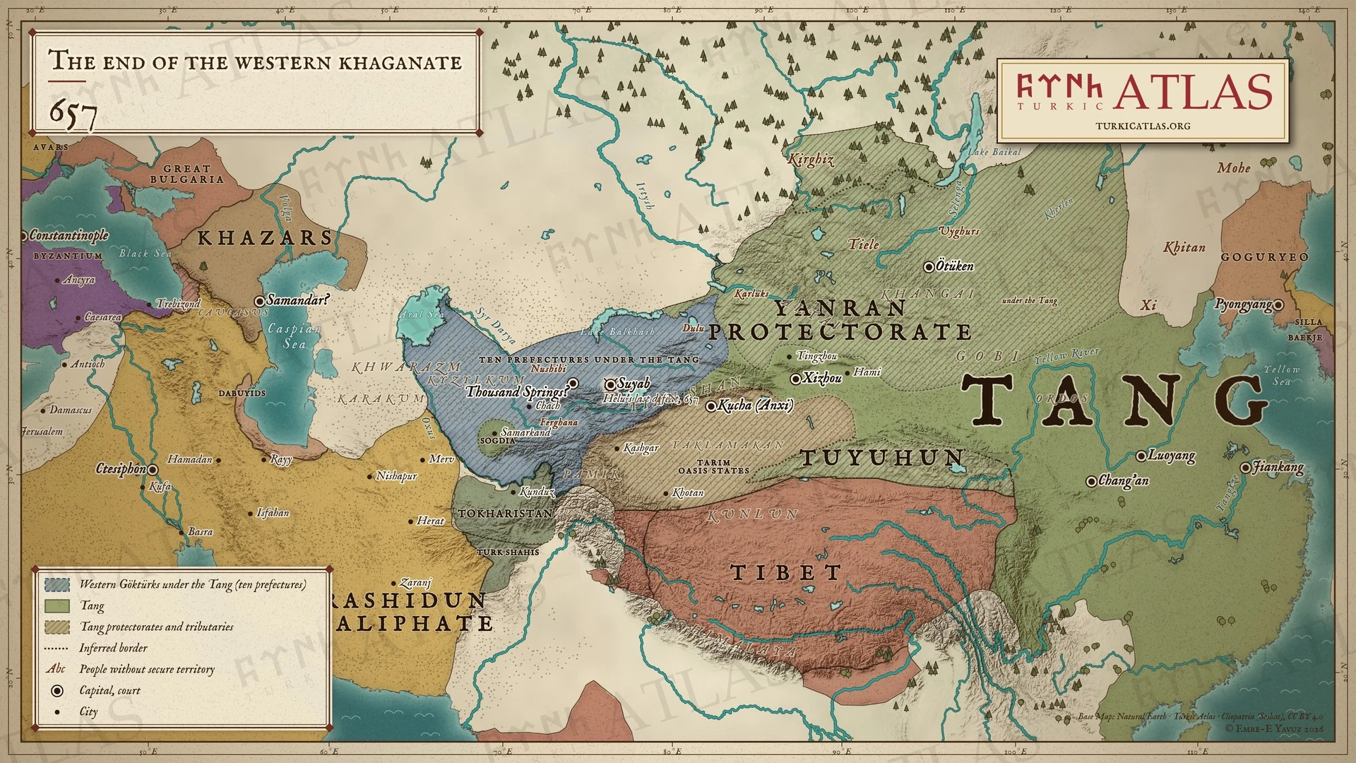 © Emre-E Yavuz 2026
657年。唐が西突厥最後の可汗、阿史那賀魯を捕らえる。その地は唐のもとで十の州となる。現代の地図で、州の境界は描いたもので史料にはない。 地図 掲載先: 657年, History of the Turkic peoples
-
670670: Tibet takes the Four Garrisons
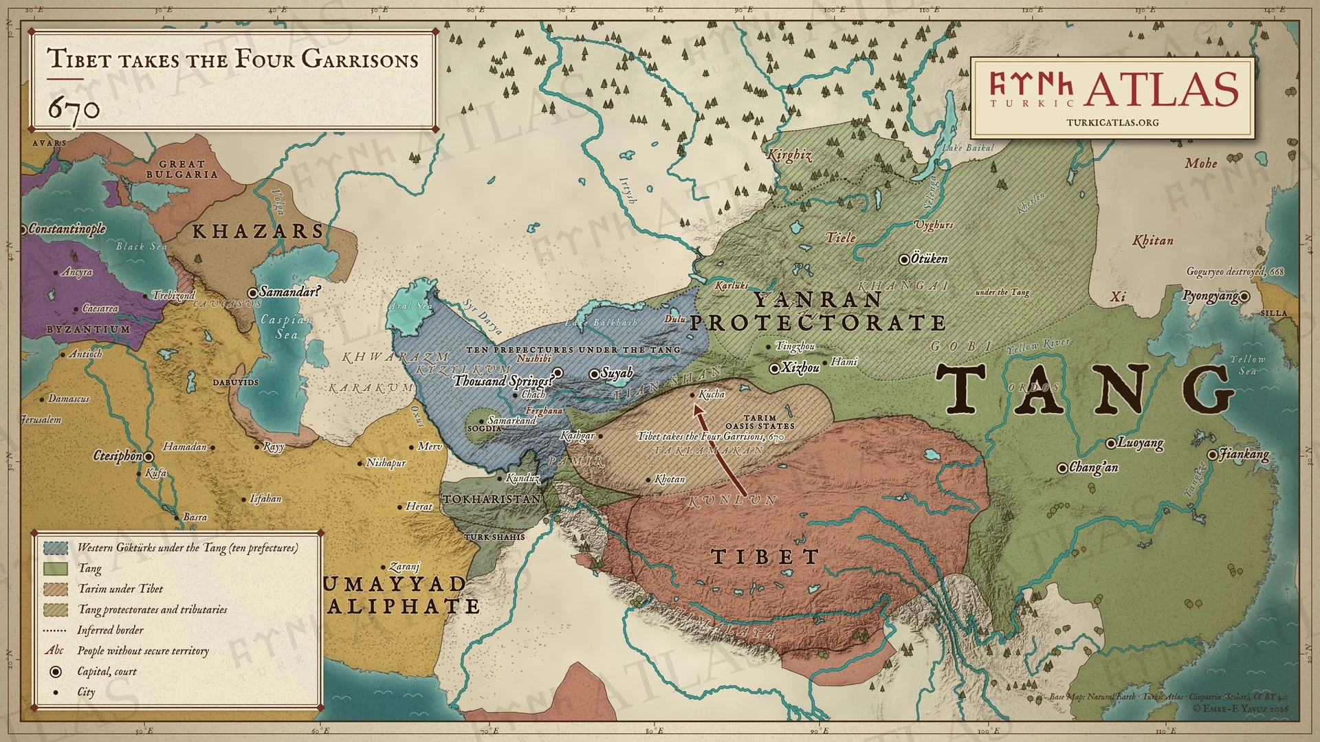 © Emre-E Yavuz 2026
670年。吐蕃が唐からタリムの安西四鎮を奪う。三十年にわたり、オアシスは何度も支配者を変える。現代の地図で、吐蕃の支配範囲は描いたもので史料にはない。 地図 掲載先: 670年
-
679–681679–681: The risings of Nishufu and Funian
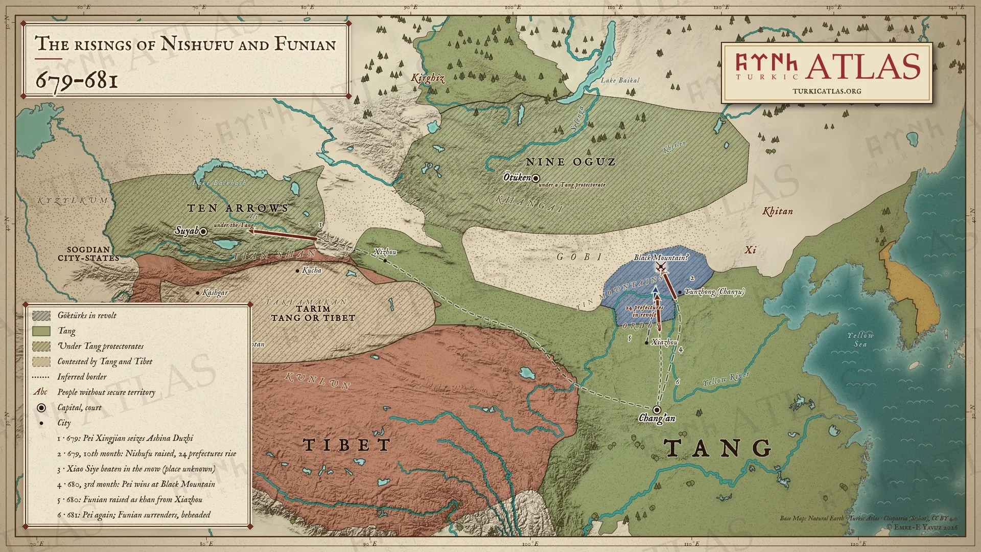 © Emre-E Yavuz 2026
679〜681年。679年、単于都護府のギョクテュルクが泥熟匐を可汗に立て、二十四州が共に背く。裴行倹は680年に黒山でこれを破り、泥熟匐は部下に殺される。次に夏州で立てられた伏念は681年に裴行倹に降り、長安で斬られる。番号は出来事の順を示す。現代の地図で、道筋は描いたもので史料にはない。 地図 掲載先: 679年, Ashina Funian, Nishufu Khan, Pei Xingjian
-
682682: The rising of Ilterish
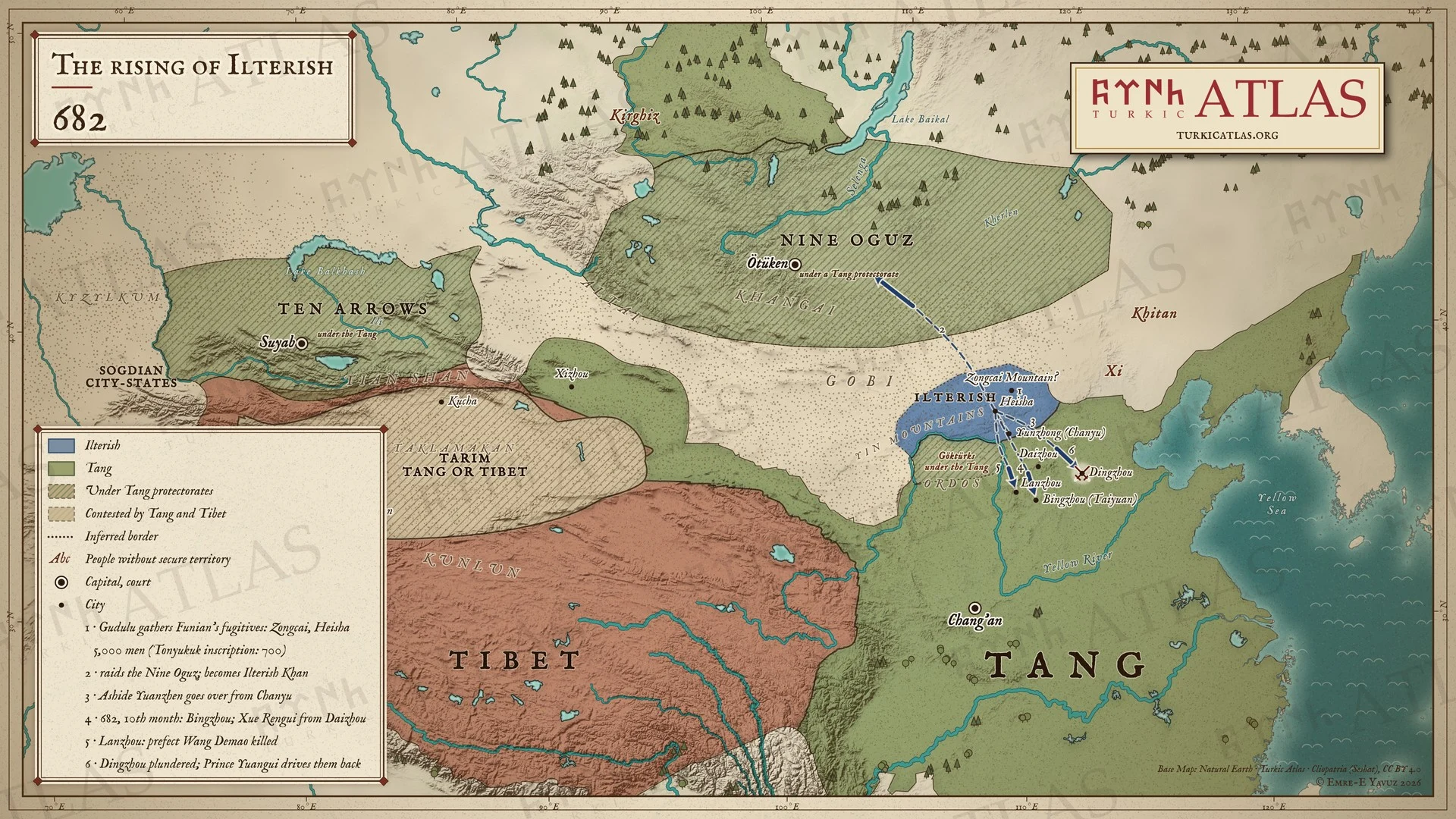 © Emre-E Yavuz 2026
682年。伏念の敗北の後、骨咄禄は逃れた者たちを総材山と黒沙に集め、九姓を襲い、自らイルテリシュ可汗となる。阿史德元珍が彼のもとに走る。十月、ギョクテュルクは并州・嵐州・定州を襲う。番号は出来事の順を示す。現代の地図で、道筋は描いたもので史料にはない。 地図 掲載先: 682年, 骨咄禄(イルテリシュ), 第二ギョクテュルク可汗国
-
691691: Kapgan Khan takes the throne
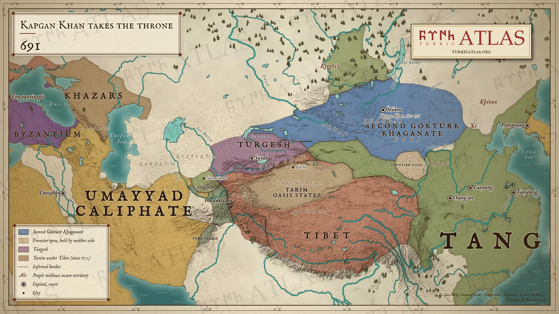 © Emre-E Yavuz 2026
691年。カプガン可汗が第二突厥可汗国の位に就く。西では突騎施がスイアブ周辺のチュー川流域を押さえる。現代の地図で、境界は描いたもので史料にはない。 地図 掲載先: 691年
-
692692: The Tang retake the Four Garrisons
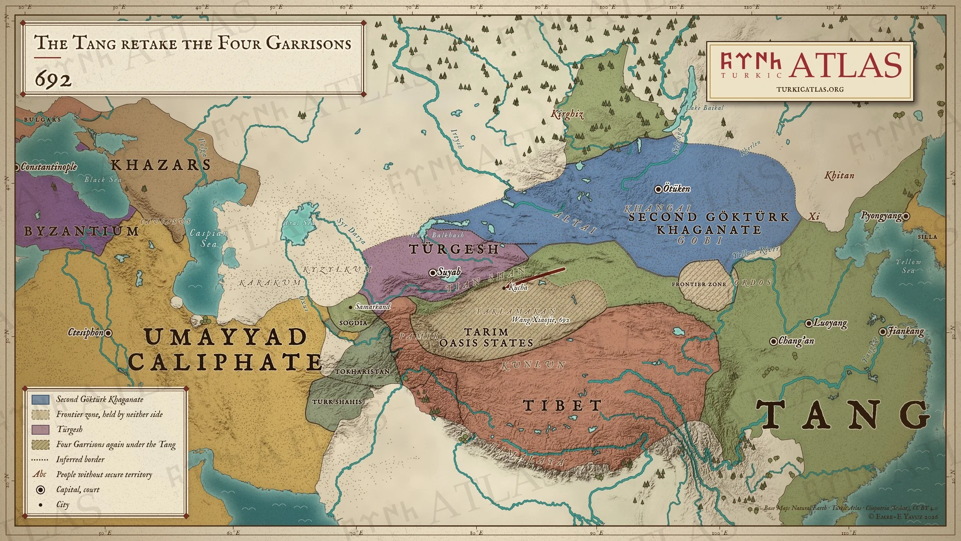 © Emre-E Yavuz 2026
692年。王孝傑の率いる唐が吐蕃から安西四鎮を奪い返す。現代の地図で、軍の道筋は描いたもので史料にはない。 地図 掲載先: 692年
-
699699: Kapgan orders the realm
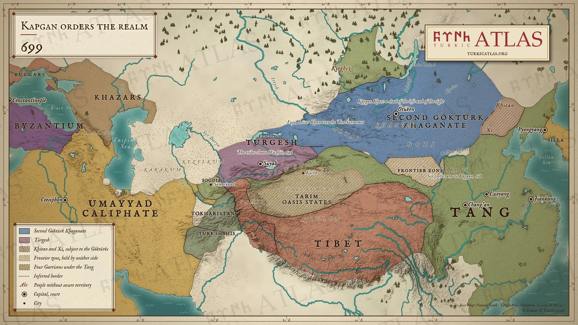 © Emre-E Yavuz 2026
699年。カプガン可汗は国を左右二人のシャドの下に整え、子の匐倶を西方の小可汗とする。十箭の部族はテュルギシュの烏質勒を選ぶ。現代の地図で、境界は描いたもので史料にはない。 地図 掲載先: 699年
-
711711: Kapgan's western war
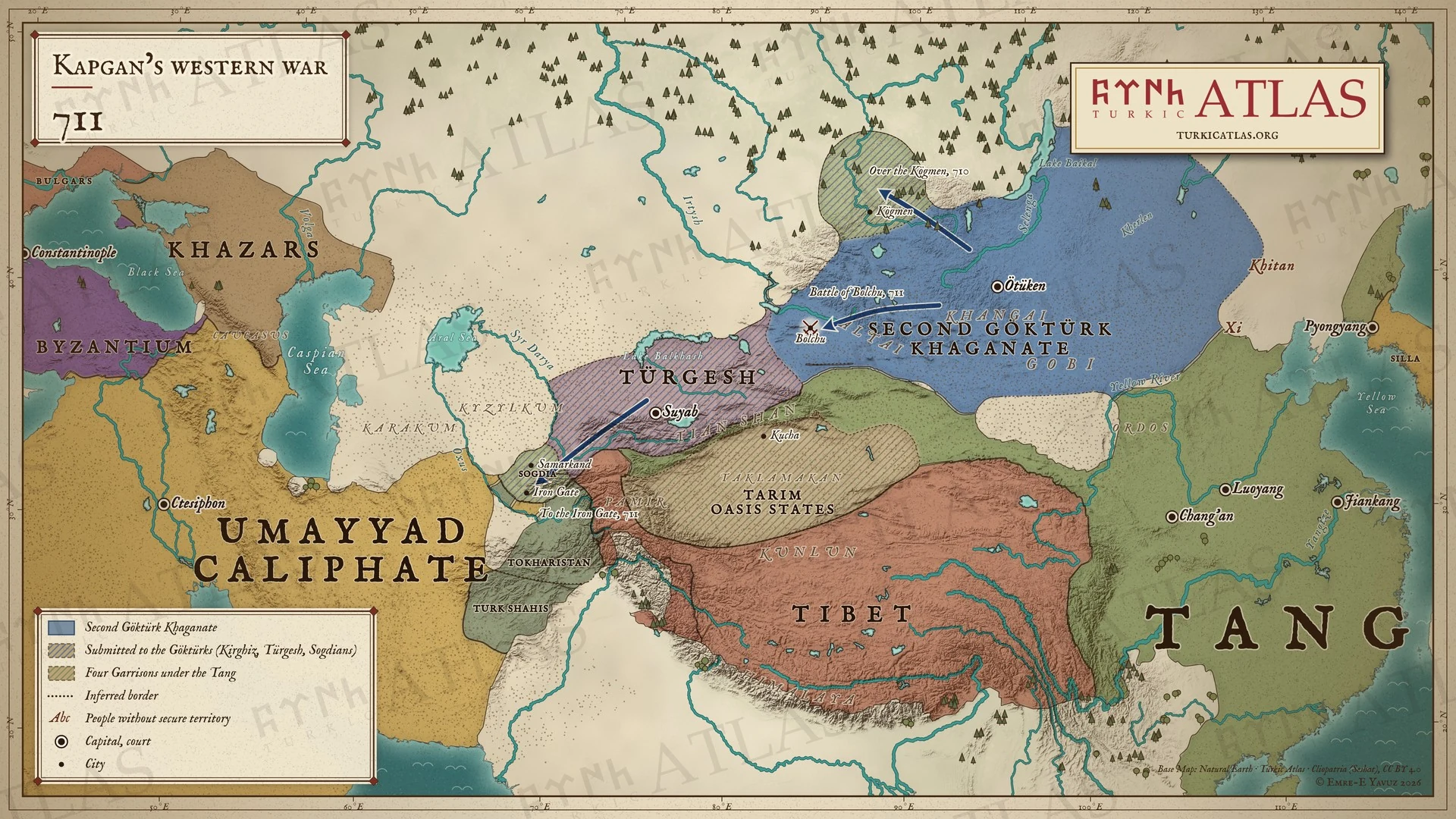 © Emre-E Yavuz 2026
710〜711年。トニュククはキョグメンを越えてキルギスの可汗を殺し、ボルチュで突騎施を滅ぼし、軍を鉄門まで進める。そこでソグドが服属する。現代の地図で、道筋は碑文が挙げる地点の間に描いたもの。 地図 掲載先: 711年
-
716716: The death of Kapgan and Bilge Khan
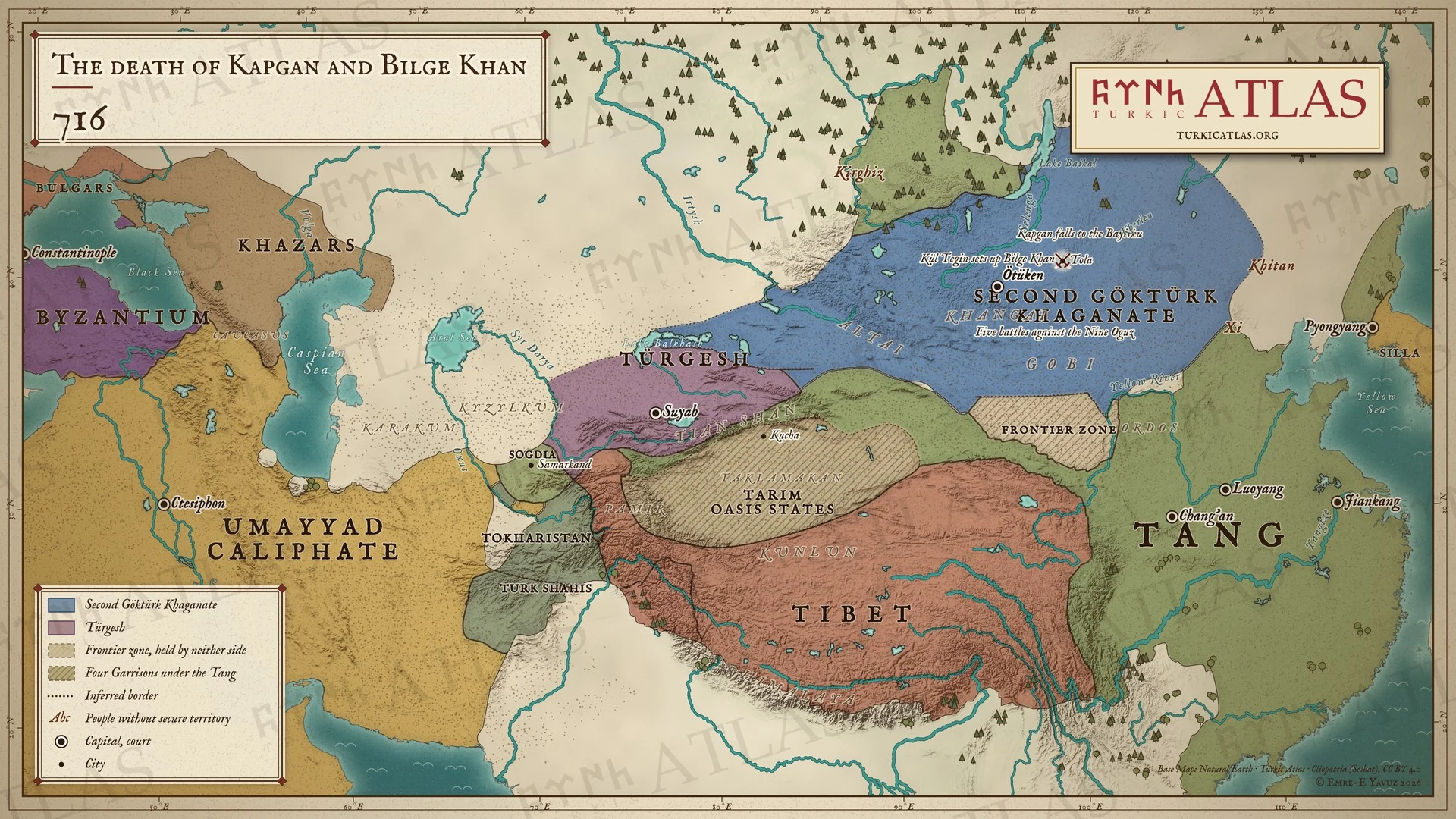 © Emre-E Yavuz 2026
716年。カプガン可汗はトラ河でバイルクに討たれる。キュル・テギンは兄をビルゲ可汗として即位させる。現代の地図で、境界は描いたもので史料にはない。 地図 掲載先: 716年
-
717717: Sulu and the Türgesh
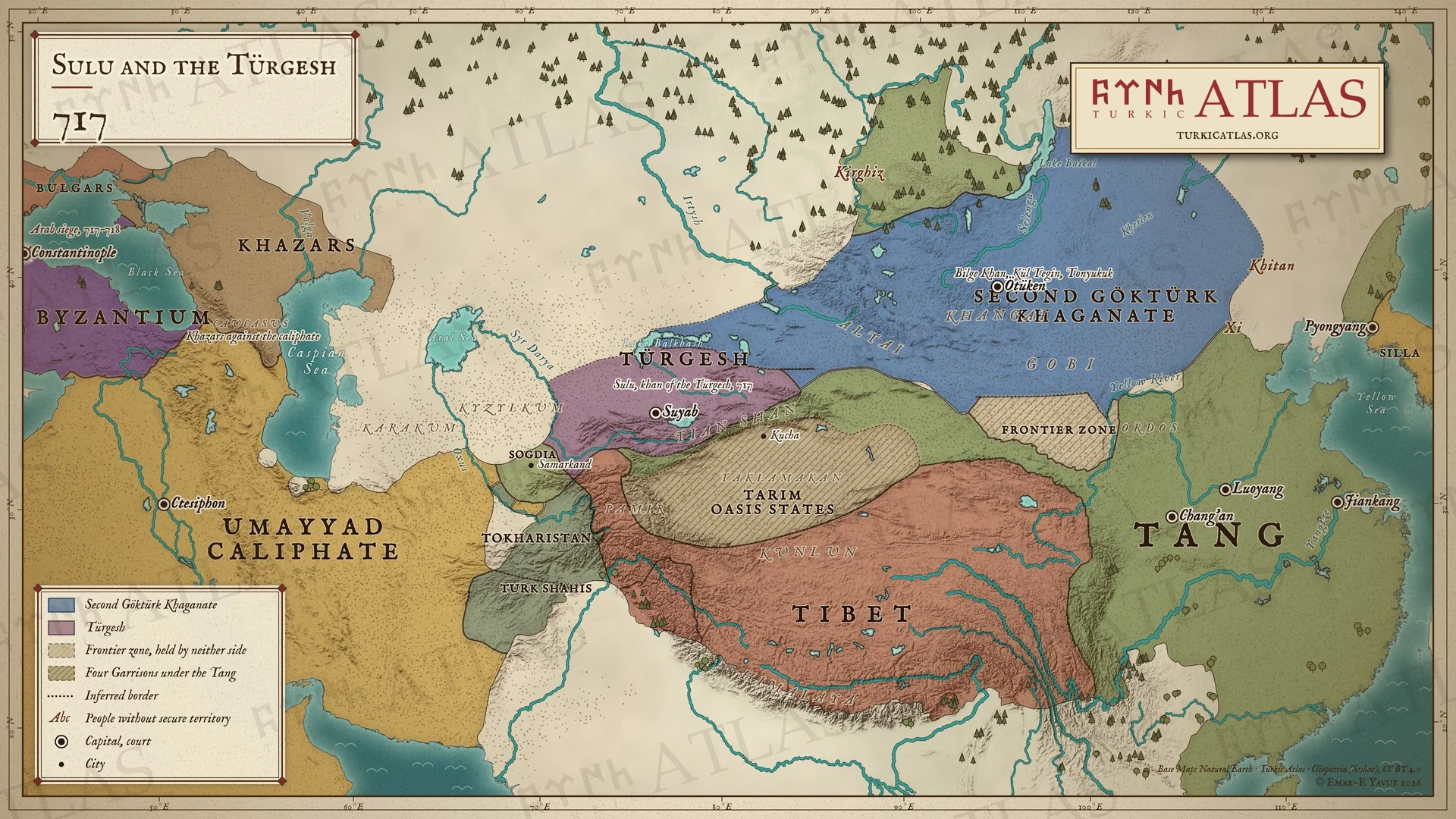 © Emre-E Yavuz 2026
717年。蘇禄がテュルギシュの可汗となる。ビルゲ可汗はキュル・テギン、トニュククとともに東方を治める。アラブがコンスタンティノープルを包囲する。現代の地図で、境界は描いたもので史料にはない。 地図 掲載先: 717年
-
721721: Tonyukuk and the war with the Tang
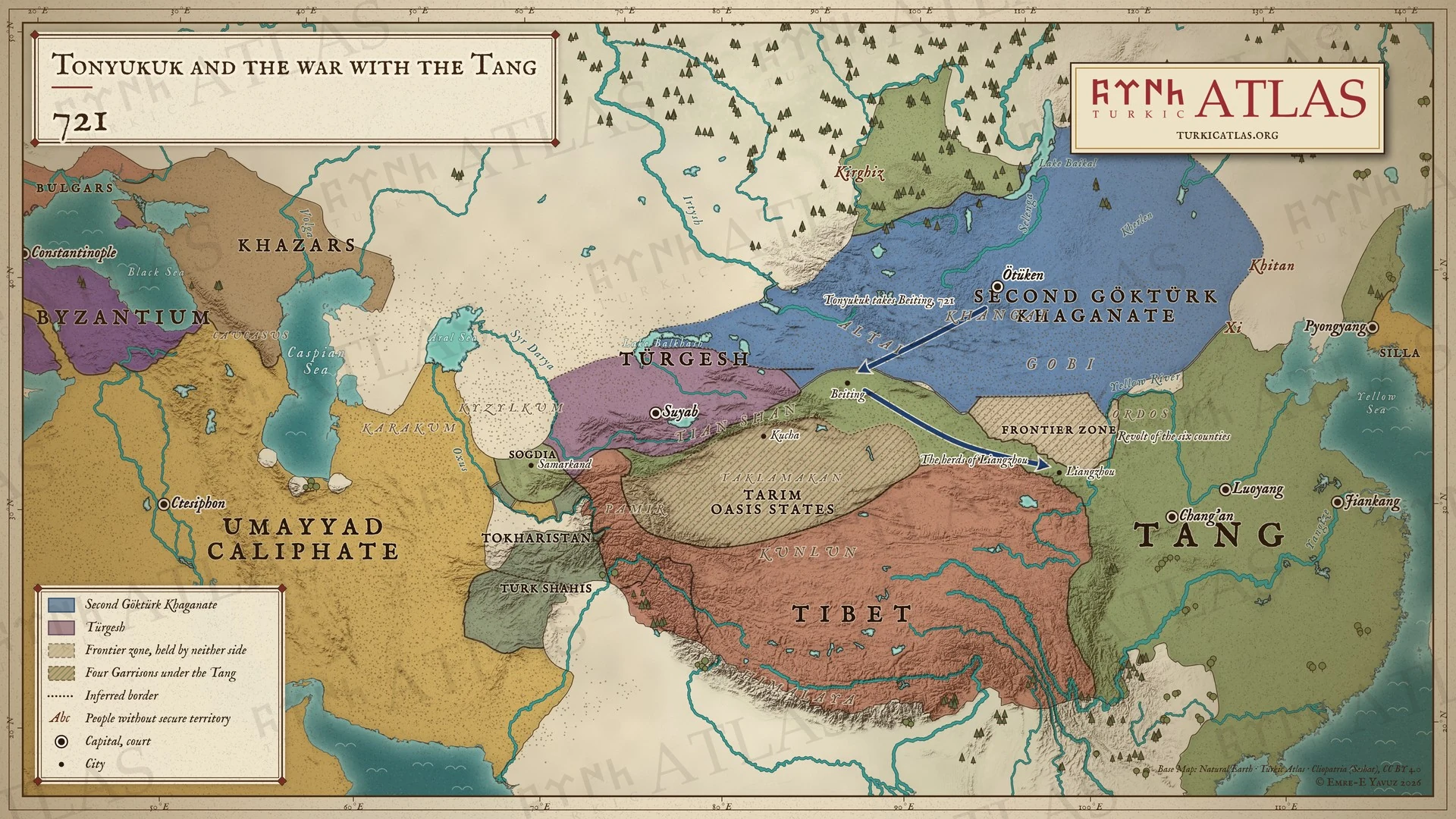 © Emre-E Yavuz 2026
721年。トニュククはバスミルに先んじて北庭を取り、涼州の家畜を奪う。オルドスの六州が反乱を起こす。現代の地図で、道筋は描いたもので史料にはない。 地図 掲載先: 721年
-
734734: The death of Bilge Khan
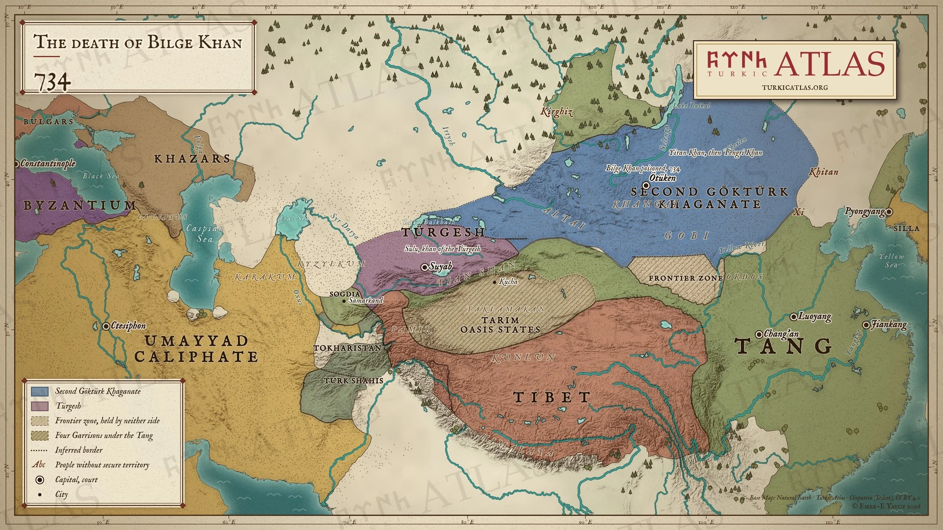 © Emre-E Yavuz 2026
734年。ビルゲ可汗は大臣に毒を盛られて死ぬ。子の伊然が継ぐが数か月で没し、幼いテングリ可汗が即位する。現代の地図で、境界は描いたもので史料にはない。 地図 掲載先: 734年
-
744744: The rise of the Uyghurs
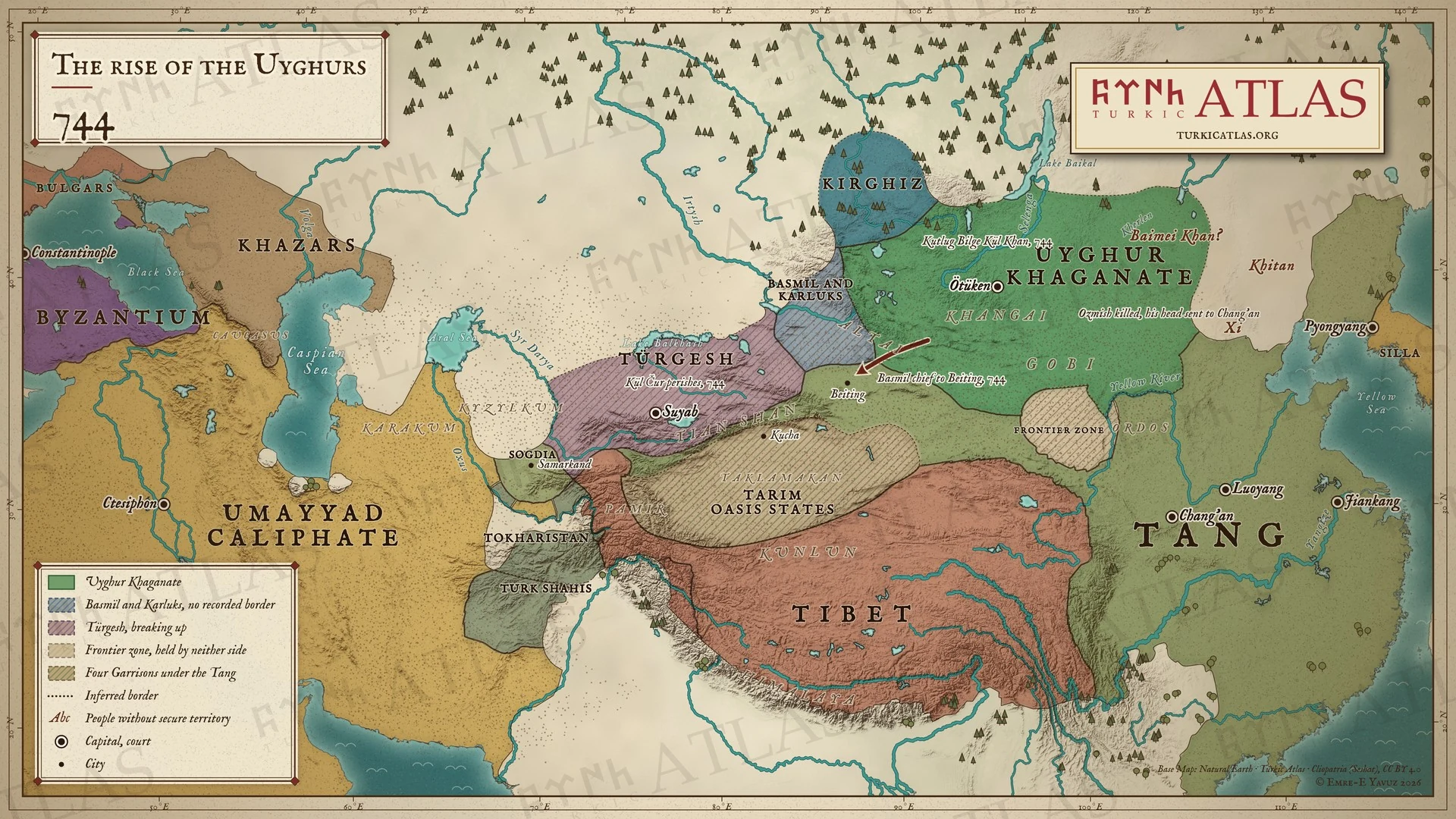 © Emre-E Yavuz 2026
744年。バスミルがオズミシュ可汗を殺し、ウイグルとカルルクがバスミルの可汗を殺す。クトルグ・ビルゲ・キュルがウイグル最初の可汗となる。現代の地図で、バスミルとカルルクの領域は描いたもので史料にはない。 地図 掲載先: 744年
-
745745: The Uyghur Khaganate
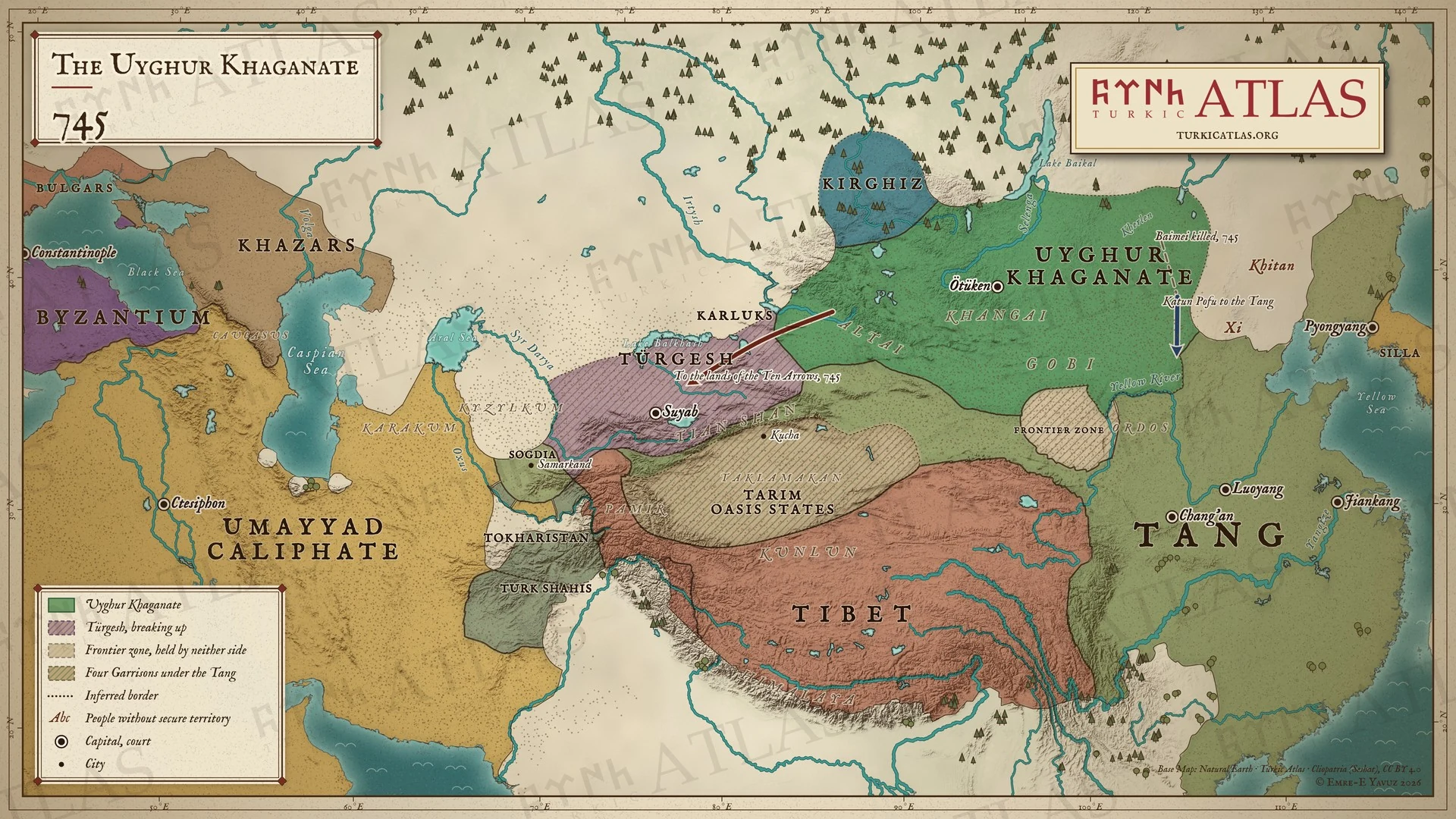 © Emre-E Yavuz 2026
745年。白眉可汗が殺され、ポフ・カトゥンが部衆を率いて唐に帰す。カルルクは西へ、十箭の地に移る。ウイグルはアルタイから室韋までの草原を支配する。現代の地図で、道筋は描いたもので史料にはない。 地図 掲載先: 745年
-
790790: The war over Beiting
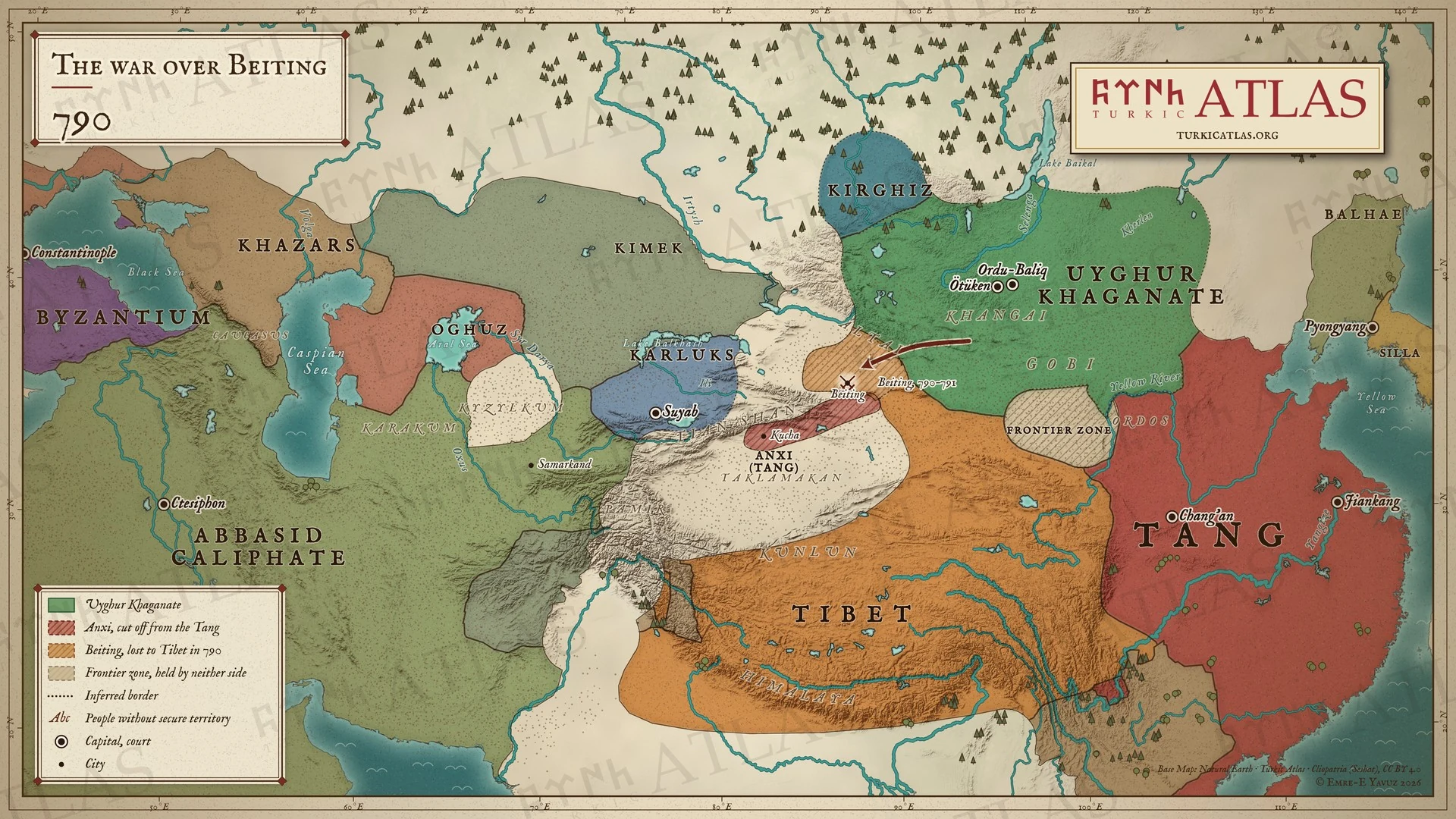 © Emre-E Yavuz 2026
790年。ウイグルは北庭を吐蕃に奪われ、790年と791年に吐蕃と戦う。安西は中国から切り離されたまま唐のために持ちこたえる。現代の地図で、境界は描いたもので史料にはない。 地図 掲載先: 790年
-
821821: The khaganate at war with the Kirghiz
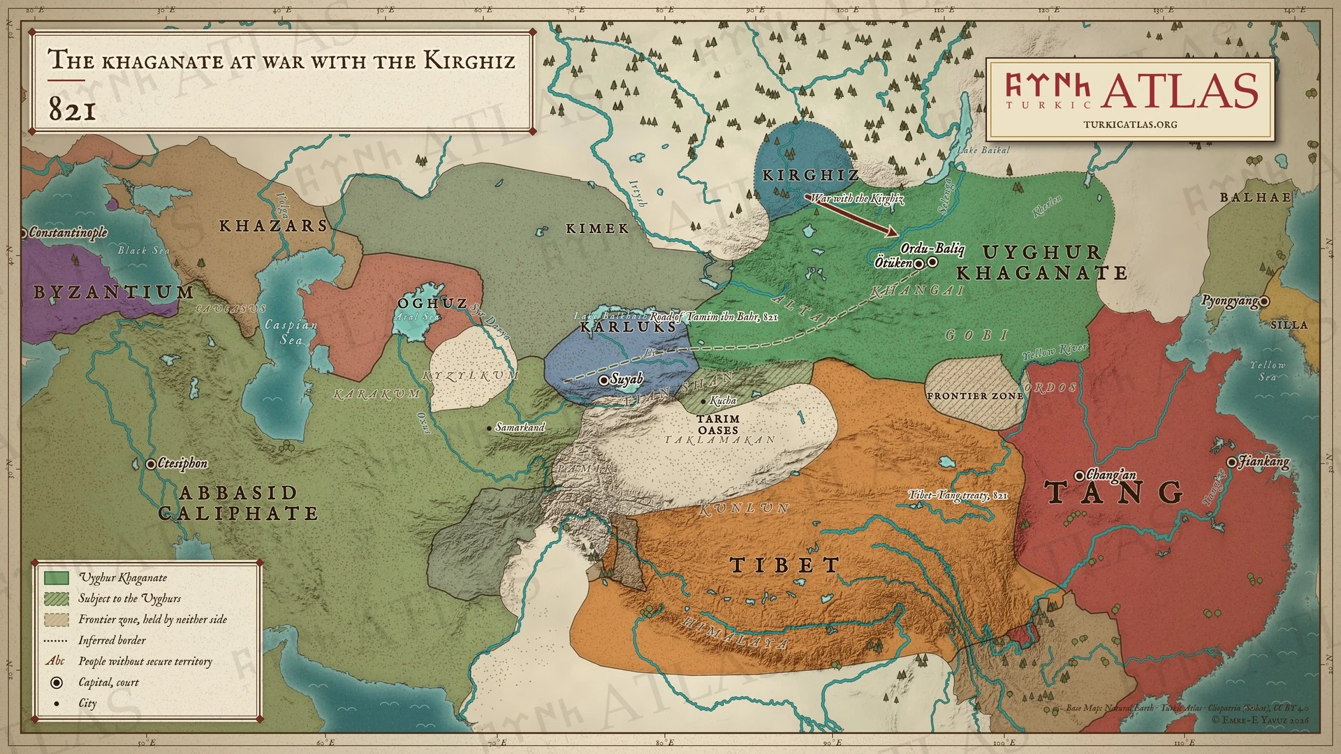 © Emre-E Yavuz 2026
821年。ウイグルは北でキルギスと戦う。タミーム・イブン・バフルが駅路を通ってウイグルの都へ向かう。吐蕃と唐は条約で国境を定める。現代の地図で、道筋は描いたもので史料にはない。 地図 掲載先: 821年
-
840840: The fall of the Uyghur Khaganate
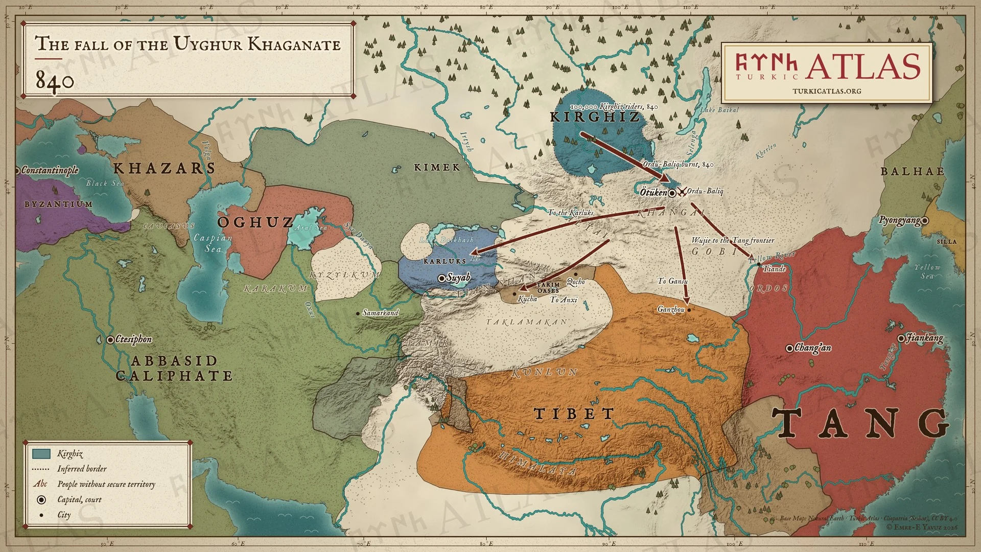 © Emre-E Yavuz 2026
840年。キルギスがウイグル可汗国を滅ぼし、オルドゥ・バリクを焼く。ウイグルは唐の国境、甘粛、タリム、カルルクへ散る。現代の地図で、逃走の道筋は描いたもので史料にはない。 地図 掲載先: 840年, History of the Turkic peoples
-
842842: After the fall of the Uyghurs
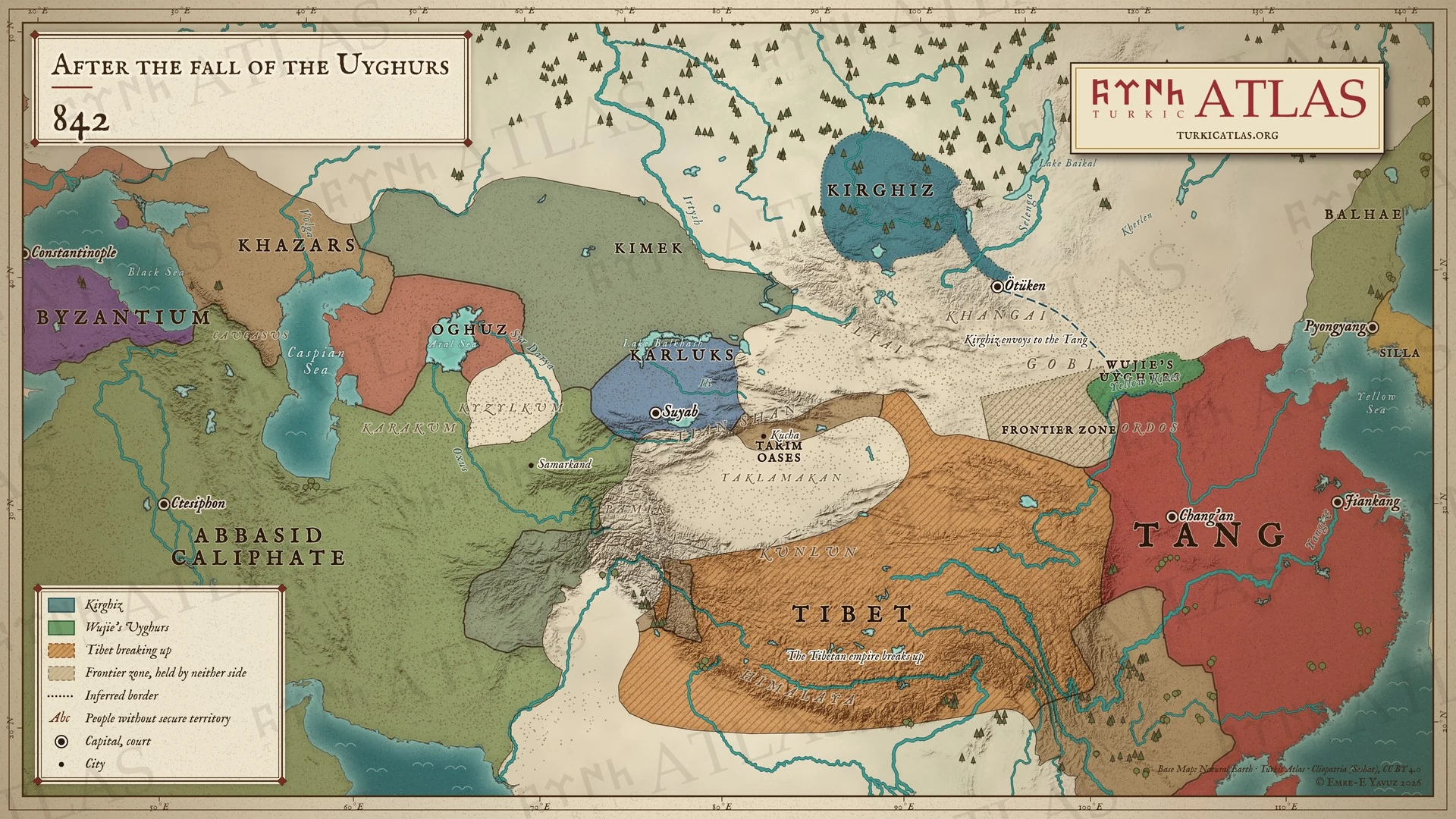 © Emre-E Yavuz 2026
842年。烏介のウイグルは唐の国境に留まり、最初のキルギスの使者が唐に至る。吐蕃は分裂する。現代の地図で、使者の道筋は描いたもので史料にはない。 地図 掲載先: 842年
写真と歴史的な図像
写真と、その時代に作られた図像。
メイン画像 115 · パノラマ 1 · 本文中 64 · 読書の道筋 8
-
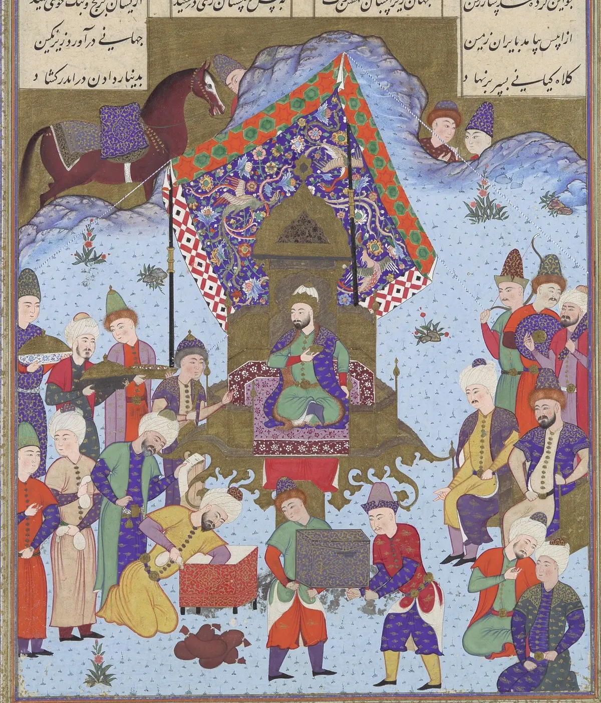
Afrasiab on the throne of Iran, which he took after killing Nowzar. A page of the Shahnameh made for Shah Tahmasp at Tabriz, about 1525–30, painting attributed to Bashdan Qara. The Metropolitan Museum of Art, New York, 1970.301.16, gift of Arthur A. Houghton Jr., 1970; detail. Public domain. メイン画像 掲載先: アフラースィヤーブ
-
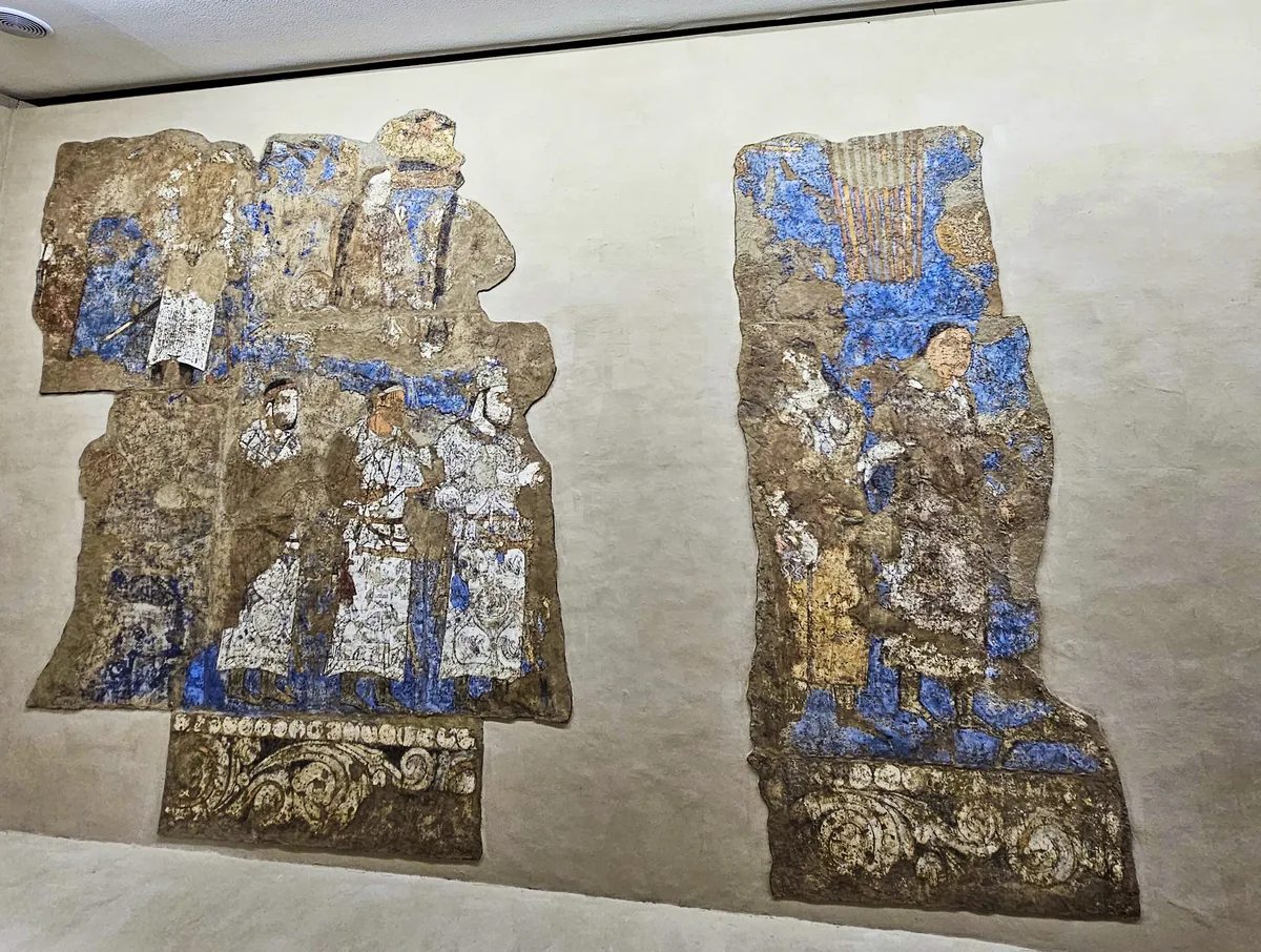
The left half of the west wall of the Hall of the Ambassadors, as mounted in the museum beside the Afrasiab mound: in the lower file three figures in white caftans, above them the caftan bearing the long Sogdian inscription. Photograph: Richard Mortel, 2023, CC BY 2.0. メイン画像 掲載先: Afrasiab paintings
-
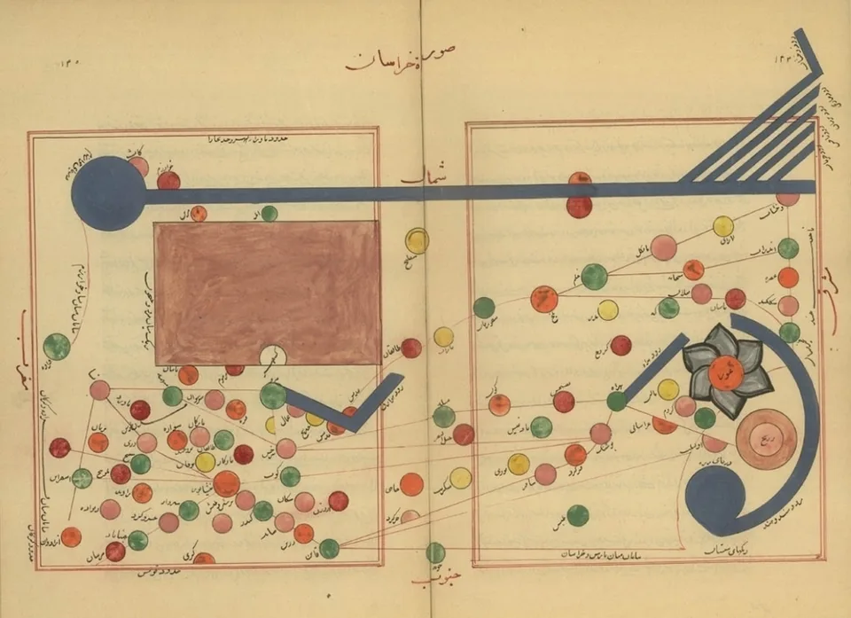
Map of Khurasan from a manuscript of al-Istakhri's geography, the Book of Routes and Realms. Al-Istakhri, manuscript map, reproduction, public domain. メイン画像 掲載先: al-Iṣṭakhrī
-
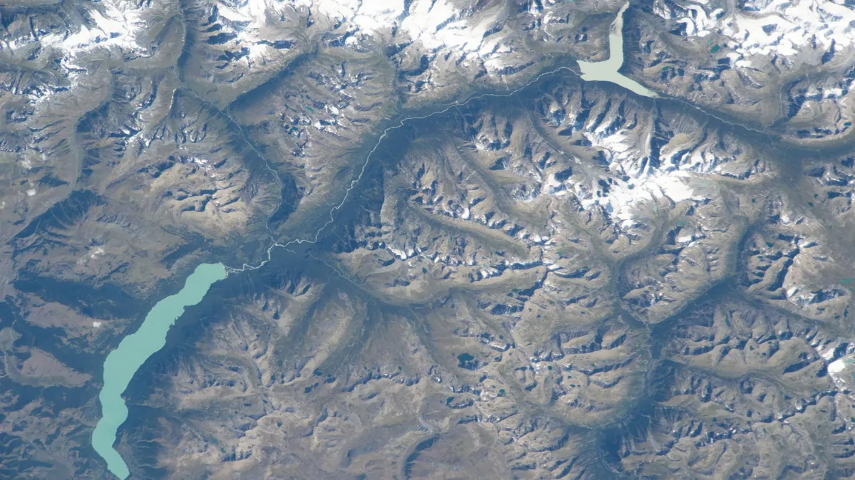
Ka Nasi Lake in the Chinese part of the Altai, photographed by an astronaut aboard the International Space Station in 2023. Astronaut photograph iss069e071176. NASA, public domain. メイン画像 掲載先: アルタイ
-
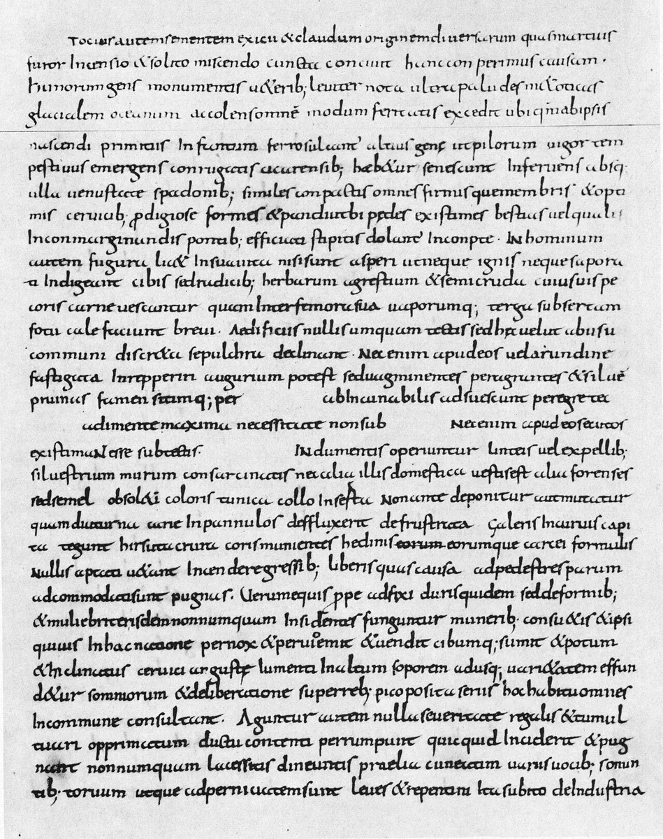
Page of a ninth-century manuscript of Ammianus Marcellinus (Vaticanus lat. 1873) with Res gestae 31,2, the description of the Huns. Ammianus Marcellinus, Res gestae, Biblioteca Apostolica Vaticana, Vat. lat. 1873, reproduction, public domain. メイン画像 掲載先: アンミアヌス・マルケリヌス
-
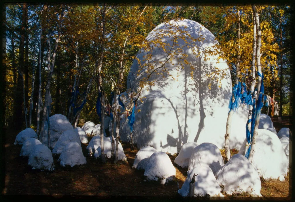
A sacred cairn (obo) near Alkhanai mountain in Transbaikalia, the stones whitewashed and the birches around it hung with blue ribbons, photographed in 2000. Photograph: William Craft Brumfield, 2000; Library of Congress, no known restrictions. メイン画像 掲載先: アニミズム
-
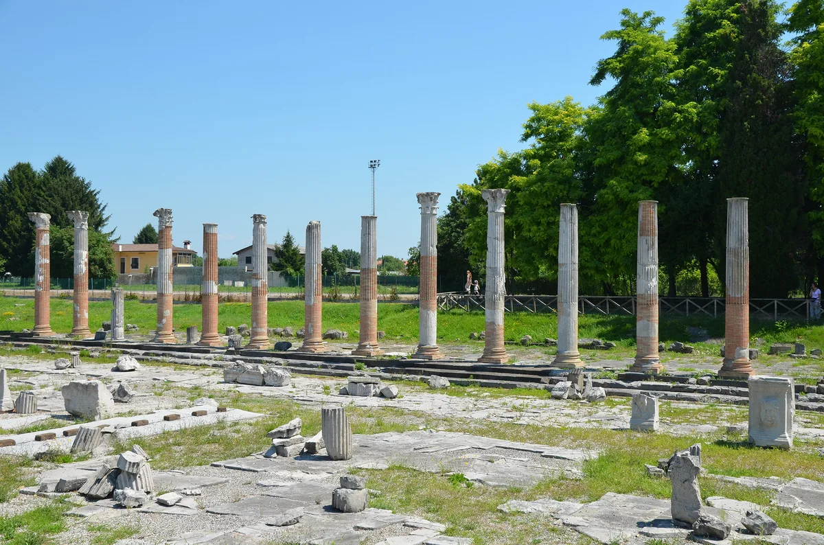
The Roman forum of Aquileia in Friuli, north-eastern Italy, with the columns of its eastern portico, which were restored and partly re-erected in 1936 and 1937; photograph of 2015. Aquileia was the chief city of Venetia, and it fell to Attila's Huns in 452 after a long siege. Image: Carole Raddato, CC BY-SA 2.0. メイン画像 掲載先: アクイレイア
-
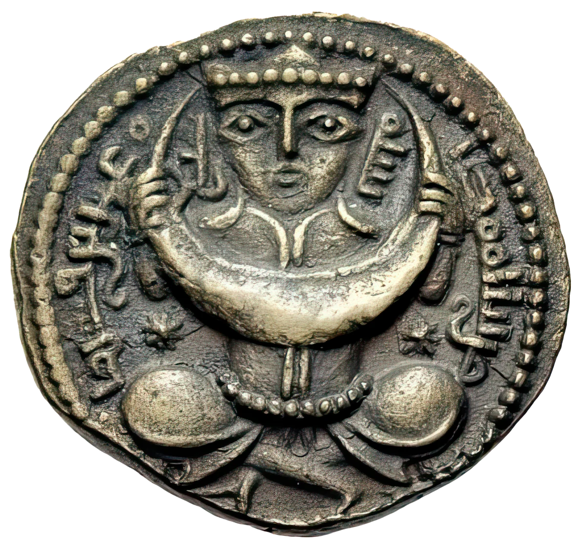
A crowned figure holding a crescent moon, a star on either side: coin, eighth century. メイン画像 掲載先: アイ・アタ
-
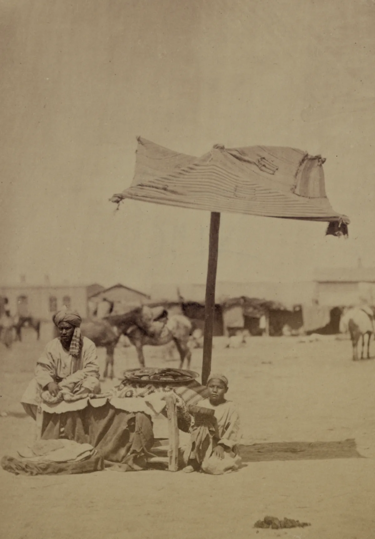
Ayran sellers in the market of Aulie-Ata on the Talas river, the modern Taraz in Kazakhstan, photographed between 1865 and 1872 for the Turkestan Album. Photograph: Turkestan Album, ethnographic part, plate 105. Library of Congress, no known restrictions on publication. メイン画像 掲載先: アイラン
-
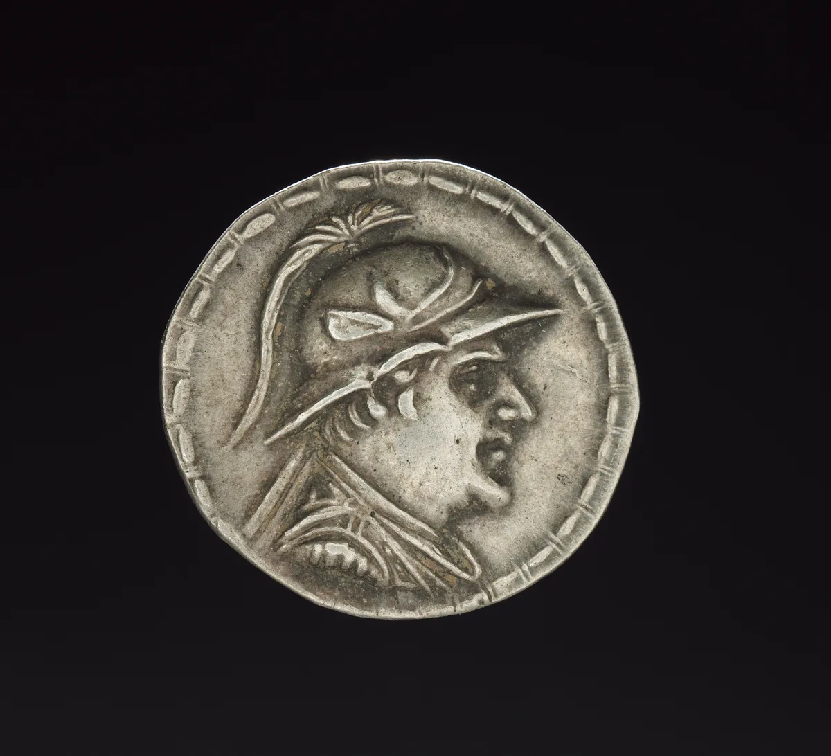
Silver coin of Eukratides I, king of Bactria between 170 and 145 BC, with his portrait in a crested helmet. The Cleveland Museum of Art, 2011.211, CC0. メイン画像 掲載先: バクトリア
-
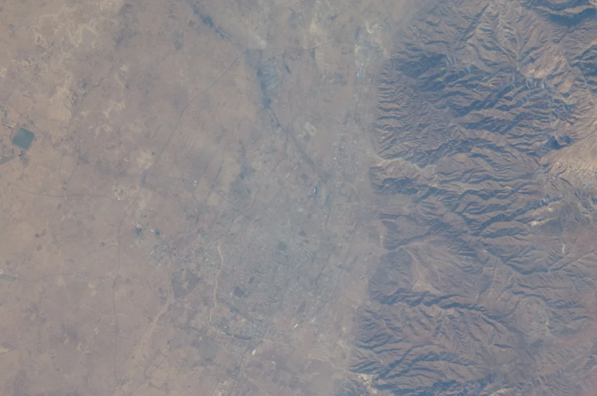
The city of Hohhot on the plain at the foot of the Daqing Shan in Inner Mongolia, photographed from the International Space Station in 2011. Baidao may have lain north of Guihuacheng, the old town of Hohhot. Image: NASA. Public domain. メイン画像 掲載先: 白道川
-
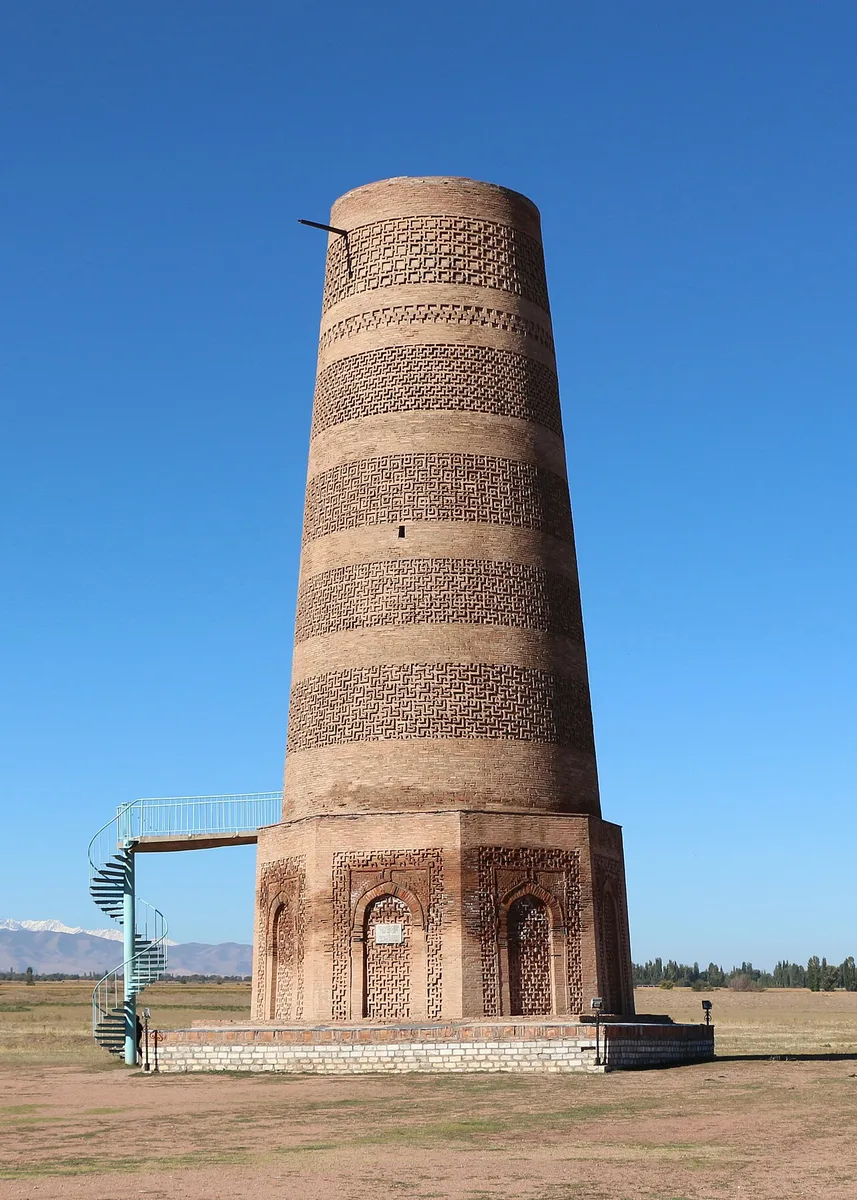
The Burana Tower near Tokmok in the Chu valley, Kyrgyzstan. Photograph: Bernard Gagnon, 2023, CC0. メイン画像 掲載先: バラサグン
-
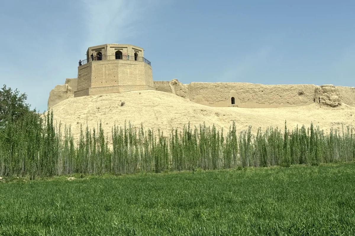
The Bala Hissar, the citadel of Balkh, and the old city walls above the fields, 2025. Photograph: Jialiang Gao, 2025, CC BY-SA 4.0. メイン画像 掲載先: バルフ
-
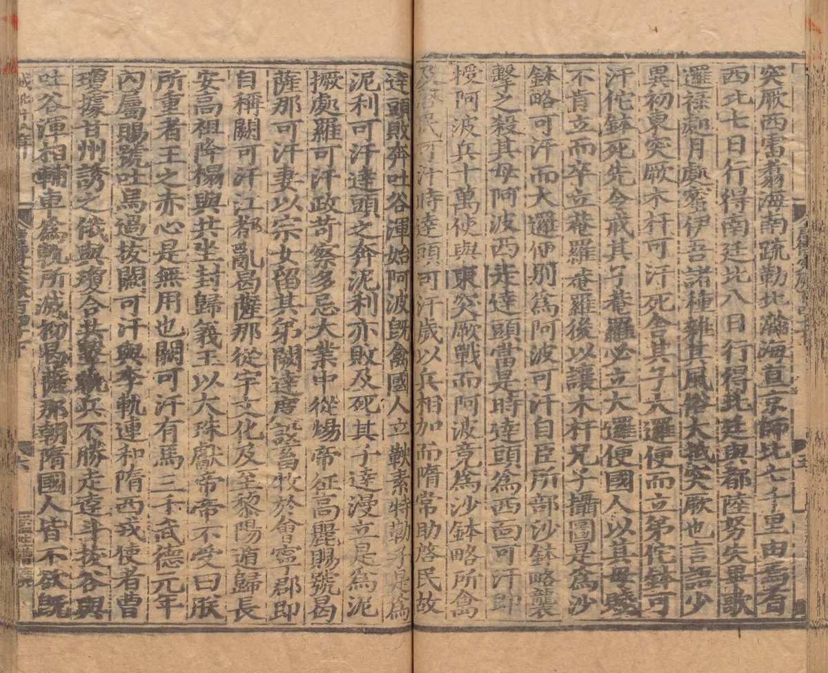
A page of the account of the western Göktürks in chapter 215B of the Xin Tang Shu, in a Yuan-period printed edition repaired under the Ming, in the National Archives of Japan. The second column of the right-hand page says that seven days' march north-west from Yanqi reach the Southern Court and eight days' march north the Northern Court. Image: National Archives of Japan. Public domain. メイン画像 掲載先: 北庭
-
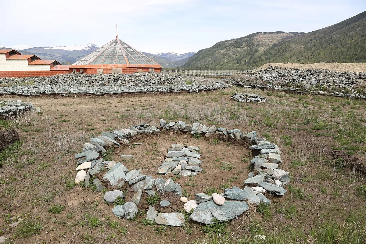
The Berel kurgans in the Kazakh Altai, 2018. Photograph: Mheidegger, 2018, CC BY 4.0. メイン画像 掲載先: ベレル
-
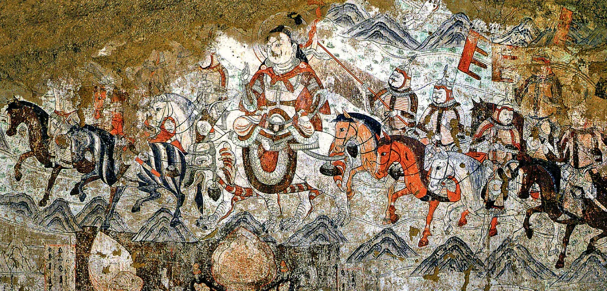
A rider with a halo and his mounted escort, from a wall painting in the West Temple at Beshbalik, the Buddhist temple that the Uyghurs of Qocho built west of the city. The scene belongs to the division of the relics of the Buddha among eight kings; it was painted in the tenth century. Wall painting: West Temple, Beiting (Beshbalik), tenth century. Photograph: Zhentong Li, CC0. メイン画像 掲載先: ビシュバリク
-
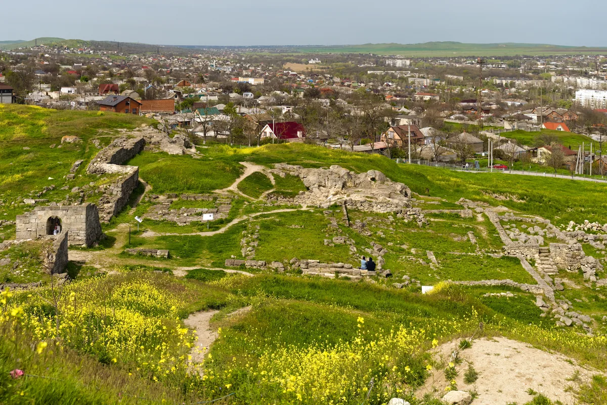
Excavated remains of ancient Panticapaeum on Mount Mithridates in Kerch, in the eastern Crimea, with the town below; photograph of 2021. Bosporos, the ancient Panticapaeum, fell to a Göktürk army and the Utigurs while the Roman envoy Valentinos was among the Göktürks. Image: Alexxx Malev, CC BY-SA 2.0. メイン画像 掲載先: ボスポロス
-
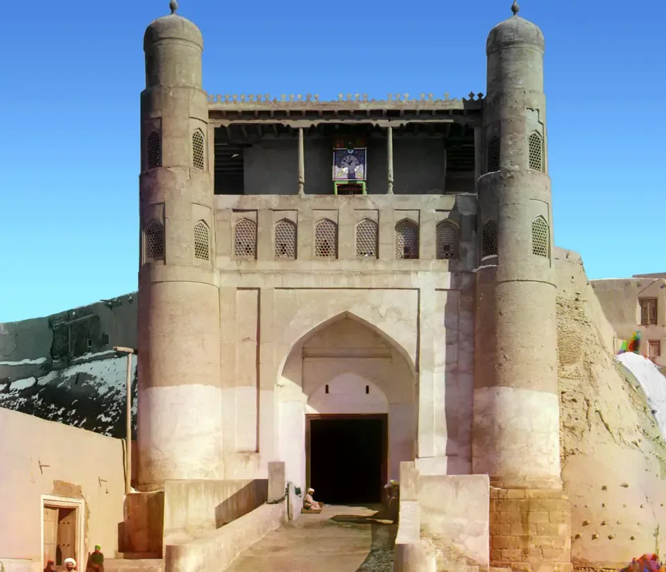
The entrance to the Emir’s palace in the old city of Bukhara, photographed by Sergei Prokudin-Gorskii between 1905 and 1915. Photograph: Sergei Prokudin-Gorskii; Library of Congress, Prints and Photographs Division. No known restrictions on publication. メイン画像 掲載先: ブハラ
-
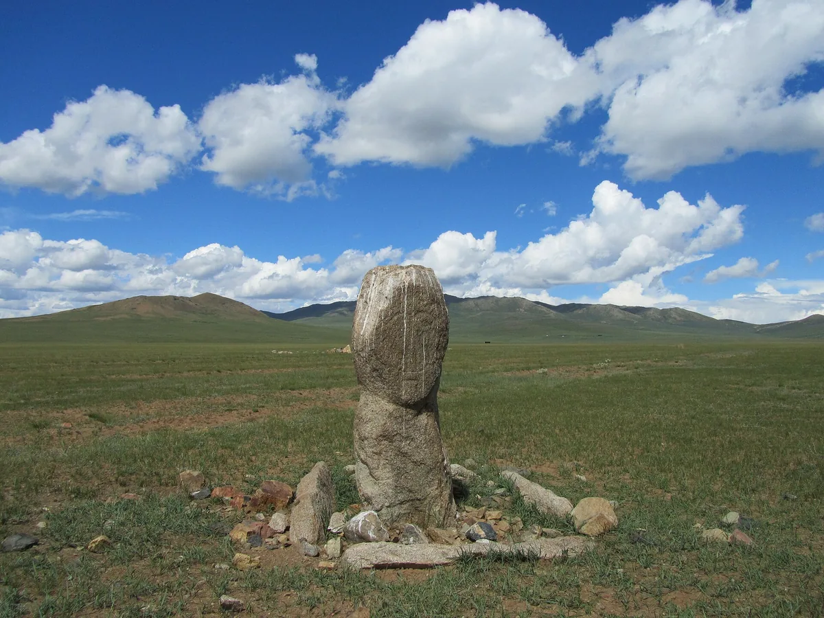
A weathered stone figure at its stone setting on the steppe near Burd, Övörkhangai, in central Mongolia. Monuments of this kind are commonly called balbals; strictly, the balbals are the rough stones set in a line from the grave. Photograph: Mongolia Expeditions, 2011, CC BY 3.0. メイン画像 掲載先: 埋葬とバルバル
-
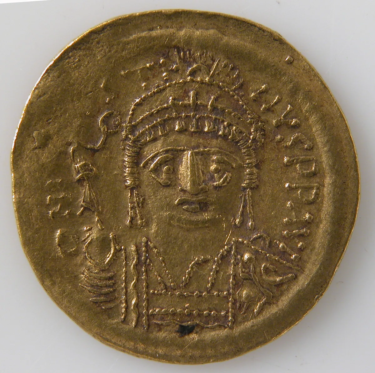
Gold solidus of the Byzantine empire, struck between 565 and 578. The Metropolitan Museum of Art, New York, 04.35.3353, Gift of Darius Ogden Mills, 1904, Open Access, public domain (CC0). メイン画像 掲載先: ビザンツ帝国
-
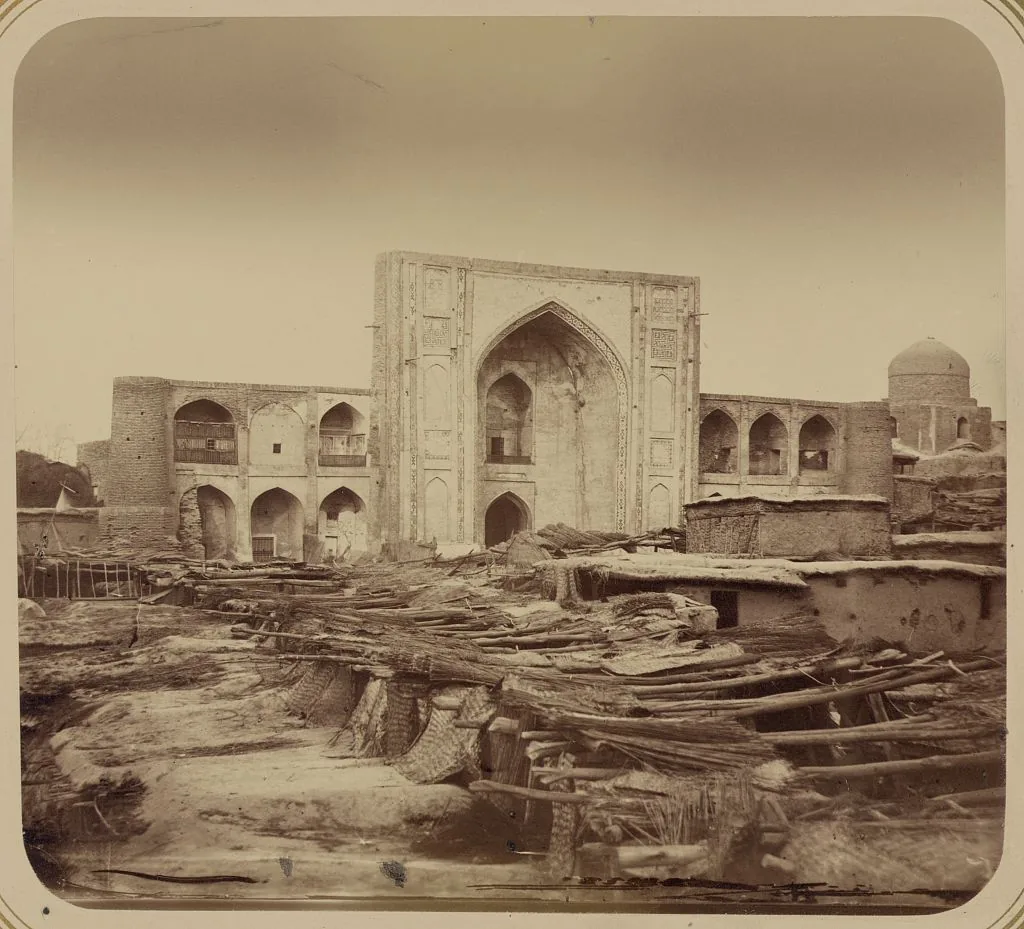
The Kukeldash madrasa in Tashkent, from the Turkestan album of 1865–1872. Photograph: N. V. Bogaevskii, Turkestan album; Library of Congress, Prints and Photographs Division. No known restrictions on publication. メイン画像 掲載先: チャーチ
-
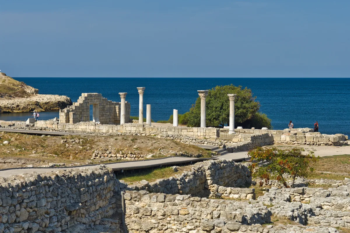
The ruins of ancient Chersonesus on the south-western coast of the Crimea, near Sevastopol, with the columns of a basilica above the Black Sea; photograph of 2023. Cherson was probably this city. In 579 the emperor Tiberius told an Avar embassy that the Göktürks were encamped there. Image: Alexxx Malev, CC BY-SA 2.0. メイン画像 掲載先: ケルソン
-
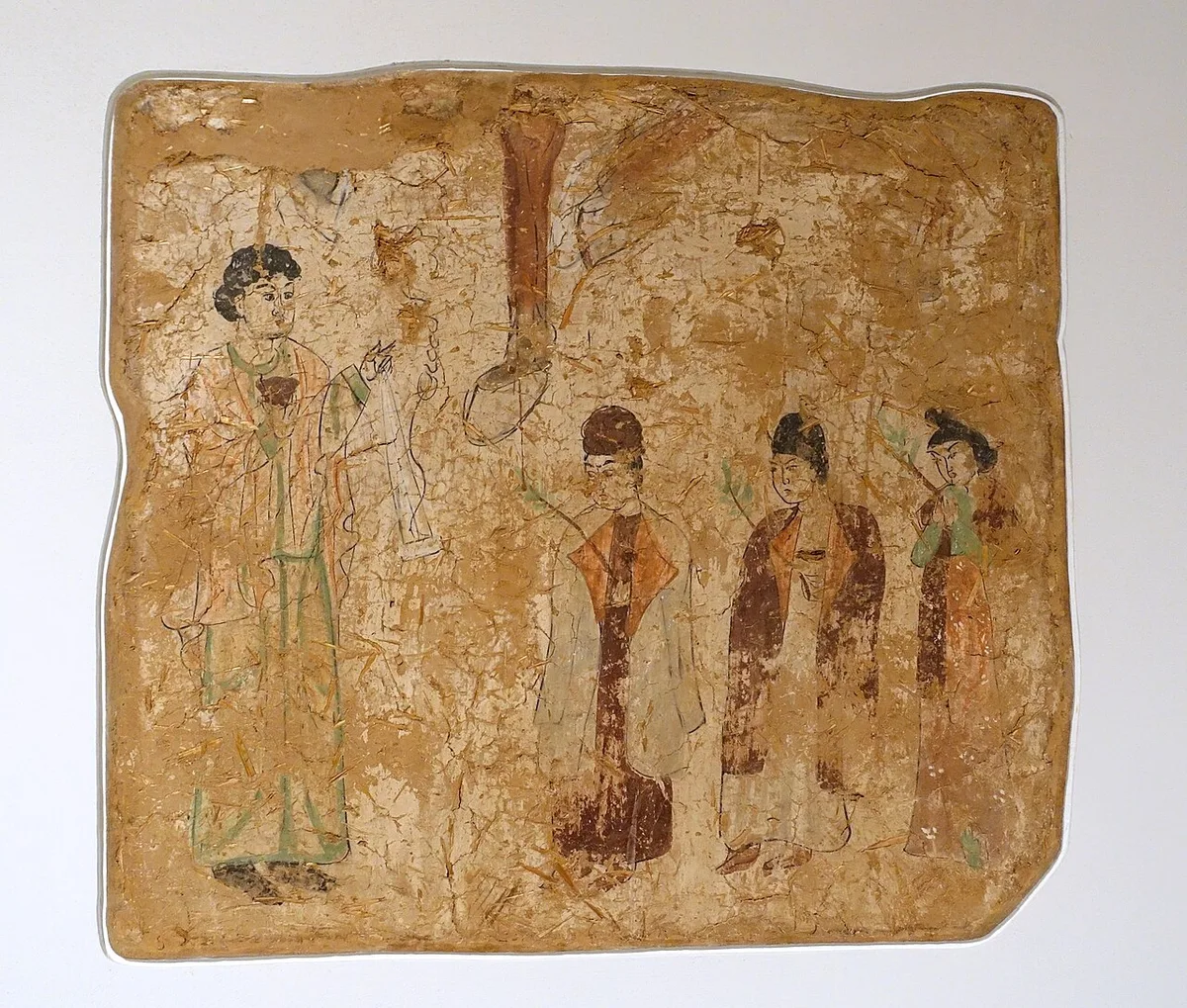
Wall painting from a ruined temple at Qocho, read as a Palm Sunday procession and dated 683–770 CE. Berlin. Photograph: Daderot, 2014, CC0. メイン画像 掲載先: 東方教会
-
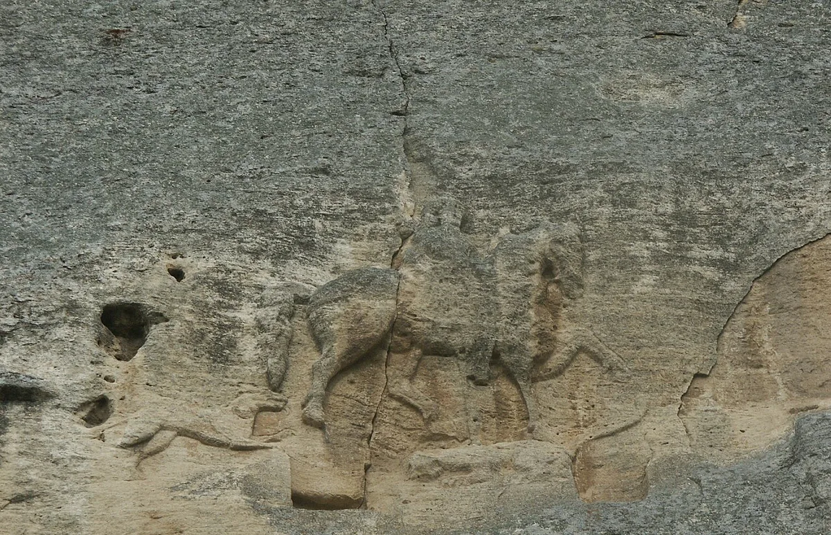
The Madara Rider, a rock relief of the eighth to ninth century near Shumen in north-eastern Bulgaria. Photograph: G. Nockemann, 2011, CC BY-SA 3.0. メイン画像 掲載先: ドナウ・ブルガリア
-
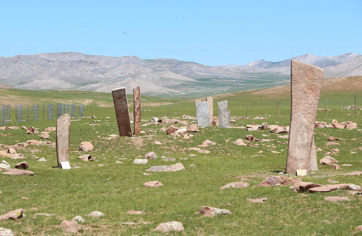
Deer stones at Uushgiin Uvur in Mongolia. Photograph: Bernard Gagnon, 2023, CC0. メイン画像 掲載先: Deer stones
-
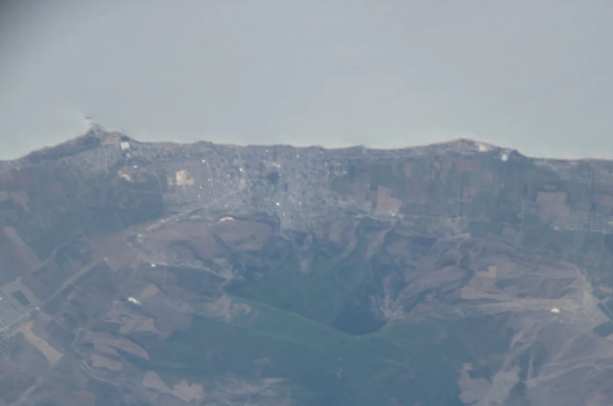
Derbent between the shore of the Caspian Sea and the foothills of the Caucasus, photographed from the International Space Station in 2005. Astronaut photograph ISS011-E-10601. NASA, public domain. メイン画像 掲載先: デルベント
-
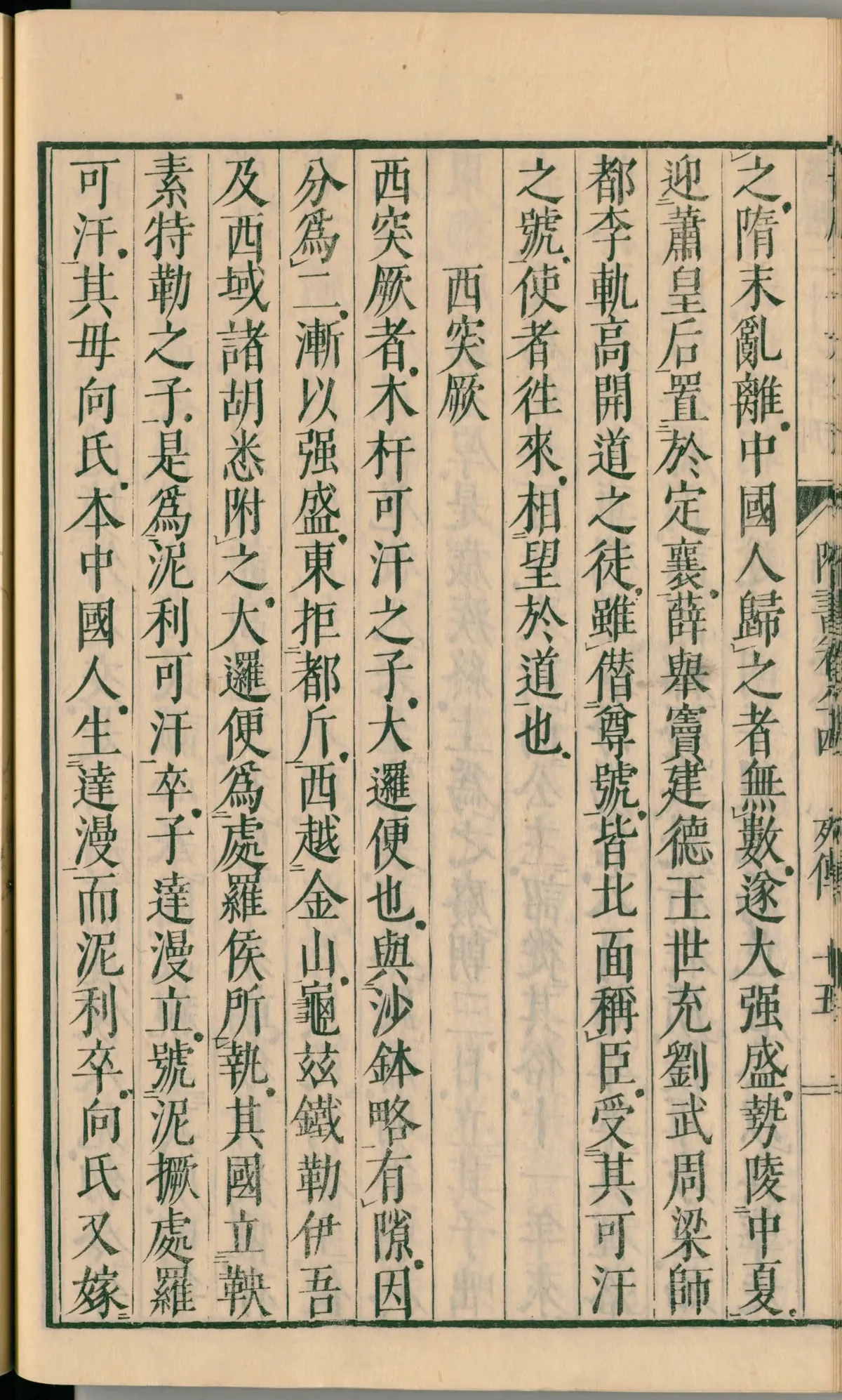
A page of chapter 84 of the Sui Shu in a Japanese edition of 1844, in the National Diet Library, Tokyo. In the second column from the right, the text says that the Göktürks brought the empress Xiao and installed her at Dingxiang (定襄). Image: National Diet Library, Japan. Public domain. メイン画像 掲載先: 定襄
-
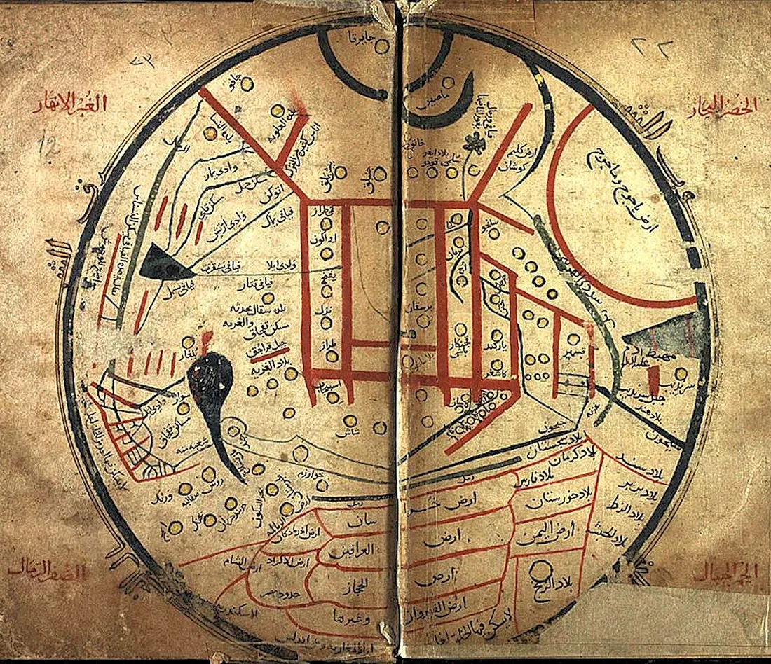
The world map of Mahmud al-Kashgari's dictionary, from a manuscript of the work. Mahmud al-Kashgari, eleventh century, manuscript copy, reproduction, public domain. メイン画像 掲載先: Dīvān Lughāt al-Turk
-
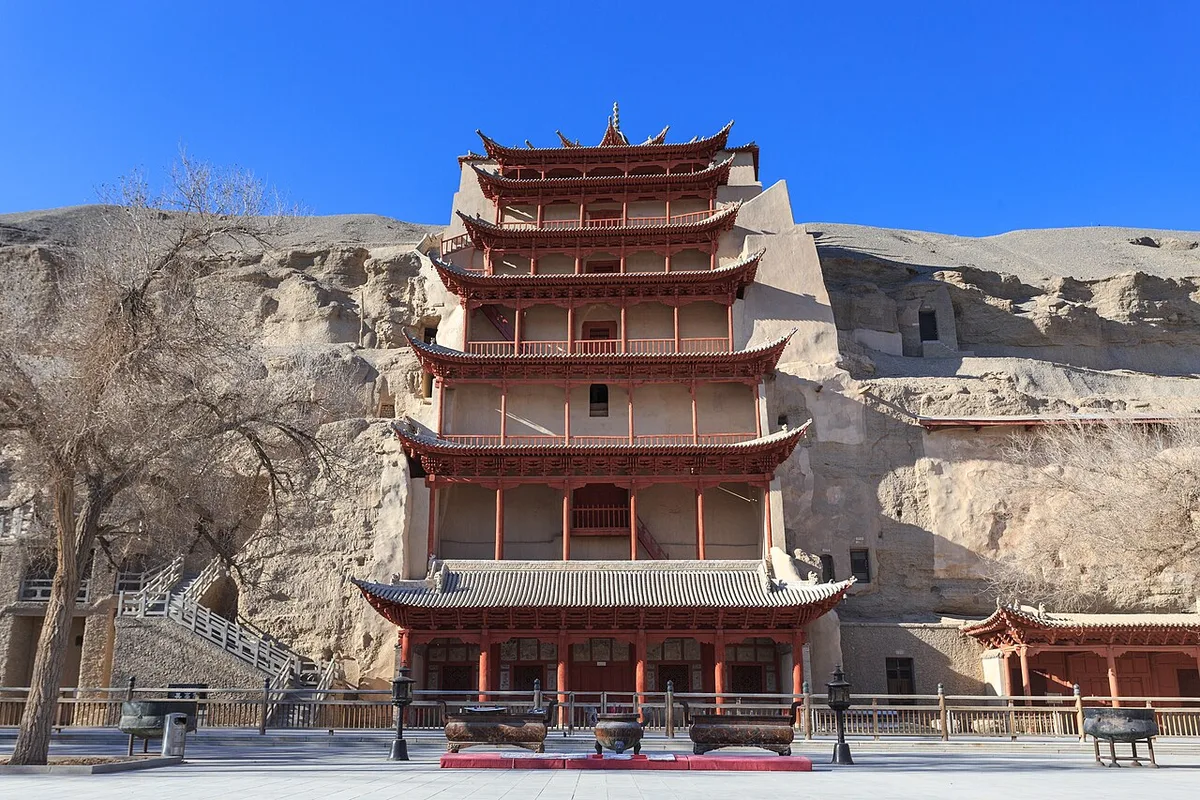
The Mogao Grottoes near Dunhuang, December 2013. Photograph: Zhangzhugang, 2013, CC BY-SA 4.0. メイン画像 掲載先: 敦煌
-
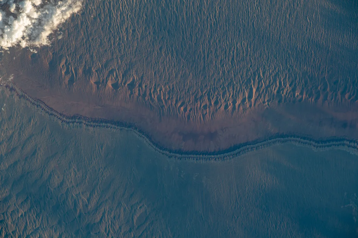
Dunes and sedimentary layers in the Junggar Basin, photographed from the International Space Station in 2023. Astronaut photograph ISS069-E-16826. NASA, public domain. メイン画像 掲載先: ジュンガリア
-
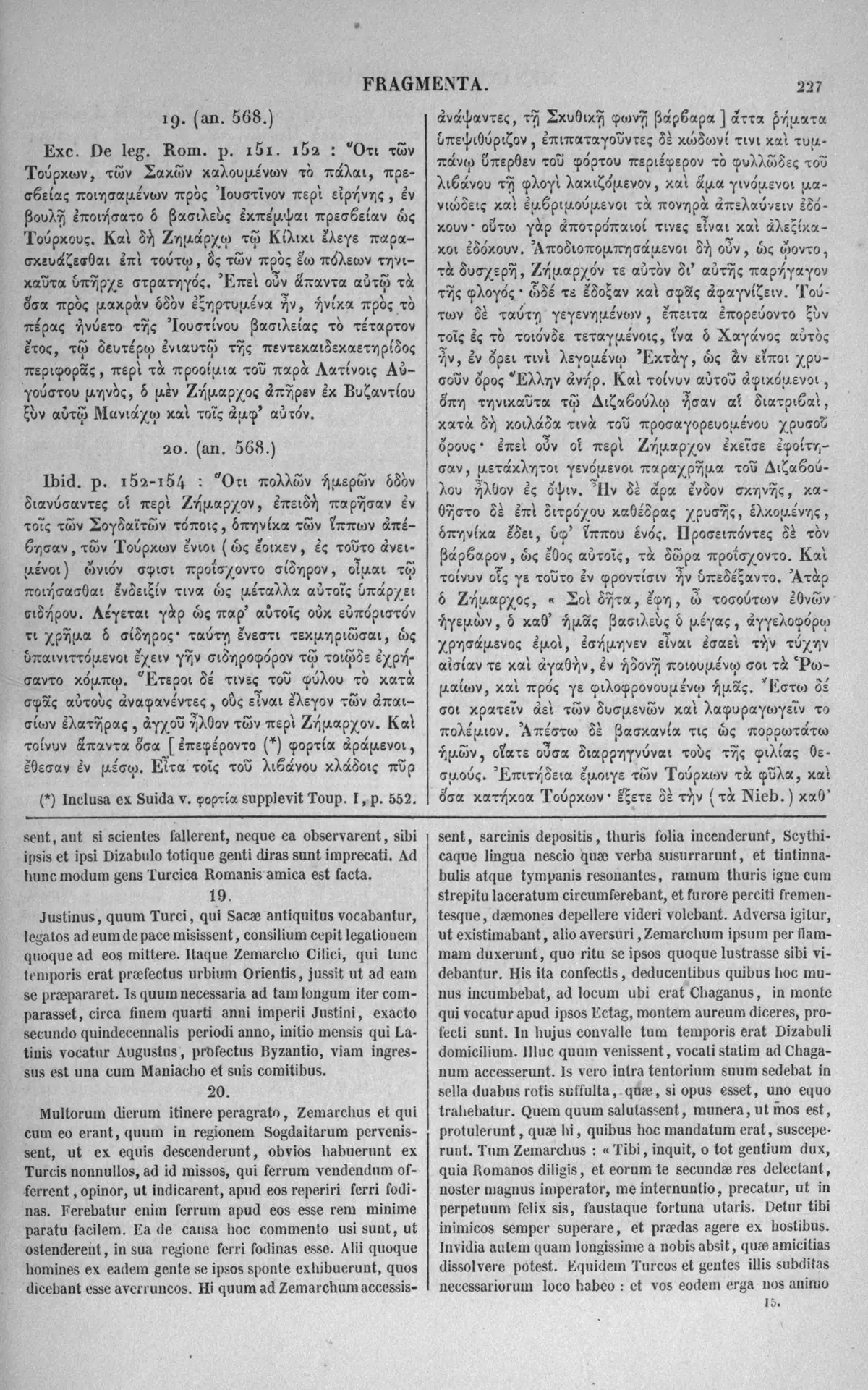
A page of the 1851 Paris edition of the Greek historical fragments, with Menander's account of the Roman embassy of 569 in Greek and Latin. The right-hand Greek column names the mountain Ektag, 'as a Greek would say, the golden mountain', where the envoys found Istemi. Image: Karl Müller (ed.), Fragmenta Historicorum Graecorum IV, Paris: Didot 1851; scan University of Toronto Libraries. Public domain. メイン画像 掲載先: エクタグ
-
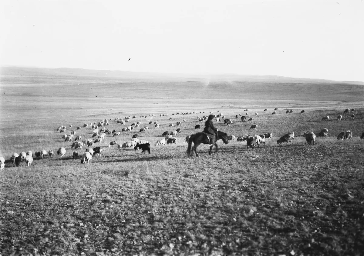
A herder on horseback with a flock of sheep and goats on the open steppe of Mongolia, photographed in 1909. Finnish Heritage Agency (Museovirasto), General Ethnographic Photo Collection, VKK156:33. Photograph by Sakari Pälsi, 1909. Finna, CC BY 4.0. メイン画像 掲載先: ユーラシアの遊牧民
-
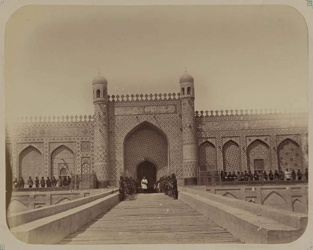
The palace of Khudoyar Khan at Kokand in the Ferghana valley, from the Turkestan album of 1865–1872. Photograph: Turkestan album; Library of Congress, Prints and Photographs Division. No known restrictions on publication. メイン画像 掲載先: フェルガナ
-
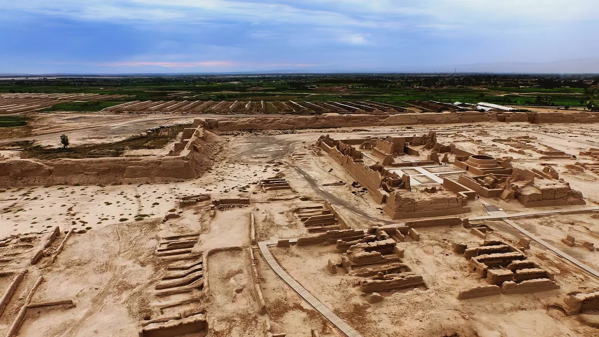
The ruins of Gaochang from the air: the mud-brick walls and halls of the city in the Turfan depression, with the fields of the oasis behind. メイン画像 掲載先: 高昌
-
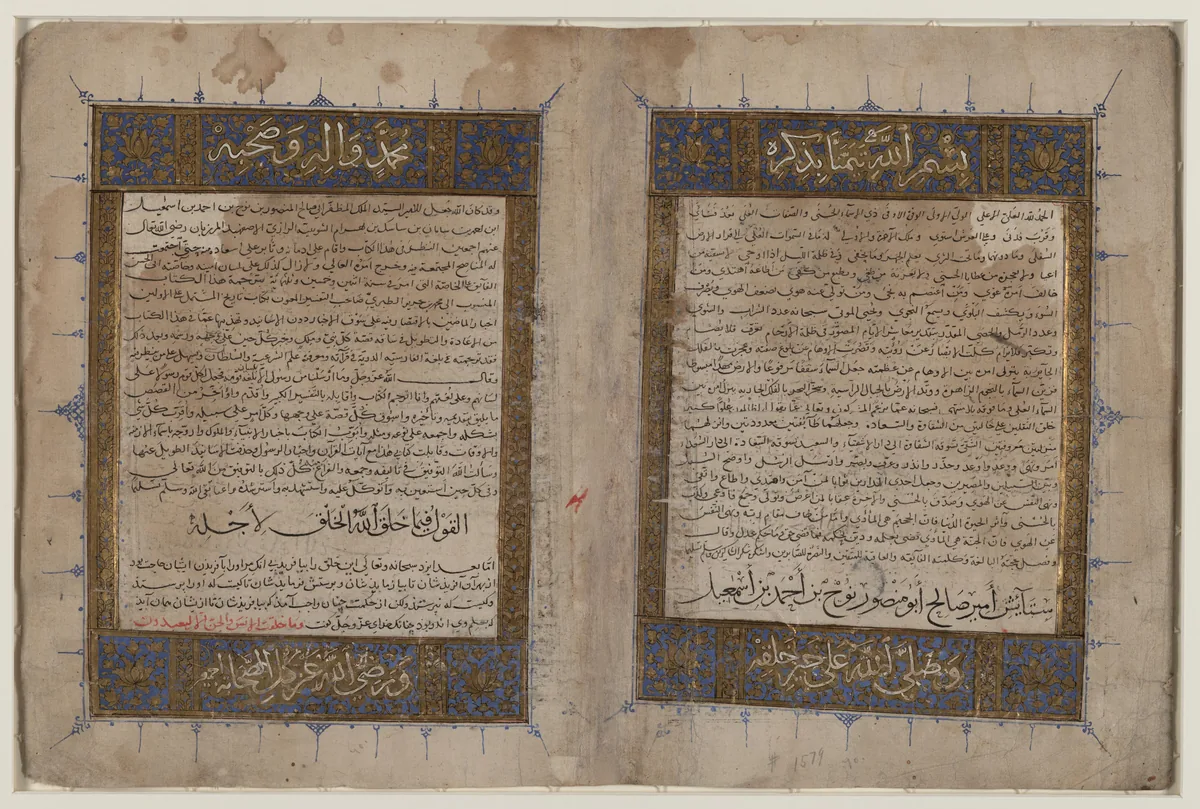
The illuminated opening pages of a manuscript of Bal'ami's Persian translation of Tabari's History, copied in the thirteenth or fourteenth century, in the Library of Congress. Tabari tells how a khagan turned back before the fortified gate of Sul without a battle; where the gate stood is disputed. Image: Library of Congress, African and Middle East Division. Public domain. メイン画像 掲載先: スール門
-
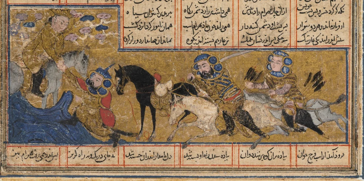
Khosrow II flees from Bahram Chobin, the Persian commander of the war of 588, and is saved by the angel Sarush. Painting in a Shahnama made in Baghdad about 1299. The Cleveland Museum of Art, 1944.480.1.a, CC0. メイン画像 掲載先: ギョクテュルク・ペルシア戦争(588〜589年)
-
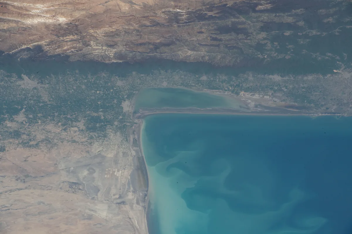
The south-eastern corner of the Caspian Sea with the Gulf of Gorgan, the Miankaleh spit and the Elburz beyond, photographed from the International Space Station in April 2022. Gurgan is the land at the south-eastern corner of the Caspian, the Hyrcania of the Greeks. Image: NASA. Public domain. メイン画像 掲載先: グルガーン
-
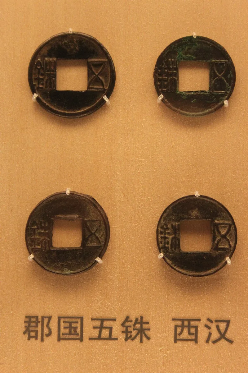
Wuzhu coins of the Western Han in the coin gallery of the Shanghai Museum. Photograph: Gary Lee Todd, 2010, CC0. メイン画像 掲載先: Han dynasty
-
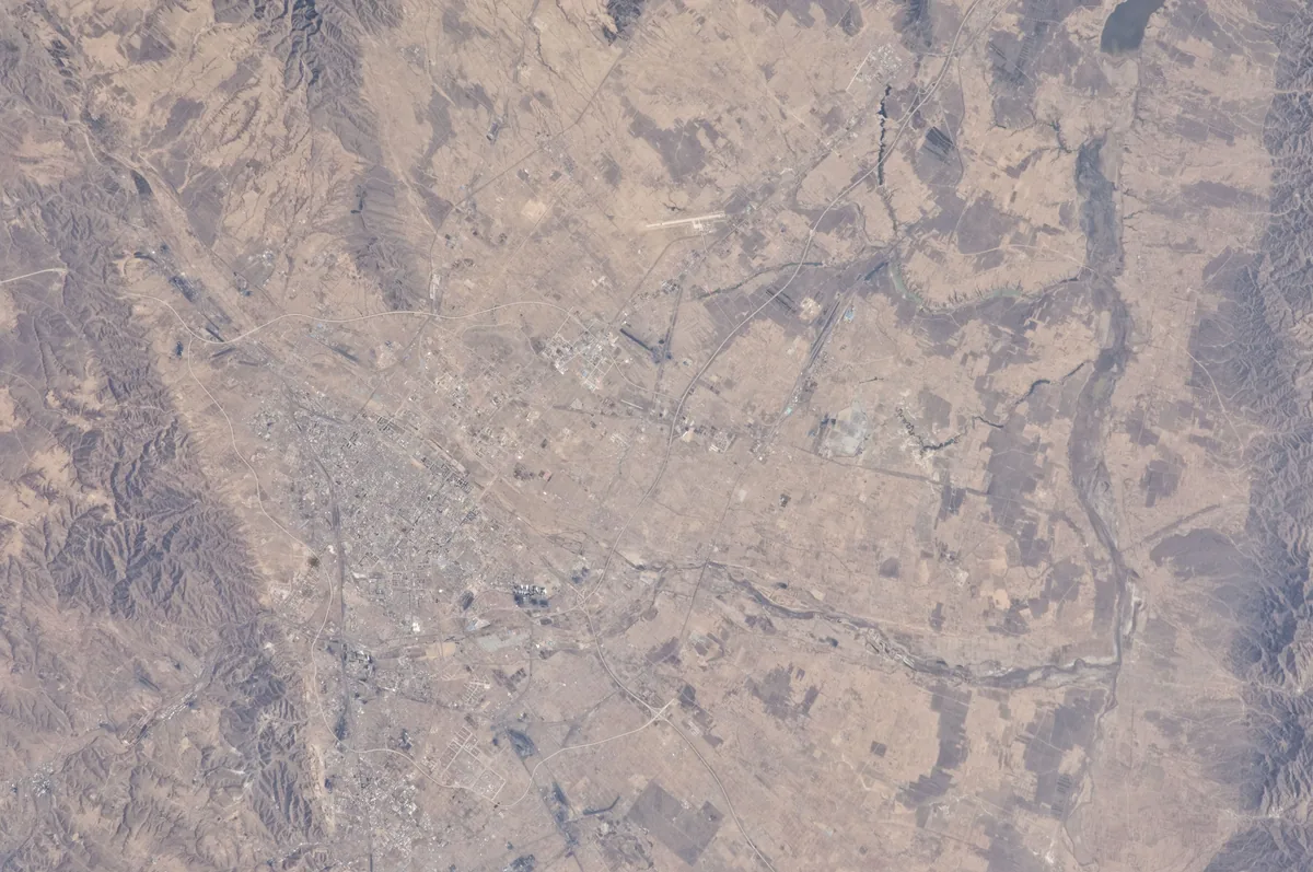
The city of Datong and its basin in northern Shanxi, photographed from the International Space Station in 2010. One identification makes Heng'an the Yunzhong county of the Tang and places it at Datong county. Image: NASA. Public domain. メイン画像 掲載先: 恒安
-
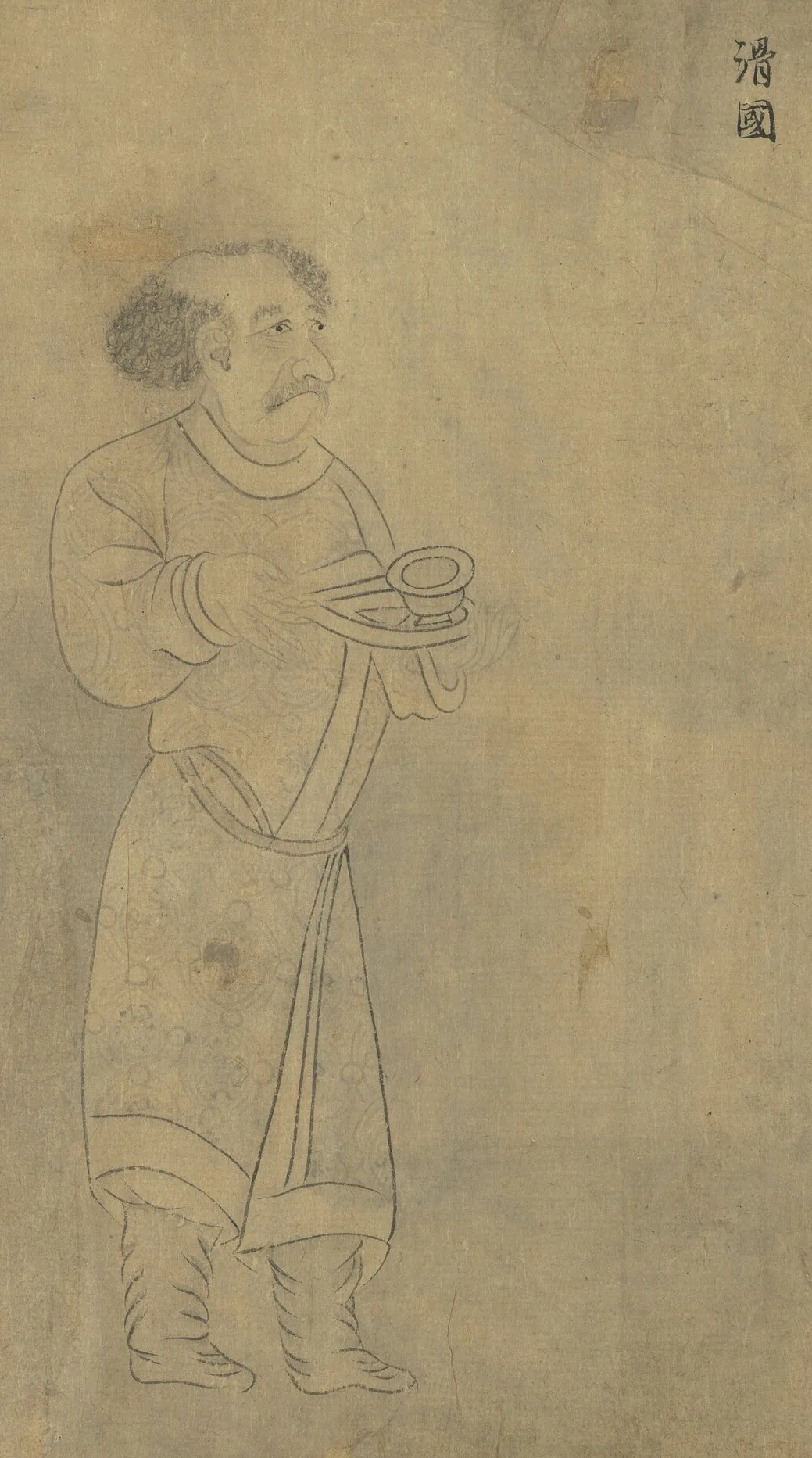
Envoy of the Hua (滑國), as the Liang court called the Hephthalites, carrying a bowl. From “Foreign Visitors Coming to Court”, a copy after a painting ascribed to Emperor Yuan of Liang (r. 552–555); an inscription of the Song emperor Lizong names Gu Deqian of the Southern Tang as the copyist. Handscroll, ink on paper; National Palace Museum, Taipei, 故畫001389N. Copy of Emperor Yuan of Liang’s “Foreign Visitors Coming to Court”, The National Palace Museum, Taipei, CC BY 4.0 @ www.npm.gov.tw. メイン画像 掲載先: Hephthalites
-
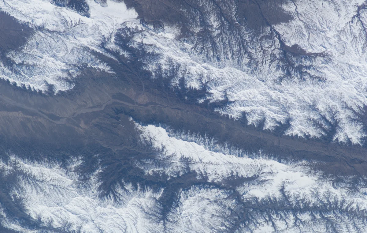
The snow-covered valley of the Hari Rud east of Herat, photographed from the International Space Station in 2003. Astronaut photograph ISS006-E-25613. NASA, public domain. メイン画像 掲載先: ヘラート
-
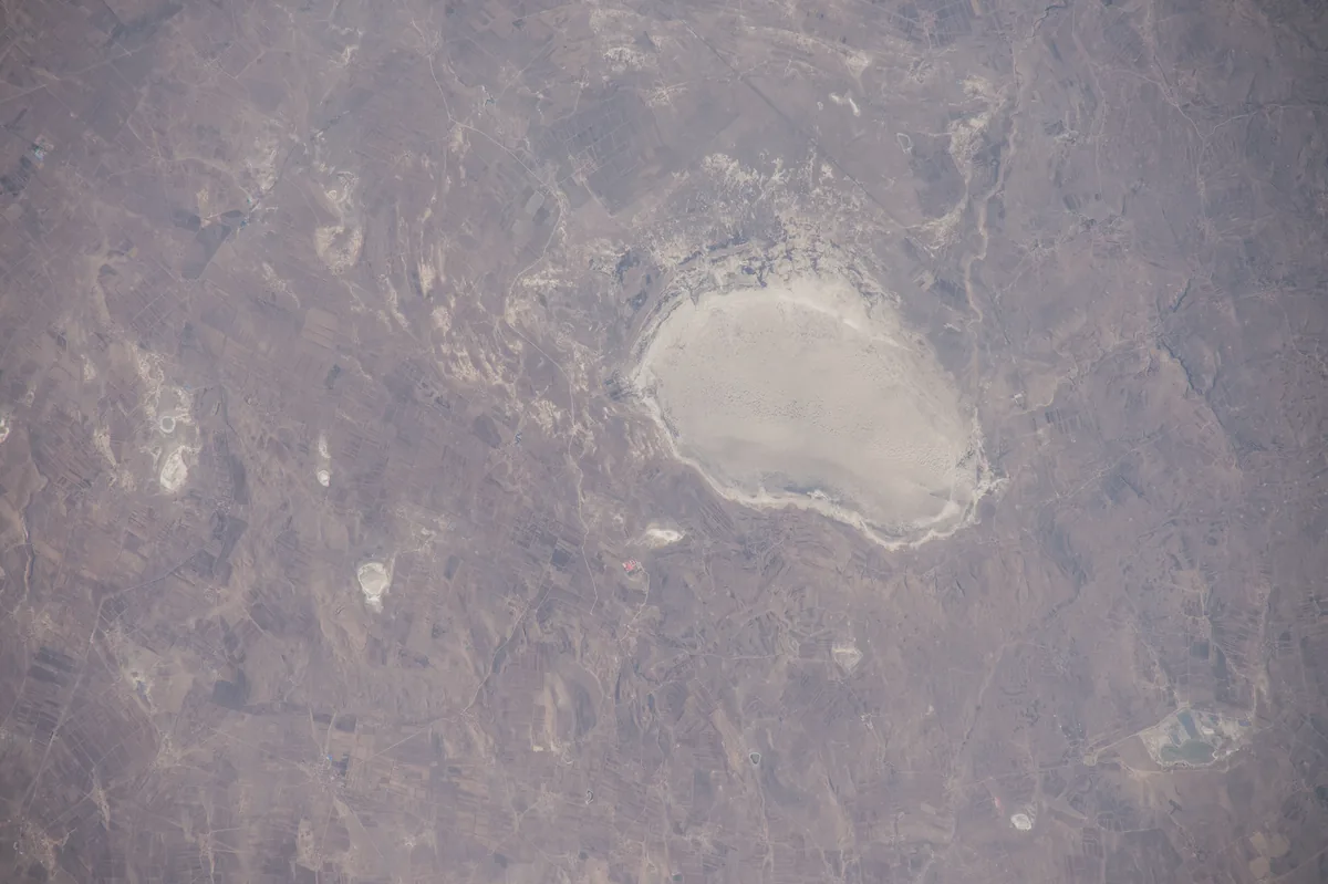
A dry lake bed on the plateau of Zhangbei county in northern Hebei, photographed from the International Space Station in 2015. Modern scholarship places Huaihuang near Zhangbei, on the edge of the Mongolian plateau. Image: NASA. Public domain. メイン画像 掲載先: 懐荒
-
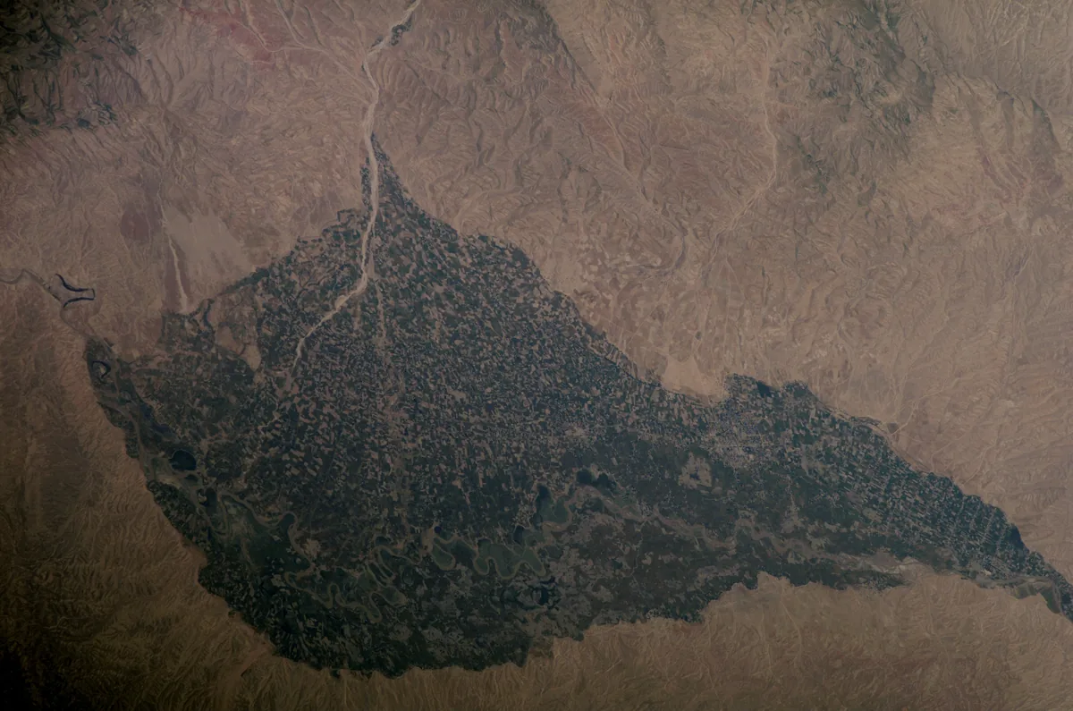
The irrigated valley of the Kunduz river, here called the Surkhab, around Baghlan in northern Afghanistan, photographed from the International Space Station in May 2007. Huo is placed at Kunduz by some and at Ghori on the road from Kunduz to Kabul by others; Baghlan lies between the two. Image: NASA. Public domain. メイン画像 掲載先: 活国
-
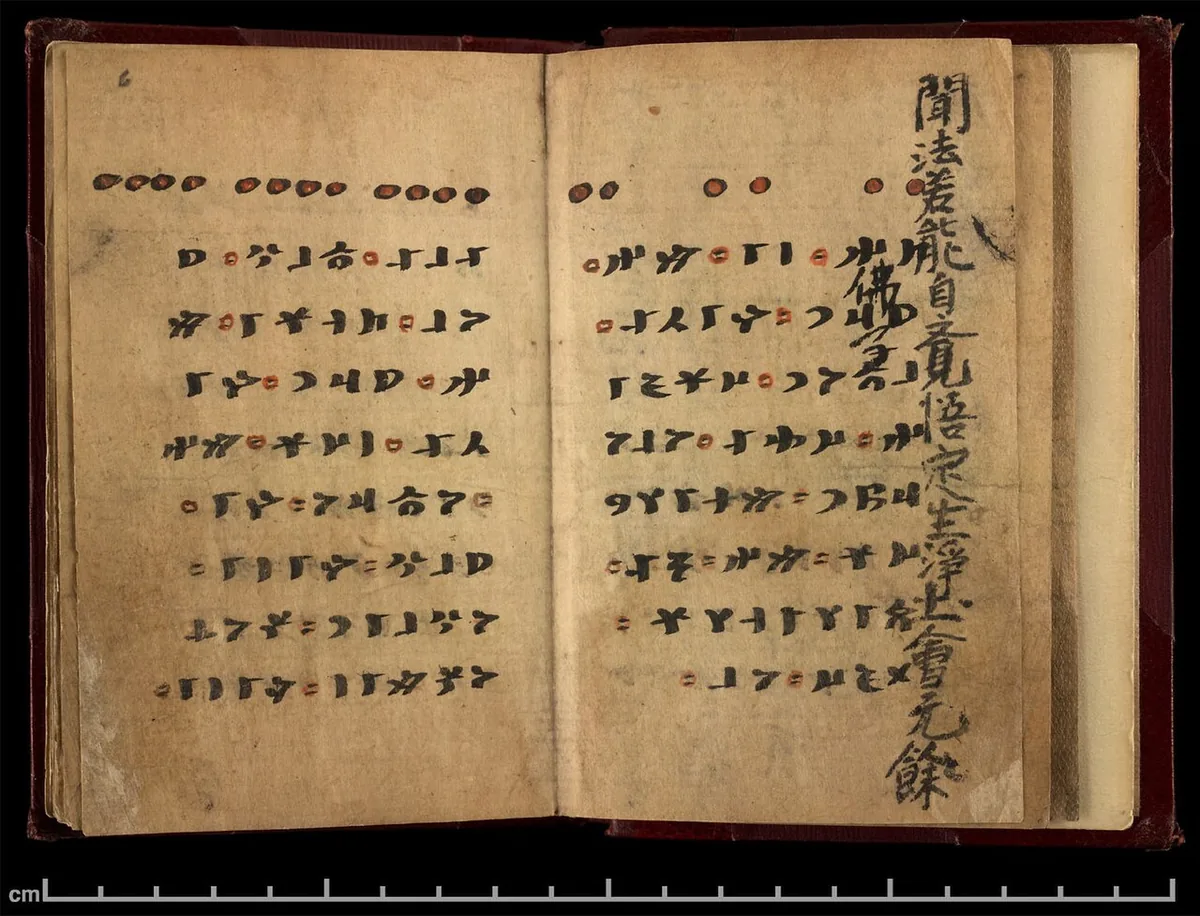
The booklet open at page 6: runiform lines in black with red punctuation, and the Chinese Buddhist text of the other side showing at the edge. British Library, Or.8212/161, via the International Dunhuang Project. Public domain. メイン画像 掲載先: イルク・ビティグ
-
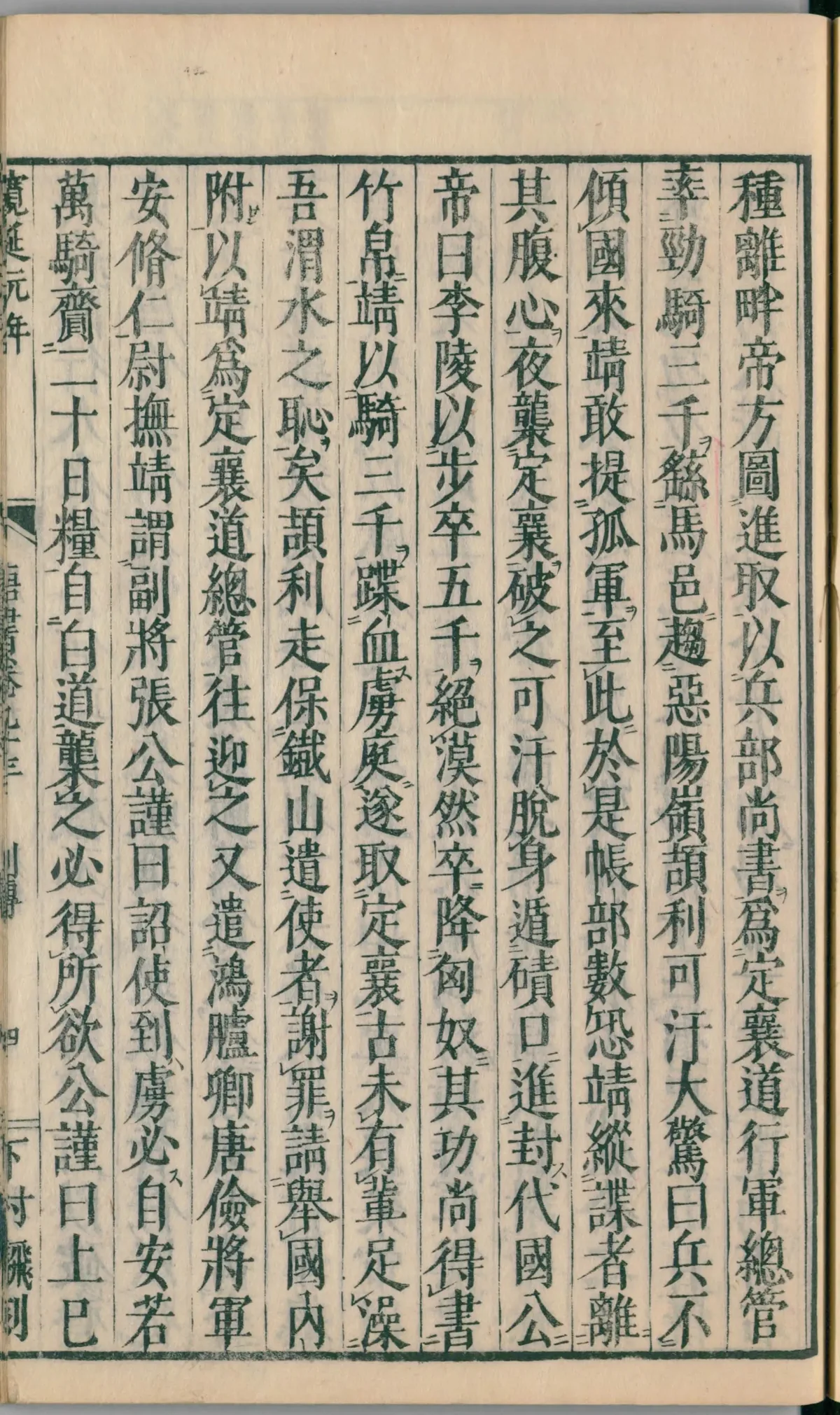
A page of the life of Li Jing in chapter 93 of the Xin Tang Shu, in a Japanese edition of 1750, in the National Diet Library, Tokyo. In the seventh column from the right, the text says that Ilig fled to the Iron Mountain (鐵山) to make a stand and sent envoys to ask that his state be received in submission. Image: National Diet Library, Japan. Public domain. メイン画像 掲載先: 鉄山
-
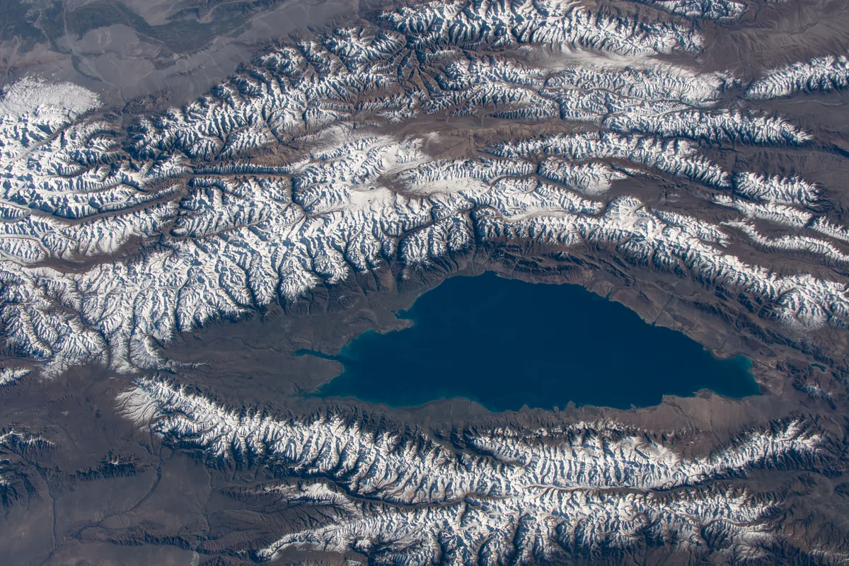
Lake Issyk-Kul in Kyrgyzstan between the snow-covered ranges of the Tian Shan, photographed from the International Space Station in October 2019. Xuanzang's Record calls it the Great Clear Lake, long from east to west and surrounded by mountains on all sides. Image: NASA. Public domain. メイン画像 掲載先: イシク・クル湖
-
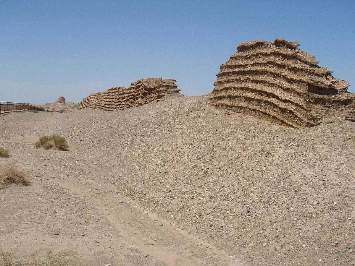
Remains of the Han wall at the Jade Gate Pass in the desert west of Dunhuang, August 2011. Photograph: Raki_Man, 2011, CC BY 3.0. メイン画像 掲載先: 玉門関
-
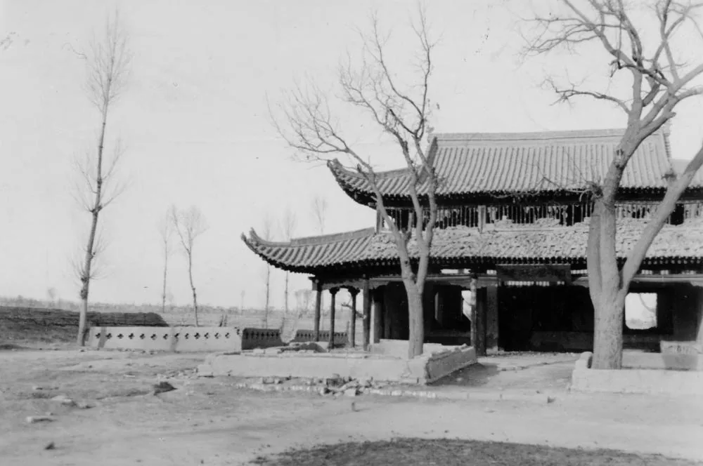
A pavilion at the spring called Jiuquan, 'Wine Spring', in Suzhou, the modern town of Jiuquan in Gansu, photographed by Irving C. Yew of Sven Hedin's Sino-Swedish expedition in December 1934. Image: Irving C. Yew, Museum of Ethnography, Stockholm. Public domain. メイン画像 掲載先: 酒泉
-
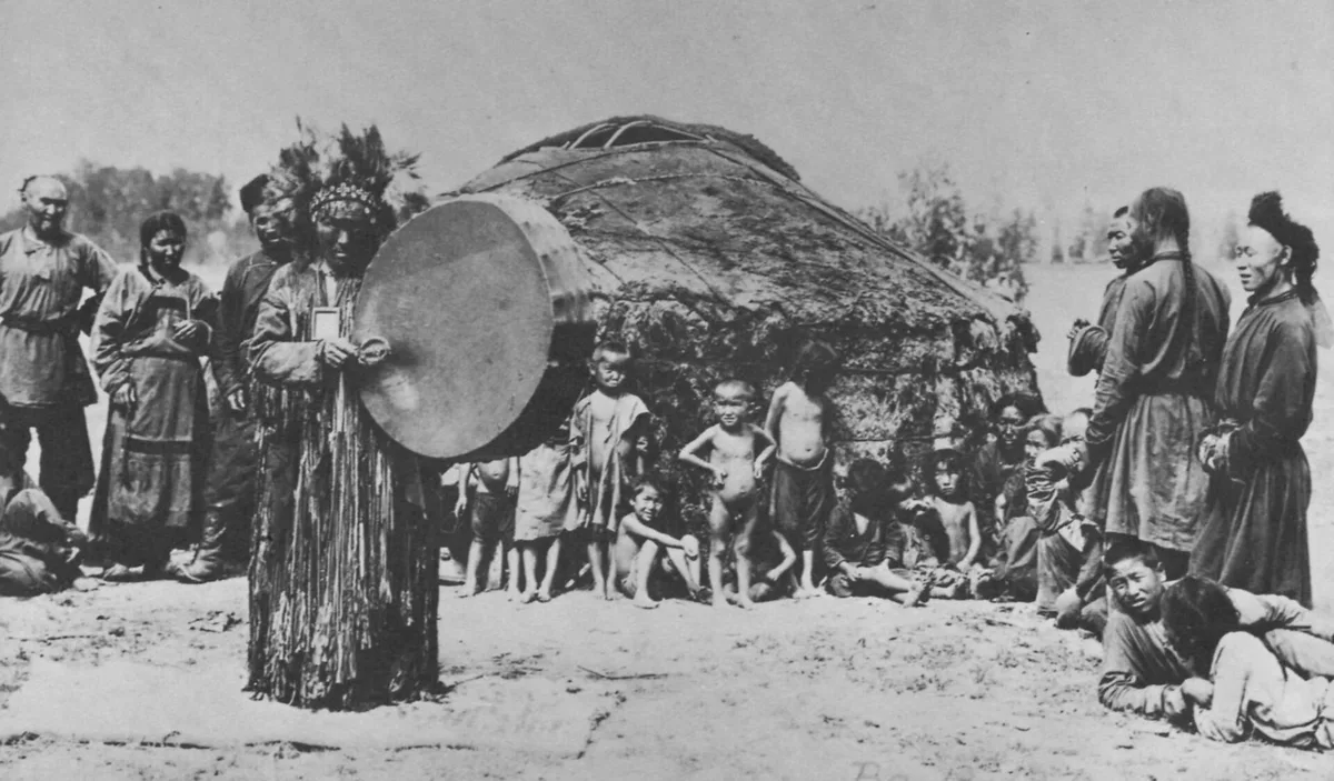
A Tuvan shaman with his frame drum before a felt yurt, photographed about 1900. It shows the practice as ethnographers recorded it among the Turkic peoples of southern Siberia, thirteen centuries after the Göktürks. Photograph: unknown Russian photographer, about 1900; Hamburgisches Museum für Völkerkunde. Public domain. メイン画像 掲載先: カム(テュルクのシャーマン)
-
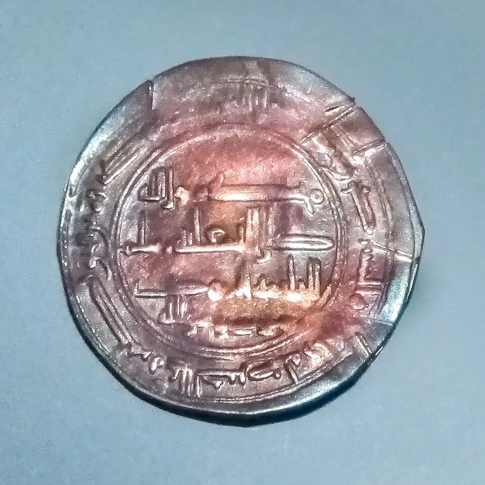
The so-called Moses coin, a Khazar silver coin from the Spillings hoard on Gotland, in the museum at Visby. Photograph: W. Carter, 2015, CC BY-SA 4.0. メイン画像 掲載先: ハザール可汗国
-
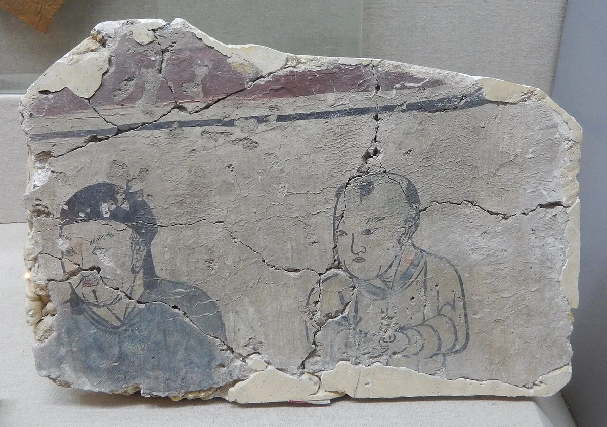
Fragment of a Liao-dynasty tomb mural showing a Khitan man and a Khitan boy, from a tomb at Paolou Hill in Lindong, excavated in 1988. Photograph: BabelStone, 2016, CC BY-SA 3.0. メイン画像 掲載先: Khitan
-
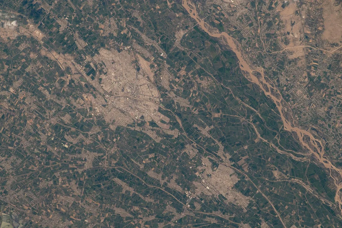
The irrigated oasis around Urgench by the Amu Darya, astronaut photograph, 2022. Astronaut photograph iss067e212667. NASA, public domain. メイン画像 掲載先: ホラズム
-
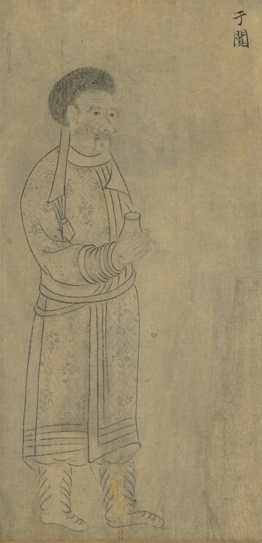
Envoy of Khotan (于闐), holding a small flask. From “Foreign Visitors Coming to Court”, a copy after a painting ascribed to Emperor Yuan of Liang (r. 552–555); an inscription of the Song emperor Lizong names Gu Deqian of the Southern Tang as the copyist. Handscroll, ink on paper; National Palace Museum, Taipei, 故畫001389N. Copy of Emperor Yuan of Liang’s “Foreign Visitors Coming to Court”, The National Palace Museum, Taipei, CC BY 4.0 @ www.npm.gov.tw. メイン画像 掲載先: ホータン
-
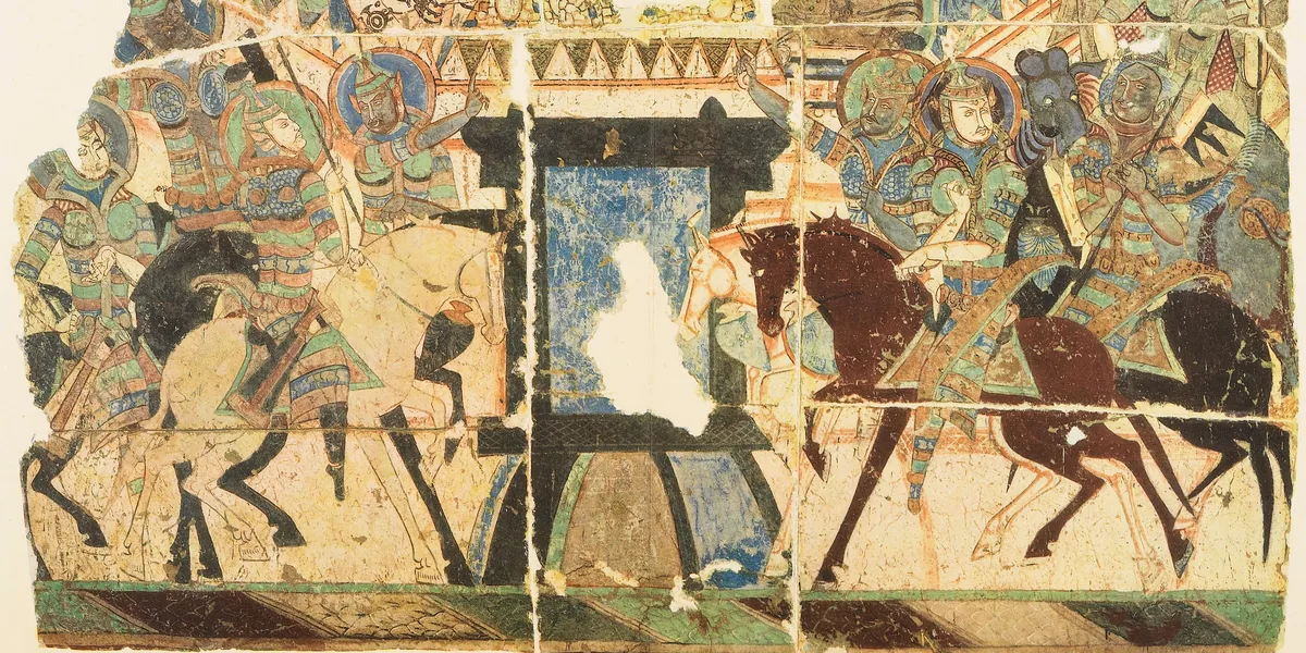
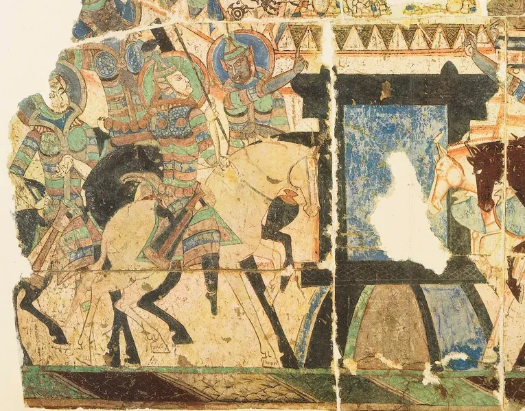
Armoured horsemen on both sides of a city gate, a wall painting from the Buddhist cave temples of the Kucha region. メイン画像 掲載先: クチャ
-
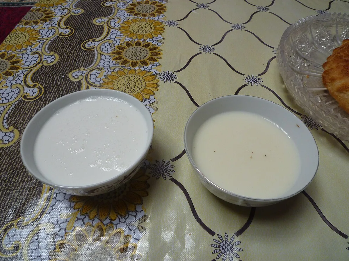
Bowls of shubat, fermented camel milk (left), and kumis, fermented mare's milk (right). Photograph: Upyernoz, 2010, CC BY 2.0. メイン画像 掲載先: 馬乳酒
-
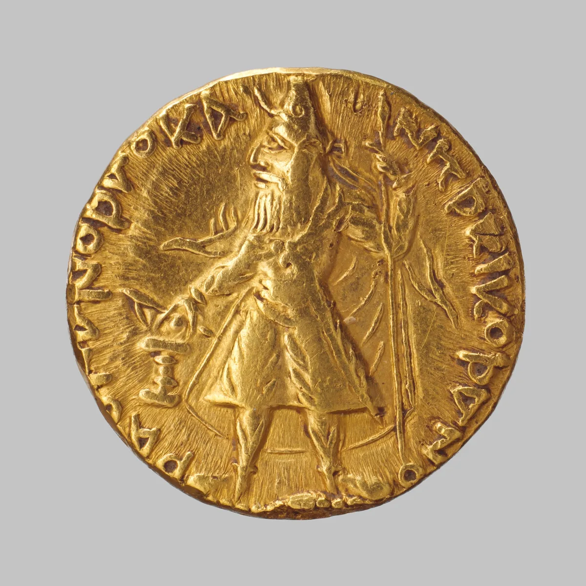
Gold coin of the Kushan king Kanishka, struck about 130 CE in the region of Gandhara. The Metropolitan Museum of Art, New York, 99.35.3024, Bequest of Joseph H. Durkee, 1898, Open Access, public domain (CC0). メイン画像 掲載先: Kushan Empire
-
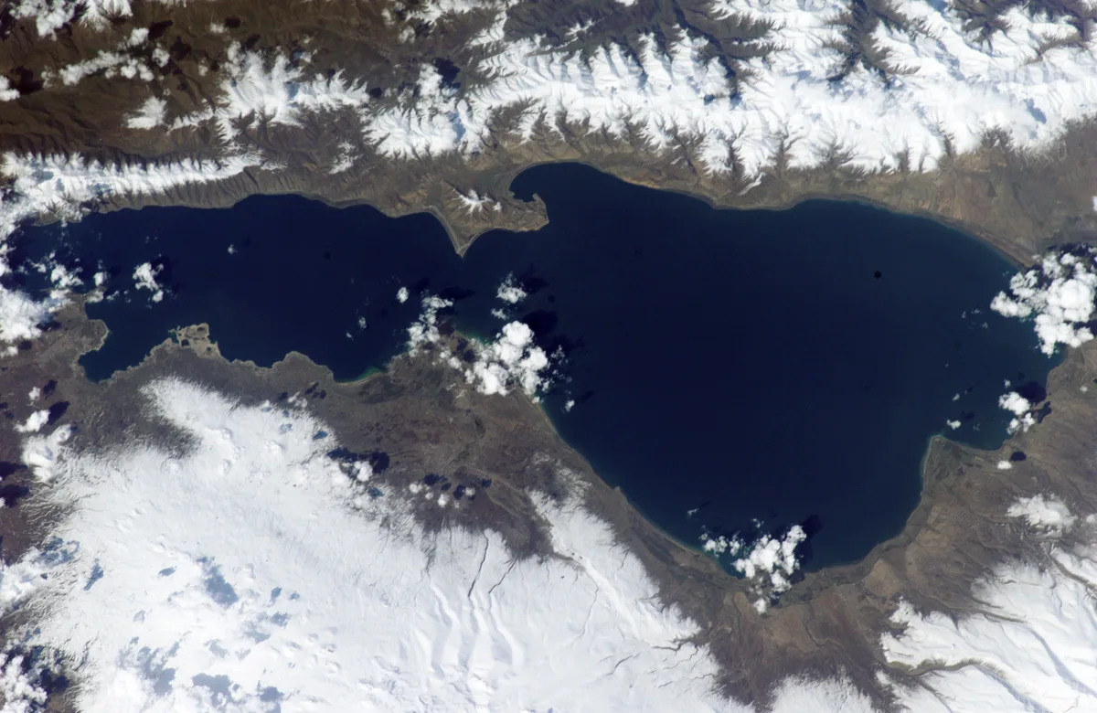
Lake Sevan in Armenia with snow on the surrounding mountains, astronaut photograph, April 2002. Astronaut photograph ISS004-E-10651. NASA, public domain. メイン画像 掲載先: セヴァン湖
-
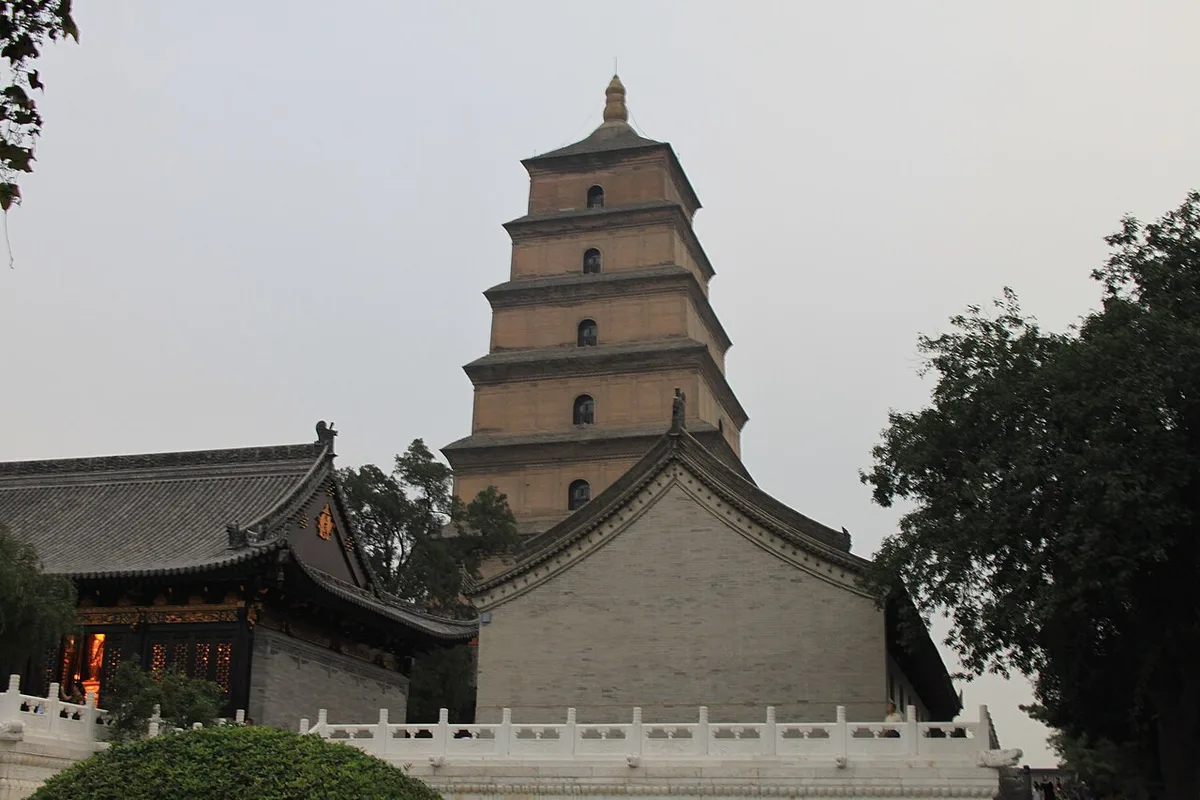
The Big Wild Goose Pagoda in the Ci'en monastery at Xi'an, the former Chang'an, where Xuanzang translated the scriptures he brought back. Photograph: Gary Todd, 2009, CC0. メイン画像 掲載先: Life of Xuanzang
-
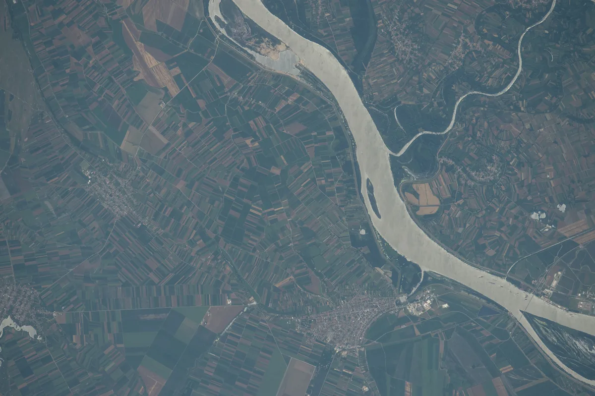
The Danube in Serbia where the Great Morava flows into it, photographed from the International Space Station on 25 June 2016. The Roman city of Margus lay near this confluence, by the modern village of Dubravica east of Belgrade. Image: NASA. Public domain. メイン画像 掲載先: マルグス
-
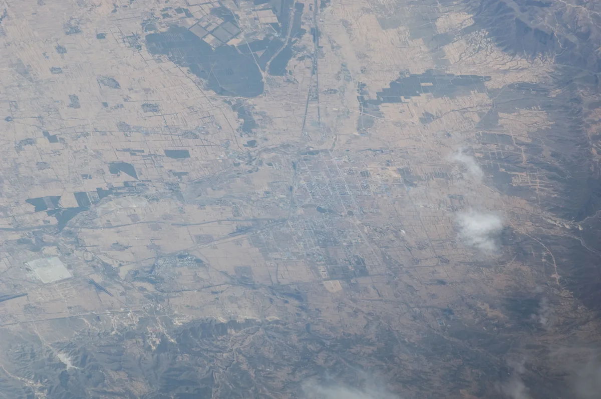
The city of Shuozhou and the plain around it in northern Shanxi, photographed from the International Space Station in 2011. One identification places Mayi east of Shuo county, on the east bank of the Mayi river. Image: NASA. Public domain. メイン画像 掲載先: 馬邑
-
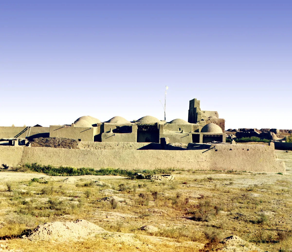
The mosque and mausoleum of Yusuf Hamadani at ancient Merv, in a colour photograph taken between 1905 and 1915. The shrine is of the twelfth century. Photograph: Sergei Prokudin-Gorskii, between 1905 and 1915; Library of Congress, no known restrictions. メイン画像 掲載先: メルヴ
-
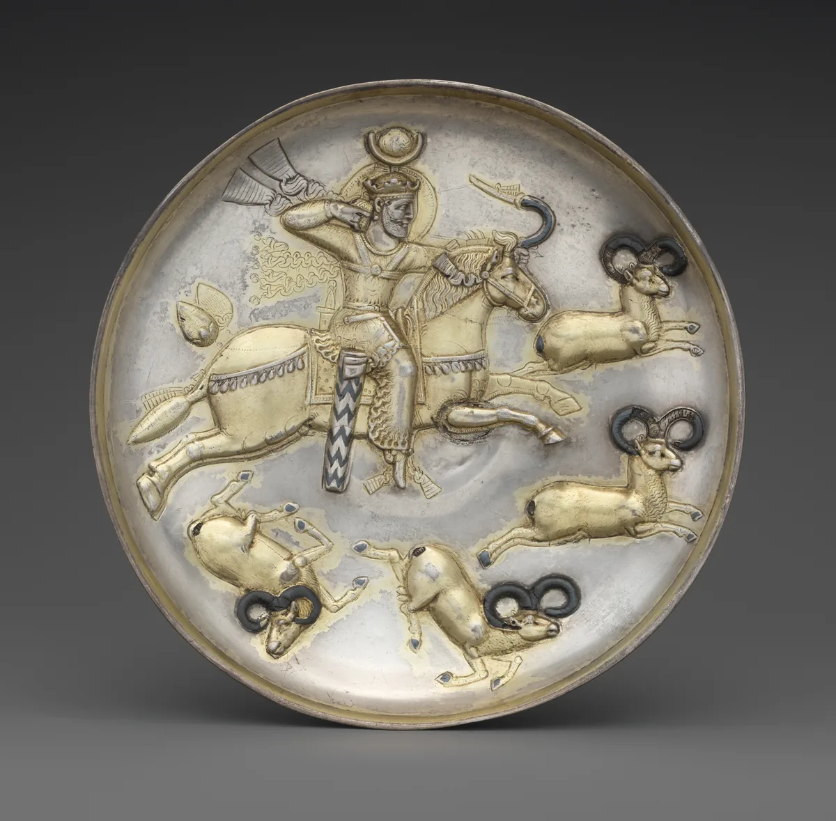
Silver plate with a Sasanian king hunting rams from horseback, Iran, mid-fifth to mid-sixth century. The rider turns in the saddle and draws the bow at full gallop. The Metropolitan Museum of Art, New York, 34.33, Fletcher Fund, 1934. Open Access, public domain (CC0). メイン画像 掲載先: 騎射
-
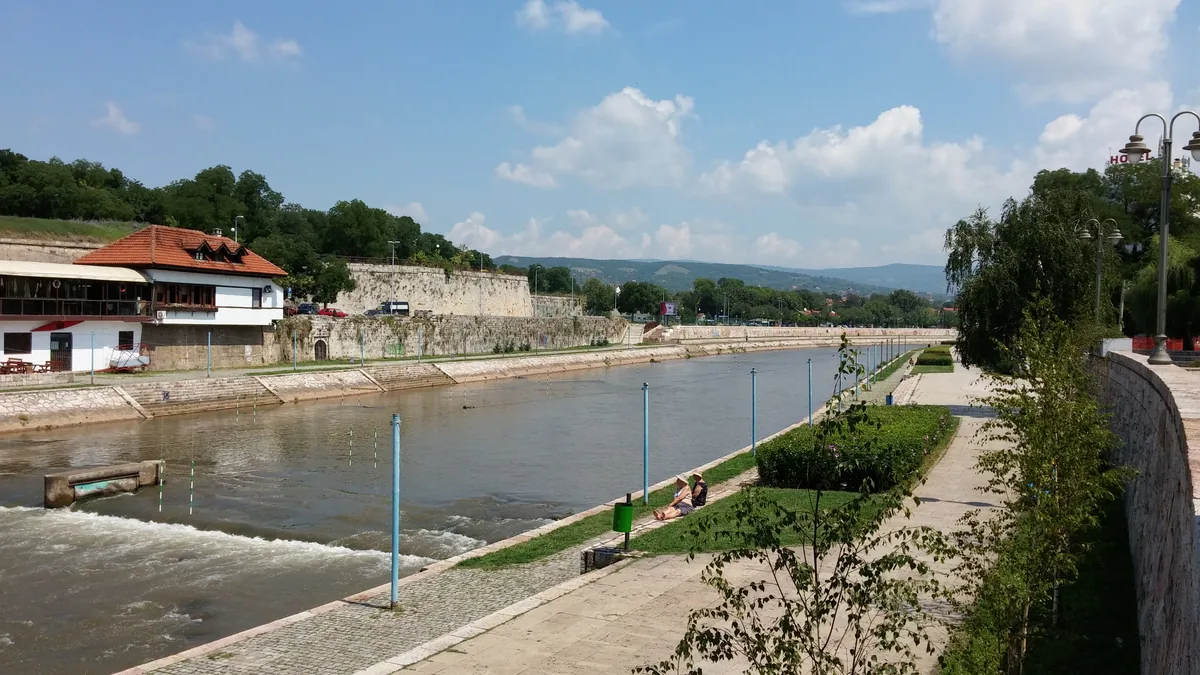
The Nišava river in Niš, southern Serbia, with the walls of the town's fortress along its bank, photographed in 2014. Roman Naissus, the modern Niš and the birthplace of Constantine, lay on the right bank of the Nišava. Image: Gagarin Miljkovich, CC BY 2.0. メイン画像 掲載先: ナイスス
-
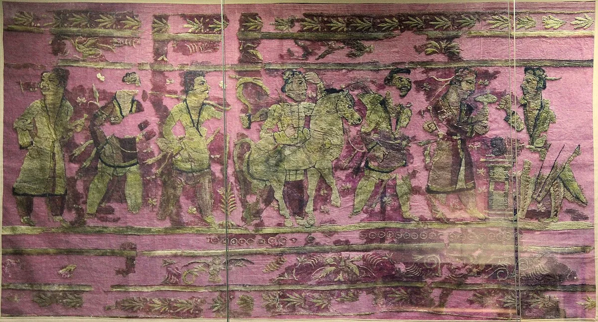
An embroidered hanging from the burial mounds of Noin-Ula, first century BCE to first century CE, as shown in a museum. Photograph: Gary Todd, 2022, CC0. メイン画像 掲載先: ノイン・ウラ
-
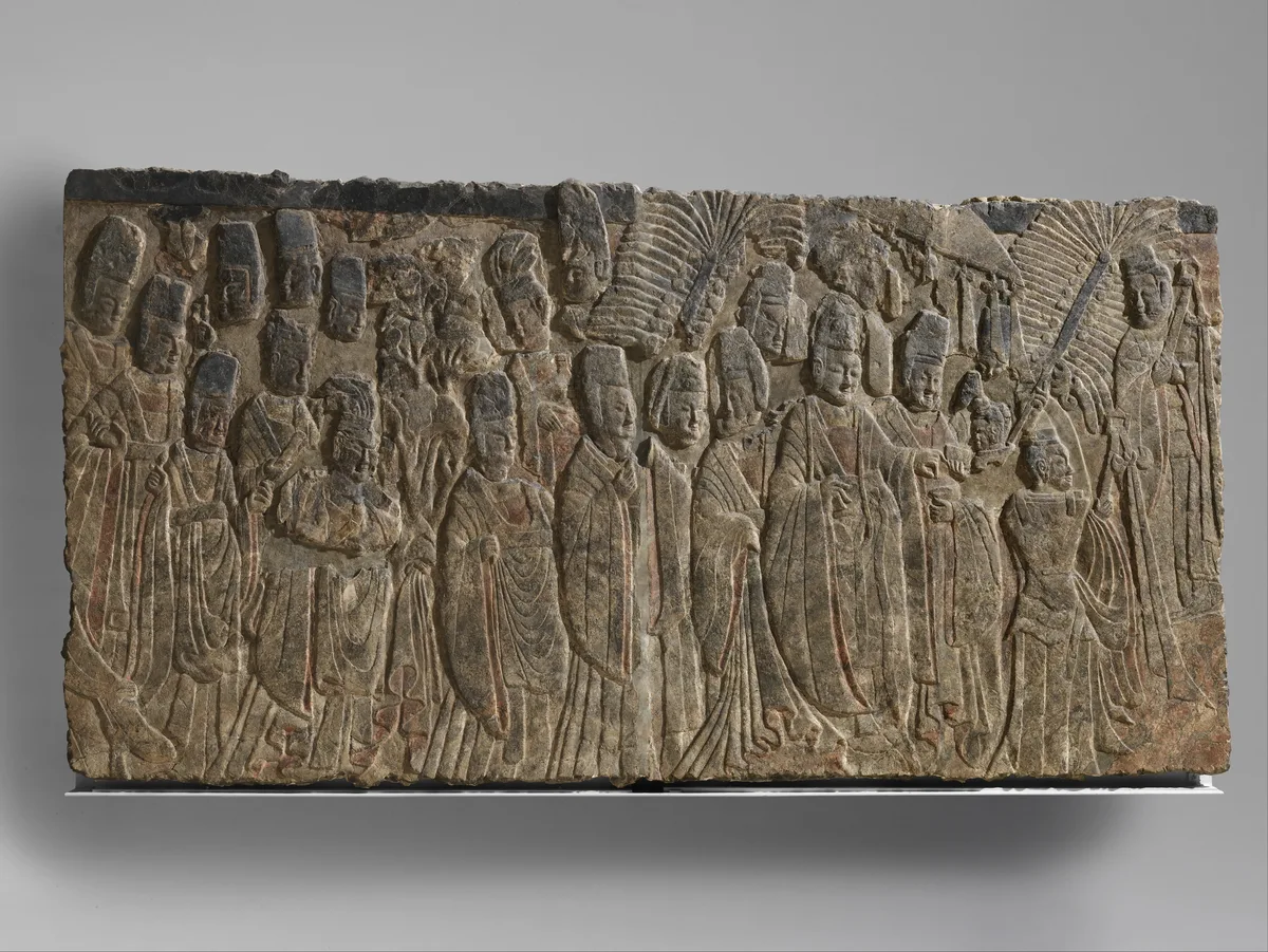
Limestone relief of Emperor Xiaowen and his entourage worshipping the Buddha, Northern Wei dynasty, about 522–23. The Metropolitan Museum of Art, New York, 35.146, Fletcher Fund, 1935, Open Access, public domain (CC0). メイン画像 掲載先: 北魏
-
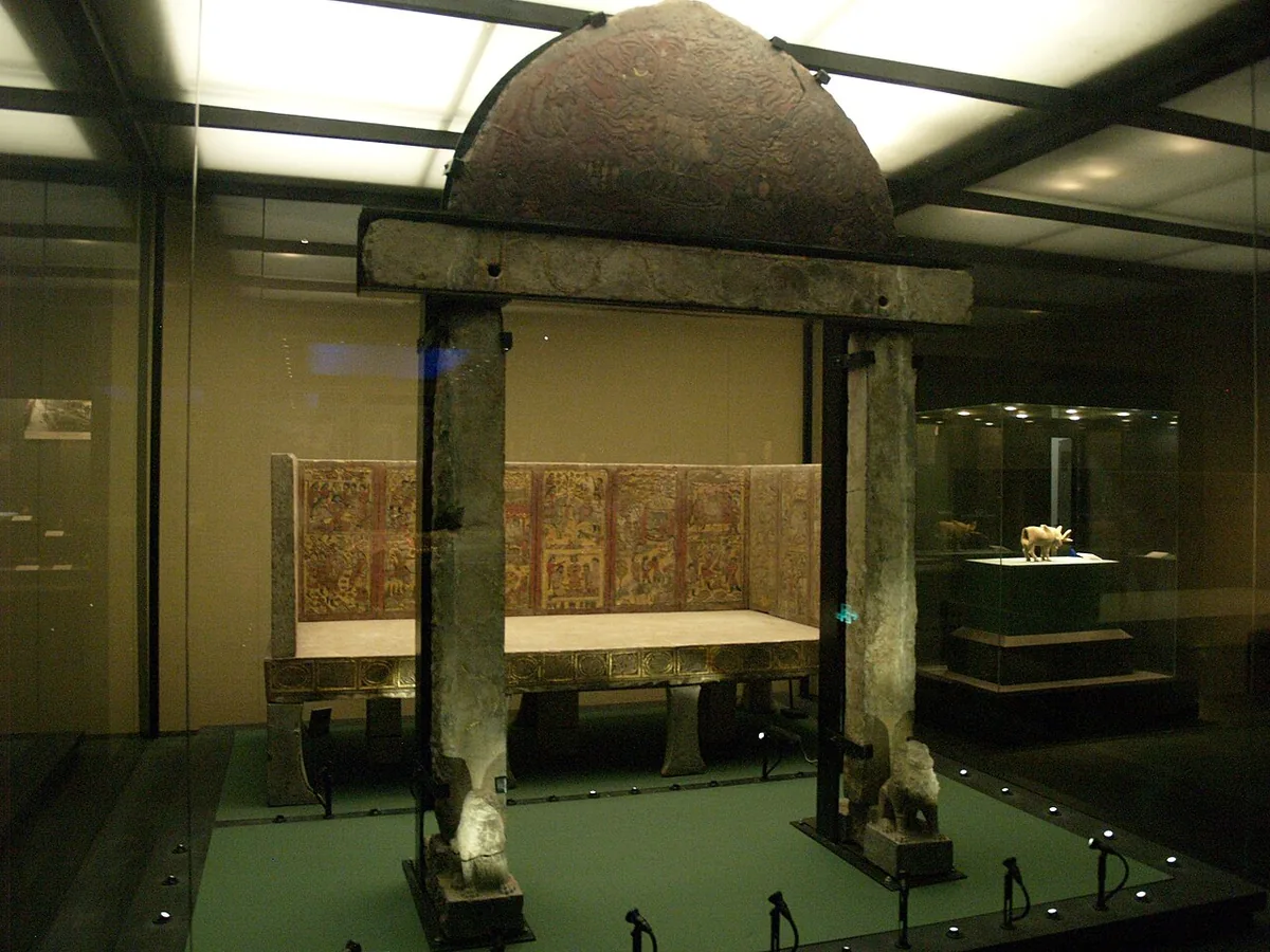
The stone gate and the funerary couch from the tomb of An Jia, a Sogdian sabao under the Zhou who died in 579, as shown at the Shaanxi History Museum in Xi'an. The painted and gilded reliefs of the couch show scenes from his life, among them his dealings with the nomads. Photograph: Deadkid dk, 2010, CC BY-SA 3.0. メイン画像 掲載先: 北周
-
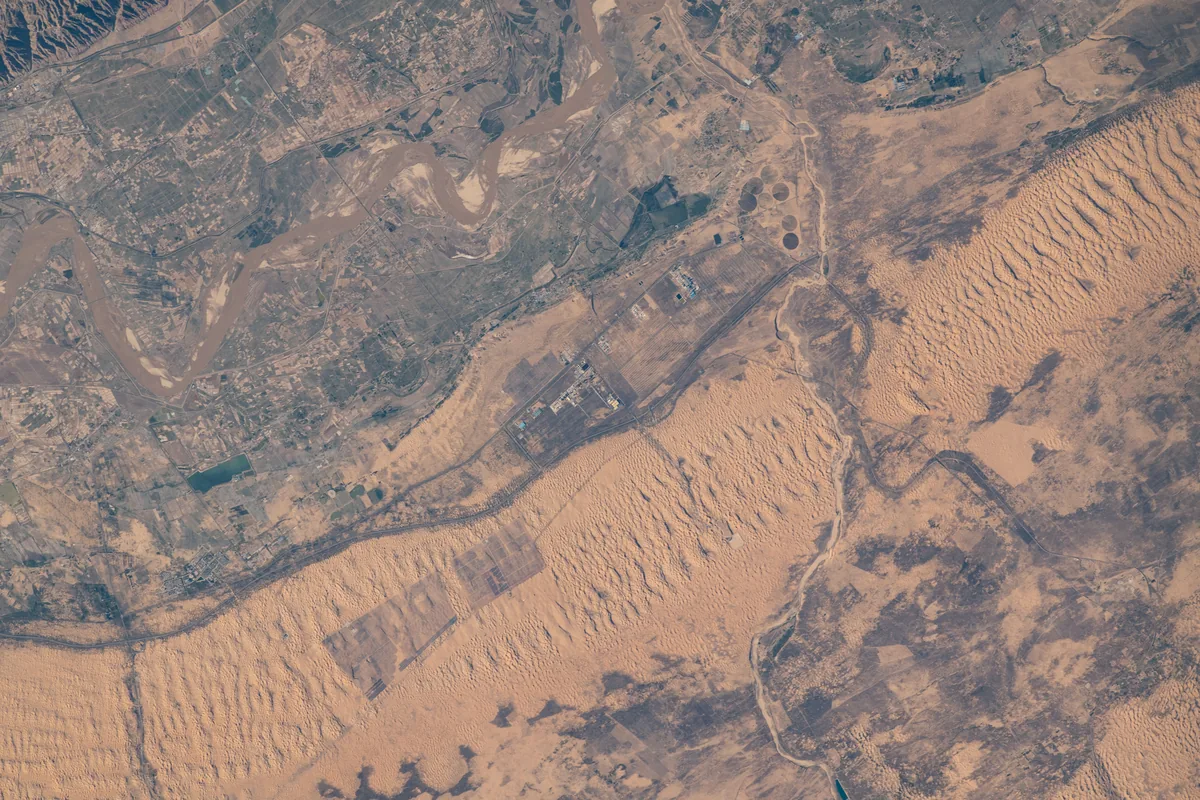
The Yellow River and the dunes of the Kubuqi desert on the northern edge of the Ordos, photographed from the International Space Station in 2022. Astronaut photograph ISS067-E-122535. NASA, public domain. メイン画像 掲載先: オルドス
-
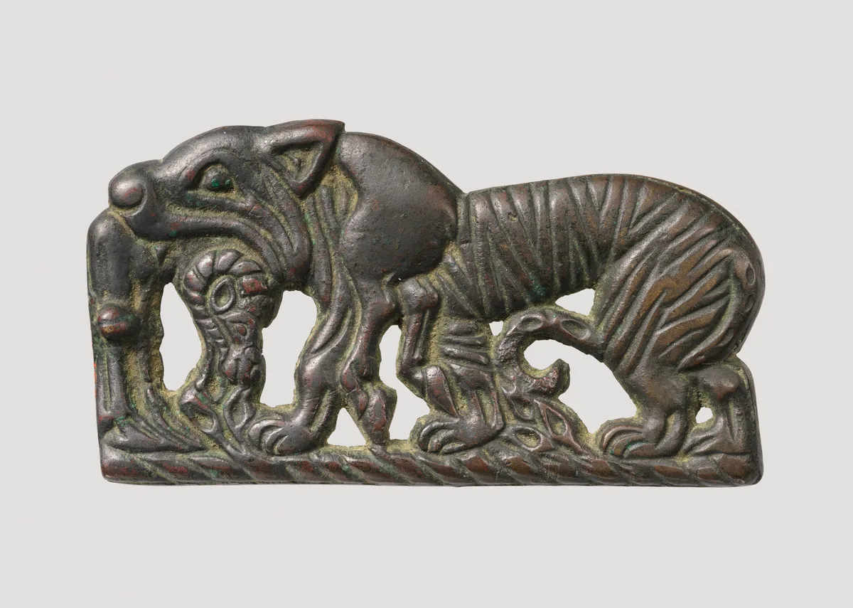
Bronze plaque of a tiger devouring a ram, attributed to the Xiongnu, about the second century BCE. The Metropolitan Museum of Art, New York, 49.132, Rogers Fund, 1949, Open Access, public domain (CC0). メイン画像 掲載先: Ordos bronzes
-
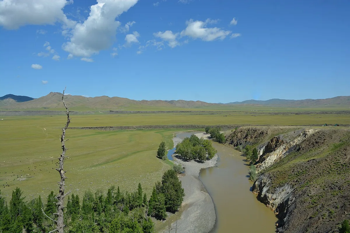
The Orkhon valley in central Mongolia, August 2024. Photograph: Jonashtand, 2024, CC BY-SA 4.0. メイン画像 掲載先: オルホン渓谷
-
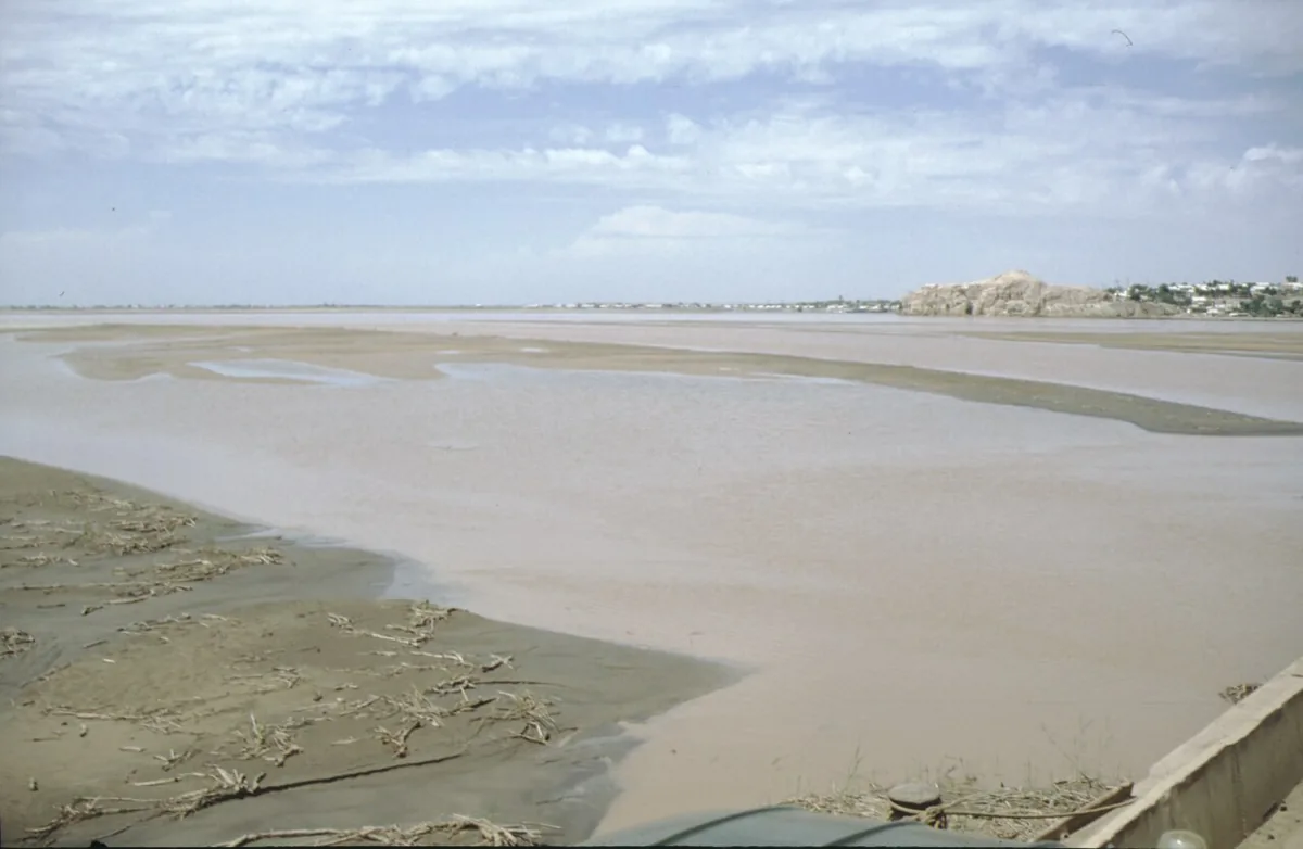
The Amu Darya, the Oxus of the ancient writers, near Kerki in Turkmenistan, 1995. Photograph: Klaus Schönitzer, 1995, CC BY-SA 4.0. メイン画像 掲載先: オクサス川
-
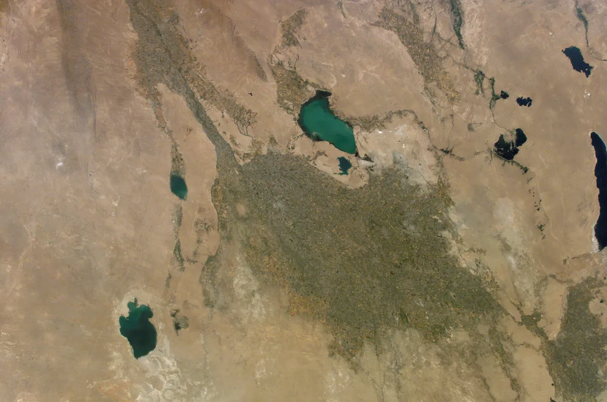
The irrigated oasis of Bukhara at the western end of the Zerafshan valley, surrounded by desert and lakes, photographed from the International Space Station in June 2002. Paikent lay in this oasis at the edge of the desert. Image: NASA. Public domain. メイン画像 掲載先: パイケント
-
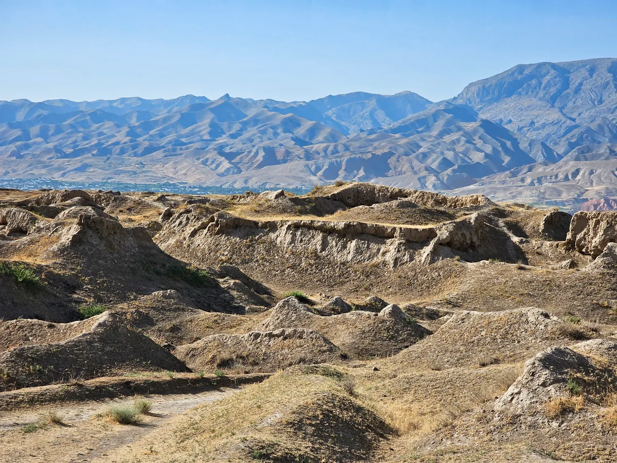
The excavated ruins of the Sogdian town of Panjikent in the upper Zarafshan valley, Tajikistan, photographed in 2023. Panjikent is the most extensively and continuously excavated town of Central Asia. Image: Richard Mortel, 2023, CC BY 2.0. メイン画像 掲載先: パンジケント
-
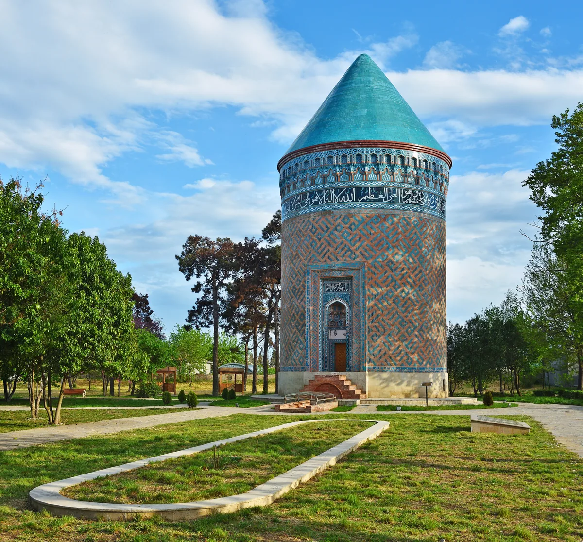
The brick tower mausoleum in the town of Barda in Azerbaijan, photographed in 2019. Partaw, the capital of Caucasian Albania, is identified with the present town of Barda. Image: Ludvig14, CC BY-SA 4.0. メイン画像 掲載先: パルタウ
-
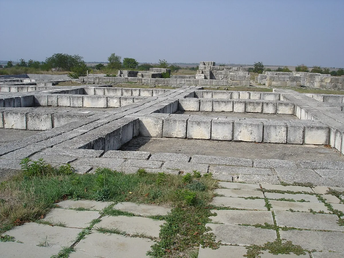
Foundations of the palace complex at Pliska. Photograph: Svilen Enev, 2007, CC BY-SA 3.0. メイン画像 掲載先: Pliska
-
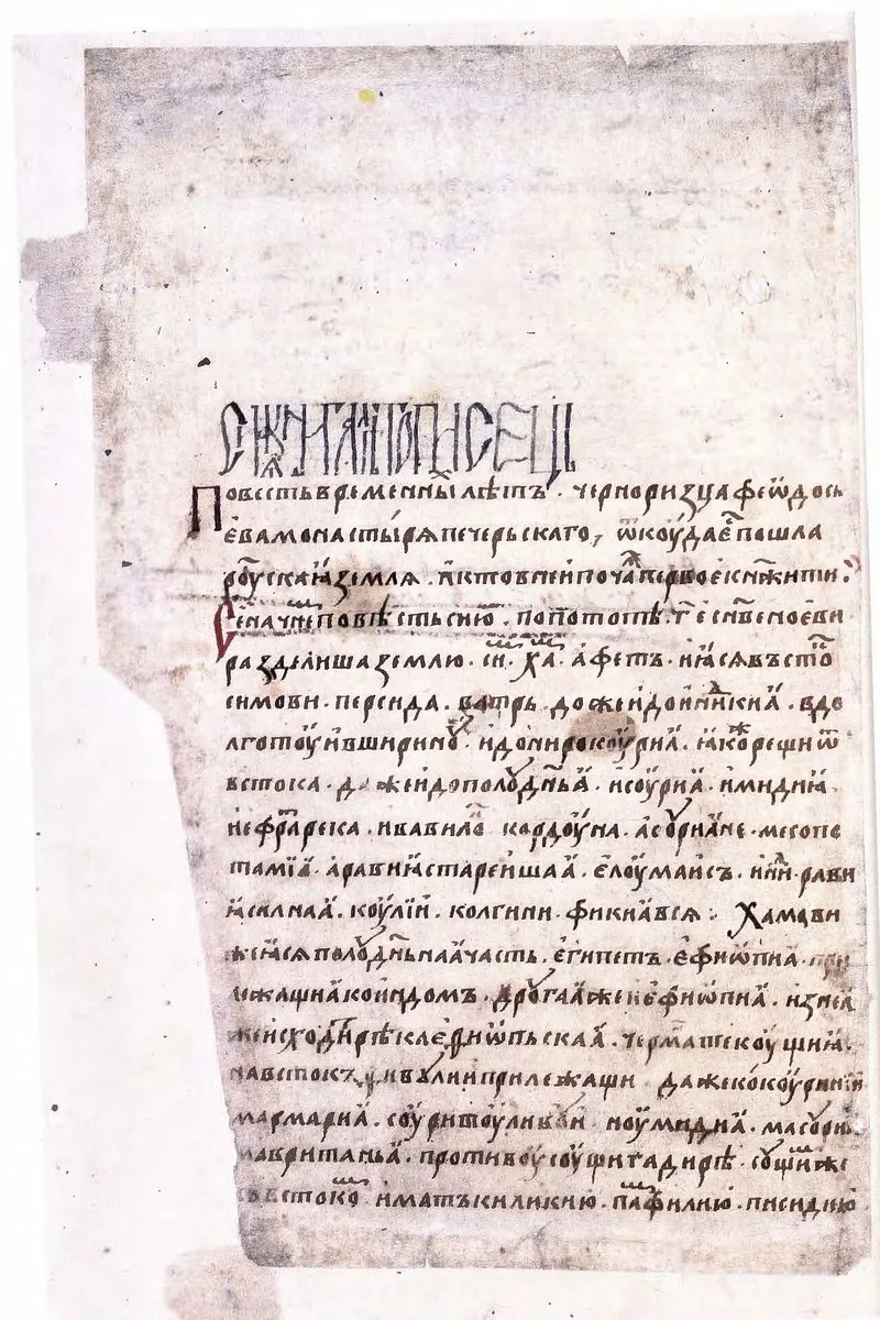
Opening leaf of the Radziwiłł (Königsberg) Chronicle, a fifteenth-century copy of the Rus chronicle. Radziwiłł Chronicle, 15th century, reproduction of the manuscript, public domain. メイン画像 掲載先: Russian Primary Chronicle
-
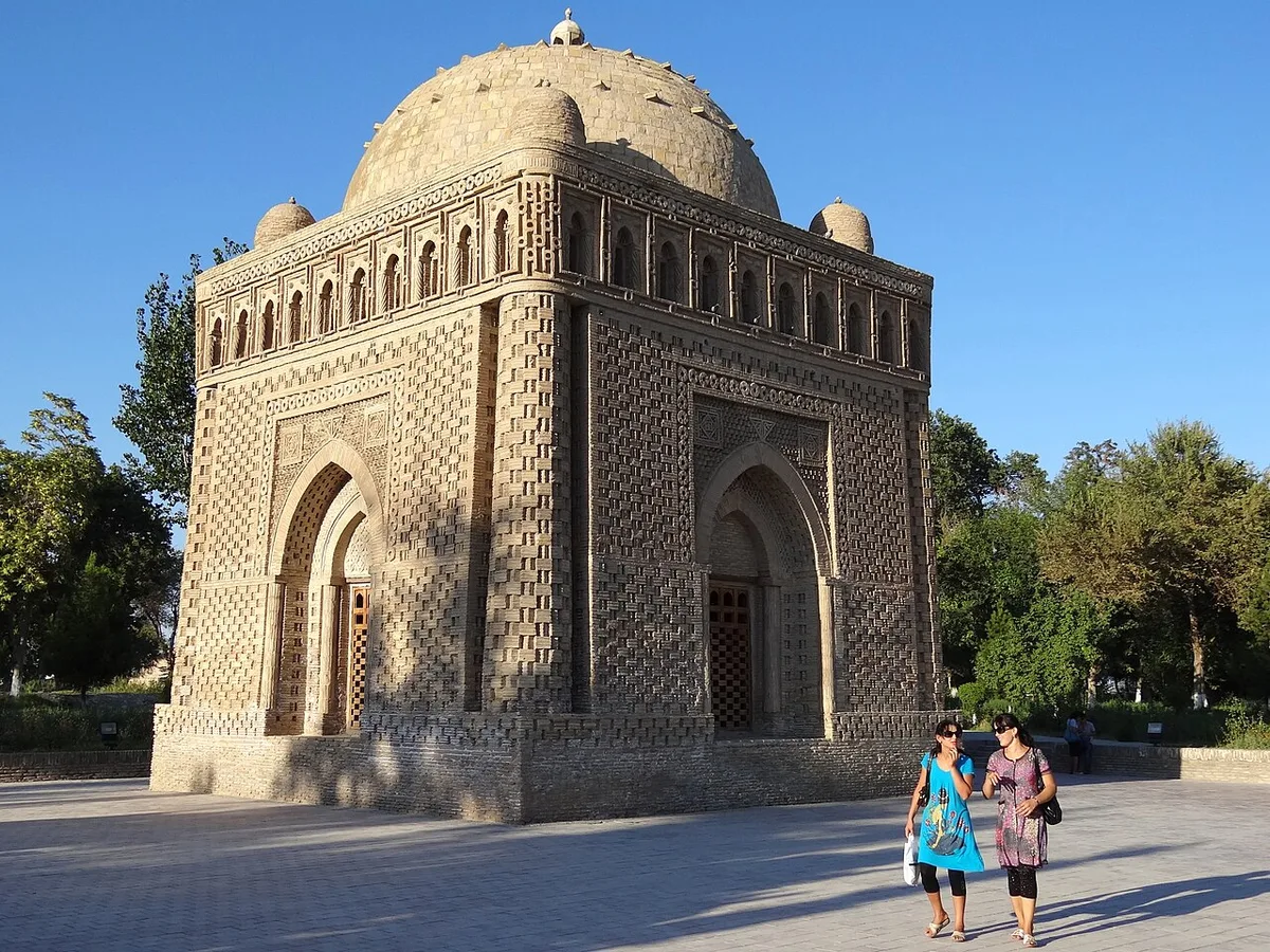
The mausoleum of Ismail Samani at Bukhara, a monument of the Samanid dynasty. Photograph: Adam Jones, 2012, CC BY-SA 2.0. メイン画像 掲載先: Samanids
-
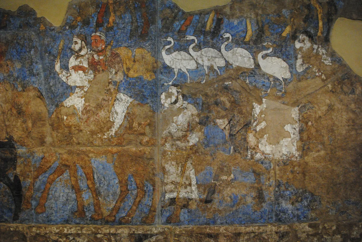
Riders on camels and a line of white birds in a procession from the paintings of the Hall of the Ambassadors at Afrasiab, the old site of Samarkand, seventh century. The paintings left Uzbekistan for the first time in 2022 for an exhibition at the Louvre. Wall painting: Hall of the Ambassadors, Afrasiab (Samarkand), seventh century. Photograph: Carole Raddato, CC BY-SA 2.0. メイン画像 掲載先: サマルカンド
-
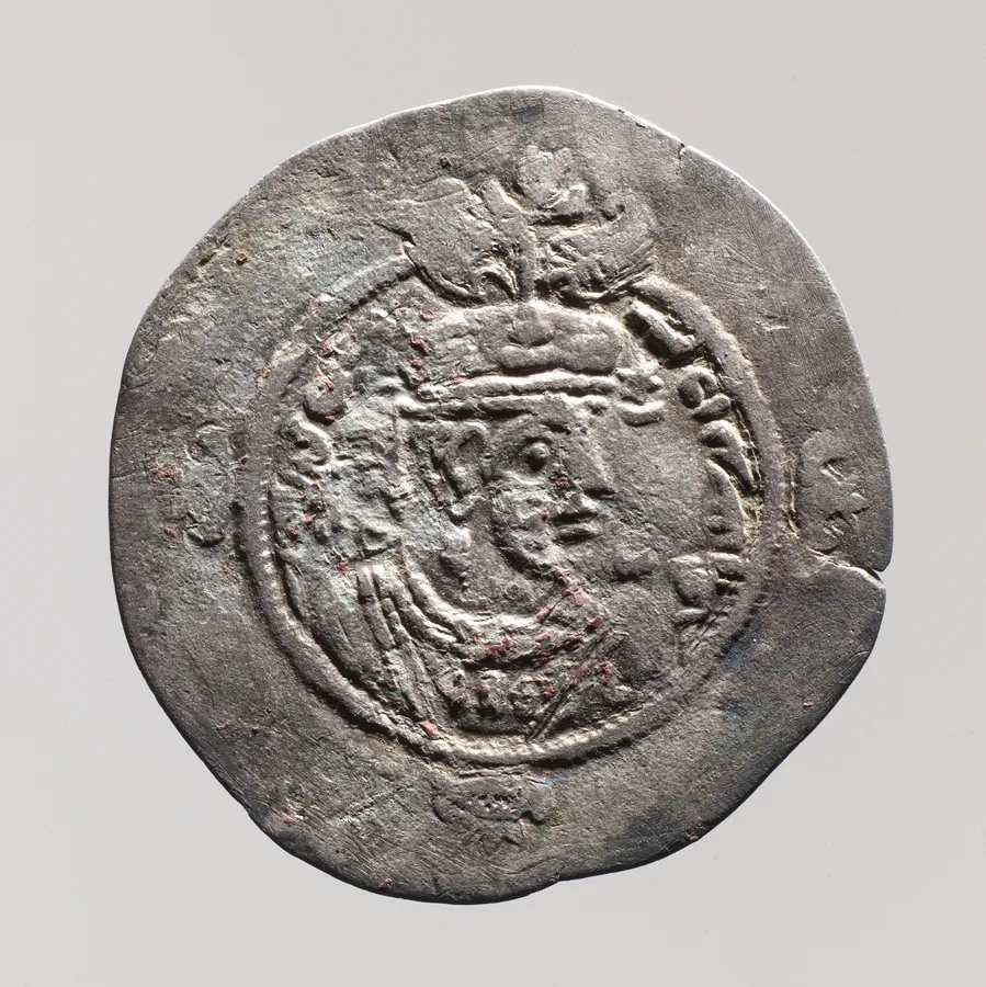
Silver drachm of the Sasanian empire, about 629 CE. The Metropolitan Museum of Art, New York, 36.30.306, Rogers Fund, 1936, Open Access, public domain (CC0). メイン画像 掲載先: サーサーン朝ペルシア
-
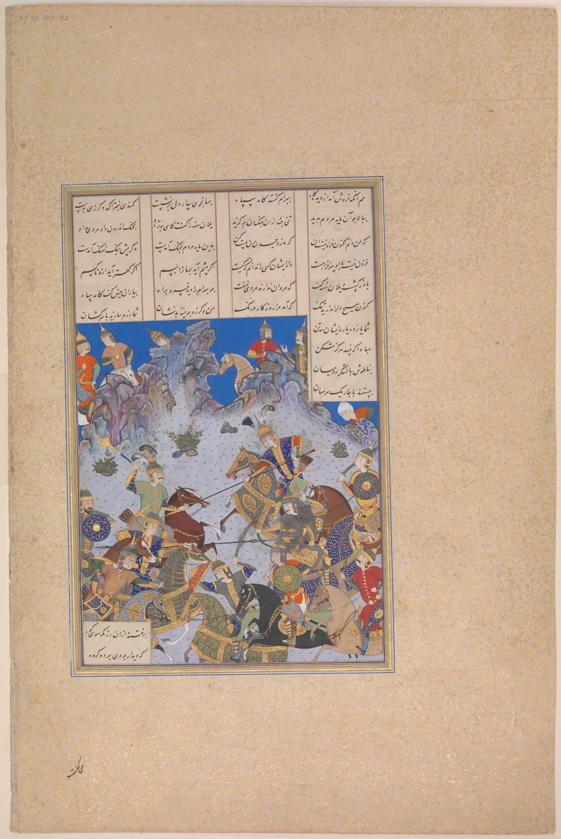
Folio 707v of the Shahnama made for Shah Tahmasp, showing Khusrau Parviz's charge against Bahram Chubina. Painted in Iran, about 1530–35. The Metropolitan Museum of Art, New York, 1970.301.72, Gift of Arthur A. Houghton Jr., 1970, Open Access, public domain (CC0). メイン画像 掲載先: Shahnameh
-
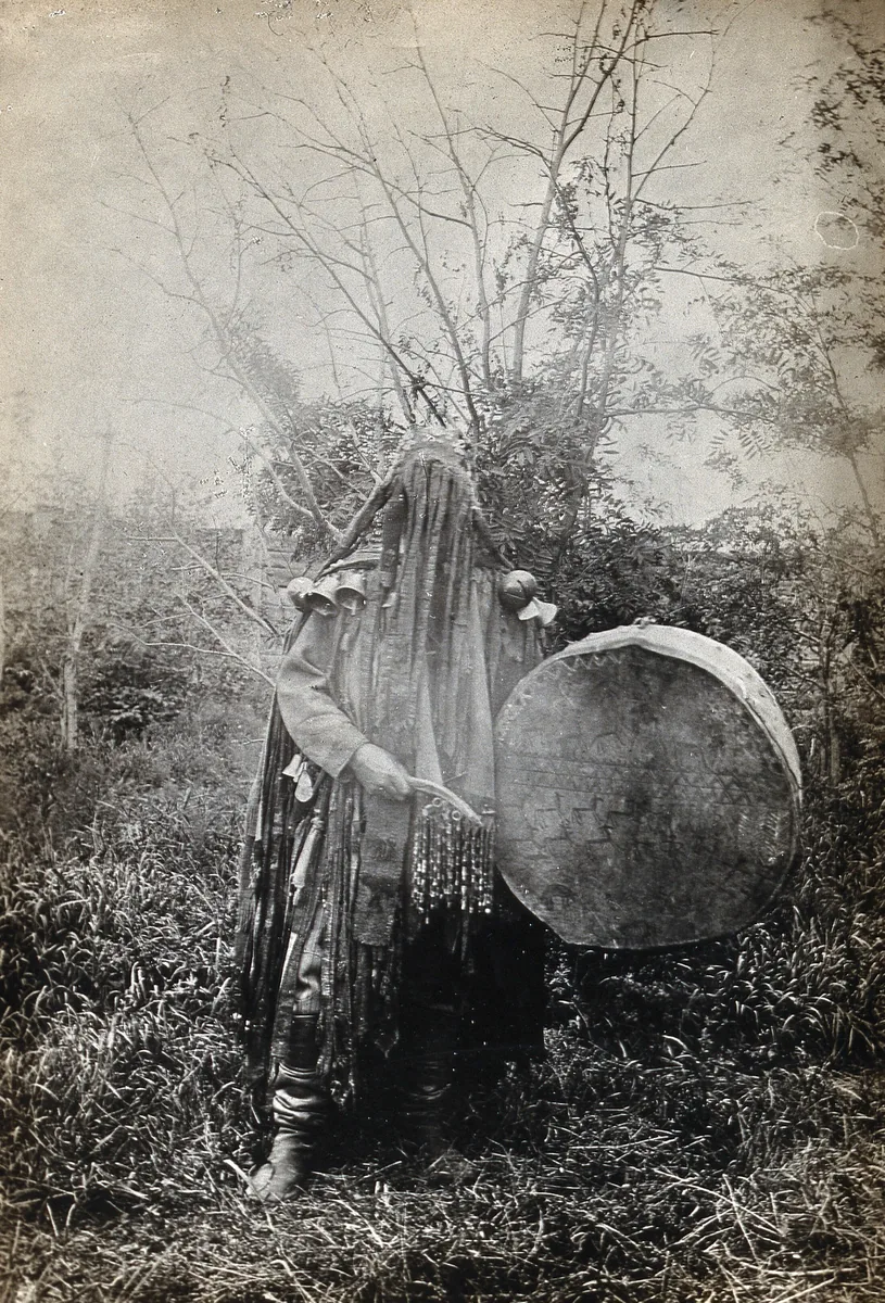
A shaman of the Minusinsk Tatars, the Khakas of the upper Yenisei, in ceremonial dress with his face covered, holding a drum. The printed caption says that his face is covered when he shamanises. Photographer unknown, 1900 to 1915; Wellcome Collection, from the papers of M. A. Czaplicka. Public domain mark. メイン画像 掲載先: シャーマニズム
-
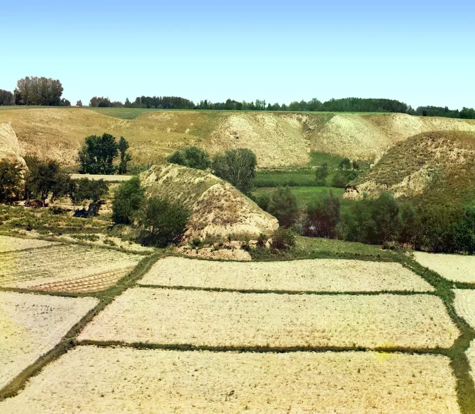
Fields near Samarkand, photographed by Sergei Prokudin-Gorskii between 1905 and 1915. Photograph: Sergei Prokudin-Gorskii; Library of Congress, Prints and Photographs Division. No known restrictions on publication. メイン画像 掲載先: ソグディアナ
-
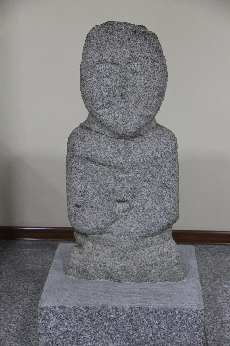
A Turkic stone statue in the Ancient States Gallery of the National Museum of Mongolia, Ulaanbaatar. Photograph: Gary Todd, 2017, CC0. メイン画像 掲載先: 石人像
-
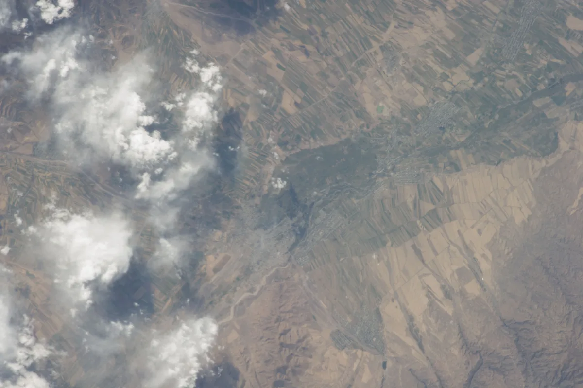
Farmland of the Chu valley around the town of Tokmak in Kyrgyzstan, photographed from the International Space Station in September 2013. Suyab stood on the Chu; its site, known today as Ak-Beshim, lies near Tokmak. Image: NASA. Public domain. メイン画像 掲載先: スイアブ
-
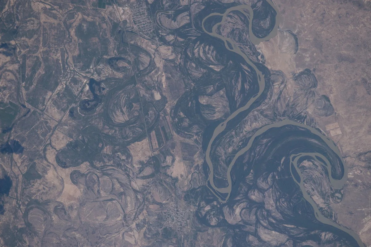
Meanders of the Syr Darya in southern Kazakhstan, astronaut photograph, 2016. Astronaut photograph ISS048-E-12868. NASA, public domain. メイン画像 掲載先: シルダリヤ川
-
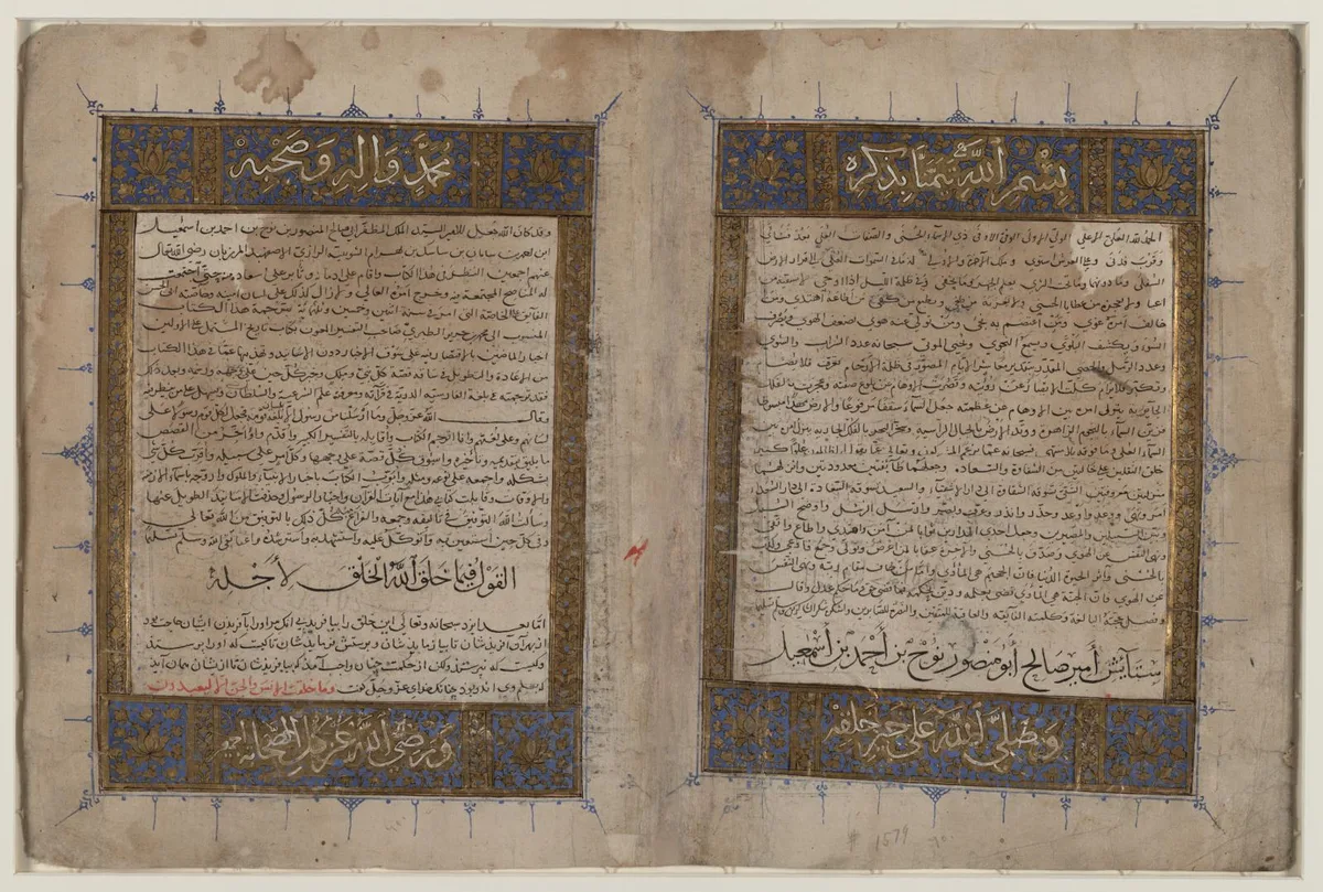
Opening pages of the Persian version of al-Tabari's History by Bal'ami, a manuscript of the Il-Khanid period. Library of Congress, African and Middle East Division, Persian Manuscript Collection, 1-85-154.69, item record, public domain (no known restrictions). メイン画像 掲載先: Tabari
-
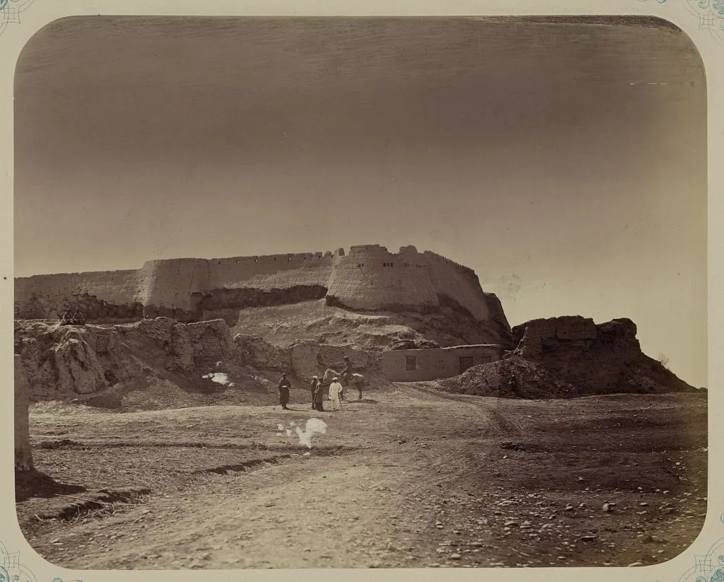
The ruins of the citadel of Aulie-Ata, the modern Taraz, from the Turkestan album of 1865–1872. Photograph: Turkestan album; Library of Congress, Prints and Photographs Division. No known restrictions on publication. メイン画像 掲載先: タラス
-
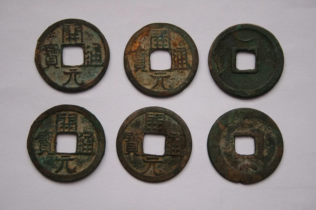
Copper cash coins of the Tang with the legend Kaiyuan tongbao. Photograph: Gary Lee Todd, 2007, CC0. メイン画像 掲載先: 唐
-
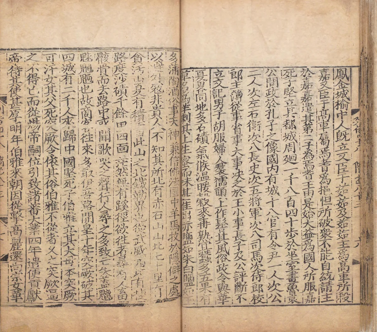
A page of the notice on Gaochang in chapter 83 of the Sui Shu, in a Yuan-period printed edition repaired in 1531, in the National Archives of Japan. On the left-hand page the text names the Red Rock Mountain north of Gaochang and, seventy li beyond it, Tanhan Mountain, printed here with the character that later editors corrected. Image: National Archives of Japan. Public domain. メイン画像 掲載先: 貪汗山
-
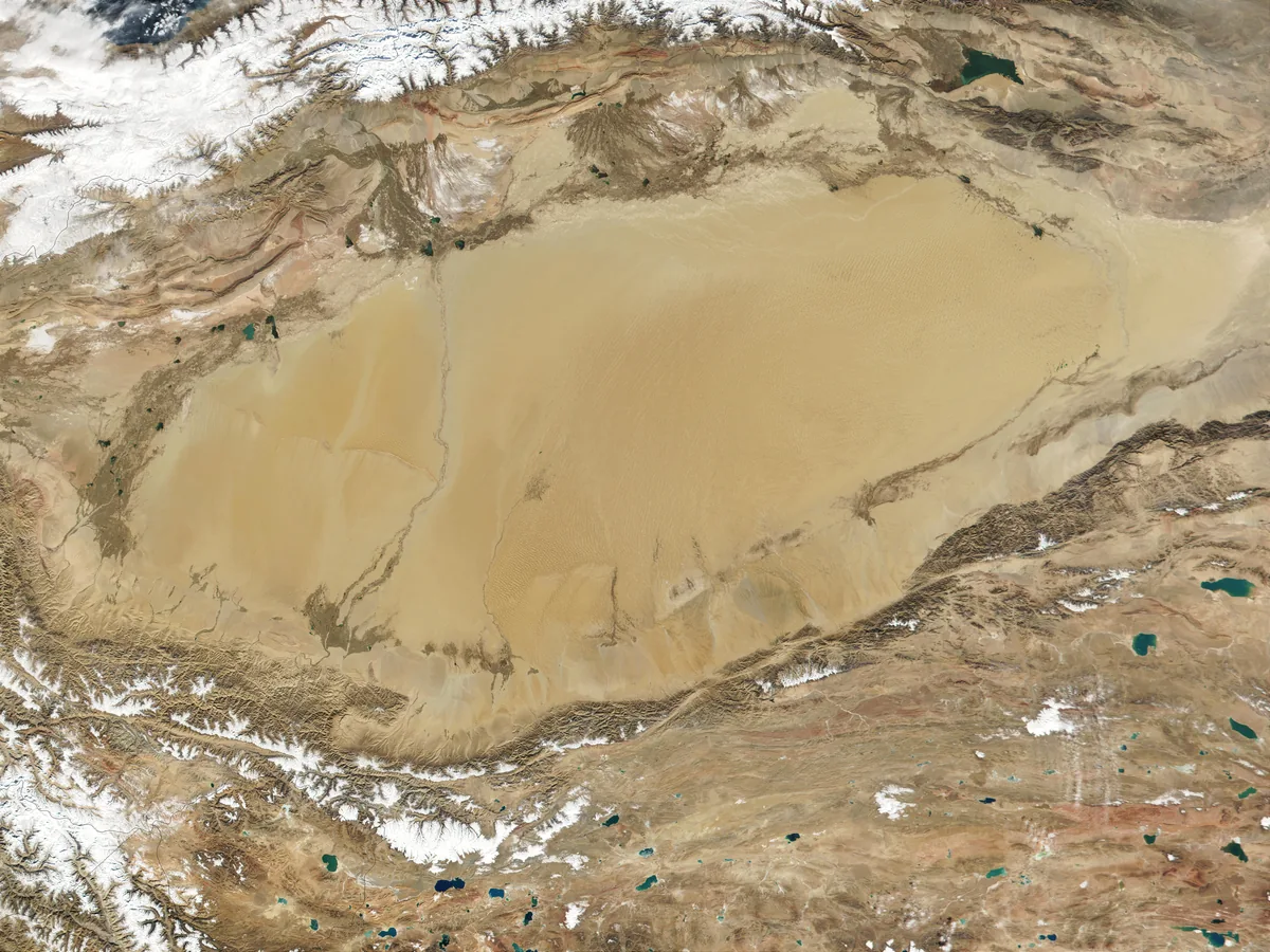
The Taklamakan desert in the Tarim Basin, between the Tian Shan in the north and the Kunlun in the south, in a MODIS satellite image of 2001. Image: Jacques Descloitres, MODIS Land Rapid Response Team. NASA Earth Observatory, public domain. メイン画像 掲載先: タリム盆地
-
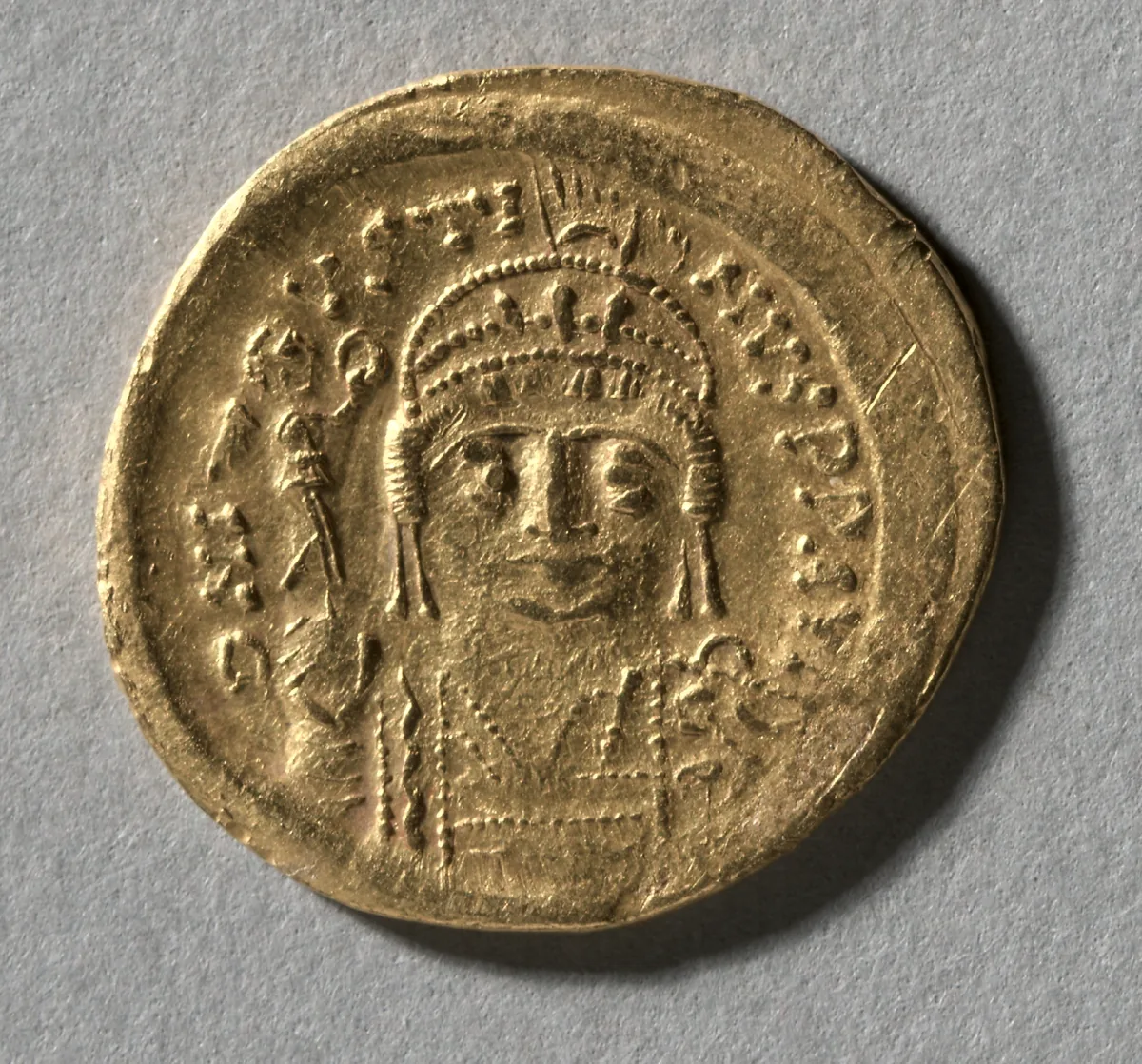
Gold solidus of Justin II, emperor in Constantinople from 565 to 578, in whose fourth year the envoys of Istemi swore the alliance. The Cleveland Museum of Art, 2004.151.a, CC0. メイン画像 掲載先: ギョクテュルク・ビザンツ同盟
-
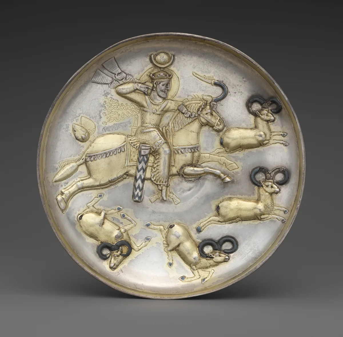
Silver plate with a Sasanian king hunting rams, gilded and inlaid with niello. Iran, middle of the fifth to middle of the sixth century. The Metropolitan Museum of Art, New York, 34.33, CC0. メイン画像 掲載先: ギョクテュルク・ササン朝交易紛争
-
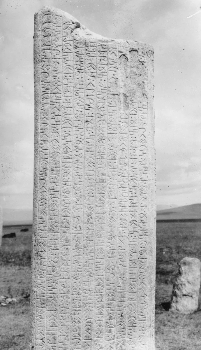
Runiform lines on the south face of the first Tonyukuk stone in the Nalaikh valley, photographed in June 1909. G. J. Ramstedt and Sakari Pälsi, 1909, Finnish Heritage Agency, record, CC BY 4.0. メイン画像 掲載先: 古代テュルク文字
-
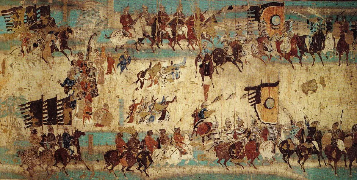
The army of Zhang Yichao on the march, with its banners, its cavalry and dancers between the columns, from the wall painting in Cave 156 at Mogao near Dunhuang. The painting commemorates the rising of 848, in which Zhang Yichao drove the Tibetan garrison out of Dunhuang. Wall painting: unknown painter, late Tang period; Mogao Cave 156, Dunhuang. Public domain. メイン画像 掲載先: 吐蕃
-
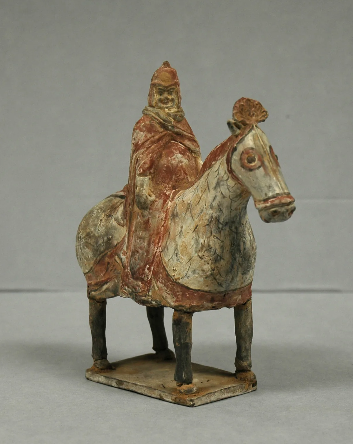
Painted earthenware tomb figure of an armoured horseman, Northern Wei dynasty, sixth century. The Western Wei, one of the two states into which the Northern Wei split in 534, were the Göktürks’ allies against the Rouran. The Metropolitan Museum of Art, New York, 20.39.3, Rogers Fund, 1920. Open Access, public domain (CC0). メイン画像 掲載先: ギョクテュルク独立戦争
-
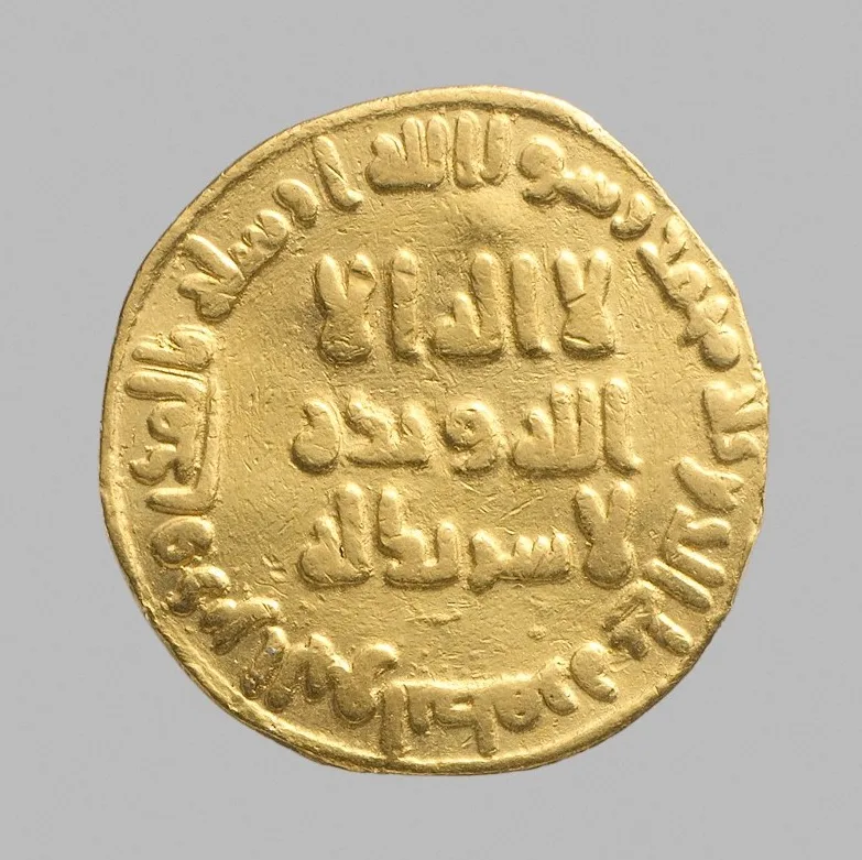
Gold dinar dated 79 AH (698–99 CE), with an Arabic inscription. The Metropolitan Museum of Art, New York, 99.35.2386, Bequest of Joseph H. Durkee, 1898, Open Access, public domain (CC0). メイン画像 掲載先: The Umayyad Caliphate
-
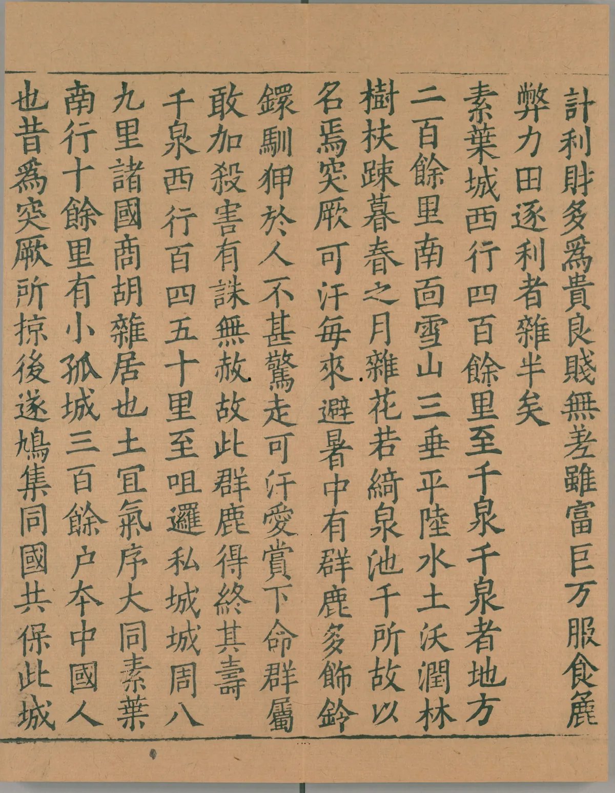
A page from the first book of the Record of the Western Regions, the account of the pilgrim Xuanzang, in a Southern Song print of the Buddhist canon. It describes the Thousand Springs, 千泉, four hundred li west of Suyab, where the Göktürk khan came every year to escape the summer heat. Image: Sixi canon print, Southern Song; scan National Diet Library, Japan. Public domain. メイン画像 掲載先: 千泉
-
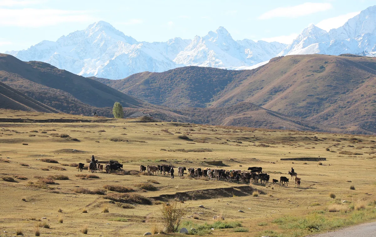
Herds below the snow peaks of the Tian Shan in Kyrgyzstan, 2023. Photograph: Bgag, 2023, CC0. メイン画像 掲載先: 天山
-
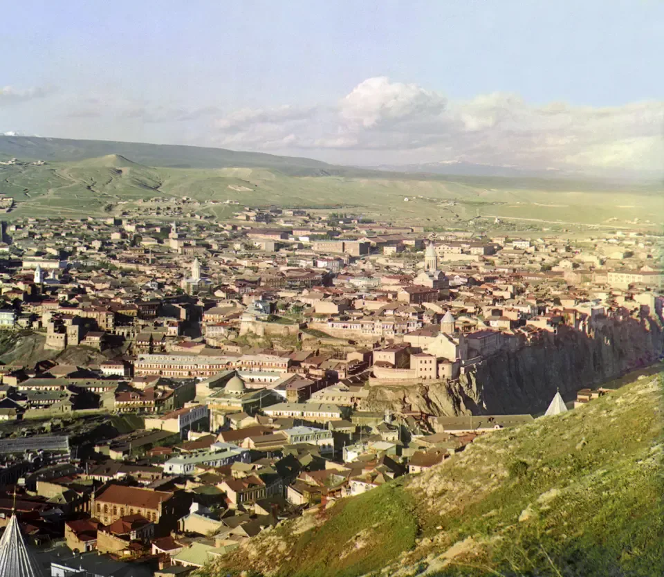
A view over Tiflis, the modern Tbilisi, photographed by Sergei Prokudin-Gorskii between 1905 and 1915. Photograph: Sergei Prokudin-Gorskii; Library of Congress, Prints and Photographs Division. No known restrictions on publication. メイン画像 掲載先: ティフリス
-
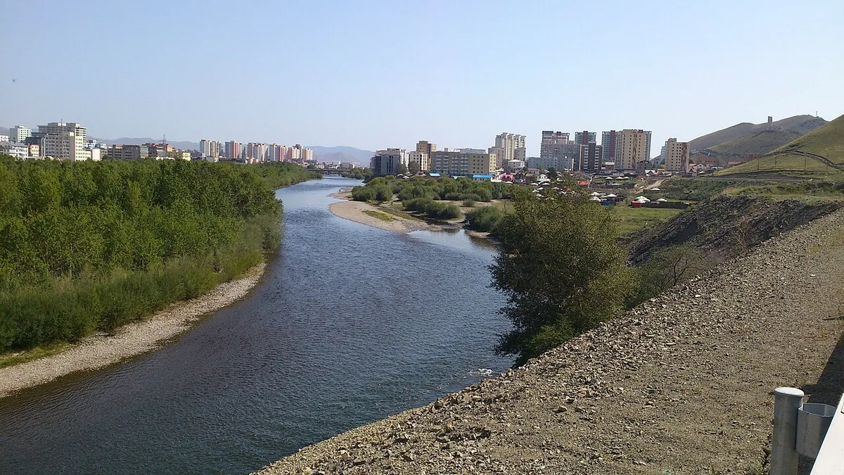
The Tuul river at Ulaanbaatar. Photograph: Römert, 2015, CC BY-SA 4.0. メイン画像 掲載先: トーラ川
-
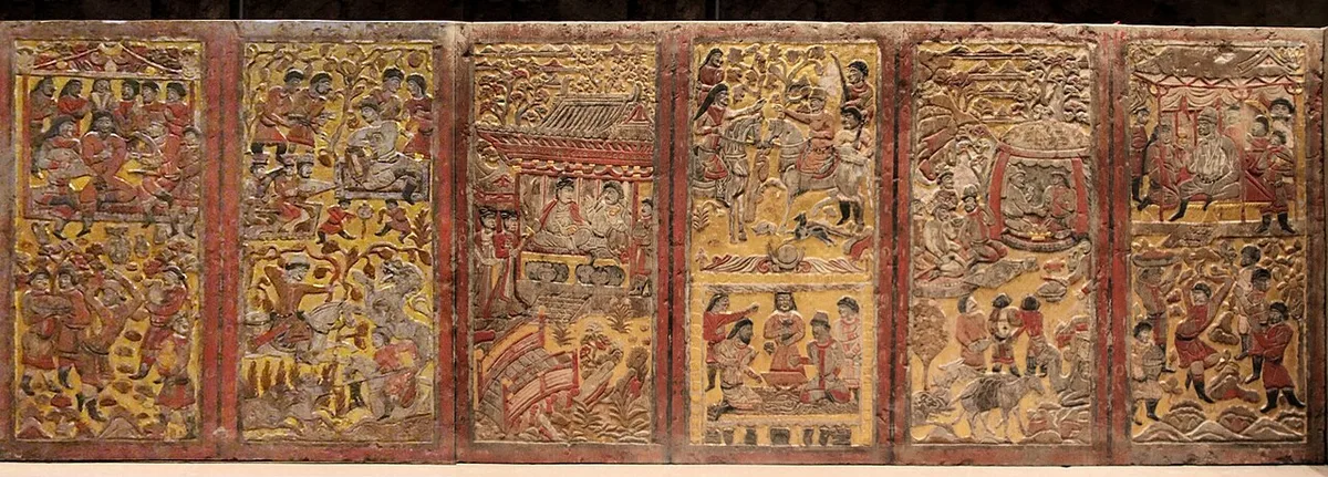
The painted and gilded back panels of the stone funerary couch from the tomb of An Jia at Xi'an, buried in 579. Photograph: Momo and Gary Todd, 2022, file page, CC0. メイン画像 掲載先: 安伽墓
-
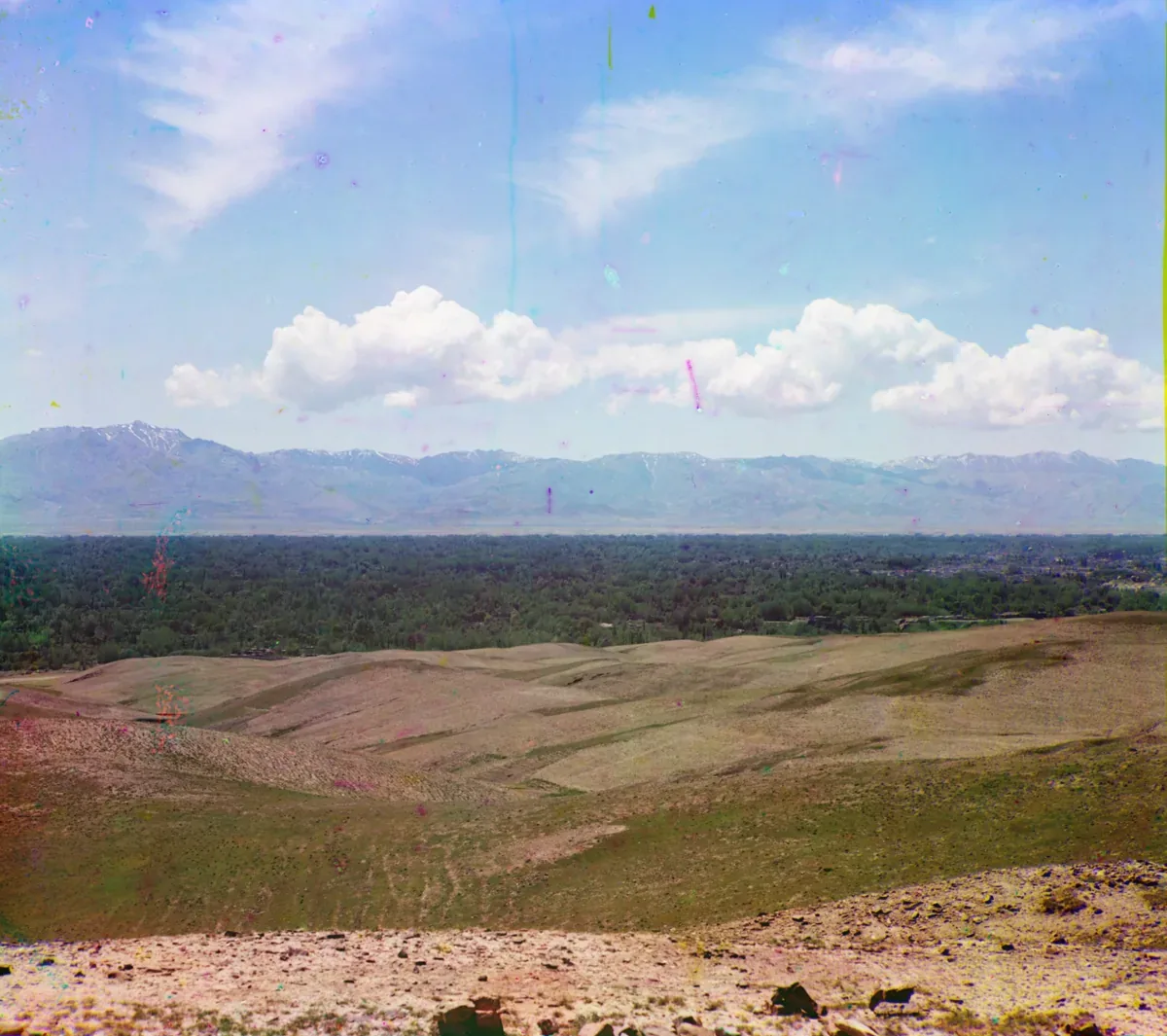
The Zarafshan range seen from the north across the valley of the Zarafshan near Samarkand, in a colour photograph taken between 1905 and 1915. Photograph: Sergei Prokudin-Gorskii, between 1905 and 1915; Library of Congress, no known restrictions. メイン画像 掲載先: トランスオクシアナ
-
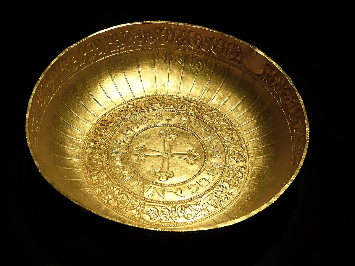
Gold bowl from the Treasure of Nagyszentmiklós, seventh to ninth century, in the Kunsthistorisches Museum, Vienna. Photograph: Wolfgang Sauber, 2015, CC BY-SA 4.0. メイン画像 掲載先: Treasure of Nagyszentmiklós
-
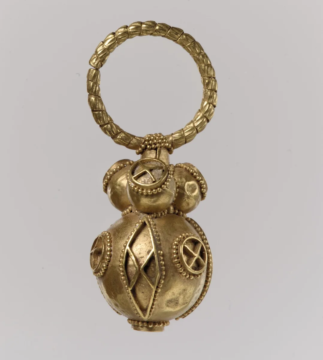
One of a pair of gold earrings, Avar work, 550 to 650. The Metropolitan Museum of Art, New York, 17.191.4, CC0. メイン画像 掲載先: ヨーロッパのテュルク系諸部族
-
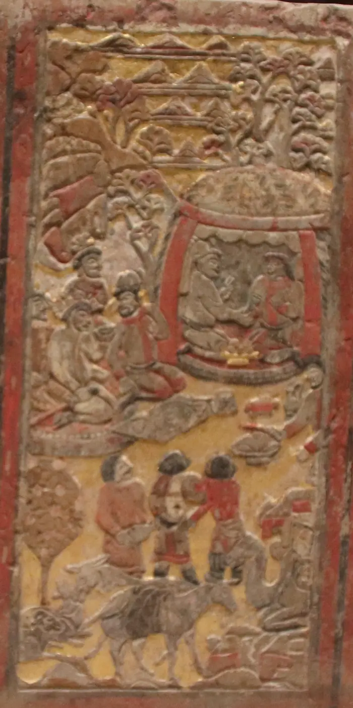
Back panel of the funerary couch of An Jia, a Sogdian sabao at the Zhou court who died in 579. Two men kneel facing each other inside a yurt, a gilded vessel between them; others drink before the tent, and a laden camel and a donkey rest below. The scene is taken to show An Jia at talks with a Göktürk chief. Shaanxi History Museum, Xi’an. Photograph: Gary Todd, 2019, CC0 (detail). メイン画像 掲載先: Turkic-Sogdian Synthesis
-
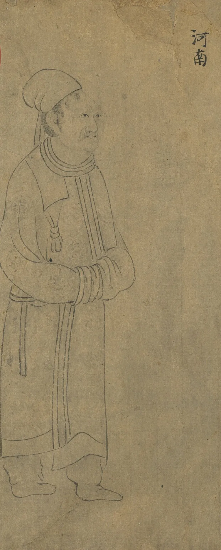
Envoy of the Tuyuhun, labelled 河南, the name under which the southern histories treat their kingdom. From “Foreign Visitors Coming to Court”, a copy after a painting ascribed to Emperor Yuan of Liang (r. 552–555); an inscription of the Song emperor Lizong names Gu Deqian of the Southern Tang as the copyist. Handscroll, ink on paper; National Palace Museum, Taipei, 故畫001389N. Copy of Emperor Yuan of Liang’s “Foreign Visitors Coming to Court”, The National Palace Museum, Taipei, CC BY 4.0 @ www.npm.gov.tw. メイン画像 掲載先: Tuyuhun
-
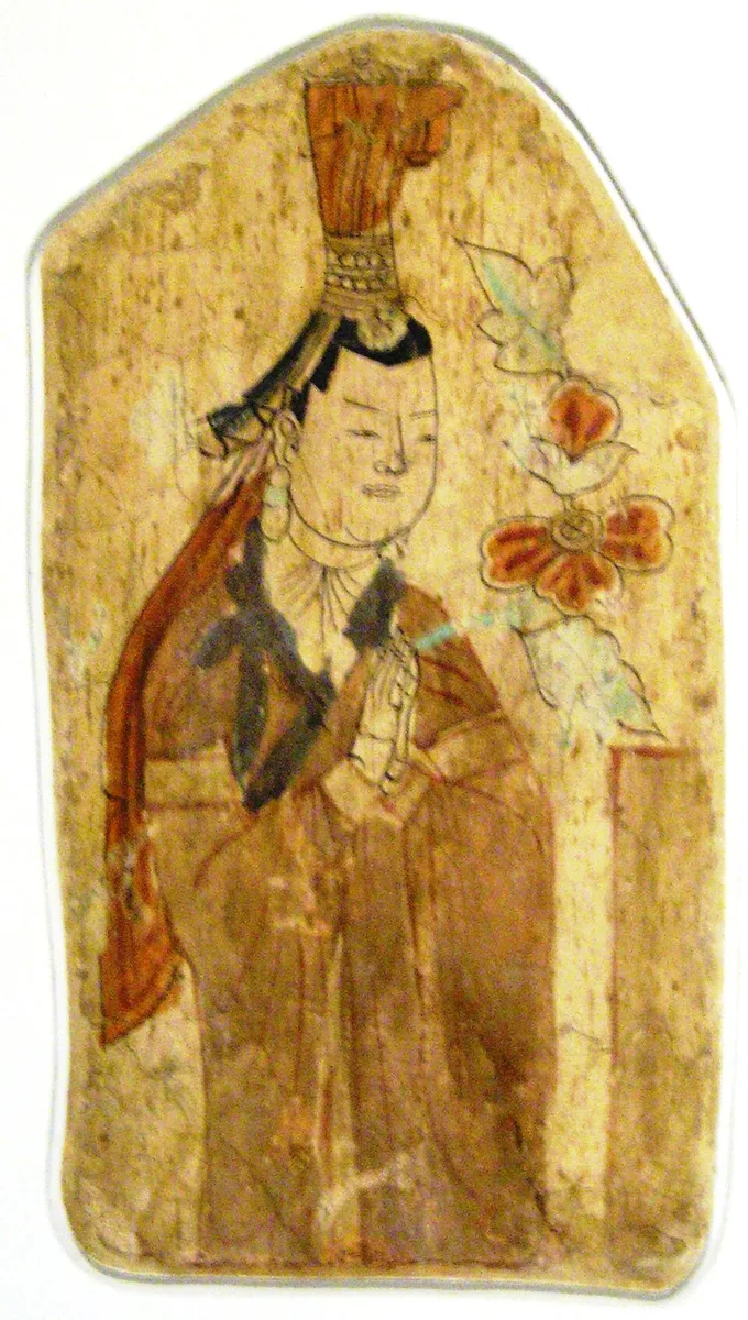
Uyghur donor, wall painting from Cave 17 at Bezeklik, about the tenth to eleventh century, photographed in Berlin in 2006. Photograph: Gryffindor, 2006, public domain. メイン画像 掲載先: 高昌ウイグル王国
-
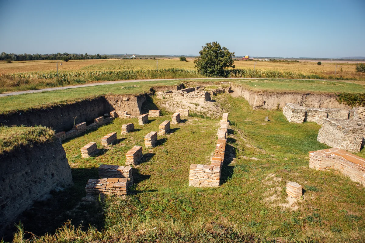
Excavated Roman walls and brick pillars at the archaeological site of Viminacium near Kostolac in eastern Serbia, photographed in 2020. In 441 Viminacium was the first great city that the Huns took in their Balkan wars, and they razed it to the ground. Image: Ivan Radic, CC BY 2.0. メイン画像 掲載先: ウィミナキウム
-
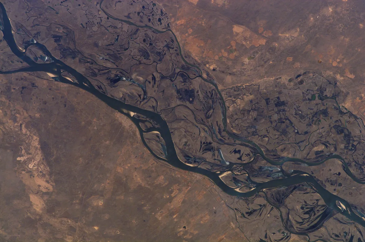
The lower Volga and its wide floodplain between Volgograd and Astrakhan, photographed from the International Space Station on 13 March 2007. Menander calls the river the Attila; the Roman envoy Zemarchos came to it in 571 on his way home from Istemi. Image: NASA. Public domain. メイン画像 掲載先: ヴォルガ川
-
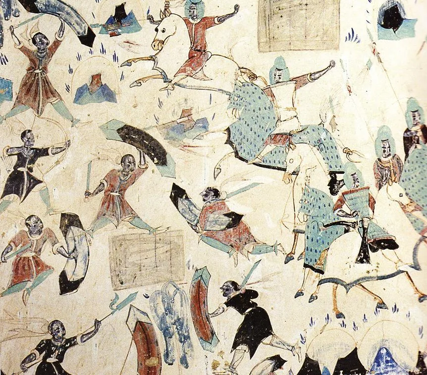
Horsemen in armour on armoured horses ride down robbers on foot in the story of the Five Hundred Robbers, a wall painting in Cave 285 at Mogao near Dunhuang. The cave was painted under the Western Wei and carries dedications of 538 and 539. Wall painting: unknown painter, Western Wei period (535–557); Mogao Cave 285, Dunhuang. Public domain. メイン画像 掲載先: 西魏
-
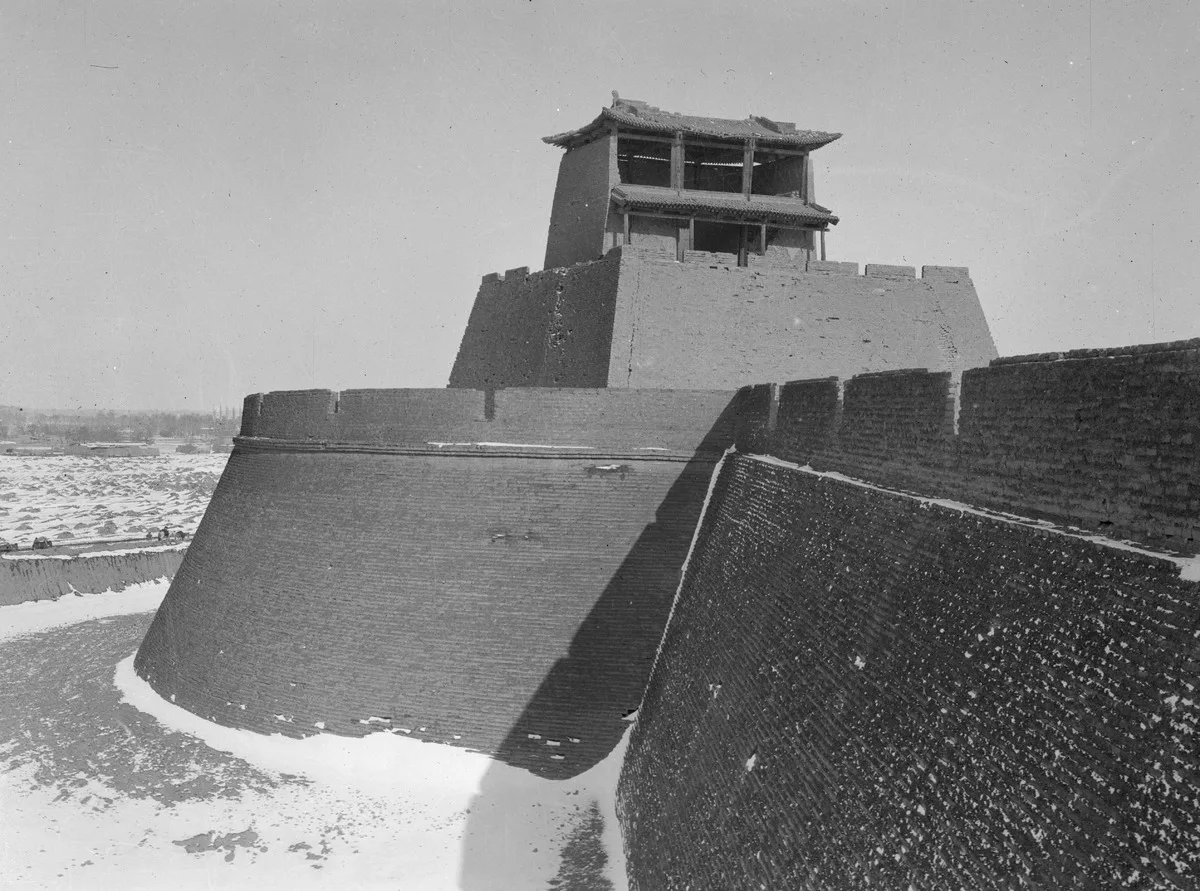
Tower on a bastion of the city wall of Liangzhou, today Wuwei, photographed in 1906. Carl Gustaf Mannerheim, 1906, Finnish Heritage Agency, record, CC BY 4.0. メイン画像 掲載先: 武威
-
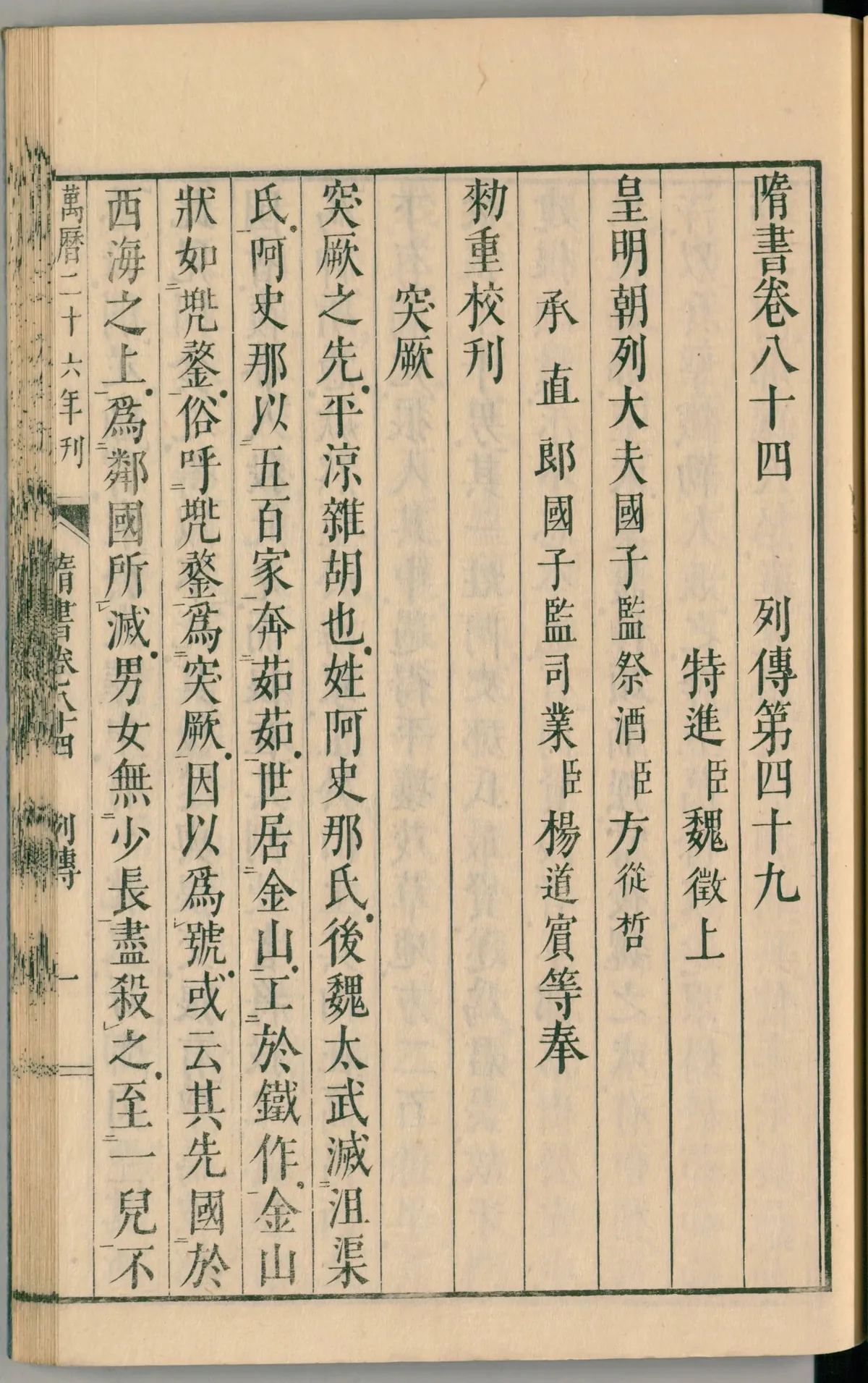
The opening page of book 84 of the Sui Shu, the chapter on the Göktürks, in a Japanese print of 1844. Its first lines give the second account of Göktürk origins, which sets their forebears in a state upon the Western Sea, 西海. Image: Kōdōkan, Takamatsu (print, 1844); scan National Diet Library, Japan. Public domain. メイン画像 掲載先: 西海
-
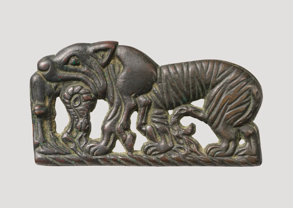
Bronze belt plaque with a tiger devouring a ram, Xiongnu, about second century BC. The Metropolitan Museum of Art, New York, 49.132, Rogers Fund, 1949. Open Access, public domain (CC0). メイン画像 掲載先: 匈奴
-
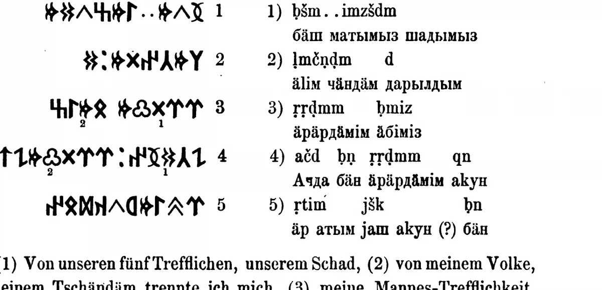
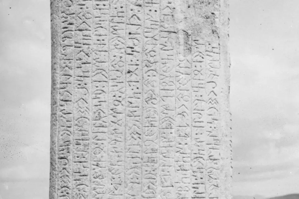
The inscription of Ujuk-Archan on the upper Yenisei, five lines of runiform script with transcription, as Wilhelm Radloff printed it from the squeezes of the Finnish expedition. W. Radloff, Die alttürkischen Inschriften der Mongolei, St Petersburg 1895, p. 305. Public domain. メイン画像 掲載先: Yenisei inscriptions
-
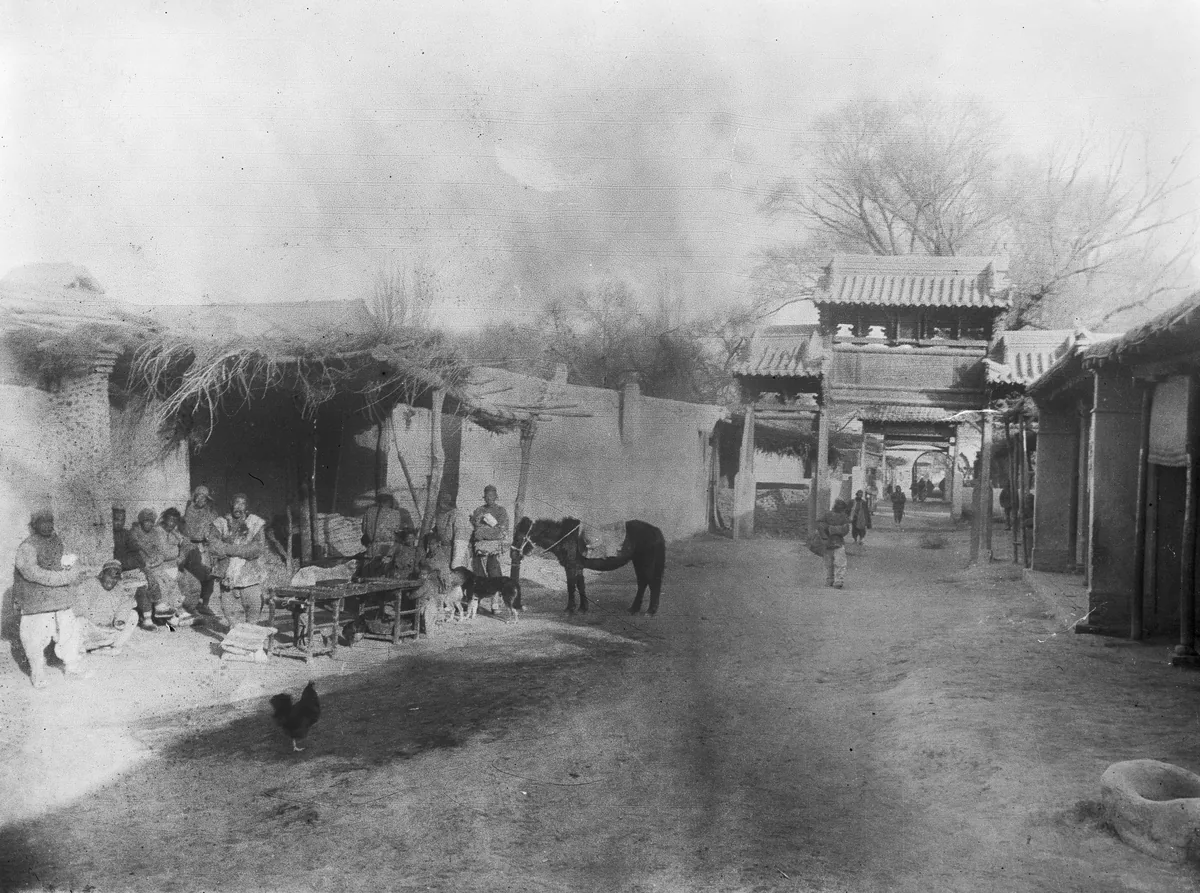
A street with a gateway in Hami, the oasis town identified with Yiwu, photographed by C. G. Mannerheim on his journey through Central Asia and China between 1906 and 1908. Image: C. G. Mannerheim, Finnish Heritage Agency, CC BY 4.0. メイン画像 掲載先: 伊吾
-
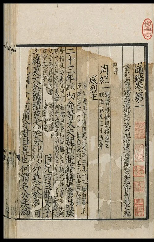
Opening of chapter 1 of the Zizhi tongjian in a printed edition of the Song period. Sima Guang, Zizhi tongjian, Song-period edition, reproduction, public domain. メイン画像 掲載先: Zizhi tongjian (Comprehensive Mirror in Aid of Governance)
-
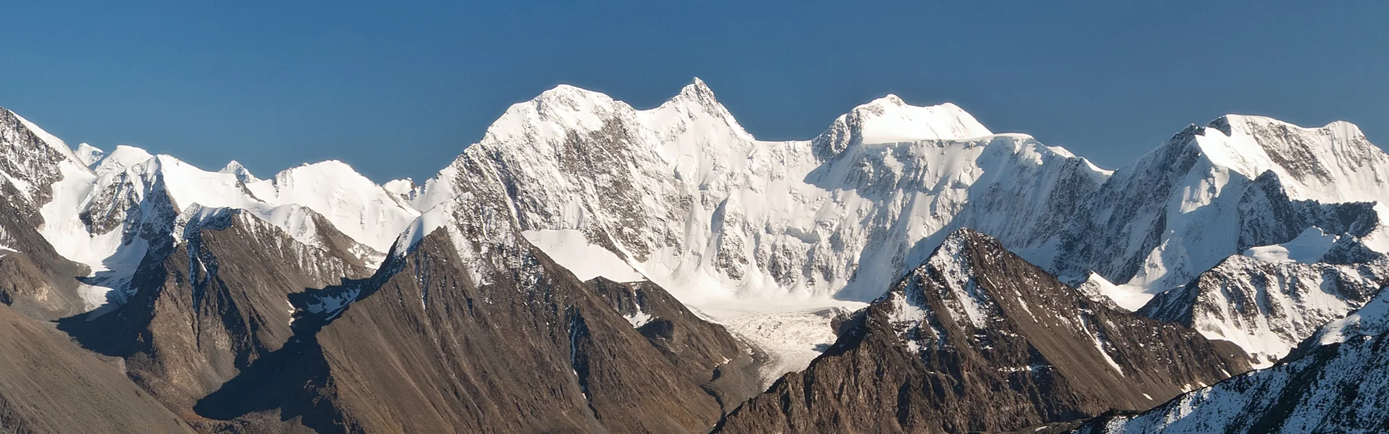
The Katun range from the Kara-Tyurek pass, with Belukha at its centre and the Akkem valley below. Photograph: Александр Лещёнок, CC BY-SA 4.0. パノラマ 掲載先: アルタイ
-
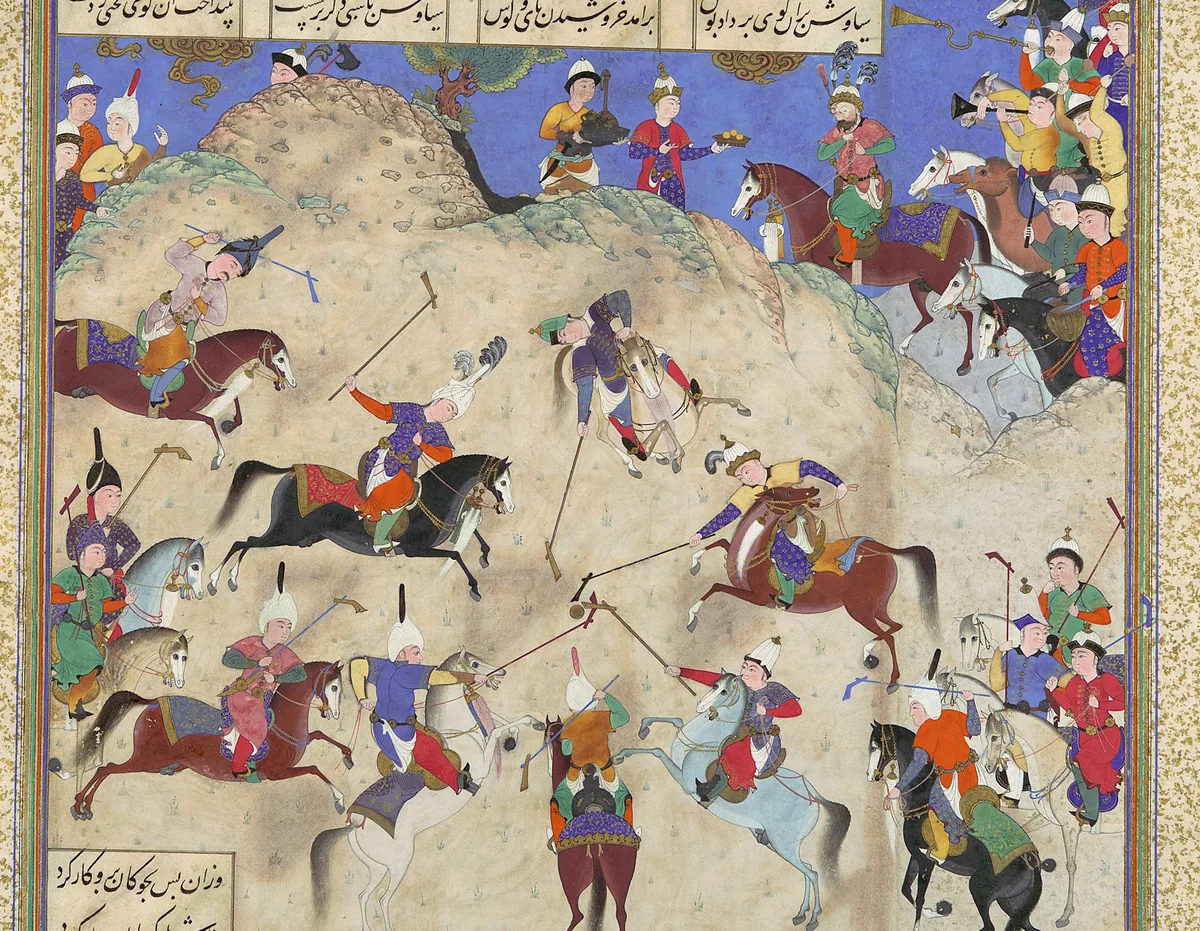
Siyavash plays polo before Afrasiab. A page of the Shahnameh made for Shah Tahmasp at Tabriz, about 1525–30, painting attributed to Qasim ibn ʿAli. The Metropolitan Museum of Art, New York, 1970.301.26, gift of Arthur A. Houghton Jr., 1970; detail. Public domain. 本文中 掲載先: アフラースィヤーブ
-
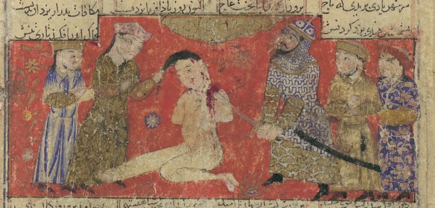
Kay Khosrow puts Afrasiab to death. A page of a Shahnameh, probably from Isfahan, about 1330–40. The Metropolitan Museum of Art, New York, 1974.290.21, bequest of Monroe C. Gutman, 1974; detail. Public domain. 本文中 掲載先: アフラースィヤーブ
-
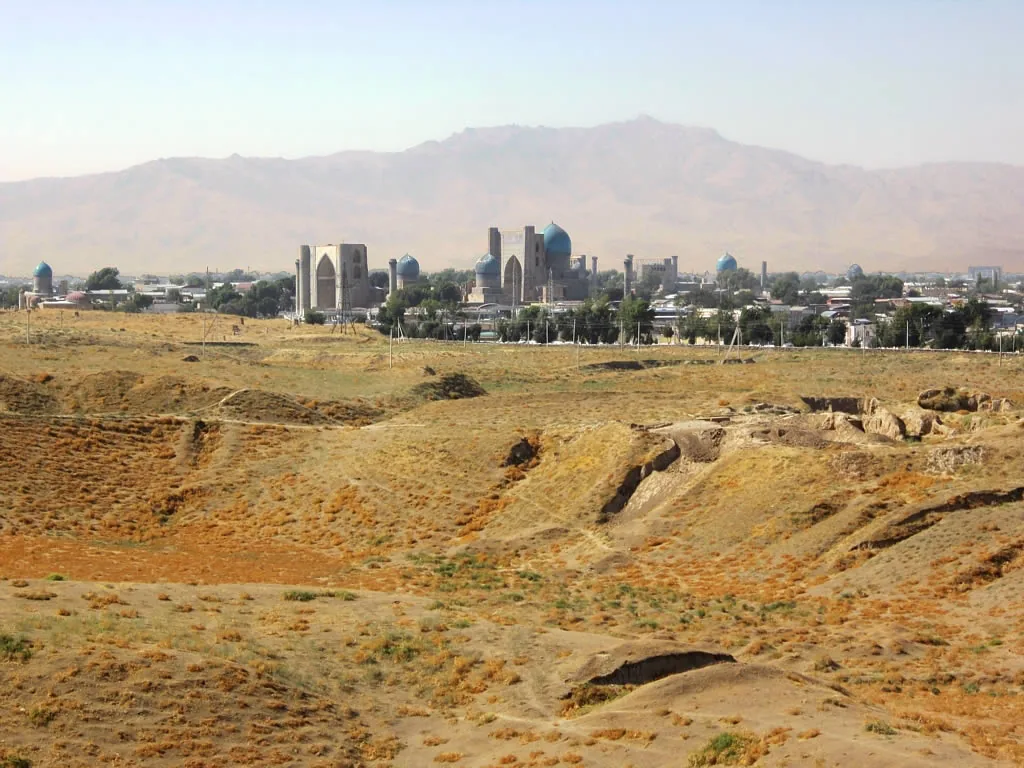
The Afrasiab mound, the site of Samarkand before the Mongol period, with the domes of the later city behind it. Photograph: David Stanley, 2012, CC BY 2.0. 本文中 掲載先: アフラースィヤーブ, Afrasiab paintings
-
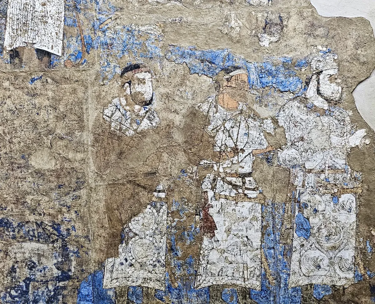
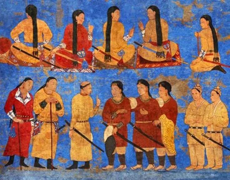
Three figures in white silk caftans with woven roundels, in the lower file on the left half of the west wall. There is more than one view of who they are. Photograph: Richard Mortel, 2023, CC BY 2.0. 本文中 掲載先: Afrasiab paintings
-
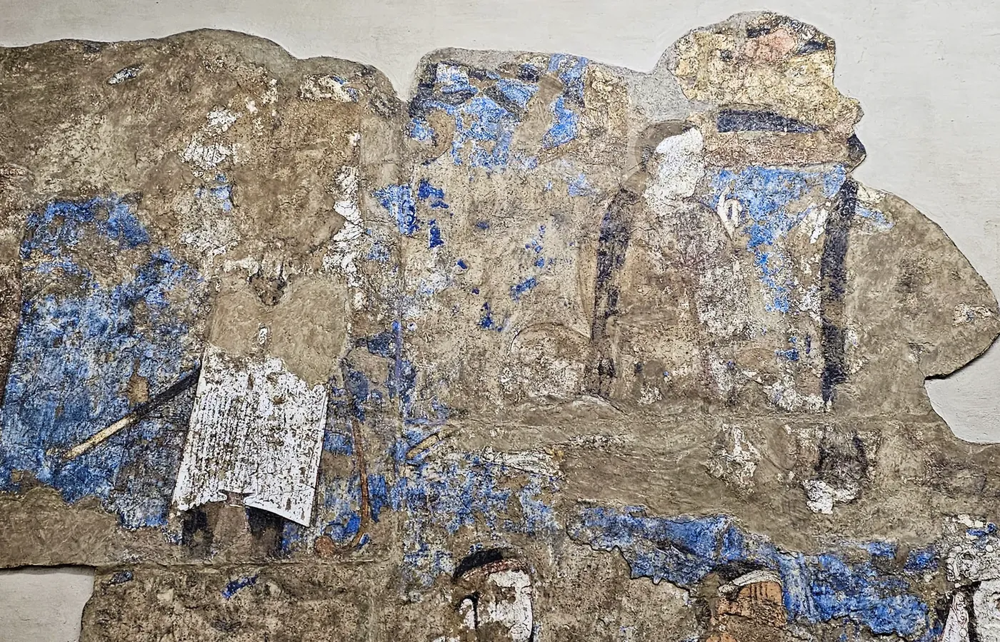
The upper file of the west wall, left half: the white caftan bearing the long Sogdian inscription, and beside it seated figures seen from behind with long plaited hair, the Göktürks of the painting. Photograph: Richard Mortel, 2023, CC BY 2.0. 本文中 掲載先: Afrasiab paintings
-
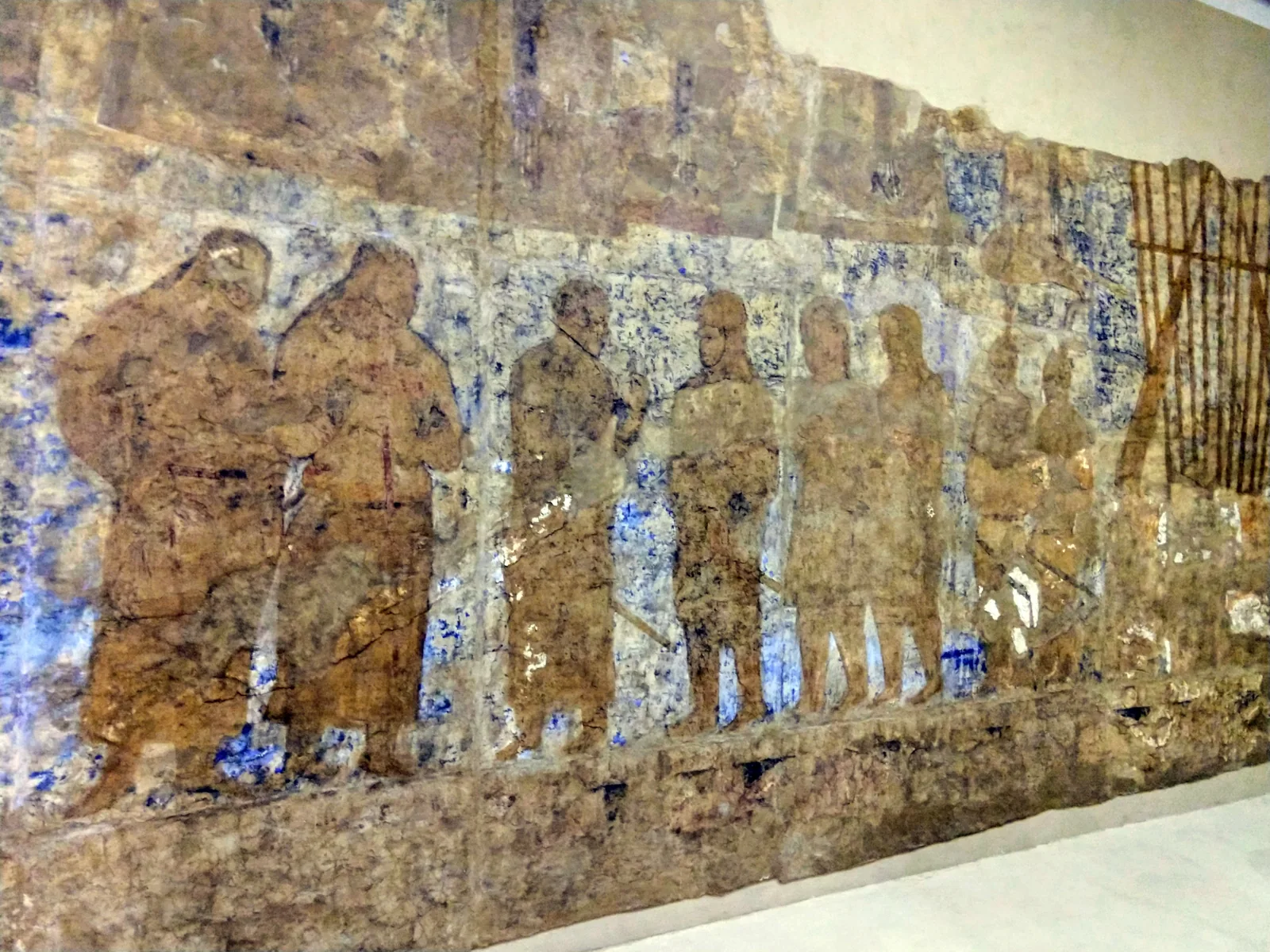
The right half of the west wall. The foreign envoys stand in a row; at the far right, beside a frame of banner poles, stand the two figures in feathered caps. Photograph: amanderson2, 2018, CC BY 2.0. 本文中 掲載先: Afrasiab paintings
-
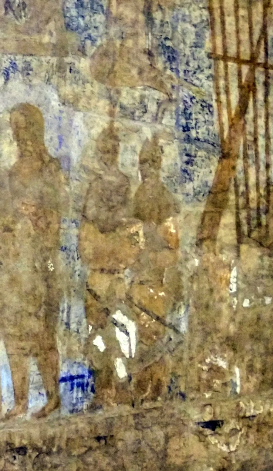
The two figures in feathered caps at the right end of the west wall. Their paint survives almost only as outline. Photograph: amanderson2, 2018, CC BY 2.0; detail. 本文中 掲載先: Afrasiab paintings
-
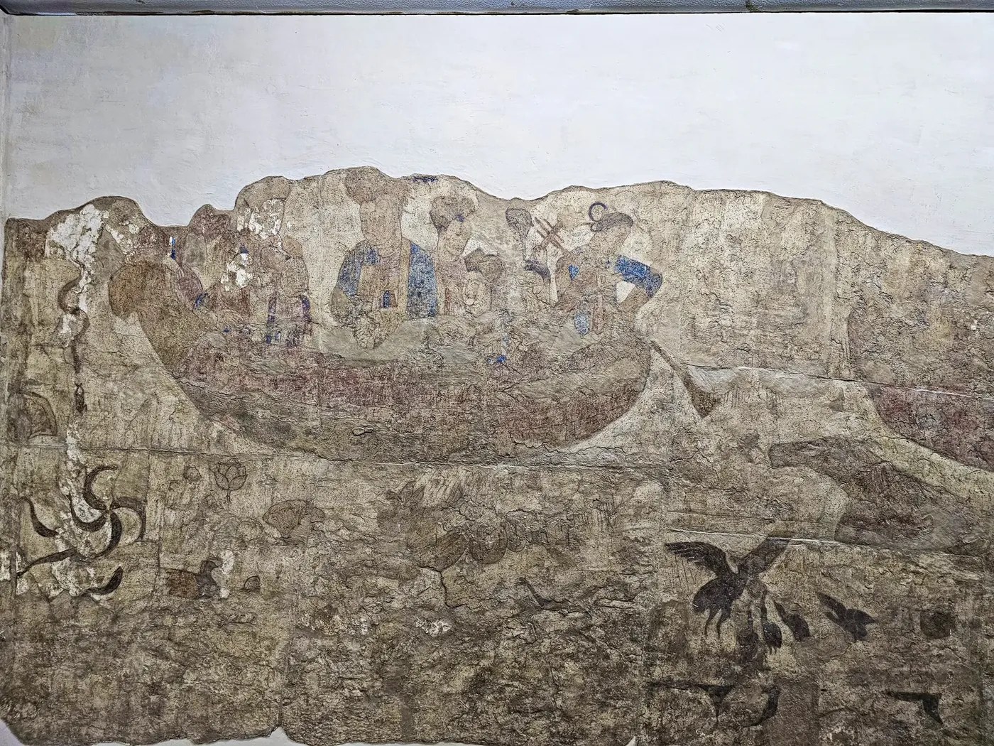
The north wall: a boat with Chinese court ladies on the water, and water creatures beneath it. The tallest figure is taken to be an empress or a princess. Photograph: Richard Mortel, 2023, CC BY 2.0. 本文中 掲載先: Afrasiab paintings
-
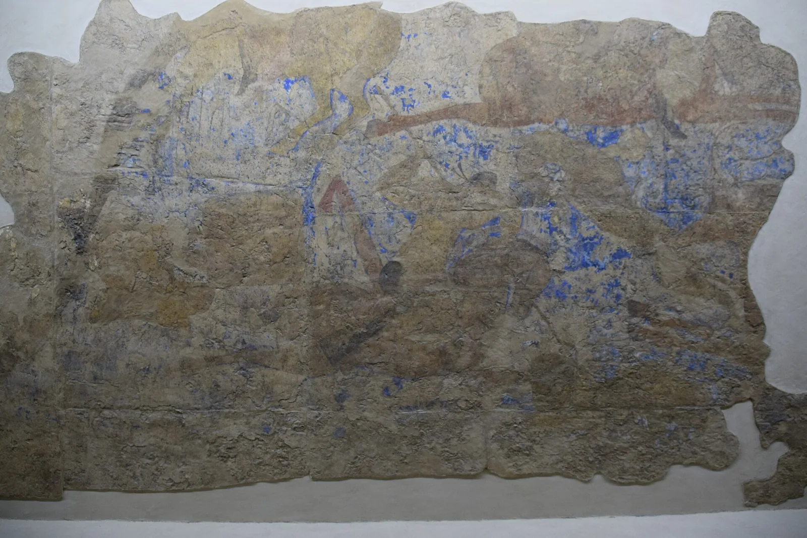
The north wall, right part: riders at a hunt, taken to be the hunt of the Chinese emperor. Little more than the outlines survives. Photograph: Jean Housen, 2023, CC BY-SA 4.0. 本文中 掲載先: Afrasiab paintings
-
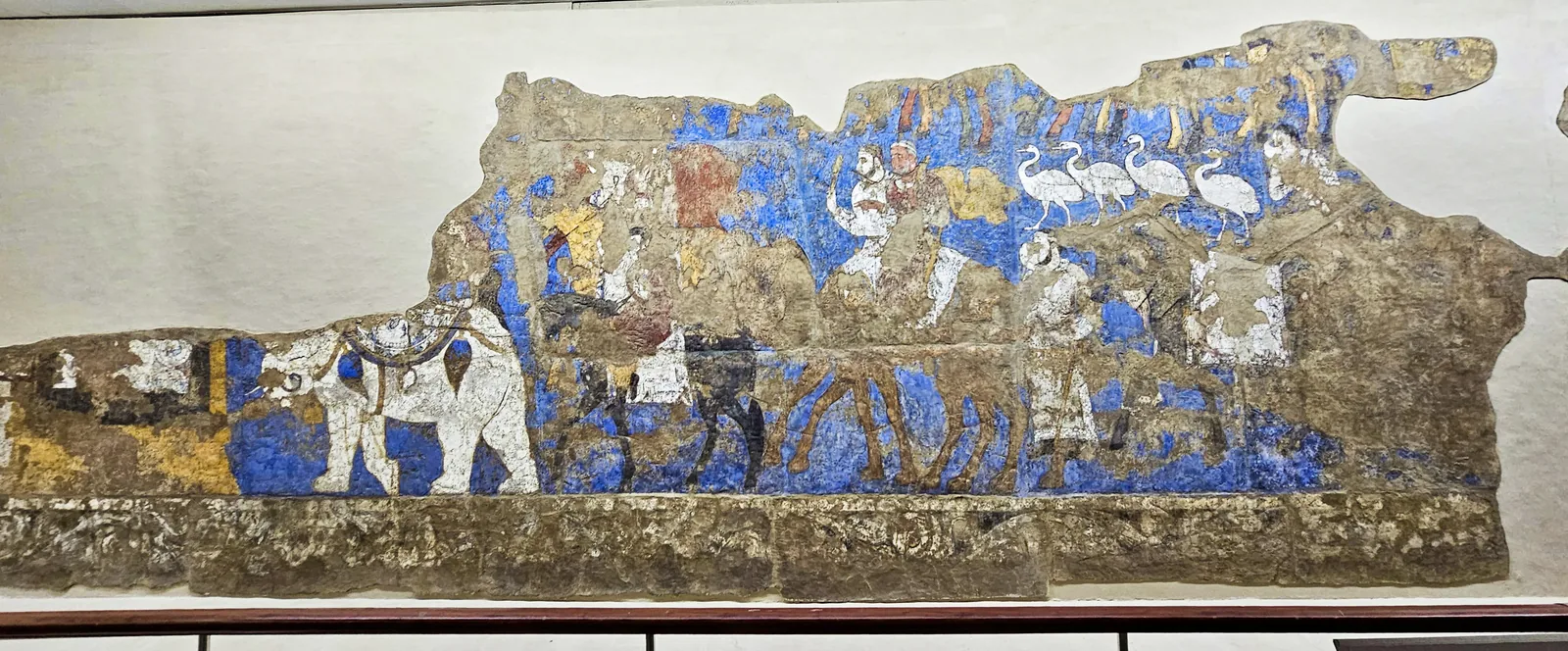
The procession on the south wall, from the white elephant at its head to the riders on camels and the white birds. Photograph: Richard Mortel, 2023, CC BY 2.0. 本文中 掲載先: Afrasiab paintings
-
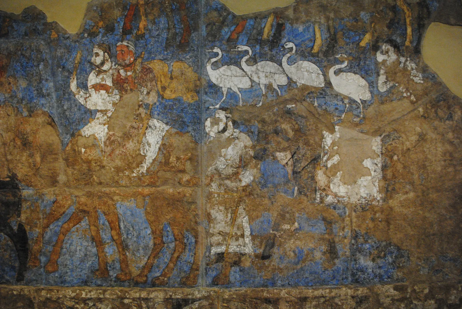
Riders on camels, a line of white birds and a standing man in the procession on the south wall of the Hall of the Ambassadors, seventh century: the painting as it survives, and the same section in an original artistic reconstruction for the atlas, after the photograph. The reconstruction restores the faded colours and fills the losses of plaster. What it paints into the losses, the saddled camel on the right among them, is conjecture. Photograph: Carole Raddato, CC BY-SA 2.0. Reconstruction: original artistic rendering for the atlas after this photograph, 2026, CC BY-SA 2.0. 本文中 掲載先: Afrasiab paintings
-
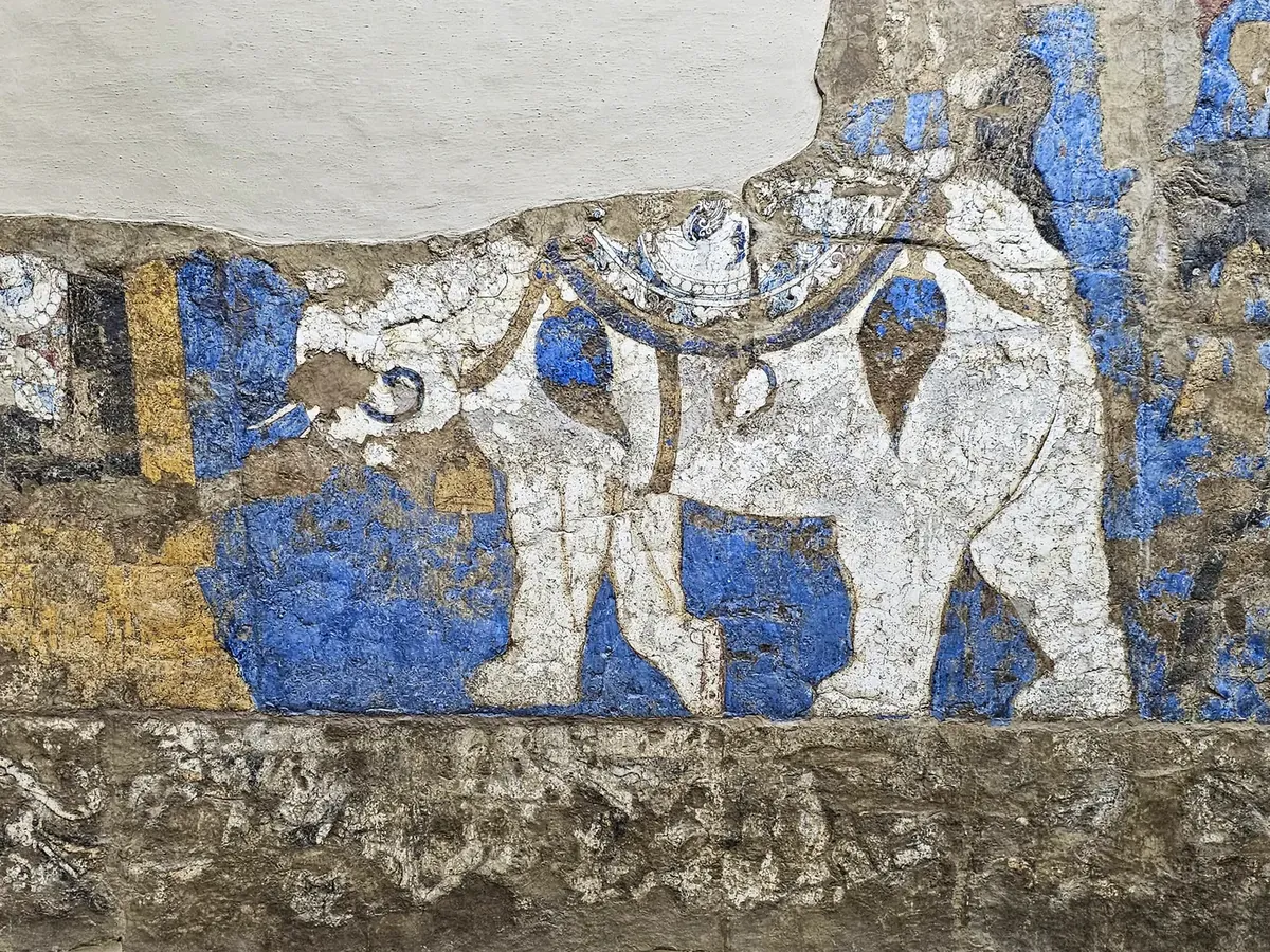
The white elephant at the head of the procession on the south wall. The riders on its back are lost. Photograph: Richard Mortel, 2023, CC BY 2.0. 本文中 掲載先: Afrasiab paintings
-
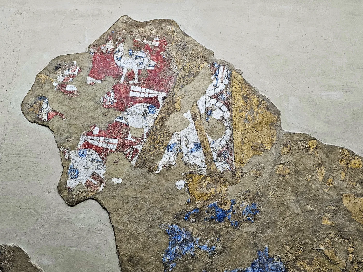
What survives of the outsized rider on the south wall, taken to be Varkhuman: a red silk garment patterned with birds, a golden scabbard and a saddle-cloth bordered with pearl roundels. Photograph: Richard Mortel, 2023, CC BY 2.0. 本文中 掲載先: Afrasiab paintings
-
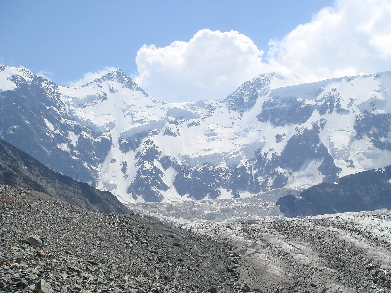
Belukha, at 4 506 metres the highest summit of the range, seen from the Akkem glacier on its northern side. The bare moraine in the foreground and the ice tongue behind it are what the upper Altai looks like above the forest. Photograph: Ondřej Žváček, 2007, CC BY 2.5. 本文中 掲載先: アルタイ
-
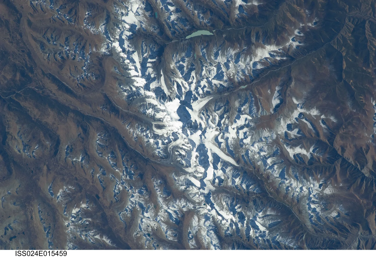
The Belukha massif and the Katun range from the International Space Station, looking straight down. The glaciers run out from the summit block in several directions; the brown ground around them is the treeless upper slope, and the pale lake near the top of the picture is one of the glacier-fed lakes of the Akkem valley. Photograph: NASA, ISS024-E-15459 (2010), public domain. 本文中 掲載先: アルタイ
-
The Ak-Alakha river on the Ukok plateau, in the south of the range, with the channel behind it through which a lake dammed by ice once drained across the ridge into the neighbouring valley. The milky colour of the water is rock flour, ground by the glaciers upstream. Photograph: A. N. Rudoy, 2000, CC BY-SA 3.0. 本文中 掲載先: アルタイ
-
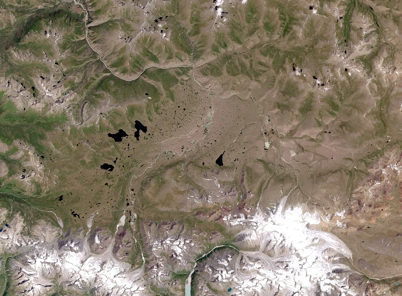
The Ukok plateau in a Landsat 7 image at thirty metres a pixel, near natural colour. The dark spots are lakes in a permafrost basin; the snow along the lower edge is the Tabyn-Bogdo-Ola massif on the Mongolian border. The frozen barrows of the Pazyryk period on this plateau owe their preservation to the ground shown here. Image: NASA, Landsat 7 (2006), public domain. 本文中 掲載先: アルタイ
-
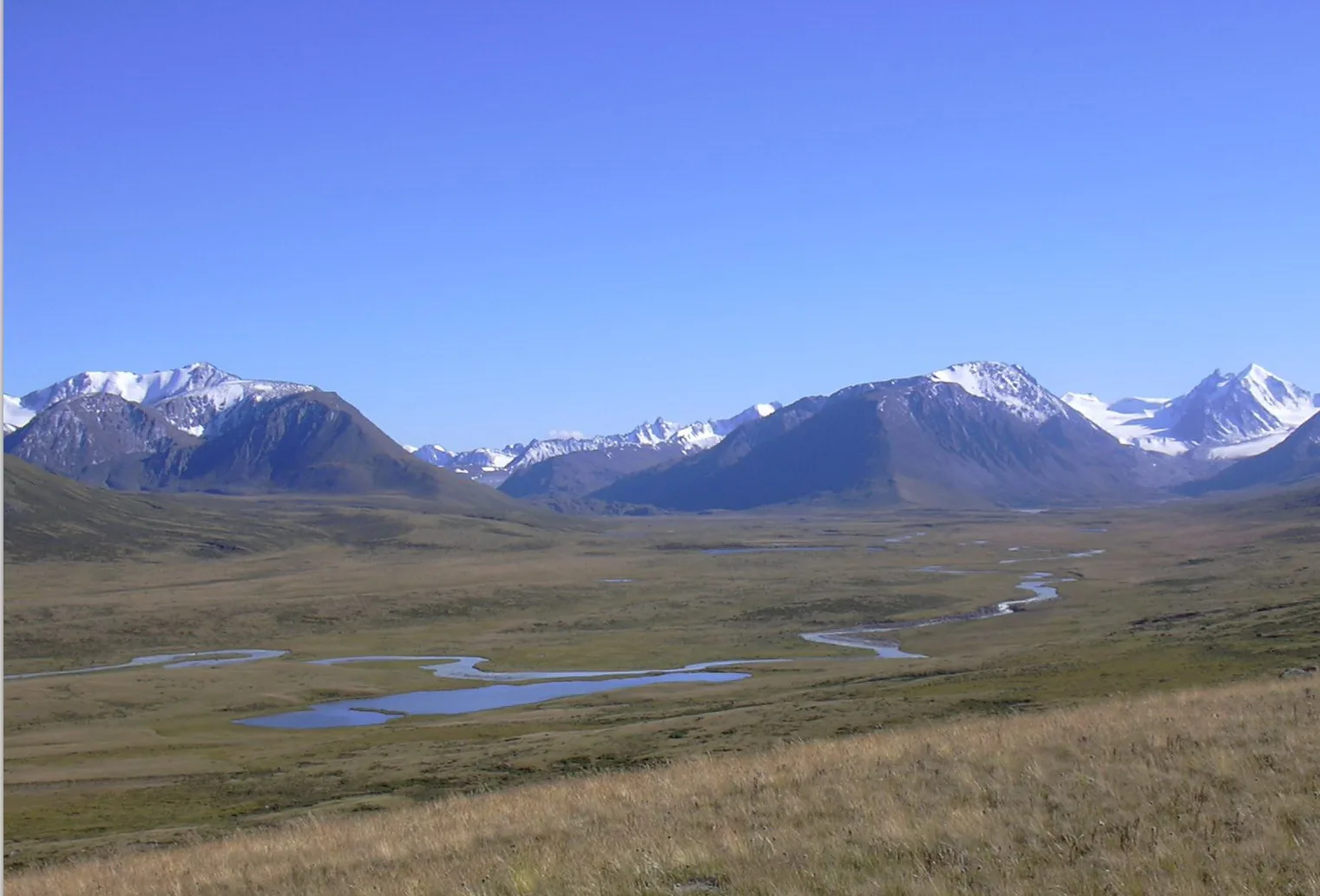
The valley of the Ak-Alakha on the Ukok plateau, one of the places where the frozen barrows of the Pazyryk period lie. The river winds through a basin that is grassland in summer and permafrost underneath. Photograph: Kobsev, 2006, CC BY 2.5. 本文中 掲載先: アルタイ
-
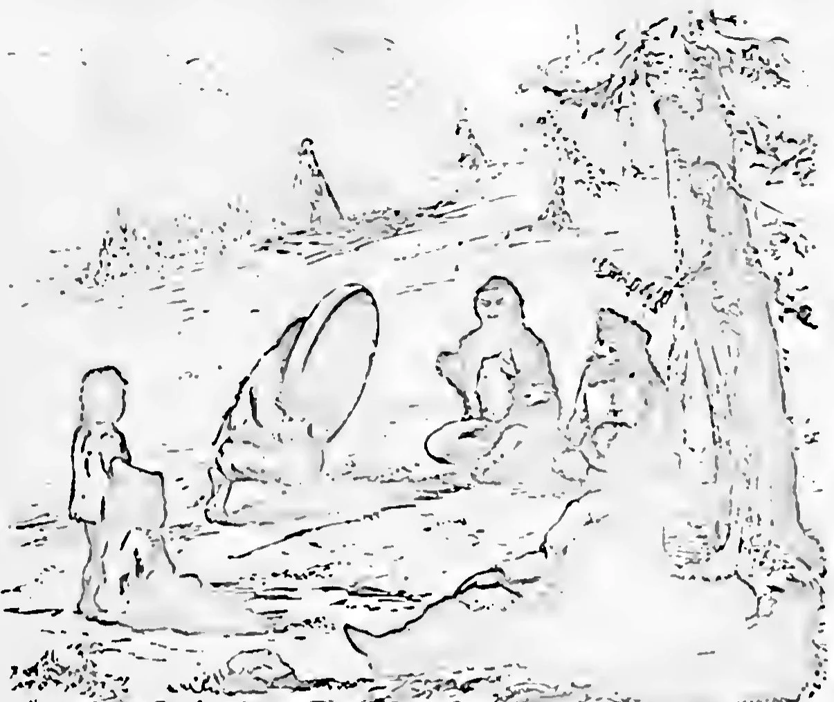
Altaians at the conjuring of spirits by a shaman, in the open beside a tree, with tents behind. Drawing in Radloff’s account of his years in the Altai. W. Radloff, Aus Sibirien, vol. 2, Leipzig 1893, plate 1, Public domain. 本文中 掲載先: アニミズム
-
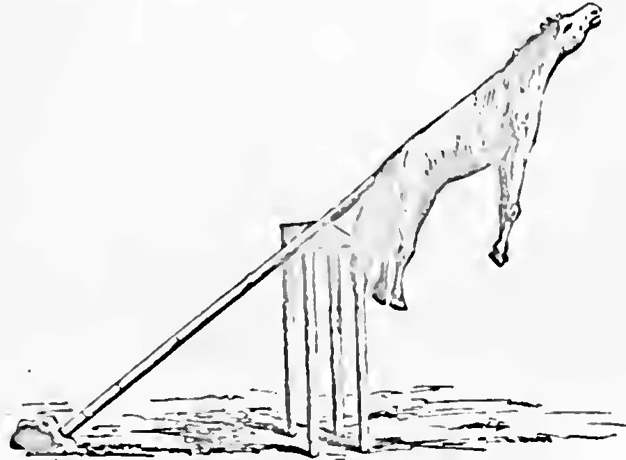
A sacrificial place of the Altaians: the hide of the offered horse hung on a pole above a frame of posts. W. Radloff, Aus Sibirien, vol. 2, Leipzig 1893, plate 1, Public domain. 本文中 掲載先: アニミズム
-
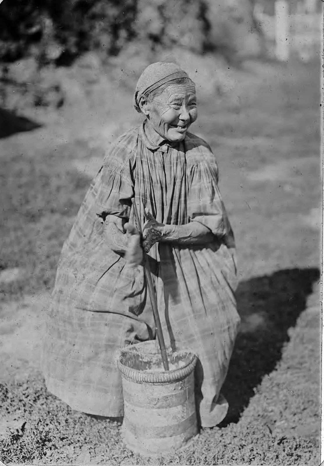
Churning butter with a dasher in a tall churn. The liquid left in the churn when the butter has been lifted out is what Kashgari calls ayran. From an album of views of the Yakutsk region, late nineteenth or early twentieth century. Irkutsk State University. Library of Congress, World Digital Library, free to use. 本文中 掲載先: アイラン
-
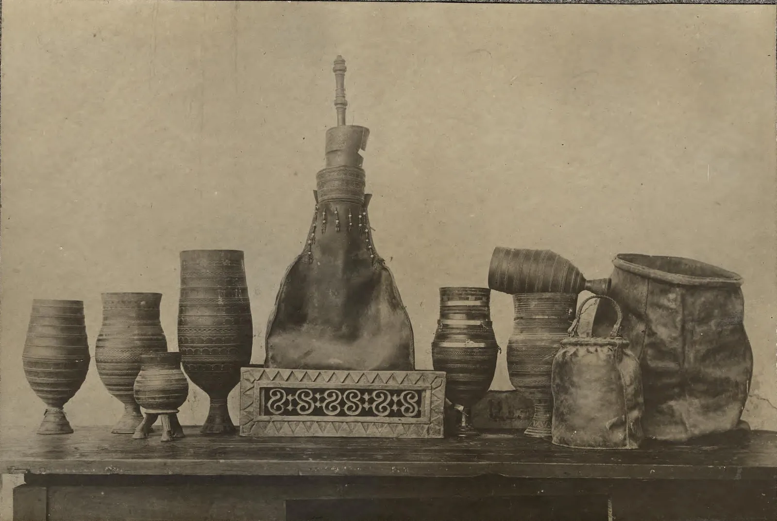
Vessels for kumys among the Yakuts, whose word for milk food is ürüŋ , "white": in the middle a skin bag in which the kumys is made, on the right two skins for keeping it, the others wooden drinking cups. Photograph: L. Veniukov; Novosibirsk State Museum of Regional History. Library of Congress, World Digital Library, free to use. 本文中 掲載先: アイラン
-
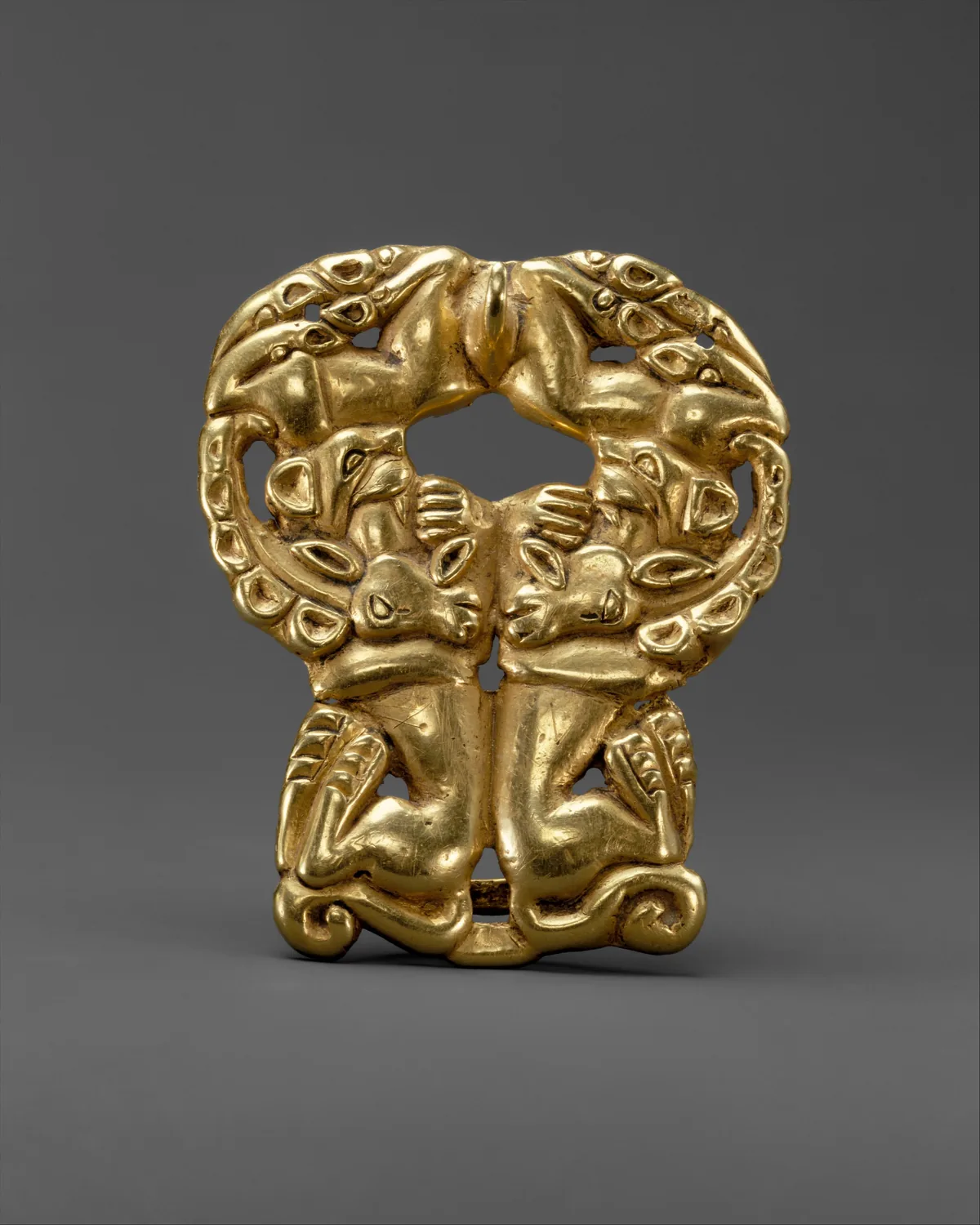
Gold belt buckle with paired felines attacking ibexes, Xiongnu, about third to second century BC, the time of Bagatur. The Metropolitan Museum of Art, New York, 17.190.1672, Gift of J. Pierpont Morgan, 1917. Open Access, public domain (CC0). 本文中 掲載先: Bagatur (Modu Chanyu)
-
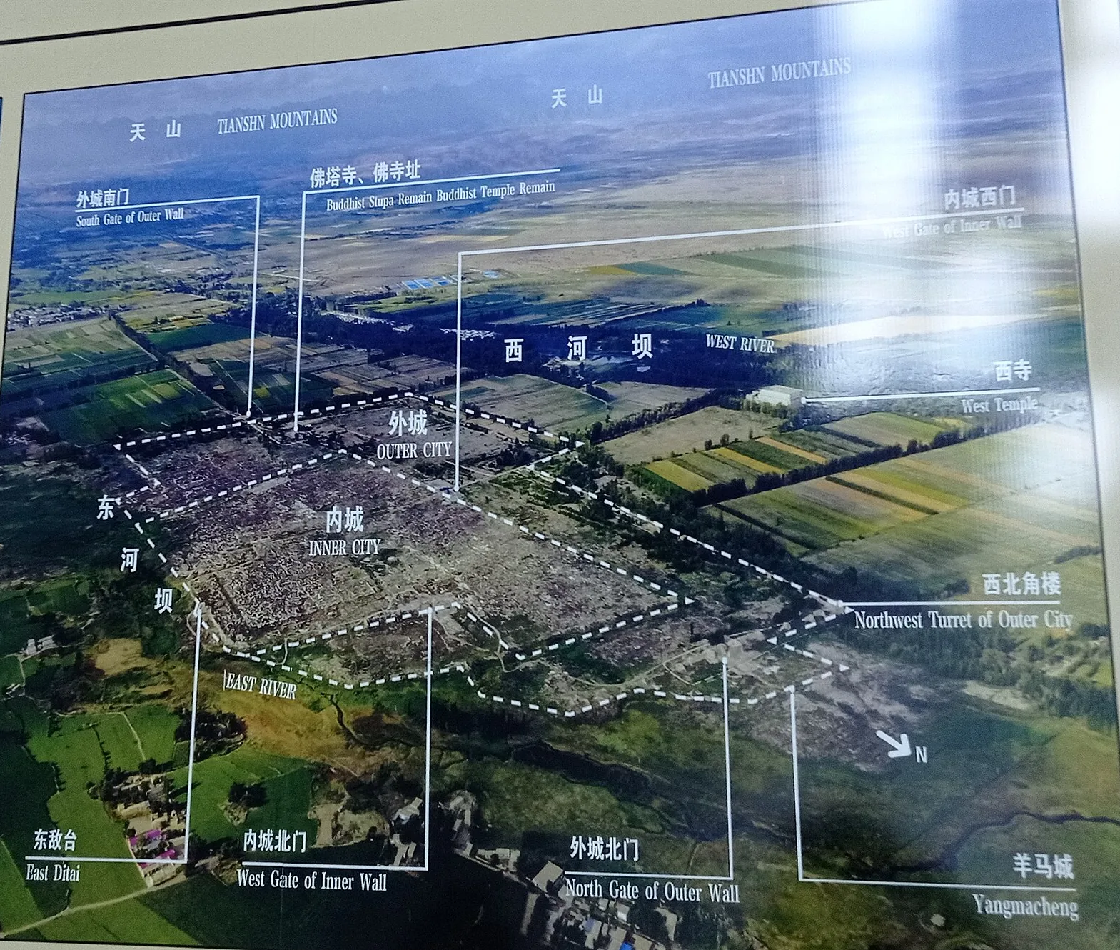
The ruins of Beshbalik from the air, as the information board at the site shows them: the inner city within the outer city, the West Temple beyond the West River, and the Tian Shan on the horizon. The arrow at lower right points north. Photograph of the information board at the Beiting ruins. 本文中 掲載先: ビシュバリク
-
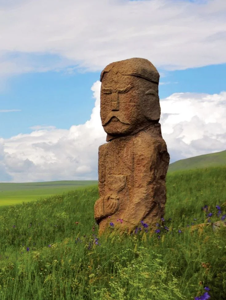
A carved stone figure on the open steppe: the face with brows and moustache, and a vessel held at the chest. It is a figure of the kind that stood at the enclosure, which is often called a balbal. 本文中 掲載先: 埋葬とバルバル
-
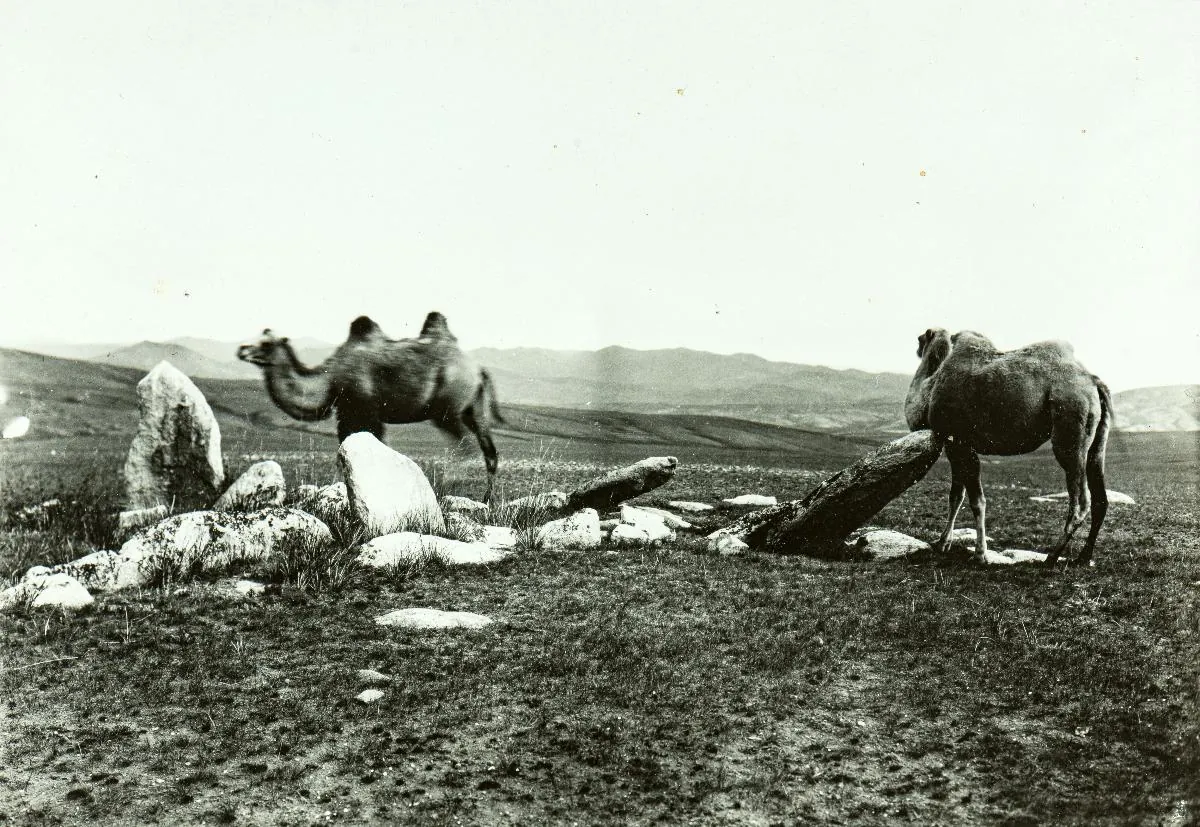
A grave marked by standing stones on the steppe between Schargaldschut and Lake Biir in Mongolia, with two camels, photographed in 1909. The collection does not date the grave itself. Finnish Heritage Agency (Museovirasto), General Ethnographic Photo Collection, VKK156:146. Photograph by Sakari Pälsi, 1909. Finna, CC BY 4.0. 本文中 掲載先: ユーラシアの遊牧民
-
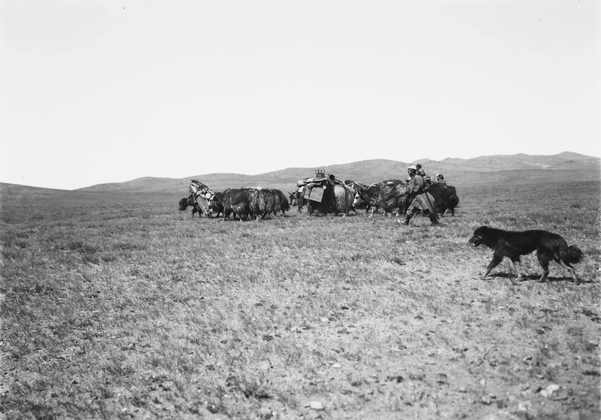
A Mongol family moving across the steppe in 1909, with their goods carried on yaks. Finnish Heritage Agency (Museovirasto), General Ethnographic Photo Collection, VKK156:38. Photograph by Sakari Pälsi, 1909. Finna, CC BY 4.0. 本文中 掲載先: ユーラシアの遊牧民
-
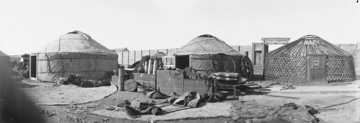
Felt tents standing for sale at Urga, today Ulaanbaatar, in 1909. On the right the lattice frame and roof ring of one tent are still uncovered. Finnish Heritage Agency (Museovirasto), General Ethnographic Photo Collection, VKK156:89. Photograph by Sakari Pälsi, 1909. Finna, CC BY 4.0. 本文中 掲載先: ユーラシアの遊牧民
-
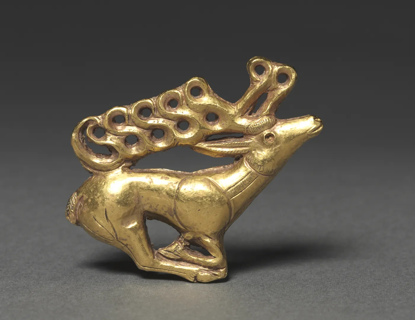
Gold plaque of a stag with antlers drawn out into open loops, Scythian, 400–300 BC. The Cleveland Museum of Art, 1985.77, The Severance and Greta Millikin Purchase Fund. Open Access, public domain (CC0). 本文中 掲載先: ユーラシアの遊牧民, History of the Turkic peoples
-
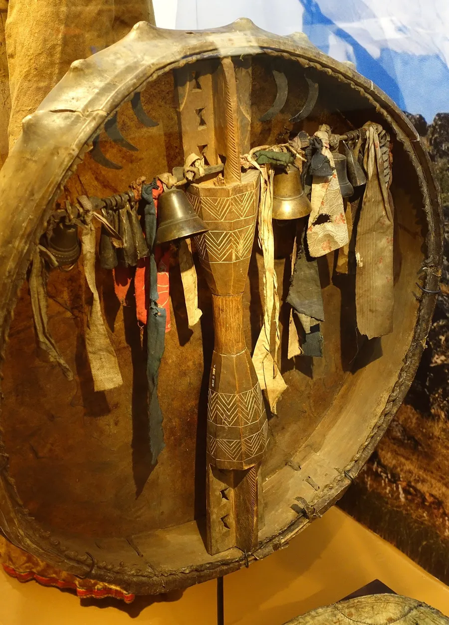
A shaman’s drum from the Altai and Khakassia, collected in 1892, seen from behind: brass bells hang from the crossbar. Drum and bell are the two instruments Menander names at the purification of 569. Etnografiska museet, Stockholm, no. 1892.03.0354. Photograph: Daderot, 2014, CC0. 本文中 掲載先: カム(テュルクのシャーマン)
-
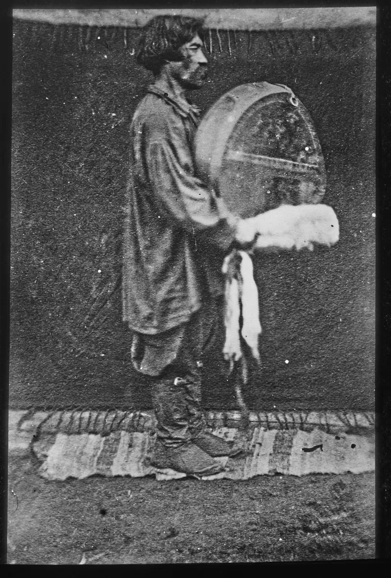
A shaman of the second rank in the Minusinsk district on the upper Yenisei, with his drum, photographed in 1897 on the expedition of Joseph de Baye. Bibliothèque nationale de France, Société de Géographie, SG XCD-199. Public domain. 本文中 掲載先: カム(テュルクのシャーマン)
-
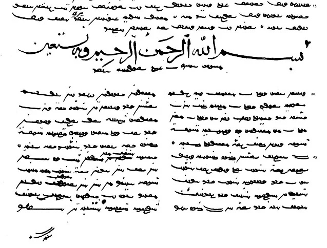
A page of the Vienna manuscript, copied at Herat in 1439 in Uyghur script, with a heading in Arabic letters. Facsimile of the Vienna manuscript, St Petersburg 1890, public domain. 本文中 掲載先: クタドグ・ビリグ
-
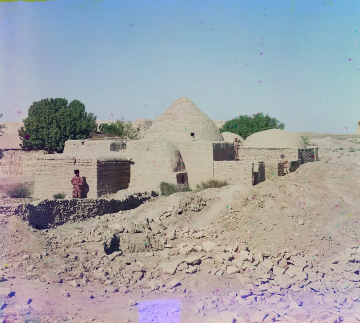
The mausoleum of Akhmed Zamchi in the ruin fields of ancient Merv, between 1905 and 1915. Photograph: Sergei Prokudin-Gorskii, between 1905 and 1915; Library of Congress, no known restrictions. 本文中 掲載先: メルヴ
-
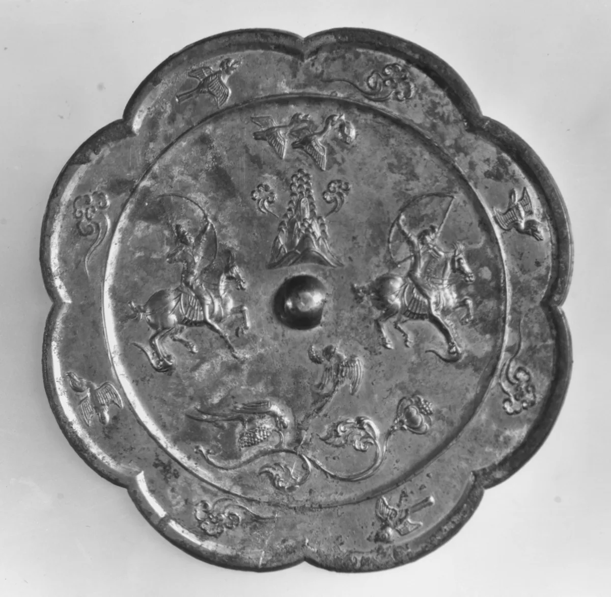
Bronze mirror with a hunting scene, China, Tang dynasty, eighth century. Two horsemen draw their bows at full gallop. The Metropolitan Museum of Art, New York, 25.20.3, Rogers Fund, 1925. Open Access, public domain (CC0). 本文中 掲載先: 騎射
-
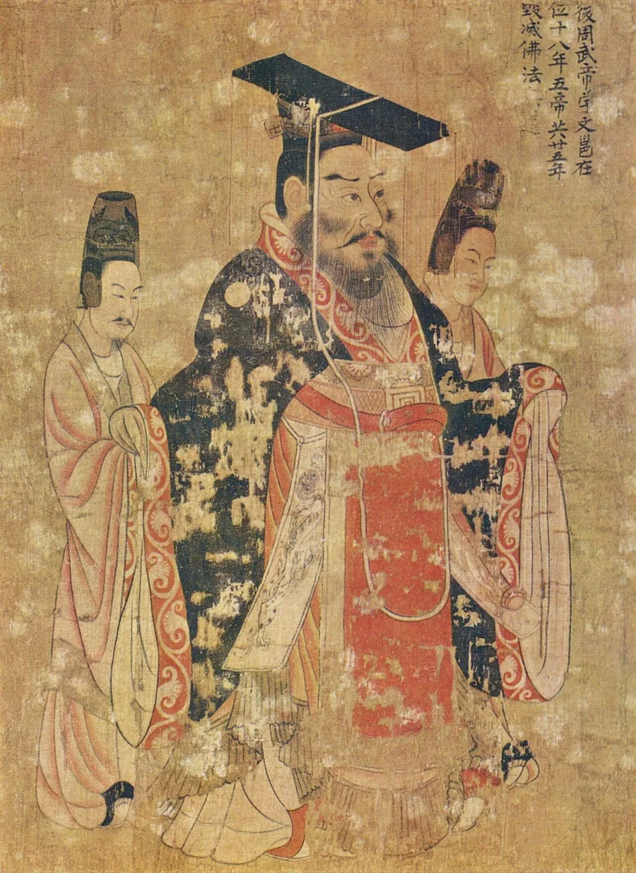
Emperor Wu of the Zhou in the Thirteen Emperors Scroll, a handscroll attributed to the Tang court painter Yan Liben and painted in the seventh century. It is a later depiction, not a portrait from life. The inscription calls him Emperor Wu of the Later Zhou, Yuwen Yong, counts five emperors in twenty-five years, and notes that he destroyed the Buddhist law. Museum of Fine Arts, Boston. Painting attributed to Yan Liben; reproduction from The Yorck Project. Public domain. 本文中 掲載先: 北周
-
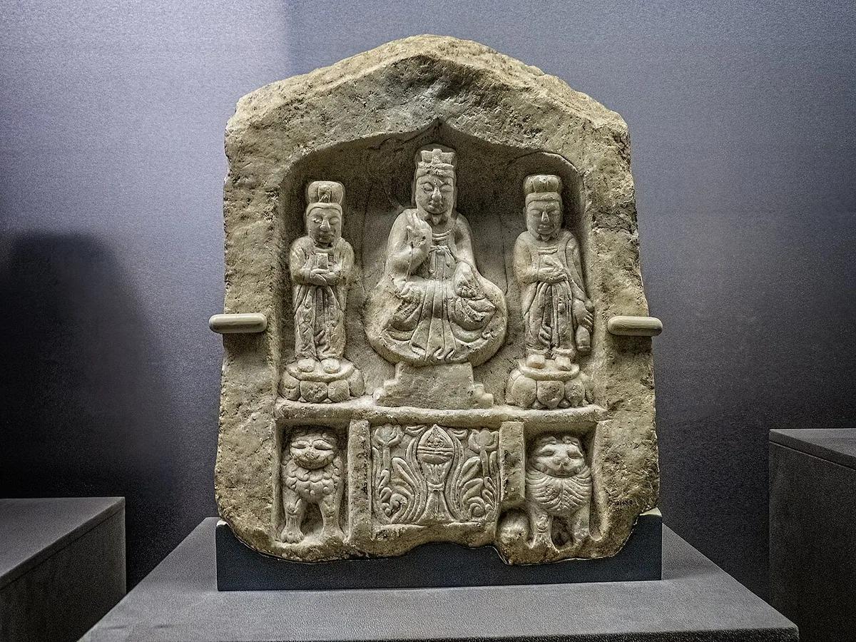
Laozi seated between two attendants, a Daoist stone image from Shaanxi dated 564, ten years before the ban. The figure sits in the posture of a Buddha; lions and an incense burner fill the base. Field Museum, Chicago. Photograph: Mary Harrsch, CC BY-SA 4.0. 本文中 掲載先: 北周
-
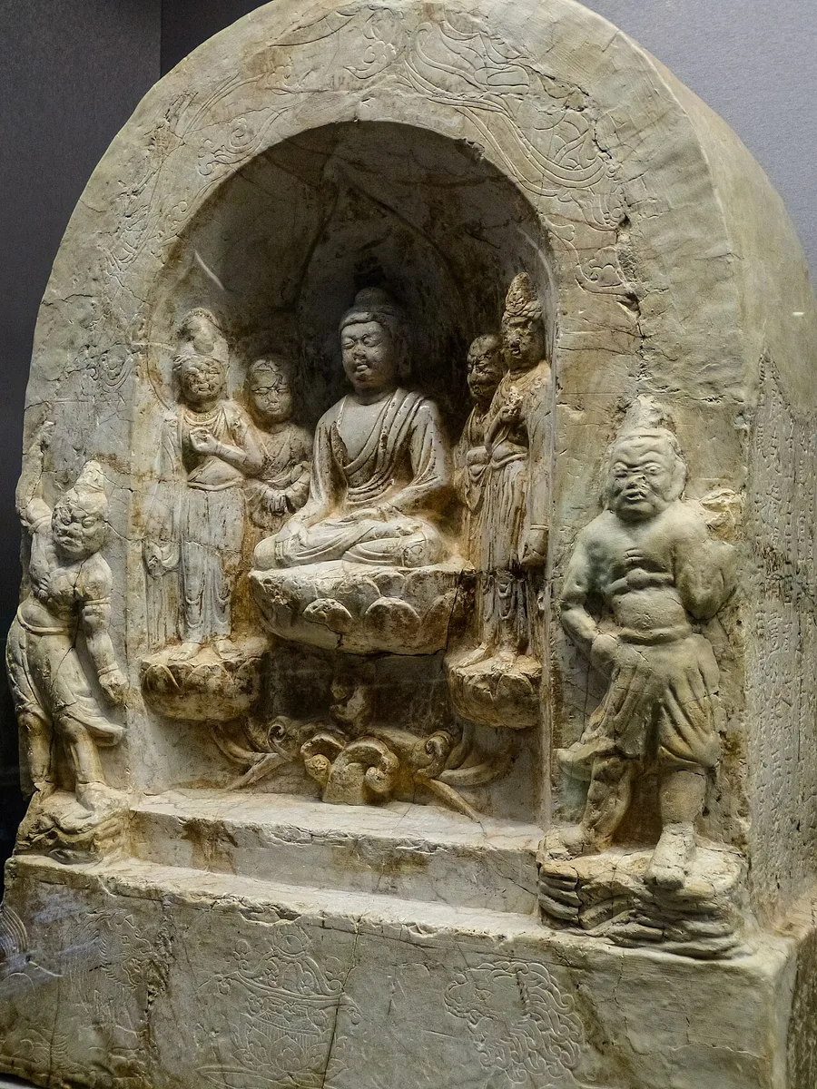
Buddhist stone shrine of the Zhou period from Shaanxi: the Buddha seated on a lotus between disciples and bodhisattvas, with a guardian on either side. Field Museum, Chicago. Photograph: Mary Harrsch, 2016, CC BY-SA 4.0. 本文中 掲載先: 北周
-
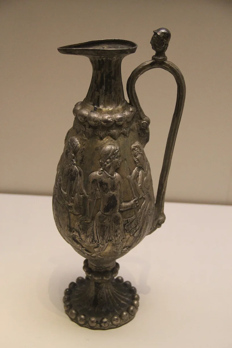
Replica of the gilded silver ewer from the tomb of Li Xian at Guyuan, shown at the National Museum of China in Beijing. The ewer was made in Central Asia; the figures in relief on its body come from Greek myth. Photograph: Gary Todd, 2011, CC0. 本文中 掲載先: 北周
-
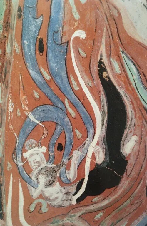
A flying celestial playing a lute, from the wall paintings of cave 301 at Mogao near Dunhuang, of the Zhou period. Wall painting, Mogao cave 301. Public domain. 本文中 掲載先: 北周
-
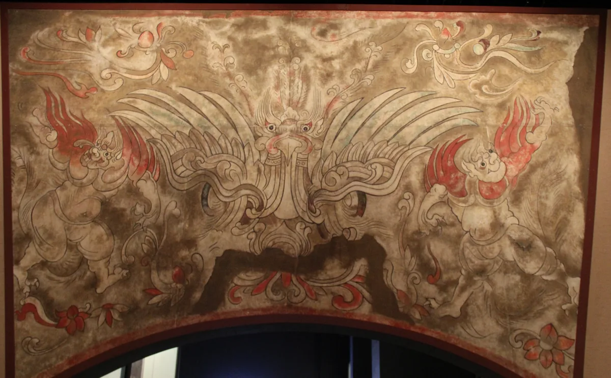
Modern copy of the painting above the gate of her tomb: a monster mask between two winged figures. Hebei Museum. Copy: Hebei Museum. Photograph: Gary Todd, 2014, CC0. 本文中 掲載先: Princess Linhe, Tomb of Princess Linhe
-
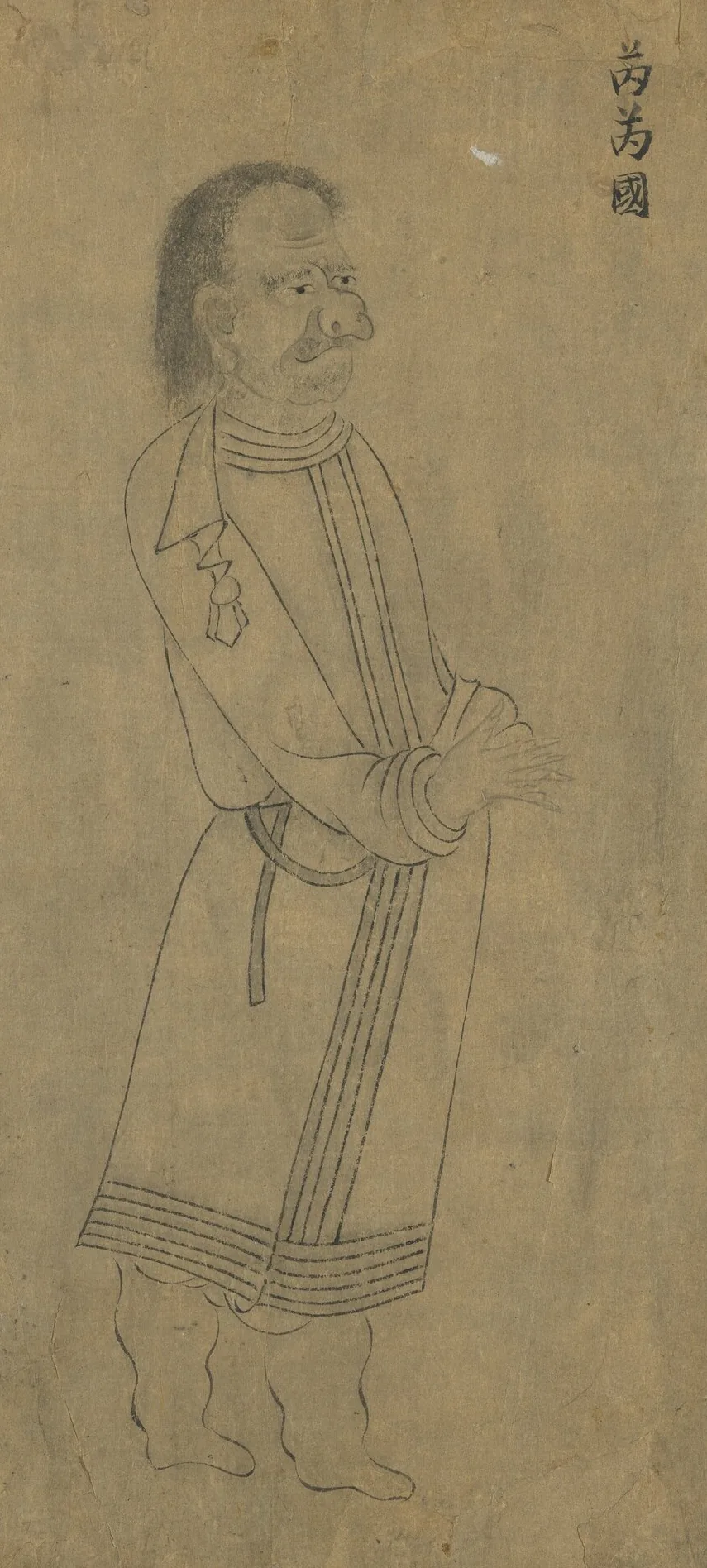
Envoy of the Rouran, labelled 芮芮國, the name the southern courts used for them. From “Foreign Visitors Coming to Court”, a copy after a painting ascribed to Emperor Yuan of Liang (r. 552–555); an inscription of the Song emperor Lizong names Gu Deqian of the Southern Tang as the copyist. Handscroll, ink on paper; National Palace Museum, Taipei, 故畫001389N. Copy of Emperor Yuan of Liang’s “Foreign Visitors Coming to Court”, The National Palace Museum, Taipei, CC BY 4.0 @ www.npm.gov.tw. 本文中 掲載先: 柔然可汗国
-
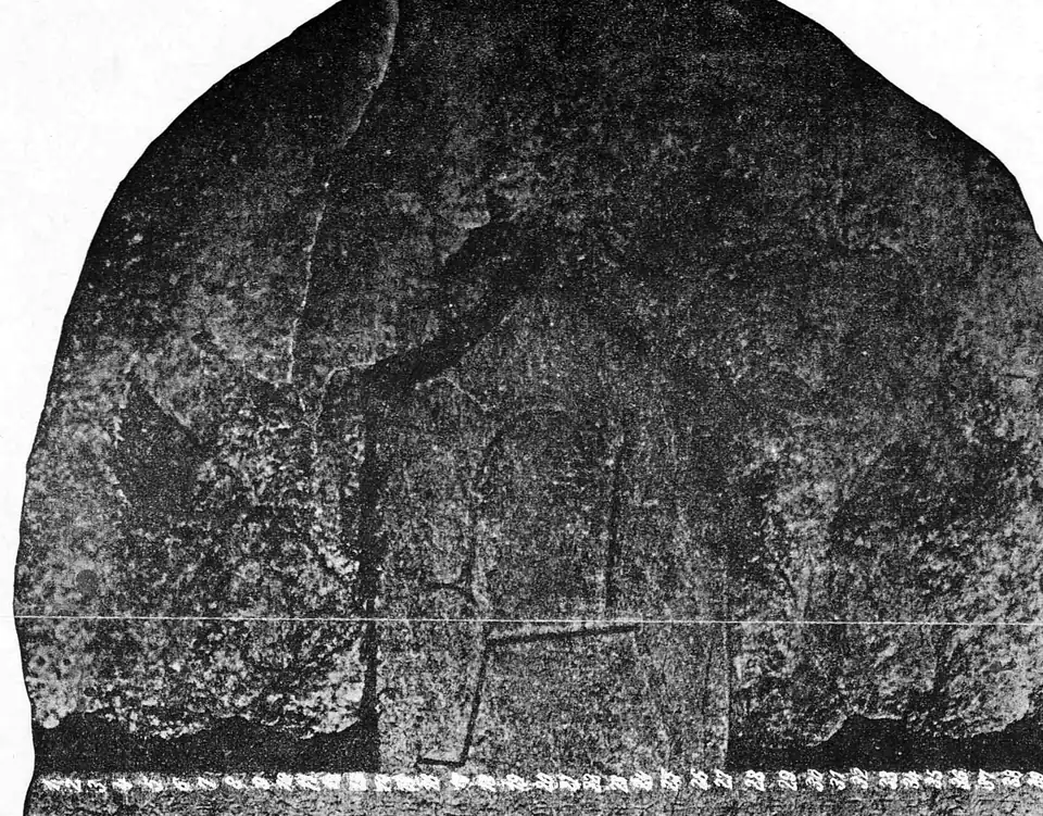
The crown and upper runes of the Kül Tegin stone, photographed by the Finnish expedition of 1890. Photograph: Finnish expedition of 1890, Inscriptions de l’Orkhon recueillies par l’expédition finnoise 1890, Helsingfors 1892, Tab. 2, public domain. 本文中 掲載先: 第二ギョクテュルク可汗国, History of the Turkic peoples
-
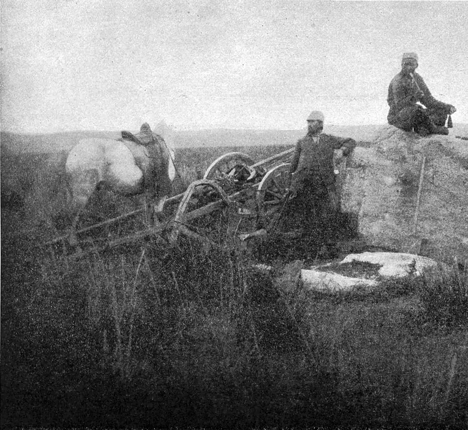
General view of the site of the Bilge Khan monument on the Orkhon, photographed in 1890. Photograph: Finnish expedition of 1890, Inscriptions de l’Orkhon recueillies par l’expédition finnoise 1890, Helsingfors 1892, public domain. 本文中 掲載先: 第二ギョクテュルク可汗国
-
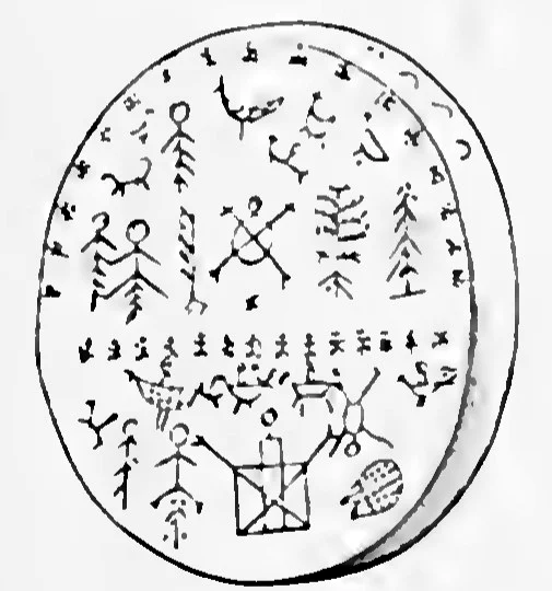
The outer side of an Altaian shaman’s drum: men, animals, birds and trees painted on the skin, above and below a dividing band. W. Radloff, Aus Sibirien, vol. 2, Leipzig 1893, plate 1, Public domain. 本文中 掲載先: シャーマニズム
-
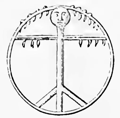
The inside of the same kind of drum: the handle shaped as a figure with a head, and the crossbar hung with pendants. W. Radloff, Aus Sibirien, vol. 2, Leipzig 1893, plate 1, Public domain. 本文中 掲載先: シャーマニズム
-
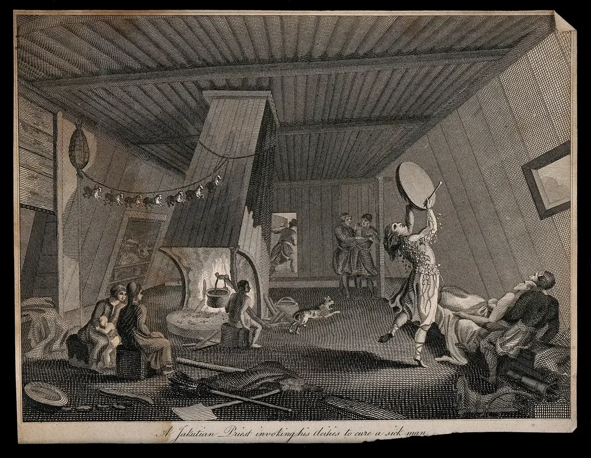
A Yakut shaman invoking his spirits to cure a sick man, an engraving titled "A Jakutian Priest invoking his deities to cure a sick man". The Yakut, who call themselves Sakha, speak a Turkic language. The date of the print is not recorded. Engraving by S. Davenport, date not recorded; Wellcome Collection. Public domain mark. 本文中 掲載先: シャーマニズム
-
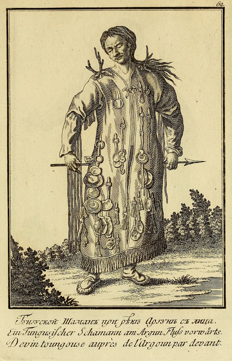
A Tungus shaman on the Argun, seen from the front: a coat hung with iron rings and discs, antler-like prongs at the shoulders, an arrow in the hands. The Tungus speak a Tungusic language. The plate shows the wider Siberian pattern and not the Göktürks. Plate from J. G. Georgi, Description de toutes les nations de l'Empire de Russie, 1776, Boston Public Library copy at the Internet Archive. Public domain. 本文中 掲載先: シャーマニズム
-
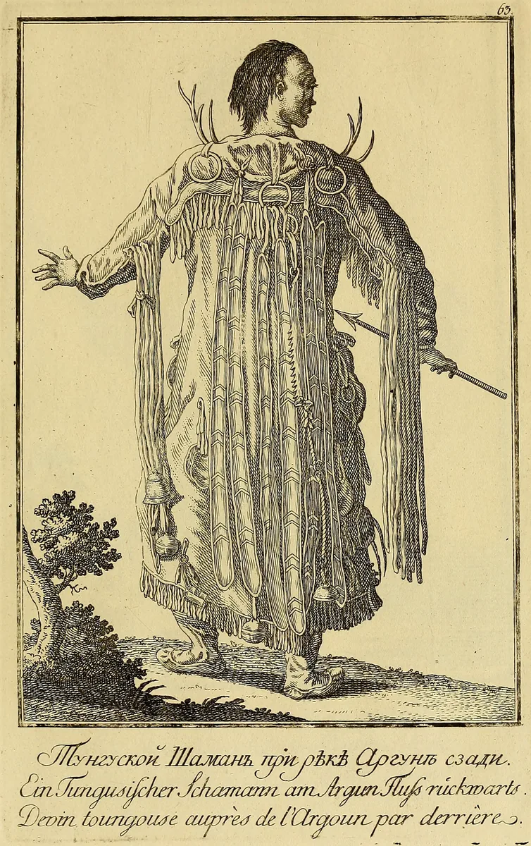
The same Tungus shaman from behind: long strips down the back, iron rings at the collar under the antler-like prongs, and bells at the hem of the coat. Plate from J. G. Georgi, Description de toutes les nations de l'Empire de Russie, 1776, Boston Public Library copy at the Internet Archive. Public domain. 本文中 掲載先: シャーマニズム
-
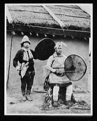
A Nanai shaman priest and his assistant, each with a frame drum, photographed about 1895. The Nanai, called Goldi in the older literature, are a Tungusic people and not a Turkic one. Photograph by William Henry Jackson, about 1895; Library of Congress, Prints and Photographs Division, World's Transportation Commission collection. Public domain. 本文中 掲載先: シャーマニズム
-
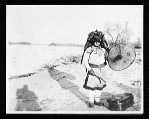
A Nanai shaman in regalia with a frame drum on a river bank, photographed between 1890 and 1900. The shadow of the photographer falls in the foreground. Photograph by William Henry Jackson, 1890 to 1900; Library of Congress, Prints and Photographs Division, World's Transportation Commission collection. Public domain. 本文中 掲載先: シャーマニズム
-
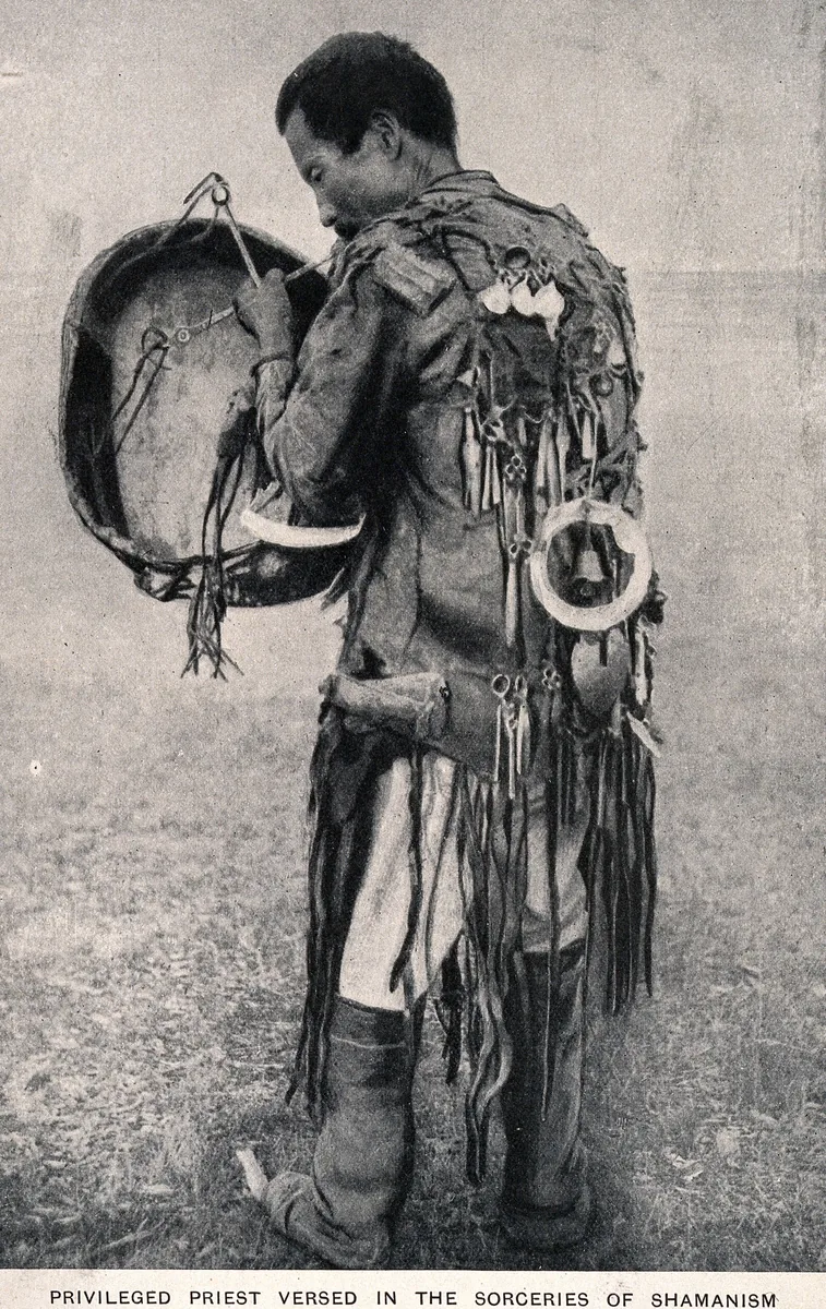
A shaman with a drum in full costume, seen from behind: iron pendants, a large ring with a bell at the back and a long fringe. The printed caption reads "Privileged priest versed in the sorceries of shamanism". The place and date of the photograph are not recorded. Photographer and date not recorded; Wellcome Collection. Public domain mark. 本文中 掲載先: シャーマニズム
-
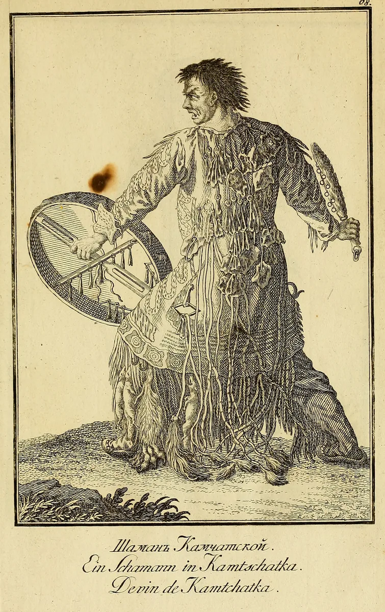
A shaman of Kamchatka with a frame drum, a ringed beater and a coat hung with strips and pendants, a plate titled "Ein Schamann in Kamtschatka". The Kamchadal are not a Turkic people. The plate shows the wider Siberian pattern and not the Göktürks. Plate from J. G. Georgi, Description de toutes les nations de l'Empire de Russie, 1776, Boston Public Library copy at the Internet Archive. Public domain. 本文中 掲載先: シャーマニズム
-
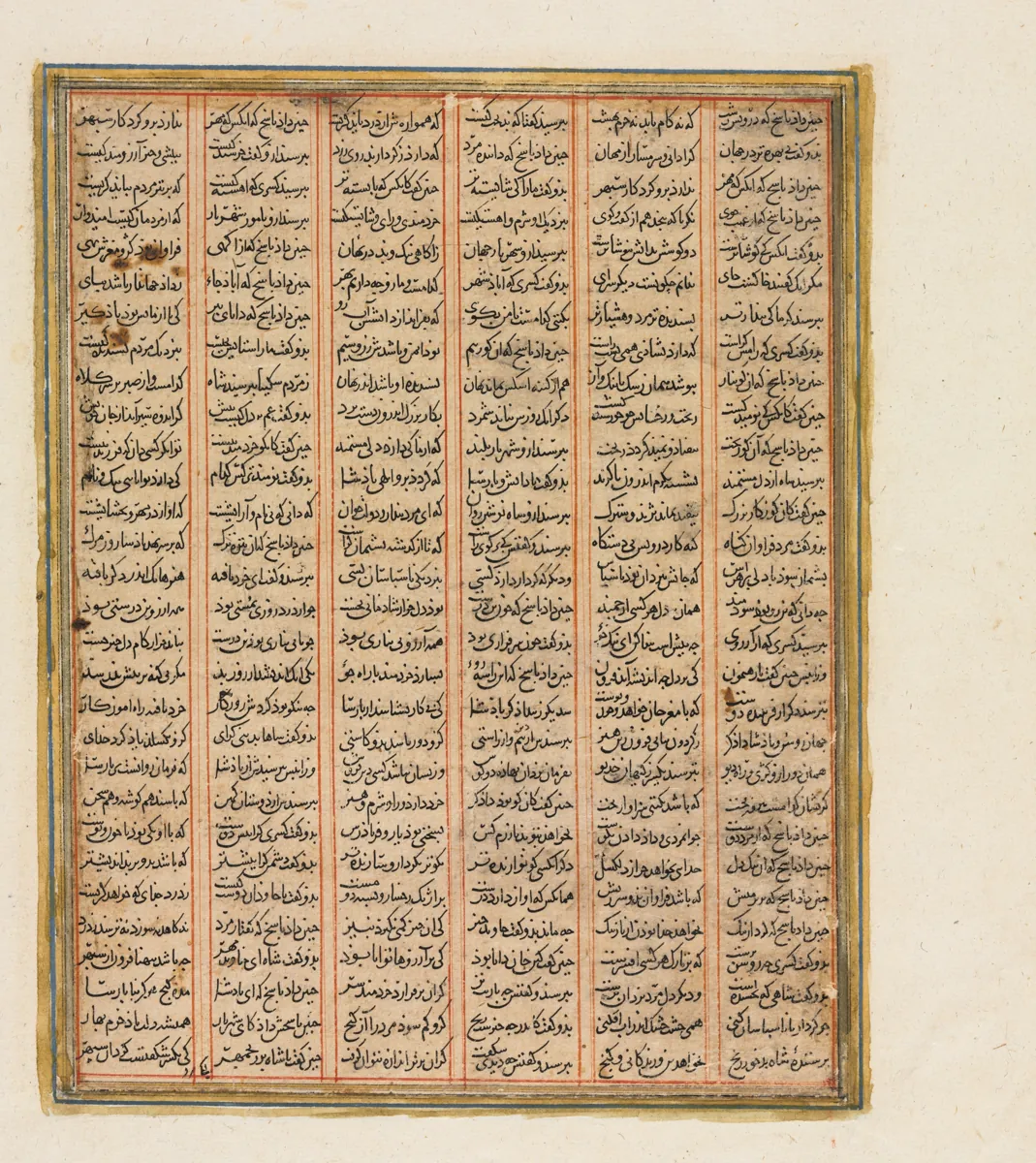
A page of a Shahnama made in Baghdad about 1299, from the reign of Nushirwan (Khosrow I): the war between the Khan of Chin, the khan of the Turks in the Persian epic, and the Haitalians, the Hephthalites. The Cleveland Museum of Art, 1944.480.2.b, CC0. 本文中 掲載先: ギョクテュルク・エフタル戦争(555〜563年)
-
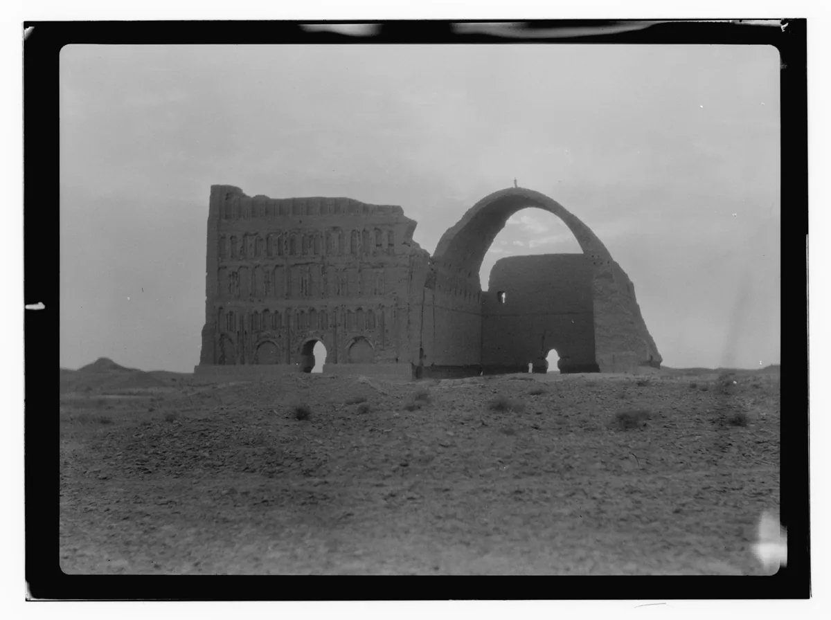
The Taq Kasra at Ctesiphon, the great vaulted hall of the Sasanian palace on the Tigris, photographed in 1932. Photograph: American Colony Photo Department, 1932; Library of Congress, no known restrictions. 本文中 掲載先: ギョクテュルク・ササン朝交易紛争
-
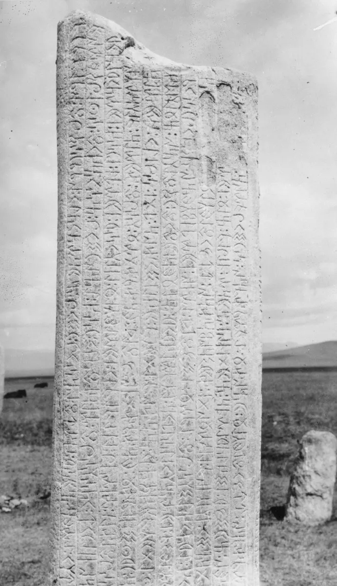
The upper part of the south face of the first Tonyukuk stone in the Nalaikh valley, photographed in June 1909. Photograph: G. J. Ramstedt and Sakari Pälsi, 1909, Finnish Heritage Agency, CC BY 4.0. -
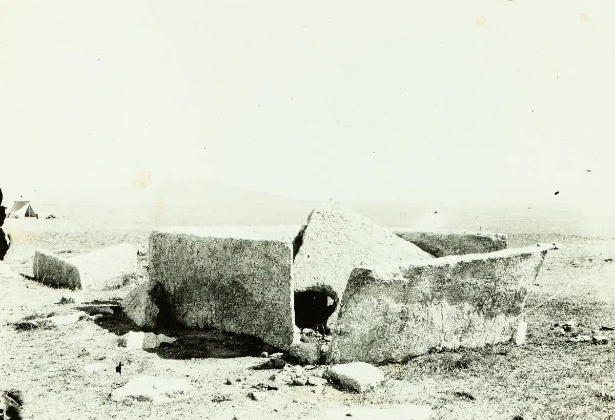
The stone coffin at the Tonyukuk tomb, seen from the southwest, in 1909. Photograph: Sakari Pälsi, 1909, Finnish Heritage Agency, CC BY 4.0. -
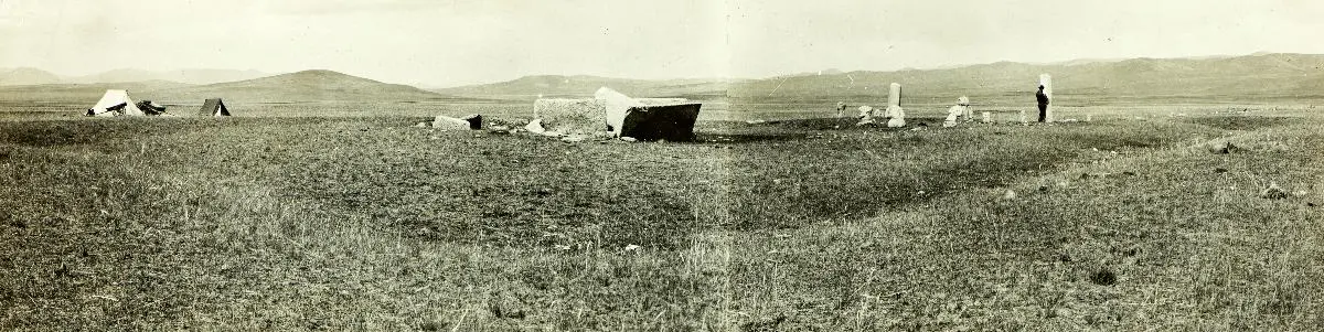
The Tonyukuk tomb, seen from the southwest corner of its earth bank, in 1909. Photograph: Sakari Pälsi, 1909, Finnish Heritage Agency, CC BY 4.0. 本文中 掲載先: トニュクク碑文
-
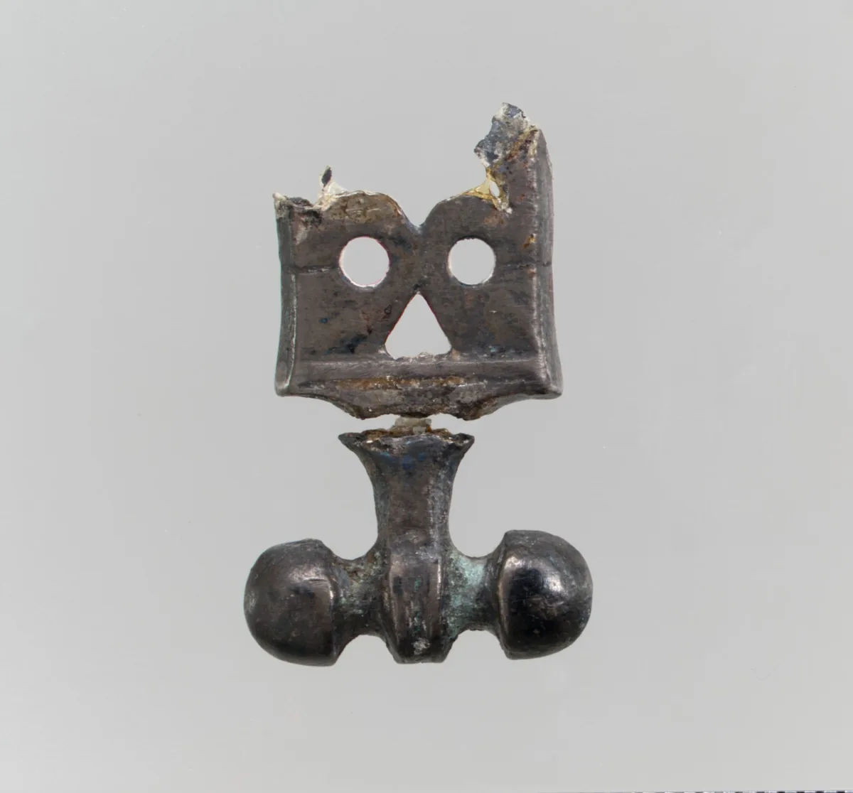
Silver belt ornament, Avar or Byzantine work, about 575. The Metropolitan Museum of Art, New York, 17.191.179, CC0. 本文中 掲載先: ヨーロッパのテュルク系諸部族
-
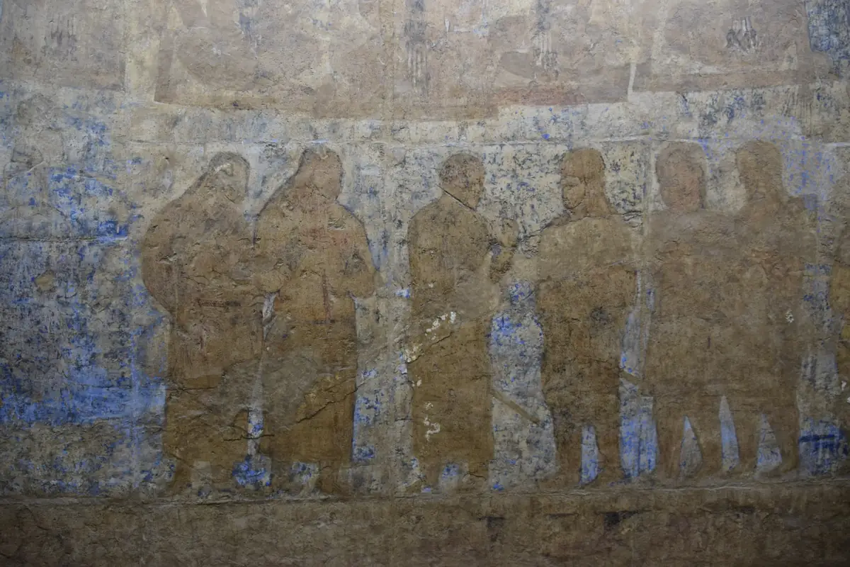
West wall of the Hall of the Ambassadors at Afrasiab, Samarkand, middle of the seventh century: a row of standing figures in long coats. Above them runs the lower edge of the seated figures with long plaits whom the museum’s drawing of the wall marks as Turkic guards. Photograph: Jean Housen, 2023, CC BY-SA 4.0. 本文中 掲載先: Turkic-Sogdian Synthesis
-
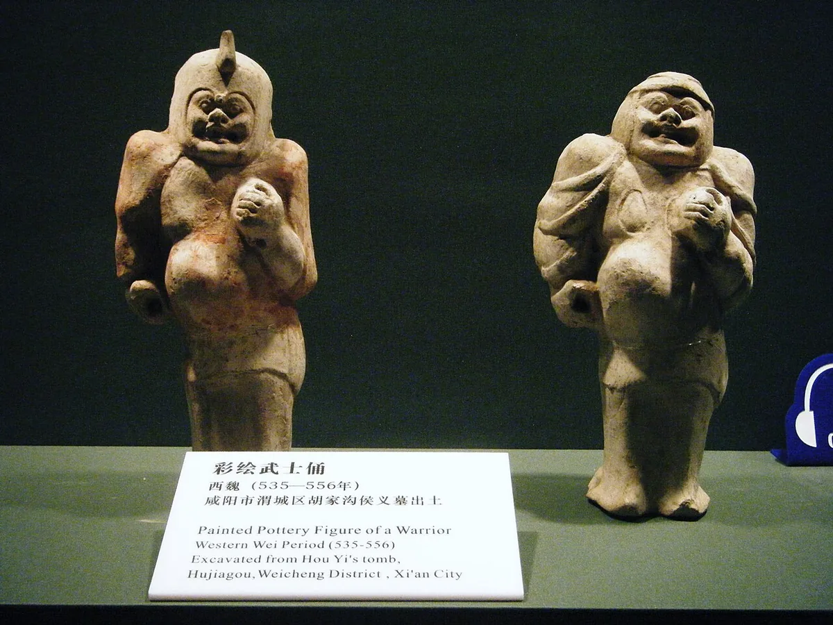
Two painted pottery warriors from the tomb of Hou Yi at Hujiagou in Xianyang, a burial of the Western Wei period in the country round Chang'an, now in the Shaanxi History Museum in Xi'an. Photograph: Hugh Llewelyn, 2009, CC BY-SA 2.0. 本文中 掲載先: 西魏
-
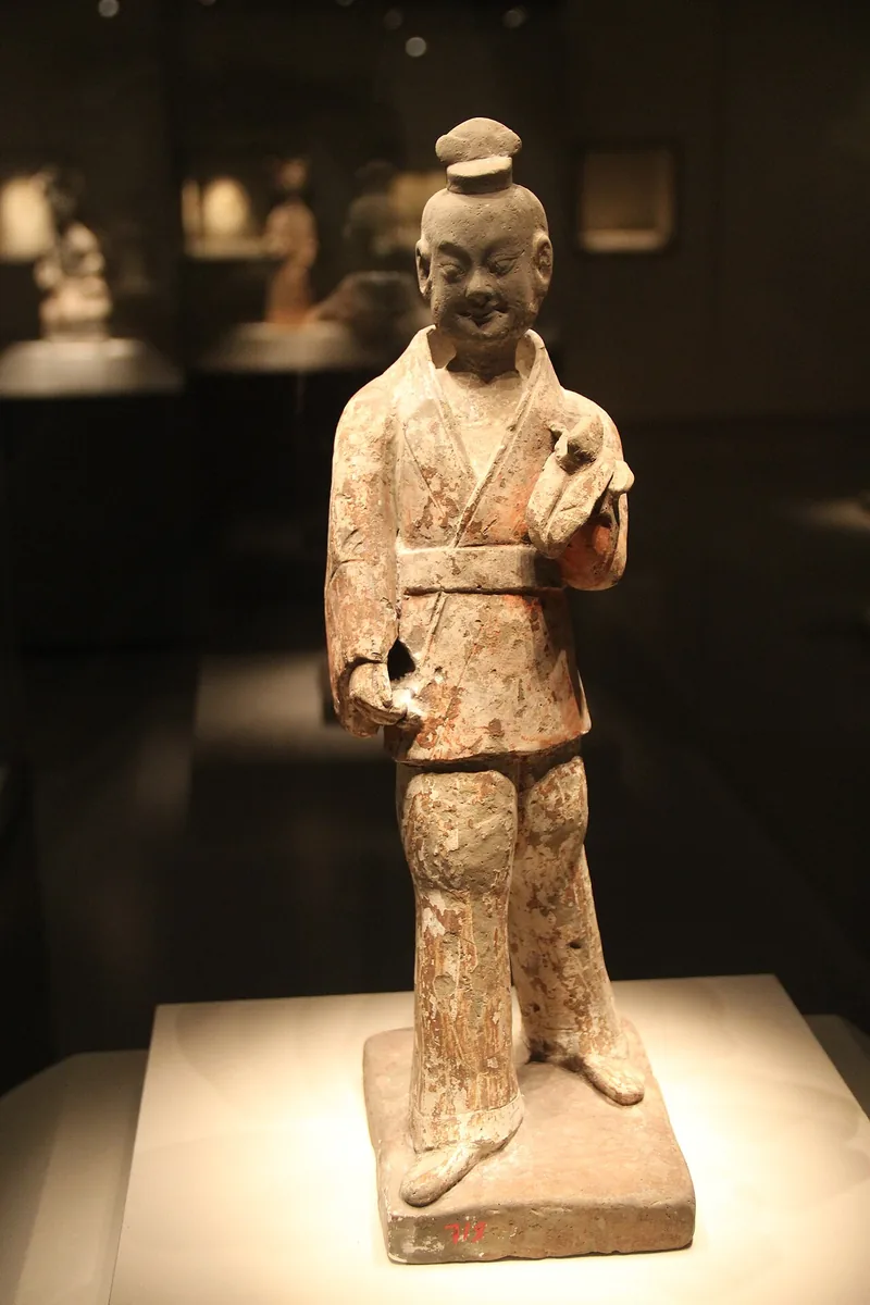
Pottery figure of a military official of the Western Wei period in the National Museum of China, Beijing. Photograph: Gary Todd, 2011, CC0. 本文中 掲載先: 西魏
-
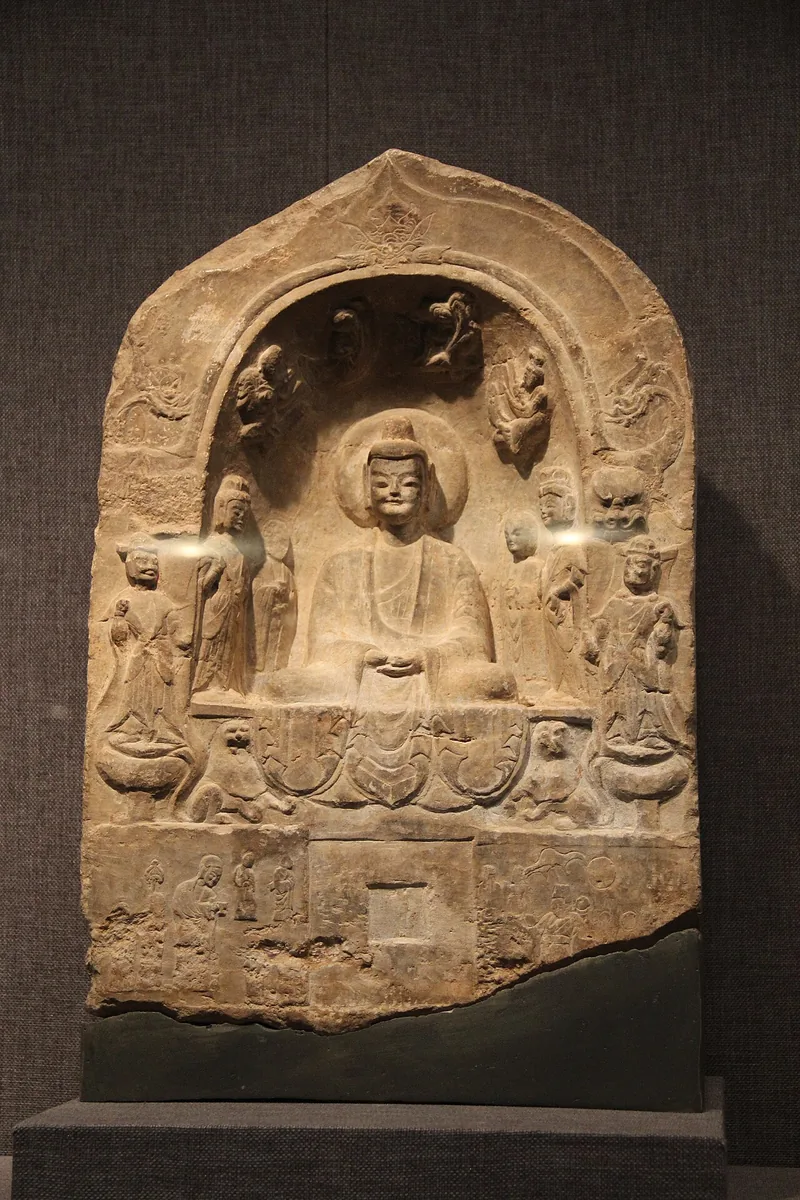
Buddhist stele of the Western Wei period, a seated Buddha between attendants, in the Beilin Museum in Xi'an, the city that was Chang'an. Photograph: Gary Todd, 2011, CC0. 本文中 掲載先: 西魏
-
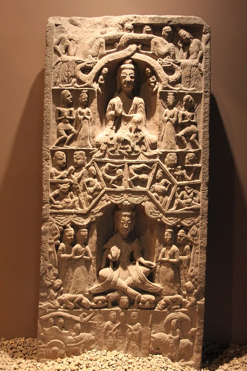
Buddhist stele of the Western Wei period, carved in registers with two seated Buddhas and scenes in relief, in the Xi'an Museum. Photograph: Gary Todd, 2011, CC0. 本文中 掲載先: 西魏
-
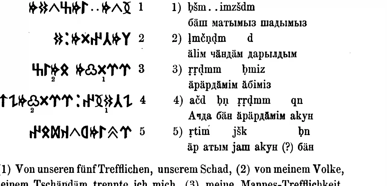
The Ujuk-Archan inscription from the upper Yenisei in runiform script, with transcription, as Wilhelm Radloff printed it in 1895. W. Radloff, Die alttürkischen Inschriften der Mongolei, St Petersburg 1895, p. 305. Public domain. 本文中 掲載先: エニセイ・キルギス可汗国
-
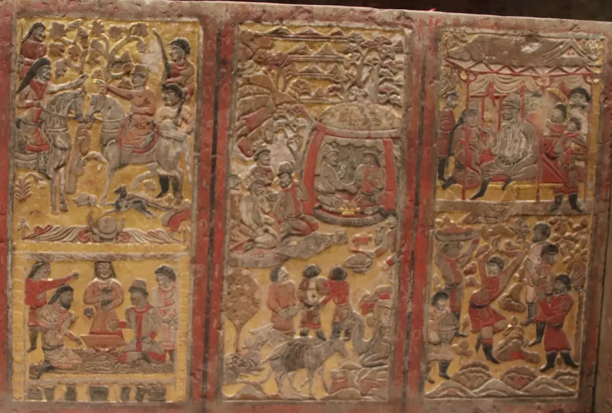
読書の道筋の表紙画像。 Funerary couch of An Jia, a Sogdian sabao at the Zhou court who died in 579, three of its back panels: a meeting of riders and talks at a low table, a feast in a yurt with a laden camel below, a banquet with dancers. Shaanxi History Museum, Xi’an. Photograph: Gary Todd, 2019, CC0. 読書の道筋 掲載先: イステミの西方への旅
-
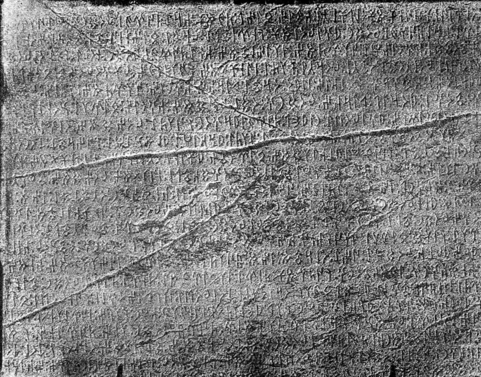
読書の道筋の表紙画像。 Runes on the east face of the Kül Tegin stone, photographed by the Finnish expedition of 1890. Inscriptions de l’Orkhon, Helsingfors 1892, Tab. 4; National Library of Finland, Public domain. 読書の道筋 掲載先: 名、称号、主張
-
読書の道筋の表紙画像。 読書の道筋 掲載先: 第一ギョクテュルク帝国の分裂
-
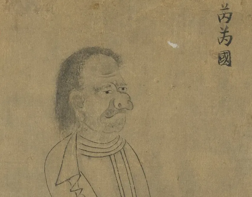
読書の道筋の表紙画像。 Envoy of the Rouran, labelled 芮芮國, from a copy of Emperor Yuan of Liang’s “Foreign Visitors Coming to Court”. National Palace Museum, Taipei, 故畫001389N, CC BY 4.0 @ www.npm.gov.tw. 読書の道筋 掲載先: 柔然帝国の興亡
-
読書の道筋の表紙画像。 Crown and upper runes of the Kül Tegin stone, photographed by the Finnish expedition of 1890. Inscriptions de l’Orkhon, Helsingfors 1892, Tab. 2; National Library of Finland, Public domain. 読書の道筋 掲載先: ギョクテュルクの没落
-
読書の道筋の表紙画像。 Upper part of the south face of the first Tonyukuk stone, photographed in June 1909 by G. J. Ramstedt and Sakari Pälsi (cropped). Finnish Heritage Agency, VKK532:464, CC BY 4.0. 読書の道筋 掲載先: ギョクテュルクの再興
-
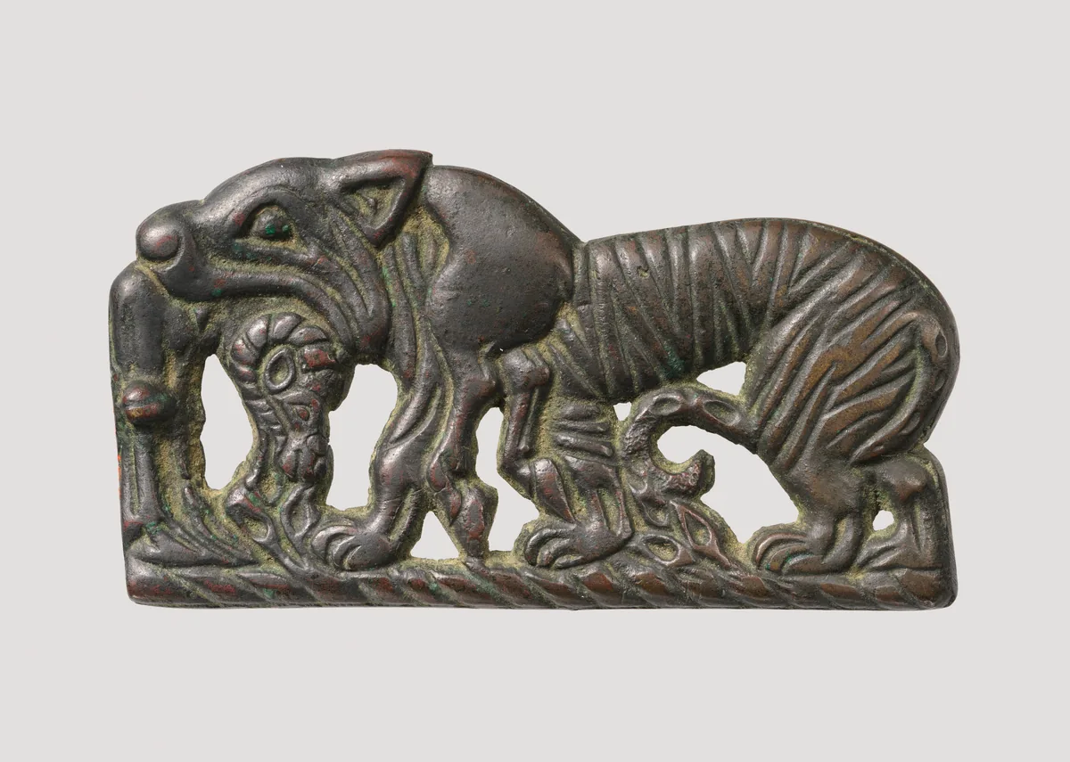
読書の道筋の表紙画像。 The Metropolitan Museum of Art, New York, 49.132, Rogers Fund, 1949. Open Access, public domain (CC0). 読書の道筋 掲載先: 匈奴
-
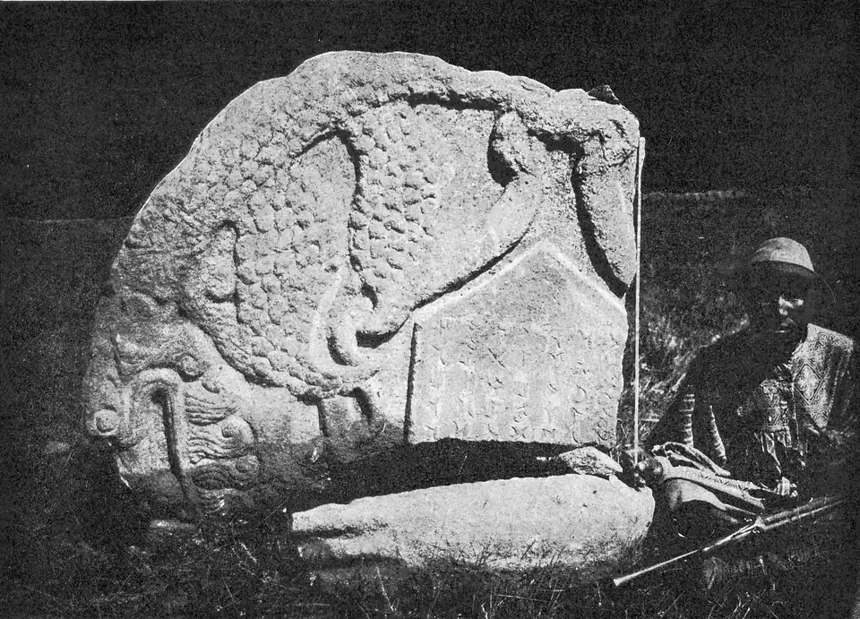
読書の道筋の表紙画像。 Fragment of the dragon crown of the Karabalghasun stone, photographed by the Finnish expedition of 1890. Inscriptions de l’Orkhon, Helsingfors 1892, Tab. 46; National Library of Finland, Public domain. 読書の道筋 掲載先: ウイグルとキルギス
現代の描写
今日の挿絵、復元図、絵画。
メイン画像 64 · 本文中 12 · 読書の道筋 6 · テュルクのトレ 1 · ページ 1
-
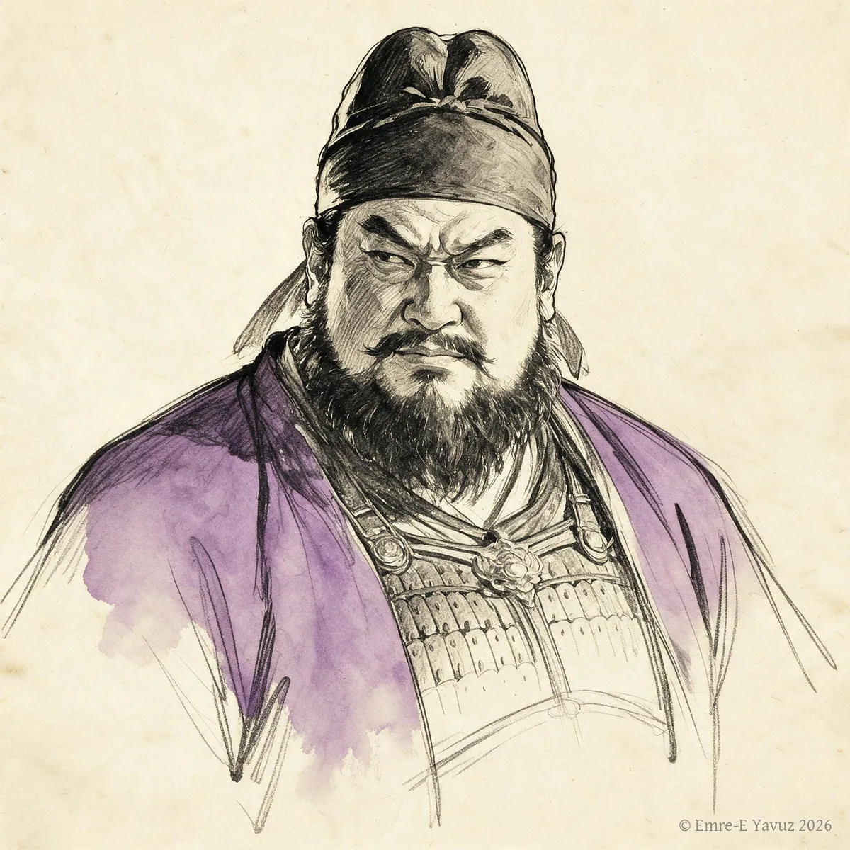
An Lushan in a modern portrait. © Emre-E Yavuz 2026 メイン画像 掲載先: An Lushan
-

Anagui in a modern portrait. © Emre-E Yavuz 2026 メイン画像 掲載先: 阿那瓌(アナグイ)
-
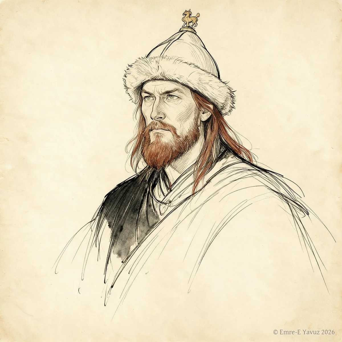
Are Khan in a modern portrait. © Emre-E Yavuz 2026 メイン画像 掲載先: 阿熱可汗(アレ)
-
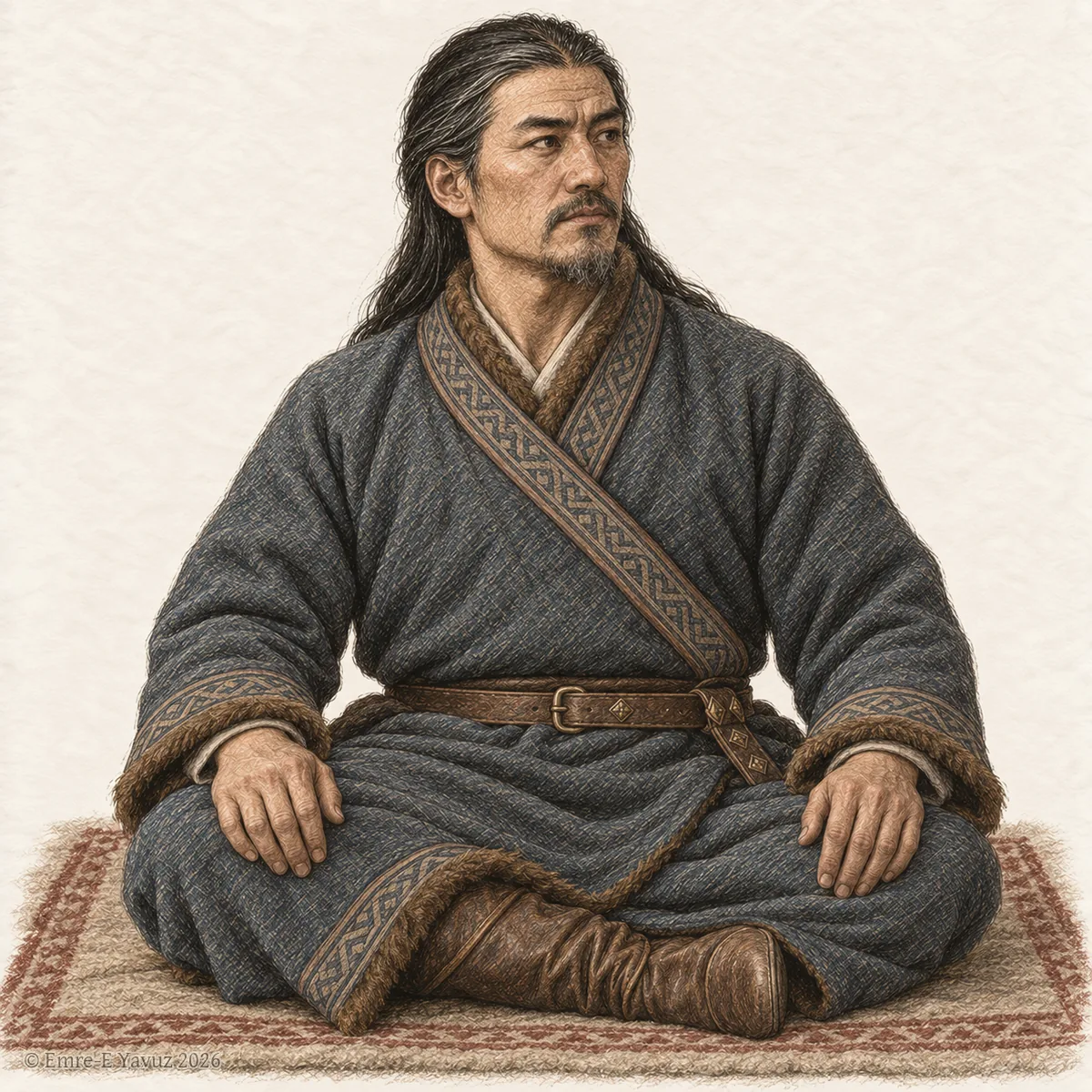
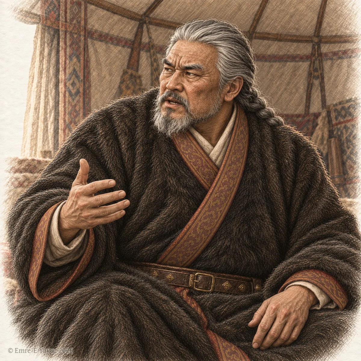
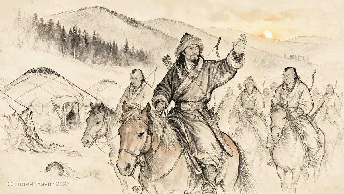
A Göktürk nobleman seated on a felt rug, in a modern drawing. © Emre-E Yavuz 2026 メイン画像 掲載先: バガ(莫何)
-

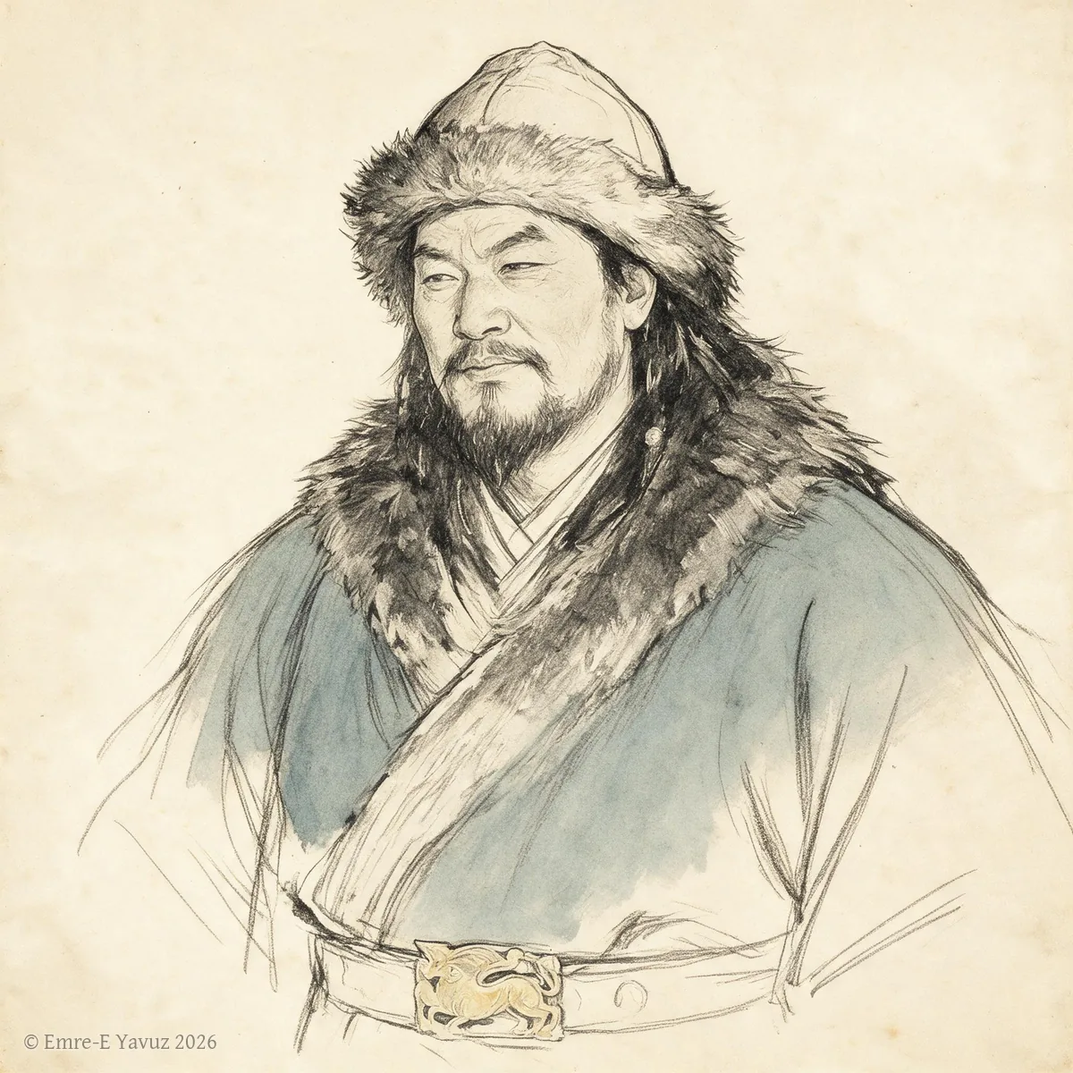
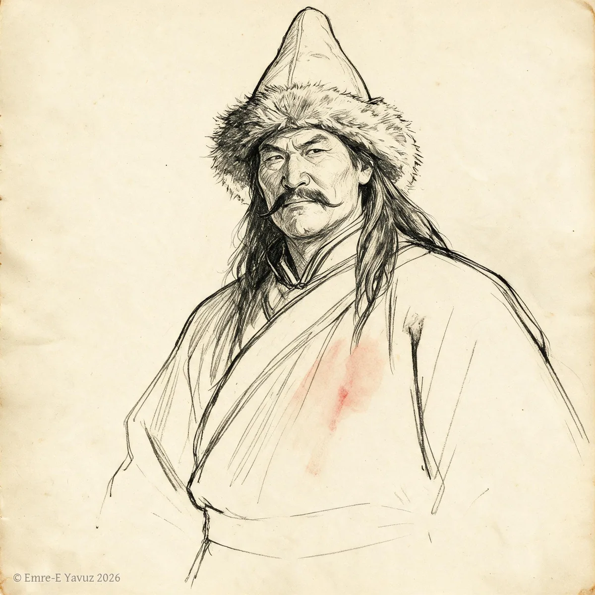
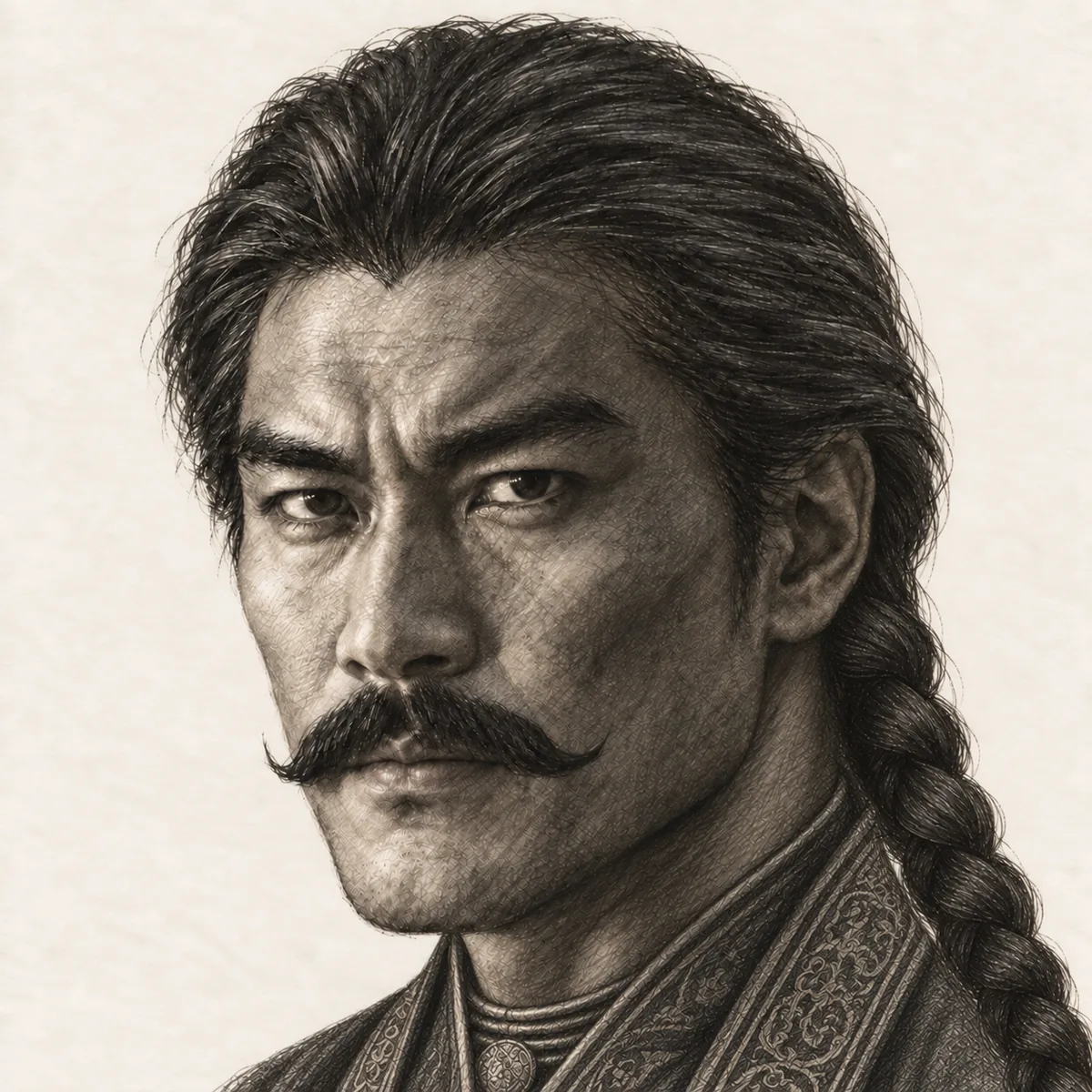
Bagatur in a modern portrait. © Emre-E Yavuz 2026 メイン画像 掲載先: Bagatur (Modu Chanyu)
-
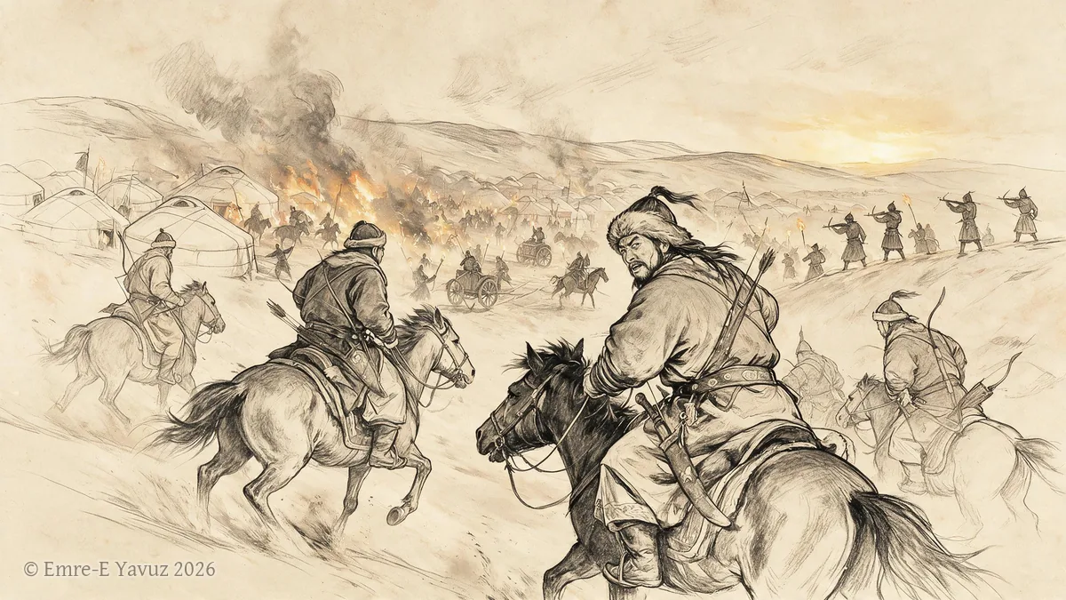
Battle of Dzungaria, 552 in a modern illustration. © Emre-E Yavuz 2026 メイン画像 掲載先: ジュンガルの戦い(552年)
-
Battle of Huaihuang, 552 in a modern illustration. © Emre-E Yavuz 2026 メイン画像 掲載先: 懐荒の戦い(552年)
-
Bayanchur Khan in a modern portrait. © Emre-E Yavuz 2026 メイン画像 掲載先: Bayanchur Khan
-
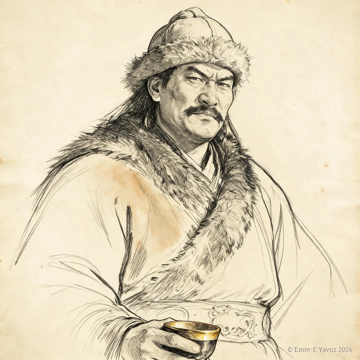
Bilge Khan in a modern drawing. © Emre-E Yavuz 2026 メイン画像 掲載先: 毗伽可汗(ビルゲ)
-

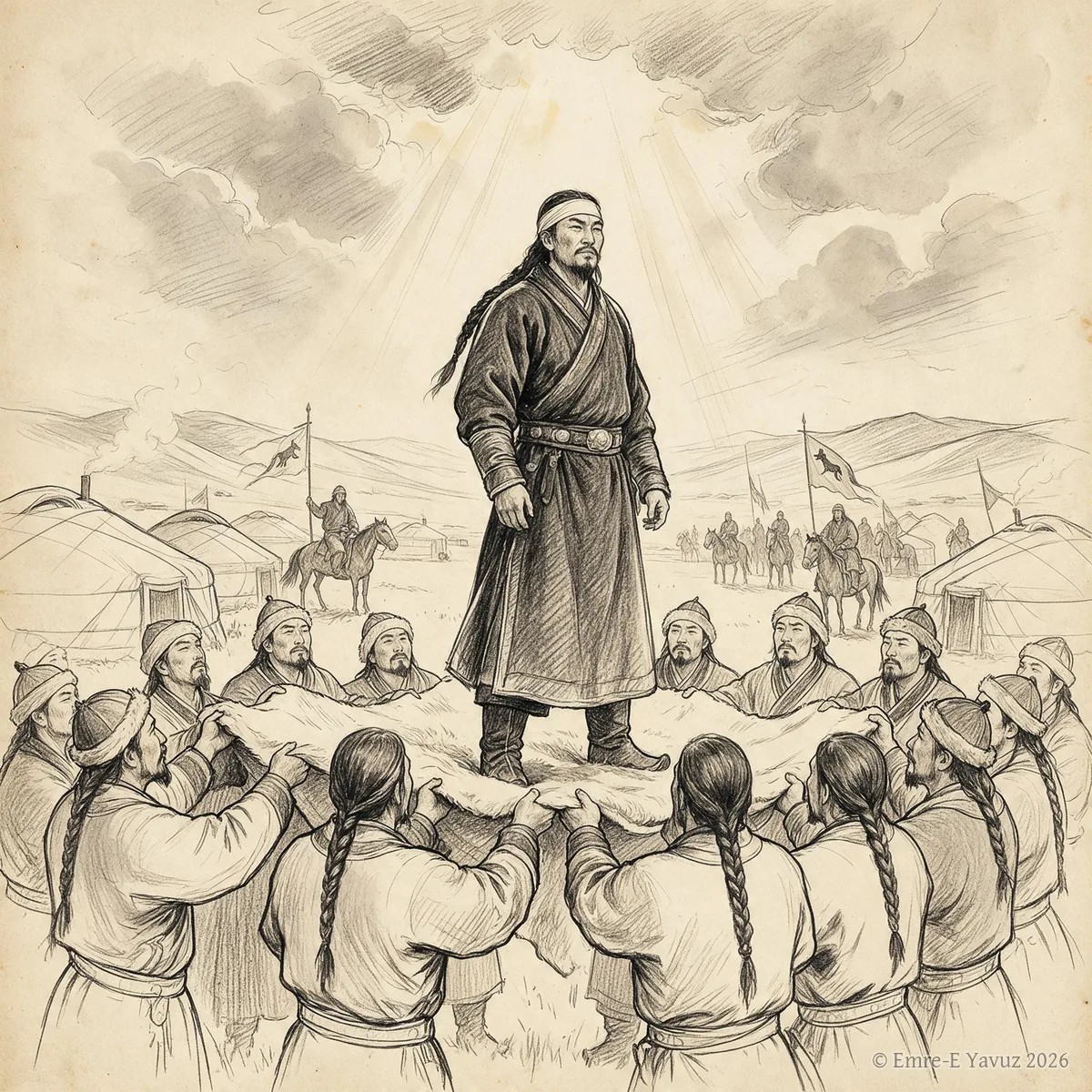
Bumin Khan in a modern portrait. © Emre-E Yavuz 2026 メイン画像 掲載先: 伊利可汗(ブミン)
-
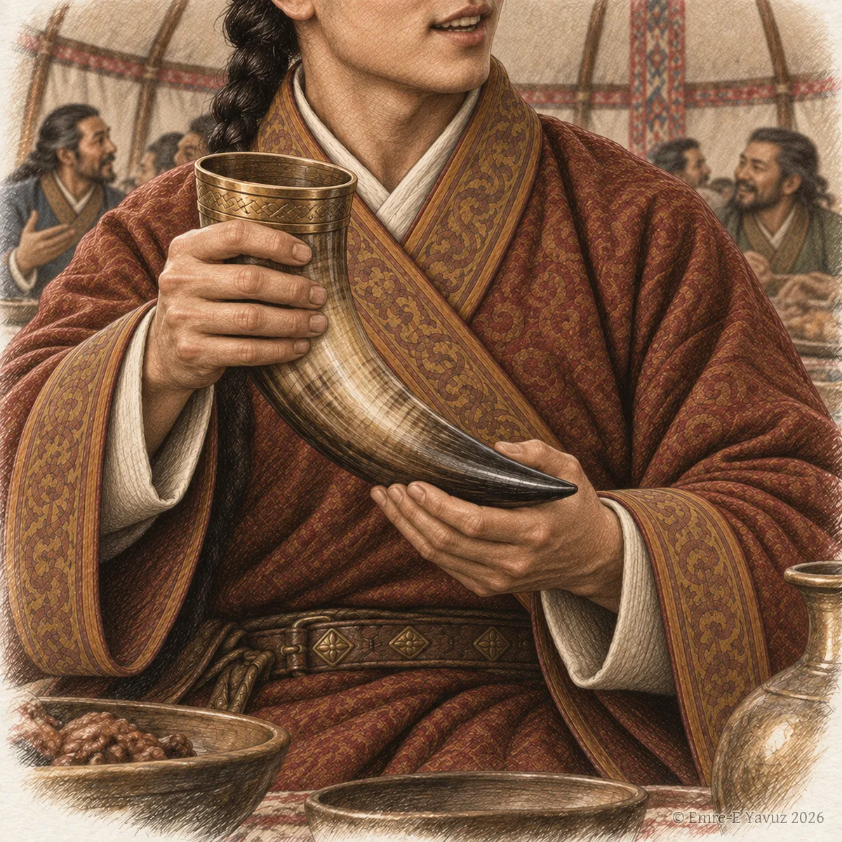
A holder of the title at a feast with a drinking horn, in a modern illustration. © Emre-E Yavuz 2026 メイン画像 掲載先: 大羅便
-
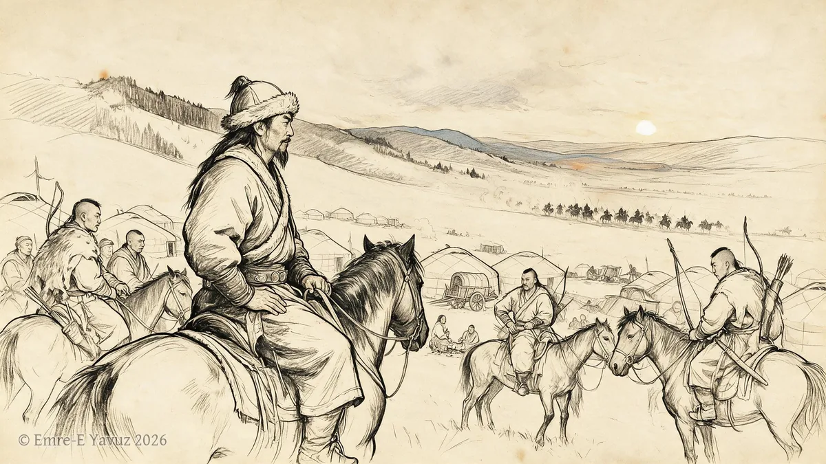
Donghu in a modern illustration. © Emre-E Yavuz 2026 メイン画像 掲載先: Donghu
-
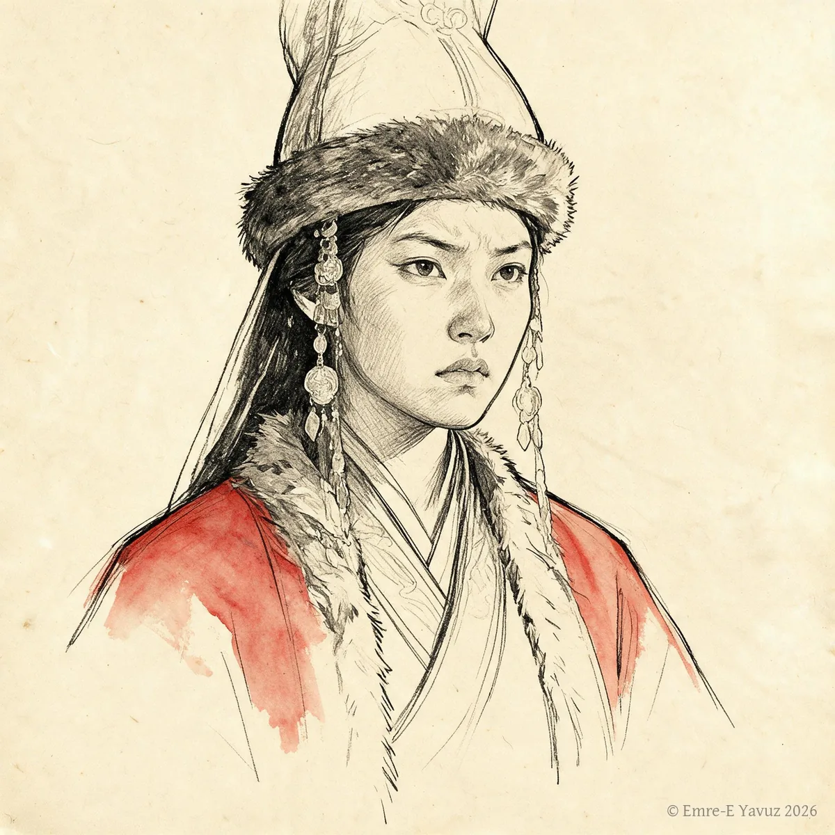
Empress Yujiulü in a modern portrait. © Emre-E Yavuz 2026 メイン画像 掲載先: 郁久閭皇后
-
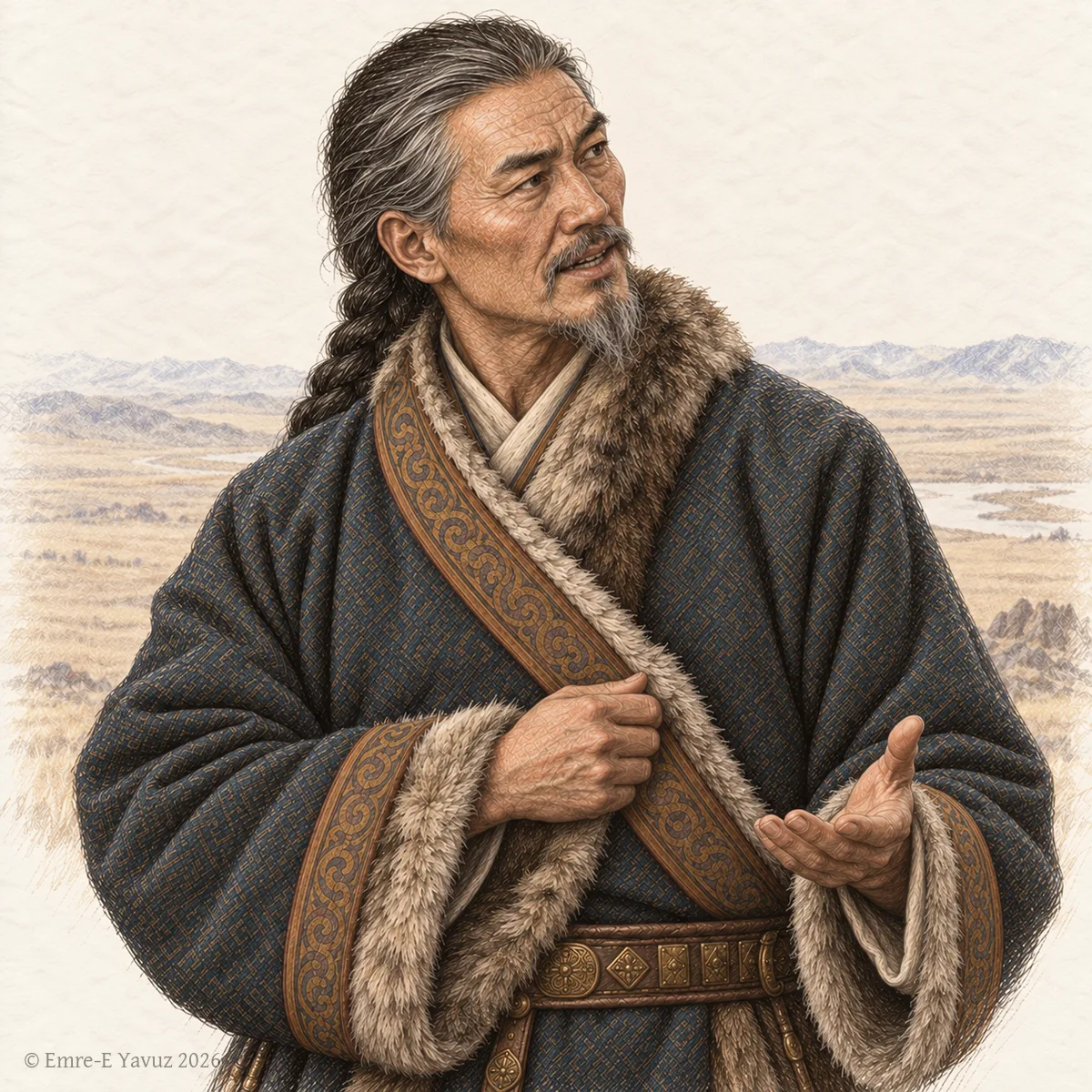
An elder officer of the khaganate in a modern illustration: the age that the title names. © Emre-E Yavuz 2026 メイン画像 掲載先: 哥利達官
-
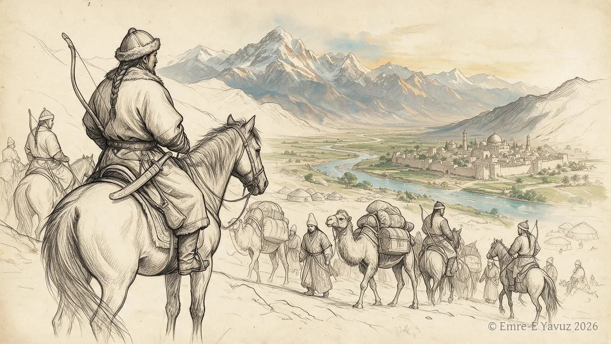
Göktürk Expansion along the Silk Road in a modern illustration. © Emre-E Yavuz 2026 メイン画像 掲載先: ギョクテュルクのシルクロード進出
-
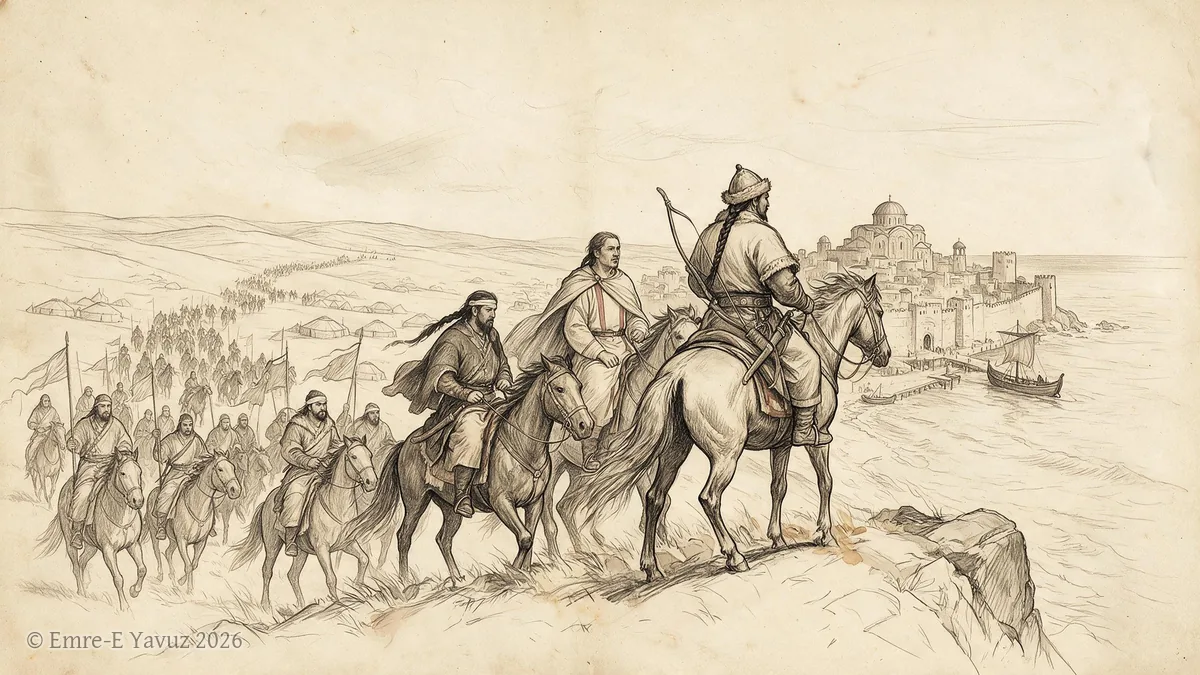
Göktürk Expansion into Europe in a modern illustration. © Emre-E Yavuz 2026 メイン画像 掲載先: ギョクテュルクのヨーロッパ進出
-
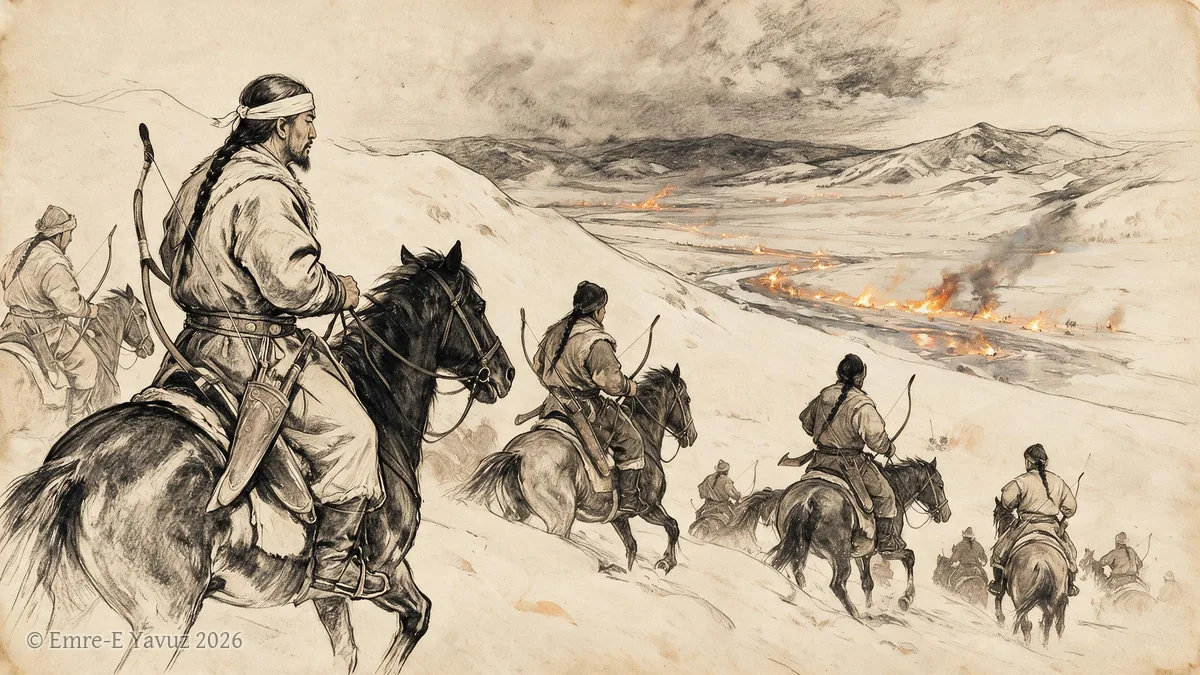
Göktürk raid of 542 in a modern illustration. © Emre-E Yavuz 2026 メイン画像 掲載先: 542年のギョクテュルクの襲撃
-
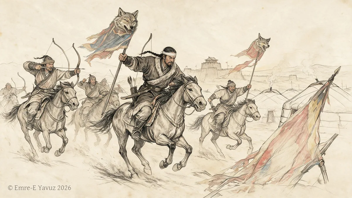
Göktürk war of restoration, 679–687 in a modern illustration. © Emre-E Yavuz 2026 メイン画像 掲載先: Göktürk war of restoration, 679–687
-
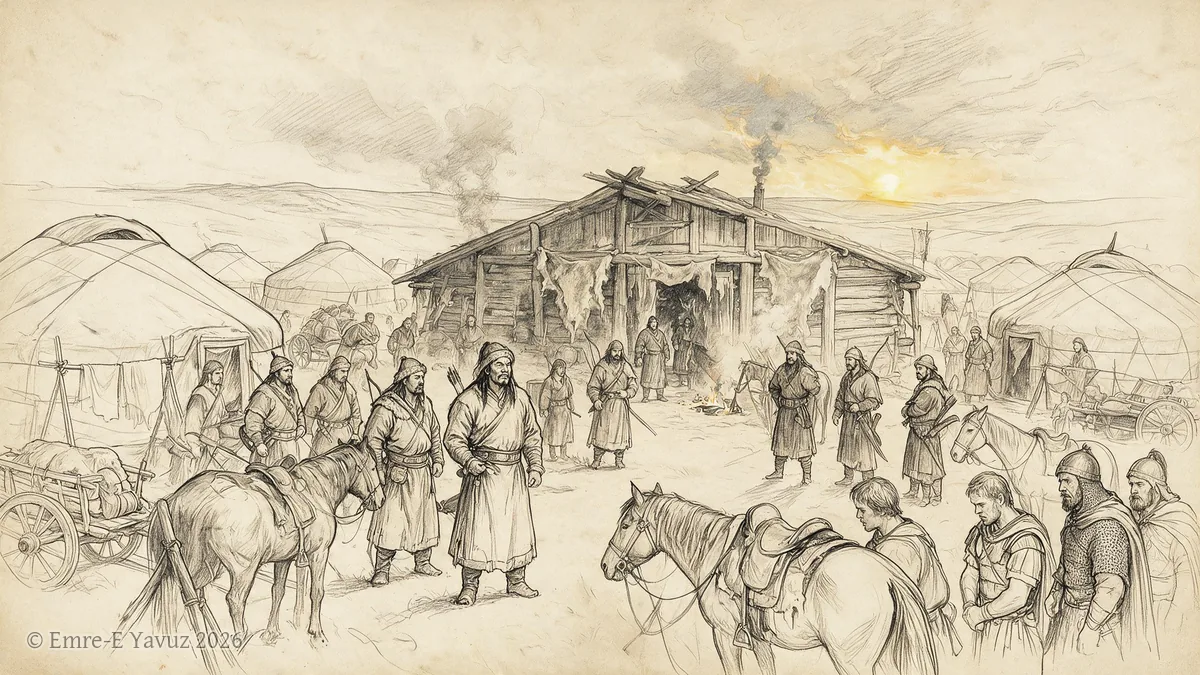
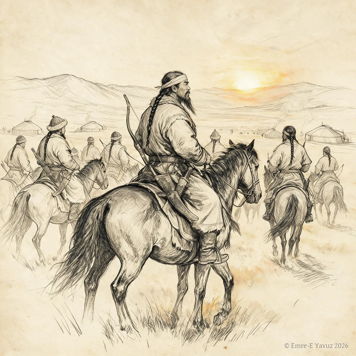
Göktürks in a modern illustration. © Emre-E Yavuz 2026 メイン画像 掲載先: ギョクテュルク
-
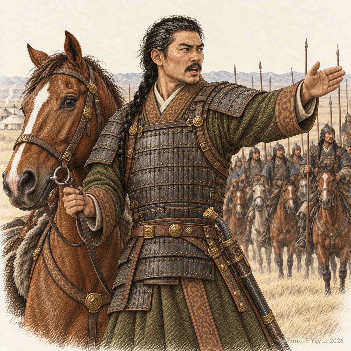
A commander with his horse before his riders, in a modern illustration: the horse and the command that the title names. © Emre-E Yavuz 2026 メイン画像 掲載先: 賀蘭蘇尼闕
-
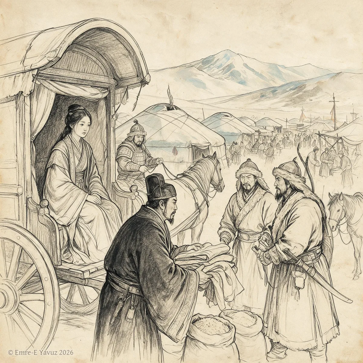
Heqin in a modern illustration. © Emre-E Yavuz 2026 メイン画像 掲載先: Heqin
-
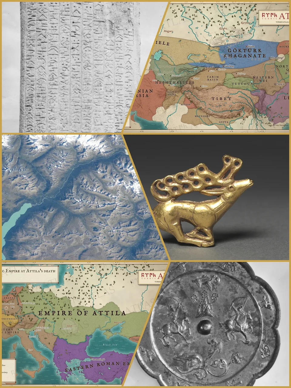
Runes of the Tonyukuk stone, the Göktürk realm in 552, the Altai from space, a Scythian gold stag, the empire of Attila in 453 and riders on a Tang bronze mirror. Photographs: G. J. Ramstedt and Sakari Pälsi, Finnish Heritage Agency (CC BY 4.0); NASA, astronaut photograph iss069e071176 (public domain); The Cleveland Museum of Art, 1985.77 (CC0); The Metropolitan Museum of Art, 25.20.3 (CC0). Maps: © Emre-E Yavuz 2026 メイン画像 掲載先: History of the Turkic peoples
-
Huhanye Chanyu in a modern portrait. © Emre-E Yavuz 2026 メイン画像 掲載先: Huhanye Chanyu
-
Huns in a modern illustration. © Emre-E Yavuz 2026 メイン画像 掲載先: フン族
-
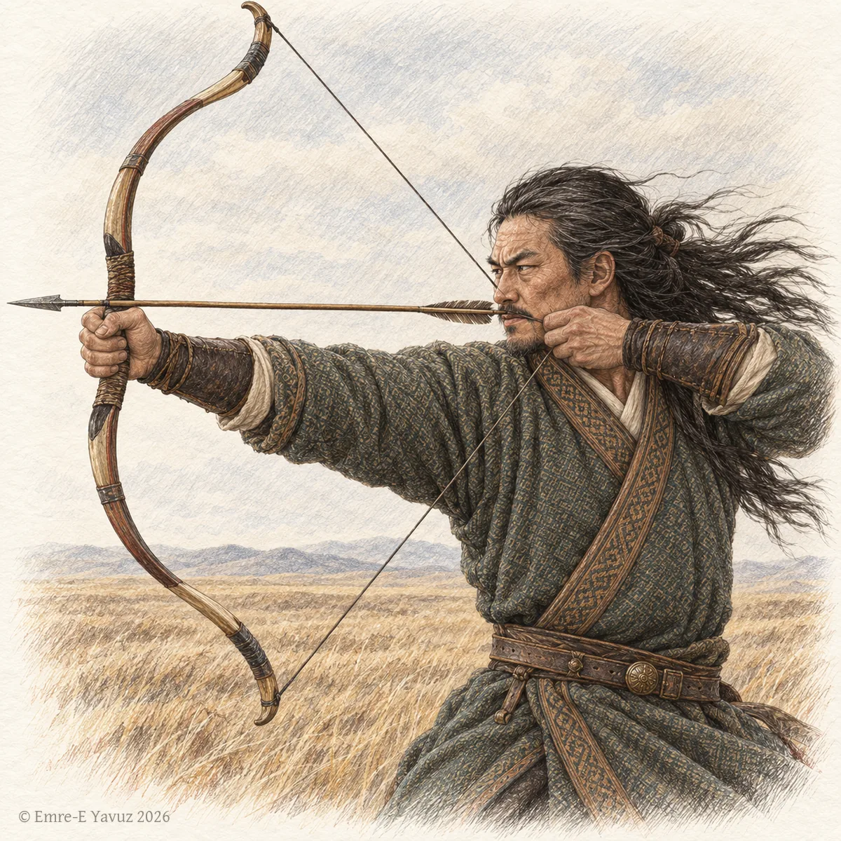
A Göktürk archer in a modern illustration: the strength and courage that the title names. © Emre-E Yavuz 2026 メイン画像 掲載先: 始波羅(称号)
-
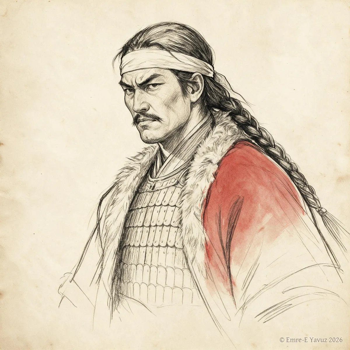
Issik Khan in a modern drawing. © Emre-E Yavuz 2026 メイン画像 掲載先: 乙息記可汗(イシク)
-

Istemi in a modern portrait. © Emre-E Yavuz 2026 メイン画像 掲載先: 室点蜜(イステミ)
-
An aged dignitary in a modern illustration: the high office that men of great age held. © Emre-E Yavuz 2026 メイン画像 掲載先: 珂羅啜
-
Khan (Khagan) in a modern illustration. © Emre-E Yavuz 2026 メイン画像 掲載先: 汗(可汗)
-
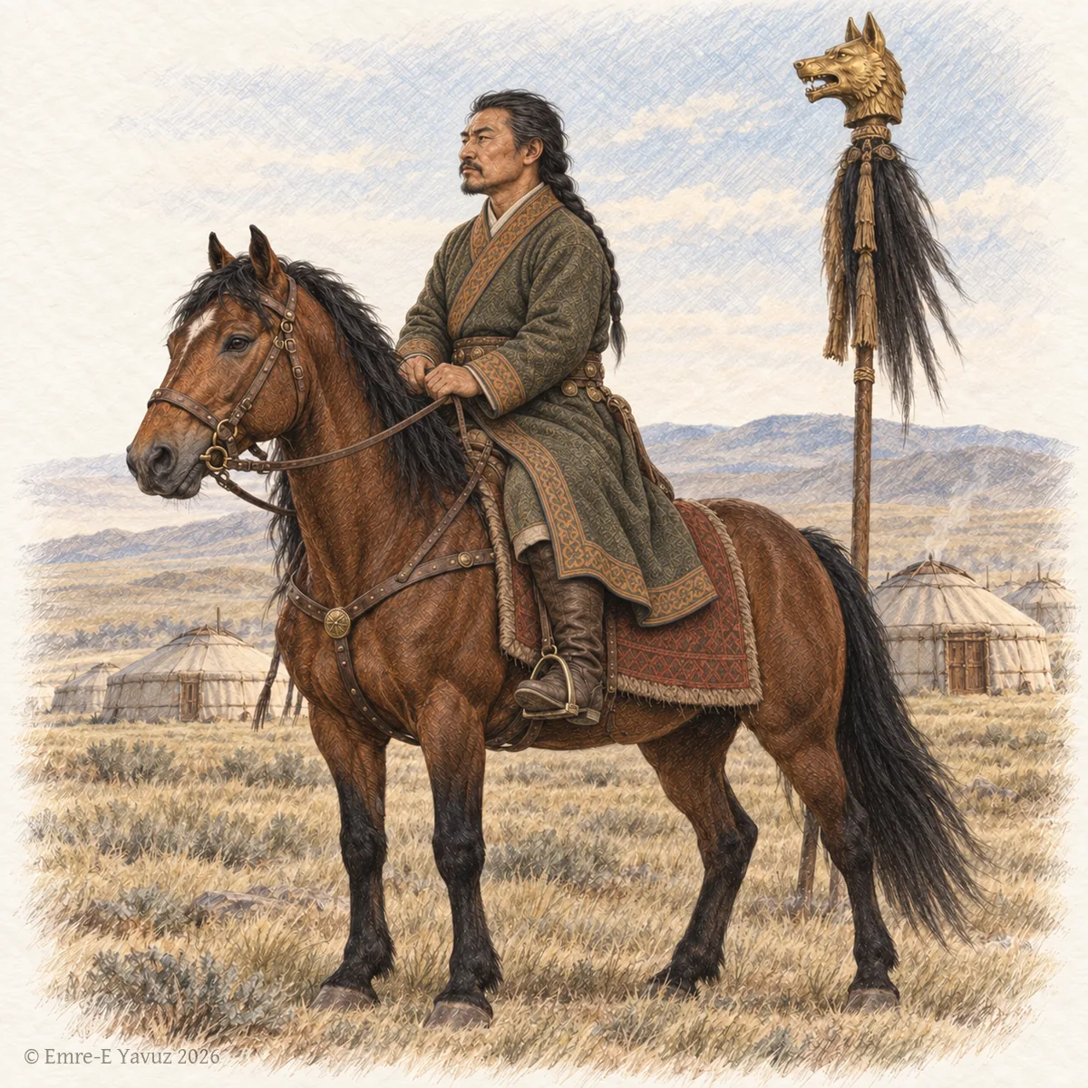
A Göktürk chur on horseback before a camp, with a golden wolf-head standard behind him, in a modern drawing. © Emre-E Yavuz 2026 メイン画像 掲載先: 屈律啜(キュリュグ・チョル)
-
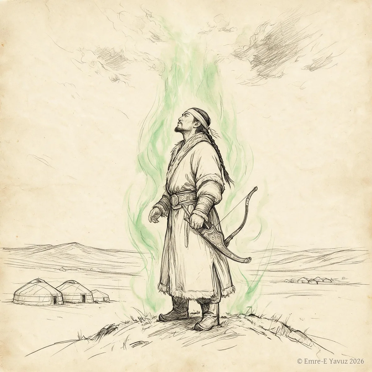
Kut in a modern illustration. © Emre-E Yavuz 2026 メイン画像 掲載先: クト
-
Kutlug Bilge Kül Khan in a modern portrait. © Emre-E Yavuz 2026 メイン画像 掲載先: Kutlug Bilge Kül Khan
-
Laoshang Chanyu in a modern portrait. © Emre-E Yavuz 2026 メイン画像 掲載先: Laoshang Chanyu
-
Loose-rein prefectures in a modern illustration. © Emre-E Yavuz 2026 メイン画像 掲載先: Loose-rein prefectures
-
Mobei campaign, 119 BC in a modern illustration. © Emre-E Yavuz 2026 メイン画像 掲載先: 漠北遠征、紀元前119年
-
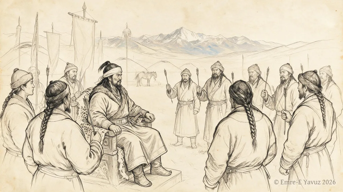
On Oq in a modern illustration. © Emre-E Yavuz 2026 メイン画像 掲載先: On Oq
-
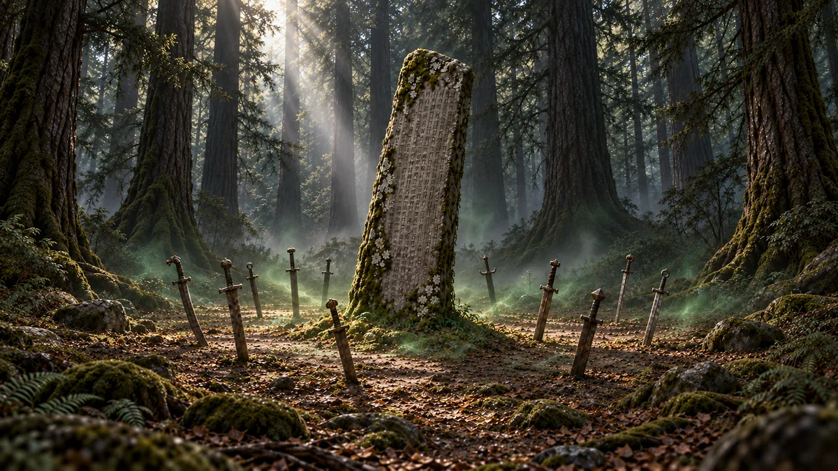
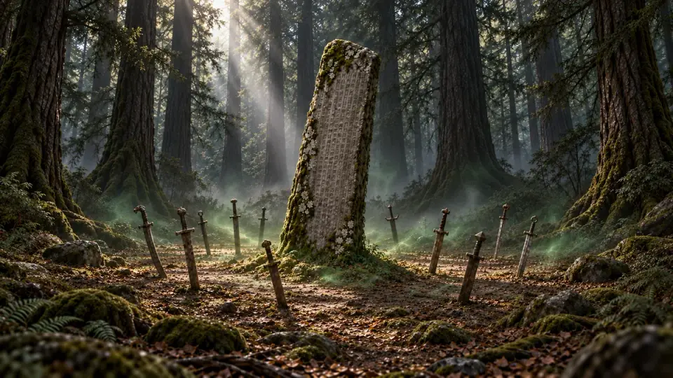
Ötüken in a modern illustration: an inscribed stele in the forested upland, with swords set upright in the ground around it. © Emre-E Yavuz 2026 メイン画像 掲載先: ウテュケン
-

A peri at a spring in a modern illustration: the shape the being takes in later Turkic storytelling, not in any source of the khaganates. © Emre-E Yavuz 2026 メイン画像 掲載先: ペリ
-
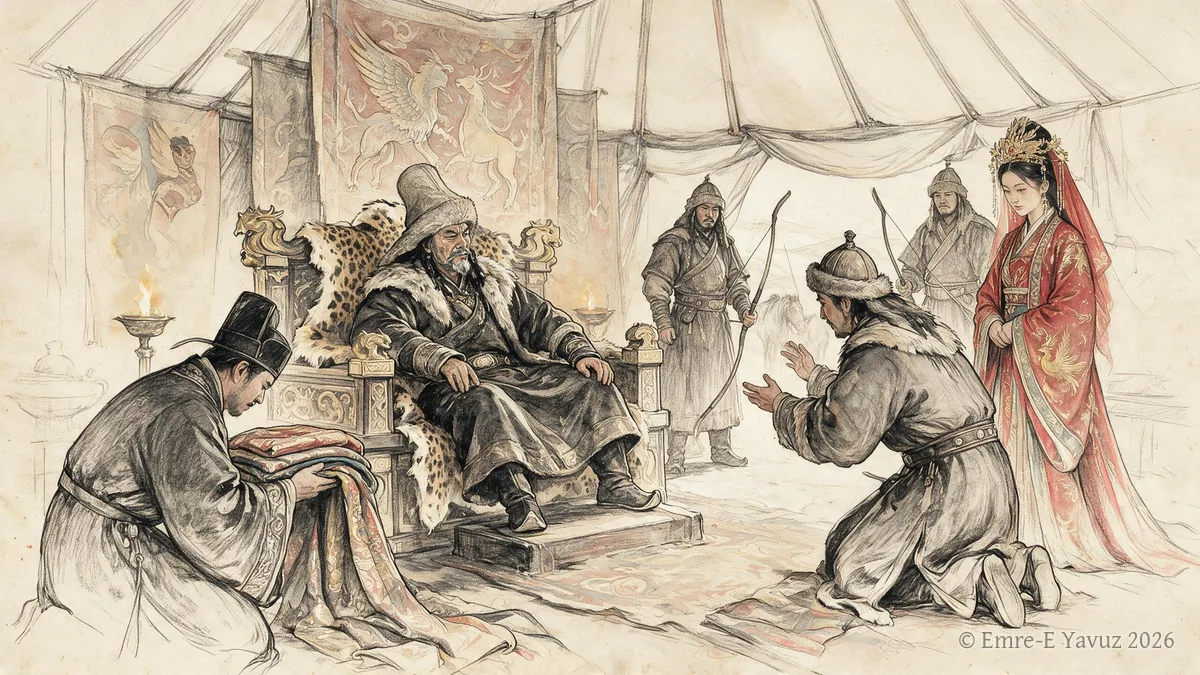
Rise of Anagui Khan in a modern illustration. © Emre-E Yavuz 2026 メイン画像 掲載先: 阿那瓌の台頭
-
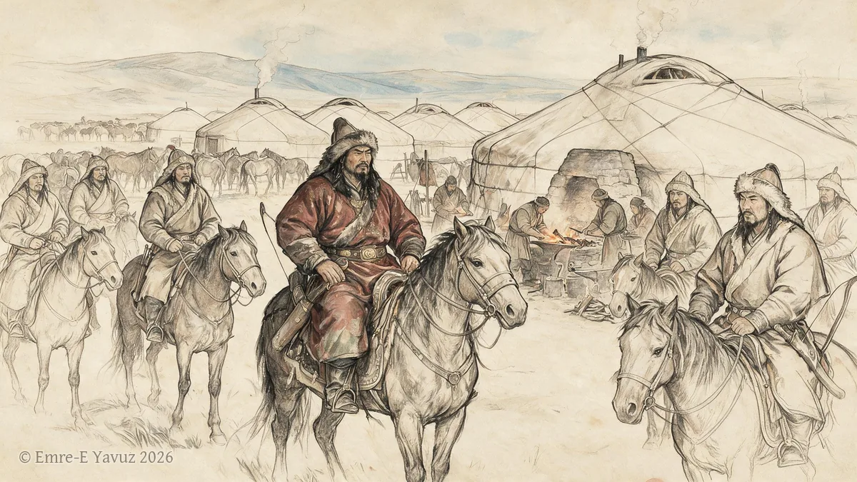
Rouran in a modern illustration. © Emre-E Yavuz 2026 メイン画像 掲載先: Rouran
-
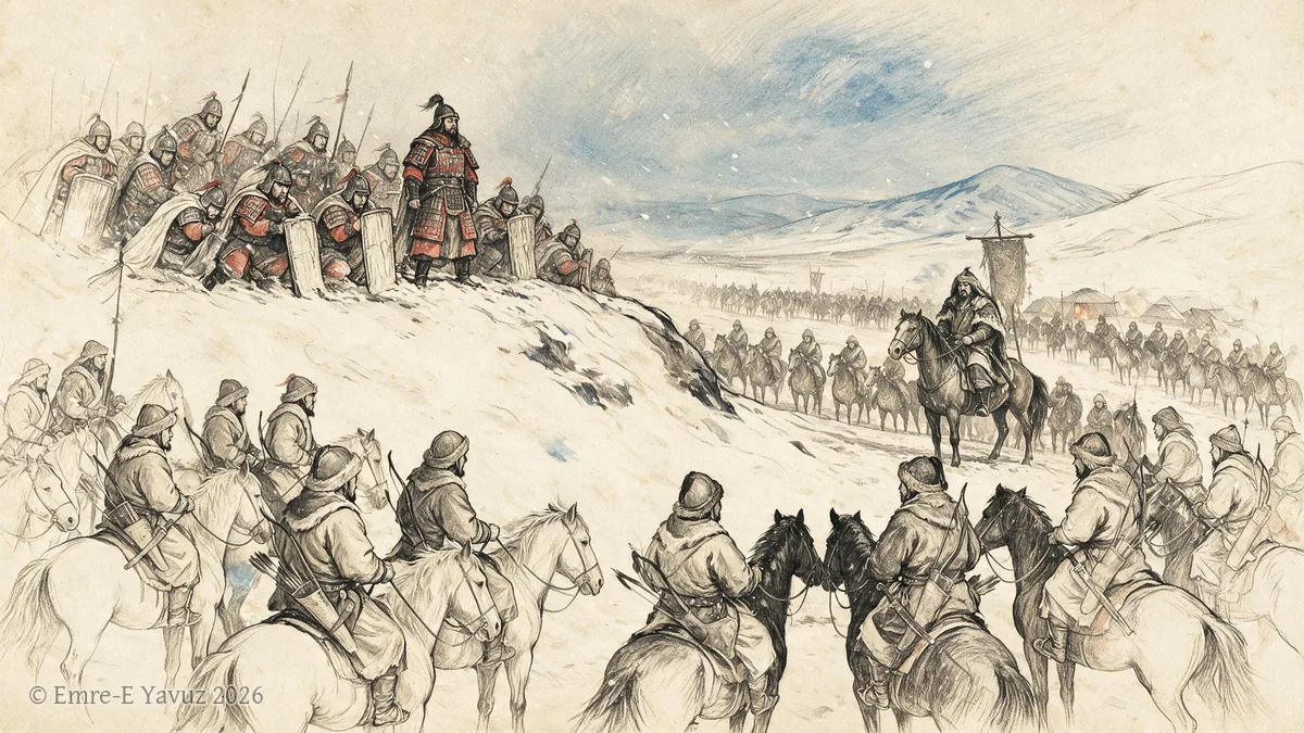
Siege of Baideng in a modern illustration. © Emre-E Yavuz 2026 メイン画像 掲載先: 白登包囲
-
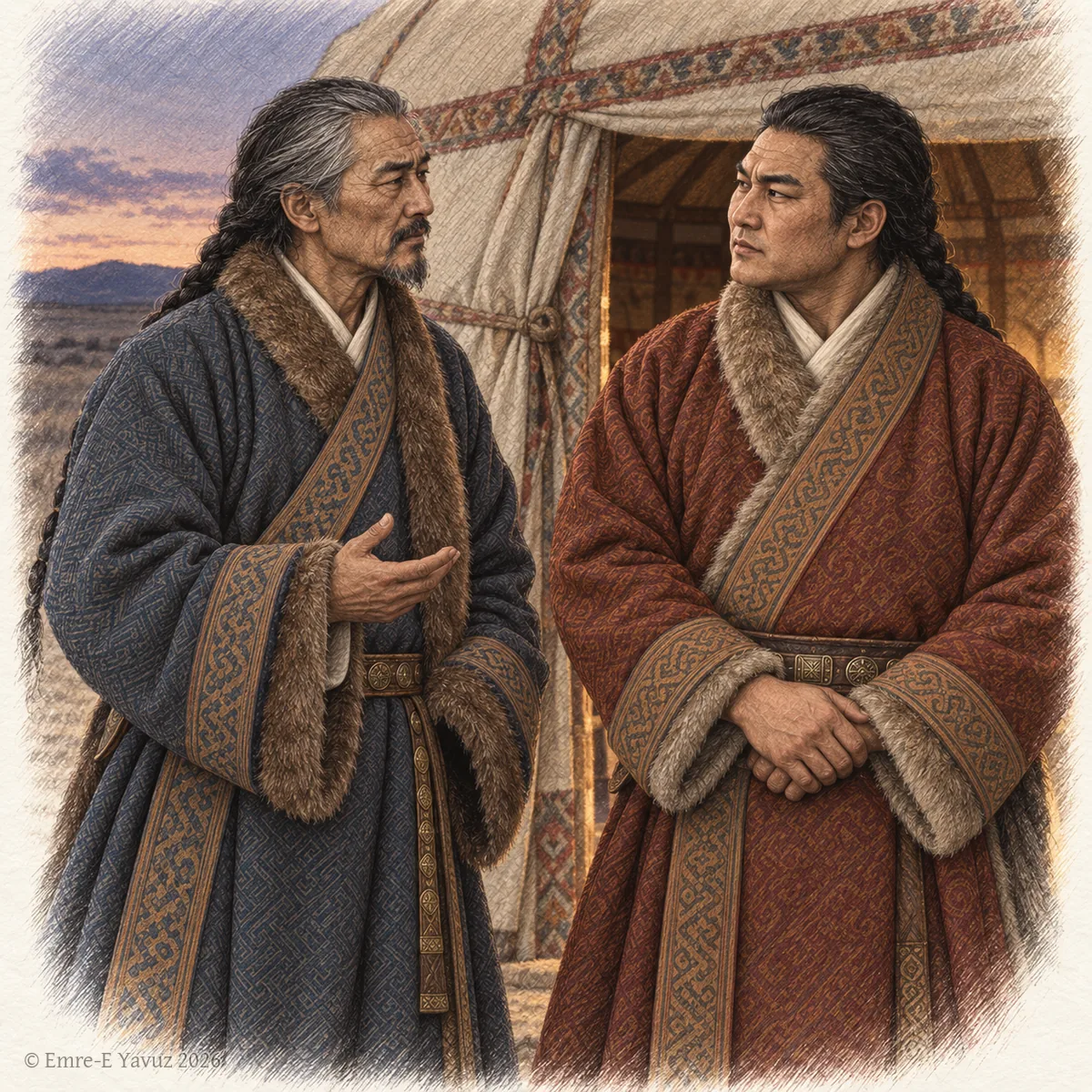
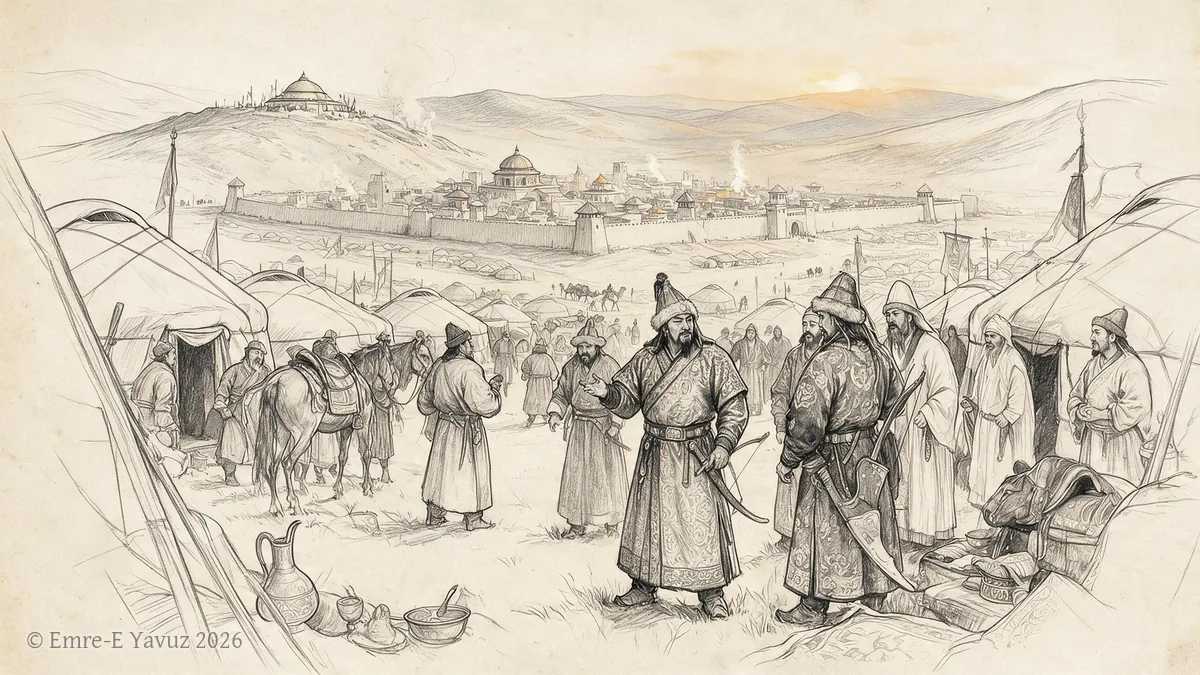
Two Göktürk dignitaries in conversation at the entrance of a felt tent at dusk, in a modern drawing. © Emre-E Yavuz 2026 メイン画像 掲載先: 俟発
-
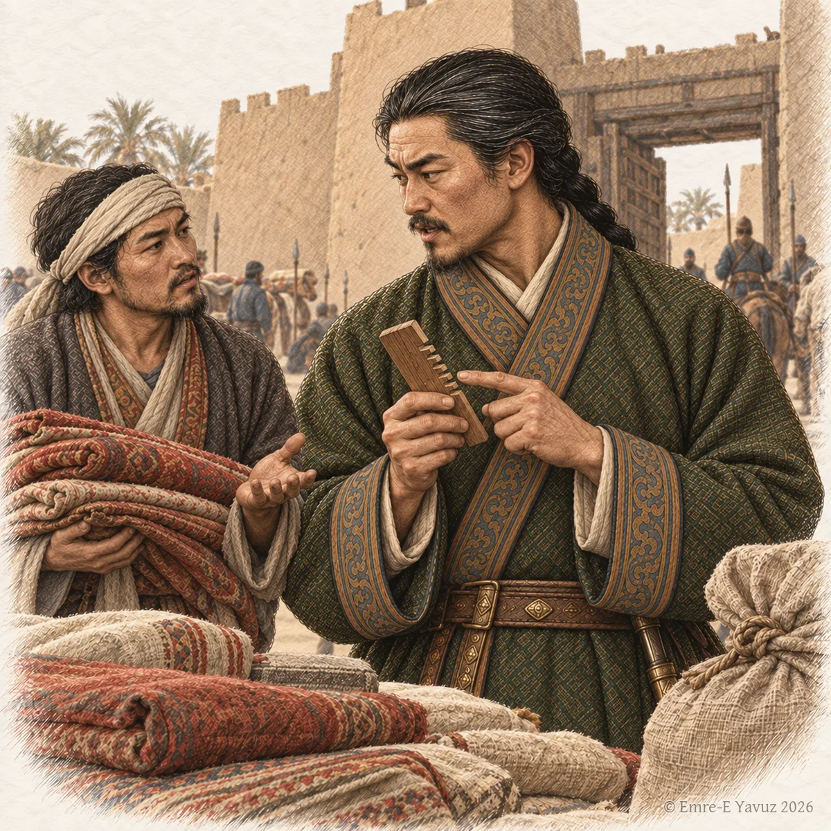
An officer with a comb at a walled market town, in a modern illustration: the hair of the title's name and the office likened to a prefect's. © Emre-E Yavuz 2026 メイン画像 掲載先: 索葛吐屯
-
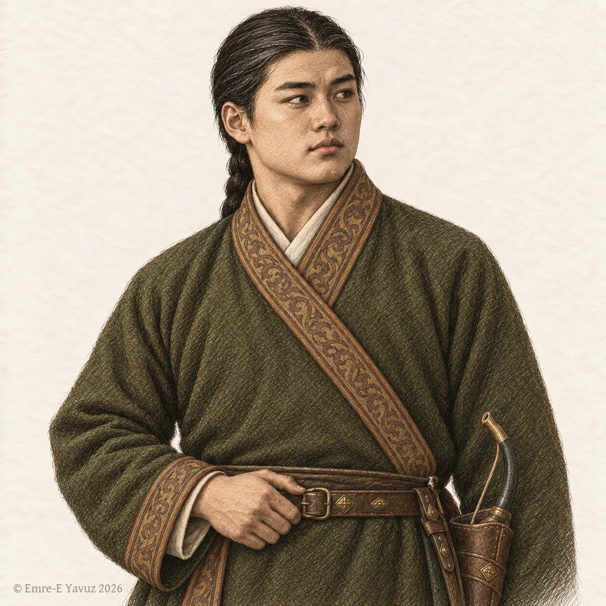
A young Göktürk prince, a tegin, in a modern drawing. © Emre-E Yavuz 2026 メイン画像 掲載先: テギン(特勤)
-
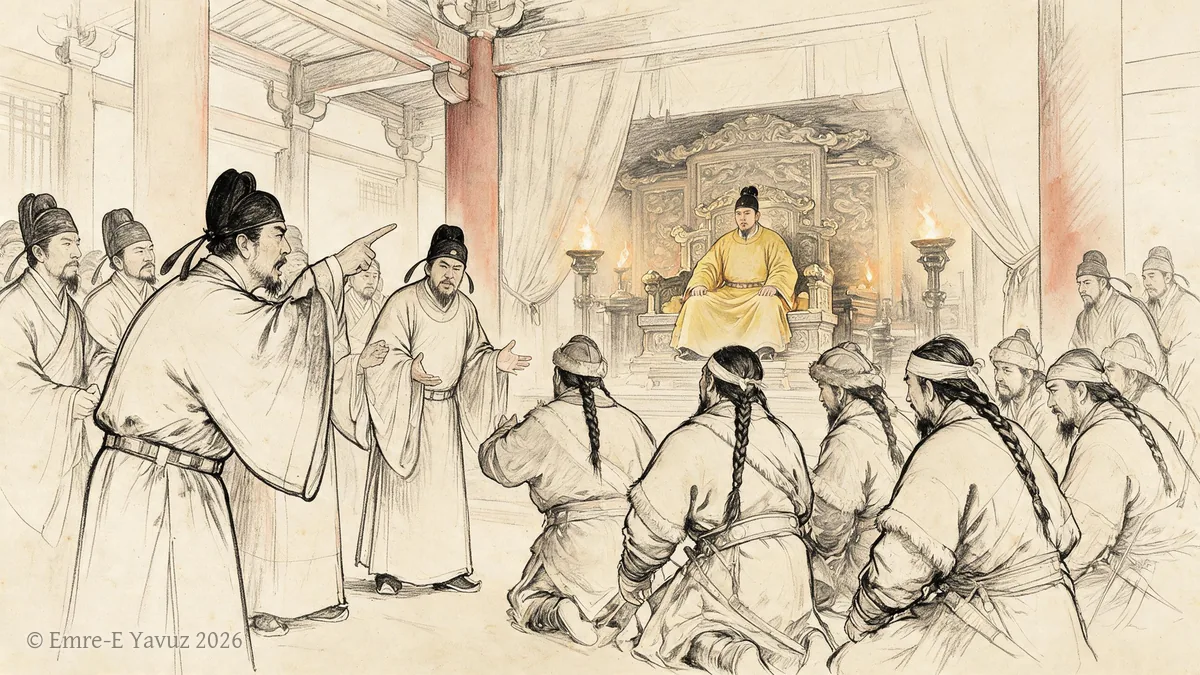
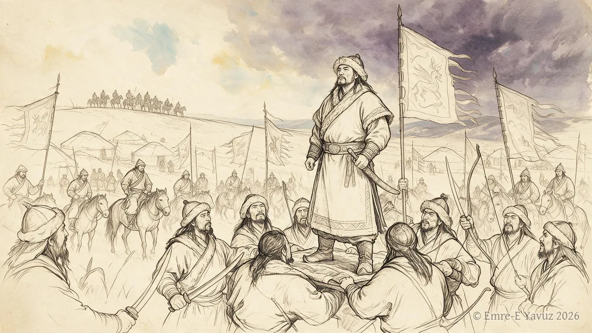
The Court Debate of 630 in a modern illustration. © Emre-E Yavuz 2026 メイン画像 掲載先: 630年の廷議
-
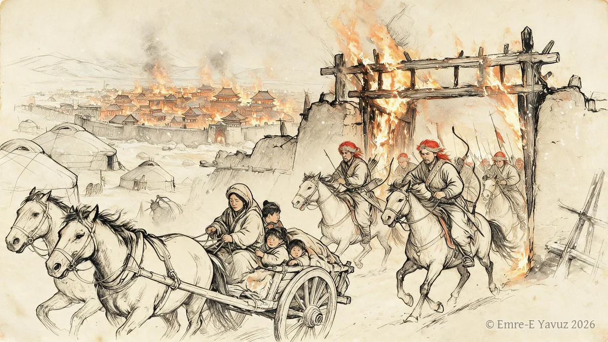
The fall of Ordu-Balık, 840 in a modern illustration. © Emre-E Yavuz 2026 メイン画像 掲載先: オルドゥ・バリクの陥落、840年
-
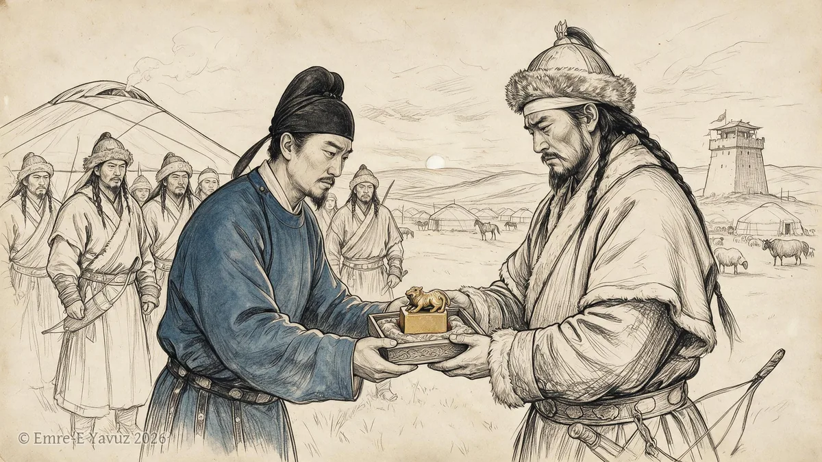
The Göktürk interregnum, 630–682 in a modern illustration. © Emre-E Yavuz 2026 メイン画像 掲載先: ギョクテュルクの空位期(630–682年)
-
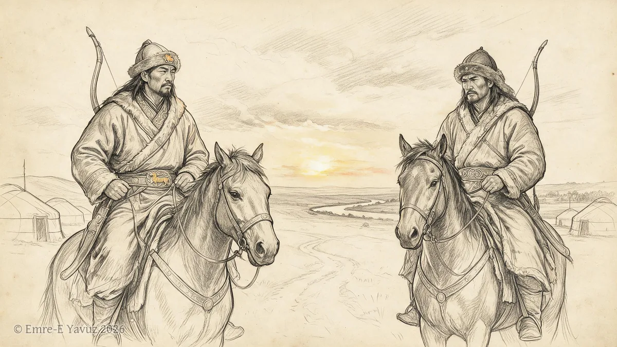
The Huns and the Xiongnu in a modern illustration. © Emre-E Yavuz 2026 メイン画像 掲載先: フン族と匈奴
-
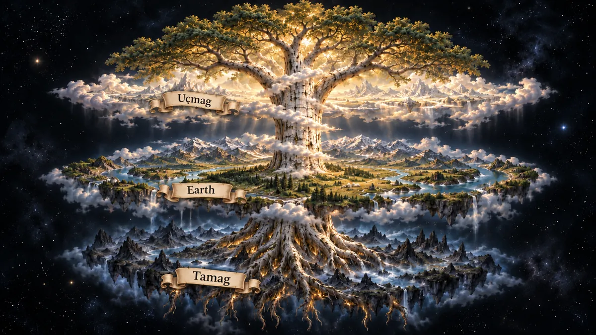
The tiered cosmos in a modern illustration: Uçmag above, the earth in the middle, Tamag below, the world tree through all three. © Emre-E Yavuz 2026 メイン画像 掲載先: 三つの世界
-
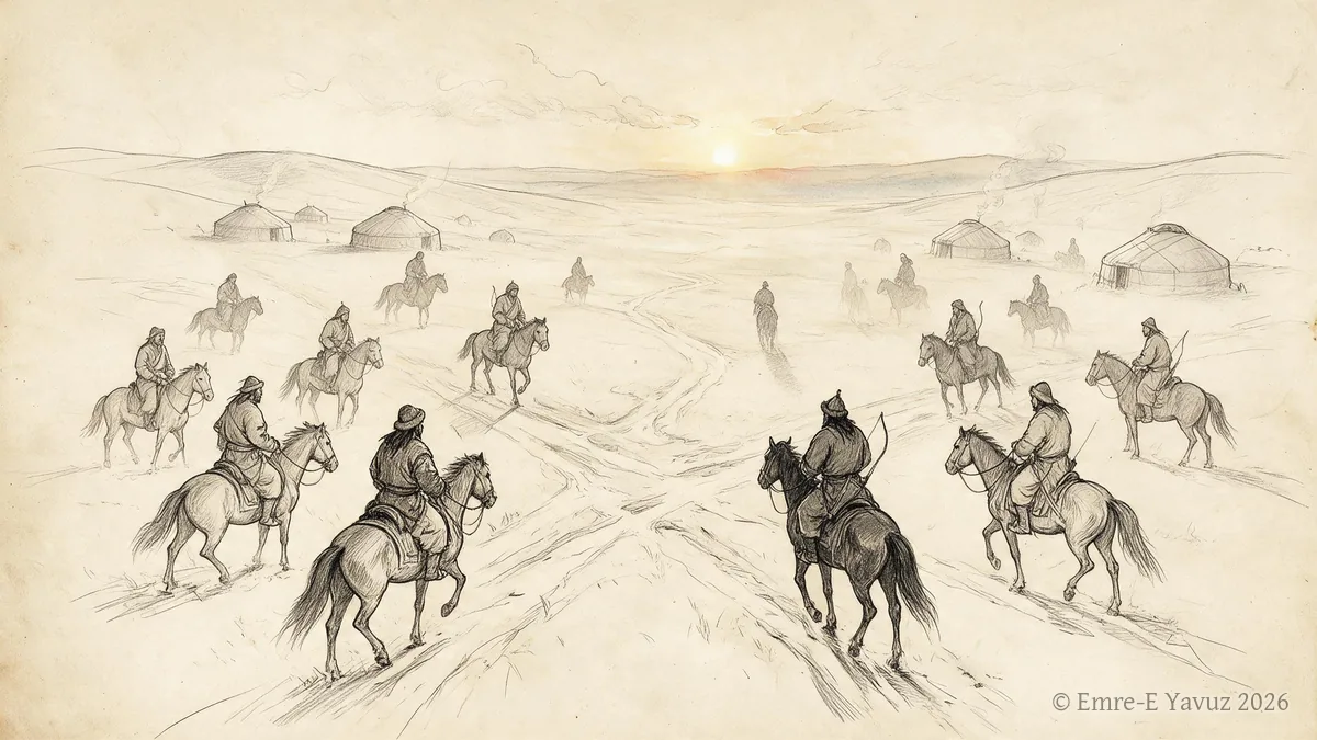
The Turkic ethnogenesis debate in a modern illustration. © Emre-E Yavuz 2026 メイン画像 掲載先: テュルク民族起源論争
-
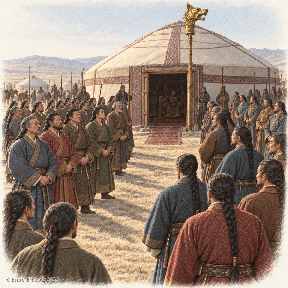
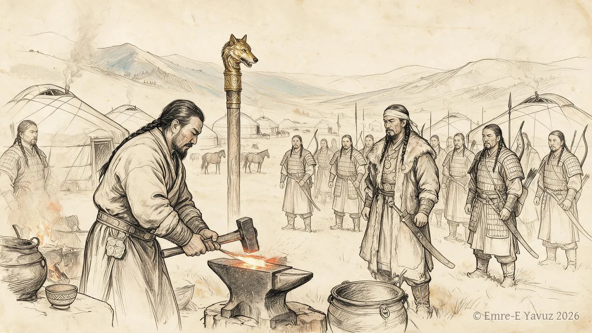
The officers of the khaganate before the khan's tent in a modern illustration, beneath the standard with the golden wolf's head. © Emre-E Yavuz 2026 メイン画像 掲載先: 二十八等
-
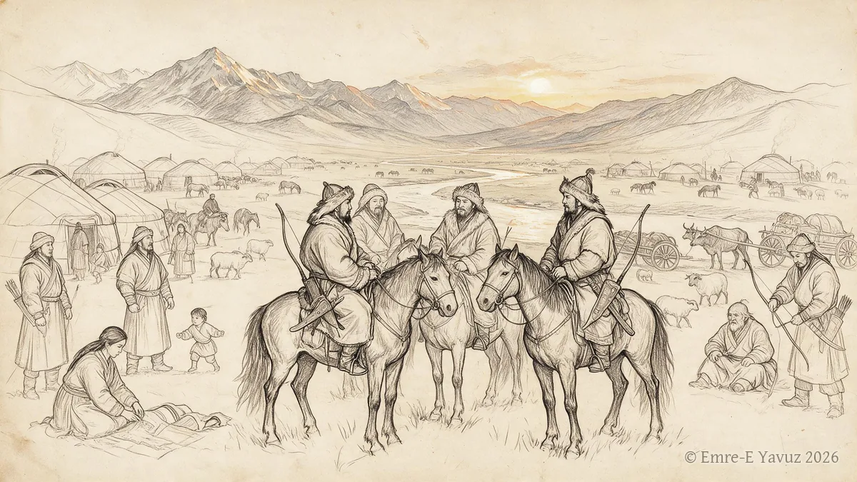
Tiele in a modern illustration. © Emre-E Yavuz 2026 メイン画像 掲載先: 鉄勒
-
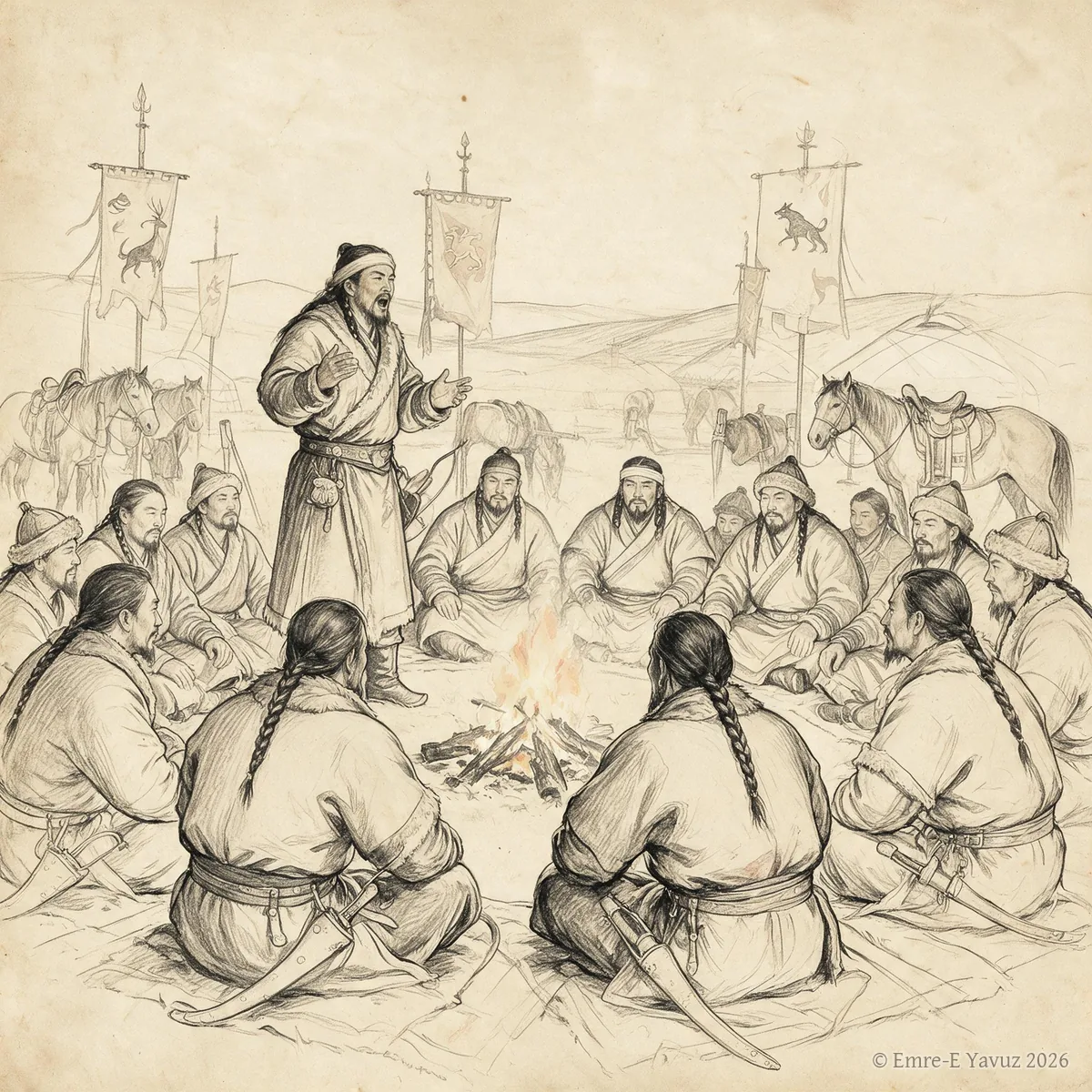
Töre in a modern illustration. © Emre-E Yavuz 2026 メイン画像 掲載先: テョレ
-
Toy in a modern illustration. © Emre-E Yavuz 2026 メイン画像 掲載先: トイ
-

Ulukayın in a modern illustration: the birch at the centre of the world, its crown among the stars. © Emre-E Yavuz 2026 メイン画像 掲載先: ウルカヤン(テュルクの世界樹)
-
Uyghur Khaganate in a modern illustration. © Emre-E Yavuz 2026 メイン画像 掲載先: ウイグル可汗国
-
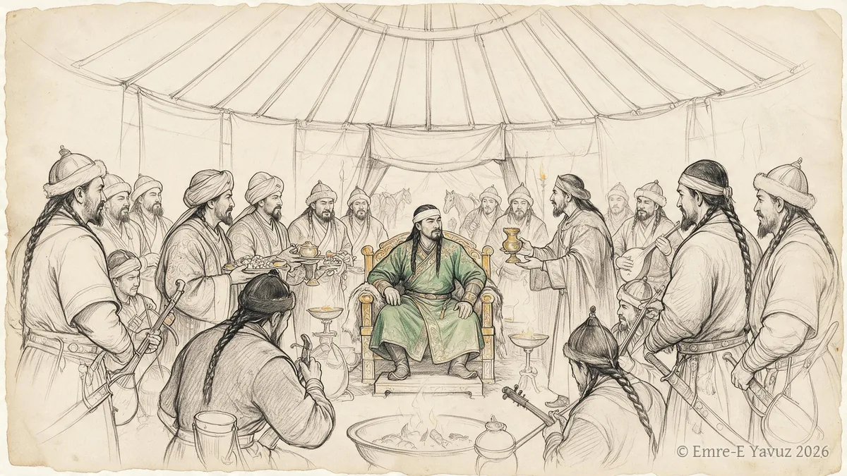
Western Göktürk Khaganate in a modern illustration. © Emre-E Yavuz 2026 メイン画像 掲載先: 西ギョクテュルク可汗国
-
Xianbei in a modern illustration. © Emre-E Yavuz 2026 メイン画像 掲載先: Xianbei
-
Xiongnu split of 48 in a modern illustration. © Emre-E Yavuz 2026 メイン画像 掲載先: 48年の匈奴の分裂
-
Yabgu in a modern illustration. © Emre-E Yavuz 2026 メイン画像 掲載先: 葉護
-
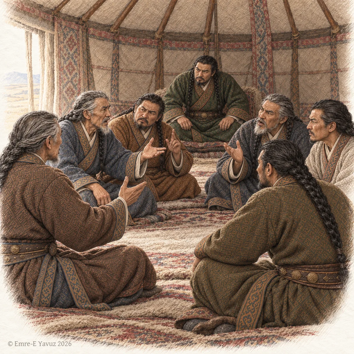
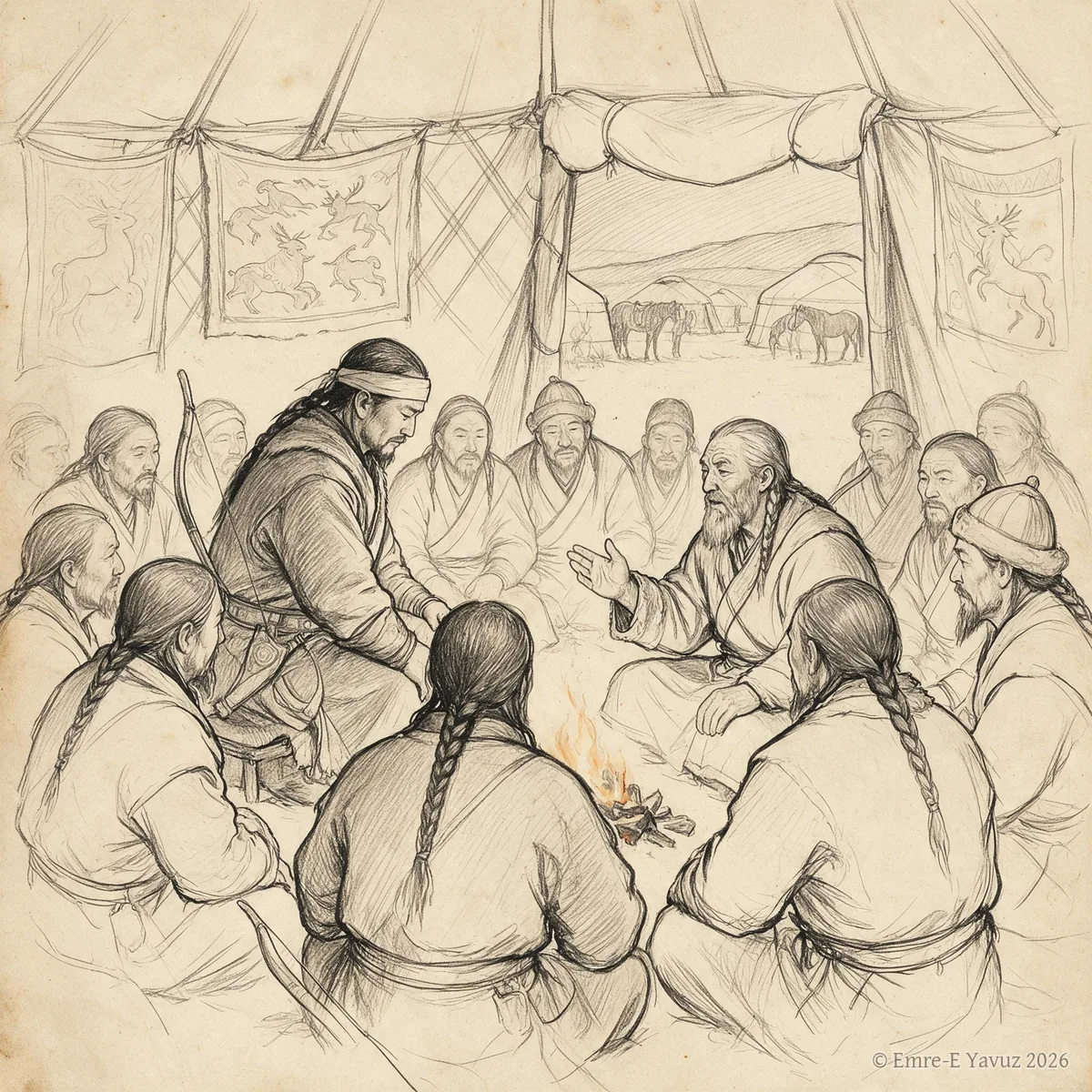
Elders of the western Göktürks in council inside a felt tent, the khan listening at the back, in a modern drawing. © Emre-E Yavuz 2026 メイン画像 掲載先: 閻洪達
-
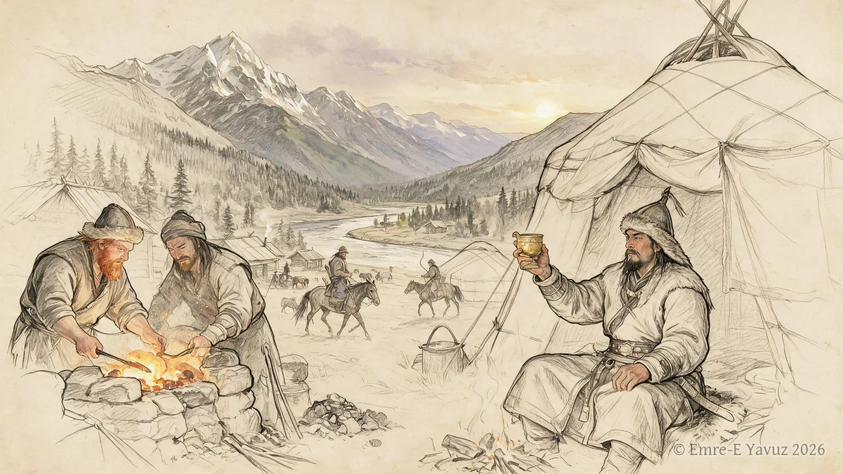
Yenisei Kirghiz in a modern illustration. © Emre-E Yavuz 2026 メイン画像 掲載先: Yenisei Kirghiz
-
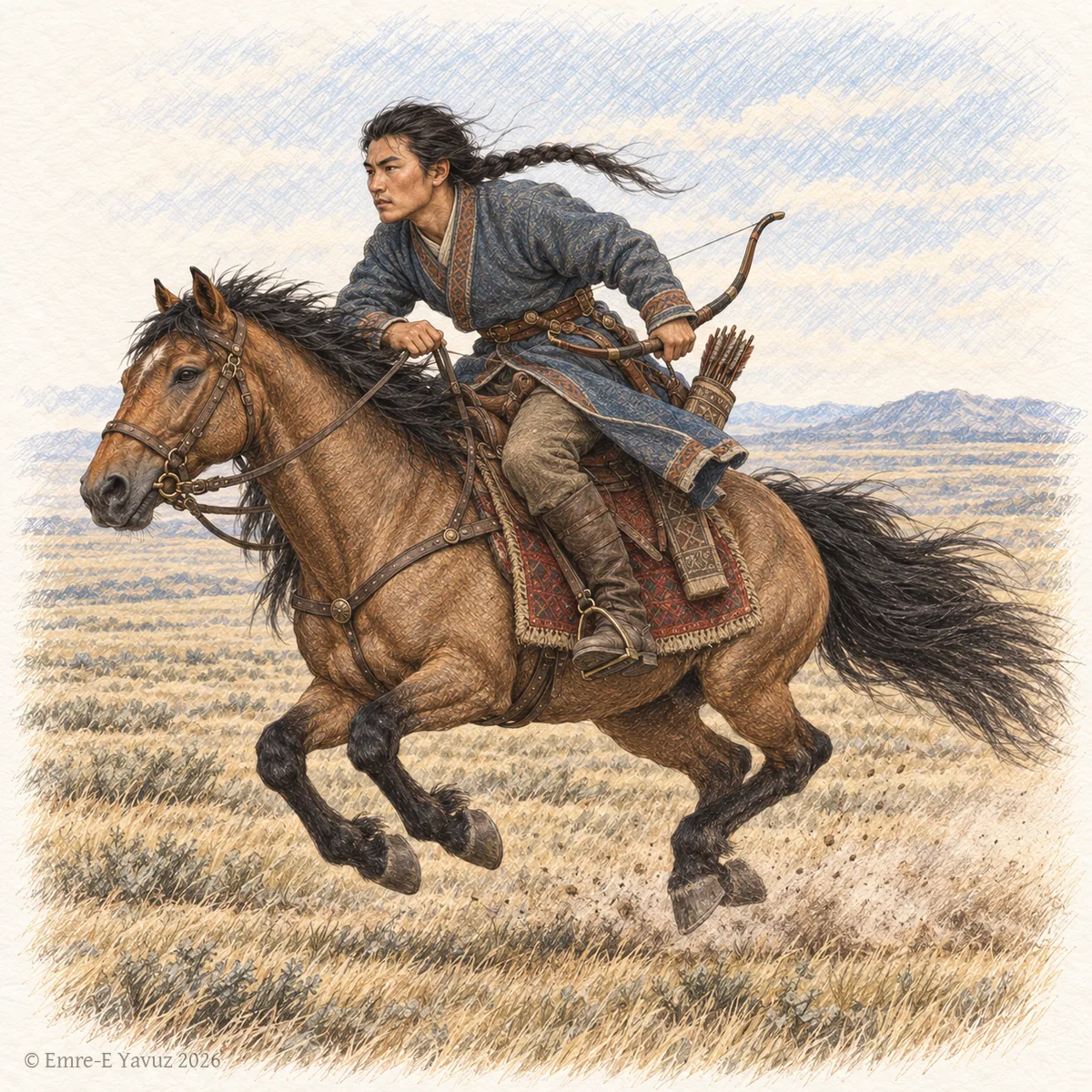
A Göktürk rider at the gallop in a modern illustration: the bravery and strength that the word names. © Emre-E Yavuz 2026 メイン画像 掲載先: 英賀弗
-
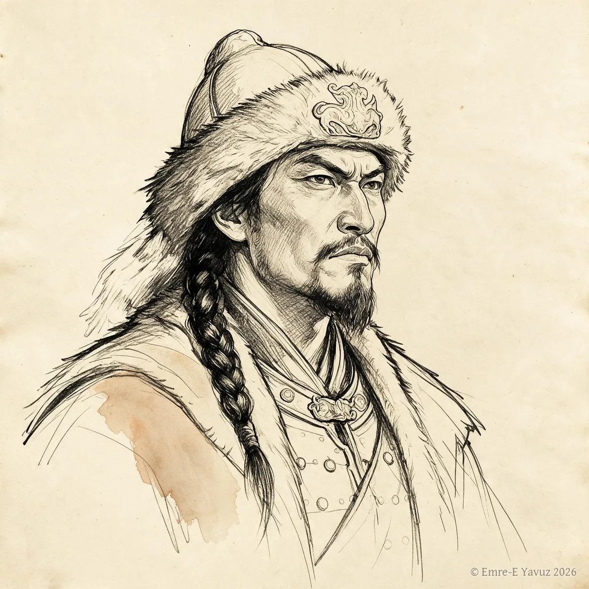
Zhizhi Chanyu in a modern portrait. © Emre-E Yavuz 2026 メイン画像 掲載先: Zhizhi Chanyu
-
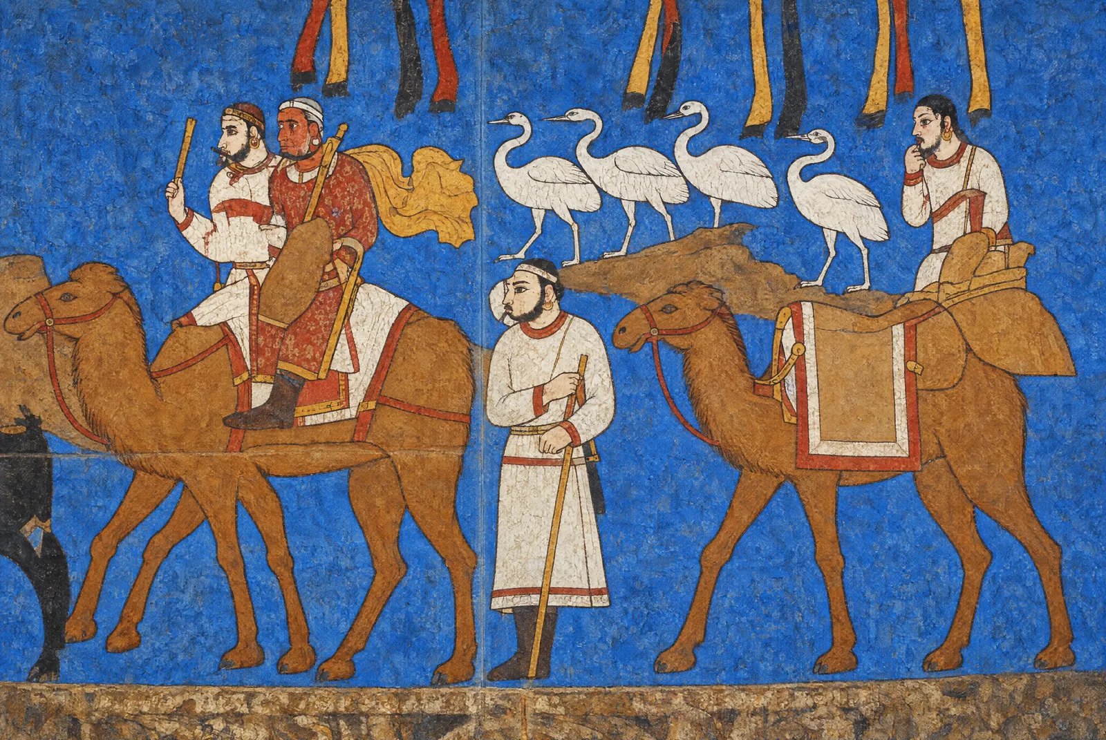
Riders on camels, a line of white birds and a standing man in the procession on the south wall of the Hall of the Ambassadors, seventh century: the painting as it survives, and the same section in an original artistic reconstruction for the atlas, after the photograph. The reconstruction restores the faded colours and fills the losses of plaster. What it paints into the losses, the saddled camel on the right among them, is conjecture. Photograph: Carole Raddato, CC BY-SA 2.0. Reconstruction: original artistic rendering for the atlas after this photograph, 2026, CC BY-SA 2.0. 本文中 掲載先: Afrasiab paintings
-
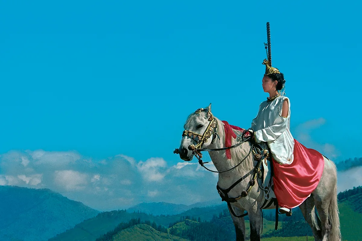
A rider in a modern reconstruction of the dress of the Pazyryk barrows: the tall headdress, the light blouse and the red skirt. A staged photograph of the present day, not a find. 本文中 掲載先: アルタイ
-
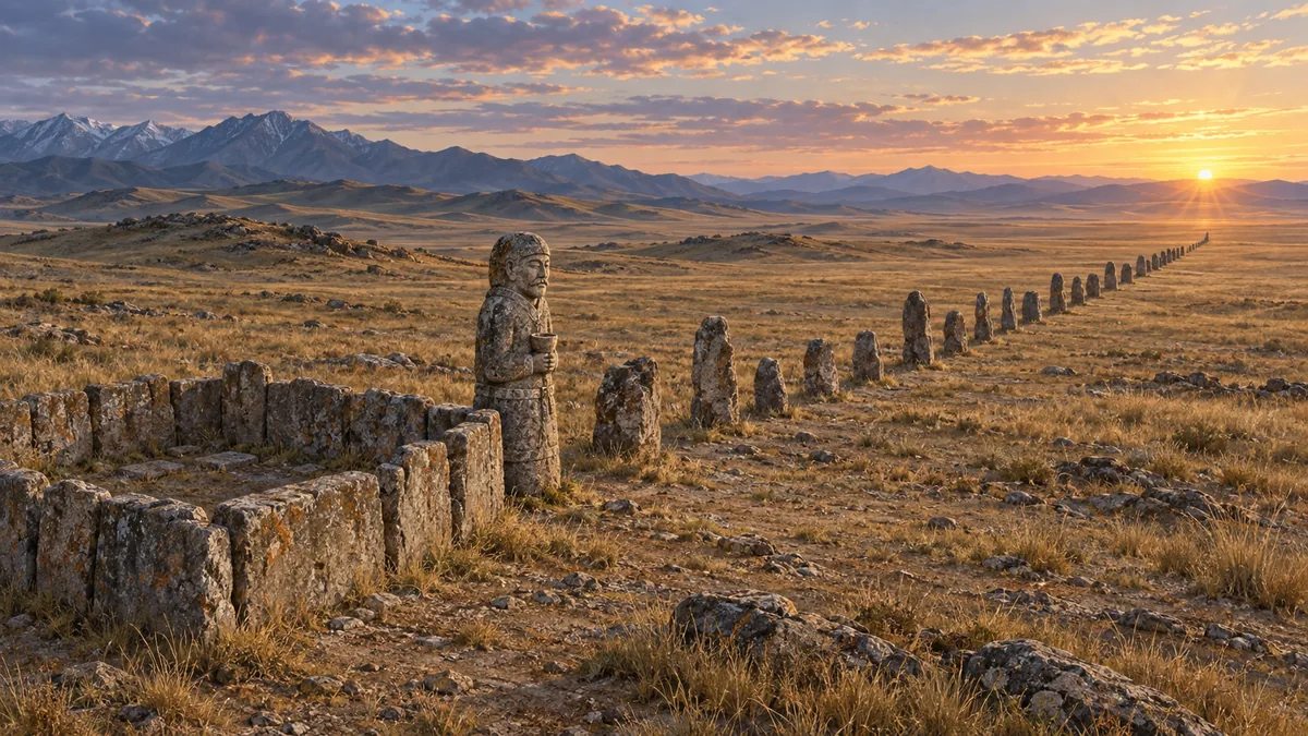
A memorial enclosure in an original artistic rendering for the atlas: the setting of stone slabs, the carved figure with the cup at the chest, and the line of balbals running east toward the sunrise. It shows no particular site. © Emre-E Yavuz 2026 本文中 掲載先: 埋葬とバルバル
-
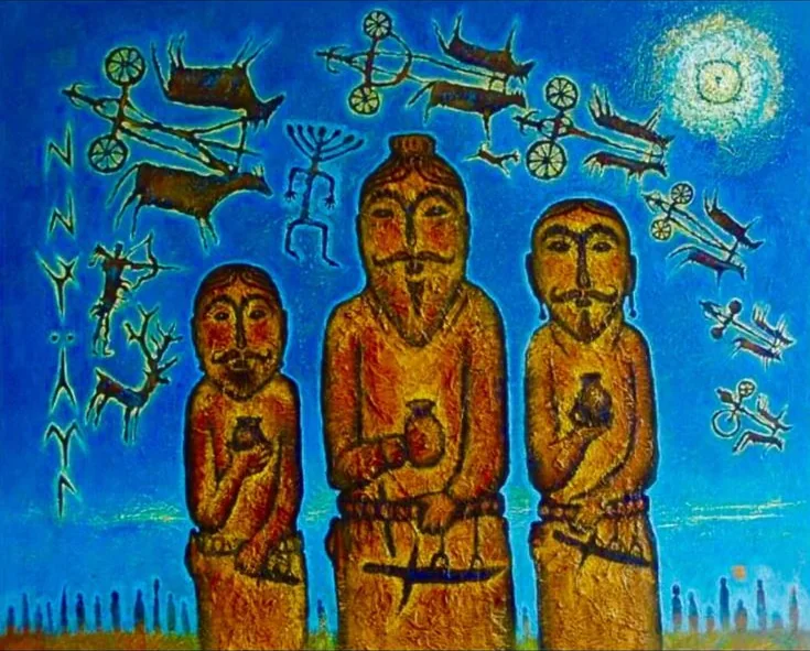
Three carved figures with cups at the chest and daggers at the belt, in a modern painting. Behind them the painter has set chariots, deer and an archer in the manner of steppe rock art, and signs in the manner of Old Turkic runes; a line of stones runs along the horizon. 本文中 掲載先: 埋葬とバルバル
-
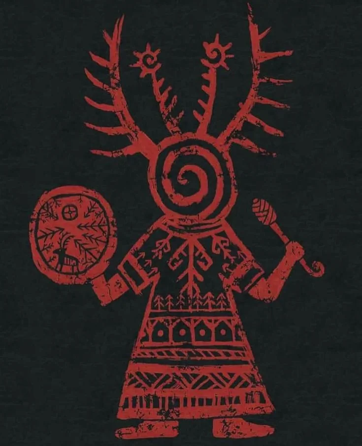
A kam with drum and beater, in a modern graphic in red on black: an antlered headdress, a spiral in place of the face, and a drum marked with a deer and trees. 本文中 掲載先: カム(テュルクのシャーマン)
-
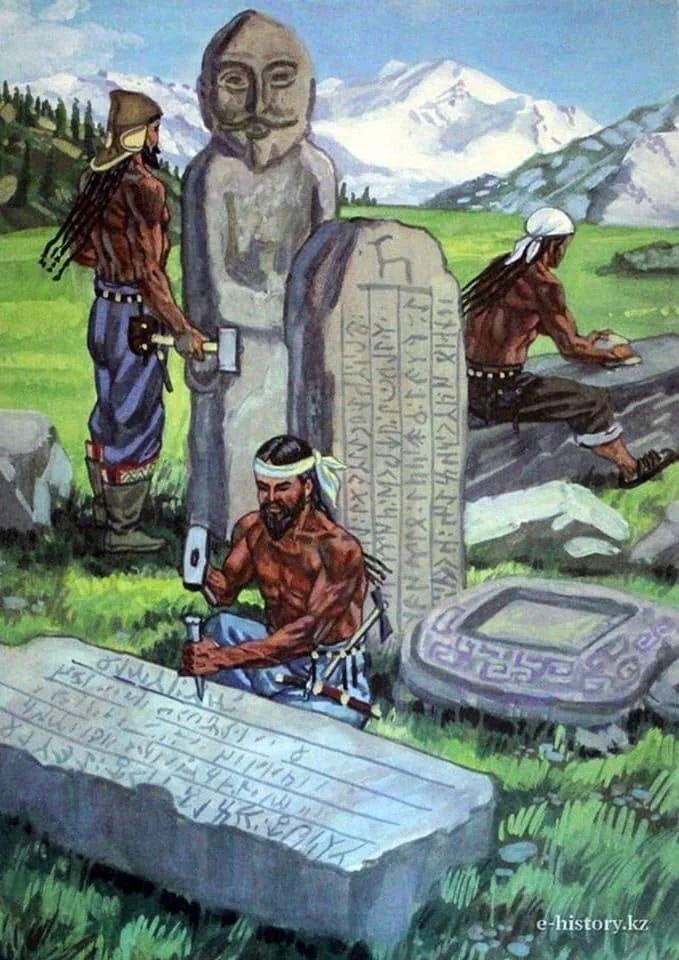
The cutting of runic stones on the steppe, in a modern illustration. The inscription names its makers otherwise: the carvers were sent by the Chinese emperor, and Yollug Tegin wrote the text. Illustration as published by e-history.kz. 本文中 掲載先: キョル・テギン碑文
-
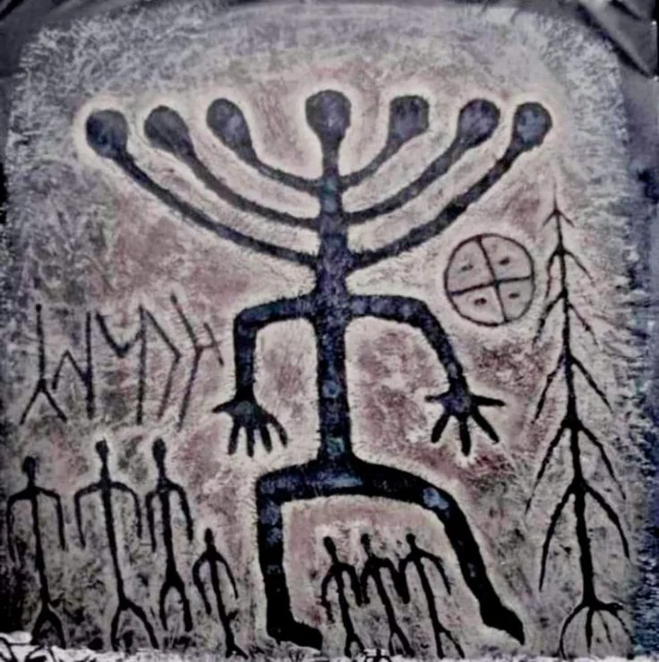
A figure with a rayed head over a row of smaller figures, beside a quartered circle, a tree and signs in the manner of Old Turkic runes: an image in the style of steppe rock art. 本文中 掲載先: テングリ
-
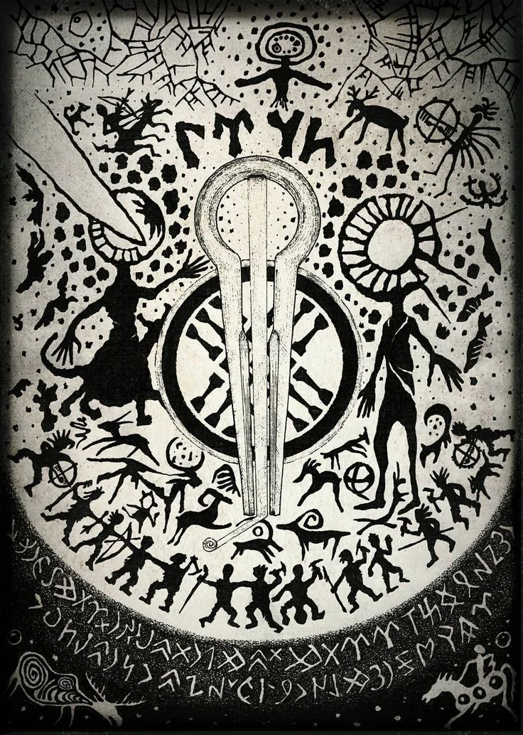
A modern drawing that gathers motifs of present-day Tengrism: a jaw harp over a spoked wheel, figures in the manner of steppe rock art, a figure with a sun for a head, and bands of signs in the manner of Old Turkic runes. It belongs to the modern revival, not to the sixth century. 本文中 掲載先: テングリ信仰
-
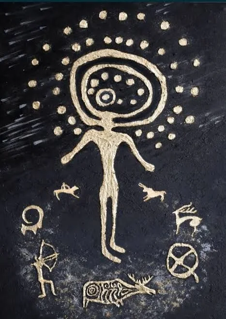
A figure with a rayed head among an archer, deer, an elk and a spoked wheel: a modern rendering in gold on black after the rock art of Kazakhstan. 本文中 掲載先: The steppe before the Xiongnu
-
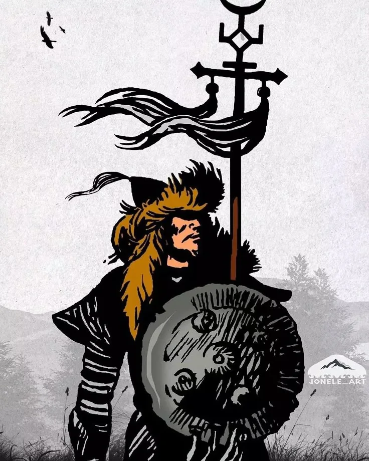
A steppe warrior beneath a standard with a metal finial and long streamers, in a modern drawing. Drawing: signed jonele_art. 本文中 掲載先: トゥグ
-
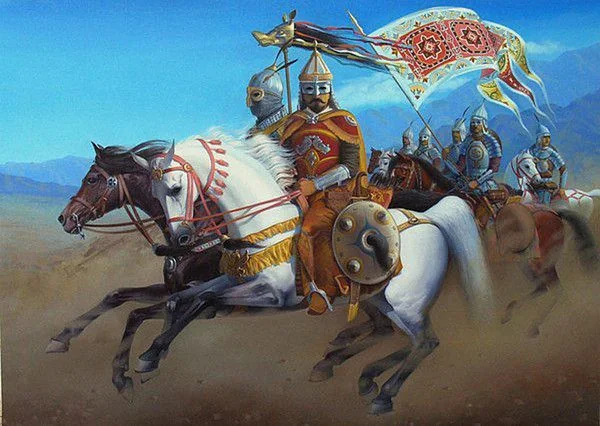
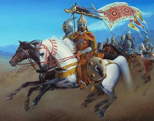
Göktürk riders under a standard with a wolf’s head, in a modern painting. The Zhou Shu reports that a golden wolf’s head was set on the Göktürk standards; the armour, the banner and the scene are the painter’s. 本文中 掲載先: トゥグ
-
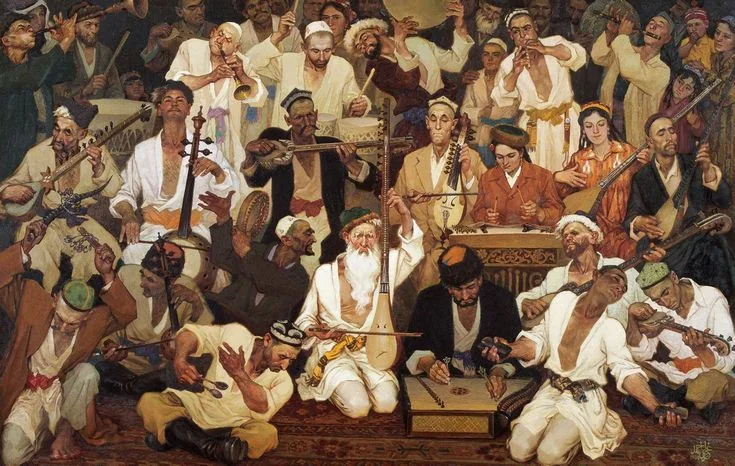
Muqam , a painting of 1984 by the Uyghur painter Ghazi Ehmet: singers and musicians of the Uyghur muqam with long-necked lutes, fiddles, a dulcimer, frame drums and flutes. It shows the Uyghurs of the twentieth century, eleven centuries after the dispersal of 840. Painting: Ghazi Ehmet, 1984. 本文中 掲載先: Uyghurs
-
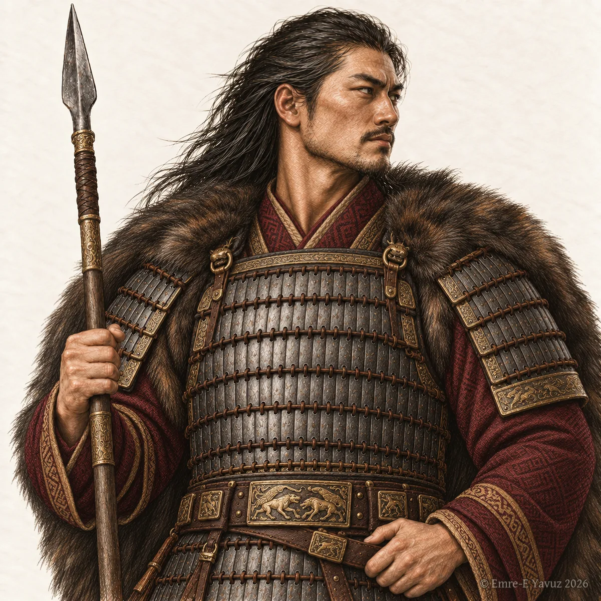
読書の道筋の表紙画像。 読書の道筋 掲載先: 匈奴とフンの時代
-
読書の道筋の表紙画像。 読書の道筋 掲載先: 阿史那氏の王朝
-
読書の道筋の表紙画像。 読書の道筋 掲載先: ギョクテュルクの興隆
-
読書の道筋の表紙画像。 読書の道筋 掲載先: ギョクテュルク独立戦争
-
読書の道筋の表紙画像。 読書の道筋 掲載先: 草原の世界
-
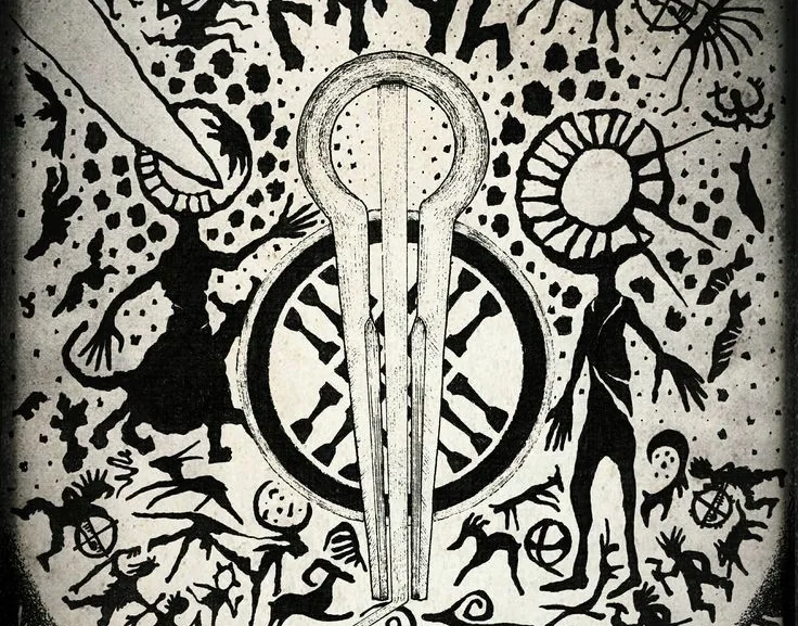
読書の道筋の表紙画像。 読書の道筋 掲載先: テュルクの宇宙観
-
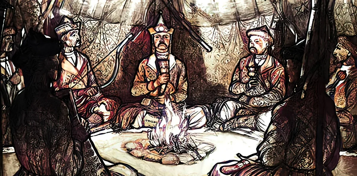
「テュルクのトレ」ページの一群の表紙画像。 テュルクのトレ 掲載先: 法と集会
-
まだ書かれていない項目のためのページの画像。 ページ 掲載先: この項目はこれから設けられます




