
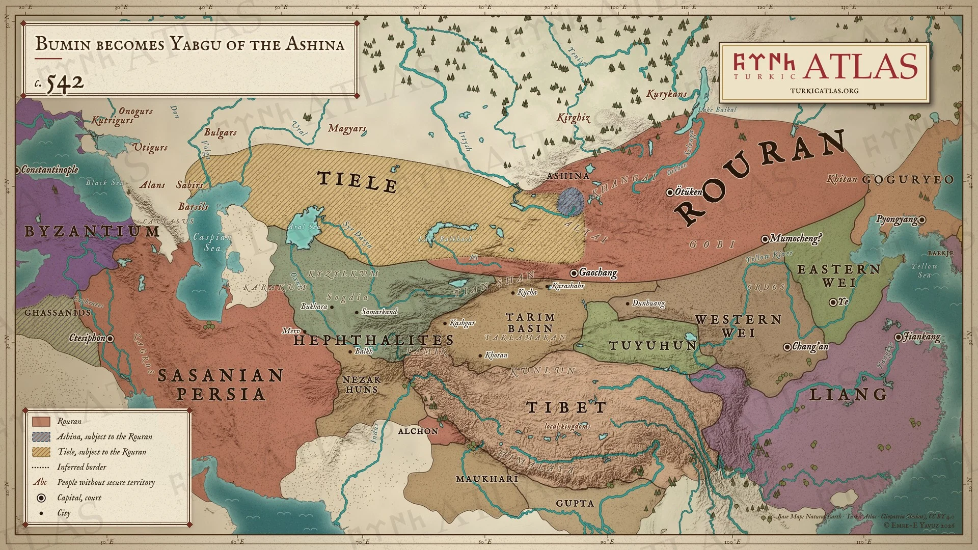
Quién gobernaba
- Rouran Khaganate Anagui 520–552
- Sasanian Persia Khosrow I 531–579
Y más allá de la estepa
- China Eastern Wei Emperor Xiaojing 534–550 · Western Wei Emperor Wen 535–551
- Irán Sasanian Khosrow I 531–579
- Corea Goguryeo Anwon 531–545
- Bizancio Justinian Justinian I 527–565
Estepa oriental
-
Entorno · Clima extremo en la estepa oriental, según los anillos de los árboles; una lectura considera la duración de seis años de la guerra de Bumin como una consecuencia (536–545)
The Turkic War of Independence
La misma década es la más fría de dos mil años según los anillos de los árboles del Altái y según los testigos de hielo
-
Entorno · Pequeña Edad de Hielo de la Antigüedad Tardía: la fase fría que los anillos de los árboles del Altái delimitan de 536 a hacia 660 (536–660)
Climate and the steppe empires · First Göktürk Khaganate · Avars
La década más fría en el Altái es la de 540
Estepa occidental
-
Cultura · Colonos sogdianos fundan las primeras ciudades de Semirech'e, entre ellas Suyab y Navaket, como fincas de nobles (450–600)
-
Muere Tuwu y Bumin toma el mando de los Ashina
Bumin Khan · Tuwu · Ashina
China
-
invierno · Jinetes göktürk cruzan un río helado hacia territorio de los Wei Occidentales y se retiran sin batalla
Göktürk raid of 542 · Bumin Khan · Hegemony Wars in Northern China
Bizancio
-
Entorno · La peste de Justiniano estalla en todo el Imperio romano de Oriente tras la escasez de alimentos del primer frío (541–543)

