
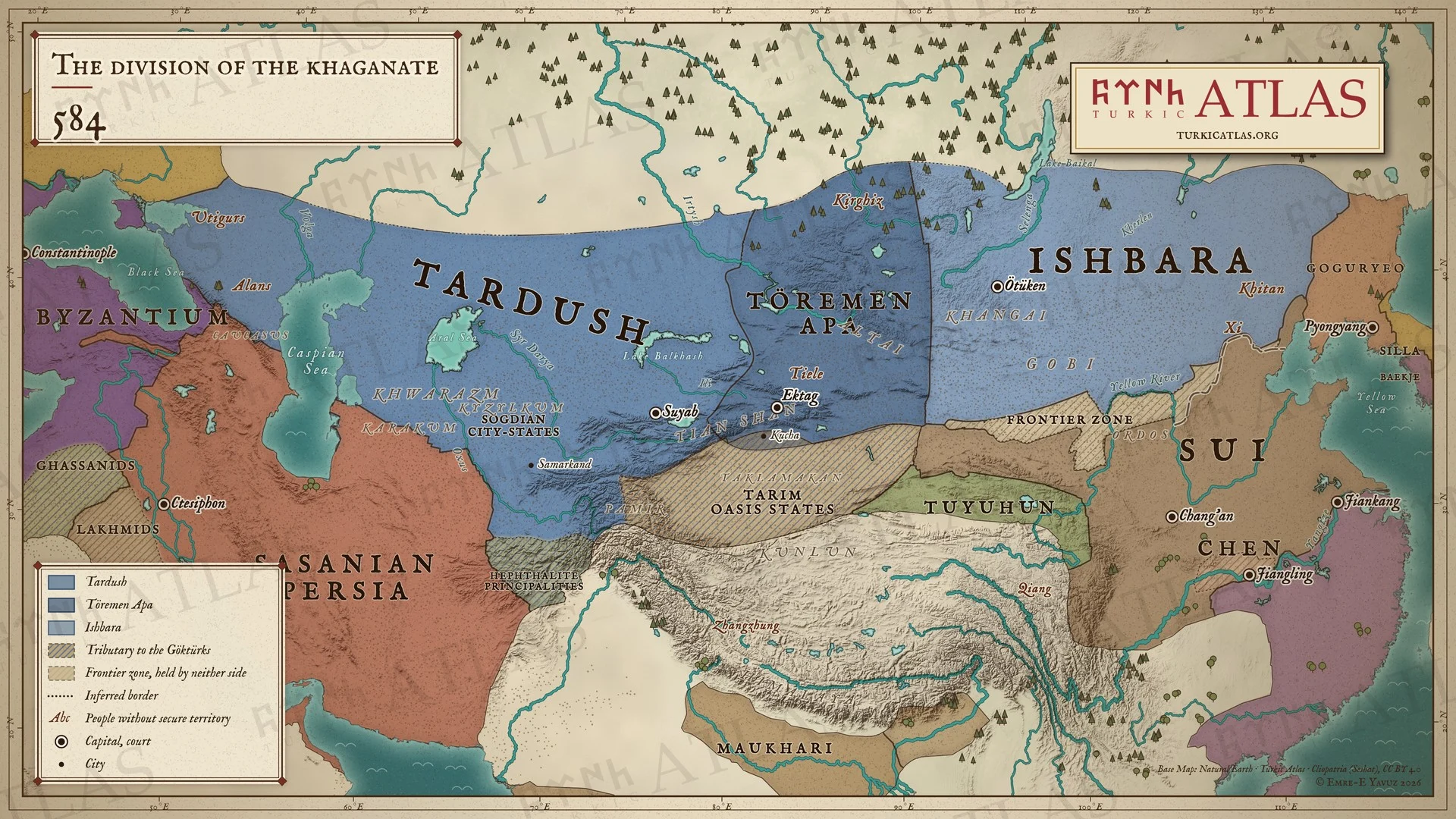
誰が治めていたか
- First Göktürk Khaganate Ishbara Khan 582–587
- Sasanian Persia Hormizd IV 579–590
- Western Göktürk Khaganate Tardush 576–603
草原の外では
- 中国 Sui Emperor Wen 581–604
- イラン Sasanian Hormizd IV 579–590
- 朝鮮 Goguryeo Pyeongwon 559–590
- ビザンツ Justinian Maurice 582–602
東方草原
-
環境 · 古代末期小氷期:アルタイの年輪が536年からおよそ660年までと定める寒冷期 (536–660)
Climate and the steppe empires · First Göktürk Khaganate · Avars
アルタイで最も寒い十年は540年代である
-
文化 · タスパルのために、ソグド語のブグト碑文が建てられる
西方草原
中国
-
イシュバラの書簡に応えて隋が虞慶則を遣わす。イシュバラはひざまずいて皇帝の書を受け、自らを皇帝の臣と称する

