
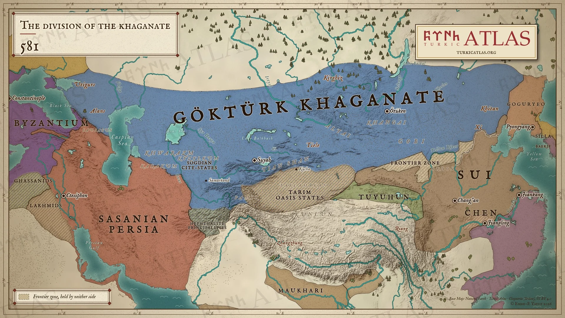
Quién gobernaba
- First Göktürk Khaganate Taspar Khan 572–581 · Amrak 581–582
- Sasanian Persia Hormizd IV 579–590
- Western Göktürk Khaganate Tardush 576–603
Y más allá de la estepa
- China Northern Zhou Emperor Jing 579–581 · Sui Emperor Wen 581–604
- Irán Sasanian Hormizd IV 579–590
- Corea Goguryeo Pyeongwon 559–590
- Bizancio Justinian Tiberius II 578–582
Estepa oriental
-
Entorno · Clima extremo en los primeros años de la guerra civil, según los anillos de los árboles (581–583)
-
Entorno · Pequeña Edad de Hielo de la Antigüedad Tardía: la fase fría que los anillos de los árboles del Altái delimitan de 536 a hacia 660 (536–660)
Climate and the steppe empires · First Göktürk Khaganate · Avars
La década más fría en el Altái es la de 540
-
Muere Taspar; la nobleza se reúne en Ötüken, pasa por alto su deseo a favor de Töremen y elige a Amrak
Göktürk Succession Crisis (581) · Taspar Khan · Amrak · Ishbara Khan · Töremen Apa · Toy · Töre · Ötüken
Estepa occidental
China
-
Economía · Los Zhou dan a Taspar cien mil piezas de seda al año y los Qi vacían su tesoro para igualarlos; el excedente va al oeste con los sogdianos (572–581)
-
Yang Jian toma el trono Zhou y funda los Sui; la corte Zhou es masacrada, y la emperatriz Ashina, perdonada
Sui · Empress Ashina · Göktürk Succession Crisis (581) · Northern Zhou · Hegemony Wars in Northern China

