Görseller ve haritalar
Medya
Atlasın maddelerinde ve sayfalarında yer alan her görsel burada bir arada durur. İlk sütunda fotoğraflar ve tarihî tasvirler var: duvar resimleri, steller, sikkeler, buluntular ve manzaralar. Haritalar en başta, kendi başlarına durur. İkinci sütunda modern tasvirler var: çizimler, rekonstrüksiyonlar ve resimler. Her kart görselin yer aldığı maddeyi gösterir. Bir tıklama görseli alt yazısıyla birlikte büyütür.
Bu sayfa ve menü Türkçedir. Maddelerin bir kısmı Türkçe okunabilir, kalanı İngilizcedir ve öyle işaretlenir.
Haritalar
Bozkır imparatorluklarının ve komşularının haritaları, her biri kendi zaman kesitiyle. Bir harita, kaynakların ve araştırmanın izin verdiğini gösterir. Alt yazı öyle diyorsa sınırlar ve bölgeler yaklaşıktır.
-
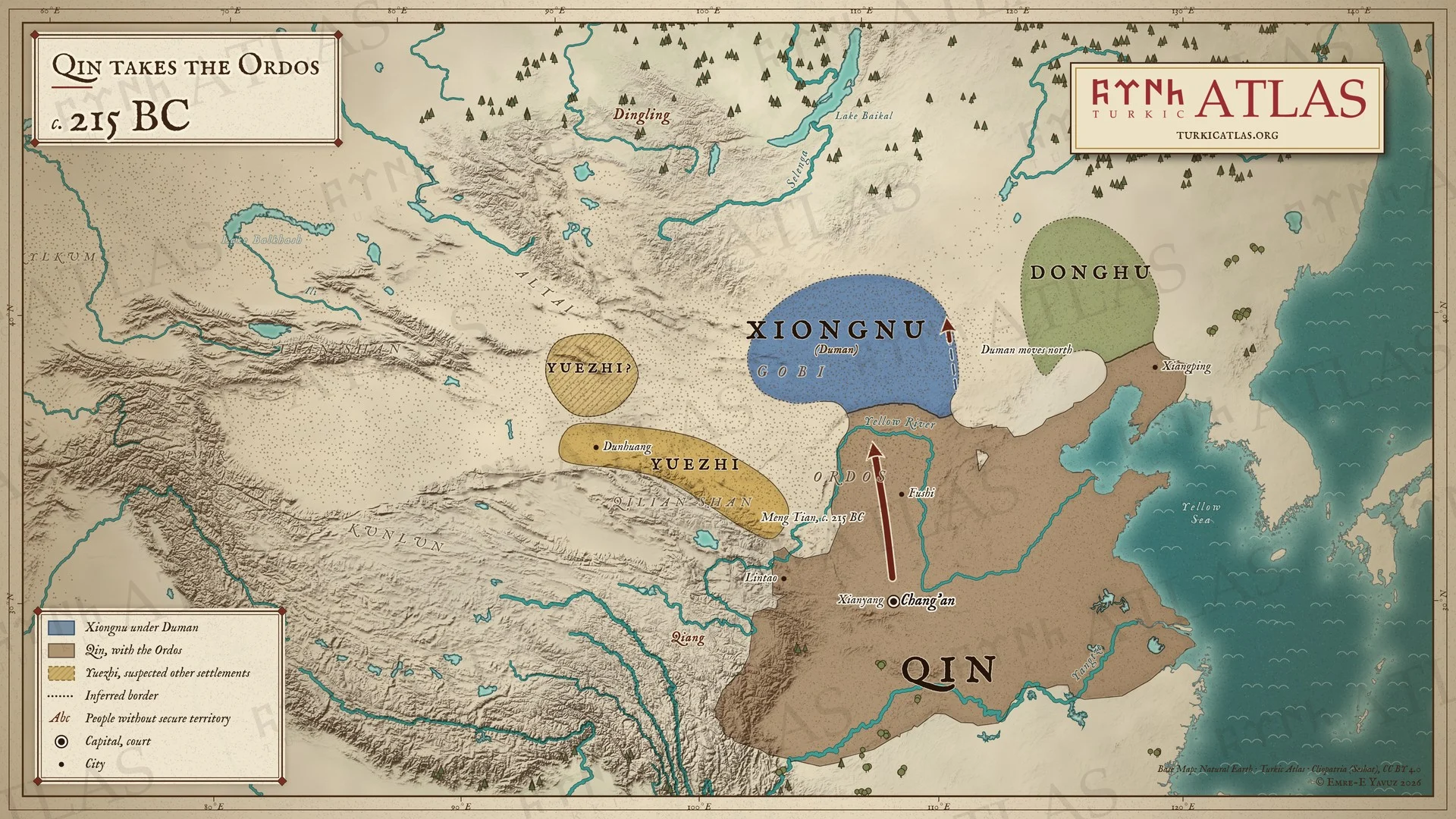
c. 215 BCc. 215 BC: Qin takes the Ordos
 © Emre-E Yavuz 2026
MÖ 215 civarı: Qin’in ilk imparatoru Meng Tian’ı kuzeye gönderir. Meng Tian, Sarı Irmak’ın büyük kıvrımı içindeki Ordos’u alır ve ırmağı sınır yapar. Asya Hunlarının chanyusu Duman kuzeye çekilir, ne kadar uzağa çekildiğini kaynak söylemez. Doğuda Donghular, Dunhuang ile Qilian Dağları arasında Yuezhiler yaşar, ikinci bir yoruma göre Tanrı Dağlarında. Modern harita, bozkırdaki sınırlar yaklaşıktır. Harita Yer aldığı yer: Yıl -215, Duman (Touman), Asya Hunları (Xiongnu)
-
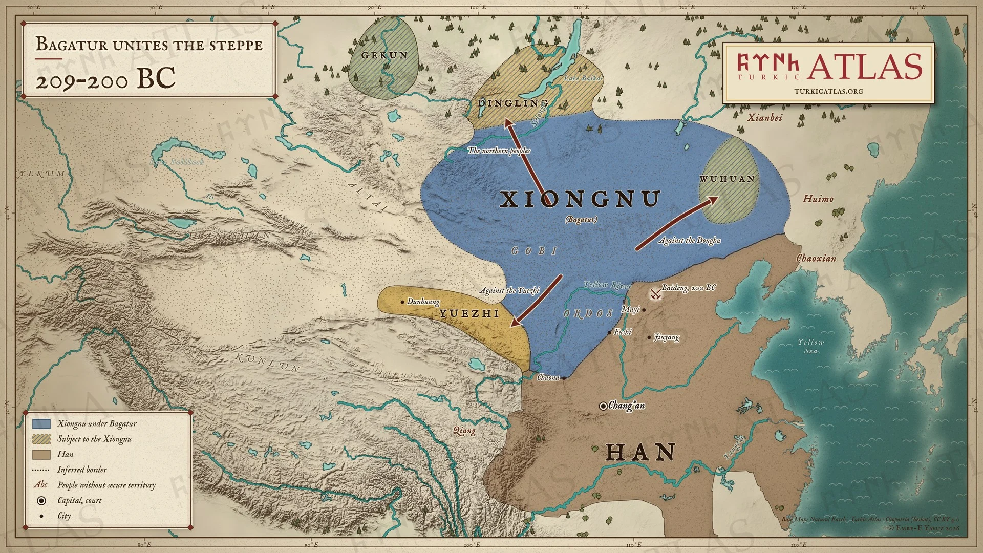
209–200 BC209–200 BC: Bagatur unites the steppe
 © Emre-E Yavuz 2026
MÖ 209–200: Mete Han (Bagatur) babası Duman’ı öldürür ve chanyu olur. Donghu kralını yok eder, Yuezhileri geri püskürtür, Meng Tian’ın aldığı toprakları Chaona ve Fushi’ye kadar geri alır, Dingling, Gekun ve kuzeyin diğer halklarını kendine bağlar. Wuhuanlar ona vergi öder. MÖ 200’de Han imparatoru Gaozu’yu Pingcheng yakınındaki Baideng’de kuşatır. Modern harita, yollar çizilmiştir, bozkırdaki sınırlar yaklaşıktır. Harita Yer aldığı yer: Yıl -209, Bagatur (Modu Chanyu), Asya Hunları-Han Savaşları
-
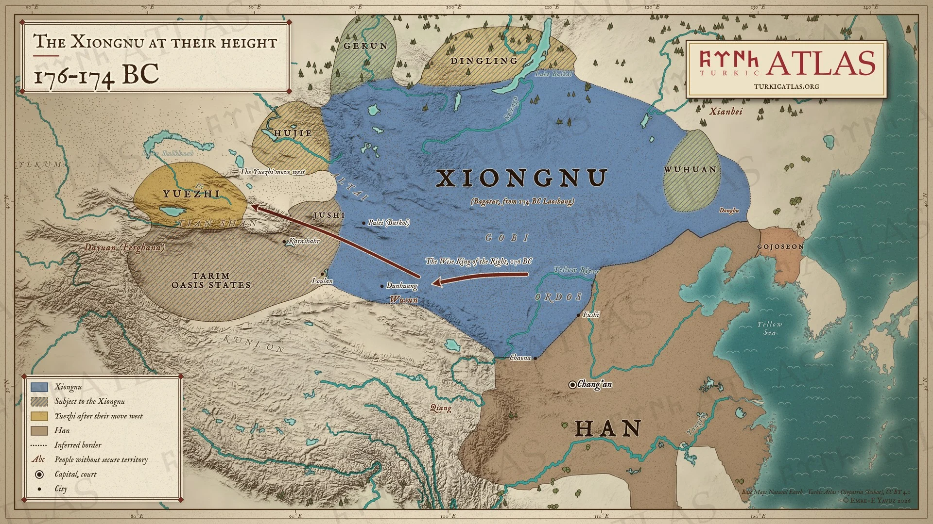
176–174 BC176–174 BC: The Xiongnu at their height
 © Emre-E Yavuz 2026
MÖ 176–174: Mete Han (Bagatur), MÖ 176’da Han sarayına yazdığı mektupta Sağ Erdemli Kral’ın Yuezhileri yok ettiğini, Loulan, Wusunlar, Hujieler ve çevrelerindeki yirmi altı devletin Asya Hunlarına katıldığını bildirir. Yuezhiler batıya, İli’ye göçer. MÖ 174’te Mete Han ölür, yerine oğlu Laoshang geçer. Modern harita, ülkenin kuzey sınırını hiçbir kaynak tarif etmez, bozkırdaki sınırlar yaklaşıktır. Harita Yer aldığı yer: Yıl -177, Bagatur (Modu Chanyu), Türk halklarının tarihi
-
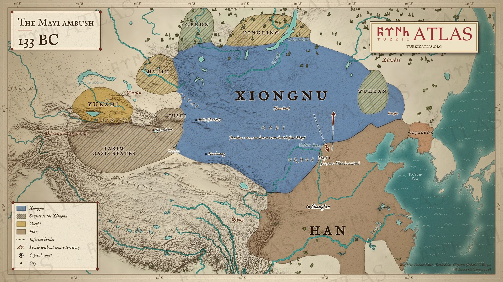
133 BC133 BC: The Mayi ambush
 © Emre-E Yavuz 2026
MÖ 133: Han, Mayi sınır kasabasının çevresine üç yüz bin asker gizler ve kasabayı chanyu Junchen'e önerir. Junchen yüz bin atlıyla sınırı geçer, kasabaya yüz li kala başıboş otlayan sığırları görür, yakaladığı bir subaydan pusuyu öğrenir ve geri döner. Heqin düzeni sona erer, altmış yıllık açık savaş başlar. Modern harita, chanyunun yolu çizilmiştir, bozkırdaki sınırlar yaklaşıktır. Harita Yer aldığı yer: Yıl -133, Mayi pususu
-
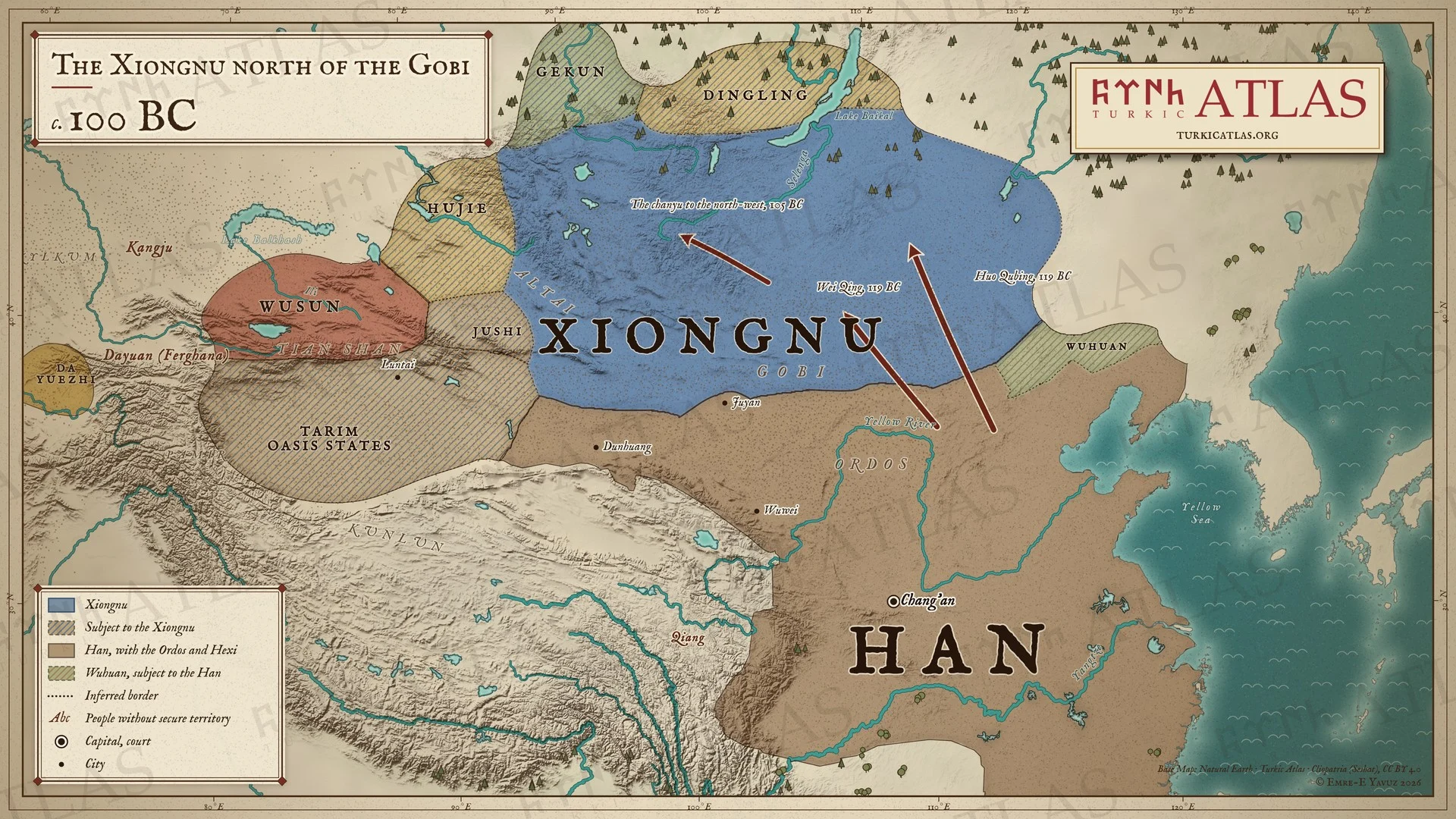
c. 100 BCc. 100 BC: The Xiongnu north of the Gobi
 © Emre-E Yavuz 2026
MÖ 100 civarı: Wei Qing ile Huo Qubing’in MÖ 119 seferlerinden sonra Gobi’nin güneyinde Asya Hunlarının bir kağanlık otağı kalmaz. Han, Ordos’u ve Wuwei’den Dunhuang’a kadar Hexi koridorunu tutar, Wuhuanlar Asya Hunlarını Han adına gözetler. MÖ 105’e gelindiğinde chanyu daha kuzeybatıya çekilmiştir. Tarım vaha devletleri ve kuzey halkları hâlâ Asya Hunlarına tabidir. Modern harita, yollar çizilmiştir, bozkırdaki sınırlar yaklaşıktır. Harita Yer aldığı yer: Yıl -100, Asya Hunları (Xiongnu), Asya Hunları-Han Savaşları
-
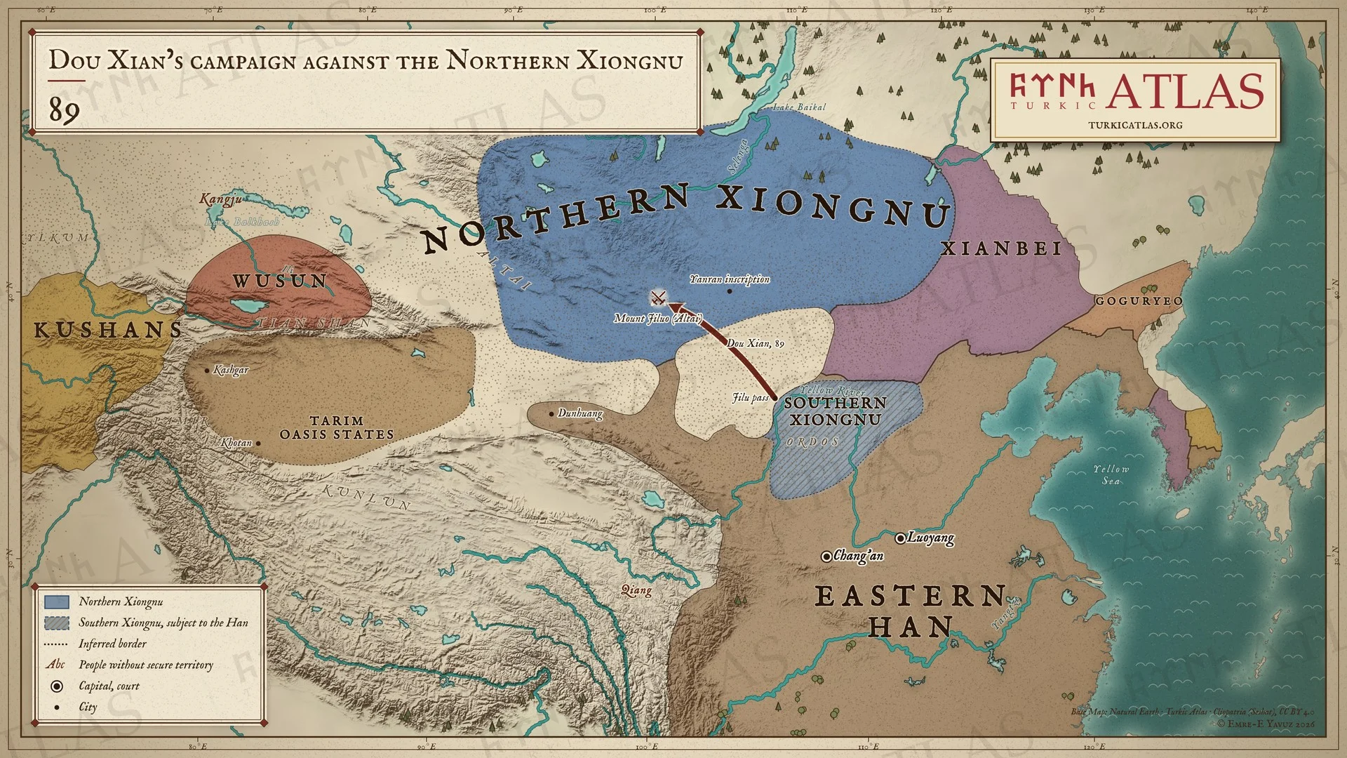
8989: Dou Xian’s campaign against the Northern Xiongnu
 © Emre-E Yavuz 2026
89: Dou Xian, Güney Asya Hunlarıyla birlikte Jilu Geçidi'nden yola çıkar ve kuzey chanyusunu Altay'daki Jiluo Dağı'nda yener. Yanran Dağı'ndaki bir yazıt zaferi kaydeder. Güney Asya Hunları Han'a tabidir, doğuda Siyenpiler hüküm sürer. Modern harita, yol çizilmiştir, bozkırdaki sınırlar yaklaşıktır. Harita Yer aldığı yer: Yıl 89, Asya Hunları (Xiongnu), Han campaigns against the Northern Xiongnu, Asya Hunları-Han Savaşları
-
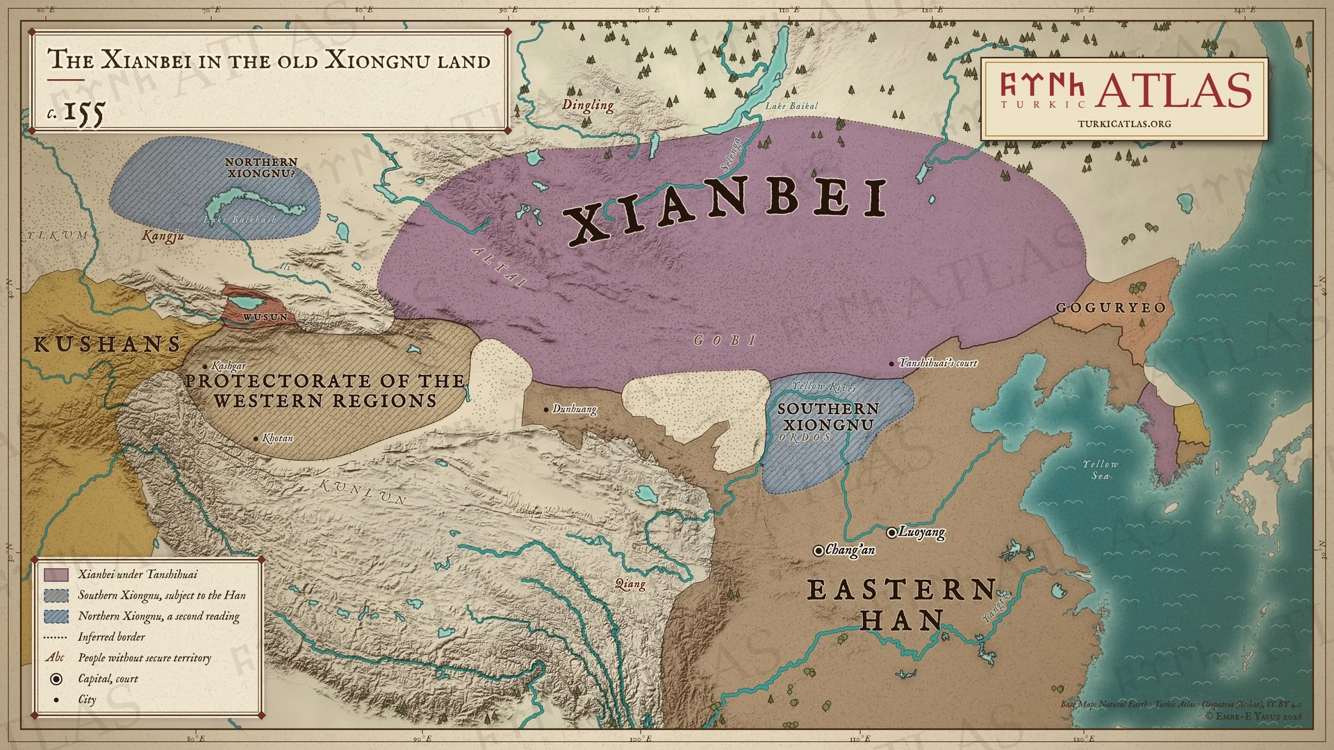
c. 155c. 155: The Xianbei in the old Xiongnu land
 © Emre-E Yavuz 2026
y. 155: Tanshihuai yönetimindeki Siyenpiler, Moğol bozkırında Asya Hunlarının eski yurdunu tutar. Güney Asya Hunları Han sınırının içinde yaşar, Han ise batıdaki vahaları Batı Bölgeleri Koruyuculuğu ile yönetir. İkinci bir okumaya göre Kuzey Asya Hunları Kangju'nun kuzeybatısındadır. Modern harita, bozkırdaki sınırlar yaklaşıktır. Harita Yer aldığı yer: Yıl 155, Tanshihuai
-
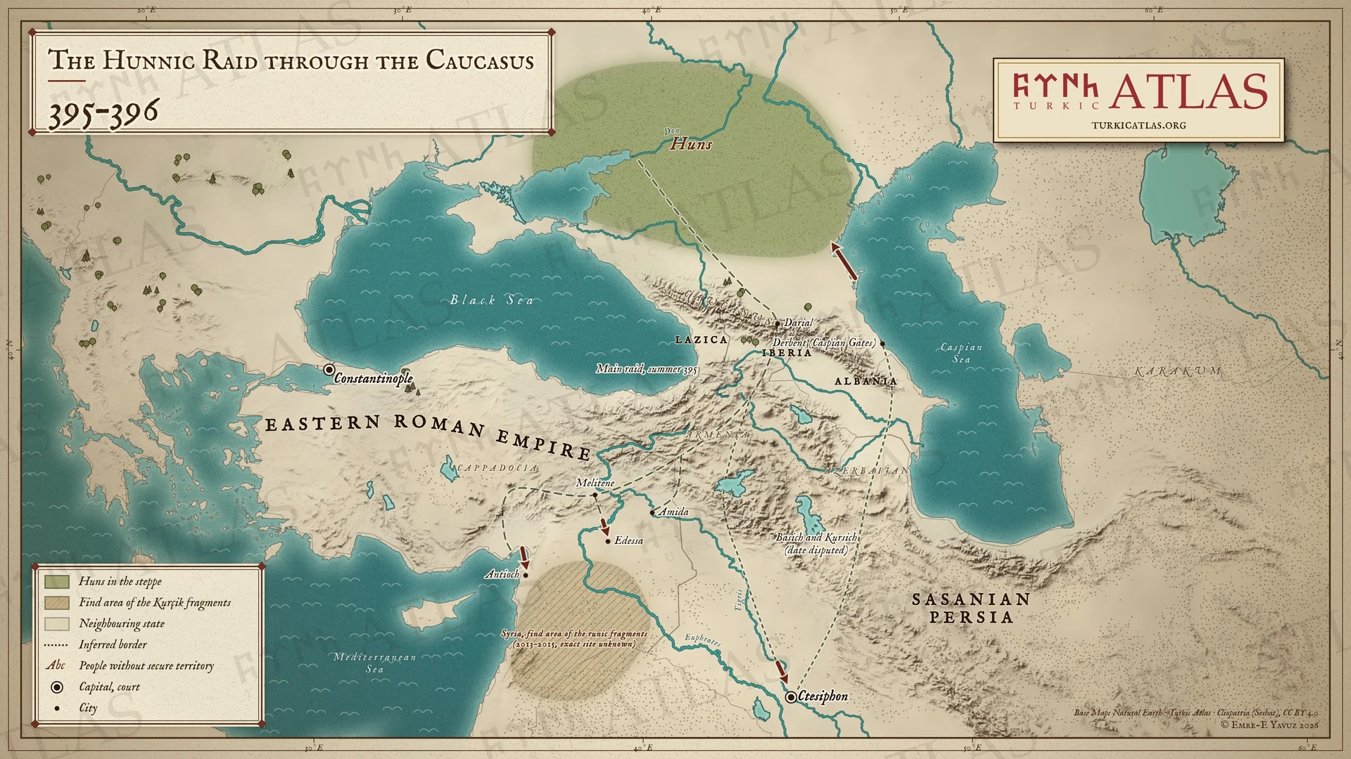
395–396395–396: The Hunnic raid through the Caucasus
 © Emre-E Yavuz 2026
395–396: Hunlar Kafkasya'yı aşar ve Ermenistan'a, Melitene'ye, Antakya'ya ve Urfa'ya akın eder. Basih ve Kursih Dicle boyunca Ktesifon'a iner ve Hazar Kapıları'ndan geri döner. Akınlarının tarihi tartışmalıdır. Suriye'deki runik parçaların bulunduğu bölge taranmıştır. Modern harita, yollar çizilmiştir. Harita Yer aldığı yer: Yıl 395, Hunların 395 seferi
-
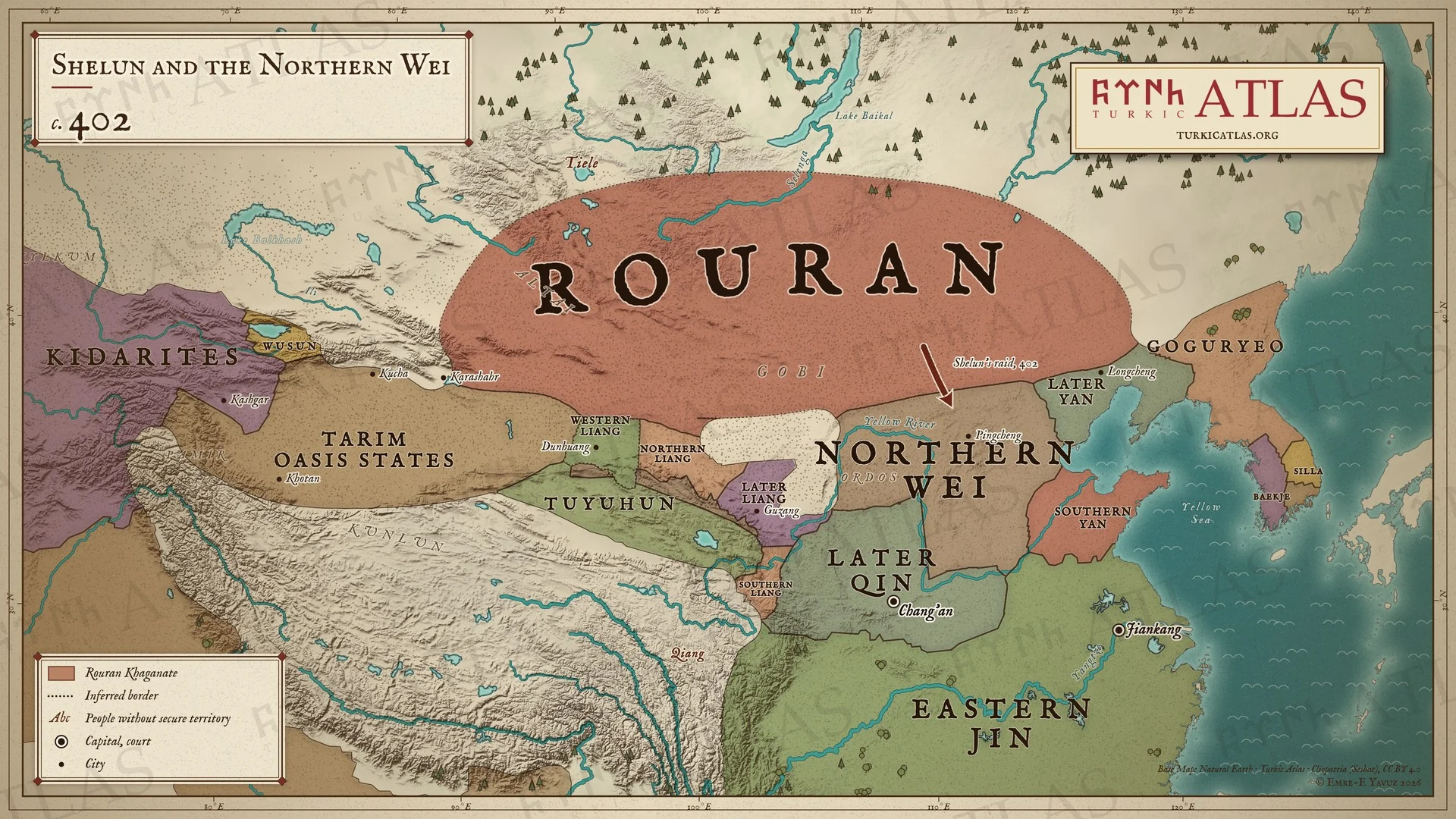
c. 402c. 402: Shelun and the Northern Wei
 © Emre-E Yavuz 2026
y. 402: Shelun, toprakları Karashahr'dan Goguryeo'ya uzanan Rouranların başındadır ve Kuzey Wei sınırına akın eder. Güneyde Çin'i Wei, Sonraki Qin, Liang devletleri, Yan devletleri ve Doğu Jin paylaşır. Modern harita, bozkırdaki sınırlar ve Çin'deki bazı sınırlar yaklaşıktır. Harita Yer aldığı yer: Yıl 402, Shelun Khan, Rouran Kağanlığı, Türk halklarının tarihi
-
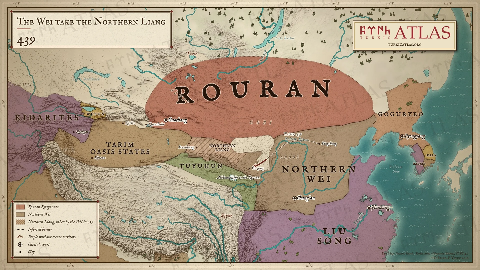
439439: The Wei take the Northern Liang
 © Emre-E Yavuz 2026
439: Kuzey Wei Guzang üzerine yürür, Kuzey Liang teslim olur. Aşinalar beş yüz aileyle Rouranlara kaçar. Rouranlar Gobi'nin kuzeyindeki bozkırı tutar, Wei'nin güneyinde Liu Song vardır. Modern harita, Wei'nin yolu çizilmiştir, bozkırdaki sınırlar yaklaşıktır. Harita Yer aldığı yer: Yıl 439, Rouran Kağanlığı, Aşinaların Kaçışı (439)
-
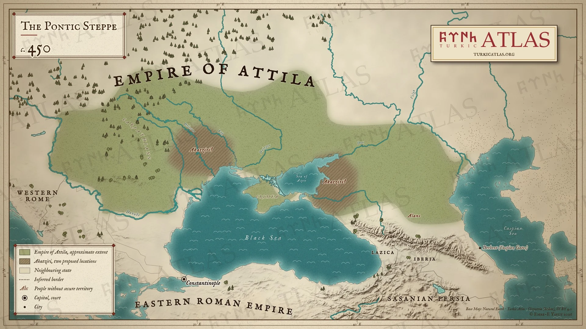
450450: The Pontic steppe
 © Emre-E Yavuz 2026
Yak. 450: Attila'nın ülkesi Tuna'dan bozkıra uzanır. Akatzirler önerilen iki yerde gösterilir, Karadeniz'in kuzeybatısında ve Azak Denizi kıyısında. Modern harita. Sınırı hiçbir kaynak kaydetmez. Harita Yer aldığı yer: Yıl 450, Akatzirler
-
453453: The Hunnic Empire at Attila’s death
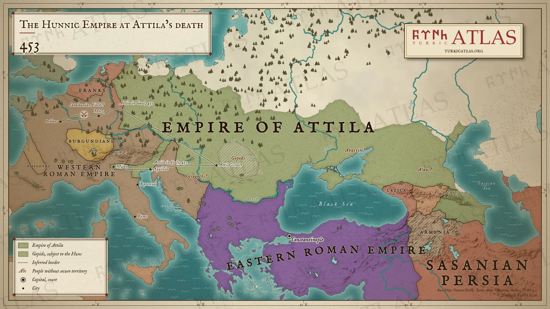 © Emre-E Yavuz 2026
453: Attila öldüğünde Hun İmparatorluğu Ren'den Hazar Denizi'ne uzanır, Gepidler ve başka halklar Hunlara tabidir. İnce çizgiler Attila'nın 451'deki Galya ve 452'deki İtalya seferlerini gösterir. Modern harita, imparatorluğun sınırları yaklaşıktır, Katalaun Ovaları'nın yeri tartışmalıdır. Harita Yer aldığı yer: Yıl 453, Attila, Türk halklarının tarihi
-
c. 460c. 460: The Ashina in the Altai
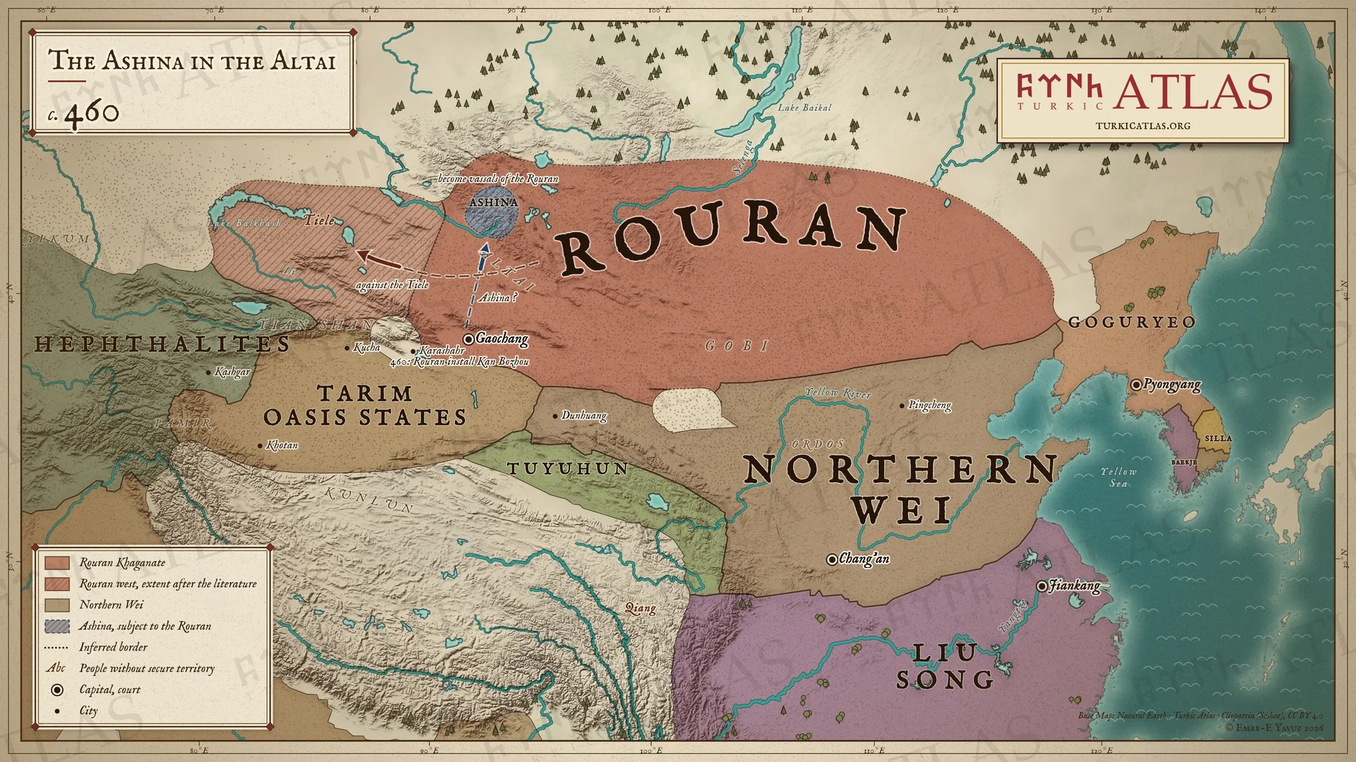 © Emre-E Yavuz 2026
460 dolayları: Aşinalar, beş yüz aile, Rouranlara tabi olarak Altay'ın güney yamacına yerleşir. Batıda Rouranlar Tieleleri boyun eğdirir, 460'ta Kan Bozhou'yu Gaochang kralı yaparlar. Gobi'nin güneyinde Kuzey Wei ve Liu Song vardır. Modern harita, Aşinaların yolu bir yeniden kurgudur, bozkırdaki sınırlar yaklaşıktır. -
463463: The chain of expulsions
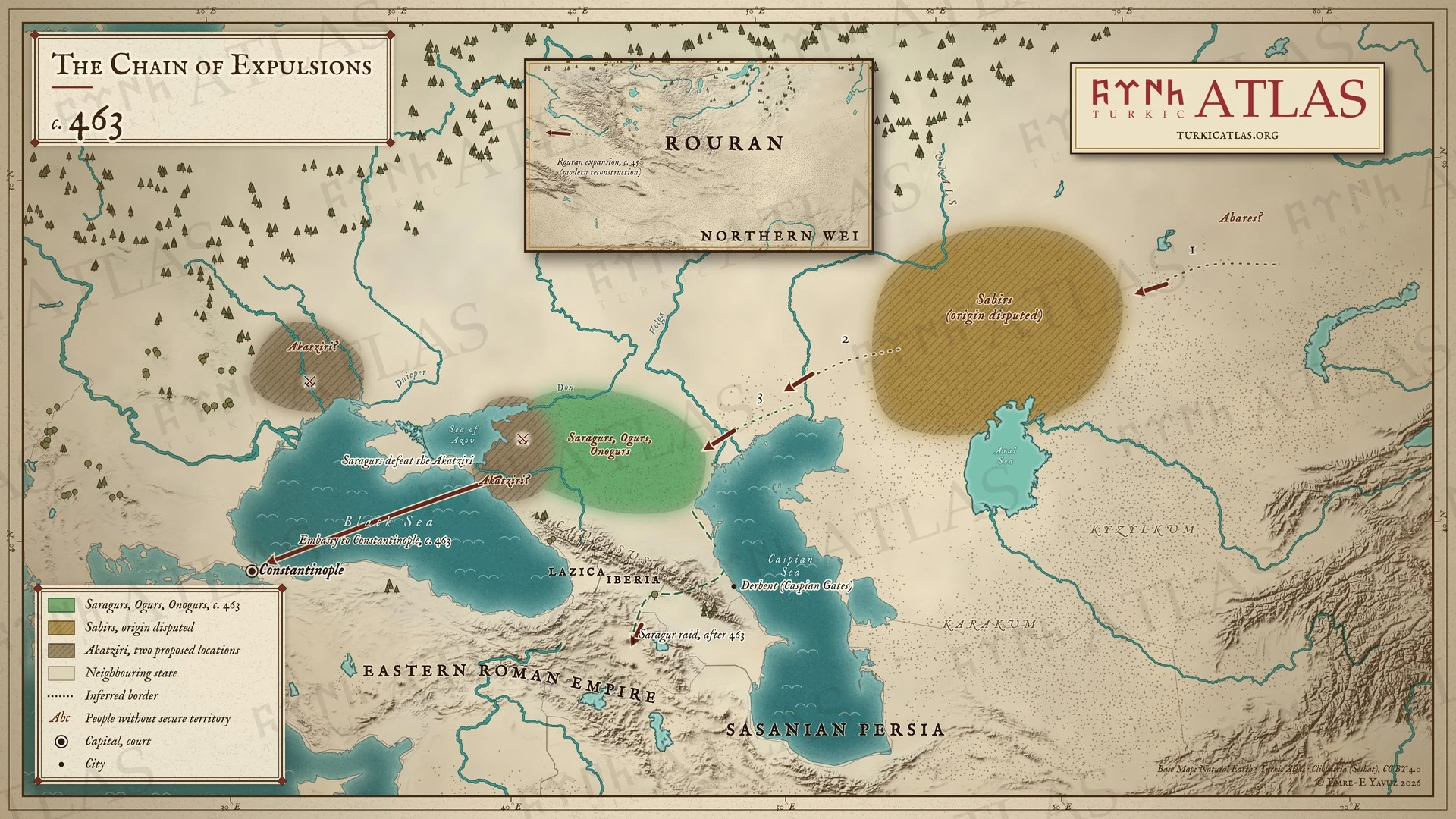 © Emre-E Yavuz 2026
Yak. 463: Abarlar Sabirleri yurtlarından sürer, Sabirler de Saragurları, Ogurları ve Onogurları batıya iter. Saragurlar Akatzirleri yener ve Konstantinopolis'e elçi gönderir. Daha sonra Kafkasya üzerinden akın ederler. Modern harita, oklar yeniden kurgudur. Harita Yer aldığı yer: Yıl 463, Saragurlar
-
466–469466–469: The end of Attila's sons
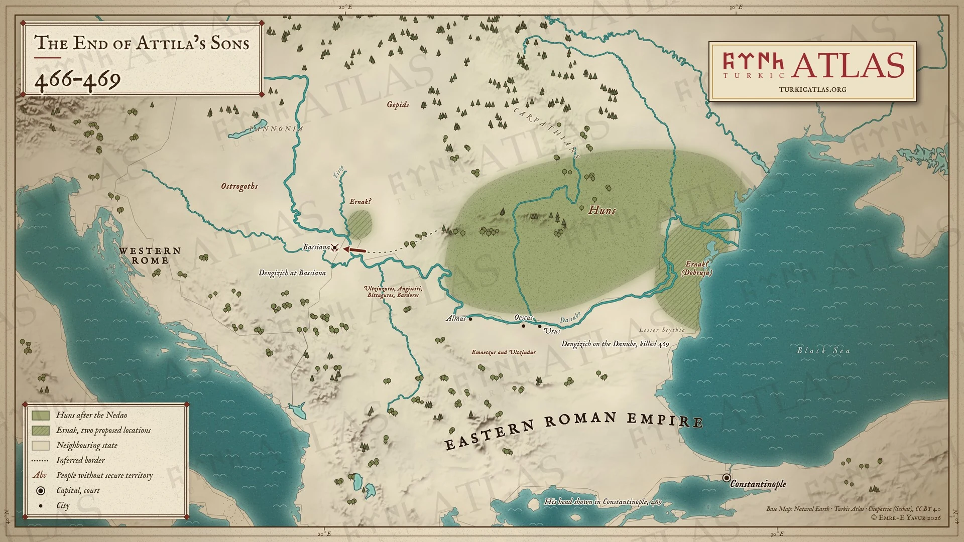 © Emre-E Yavuz 2026
466–469: Dengizik Bassiana üzerine yürür. İrnek önerilen iki yerde gösterilir, Tisa'nın ağzında ve Dobruca'da. Emnetzur ve Ultzindur Tuna kıyısındaki kasabaları tutar. Dengizik 469'da düşer ve başı Konstantinopolis'te gösterilir. Modern harita. Öldüğü yer kaydedilmemiştir. -
516516: Chounu crushes the Gaoche
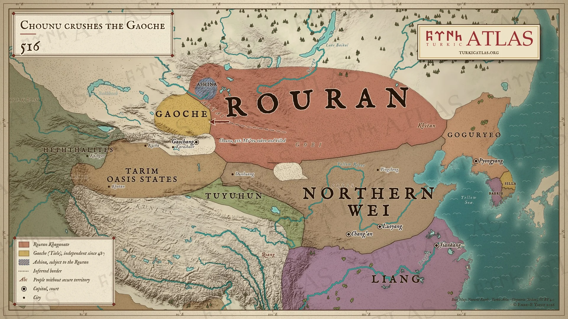 © Emre-E Yavuz 2026
516: Rouran kağanı Chounu batıya yürür, Gaocheleri yener, kralları Mi'etu'yu yakalayıp öldürür. Altay'daki Aşinalar Rouranlara tabidir. Modern harita, yol çizilmiştir, savaşın yeri kayıtlı değildir, bozkırdaki sınırlar yaklaşıktır. Harita Yer aldığı yer: Yıl 516, Chounu Khan, Rouran Kağanlığı
-
520520: Anagui flees to the Wei
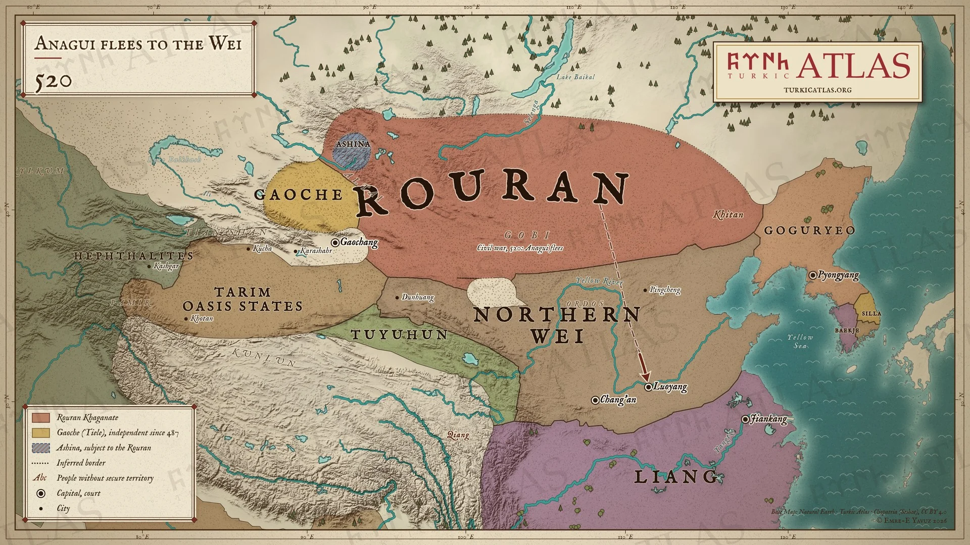 © Emre-E Yavuz 2026
520: Chounu öldürülür ve iç savaş Rouranları böler. Anagui kovulur ve Luoyang'daki Kuzey Wei'ye kaçar. Gaocheler bağımsız kalır. Modern harita, yol çizilmiştir, bozkırdaki sınırlar yaklaşıktır. -
523–528523–528: The uprisings of the Northern Wei
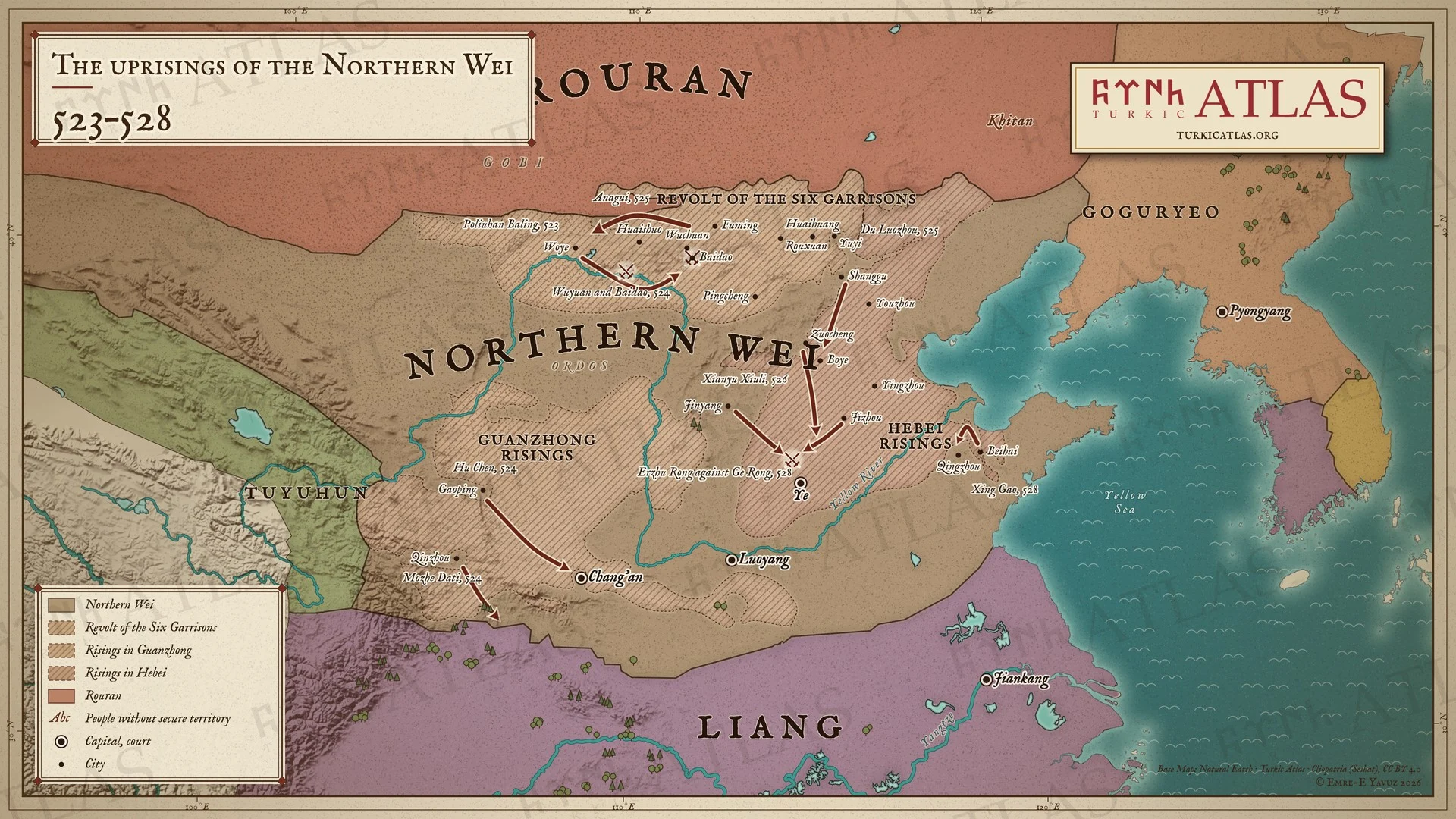 © Emre-E Yavuz 2026
523–528: Kuzey Wei'nin kuzey sınırındaki garnizonlar Poliuhan Baling önderliğinde ayaklanır ve 524'te Wei'yi Wuyuan ile Baidao'da yener. 525'te Rouran kağanı Anagui ayaklanmayı Wei adına bastırır. Savaş Guanzhong'a ve Hebei'ye kayar ve 528'de Erzhu Rong'un Ye'de Ge Rong'u yenmesiyle biter. Modern harita, taralı alanlar sınırları değil ayaklanmaların yayıldığı yerleri gösterir. Harita Yer aldığı yer: Yıl 523, Rouran Kağanlığı, Altı Garnizon İsyanı
-
c. 542Asia around 542: Bumin becomes yabgu of the Ashina
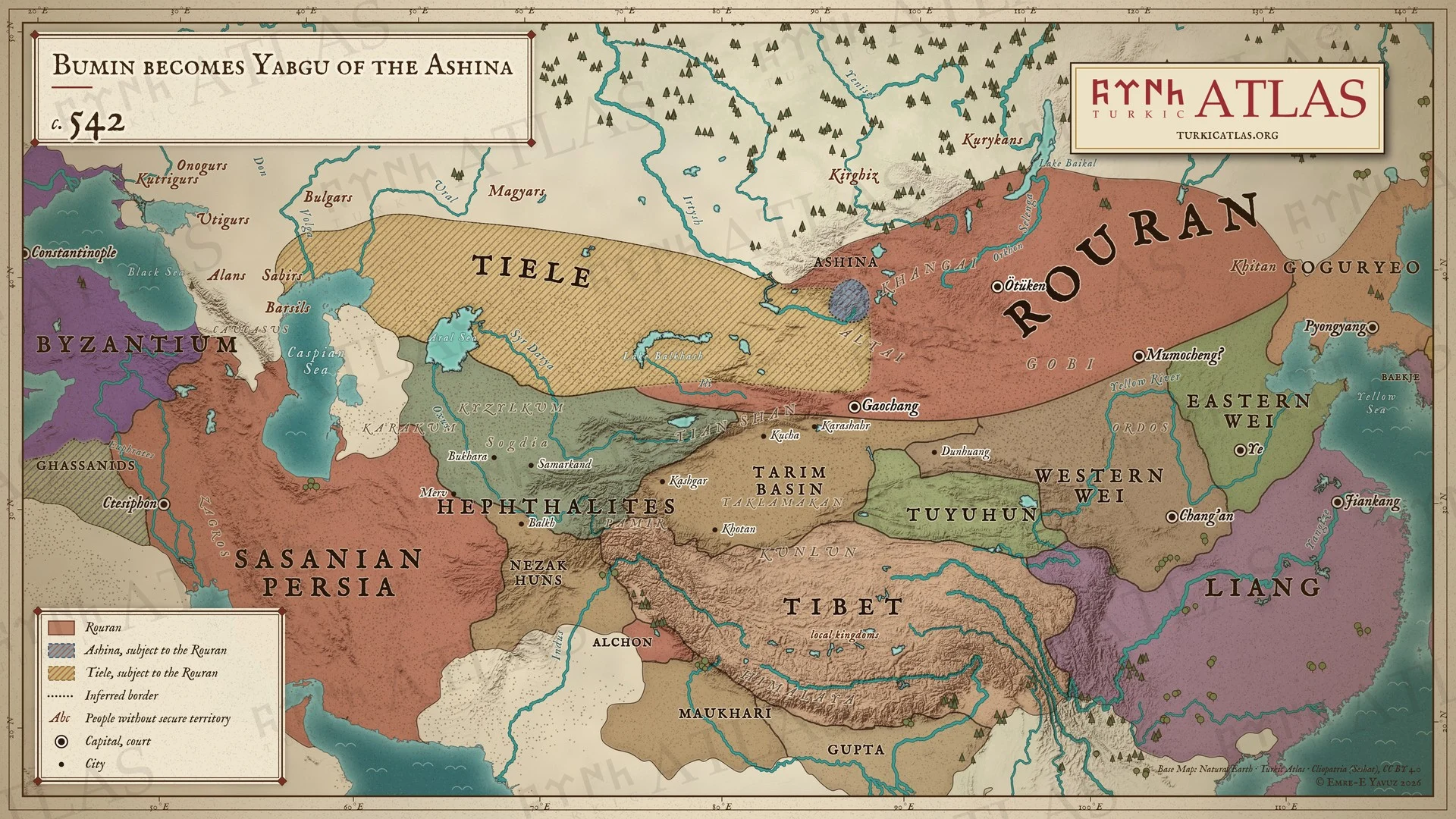 © Emre-E Yavuz 2026
542 civarında, Bumin'in Aşinaların yabgusu olduğu yıl Asya: doğu bozkırını yöneten Rouranlara tabi Altay'daki Aşinalar ve Tieleler, yanlarında Batı ve Doğu Wei, Liang, Tuyuhun, Eftalitler, Sasani İmparatorluğu ve Doğu Roma İmparatorluğu. Modern harita, sınırlar yaklaşıktır. Harita Yer aldığı yer: Yıl 542, Bumin Kağan, Birinci Göktürk Kağanlığı, Aşina
-
545545: The Western Wei embassy to the Göktürks
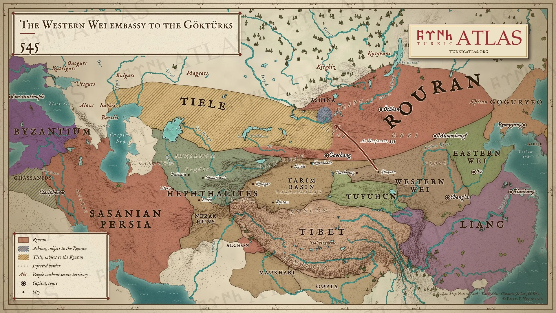 © Emre-E Yavuz 2026
545: Batı Wei'nin şansölyesi Yuwen Tai, Jiuquanlı Soğdlu An Nuopantuo'yu Altay'daki Göktürklere gönderir. Göktürkler o sırada hâlâ Rouranlara tabidir. Bu, bir Çin devletinin Aşinalara gönderdiği ilk elçiliktir. Modern harita, yol çizilmiştir, kaynak bir güzergâh vermez. Harita Yer aldığı yer: Yıl 545, Anagui, Bumin Kağan, Doğu Wei, Batı Wei, Rouranların Türk Halkları Üzerindeki Hâkimiyeti, 545 Batı Wei elçiliği
-
546546: Bumin defeats the Tiele
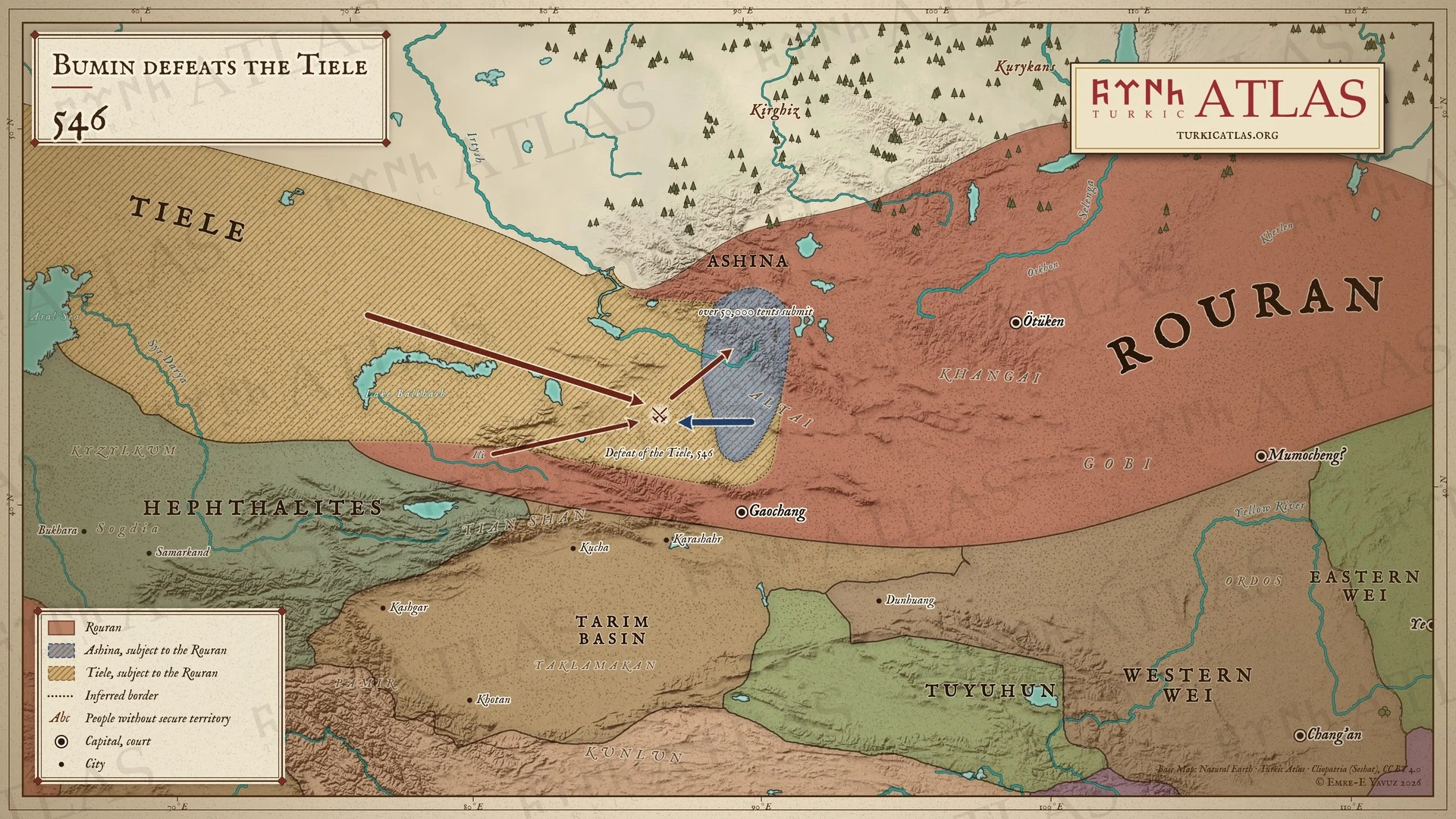 © Emre-E Yavuz 2026
546: Tieleler Rouranlara karşı harekete geçer. Bumin onları yolda karşılar ve yener, elli binden fazla Tiele çadırı ona boyun eğer. Hâlâ Rouranlara tabi olan Aşinalar Altay'ı ve güneyde Turfan'a doğru uzanan toprakları tutar. Modern harita, güzergâhlar ve savaşın yeri çizilmiştir. Harita Yer aldığı yer: Yıl 546, Tielelerin yenilgisi, 546
-
550550: The Sea of Azov
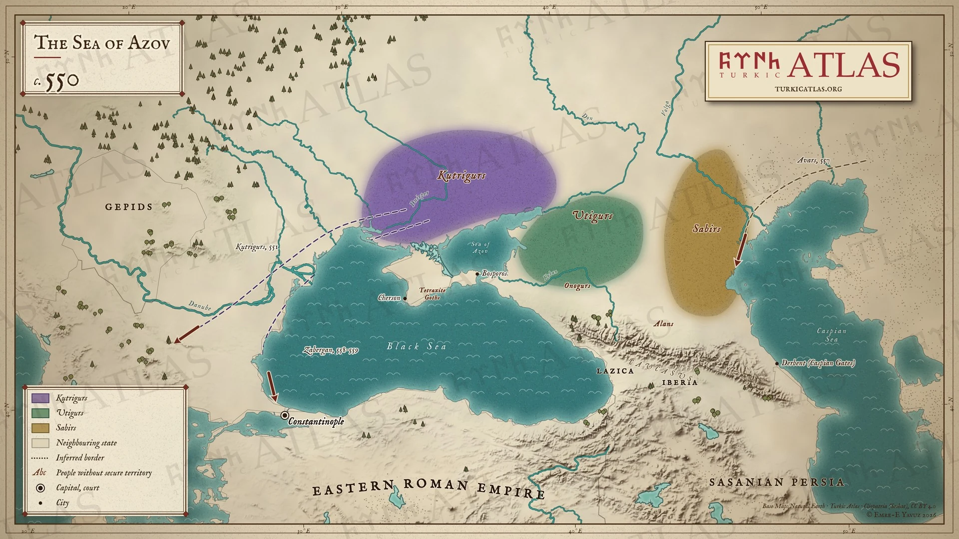 © Emre-E Yavuz 2026
Yak. 550: Kutrigurlar Don'un ve Azak Denizi'nin batısında, Utigurlar doğusunda yaşar. Sabirler ve Onogurlar Kafkasya'nın kuzeyindedir. Kutrigurlar 551'de akın eder ve 558–559'da Zabergan önderliğinde Konstantinopolis'e ulaşır. Avarlar 557'de gelir. Modern harita, yollar çizilmiştir. -
551–552551–552: The Göktürk–Rouran war
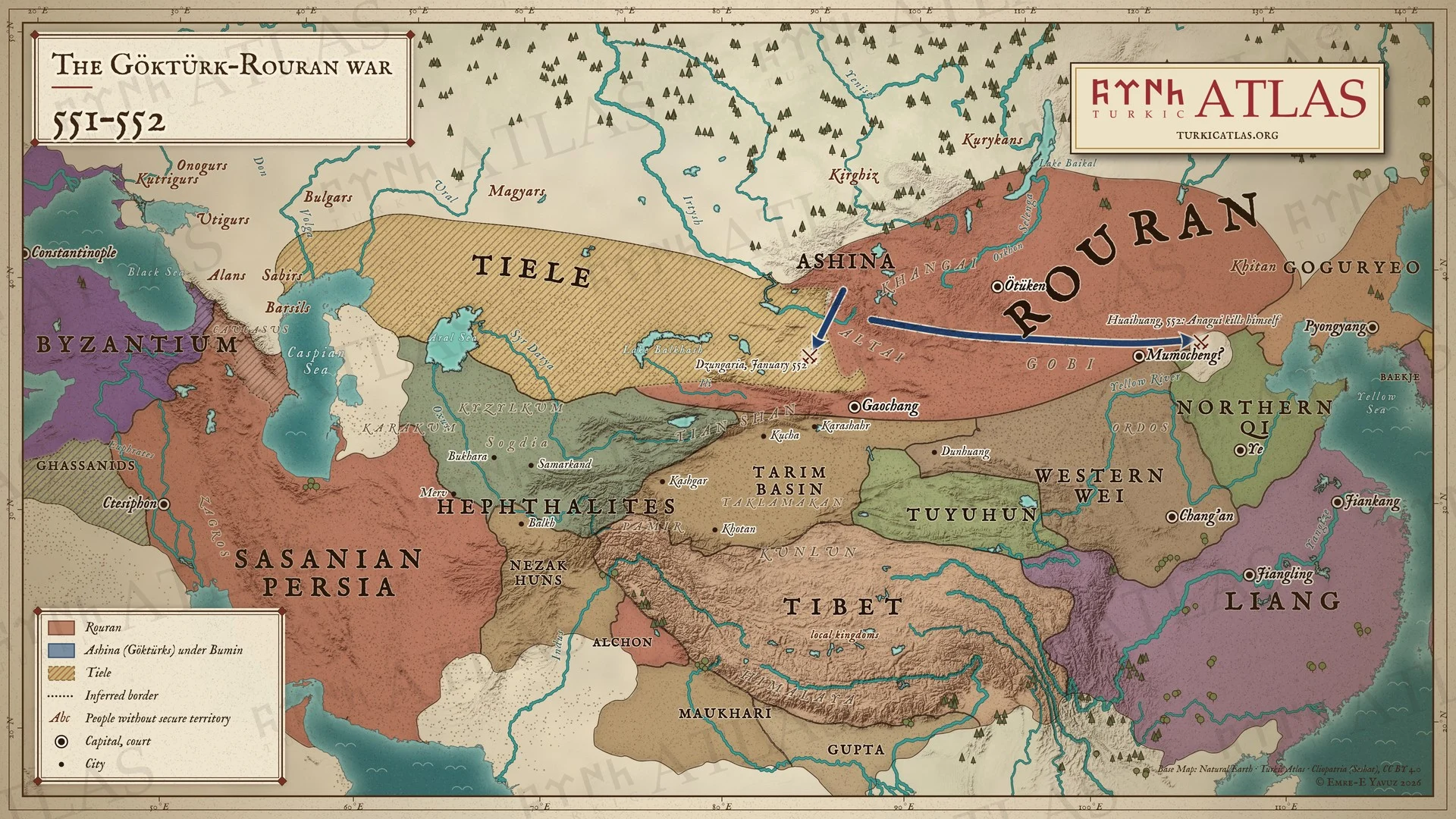 © Emre-E Yavuz 2026
551–552: Bumin yönetimindeki Göktürkler Rouranlara karşı ayaklanır. Ocak 552'de Cungarya'da bir Rouran ordusunu yenerler, ardından ana Rouran ordusunu Huaihuang'ın kuzeyinde ezerler ve Anagui kendini öldürür. Modern harita, güzergâhlar ve Cungarya'daki savaşın yeri çizilmiştir. Harita Yer aldığı yer: Yıl 551, Rouran Kağanlığı, Göktürk-Rouran Savaşları, Türk halklarının tarihi
-
552552: The First Göktürk Khaganate
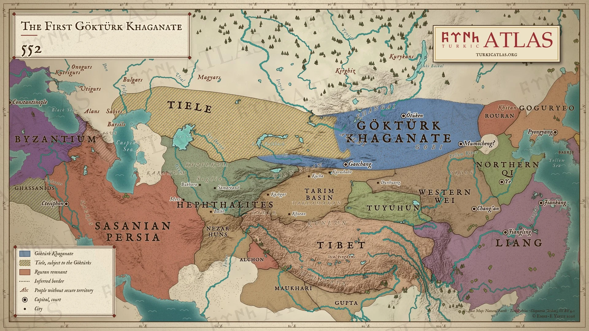 © Emre-E Yavuz 2026
552: Rouranlara karşı kazanılan zaferden sonra Bumin kağan unvanını alır ve onların topraklarında Birinci Göktürk Kağanlığı'nı kurar. Tieleler ona tabidir, Rouranların kalıntısı ise doğuda direnir. Modern harita. Harita Yer aldığı yer: Yıl 552, Bumin Kağan, Birinci Göktürk Kağanlığı, Kuzey Qi, Bumin Kağan'ın İlanı (552)
-
553553: The last Rouran and Istemi’s march west
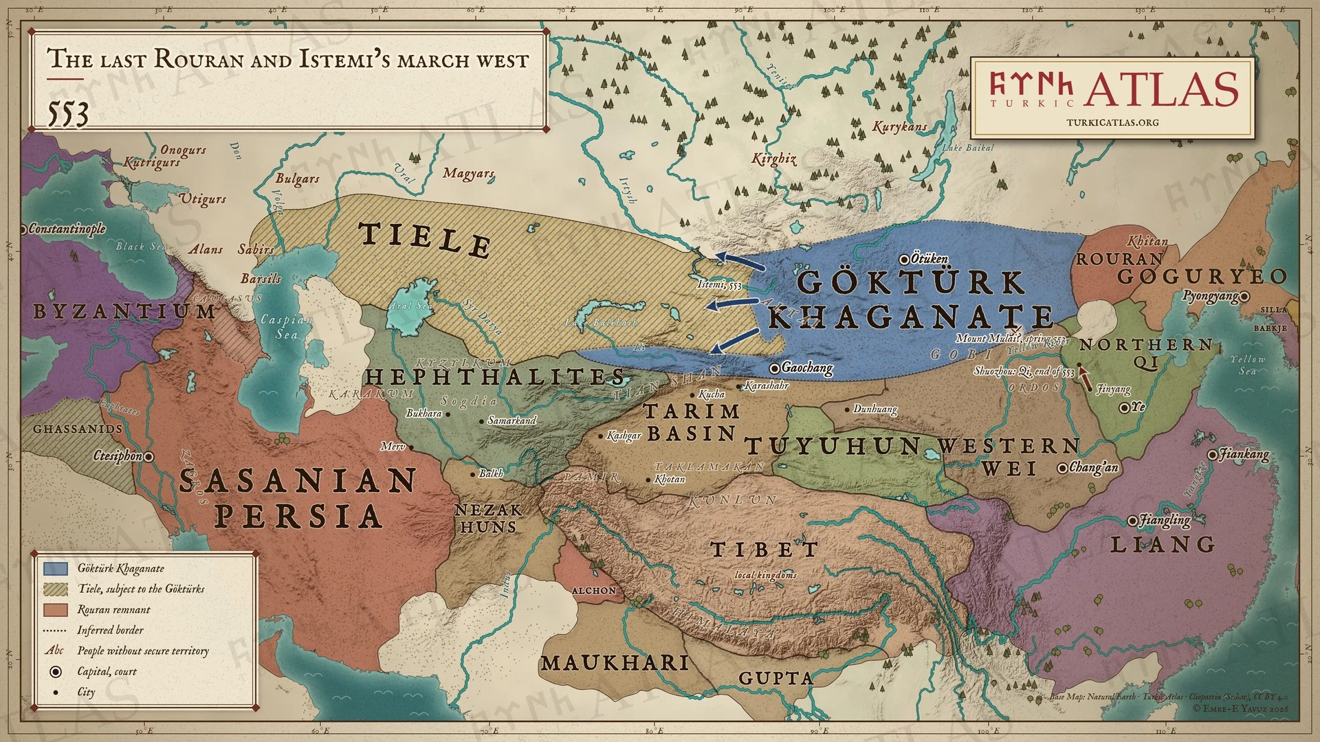 © Emre-E Yavuz 2026
553: Issık, Dengshuzi'nin Rouranlarını Mulai Dağı'nda yener. Yıl sonunda Kuzey Qi, Göktürkleri Shuozhou'ya kadar kovalar. Batıda İstemi Altay'dan yola çıkar: büyük seferinin başlangıcı. Modern harita, yollar çizilmiştir, Mulai Dağı'nın yeri tartışmalıdır. Harita Yer aldığı yer: Yıl 553, Rouran Kağanlığı, Mulai Dağı Muharebesi (553)
-
554554: Anluochen’s revolt and the fall of Jiangling
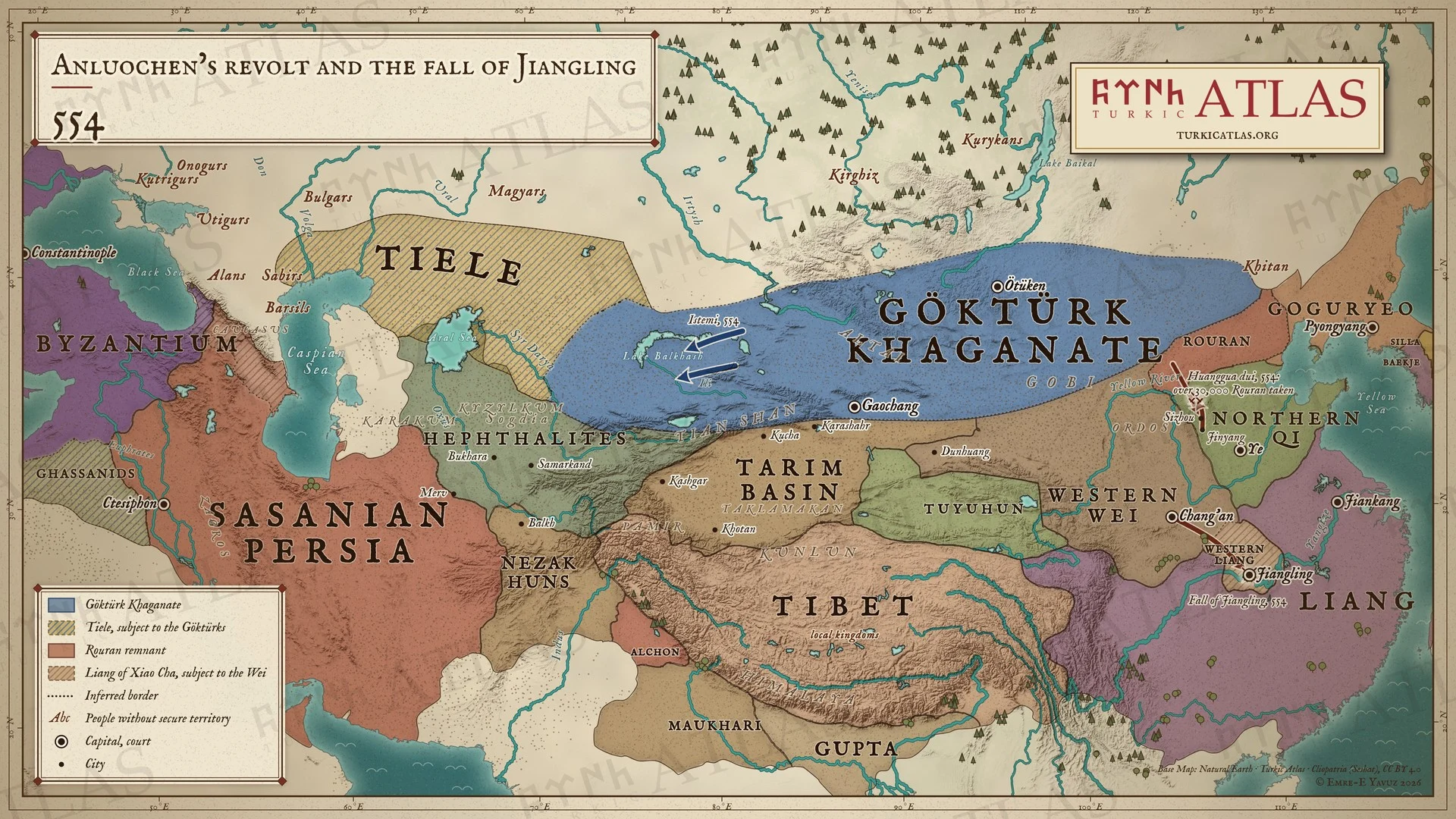 © Emre-E Yavuz 2026
554: Anluochen Kuzey Qi'ye karşı ayaklanır. Rouranlar Sizhou'ya akın eder ve Qi imparatoru onları Jinyang'dan Huanggua tepesine kadar kovalar. 30.000'den fazla kişiyi esir alır. Güneyde Batı Wei Jiangling'i alır ve Xiao Cha'yı kendisine bağlı bir Liang'ın başına geçirir. Modern harita, yollar çizilmiştir. -
555555: The end of the Rouran
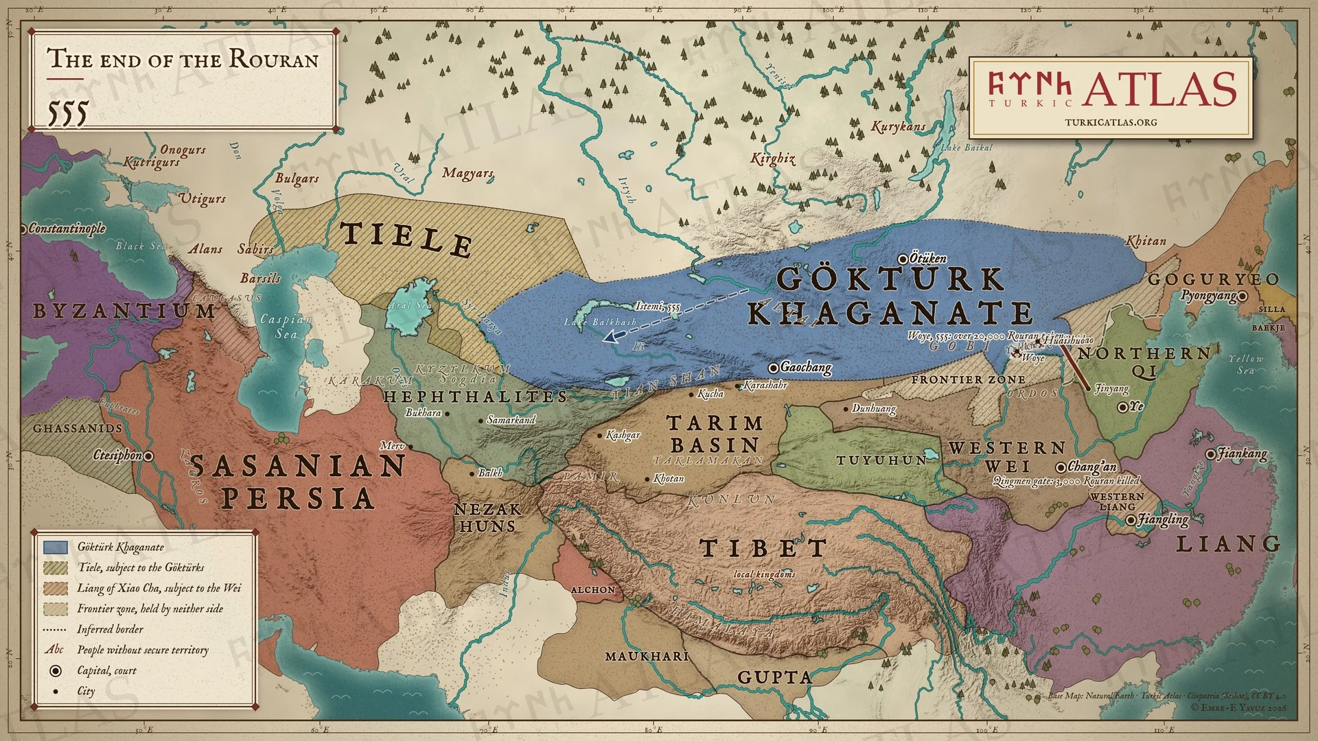 © Emre-E Yavuz 2026
555: Qi imparatoru ağırlıklarını Baidao'da bırakır ve 5.000 hafif süvariyle Rouranları Huaishuo'da ve Woye'de yener. 20.000'den fazla kişiyi esir alır. Chang'an'da Batı Wei, Dengshuzi'yi ve yaklaşık 3.000 Rouranı Mukan'ın elçilerine teslim eder, elçiler onları Qingmen kapısının önünde öldürür. Batıda İstemi bir hesaba göre Balkaş Gölü'ne ulaşır. Modern harita, yollar çizilmiştir. Harita Yer aldığı yer: Yıl 555, Rouran Kağanlığı, Qingmen Kapısı İnfazları (555)
-
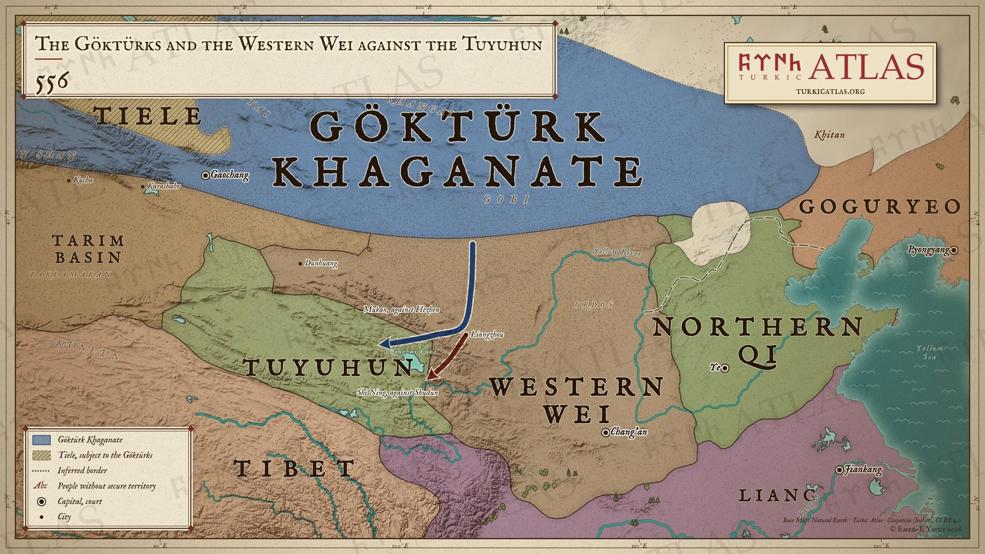
556556: The Göktürks and the Western Wei against the Tuyuhun
 © Emre-E Yavuz 2026
556: Mukan Kağan Liangzhou'ya gelir ve Batı Wei komutanı Shi Ning ile Kökenor'a yürür. Mukan kuzey yolundan Hezhen'i, Shi Ning Shudun'u alır. 555'te yapılan Qi suru, Kuzey Qi'nin kuzey sınırını korur. Modern harita, yollar çizilmiştir, seferin yılı 555 mi 556 mı, tartışmalıdır. Harita Yer aldığı yer: Yıl 556, Göktürk-Wei Tuyuhun Seferi (556)
-
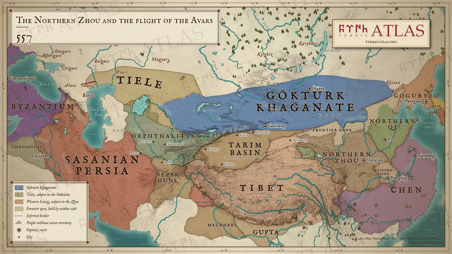
557557: The Northern Zhou and the flight of the Avars
 © Emre-E Yavuz 2026
557: Kuzey Zhou, Batı Wei'nin yerini alır ve Chen, Liang tahtına geçer. Batıda Avarlar Göktürklerin önünden kaçar ve Kafkasya'nın kuzeyindeki Alanlara ulaşır. Yolları kaydedilmemiştir. Modern harita, Avarların yolu modern bir yeniden kurmadır. Harita Yer aldığı yer: Yıl 557, Kuzey Zhou, Avarların Kaçışı (557)
-
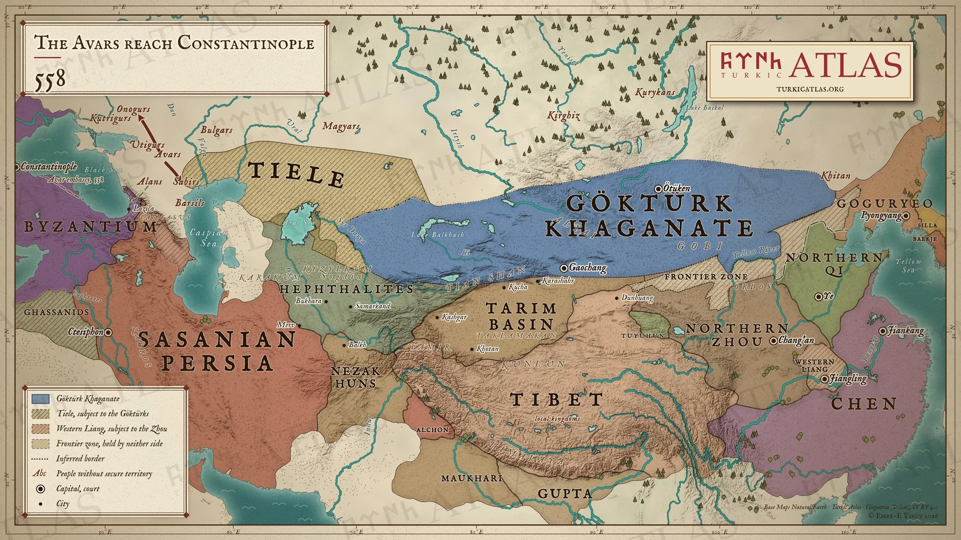
558558: The Avars reach Constantinople
 © Emre-E Yavuz 2026
558: Avarların ilk elçiliği Alanlar ve Lazika üzerinden Konstantinopolis'e gelir. Avarlar ardından Onogurları yener ve Sabirleri yok eder. Modern harita, elçiliğin yolu çizilmiştir, savaşların yerleri kaydedilmemiştir. Harita Yer aldığı yer: Yıl 558, Avarların Kaçışı (557), Avars, Sabirs
-
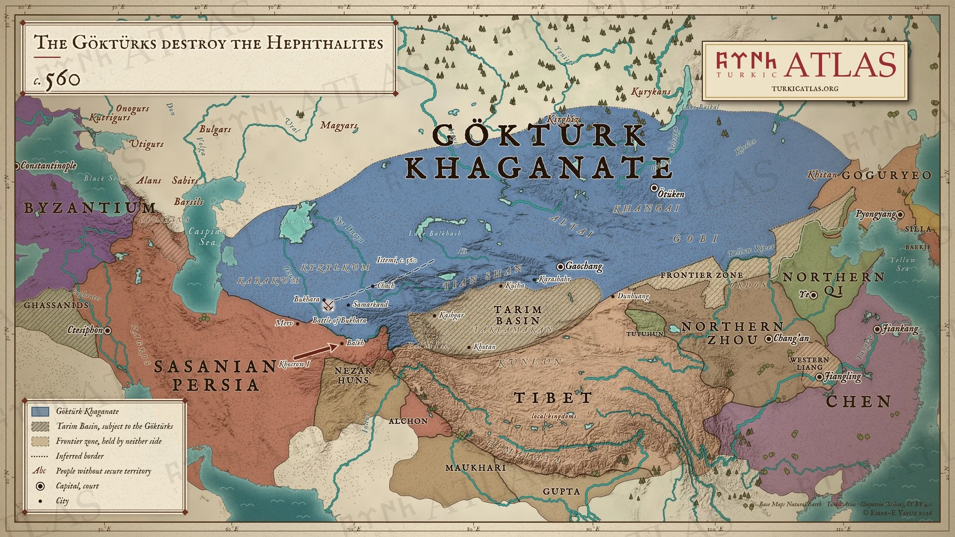
c. 560c. 560: The Göktürks destroy the Hephthalites
 © Emre-E Yavuz 2026
560 dolaylarında İstemi Çaç üzerinden Soğd'a ilerler ve Buhara Savaşı'nda Eftalitleri yok eder, I. Hüsrev ise onların Ceyhun'un güneyindeki topraklarını Belh'e kadar alır. Ceyhun, Göktürkler ile İran arasındaki sınır olur. Modern harita, İstemi'nin güzergâhı çizilmiştir. Harita Yer aldığı yer: Yıl 560, İstemi, Mukan Kağan, Birinci Göktürk Kağanlığı, Kuzey Zhou, Buhara Muharebesi, Hephthalites, Türk halklarının tarihi
-
c. 571c. 571: The Göktürk embassy to Constantinople
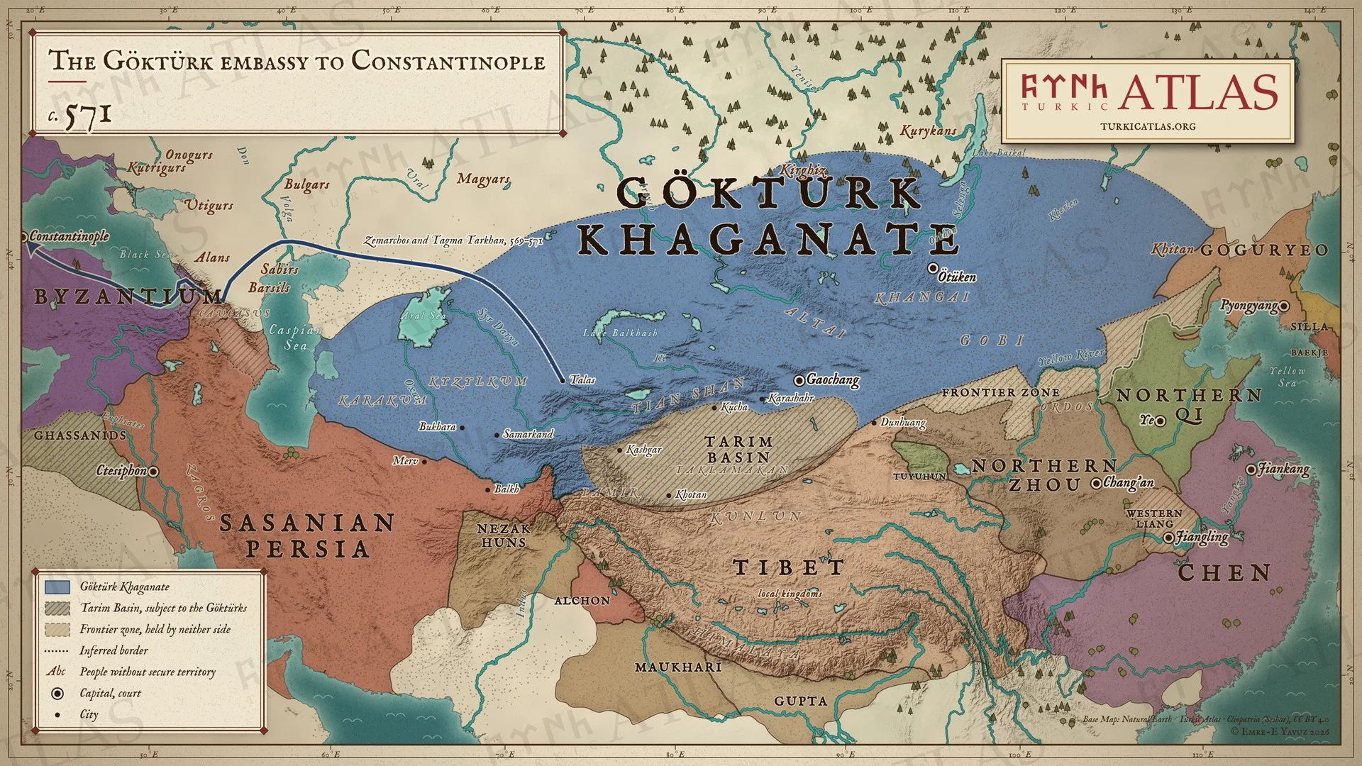 © Emre-E Yavuz 2026
569–571: Zemarkhos, Tagma Tarkan yönetimindeki bir Göktürk elçiliğiyle İstemi'nin yanından döner. Talas'tan Hazar'ın kuzeyindeki bozkırı aşar, Ogurların ve Alanların topraklarından ve Dareine yolundan Karadeniz'e ulaşır, 571'in sonunda Konstantinopolis'e varır. Modern harita, duraklar Menandros'unkilerdir, aralarındaki yol çizilmiştir. Harita Yer aldığı yer: Yıl 571, Zemarkhos elçiliği, 569
-
572572: Taspar and the lesser khans
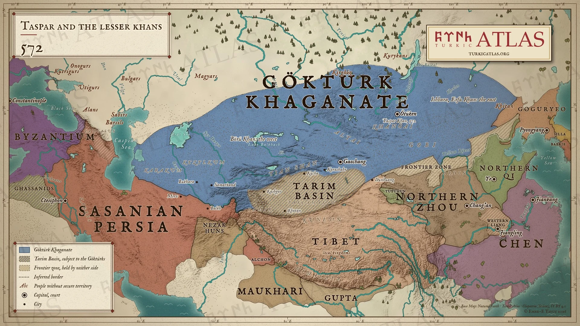 © Emre-E Yavuz 2026
572: Taspar, Mukan'ın yerine geçer ve kendine bağlı iki küçük kağan atar: yeğeni İşbara'yı Erfu Kağan olarak doğuya, Rudan Kağan'ın oğlu Börü Kağan'ı batıya. Harita yalnızca adlarını verir. Modern harita, kağanlığın sınırları yaklaşıktır. Harita Yer aldığı yer: Yıl 572, Taspar Kağan'ın Küçük Kağanları Ataması (572)
-
576576: The Pontic steppe under Göktürk rule
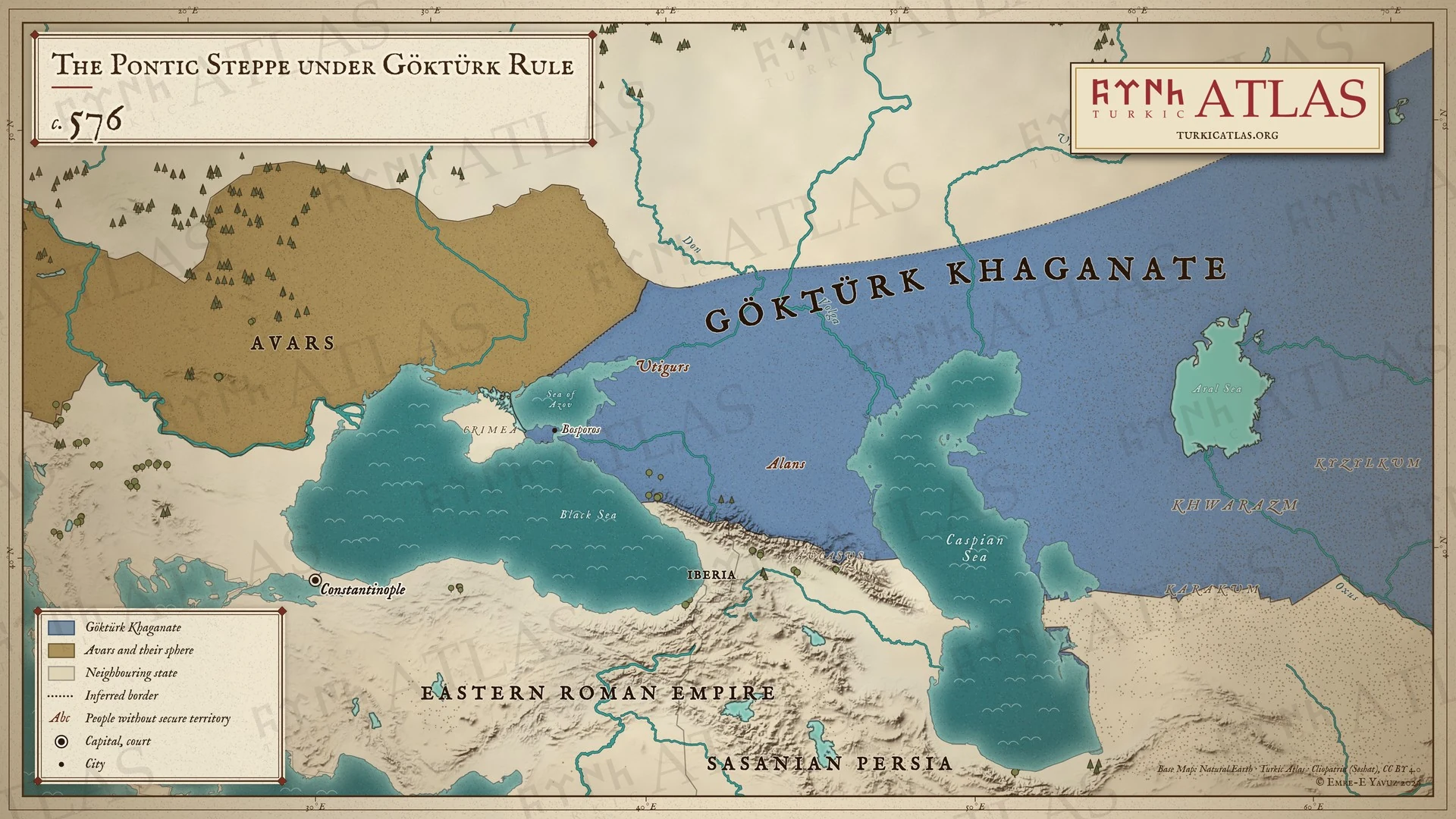 © Emre-E Yavuz 2026
Yak. 576: Göktürkler Azak Denizi'nden doğuya uzanan bozkırı tutar ve Bosporos'u alır. Utigurlar ve Alanlar onlara bağlıdır. Don'un batısında Avarlar ve nüfuz alanları uzanır. Modern harita, batı sınırları yorumdur. Harita Yer aldığı yer: Yıl 576, Avrupa'daki Türk boyları
-
c. 576The First Göktürk Khaganate, c. 576
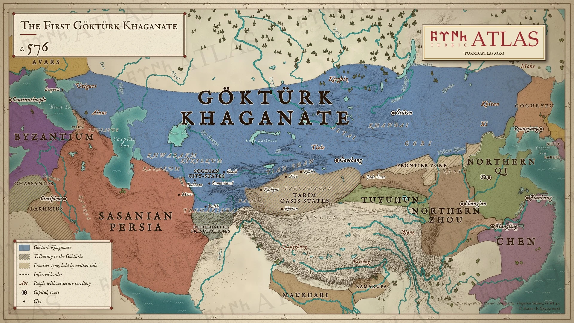 © Emre-E Yavuz 2026
576 civarında, İstemi Kağan'ın öldüğü yıl Birinci Göktürk Kağanlığı: Karadeniz'den Kitanlara kadar uzanan devlet, haraç veren Tarım vaha devletleri ve Eftalit beylikleri, yanında Doğu Roma İmparatorluğu, Sasani İmparatorluğu, Kuzey Zhou, Kuzey Qi ve Chen. Bozkır ile Çin arasında Kuzey Qi suru (556) ve iki tarafa da ait olmayan bir sınır bölgesi yer alır. Modern harita, batı sınırı çıkarımdır ve sınırlar yaklaşıktır. Harita Yer aldığı yer: Yıl 576
-
581The division of the khaganate, AD 581
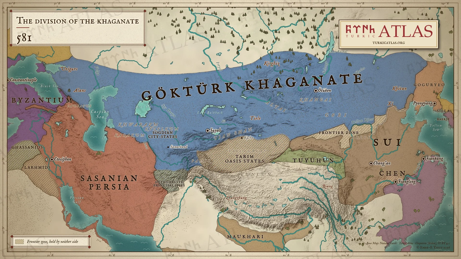 © Emre-E Yavuz 2026
581'de, Taspar Kağan'ın öldüğü yıl Göktürk Kağanlığı, Karadeniz'den Kitanlara kadar henüz bölünmemiş, sarayı Ötüken'de. Yanında o yıl hüküm sürmeye başlayan Sui, Chen, Sasani İmparatorluğu ve Doğu Roma İmparatorluğu. Bozkır ile Çin arasında Kuzey Qi suru (556) ve iki tarafa da ait olmayan bir sınır bölgesi yer alır. Modern harita, sınırlar yaklaşıktır. Harita Yer aldığı yer: Yıl 581, Taspar Kağan, Göktürk Taht Krizi (581)
-
582–583582–583: Ishbara's campaigns against the Sui
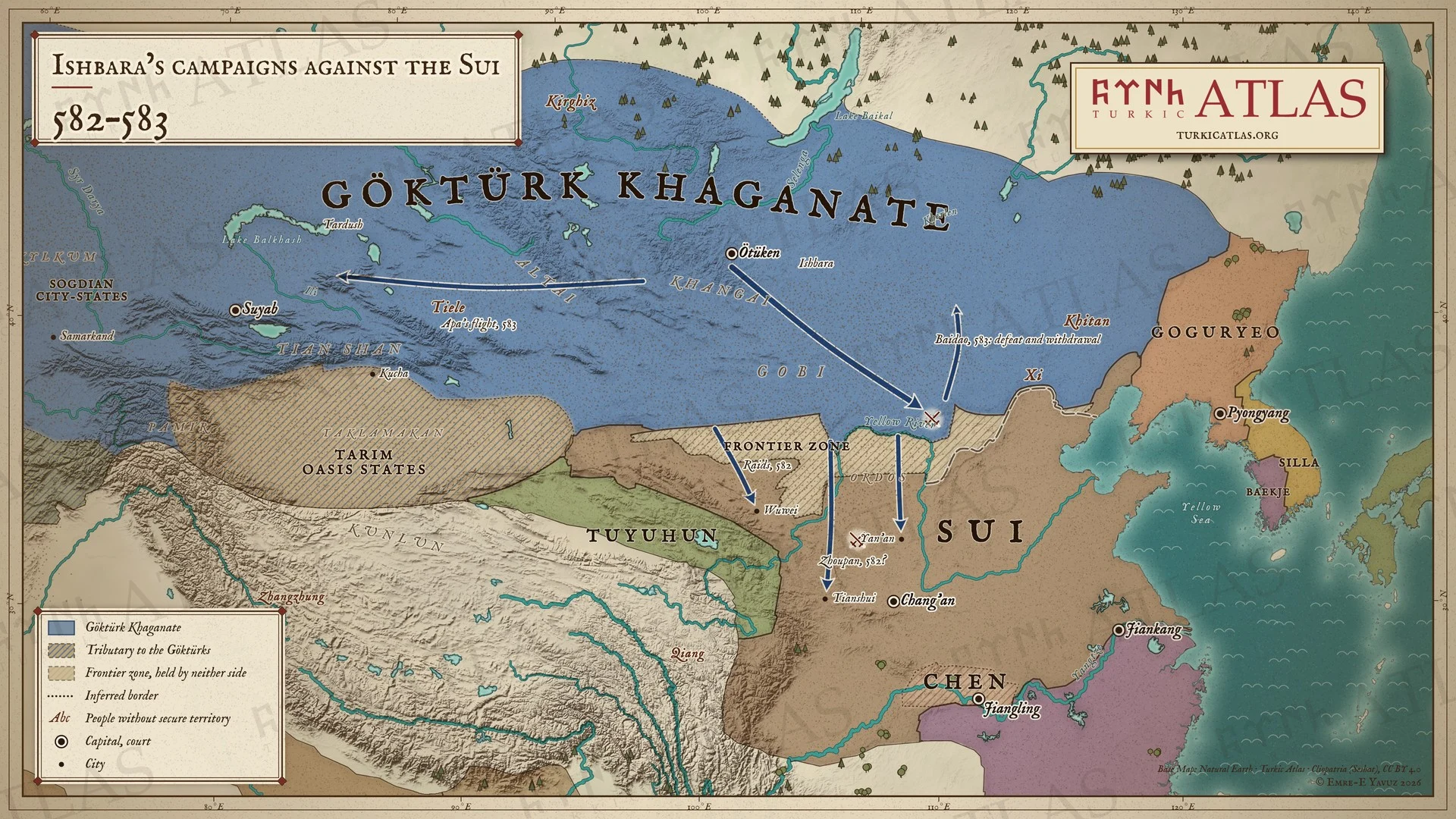 © Emre-E Yavuz 2026
582–583: 582'de İşbara önderliğindeki Göktürkler Uzun Sur'u aşar ve Sui sınırını Wuwei'den Yan'an'a kadar yağmalar. 583'te İşbara Ötüken'den Baidao'ya yürür, yenilir ve geri çekilir, Apa ise batıya, Tarduş'un yanına kaçar. Modern harita, akınların yolları çizilmiştir. Harita Yer aldığı yer: Yıl 582, İşbara Kağan, Göktürk-Sui Savaşları, 582–603
-
584The division of the khaganate, AD 584
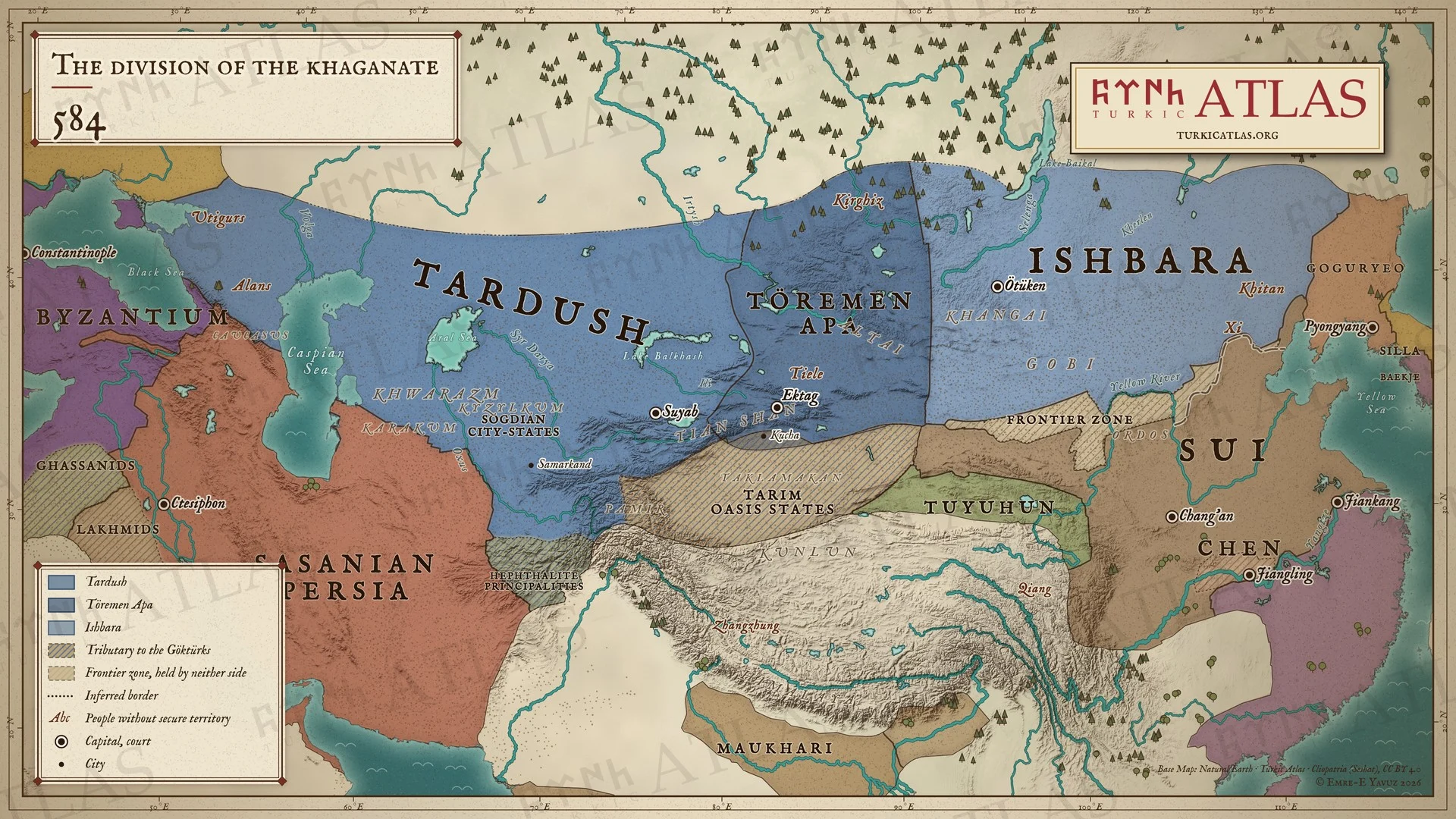 © Emre-E Yavuz 2026
584'te, iç savaş başladığında Göktürk ülkesi: batıda Tarduş, ortada Töremen Apa, doğuda İşbara, yanlarında Sui, Chen, Sasani İmparatorluğu ve Doğu Roma İmparatorluğu. Bozkır ile Çin arasında Kuzey Qi suru (556) ve iki tarafa da ait olmayan bir sınır bölgesi yer alır. Modern harita, bölgeler yaklaşıktır. Harita Yer aldığı yer: Yıl 584, Tarduş, Töremen Apa, Birinci Göktürk Kağanlığı, Göktürk İç Savaşı
-
585585: The Göktürk civil war
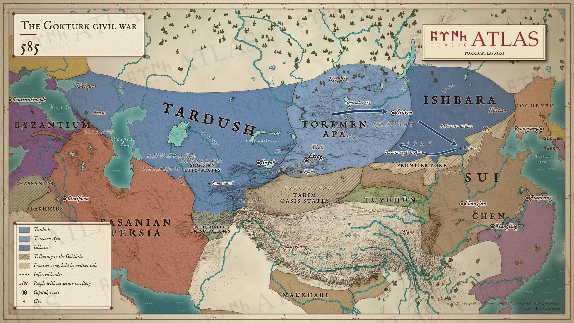 © Emre-E Yavuz 2026
585: Eylülde batının ordusu Ötüken'e yürür. İşbara Sui himayesinde Baidao'ya çekilir ve oradan Apa'ya karşı saldırıya geçer. Modern harita, yollar çizilmiştir, kağanlık içindeki bölünmeler yaklaşıktır. Harita Yer aldığı yer: Yıl 585, İşbara Kağan, Töremen Apa, Göktürk İç Savaşı
-
587–588587–588: The Göktürk civil war
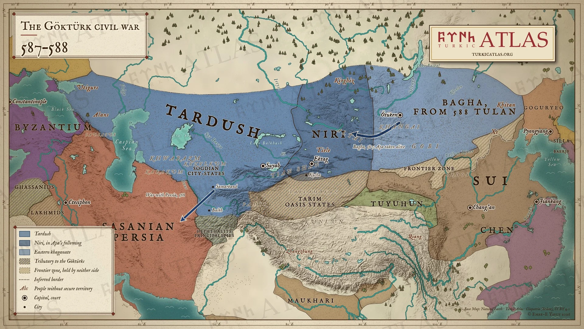 © Emre-E Yavuz 2026
587–588: İşbara ölür, doğuda yerine Bağa geçer. Bağa batıya yürür ve Apa'yı canlı yakalar, Apa'nın taraftarlarının başına Niri geçer. 588'de Bağa ölür ve yerine Tulan geçer, batı ise o sırada İran'la savaştadır. Modern harita, yollar çizilmiştir, kağanlık içindeki bölünmeler yaklaşıktır. Harita Yer aldığı yer: Yıl 587, Bağa Kağan, Töremen Apa, Tulan Kağan, Göktürk İç Savaşı
-
589589: Bahram Chobin and the end of the Chen
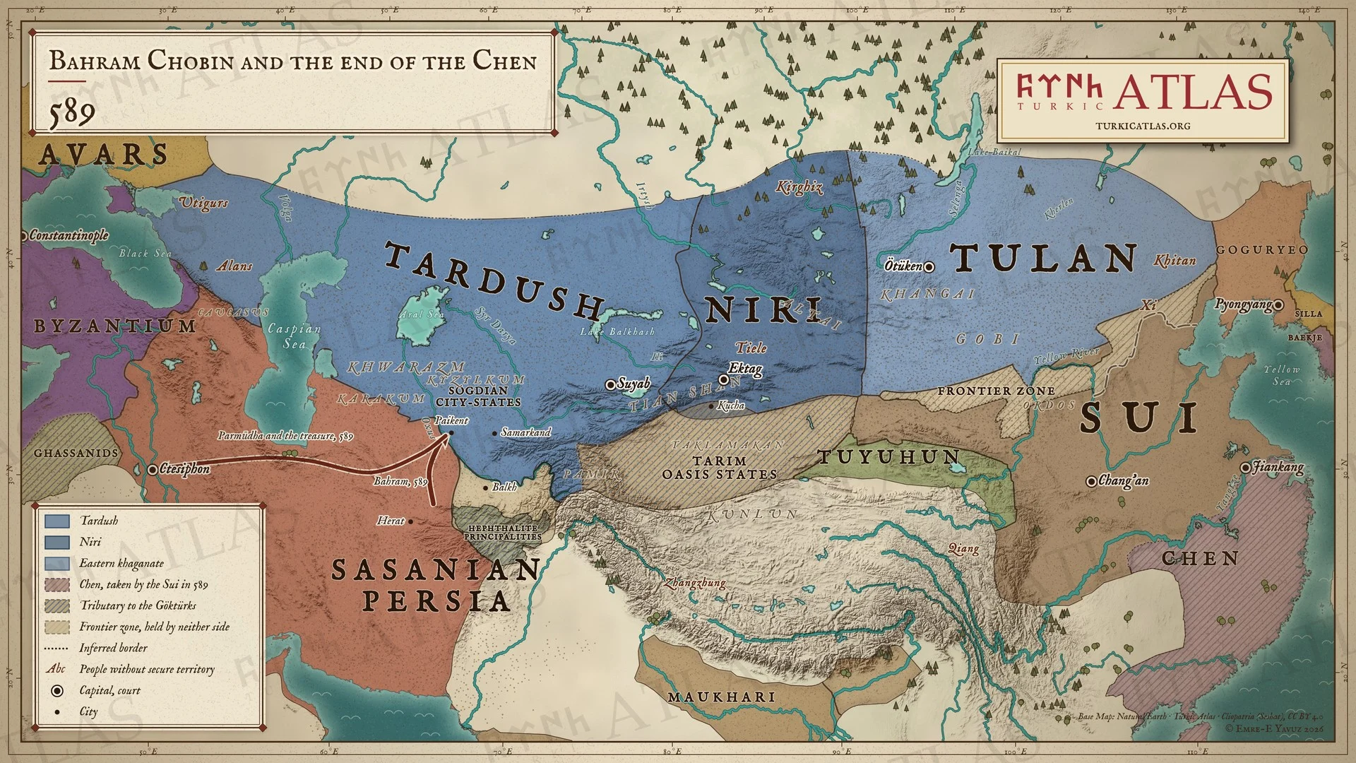 © Emre-E Yavuz 2026
589: Behram Çubin Herat'ı geri alır ve Ceyhun'u geçip Paykent'e varır. Parmūdha ve hazine Ktesifon'a gönderilir. Aynı yıl Sui, Chen'i alır ve Çin'i birleştirir. Modern harita, yollar çizilmiştir, kağanlık içindeki bölünmeler yaklaşıktır. Harita Yer aldığı yer: Yıl 589, Bahram Chobin
-
597–599597–599: The Göktürk civil war
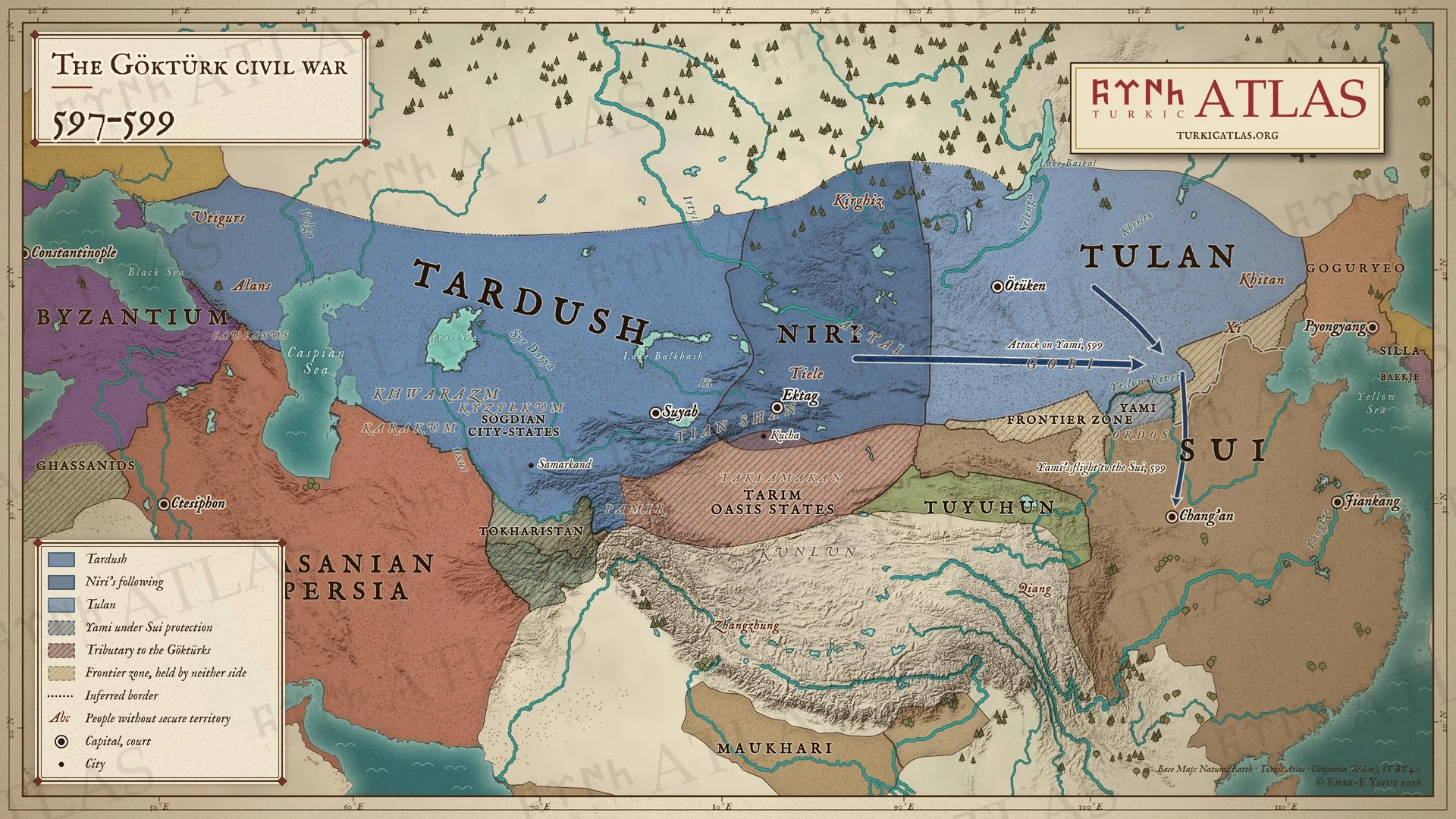 © Emre-E Yavuz 2026
597–599: Bir Sui prensesiyle evlenmiş olan Yami, 599'da Uzun Sur'un altında Tulan ve Tarduş'un saldırısına uğrar. Chang'an'daki Sui sarayına kaçar ve Qimin Kağan yapılır, Sui de halkına Ordos'ta otlaklar verir. Modern harita, yollar çizilmiştir, kağanlık içindeki bölünmeler yaklaşıktır. Harita Yer aldığı yer: Yıl 597, Tarduş, Tulan Kağan, Yami Khan, Göktürk İç Savaşı
-
600600: Tardush and the Sui
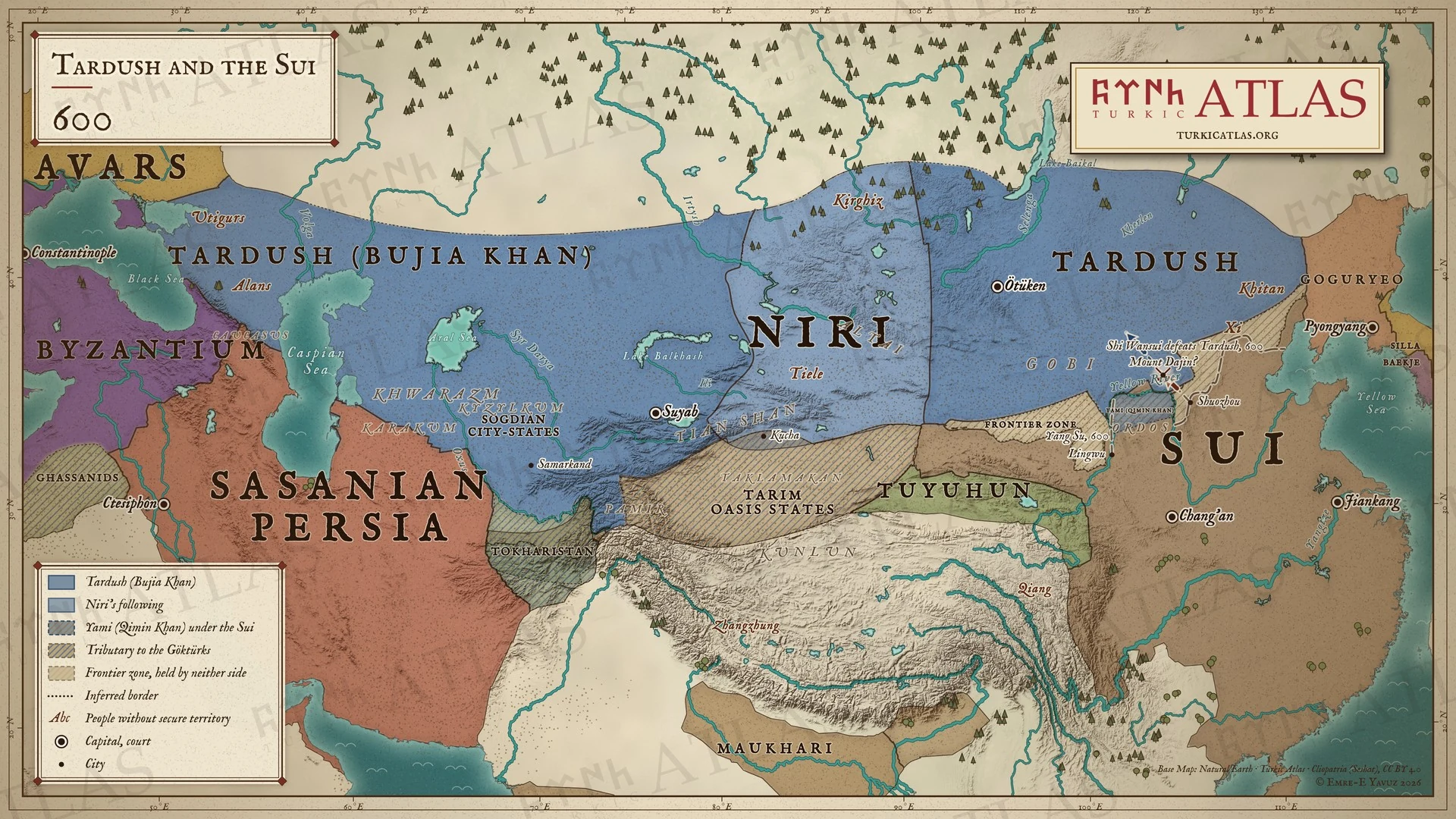 © Emre-E Yavuz 2026
600: Artık Bujia Kağan olan Tarduş bütün bozkıra hâkimdir. Yami, Ordos'ta Sui yönetiminde Qimin Kağan olarak hüküm sürer. Dajin Dağı'nda Tarduş, Shi Wansui karşısında savaşmadan çekilir. Modern harita, dağın yeri ve yollar çizimdir, kaynaklarda geçmez. Harita Yer aldığı yer: Yıl 600
-
c. 603The division of the khaganate, c. AD 603
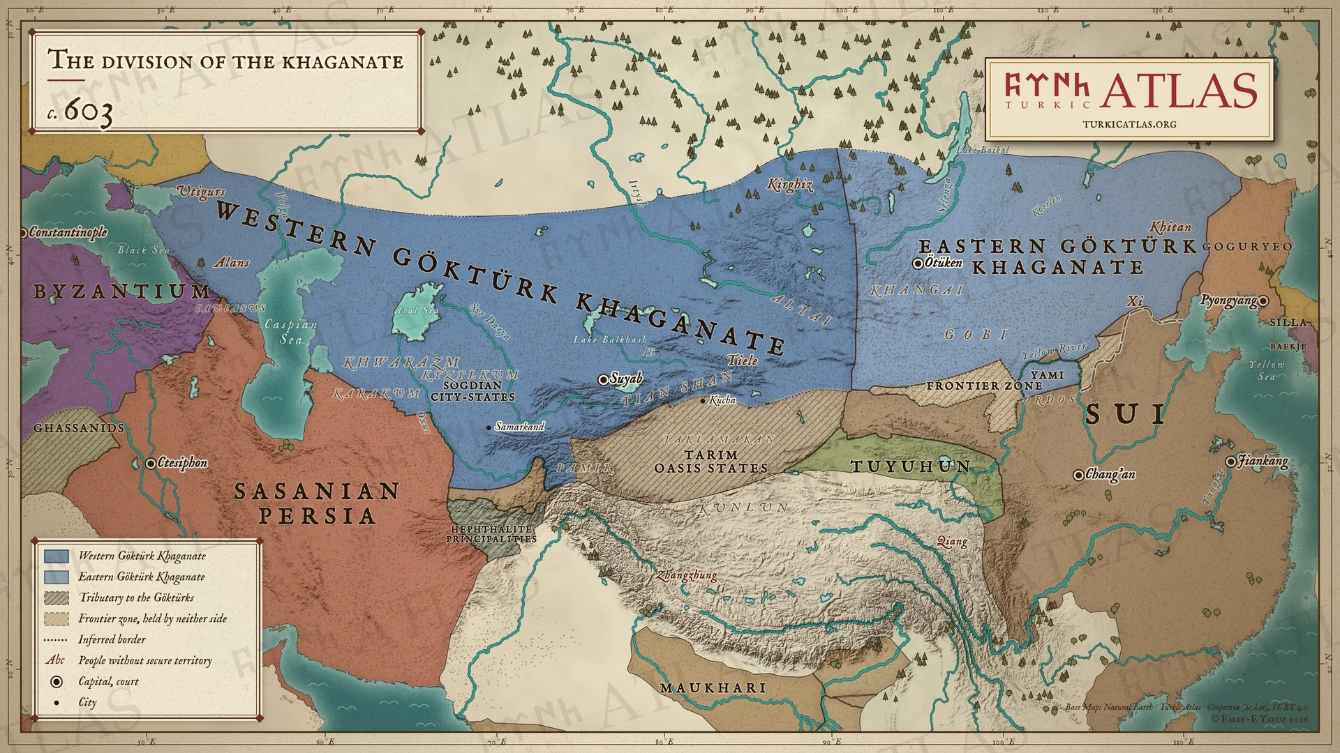 © Emre-E Yavuz 2026
603 civarında bölünmüş kağanlık: Karadeniz'den Tanrı Dağları'na Batı Göktürk Kağanlığı ve Hangay'dan Kitanlara Doğu Göktürk Kağanlığı, yanlarında artık bütün Çin'e hükmeden Sui, Sasani İmparatorluğu ve Doğu Roma İmparatorluğu. Bozkır ile Çin arasında Kuzey Qi suru (556) ve iki tarafa da ait olmayan bir sınır bölgesi yer alır. Baidao ovası Göktürklere aittir, Ordos'un kuzeyi Yami'nin otlağıdır. Modern harita, doğu ile batı arasındaki çizgi yaklaşıktır. Harita Yer aldığı yer: Yıl 603, Tarduş, Yami Khan, Göktürk İç Savaşı
-
627627: The Caucasus campaign and the revolt of the Tiele
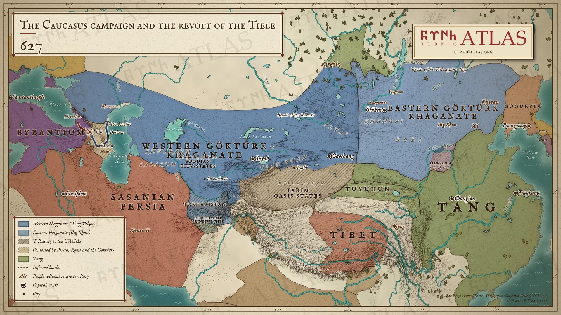 © Emre-E Yavuz 2026
627: Batıda Tong Yabgu'nun ordusu Derbent'i aşar ve Jebu Xak'an Tiflis önünde imparator Herakleios ile buluşur. Doğuda Tieleler İlig Kağan'a karşı ayaklanır, büyük bir kar halkının sürülerini öldürür. Modern harita, bozkırdaki sınırlar yaklaşıktır. Harita Yer aldığı yer: Yıl 627, Tong Yabgu
-
628628: The murder of Tong Yabgu and the secession of the Tiele
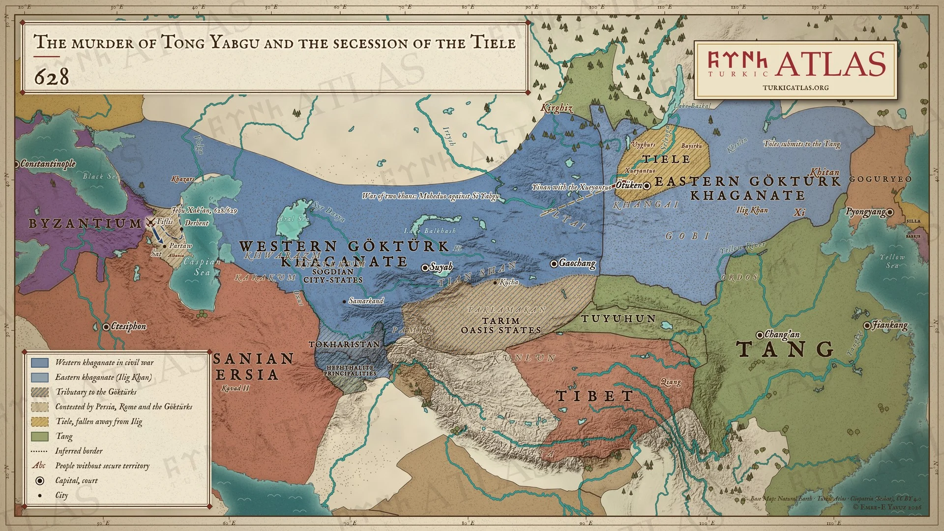 © Emre-E Yavuz 2026
628: Batıda Tong Yabgu amcası tarafından öldürülür ve iki kağan ülke için savaşır. Yinan, Xueyantuoları Altay'dan doğuya götürür. Doğuda Tieleler İlig Kağan'dan ayrılır, Töles Tang'a bağlanır. Kafkasya'da Jebu Xak'an 628 ya da 629'da Tiflis'i alır. Modern harita, bozkırdaki sınırlar yaklaşıktır. Harita Yer aldığı yer: Yıl 628, Xueyantuo Kağanlığı (Sir Tarduş), Tong Yabgu'nun Öldürülmesi (630)
-
630630: The fall of the eastern khaganate
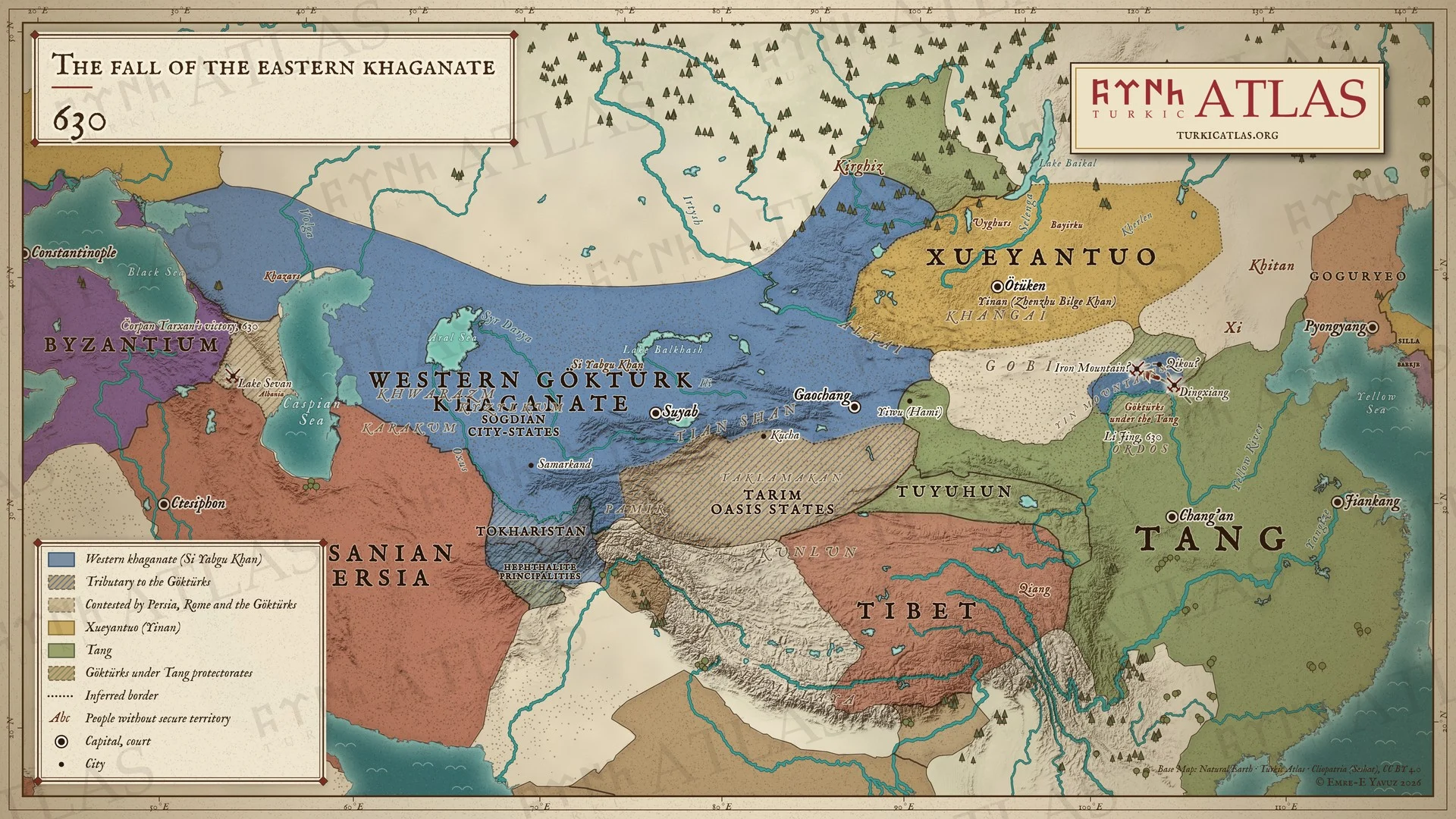 © Emre-E Yavuz 2026
630: Li Jing gece Dingxiang'a baskın yapar ve Demir Dağ'da Doğu Kağanlığını yıkar. Göktürkler Sarı Irmak boyunca Tang koruyuculuğu altına yerleştirilir. Gobi'nin kuzeyinde bozkırı Xueyantuolar tutar, Yiwu Tang'a geçer. Batıda Si Yabgu Kağan hüküm sürer, Kafkasya'da kuzey ordusu Sevan Gölü'nde kazanır. Modern harita, bozkırdaki sınırlar yaklaşıktır. Harita Yer aldığı yer: Yıl 630, Doğu Kağanlığının Tang Tarafından Fethi, 626–630, Türk halklarının tarihi
-
638638: The western khaganate divided
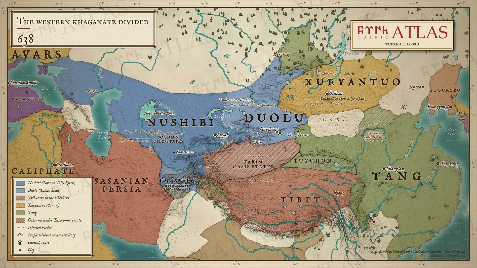 © Emre-E Yavuz 2026
638: Duolu boyları Yukuk Şad'ı İşbara Tolis'e karşı kağan yapar. Batı Kağanlığı İli ırmağında bölünür. Batıda Nuşibi, doğuda Duolu bulunur. Modern harita, ırmaktan uzaktaki sınır çizimdir, kaynaklarda geçmez. Harita Yer aldığı yer: Yıl 638
-
648648: The Tang conquest of the Tarim
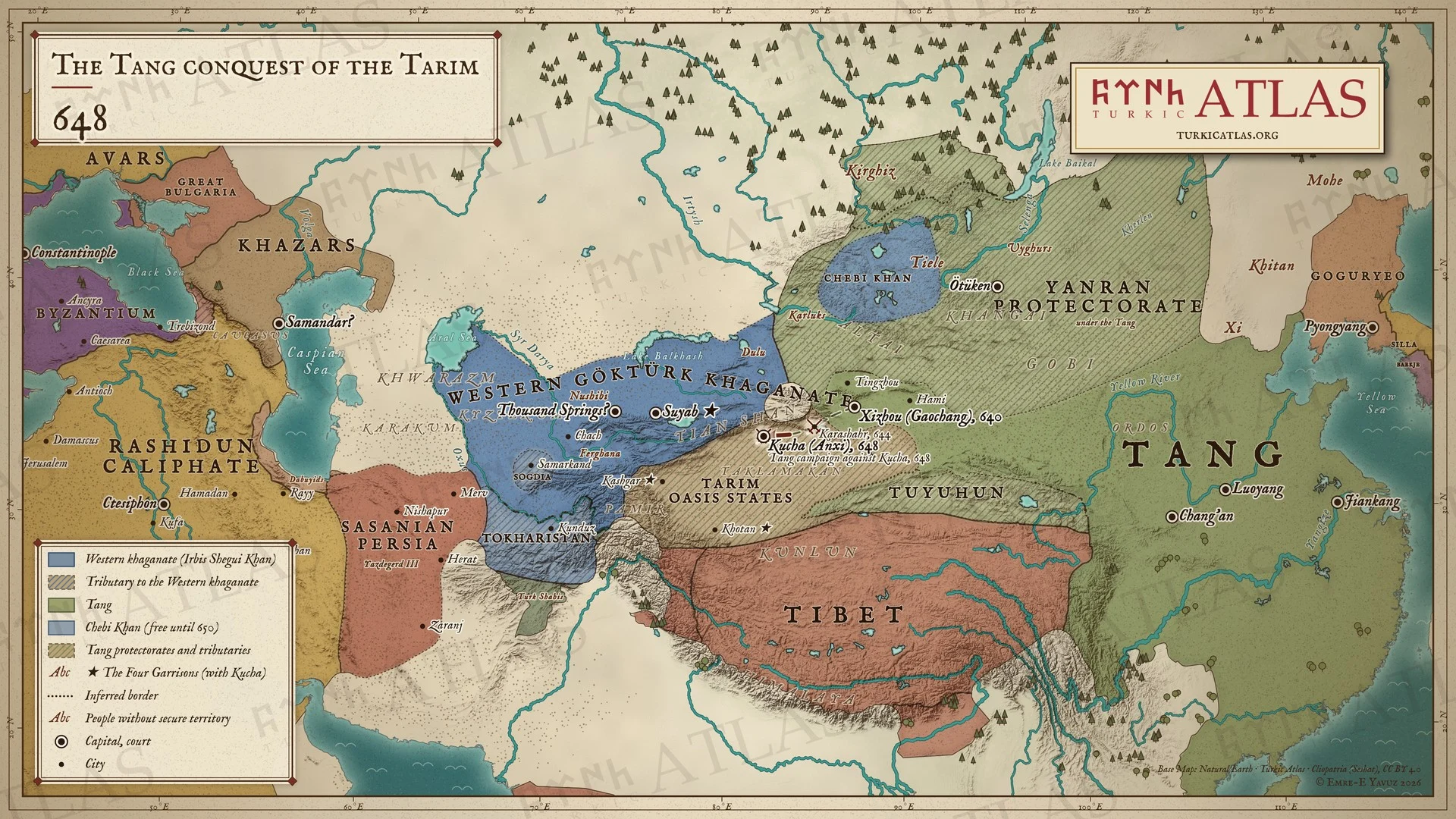 © Emre-E Yavuz 2026
648: Tang, Tarim'i adım adım alır: 640'ta Gaochang, 644'te Karaşar, 648'de Kuça. Anxi koruyuculuğu artık Kuça'dadır. Kuça, Hotan, Kaşgar ve Suyab Dört Garnizon olur. Tanrı Dağları'nın kuzeyinde Batı Kağanlığı İrbis Şegui Kağan yönetiminde ayakta kalır, Altay'da Chebi Kağan hâlâ bağımsızdır. Modern harita, bozkırdaki sınırlar yaklaşıktır. Harita Yer aldığı yer: Yıl 648, The Tang conquest of the western Khaganate, 640–659, Kuça
-
650The Western khaganate and the Tang, AD 650
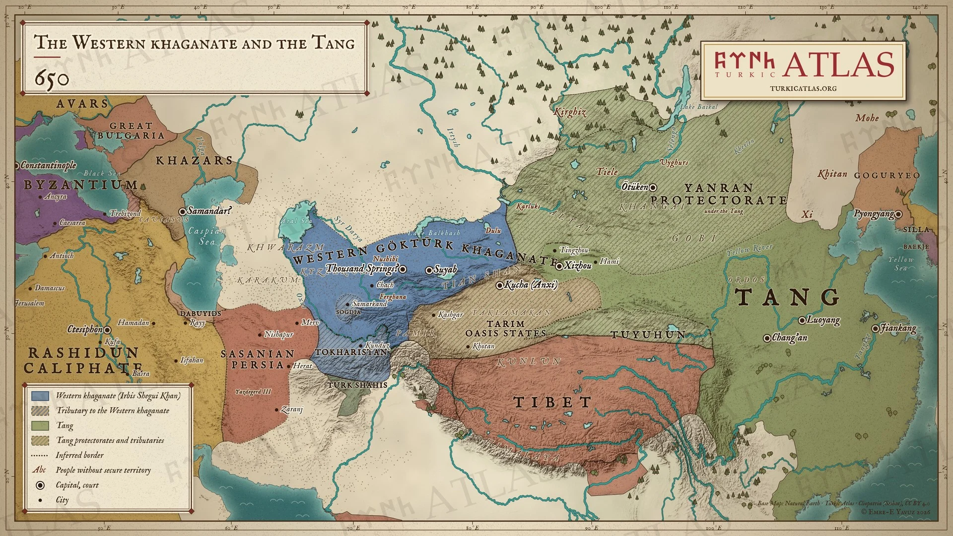 © Emre-E Yavuz 2026
650 yılında Asya: İrbis Şegui Kağan'ın Batı Göktürk Kağanlığı Tarbagatay'dan Ceyhun'a kadar uzanır, Soğd ve Toharistan ona bağlıdır. Doğuda Tang, bozkırı Yanran koruyuculuğu ile yönetir. Kırgızlar ve Tarim vaha devletleri ona haraç öder, Anxi Kuça'dadır. Batıda Halifelik Irak'ı ve Batı İran'ı almıştır, III. Yezdicerd'in elinde yalnızca Horasan ve Sistan kalmıştır. Modern harita, kağanlığın ve koruyuculukların sınırları yaklaşıktır. Harita Yer aldığı yer: Yıl 650, Irbis Shegui Khan, Türk halklarının tarihi
-
657657: The end of the western khaganate
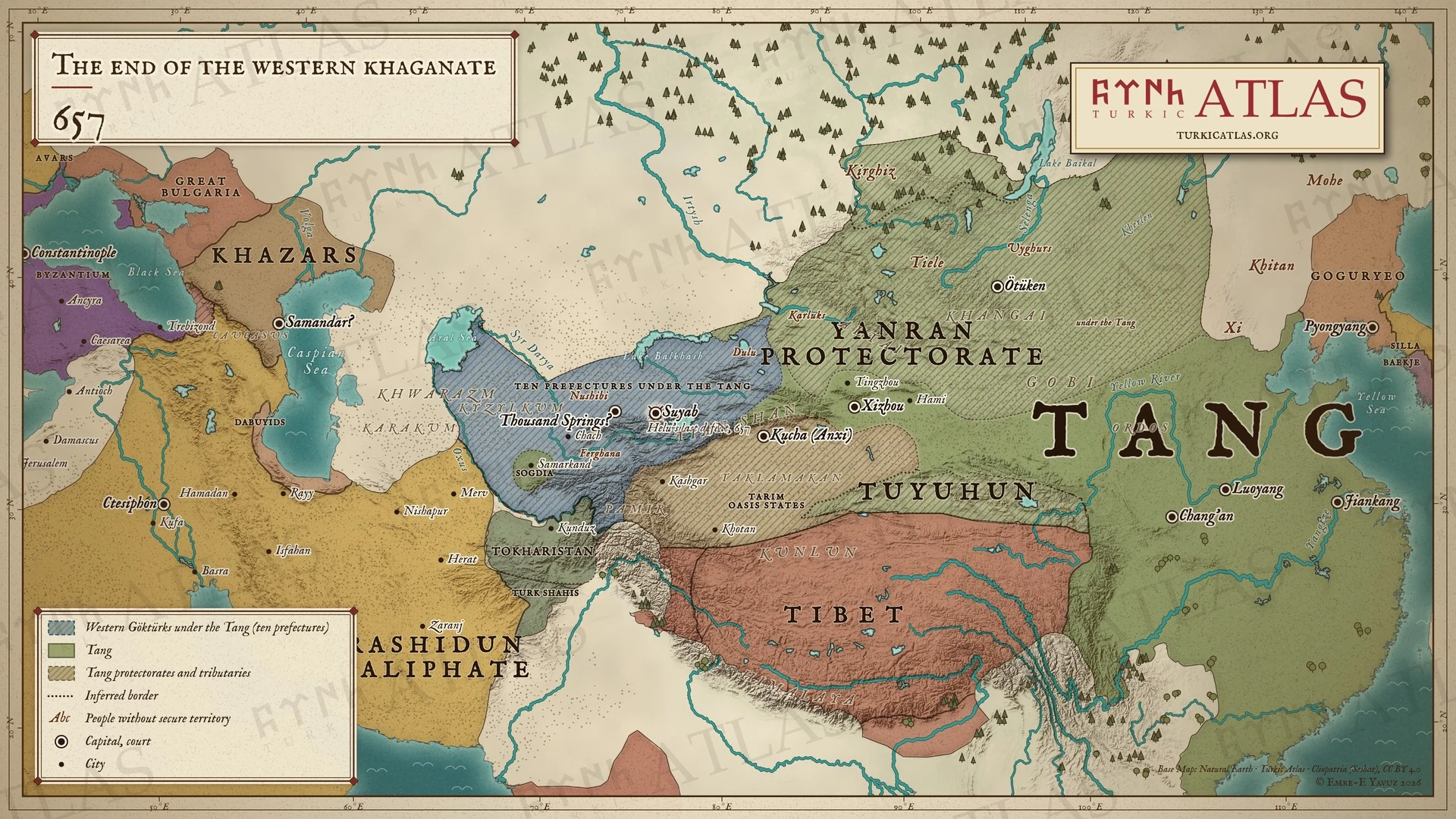 © Emre-E Yavuz 2026
657: Tang, Batı Göktürklerin son kağanı Aşina Helu'yu ele geçirir. Toprakları Tang yönetiminde on vilayete bölünür. Modern harita, vilayetlerin sınırları çizimdir, kaynaklarda geçmez. Harita Yer aldığı yer: Yıl 657, Türk halklarının tarihi
-
670670: Tibet takes the Four Garrisons
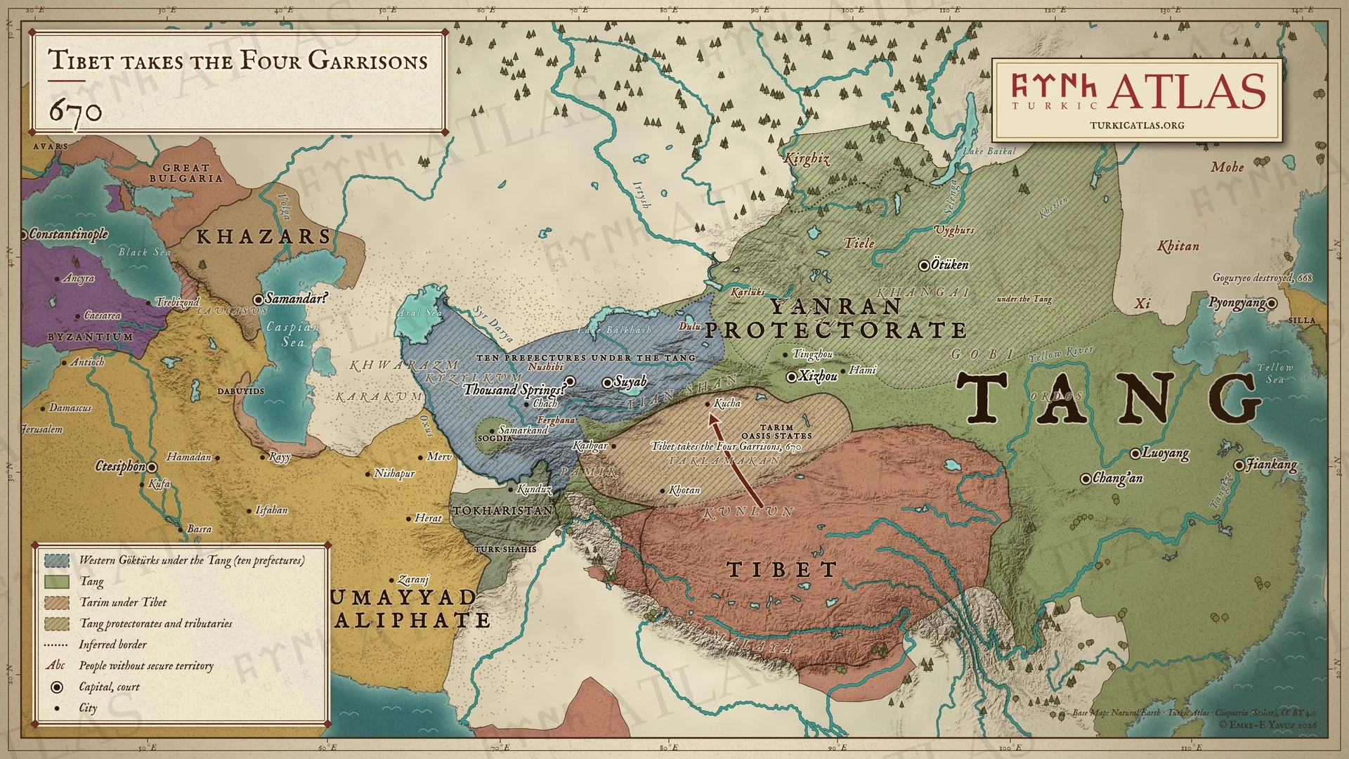 © Emre-E Yavuz 2026
670: Tibet, Tarım'ın Dört Garnizonu'nu Tang'dan alır. Otuz yıl boyunca vahalar defalarca el değiştirir. Modern harita, Tibet hâkimiyetinin sınırı çizimdir, kaynaklarda geçmez. Harita Yer aldığı yer: Yıl 670
-
679–681679–681: The risings of Nishufu and Funian
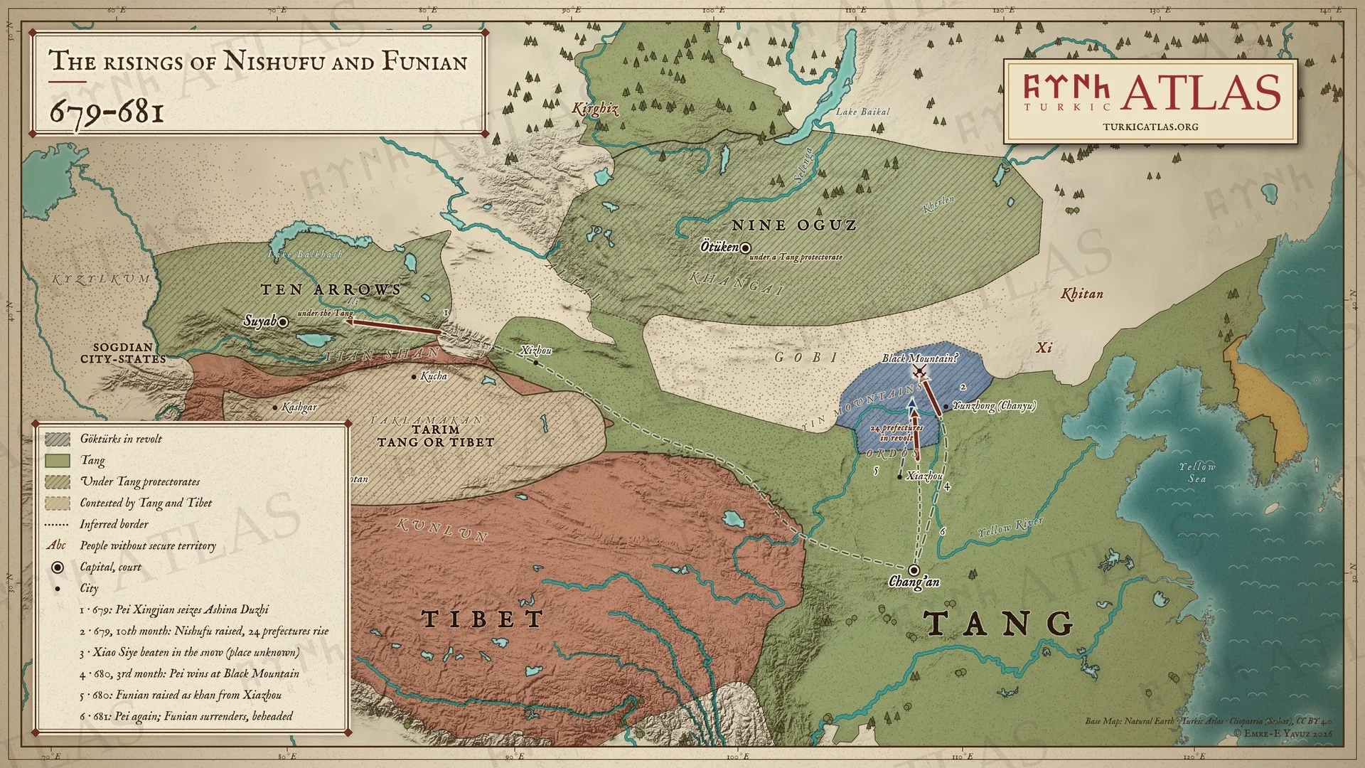 © Emre-E Yavuz 2026
679–681: 679'da Chanyu koruyuculuğundaki Göktürkler Nişufu'yu kağan yapar, yirmi dört vilayet onlarla birlikte ayaklanır. Pei Xingjian 680'de onları Kara Dağ'da yener, Nişufu kendi adamlarınca öldürülür. Ardından Xiazhou'da kağan yapılan Funian 681'de Pei Xingjian'a teslim olur ve Chang'an'da başı vurulur. Numaralar olayların sırasını izler. Modern harita, yollar çizimdir, kaynaklarda geçmez. Harita Yer aldığı yer: Yıl 679, Ashina Funian, Nishufu Khan, Pei Xingjian
-
682682: The rising of Ilterish
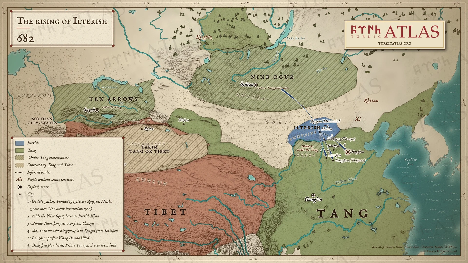 © Emre-E Yavuz 2026
682: Funian'ın yenilgisinden sonra Gudulu kaçakları Zongcai Dağı'nda ve Heisha'da toplar, Dokuz Oğuz'a akın eder ve kendini İlteriş Kağan ilan eder. Aşide Yuanzhen ona katılır. Onuncu ayda Göktürkler Bingzhou, Lanzhou ve Dingzhou'ya akın eder. Numaralar olayların sırasını izler. Modern harita, yollar çizimdir, kaynaklarda geçmez. Harita Yer aldığı yer: Yıl 682, İlteriş Kağan, İkinci Göktürk Kağanlığı
-
691691: Kapgan Khan takes the throne
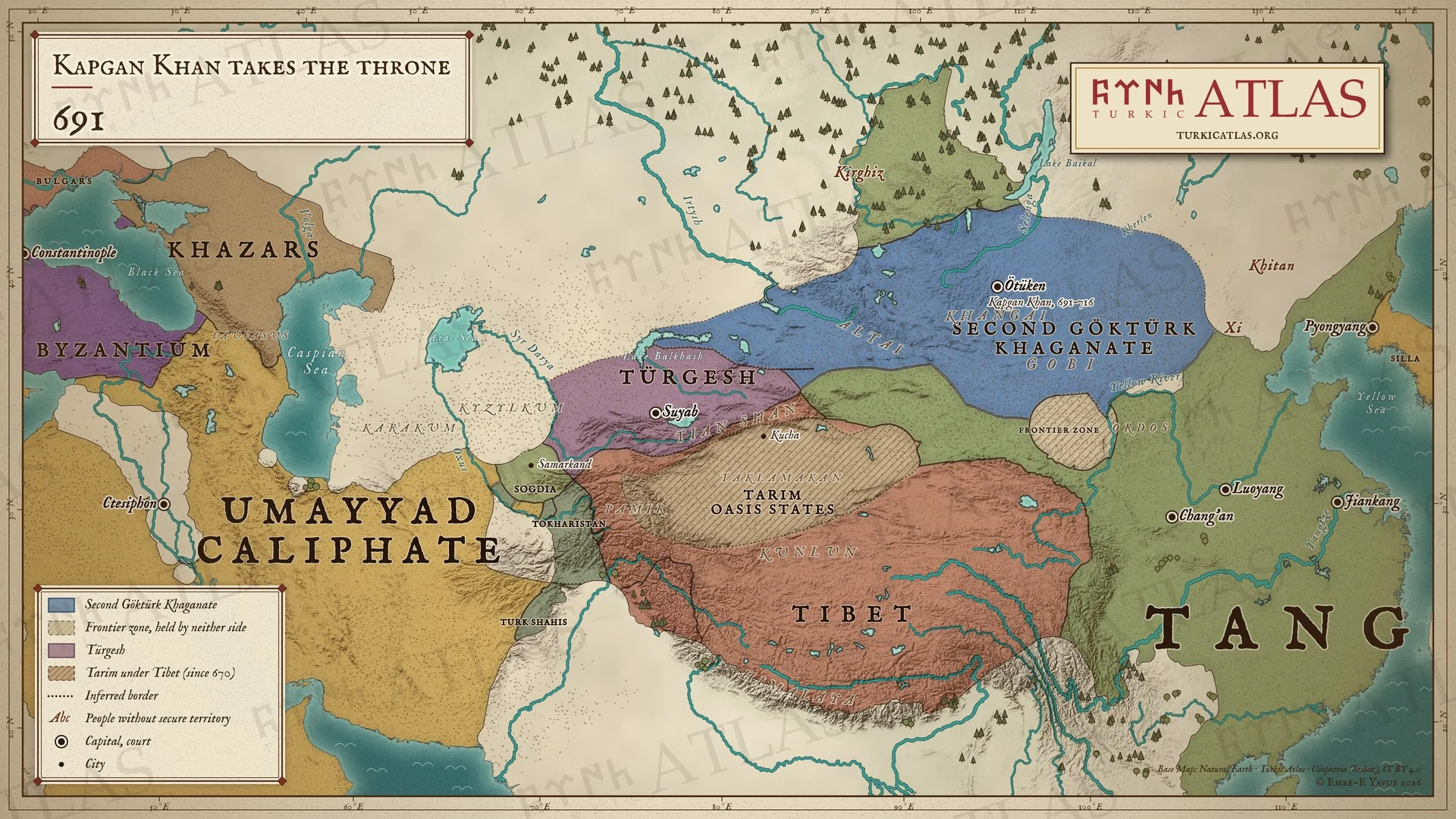 © Emre-E Yavuz 2026
691: Kapgan Kağan İkinci Göktürk Kağanlığı'nın tahtına çıkar. Batıda Türgişler Suyab çevresindeki Çu vadisini tutar. Modern harita, sınırlar çizimdir, kaynaklarda geçmez. Harita Yer aldığı yer: Yıl 691
-
692692: The Tang retake the Four Garrisons
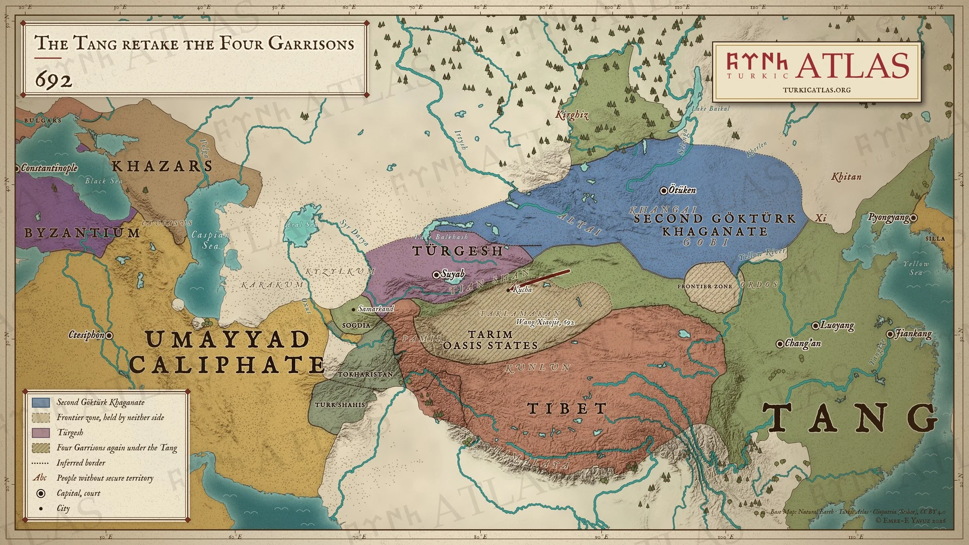 © Emre-E Yavuz 2026
692: Wang Xiaojie komutasındaki Tang, Tarım'ın Dört Garnizonu'nu Tibet'ten geri alır. Modern harita, ordunun yolu çizimdir, kaynaklarda geçmez. Harita Yer aldığı yer: Yıl 692
-
699699: Kapgan orders the realm
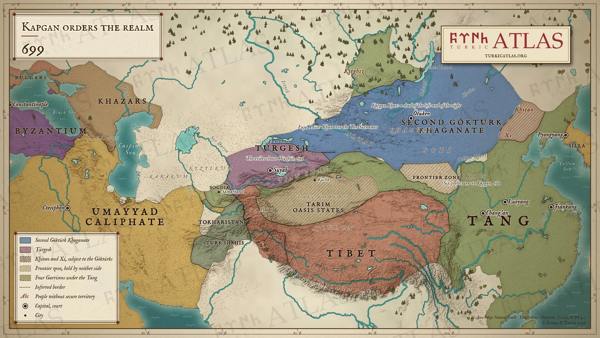 © Emre-E Yavuz 2026
699: Kapgan Kağan devletini iki şad altında düzenler ve oğlu Fuju'yu batıda Küçük Kağan yapar. On Ok boyları Türgiş Wuzhile'yi seçer. Modern harita, sınırlar çizimdir, kaynaklarda geçmez. Harita Yer aldığı yer: Yıl 699
-
711711: Kapgan's western war
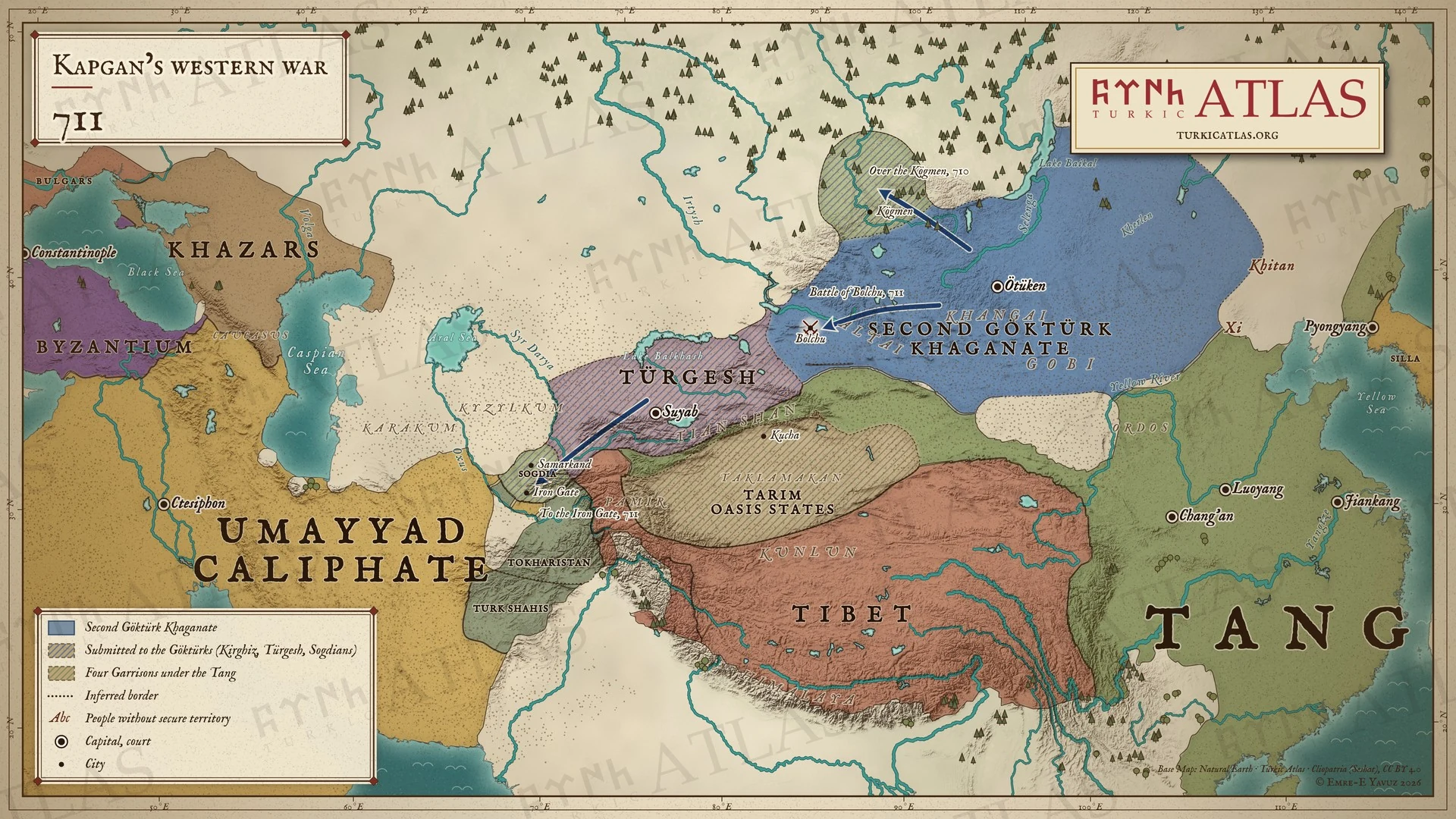 © Emre-E Yavuz 2026
710–711: Tonyukuk Kögmen'i aşar ve Kırgız kağanını öldürür, Bolçu'da Türgişleri yok eder ve orduyu Demir Kapı'ya götürür. Orada Soğdlar boyun eğer. Modern harita, yollar yazıtların andığı yerler arasında çizilmiştir. Harita Yer aldığı yer: Yıl 711
-
716716: The death of Kapgan and Bilge Khan
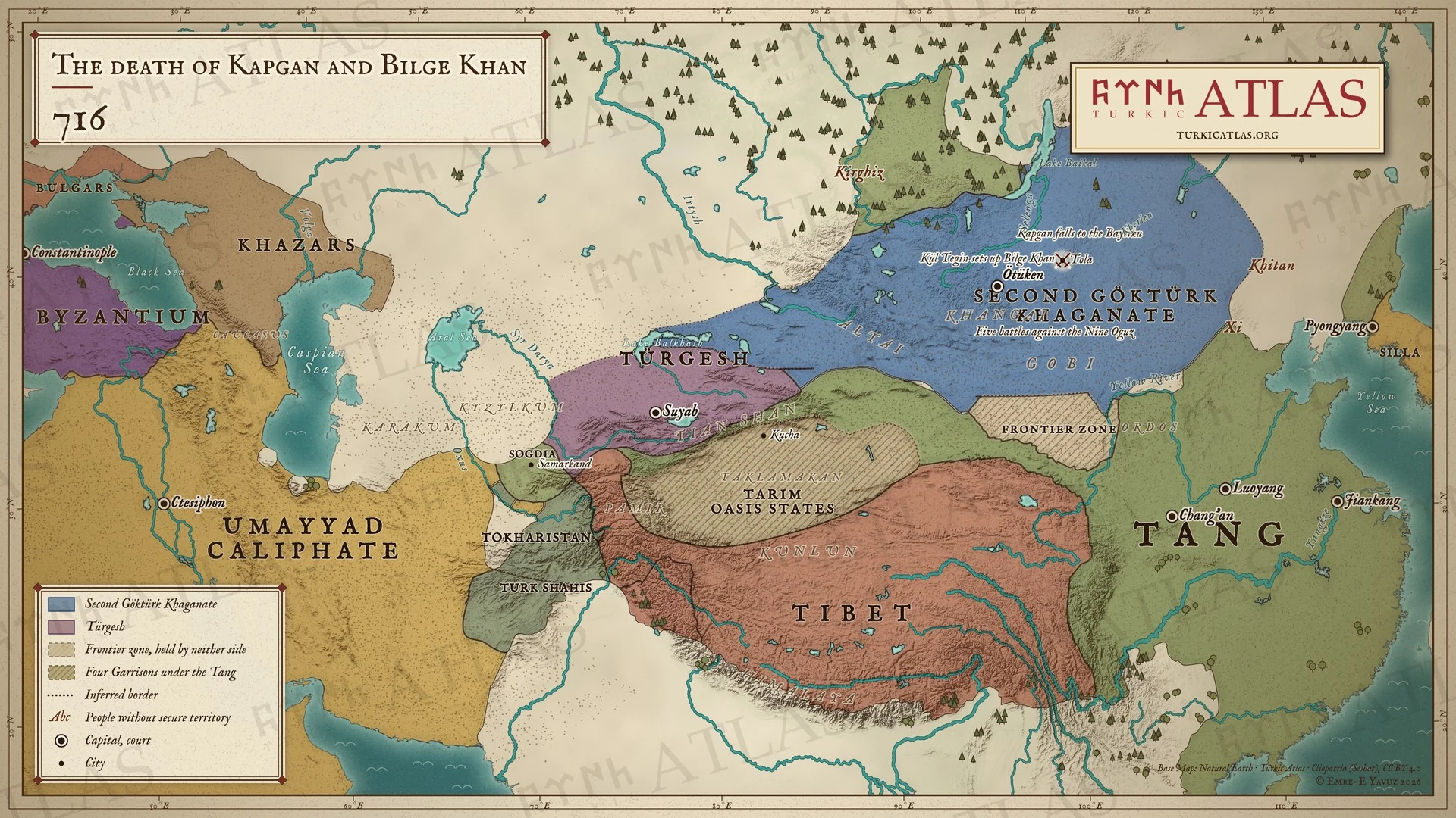 © Emre-E Yavuz 2026
716: Kapgan Kağan Tola kıyısında Bayırkulara karşı ölür. Kül Tigin ağabeyini Bilge Kağan olarak tahta çıkarır. Modern harita, sınırlar çizimdir, kaynaklarda geçmez. Harita Yer aldığı yer: Yıl 716
-
717717: Sulu and the Türgesh
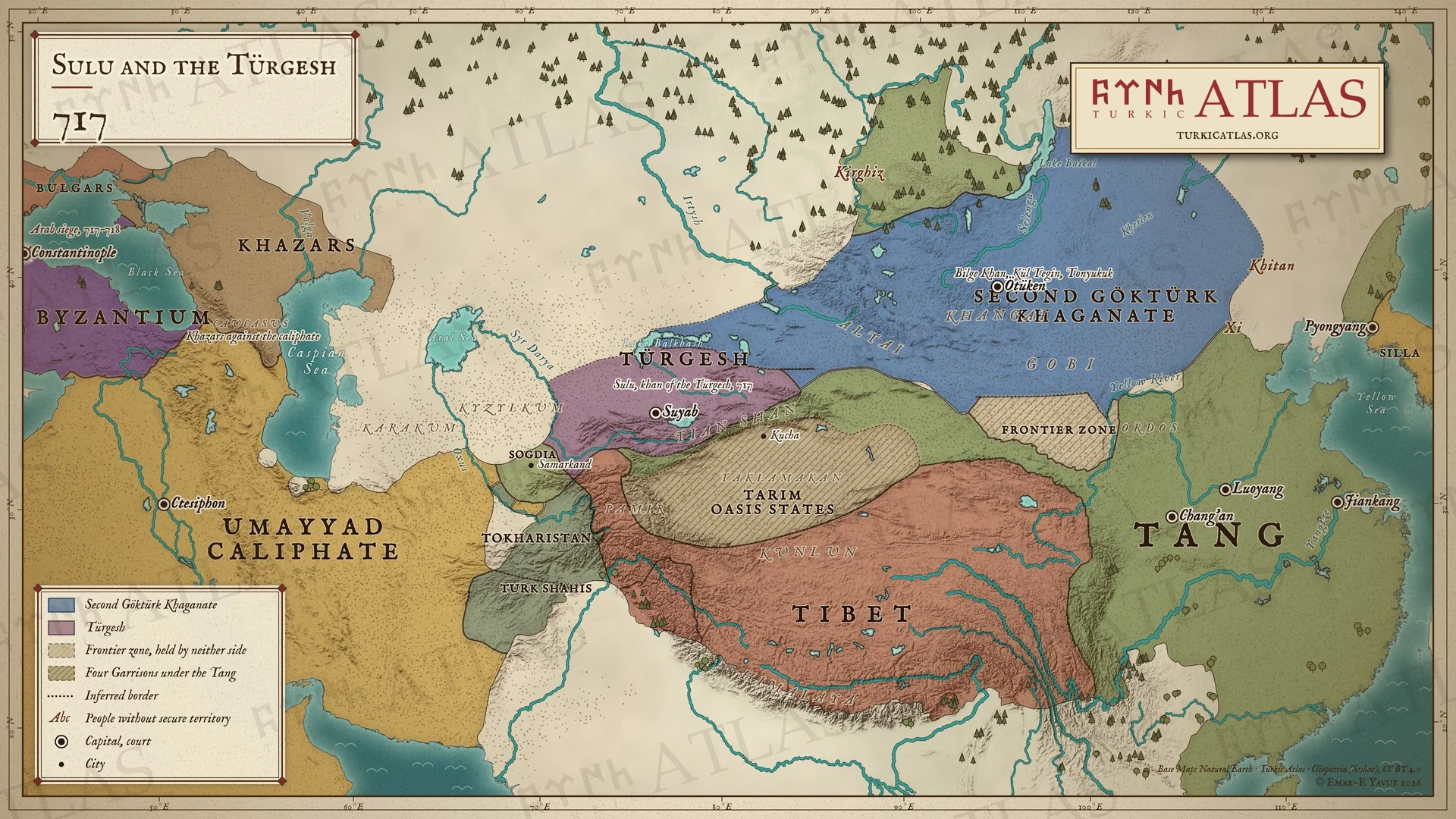 © Emre-E Yavuz 2026
717: Sulu Türgiş kağanı olur. Bilge Kağan doğuyu Kül Tigin ve Tonyukuk ile yönetir. Araplar Konstantinopolis'i kuşatır. Modern harita, sınırlar çizimdir, kaynaklarda geçmez. Harita Yer aldığı yer: Yıl 717
-
721721: Tonyukuk and the war with the Tang
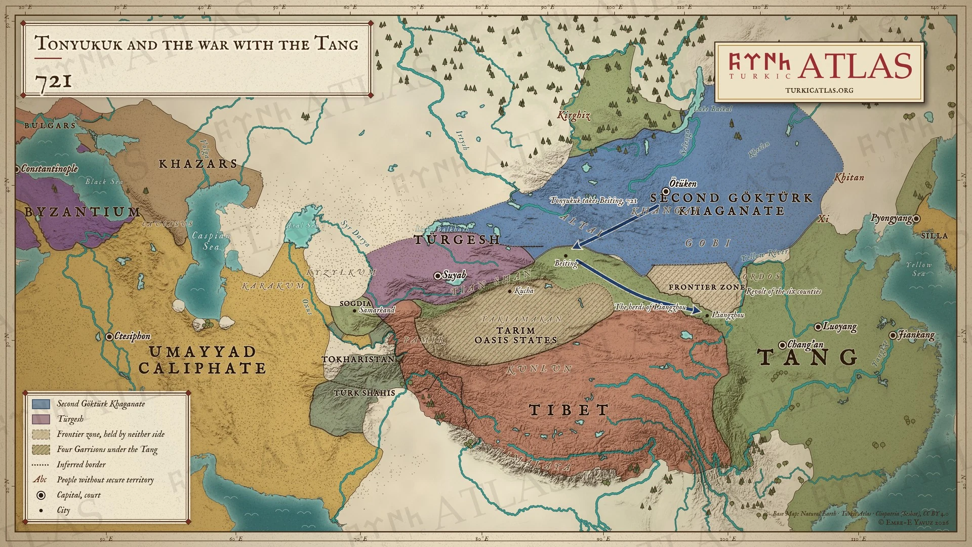 © Emre-E Yavuz 2026
721: Tonyukuk Beiting'i Basmıllardan önce alır ve Liangzhou'nun sürülerini sürer. Ordos'un altı ilçesi ayaklanır. Modern harita, yollar çizimdir, kaynaklarda geçmez. Harita Yer aldığı yer: Yıl 721
-
734734: The death of Bilge Khan
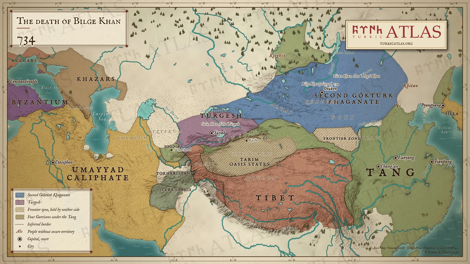 © Emre-E Yavuz 2026
734: Bilge Kağan buyruğu tarafından zehirlenir ve ölür. Oğlu Yiran ardından gelir ve aylar içinde ölür, tahta çocuk Tengri Kağan çıkar. Modern harita, sınırlar çizimdir, kaynaklarda geçmez. Harita Yer aldığı yer: Yıl 734
-
744744: The rise of the Uyghurs
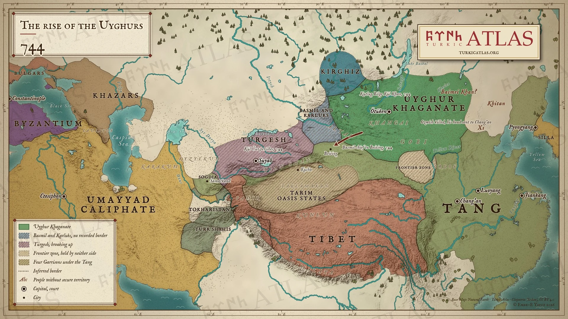 © Emre-E Yavuz 2026
744: Basmıllar Ozmış Kağan'ı öldürür, Uygurlar ve Karluklar da Basmıl kağanını. Kutlug Bilge Kül, Uygurların ilk kağanı olur. Modern harita, Basmıl ve Karluk bölgesi çizimdir, kaynaklarda geçmez. Harita Yer aldığı yer: Yıl 744
-
745745: The Uyghur Khaganate
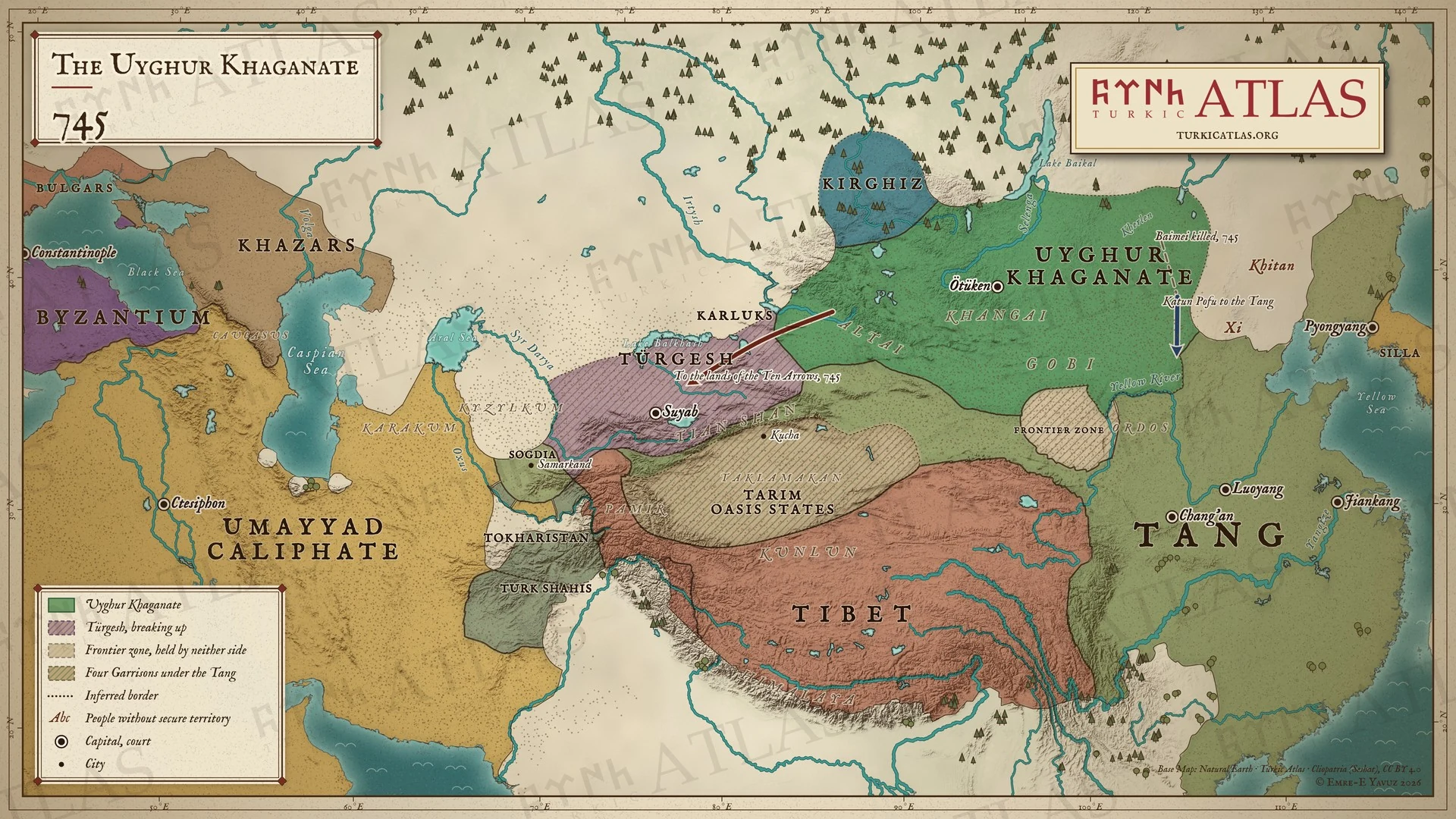 © Emre-E Yavuz 2026
745: Baimei Kağan öldürülür, Pofu Hatun halkıyla Tang'a geçer. Karluklar batıya, On Ok yurduna göçer. Uygurlar Altay'dan Şiveylere kadar bozkıra hâkimdir. Modern harita, yollar çizimdir, kaynaklarda geçmez. Harita Yer aldığı yer: Yıl 745
-
790790: The war over Beiting
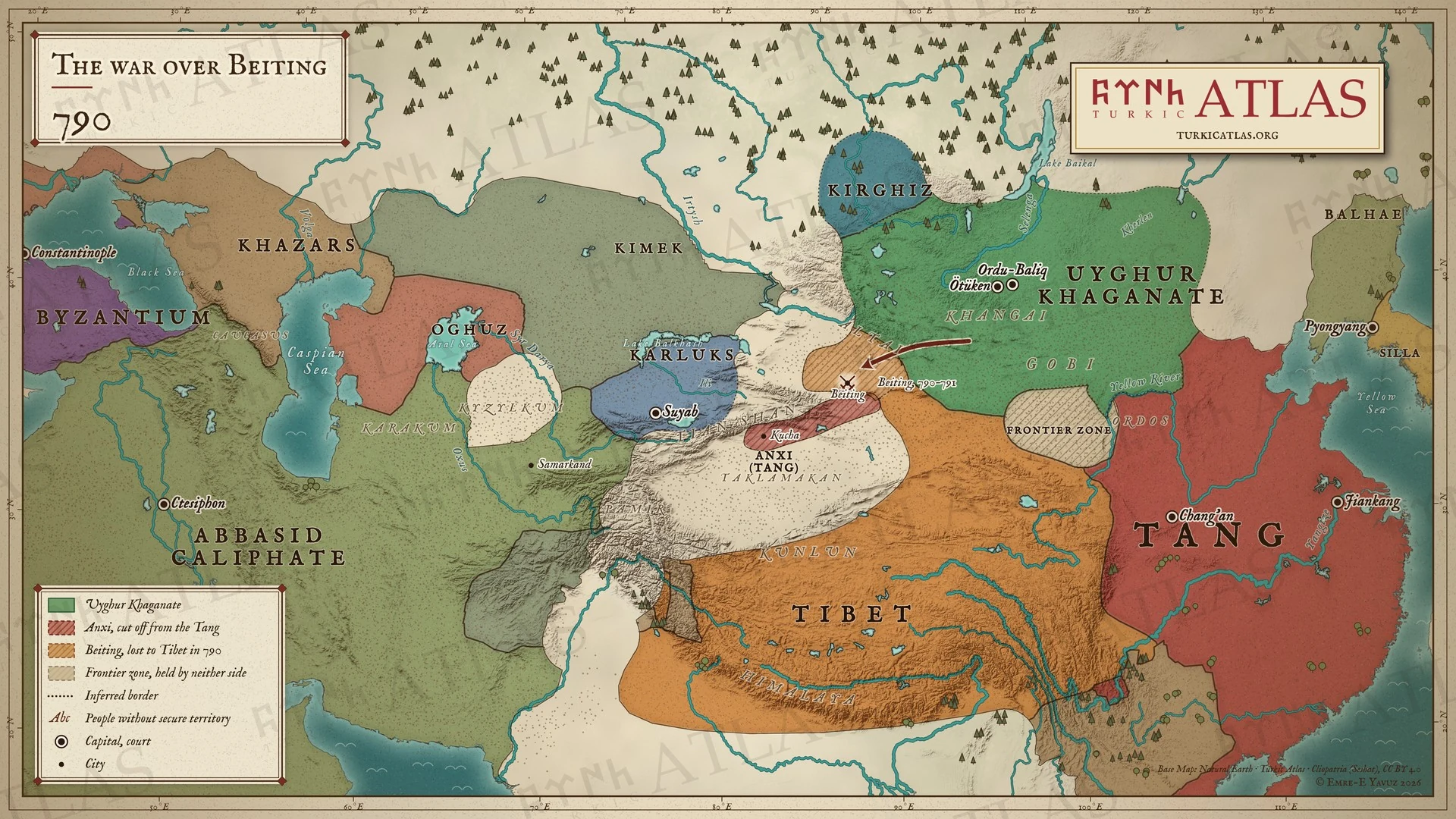 © Emre-E Yavuz 2026
790: Uygurlar Beiting'i Tibetlilere kaptırır ve 790 ile 791'de onlara karşı yürür. Anxi, Çin'den kopmuş halde Tang için direnir. Modern harita, sınırlar çizimdir, kaynaklarda geçmez. Harita Yer aldığı yer: Yıl 790
-
821821: The khaganate at war with the Kirghiz
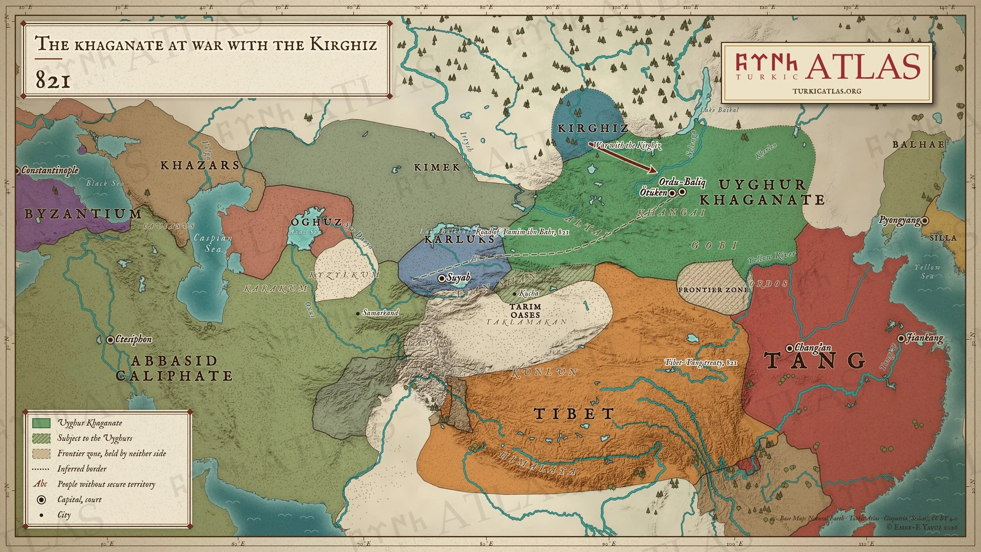 © Emre-E Yavuz 2026
821: Uygurlar kuzeyde Kırgızlarla savaşır. Temim bin Bahr posta yolundan Uygur başkentine gider. Tibet ve Tang sınırlarını antlaşmayla belirler. Modern harita, yol çizimdir, kaynaklarda geçmez. Harita Yer aldığı yer: Yıl 821
-
840840: The fall of the Uyghur Khaganate
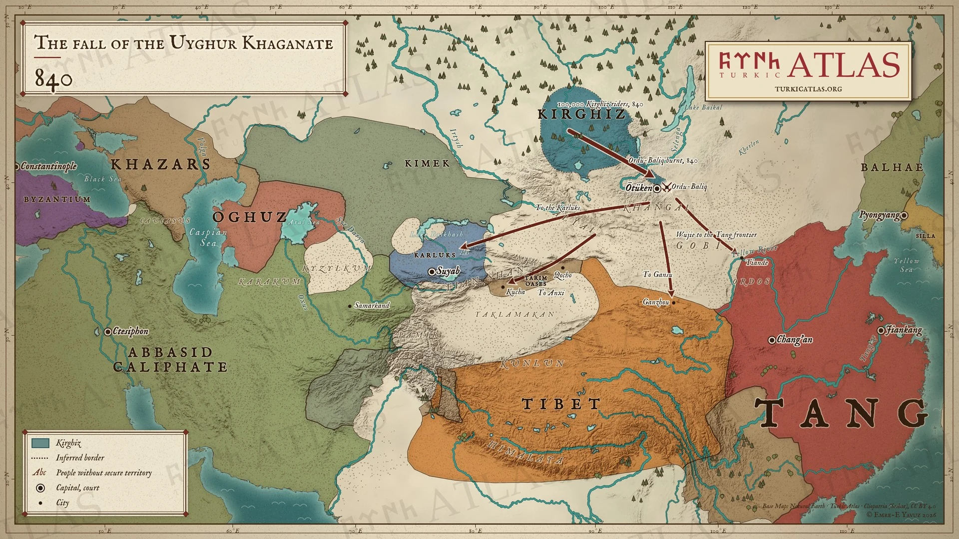 © Emre-E Yavuz 2026
840: Kırgızlar Uygur Kağanlığı'nı yıkar ve Ordu Balık'ı yakar. Uygurlar Tang sınırına, Gansu'ya, Tarım'a ve Karluklara dağılır. Modern harita, kaçış yolları çizimdir, kaynaklarda geçmez. Harita Yer aldığı yer: Yıl 840, Türk halklarının tarihi
-
842842: After the fall of the Uyghurs
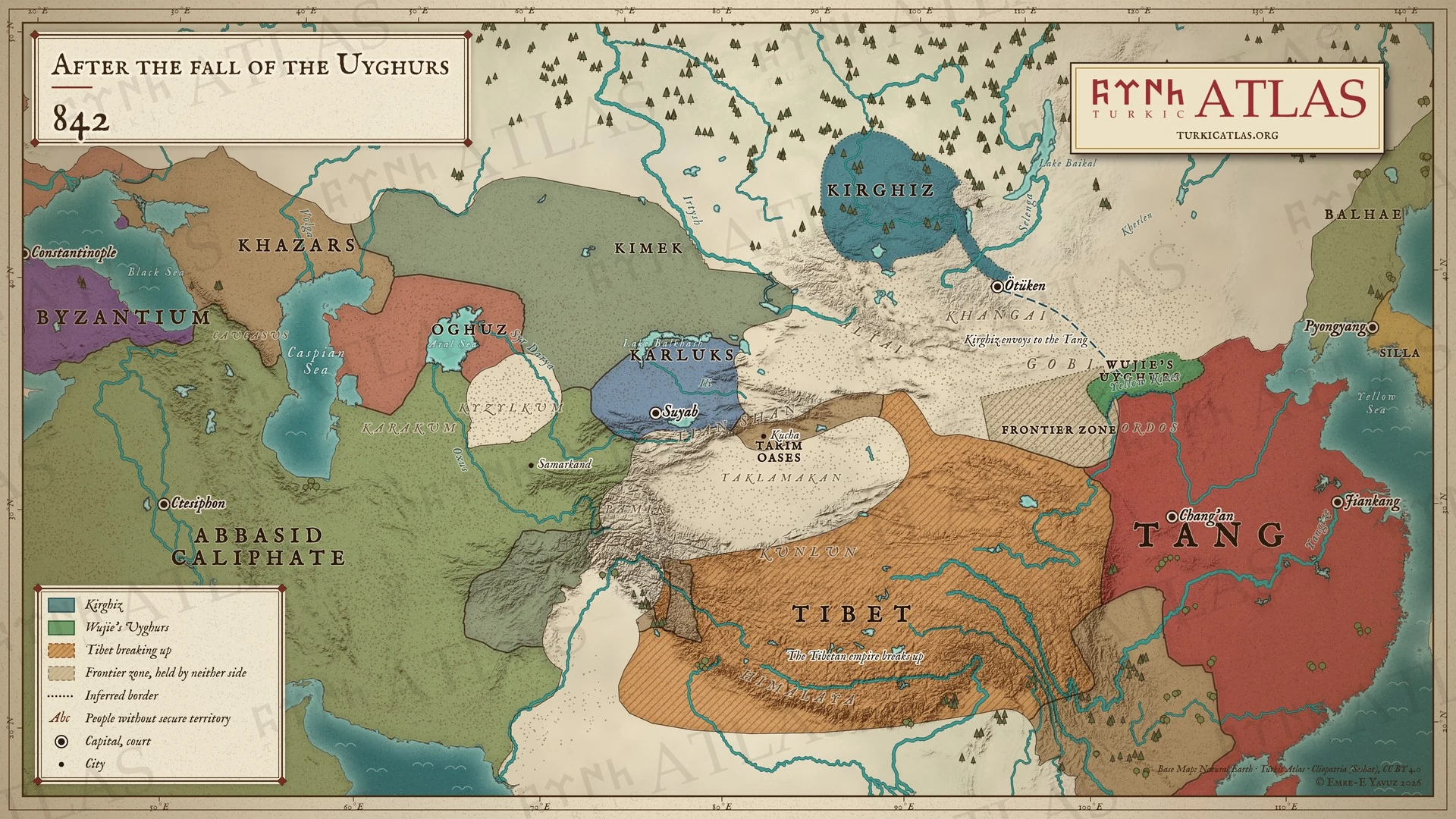 © Emre-E Yavuz 2026
842: Wujie'nin Uygurları Tang sınırında konaklar, ilk Kırgız elçisi Tang'a ulaşır. Tibet İmparatorluğu dağılır. Modern harita, elçilerin yolu çizimdir, kaynaklarda geçmez. Harita Yer aldığı yer: Yıl 842
Fotoğraflar ve tarihî tasvirler
Fotoğraflar ve kendi çağında yapılmış tasvirler.
Ana görsel 115 · Panorama 1 · Metin içinde 64 · Okuma yolu 8
-
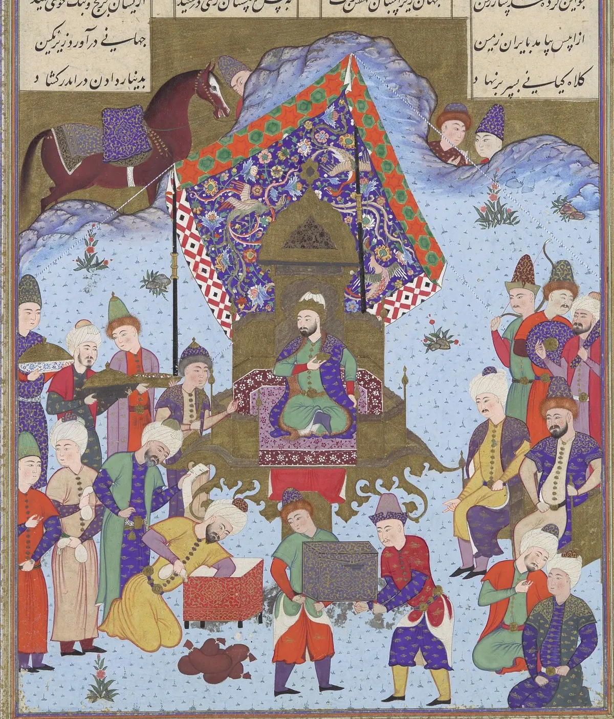
Afrasiab on the throne of Iran, which he took after killing Nowzar. A page of the Shahnameh made for Shah Tahmasp at Tabriz, about 1525–30, painting attributed to Bashdan Qara. The Metropolitan Museum of Art, New York, 1970.301.16, gift of Arthur A. Houghton Jr., 1970; detail. Public domain. Ana görsel Yer aldığı yer: Afrasiyab
-
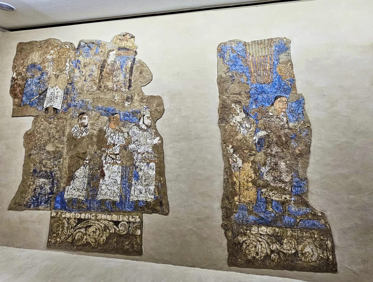
The left half of the west wall of the Hall of the Ambassadors, as mounted in the museum beside the Afrasiab mound: in the lower file three figures in white caftans, above them the caftan bearing the long Sogdian inscription. Photograph: Richard Mortel, 2023, CC BY 2.0. Ana görsel Yer aldığı yer: Afrasiab paintings
-
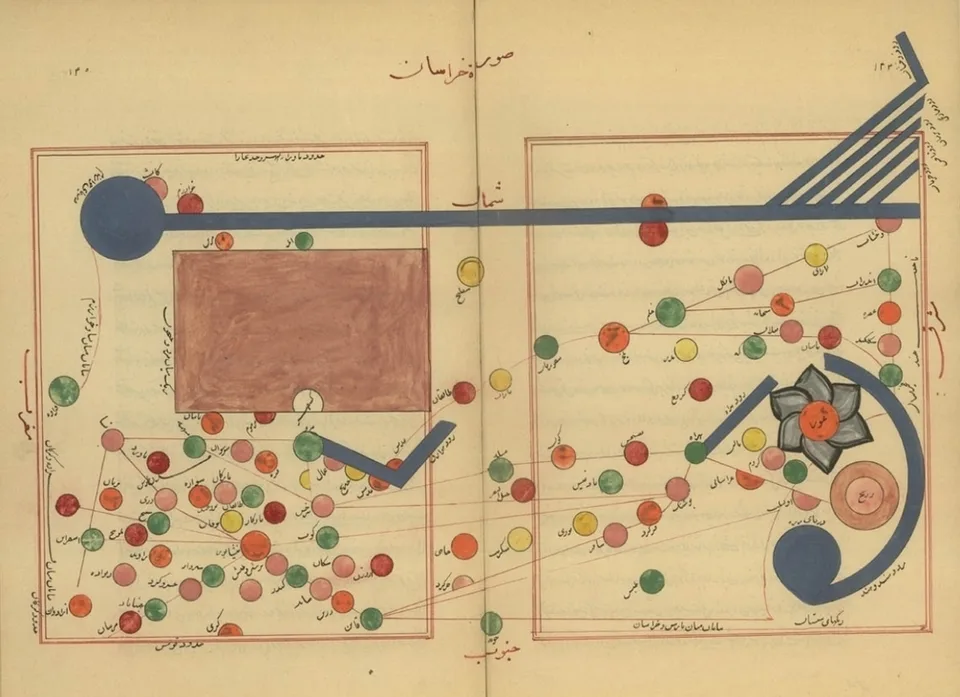
Map of Khurasan from a manuscript of al-Istakhri's geography, the Book of Routes and Realms. Al-Istakhri, manuscript map, reproduction, public domain. Ana görsel Yer aldığı yer: al-Iṣṭakhrī
-
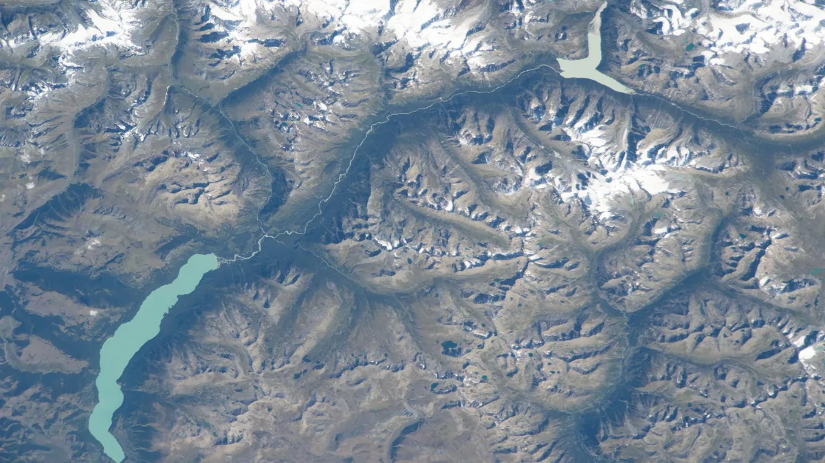
Ka Nasi Lake in the Chinese part of the Altai, photographed by an astronaut aboard the International Space Station in 2023. Astronaut photograph iss069e071176. NASA, public domain. Ana görsel Yer aldığı yer: Altay
-
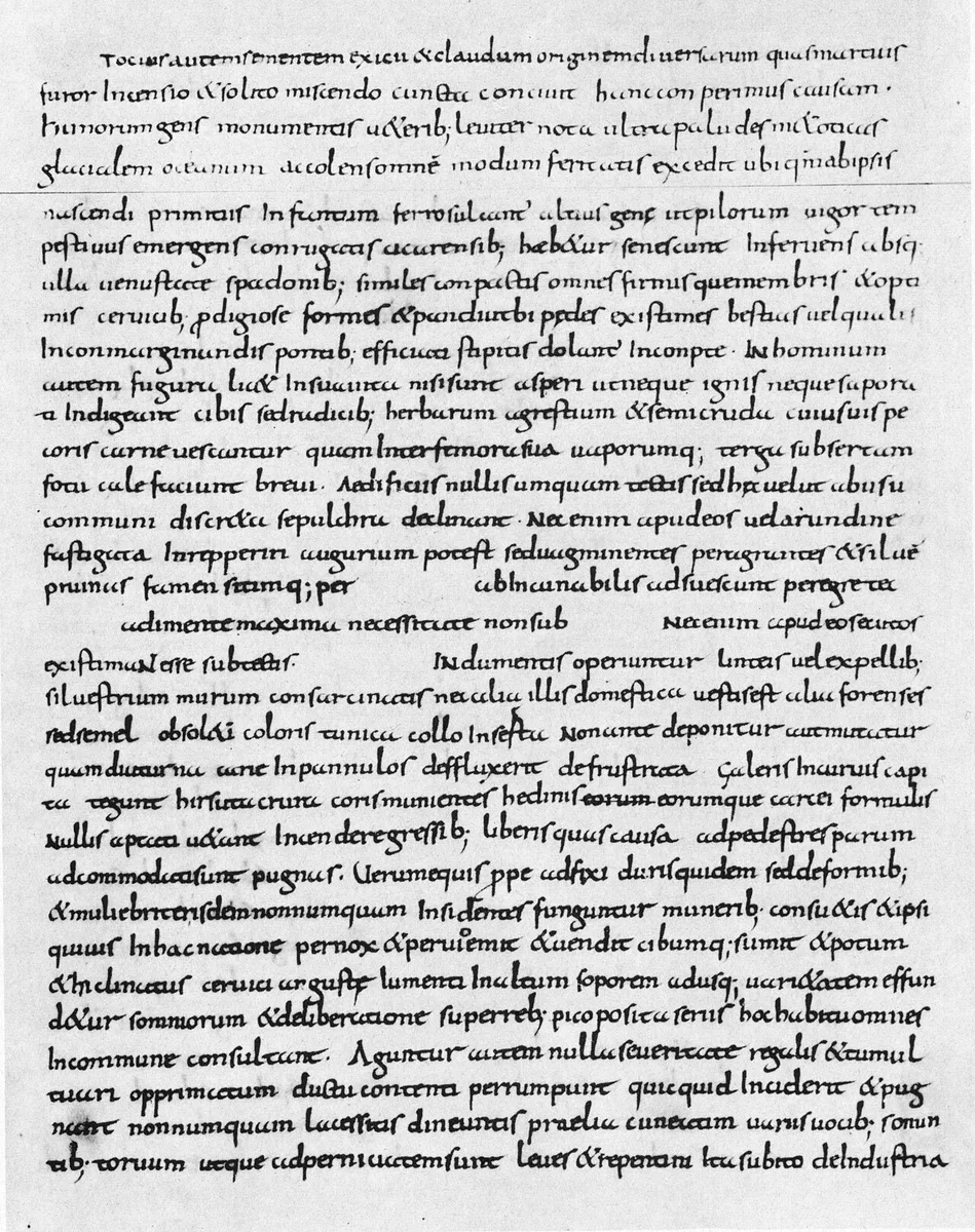
Page of a ninth-century manuscript of Ammianus Marcellinus (Vaticanus lat. 1873) with Res gestae 31,2, the description of the Huns. Ammianus Marcellinus, Res gestae, Biblioteca Apostolica Vaticana, Vat. lat. 1873, reproduction, public domain. Ana görsel Yer aldığı yer: Ammianus Marcellinus
-
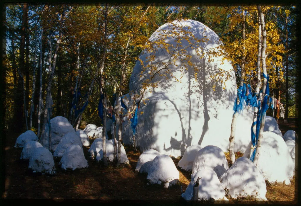
A sacred cairn (obo) near Alkhanai mountain in Transbaikalia, the stones whitewashed and the birches around it hung with blue ribbons, photographed in 2000. Photograph: William Craft Brumfield, 2000; Library of Congress, no known restrictions. Ana görsel Yer aldığı yer: Animizm
-
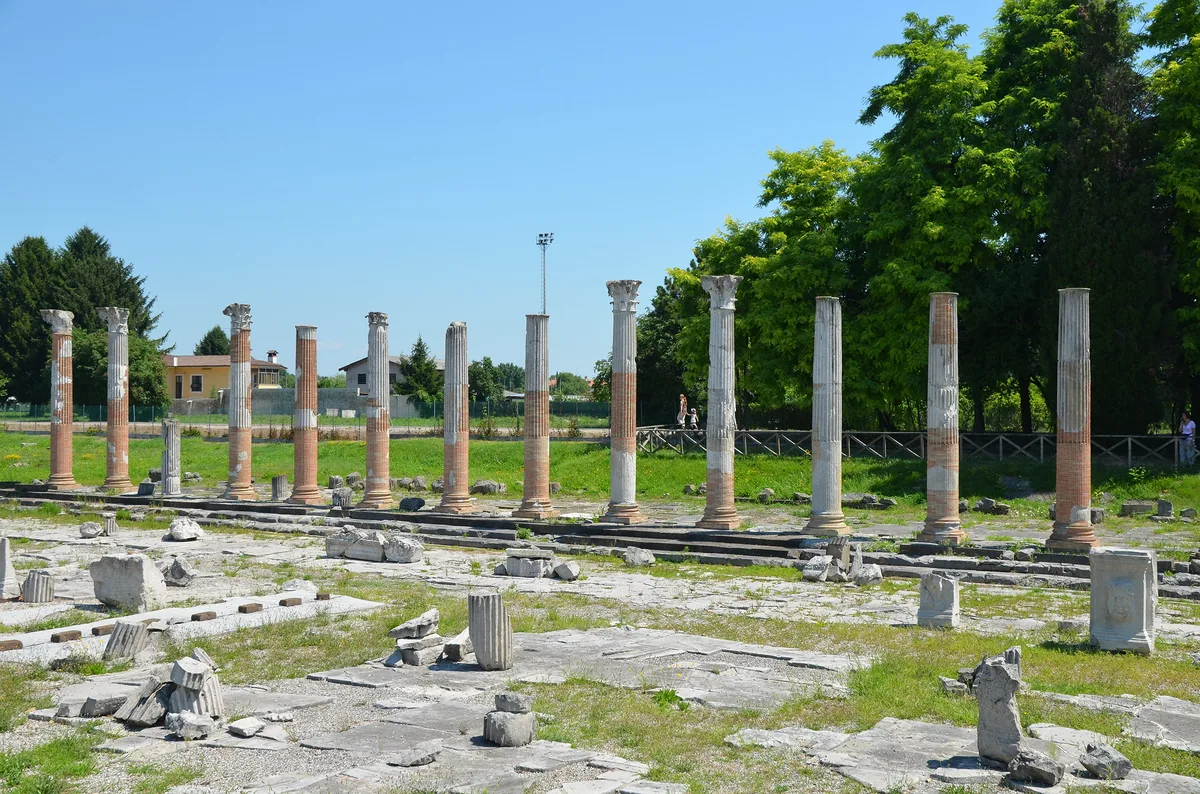
The Roman forum of Aquileia in Friuli, north-eastern Italy, with the columns of its eastern portico, which were restored and partly re-erected in 1936 and 1937; photograph of 2015. Aquileia was the chief city of Venetia, and it fell to Attila's Huns in 452 after a long siege. Image: Carole Raddato, CC BY-SA 2.0. Ana görsel Yer aldığı yer: Aquileia
-
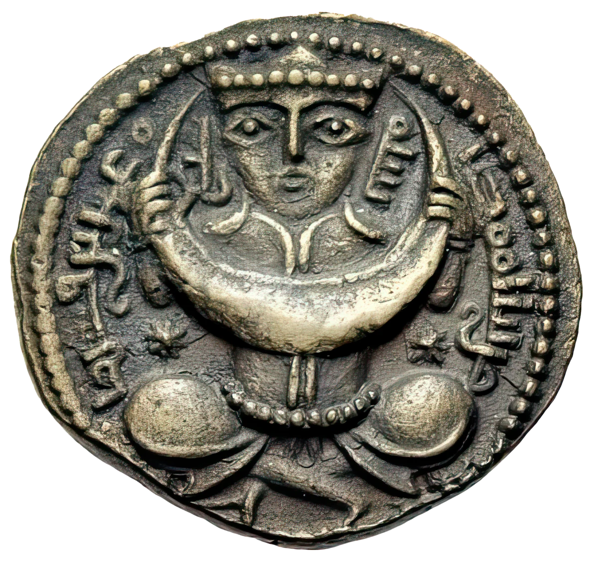
A crowned figure holding a crescent moon, a star on either side: coin, eighth century. Ana görsel Yer aldığı yer: Ay Ata
-
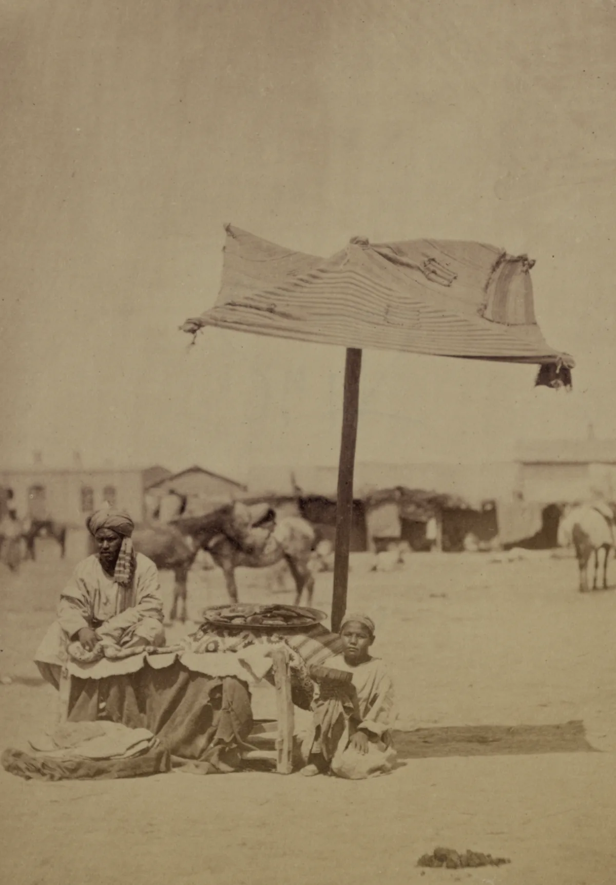
Ayran sellers in the market of Aulie-Ata on the Talas river, the modern Taraz in Kazakhstan, photographed between 1865 and 1872 for the Turkestan Album. Photograph: Turkestan Album, ethnographic part, plate 105. Library of Congress, no known restrictions on publication. Ana görsel Yer aldığı yer: Ayran
-
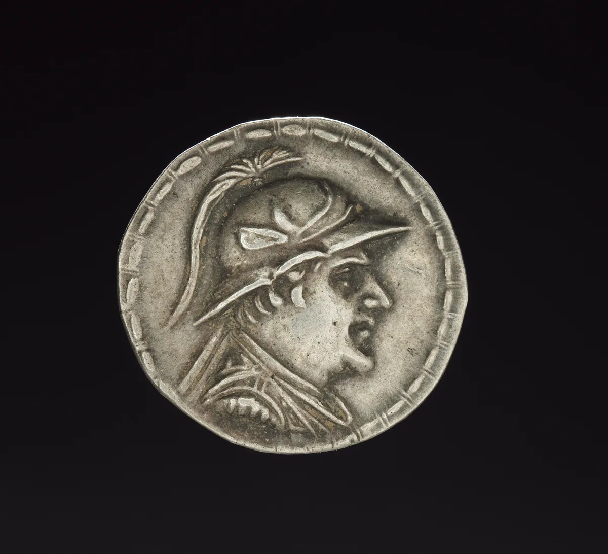
Silver coin of Eukratides I, king of Bactria between 170 and 145 BC, with his portrait in a crested helmet. The Cleveland Museum of Art, 2011.211, CC0. Ana görsel Yer aldığı yer: Baktriya
-
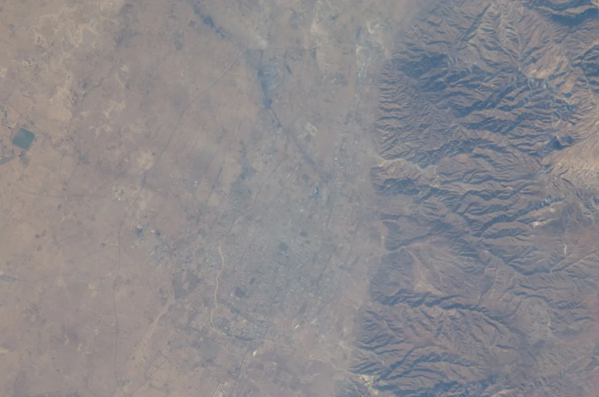
The city of Hohhot on the plain at the foot of the Daqing Shan in Inner Mongolia, photographed from the International Space Station in 2011. Baidao may have lain north of Guihuacheng, the old town of Hohhot. Image: NASA. Public domain. Ana görsel Yer aldığı yer: Baidao Ovası
-
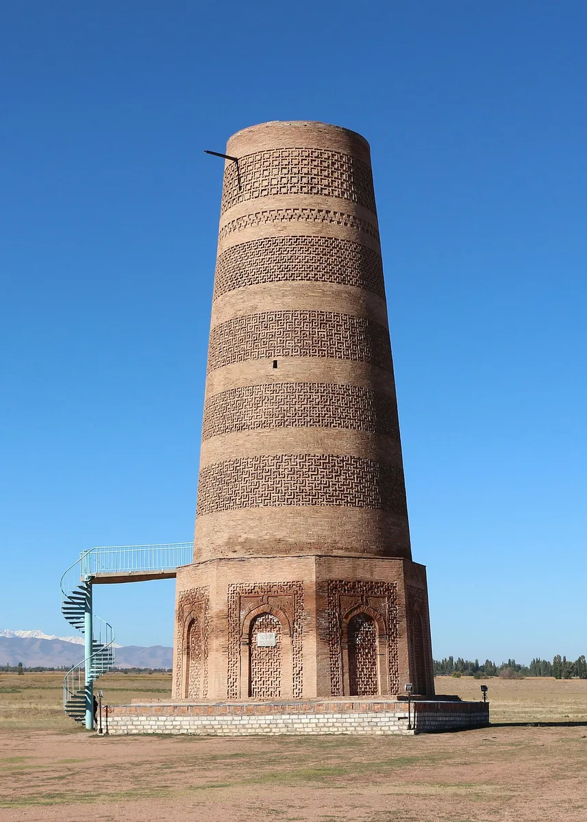
The Burana Tower near Tokmok in the Chu valley, Kyrgyzstan. Photograph: Bernard Gagnon, 2023, CC0. Ana görsel Yer aldığı yer: Balasagun
-
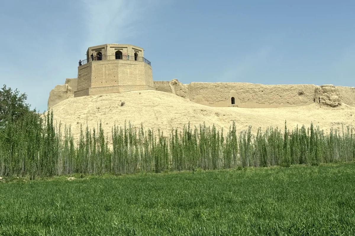
The Bala Hissar, the citadel of Balkh, and the old city walls above the fields, 2025. Photograph: Jialiang Gao, 2025, CC BY-SA 4.0. Ana görsel Yer aldığı yer: Belh
-
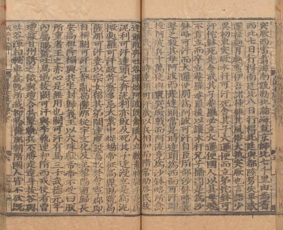
A page of the account of the western Göktürks in chapter 215B of the Xin Tang Shu, in a Yuan-period printed edition repaired under the Ming, in the National Archives of Japan. The second column of the right-hand page says that seven days' march north-west from Yanqi reach the Southern Court and eight days' march north the Northern Court. Image: National Archives of Japan. Public domain. Ana görsel Yer aldığı yer: Beiting
-
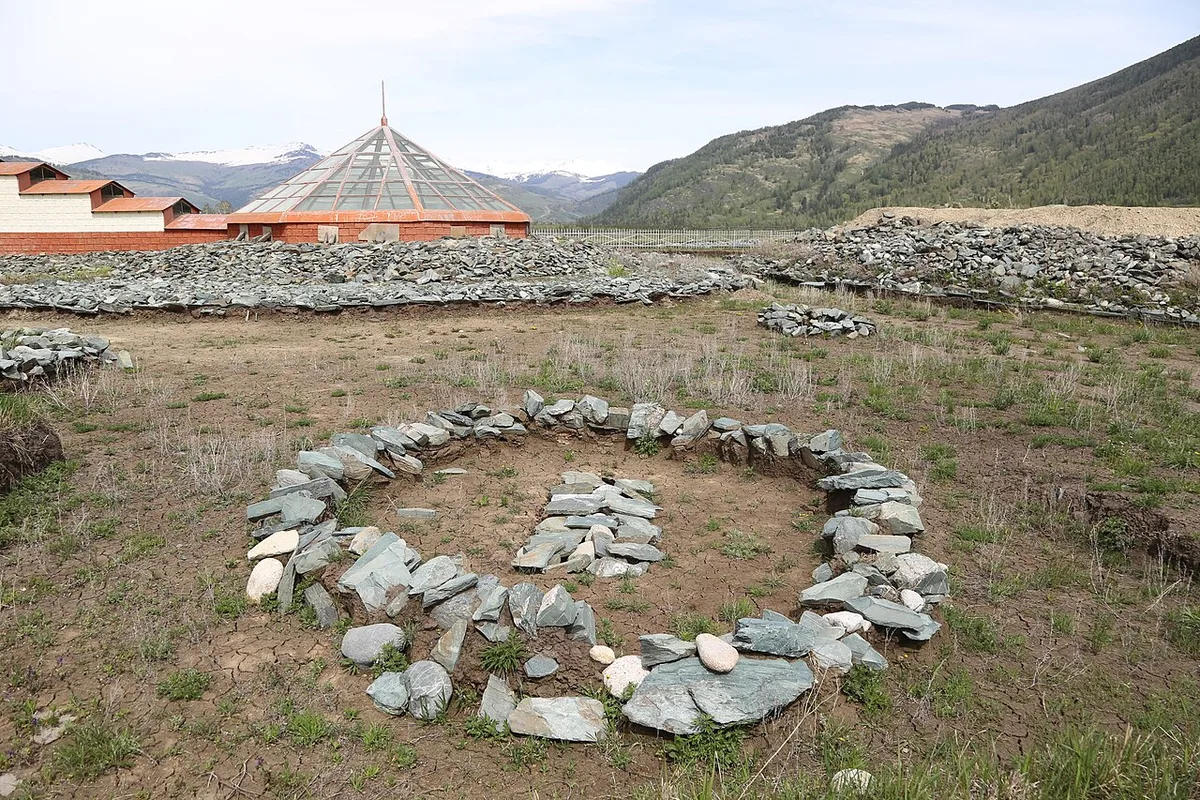
The Berel kurgans in the Kazakh Altai, 2018. Photograph: Mheidegger, 2018, CC BY 4.0. Ana görsel Yer aldığı yer: Berel
-
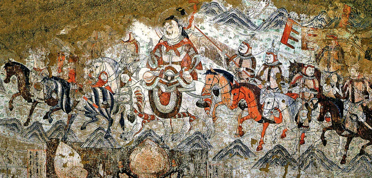
A rider with a halo and his mounted escort, from a wall painting in the West Temple at Beshbalik, the Buddhist temple that the Uyghurs of Qocho built west of the city. The scene belongs to the division of the relics of the Buddha among eight kings; it was painted in the tenth century. Wall painting: West Temple, Beiting (Beshbalik), tenth century. Photograph: Zhentong Li, CC0. Ana görsel Yer aldığı yer: Beşbalık
-
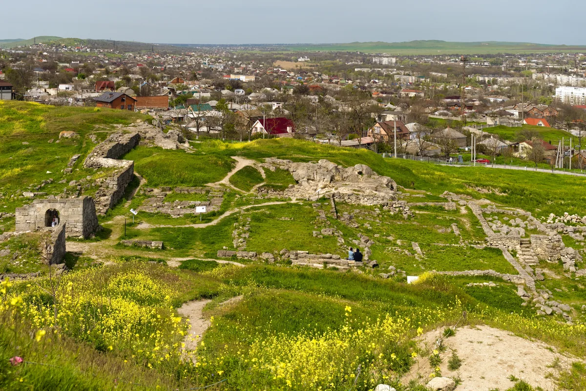
Excavated remains of ancient Panticapaeum on Mount Mithridates in Kerch, in the eastern Crimea, with the town below; photograph of 2021. Bosporos, the ancient Panticapaeum, fell to a Göktürk army and the Utigurs while the Roman envoy Valentinos was among the Göktürks. Image: Alexxx Malev, CC BY-SA 2.0. Ana görsel Yer aldığı yer: Bosporos
-
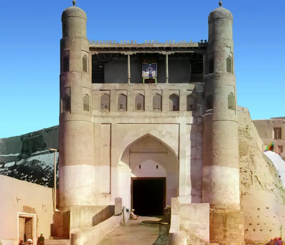
The entrance to the Emir’s palace in the old city of Bukhara, photographed by Sergei Prokudin-Gorskii between 1905 and 1915. Photograph: Sergei Prokudin-Gorskii; Library of Congress, Prints and Photographs Division. No known restrictions on publication. Ana görsel Yer aldığı yer: Buhara
-
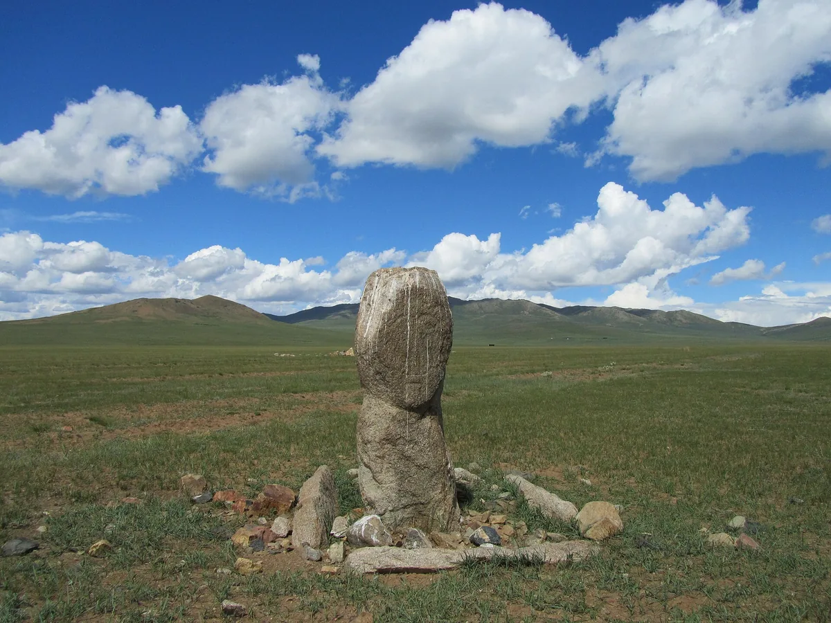
A weathered stone figure at its stone setting on the steppe near Burd, Övörkhangai, in central Mongolia. Monuments of this kind are commonly called balbals; strictly, the balbals are the rough stones set in a line from the grave. Photograph: Mongolia Expeditions, 2011, CC BY 3.0. Ana görsel Yer aldığı yer: Gömü ve balbal
-
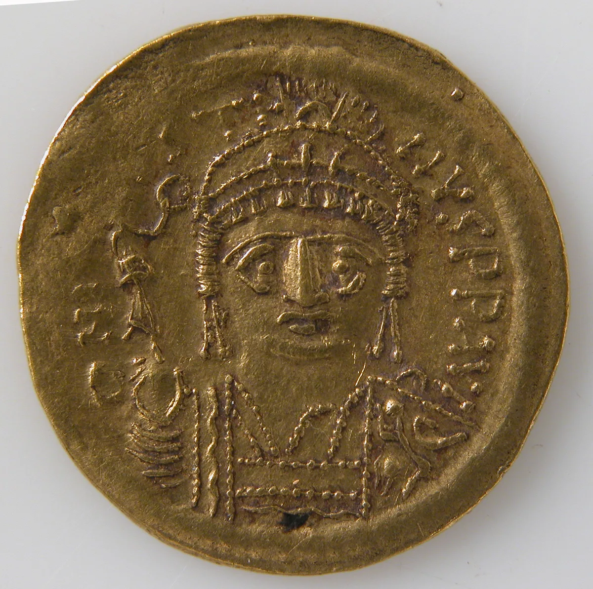
Gold solidus of the Byzantine empire, struck between 565 and 578. The Metropolitan Museum of Art, New York, 04.35.3353, Gift of Darius Ogden Mills, 1904, Open Access, public domain (CC0). Ana görsel Yer aldığı yer: Bizans
-
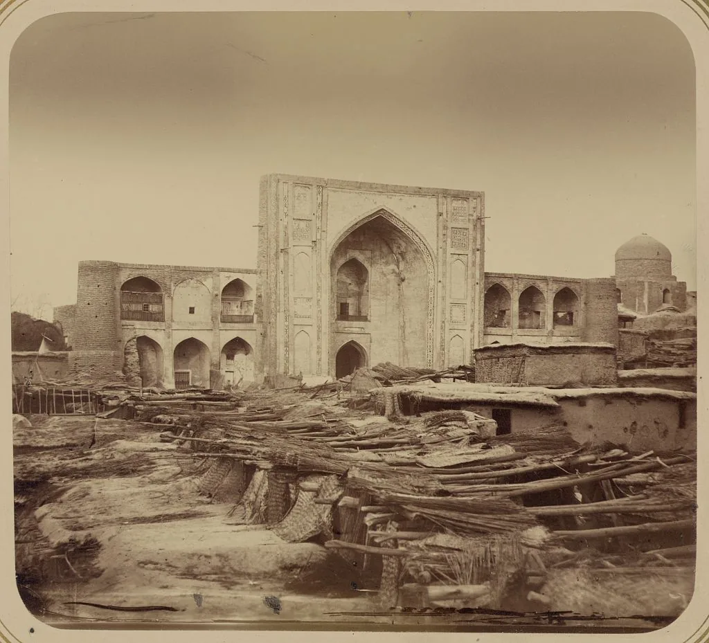
The Kukeldash madrasa in Tashkent, from the Turkestan album of 1865–1872. Photograph: N. V. Bogaevskii, Turkestan album; Library of Congress, Prints and Photographs Division. No known restrictions on publication. Ana görsel Yer aldığı yer: Çaç
-
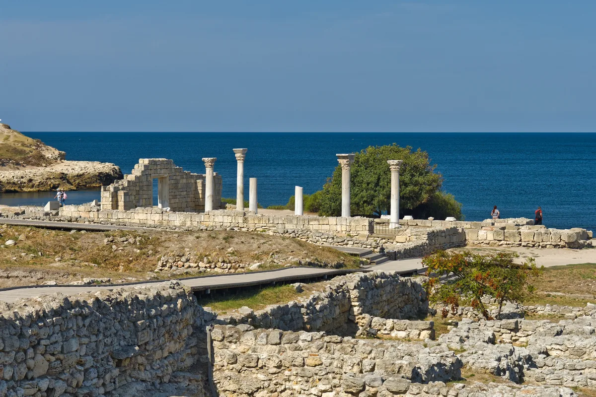
The ruins of ancient Chersonesus on the south-western coast of the Crimea, near Sevastopol, with the columns of a basilica above the Black Sea; photograph of 2023. Cherson was probably this city. In 579 the emperor Tiberius told an Avar embassy that the Göktürks were encamped there. Image: Alexxx Malev, CC BY-SA 2.0. Ana görsel Yer aldığı yer: Kherson
-
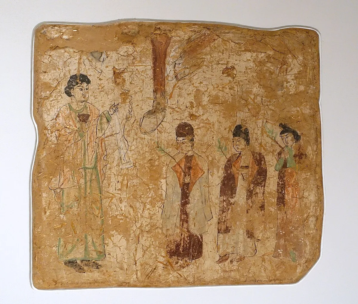
Wall painting from a ruined temple at Qocho, read as a Palm Sunday procession and dated 683–770 CE. Berlin. Photograph: Daderot, 2014, CC0. Ana görsel Yer aldığı yer: Doğu Kilisesi
-
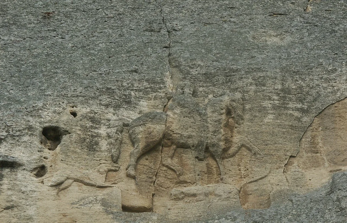
The Madara Rider, a rock relief of the eighth to ninth century near Shumen in north-eastern Bulgaria. Photograph: G. Nockemann, 2011, CC BY-SA 3.0. Ana görsel Yer aldığı yer: Tuna Bulgar Devleti
-
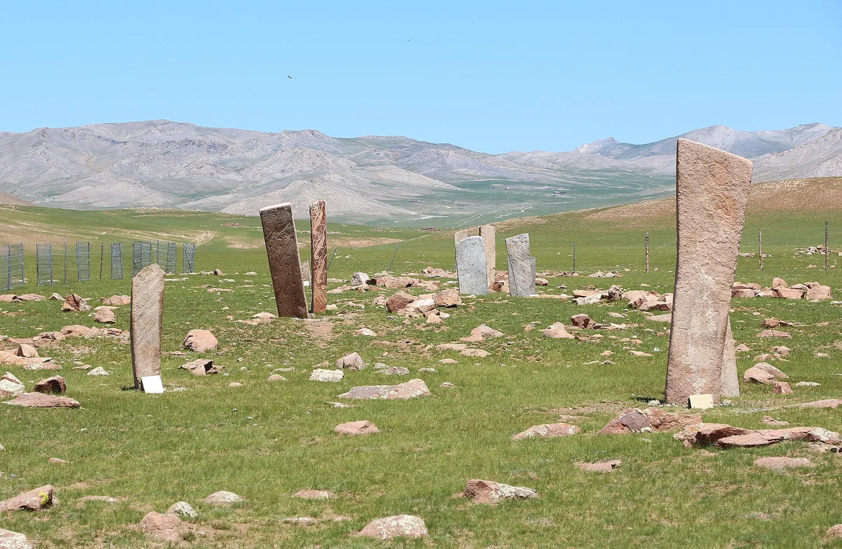
Deer stones at Uushgiin Uvur in Mongolia. Photograph: Bernard Gagnon, 2023, CC0. Ana görsel Yer aldığı yer: Deer stones
-
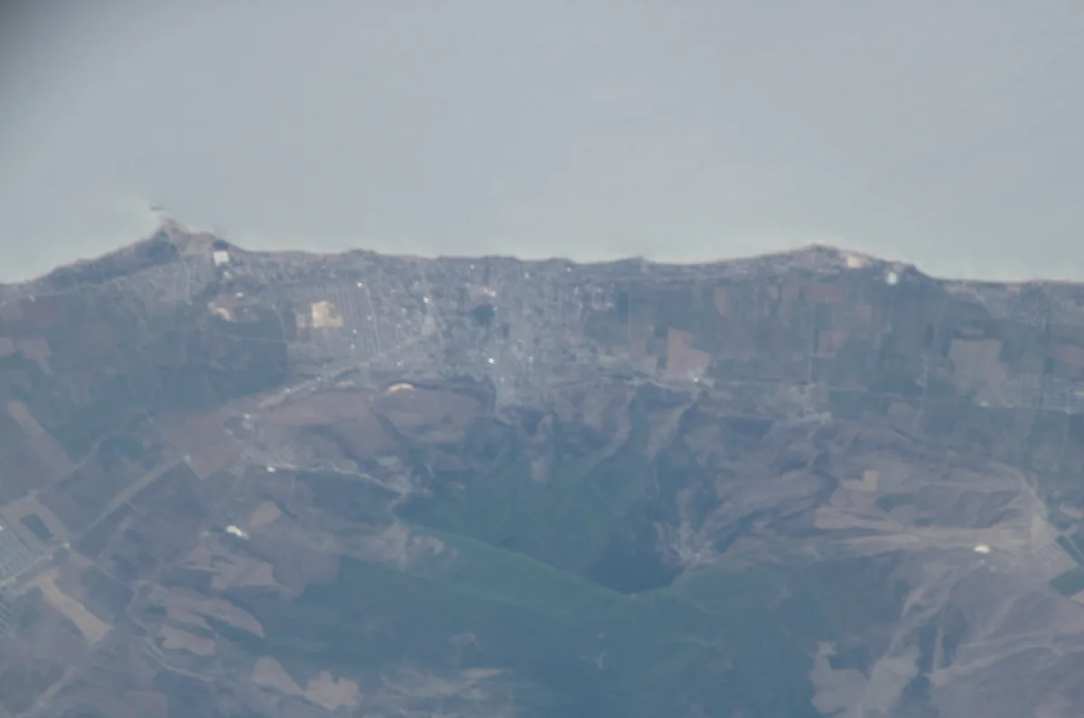
Derbent between the shore of the Caspian Sea and the foothills of the Caucasus, photographed from the International Space Station in 2005. Astronaut photograph ISS011-E-10601. NASA, public domain. Ana görsel Yer aldığı yer: Derbent
-
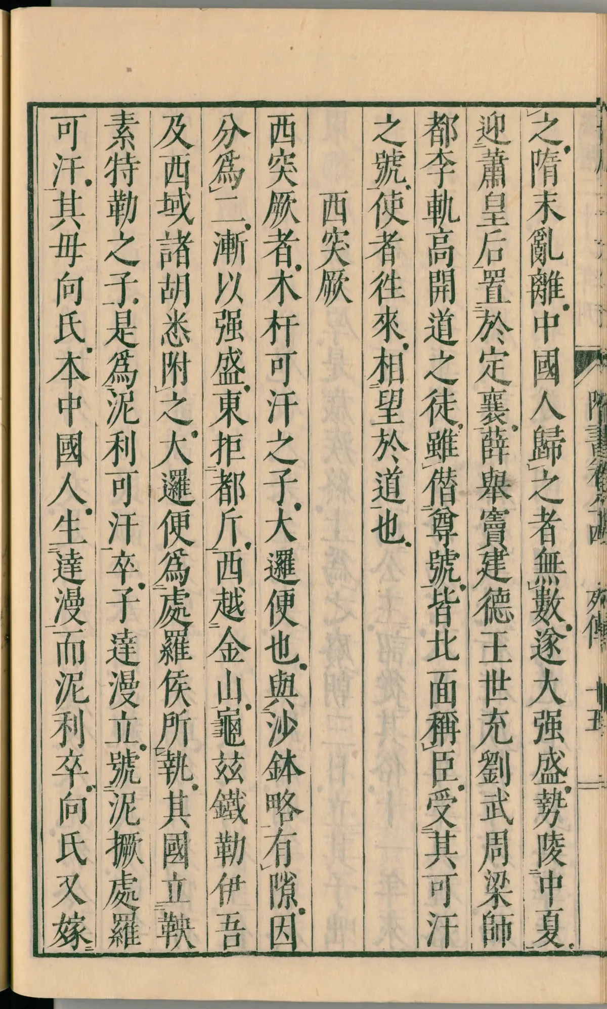
A page of chapter 84 of the Sui Shu in a Japanese edition of 1844, in the National Diet Library, Tokyo. In the second column from the right, the text says that the Göktürks brought the empress Xiao and installed her at Dingxiang (定襄). Image: National Diet Library, Japan. Public domain. Ana görsel Yer aldığı yer: Dingxiang
-
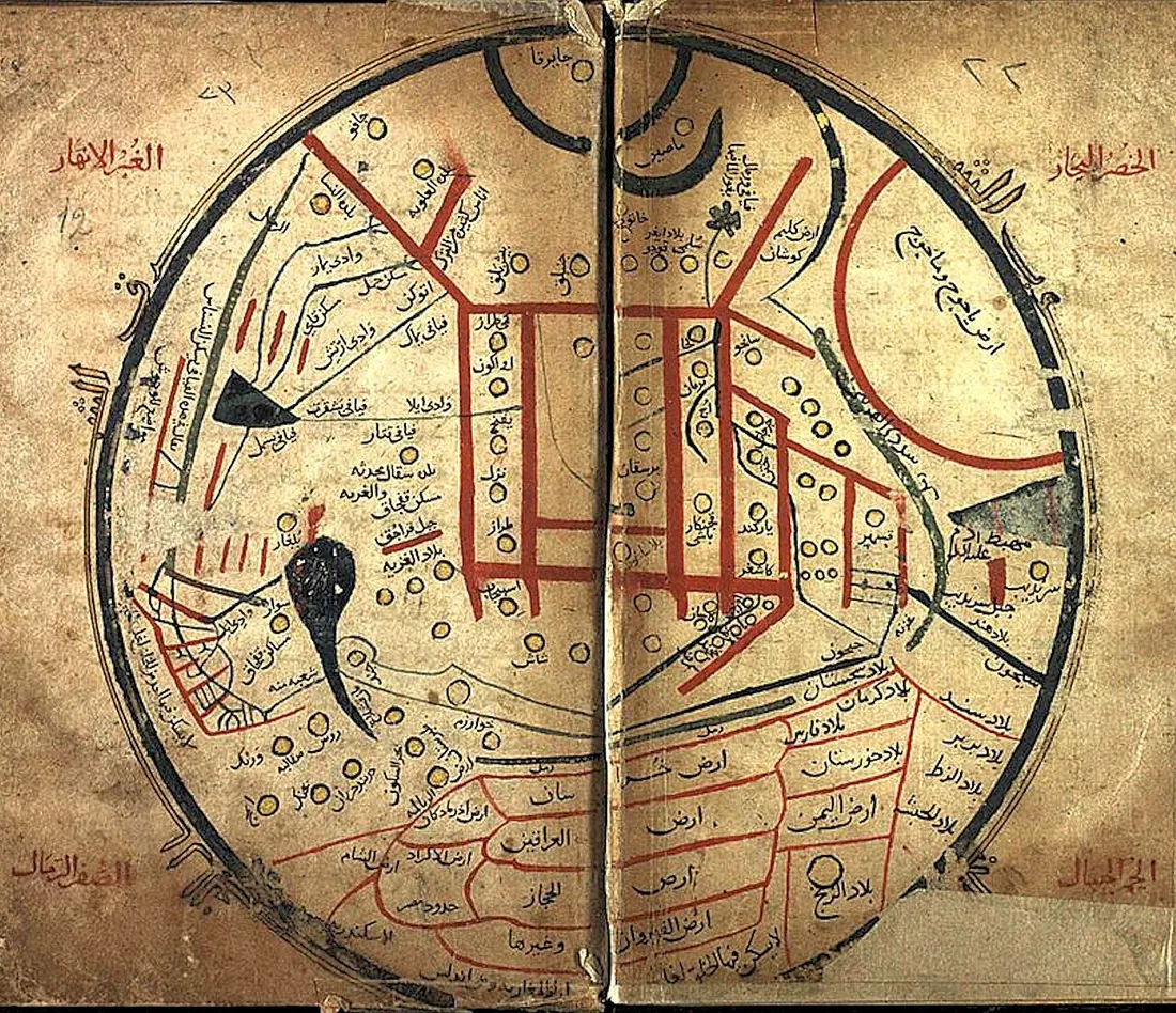
The world map of Mahmud al-Kashgari's dictionary, from a manuscript of the work. Mahmud al-Kashgari, eleventh century, manuscript copy, reproduction, public domain. Ana görsel Yer aldığı yer: Dīvān Lughāt al-Turk
-
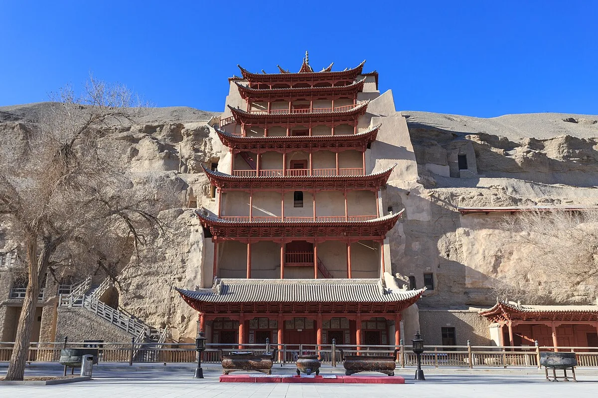
The Mogao Grottoes near Dunhuang, December 2013. Photograph: Zhangzhugang, 2013, CC BY-SA 4.0. Ana görsel Yer aldığı yer: Dunhuang
-
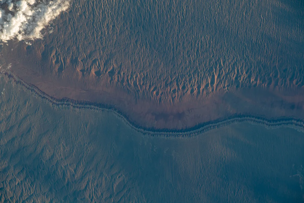
Dunes and sedimentary layers in the Junggar Basin, photographed from the International Space Station in 2023. Astronaut photograph ISS069-E-16826. NASA, public domain. Ana görsel Yer aldığı yer: Cungarya
-
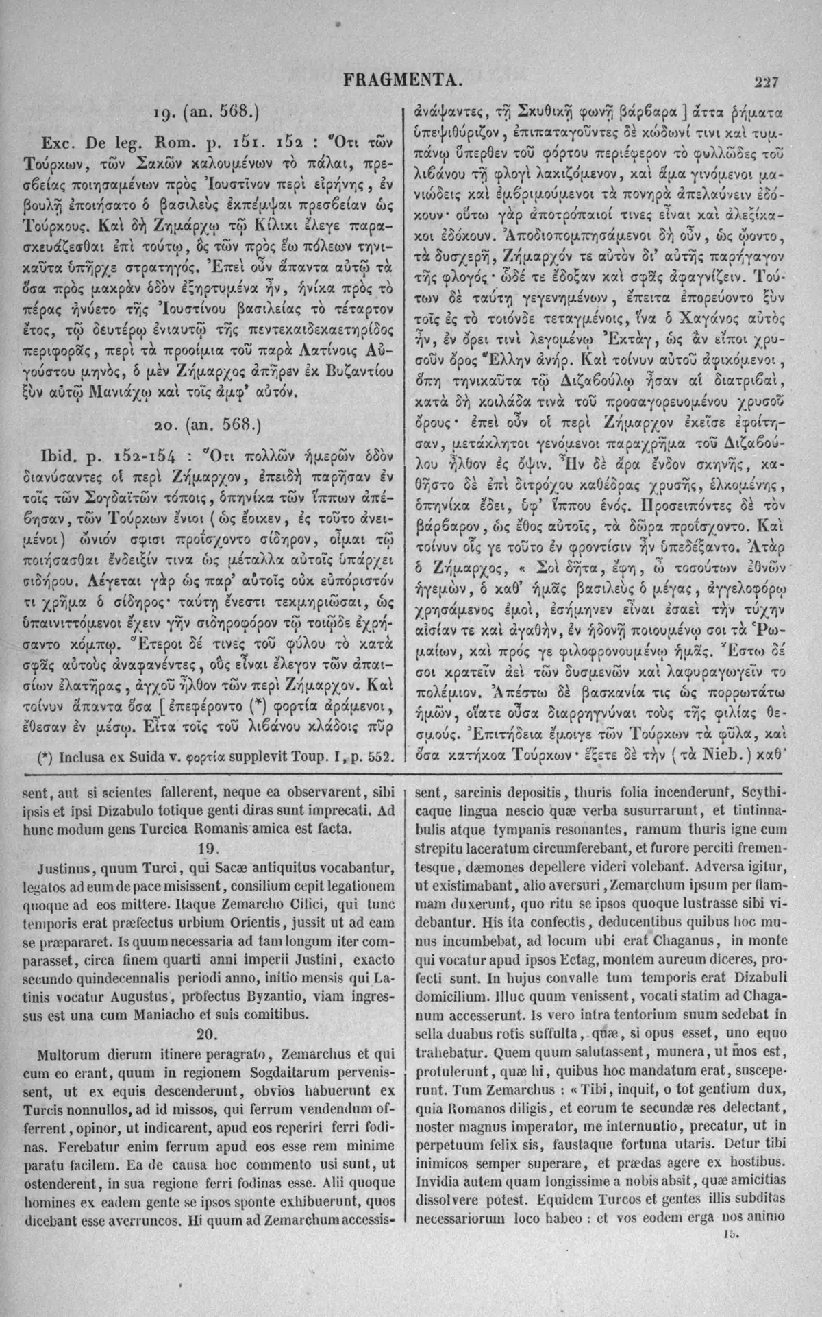
A page of the 1851 Paris edition of the Greek historical fragments, with Menander's account of the Roman embassy of 569 in Greek and Latin. The right-hand Greek column names the mountain Ektag, 'as a Greek would say, the golden mountain', where the envoys found Istemi. Image: Karl Müller (ed.), Fragmenta Historicorum Graecorum IV, Paris: Didot 1851; scan University of Toronto Libraries. Public domain. Ana görsel Yer aldığı yer: Ektag
-
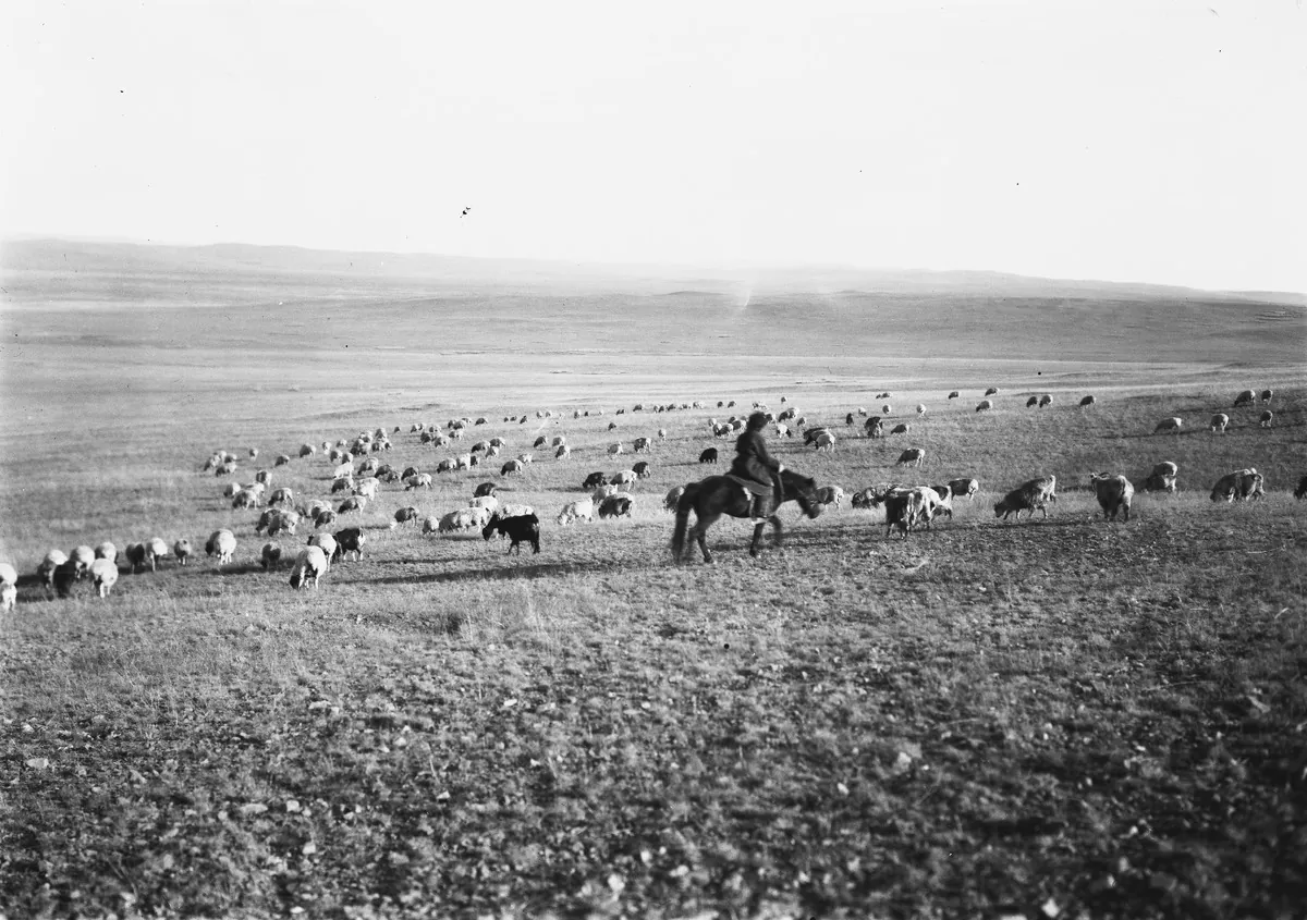
A herder on horseback with a flock of sheep and goats on the open steppe of Mongolia, photographed in 1909. Finnish Heritage Agency (Museovirasto), General Ethnographic Photo Collection, VKK156:33. Photograph by Sakari Pälsi, 1909. Finna, CC BY 4.0. Ana görsel Yer aldığı yer: Avrasya Göçebeleri
-
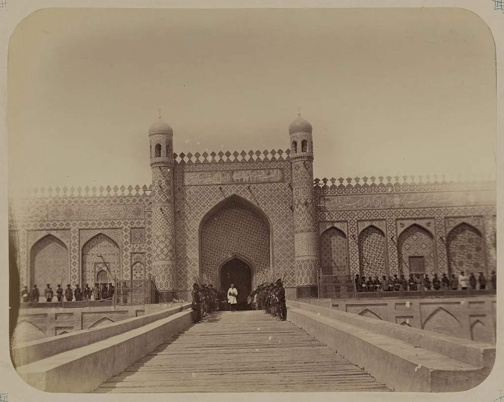
The palace of Khudoyar Khan at Kokand in the Ferghana valley, from the Turkestan album of 1865–1872. Photograph: Turkestan album; Library of Congress, Prints and Photographs Division. No known restrictions on publication. Ana görsel Yer aldığı yer: Fergana
-
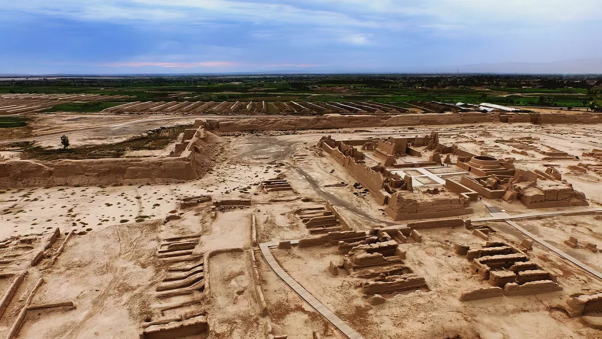
The ruins of Gaochang from the air: the mud-brick walls and halls of the city in the Turfan depression, with the fields of the oasis behind. Ana görsel Yer aldığı yer: Gaochang
-
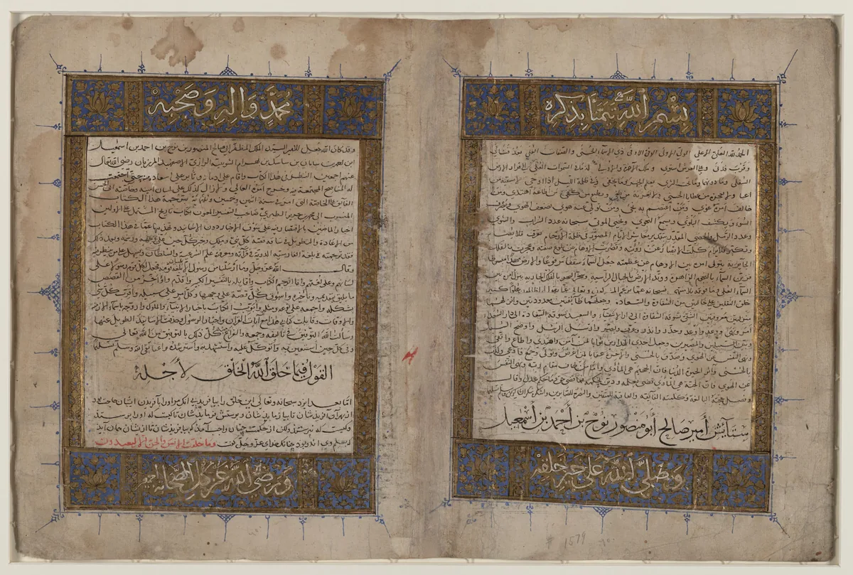
The illuminated opening pages of a manuscript of Bal'ami's Persian translation of Tabari's History, copied in the thirteenth or fourteenth century, in the Library of Congress. Tabari tells how a khagan turned back before the fortified gate of Sul without a battle; where the gate stood is disputed. Image: Library of Congress, African and Middle East Division. Public domain. Ana görsel Yer aldığı yer: Sul Kapısı
-
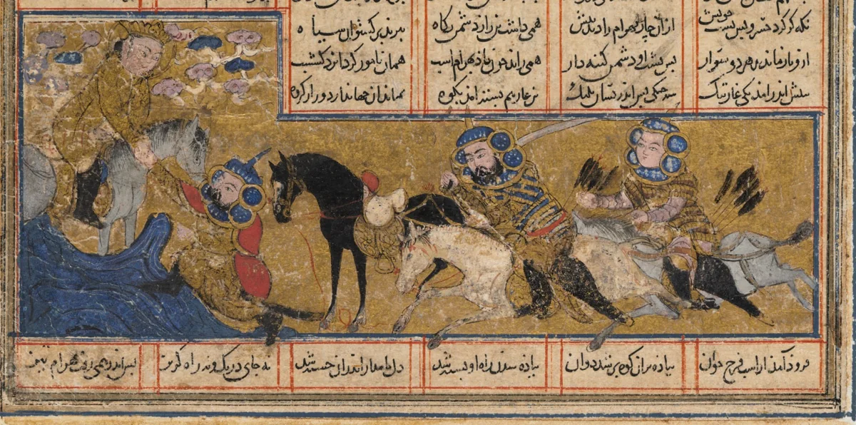
Khosrow II flees from Bahram Chobin, the Persian commander of the war of 588, and is saved by the angel Sarush. Painting in a Shahnama made in Baghdad about 1299. The Cleveland Museum of Art, 1944.480.1.a, CC0. Ana görsel Yer aldığı yer: Göktürk-İran Savaşı, 588–589
-
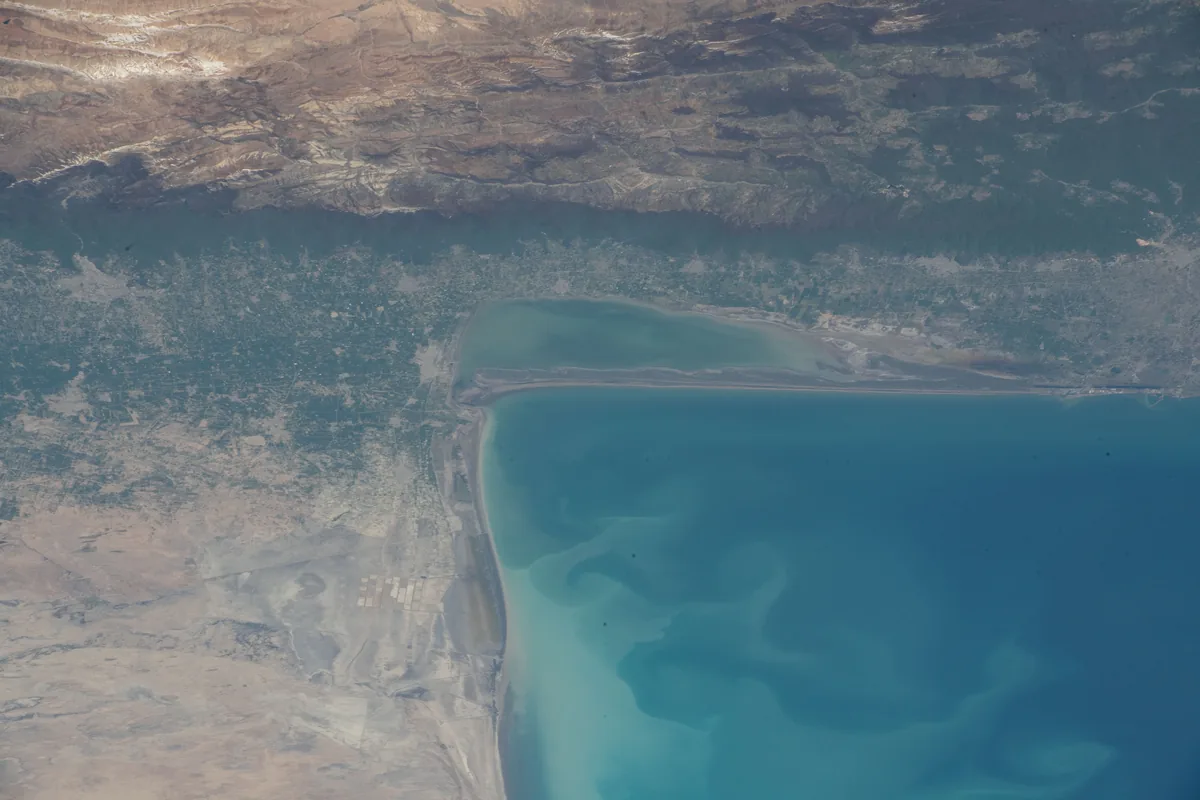
The south-eastern corner of the Caspian Sea with the Gulf of Gorgan, the Miankaleh spit and the Elburz beyond, photographed from the International Space Station in April 2022. Gurgan is the land at the south-eastern corner of the Caspian, the Hyrcania of the Greeks. Image: NASA. Public domain. Ana görsel Yer aldığı yer: Gürgan
-
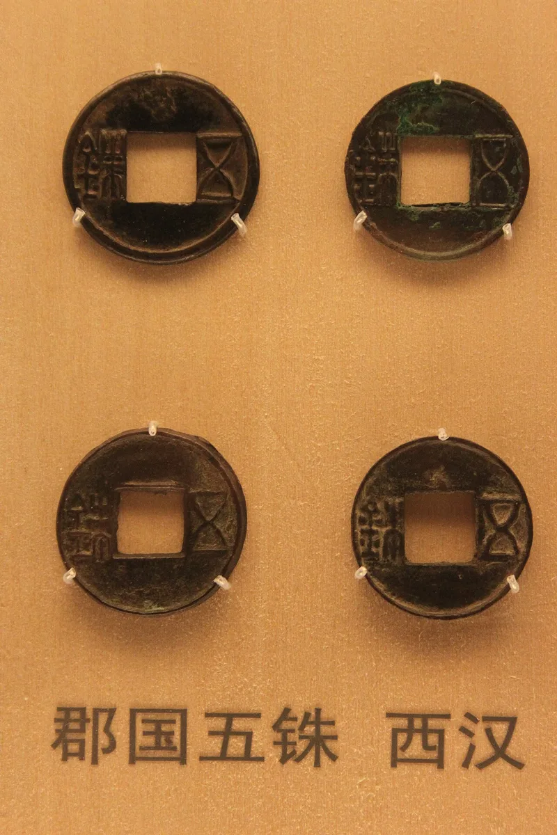
Wuzhu coins of the Western Han in the coin gallery of the Shanghai Museum. Photograph: Gary Lee Todd, 2010, CC0. Ana görsel Yer aldığı yer: Han dynasty
-
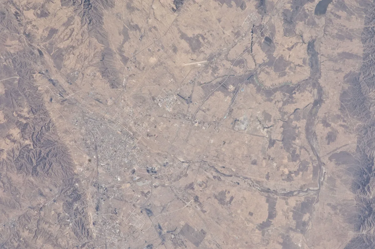
The city of Datong and its basin in northern Shanxi, photographed from the International Space Station in 2010. One identification makes Heng'an the Yunzhong county of the Tang and places it at Datong county. Image: NASA. Public domain. Ana görsel Yer aldığı yer: Heng'an
-
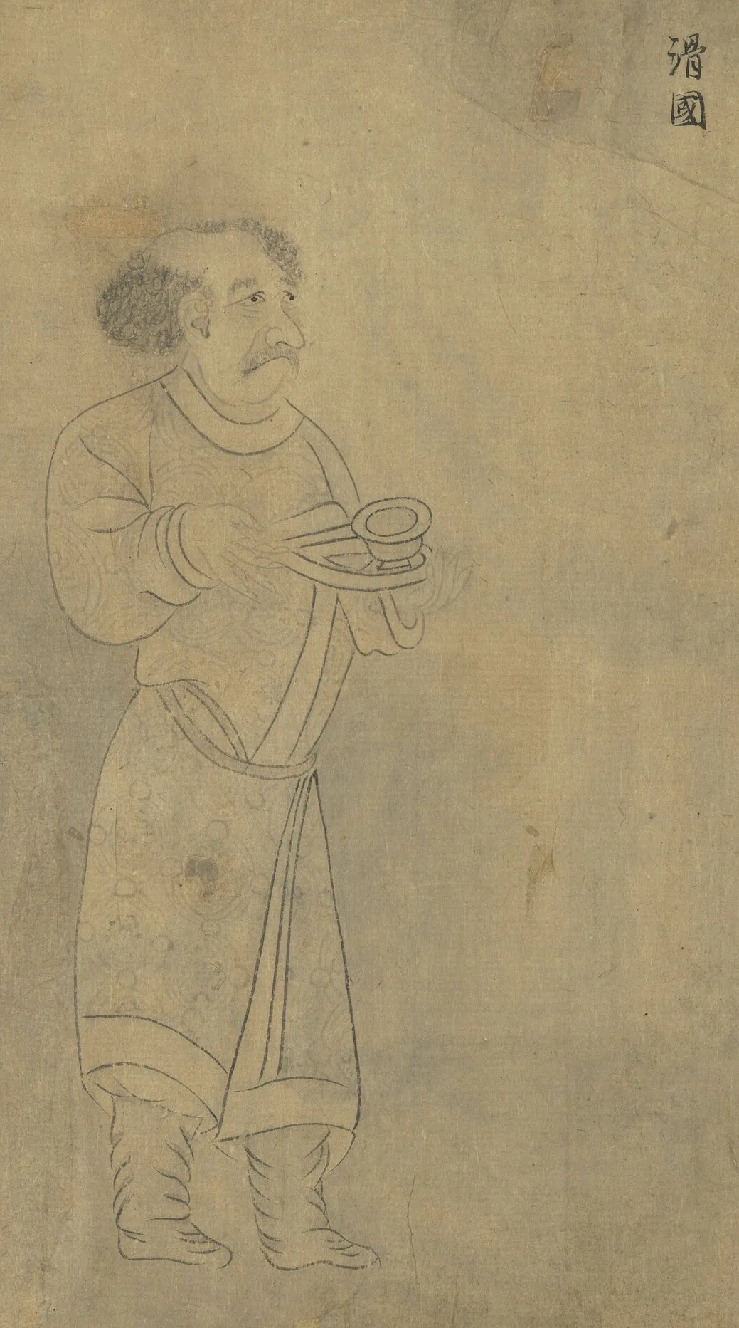
Envoy of the Hua (滑國), as the Liang court called the Hephthalites, carrying a bowl. From “Foreign Visitors Coming to Court”, a copy after a painting ascribed to Emperor Yuan of Liang (r. 552–555); an inscription of the Song emperor Lizong names Gu Deqian of the Southern Tang as the copyist. Handscroll, ink on paper; National Palace Museum, Taipei, 故畫001389N. Copy of Emperor Yuan of Liang’s “Foreign Visitors Coming to Court”, The National Palace Museum, Taipei, CC BY 4.0 @ www.npm.gov.tw. Ana görsel Yer aldığı yer: Hephthalites
-
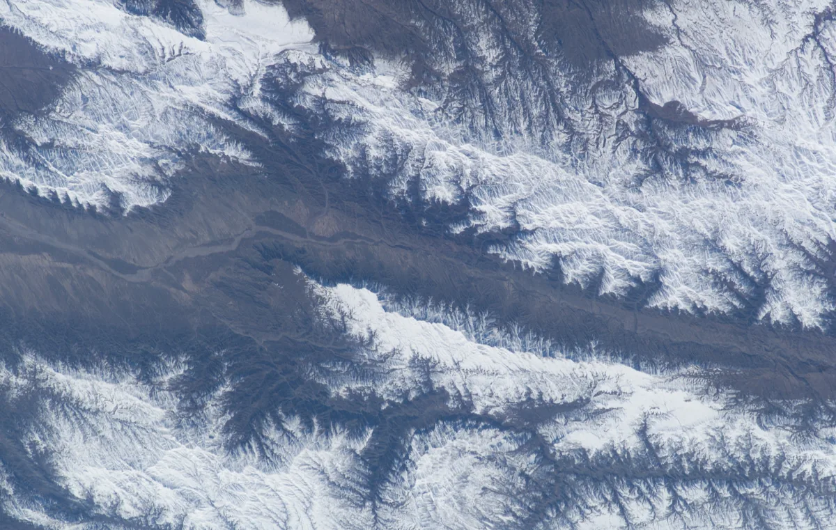
The snow-covered valley of the Hari Rud east of Herat, photographed from the International Space Station in 2003. Astronaut photograph ISS006-E-25613. NASA, public domain. Ana görsel Yer aldığı yer: Herat
-
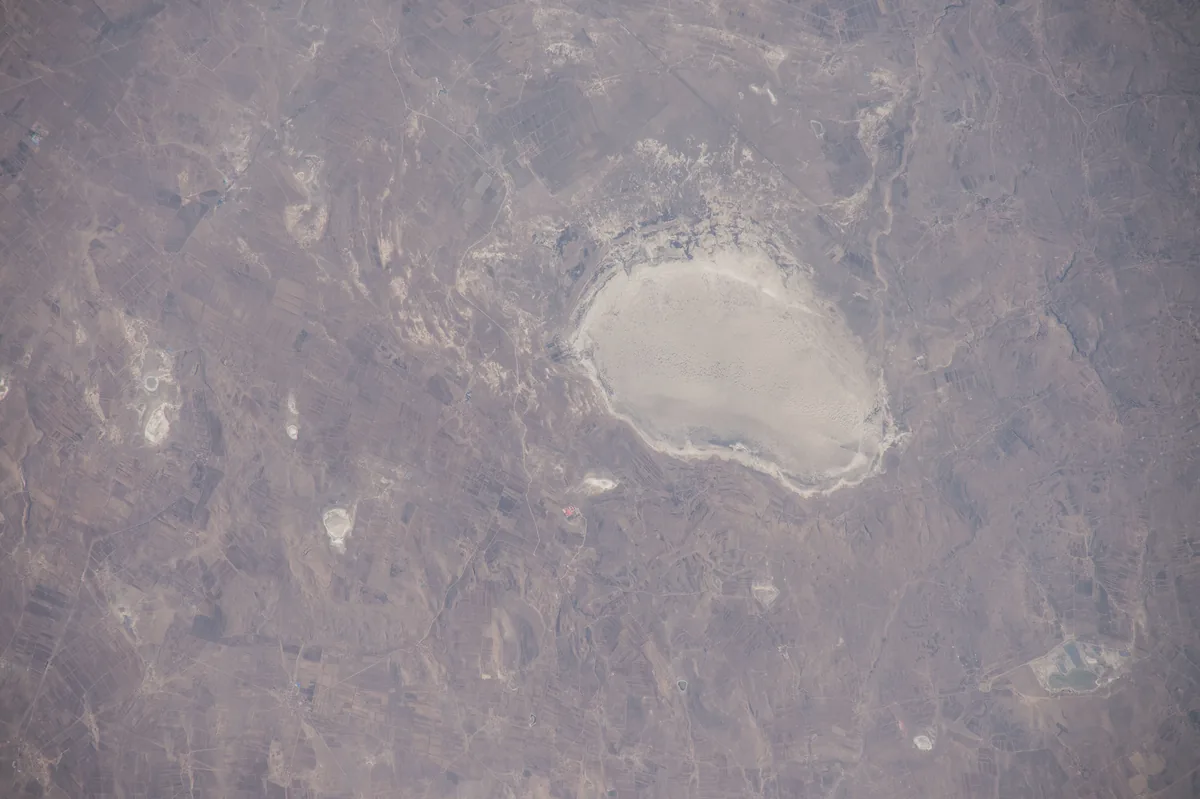
A dry lake bed on the plateau of Zhangbei county in northern Hebei, photographed from the International Space Station in 2015. Modern scholarship places Huaihuang near Zhangbei, on the edge of the Mongolian plateau. Image: NASA. Public domain. Ana görsel Yer aldığı yer: Huaihuang
-
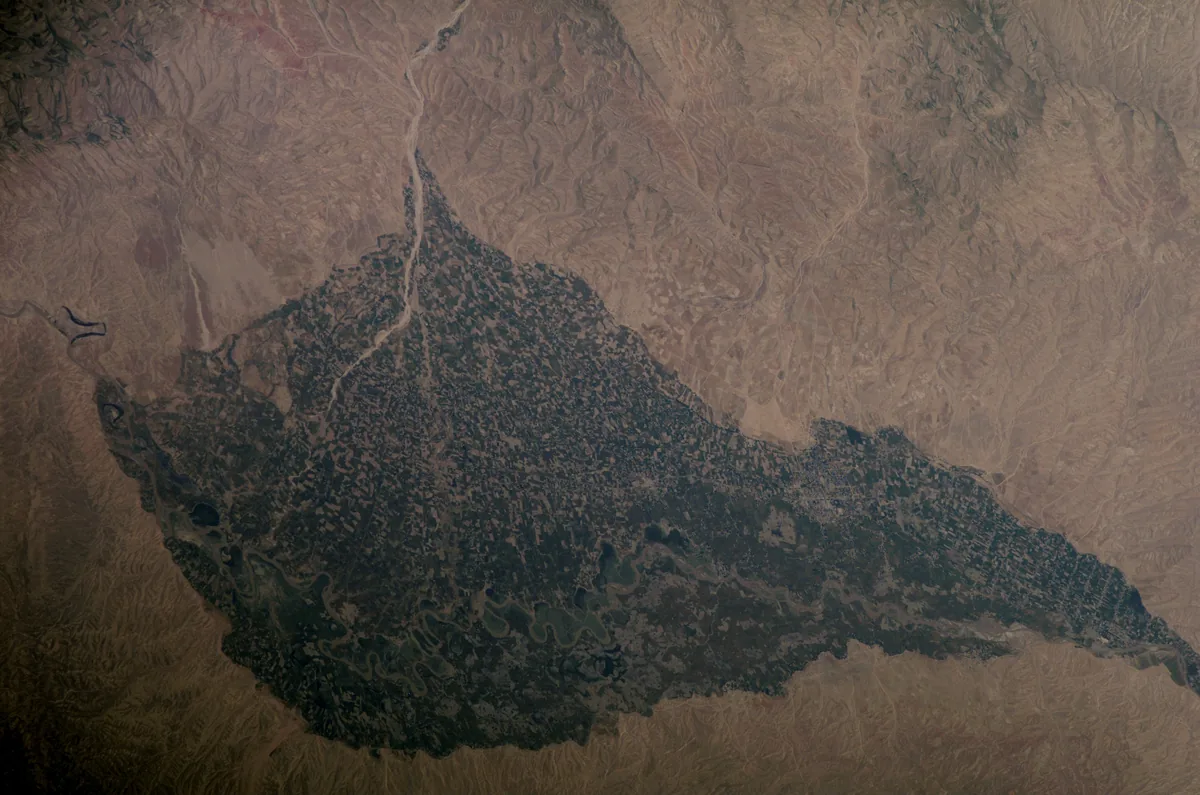
The irrigated valley of the Kunduz river, here called the Surkhab, around Baghlan in northern Afghanistan, photographed from the International Space Station in May 2007. Huo is placed at Kunduz by some and at Ghori on the road from Kunduz to Kabul by others; Baghlan lies between the two. Image: NASA. Public domain. Ana görsel Yer aldığı yer: Huo
-
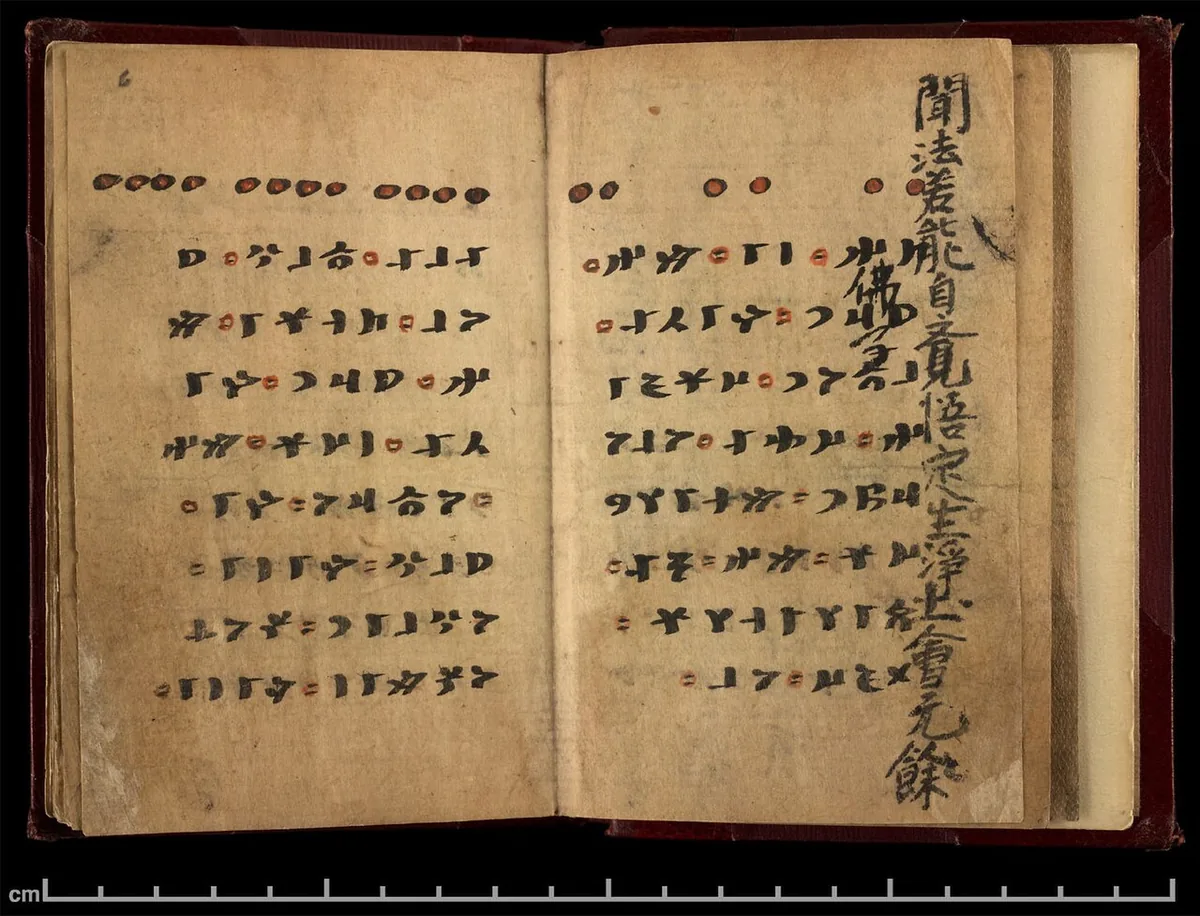
The booklet open at page 6: runiform lines in black with red punctuation, and the Chinese Buddhist text of the other side showing at the edge. British Library, Or.8212/161, via the International Dunhuang Project. Public domain. Ana görsel Yer aldığı yer: Irk Bitig
-
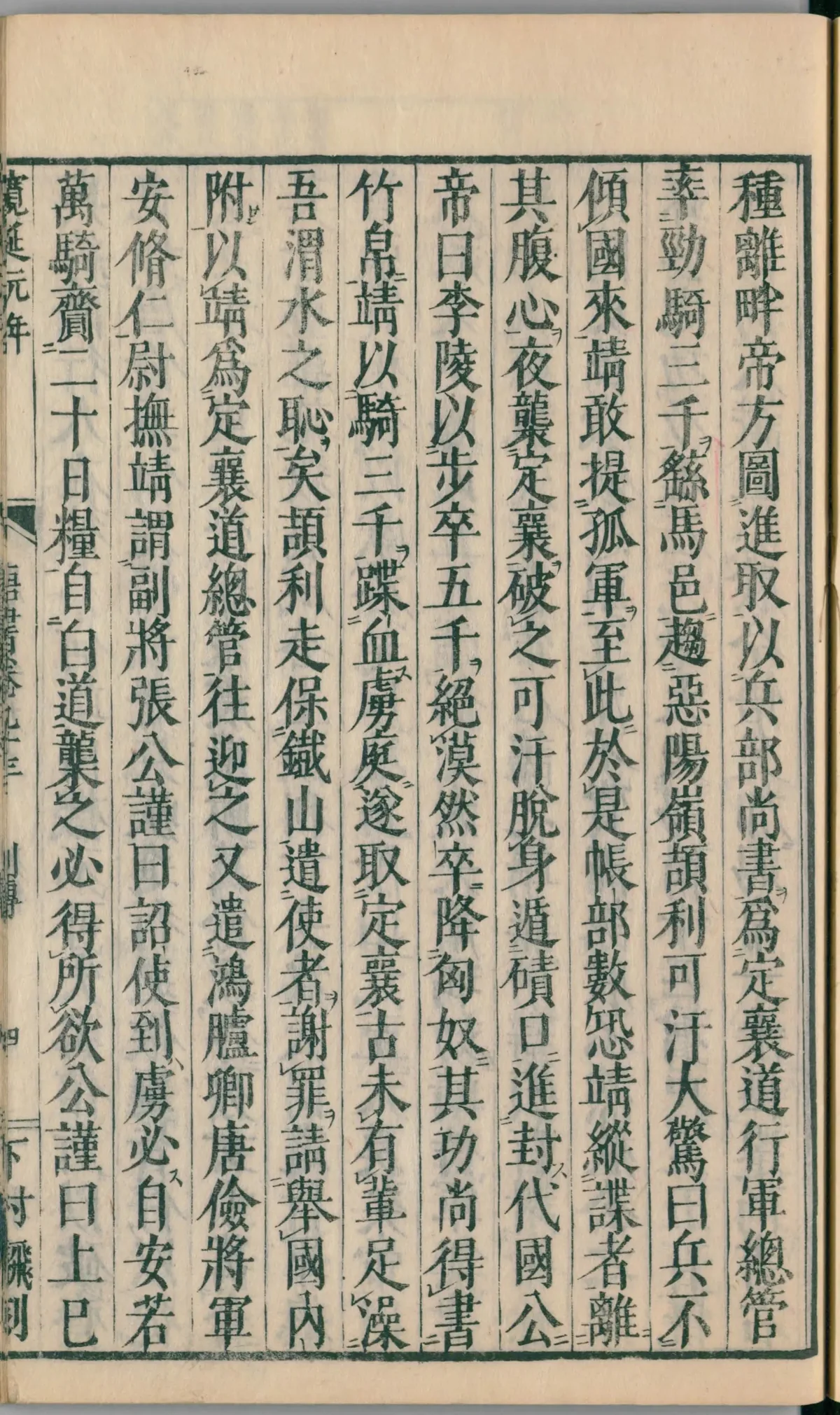
A page of the life of Li Jing in chapter 93 of the Xin Tang Shu, in a Japanese edition of 1750, in the National Diet Library, Tokyo. In the seventh column from the right, the text says that Ilig fled to the Iron Mountain (鐵山) to make a stand and sent envoys to ask that his state be received in submission. Image: National Diet Library, Japan. Public domain. Ana görsel Yer aldığı yer: Demir Dağ
-
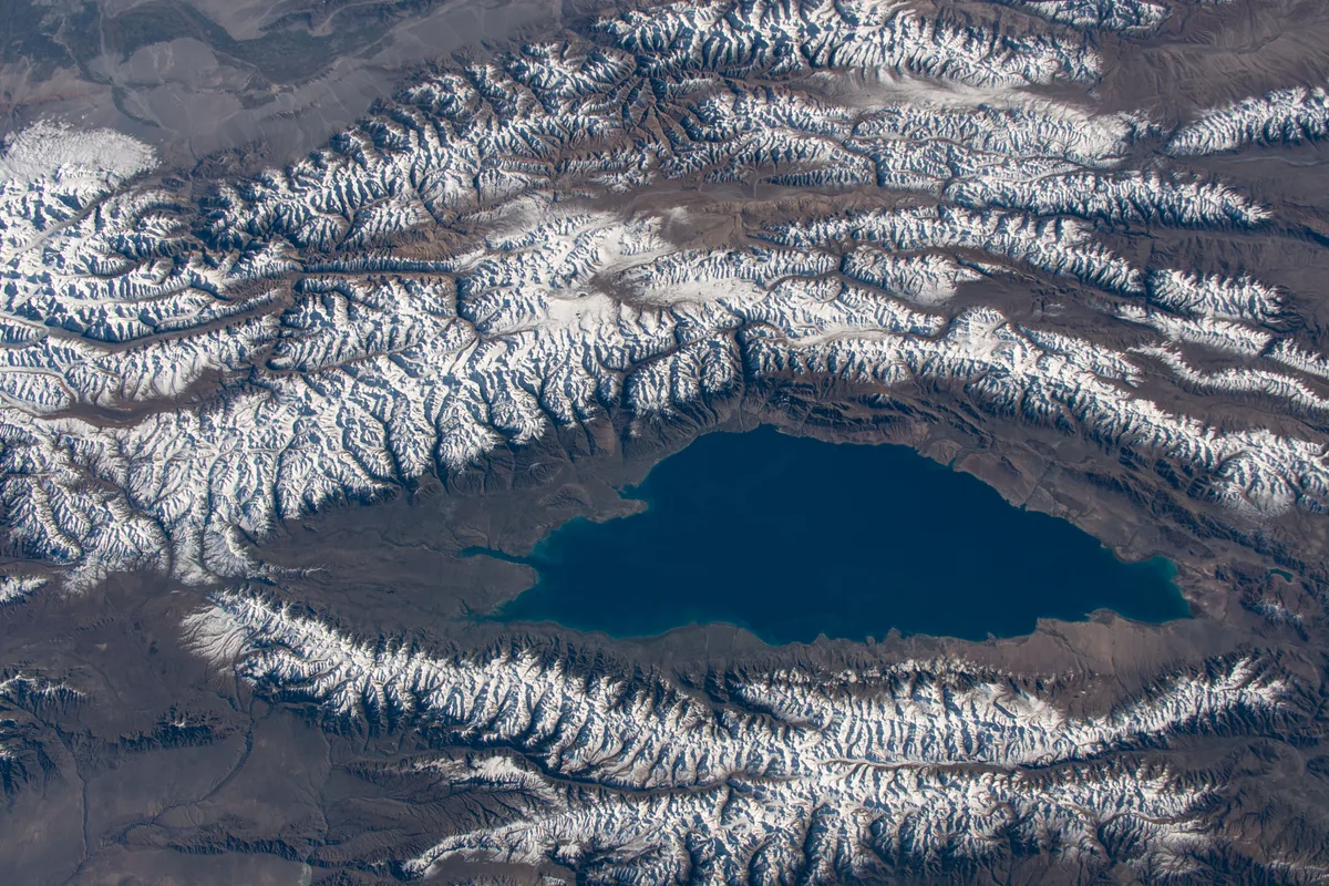
Lake Issyk-Kul in Kyrgyzstan between the snow-covered ranges of the Tian Shan, photographed from the International Space Station in October 2019. Xuanzang's Record calls it the Great Clear Lake, long from east to west and surrounded by mountains on all sides. Image: NASA. Public domain. Ana görsel Yer aldığı yer: Issık Göl
-
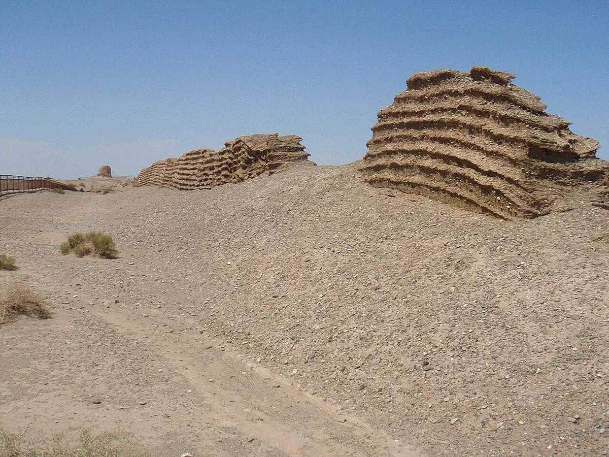
Remains of the Han wall at the Jade Gate Pass in the desert west of Dunhuang, August 2011. Photograph: Raki_Man, 2011, CC BY 3.0. Ana görsel Yer aldığı yer: Yeşim Kapı
-
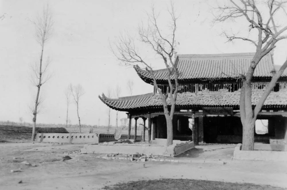
A pavilion at the spring called Jiuquan, 'Wine Spring', in Suzhou, the modern town of Jiuquan in Gansu, photographed by Irving C. Yew of Sven Hedin's Sino-Swedish expedition in December 1934. Image: Irving C. Yew, Museum of Ethnography, Stockholm. Public domain. Ana görsel Yer aldığı yer: Jiuquan
-
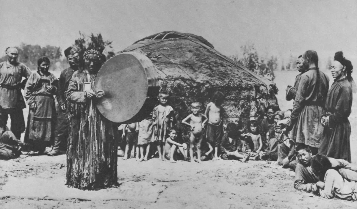
A Tuvan shaman with his frame drum before a felt yurt, photographed about 1900. It shows the practice as ethnographers recorded it among the Turkic peoples of southern Siberia, thirteen centuries after the Göktürks. Photograph: unknown Russian photographer, about 1900; Hamburgisches Museum für Völkerkunde. Public domain. Ana görsel Yer aldığı yer: Kam (Türk şamanı)
-
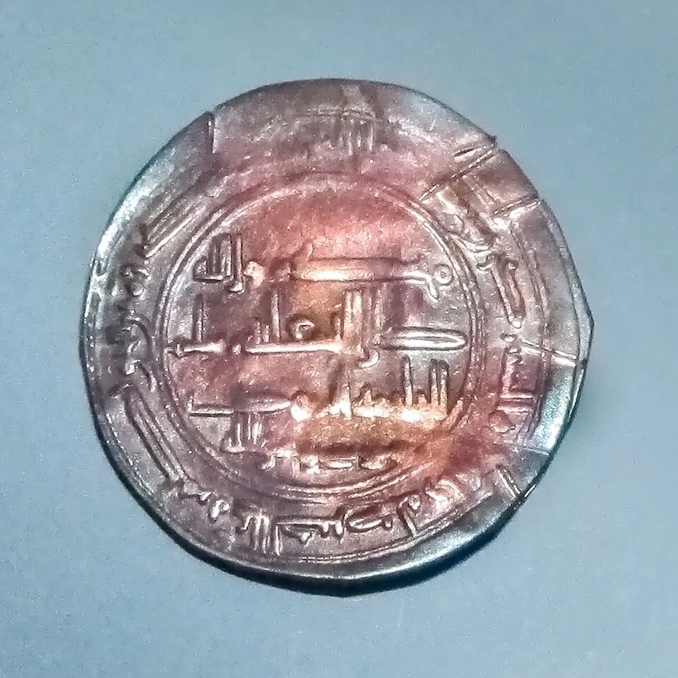
The so-called Moses coin, a Khazar silver coin from the Spillings hoard on Gotland, in the museum at Visby. Photograph: W. Carter, 2015, CC BY-SA 4.0. Ana görsel Yer aldığı yer: Hazar Kağanlığı
-
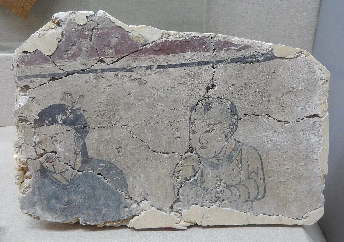
Fragment of a Liao-dynasty tomb mural showing a Khitan man and a Khitan boy, from a tomb at Paolou Hill in Lindong, excavated in 1988. Photograph: BabelStone, 2016, CC BY-SA 3.0. Ana görsel Yer aldığı yer: Khitan
-
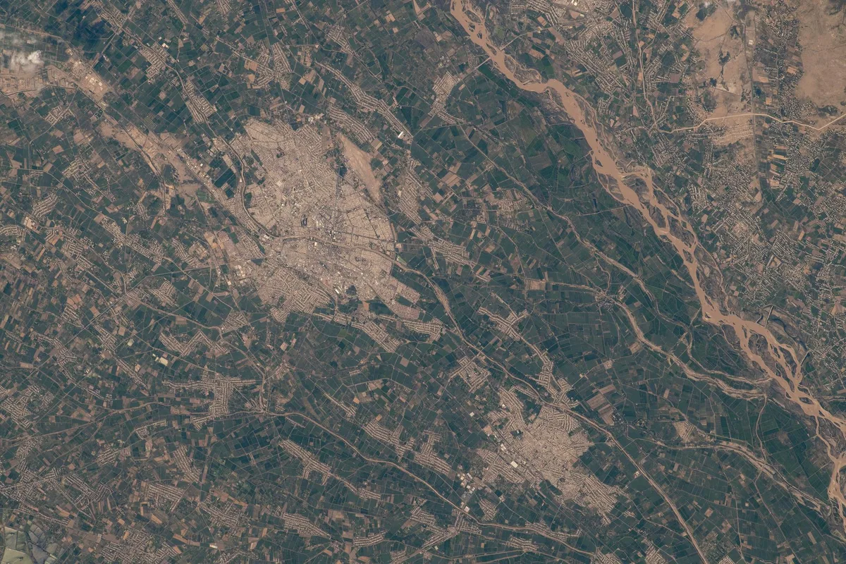
The irrigated oasis around Urgench by the Amu Darya, astronaut photograph, 2022. Astronaut photograph iss067e212667. NASA, public domain. Ana görsel Yer aldığı yer: Harezm
-
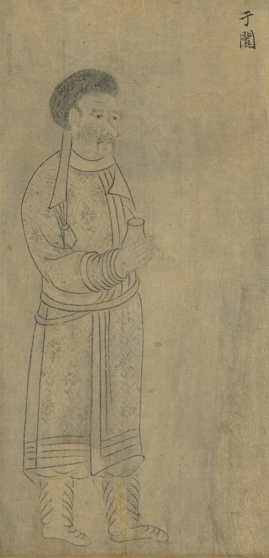
Envoy of Khotan (于闐), holding a small flask. From “Foreign Visitors Coming to Court”, a copy after a painting ascribed to Emperor Yuan of Liang (r. 552–555); an inscription of the Song emperor Lizong names Gu Deqian of the Southern Tang as the copyist. Handscroll, ink on paper; National Palace Museum, Taipei, 故畫001389N. Copy of Emperor Yuan of Liang’s “Foreign Visitors Coming to Court”, The National Palace Museum, Taipei, CC BY 4.0 @ www.npm.gov.tw. Ana görsel Yer aldığı yer: Hotan
-
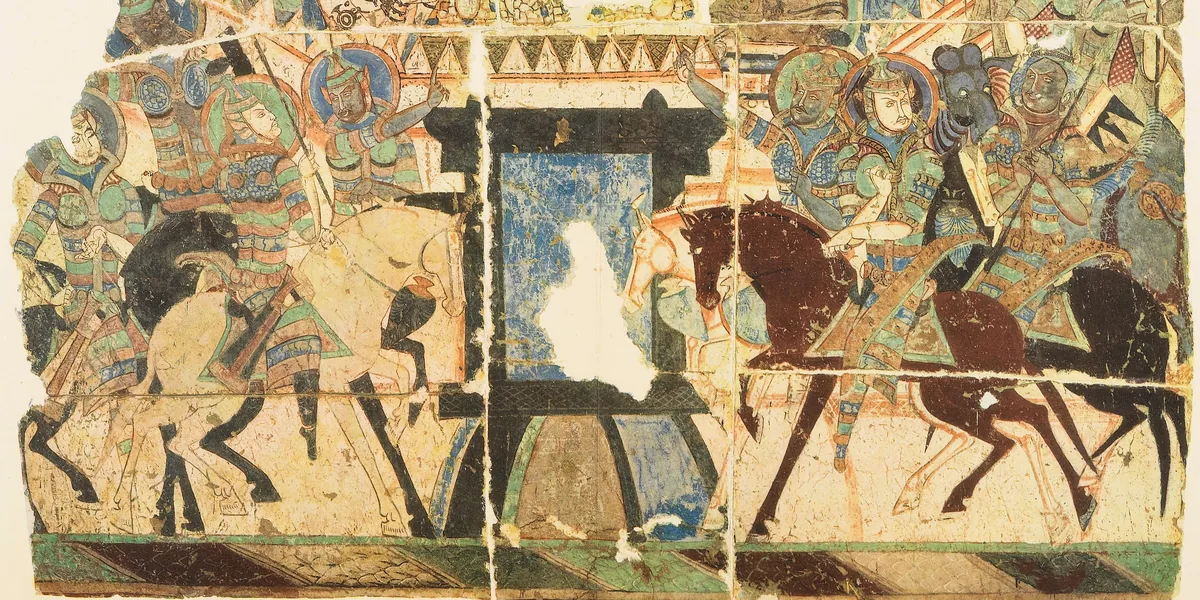
Armoured horsemen on both sides of a city gate, a wall painting from the Buddhist cave temples of the Kucha region. Ana görsel Yer aldığı yer: Kuça
-
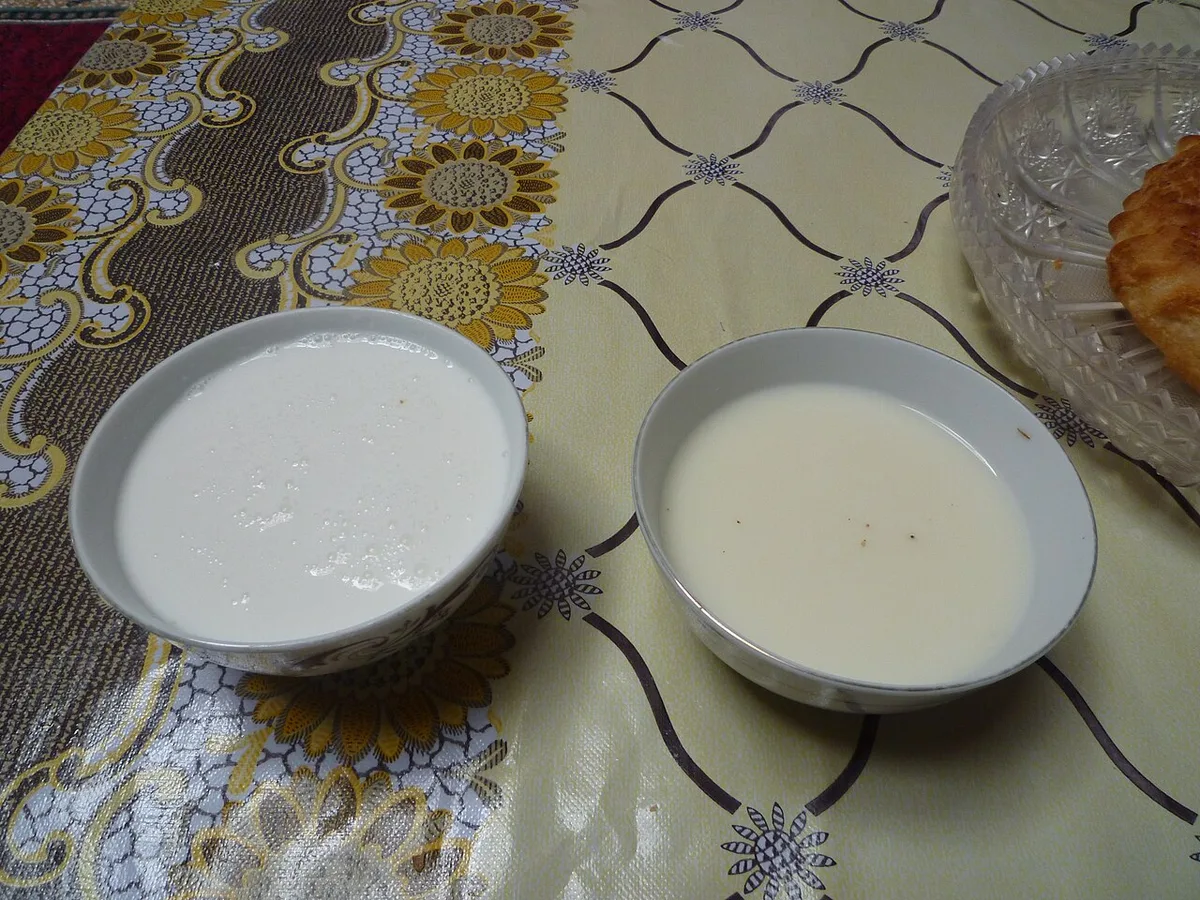
Bowls of shubat, fermented camel milk (left), and kumis, fermented mare's milk (right). Photograph: Upyernoz, 2010, CC BY 2.0. Ana görsel Yer aldığı yer: Kımız
-
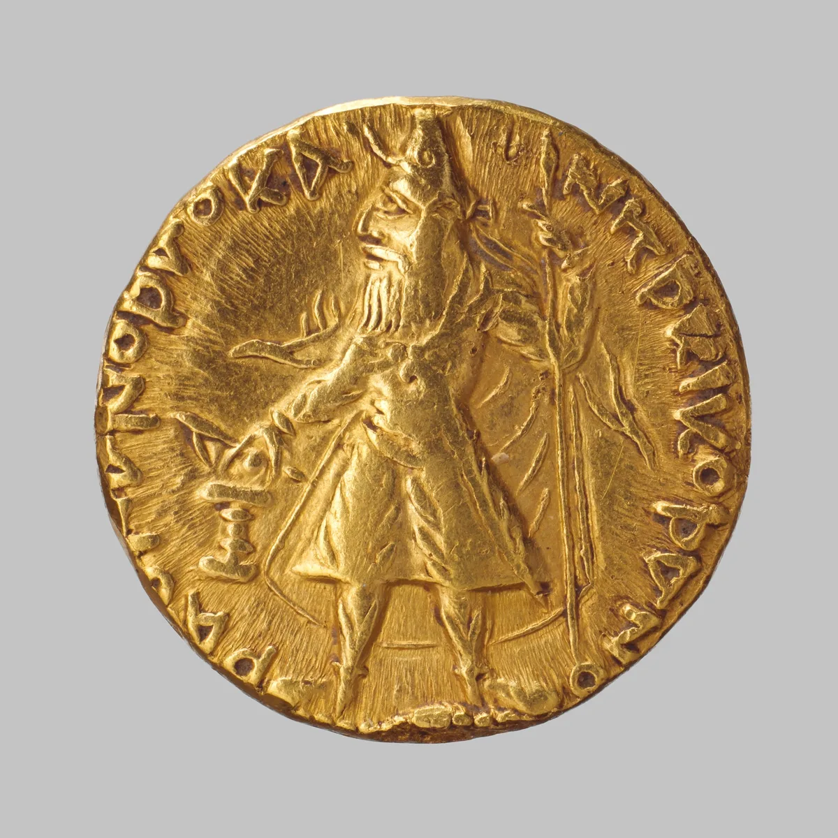
Gold coin of the Kushan king Kanishka, struck about 130 CE in the region of Gandhara. The Metropolitan Museum of Art, New York, 99.35.3024, Bequest of Joseph H. Durkee, 1898, Open Access, public domain (CC0). Ana görsel Yer aldığı yer: Kushan Empire
-
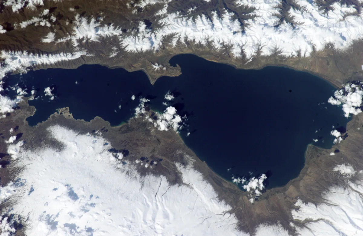
Lake Sevan in Armenia with snow on the surrounding mountains, astronaut photograph, April 2002. Astronaut photograph ISS004-E-10651. NASA, public domain. Ana görsel Yer aldığı yer: Sevan Gölü
-
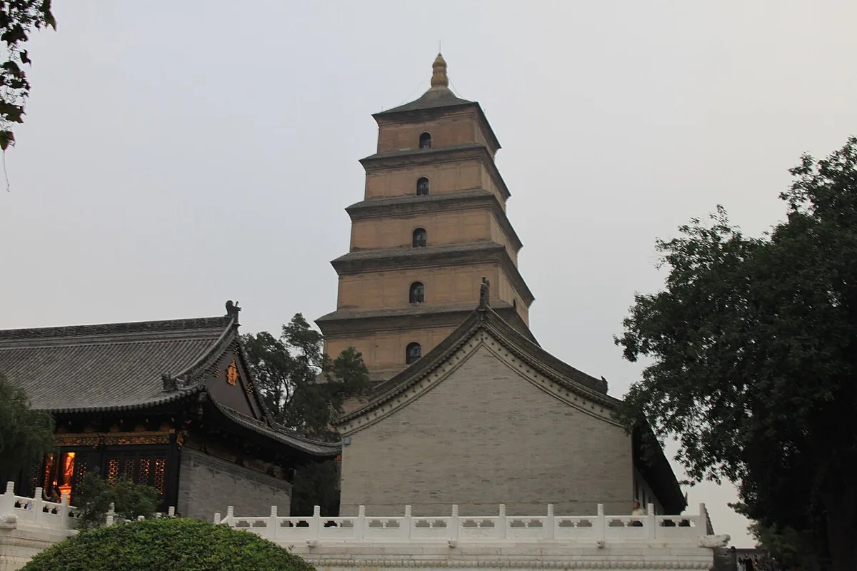
The Big Wild Goose Pagoda in the Ci'en monastery at Xi'an, the former Chang'an, where Xuanzang translated the scriptures he brought back. Photograph: Gary Todd, 2009, CC0. Ana görsel Yer aldığı yer: Life of Xuanzang
-
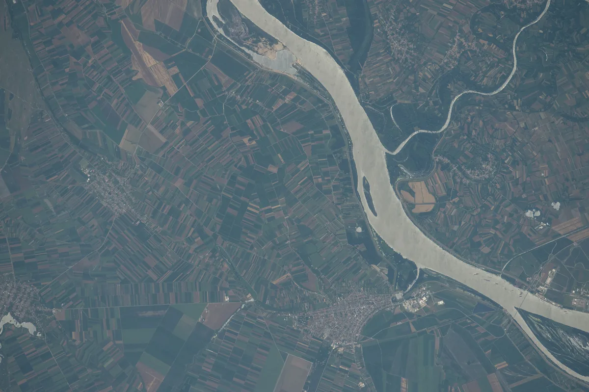
The Danube in Serbia where the Great Morava flows into it, photographed from the International Space Station on 25 June 2016. The Roman city of Margus lay near this confluence, by the modern village of Dubravica east of Belgrade. Image: NASA. Public domain. Ana görsel Yer aldığı yer: Margus
-
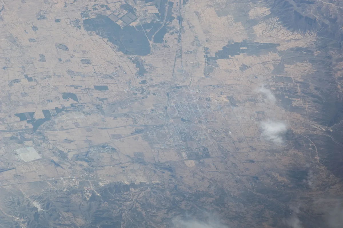
The city of Shuozhou and the plain around it in northern Shanxi, photographed from the International Space Station in 2011. One identification places Mayi east of Shuo county, on the east bank of the Mayi river. Image: NASA. Public domain. Ana görsel Yer aldığı yer: Mayi
-
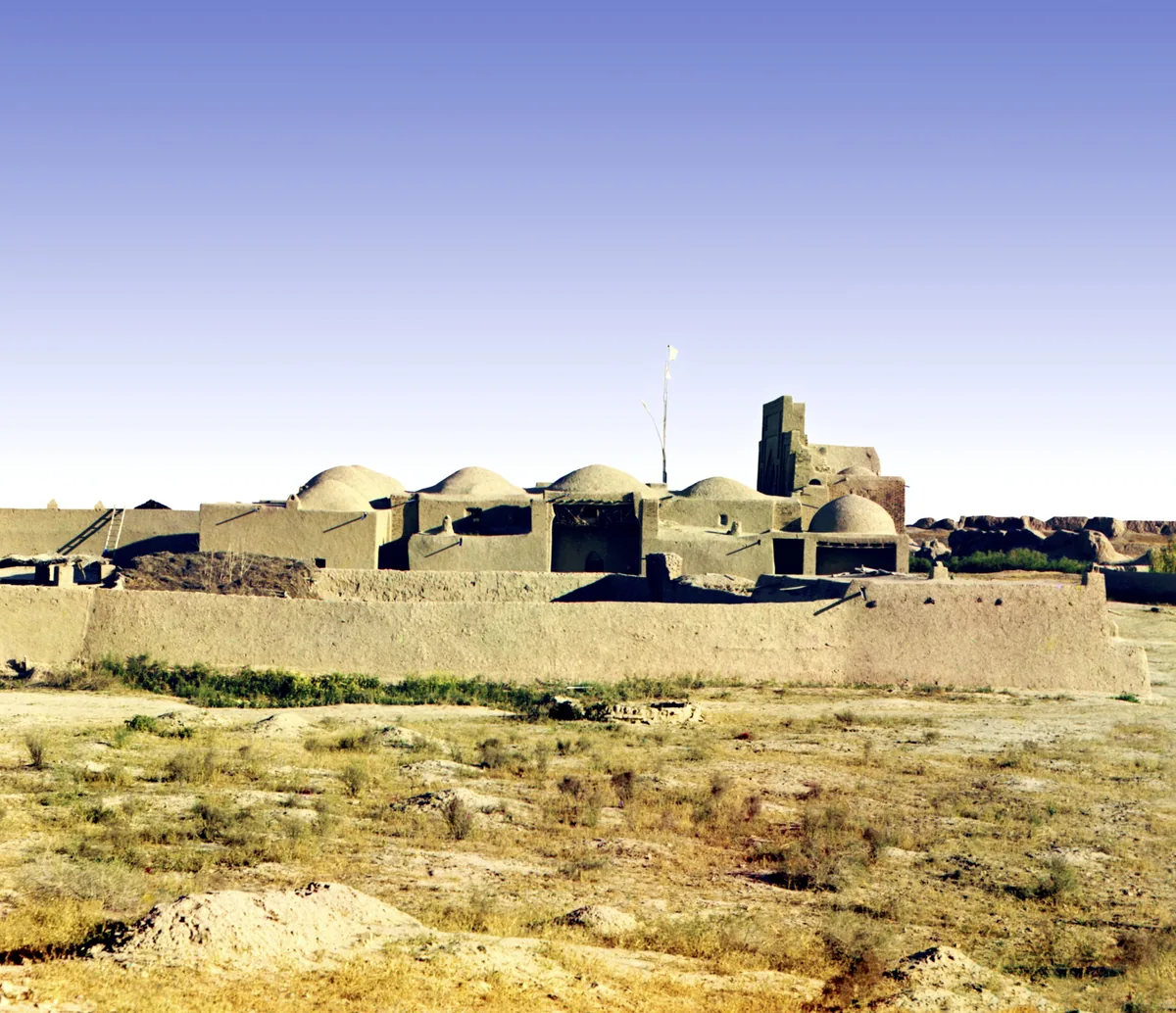
The mosque and mausoleum of Yusuf Hamadani at ancient Merv, in a colour photograph taken between 1905 and 1915. The shrine is of the twelfth century. Photograph: Sergei Prokudin-Gorskii, between 1905 and 1915; Library of Congress, no known restrictions. Ana görsel Yer aldığı yer: Merv
-
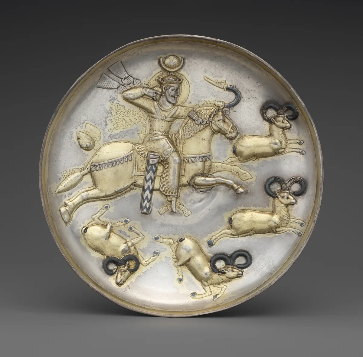
Silver plate with a Sasanian king hunting rams from horseback, Iran, mid-fifth to mid-sixth century. The rider turns in the saddle and draws the bow at full gallop. The Metropolitan Museum of Art, New York, 34.33, Fletcher Fund, 1934. Open Access, public domain (CC0). Ana görsel Yer aldığı yer: Atlı Okçuluk
-
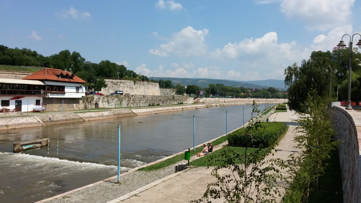
The Nišava river in Niš, southern Serbia, with the walls of the town's fortress along its bank, photographed in 2014. Roman Naissus, the modern Niš and the birthplace of Constantine, lay on the right bank of the Nišava. Image: Gagarin Miljkovich, CC BY 2.0. Ana görsel Yer aldığı yer: Naissus
-
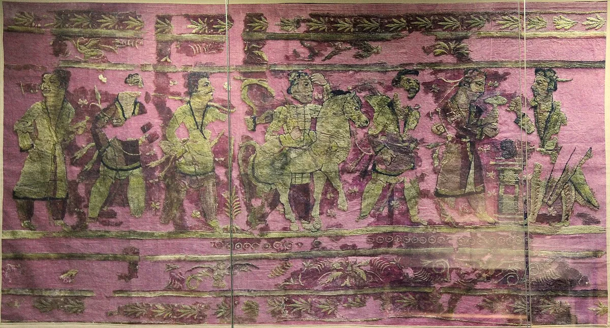
An embroidered hanging from the burial mounds of Noin-Ula, first century BCE to first century CE, as shown in a museum. Photograph: Gary Todd, 2022, CC0. Ana görsel Yer aldığı yer: Noin Ula
-
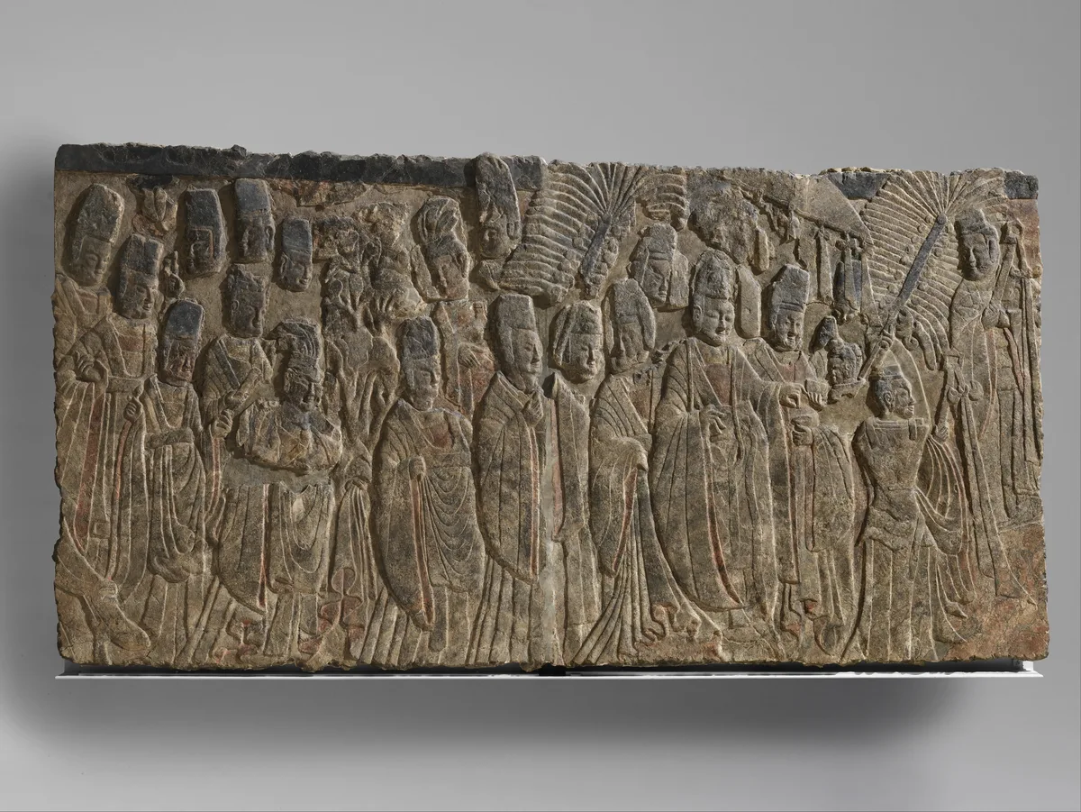
Limestone relief of Emperor Xiaowen and his entourage worshipping the Buddha, Northern Wei dynasty, about 522–23. The Metropolitan Museum of Art, New York, 35.146, Fletcher Fund, 1935, Open Access, public domain (CC0). Ana görsel Yer aldığı yer: Kuzey Wei
-
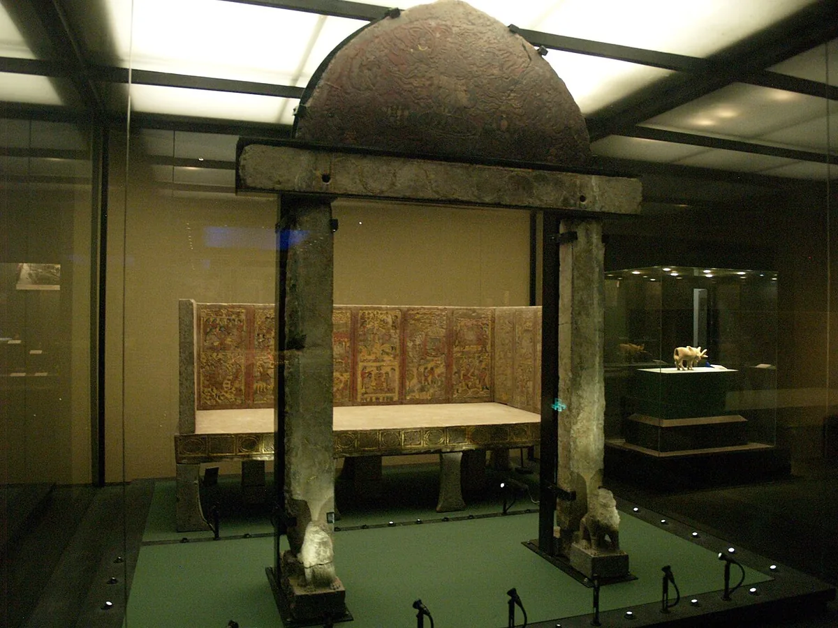
The stone gate and the funerary couch from the tomb of An Jia, a Sogdian sabao under the Zhou who died in 579, as shown at the Shaanxi History Museum in Xi'an. The painted and gilded reliefs of the couch show scenes from his life, among them his dealings with the nomads. Photograph: Deadkid dk, 2010, CC BY-SA 3.0. Ana görsel Yer aldığı yer: Kuzey Zhou
-
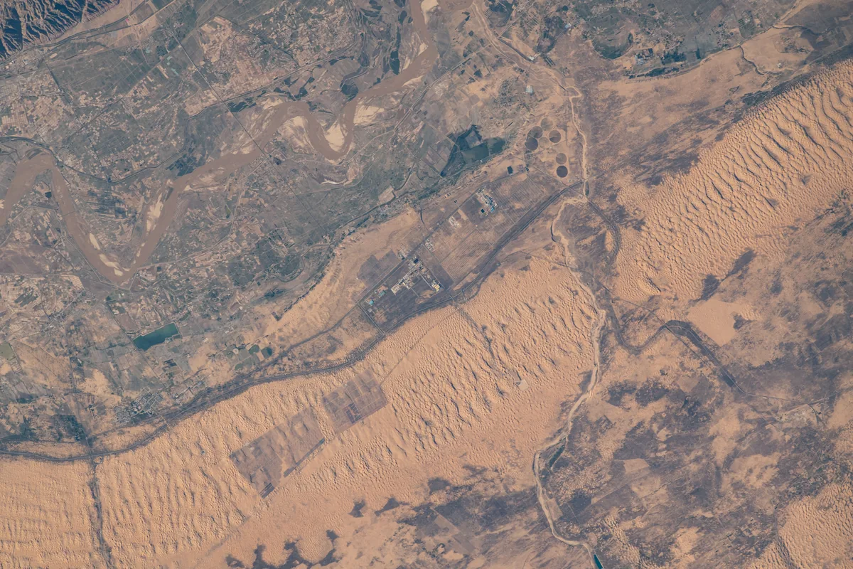
The Yellow River and the dunes of the Kubuqi desert on the northern edge of the Ordos, photographed from the International Space Station in 2022. Astronaut photograph ISS067-E-122535. NASA, public domain. Ana görsel Yer aldığı yer: Ordos
-
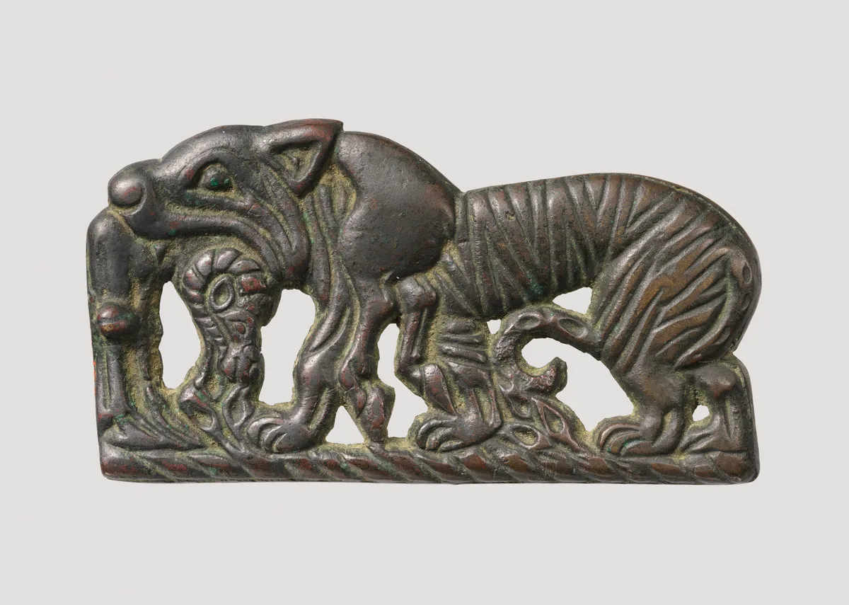
Bronze plaque of a tiger devouring a ram, attributed to the Xiongnu, about the second century BCE. The Metropolitan Museum of Art, New York, 49.132, Rogers Fund, 1949, Open Access, public domain (CC0). Ana görsel Yer aldığı yer: Ordos bronzes
-
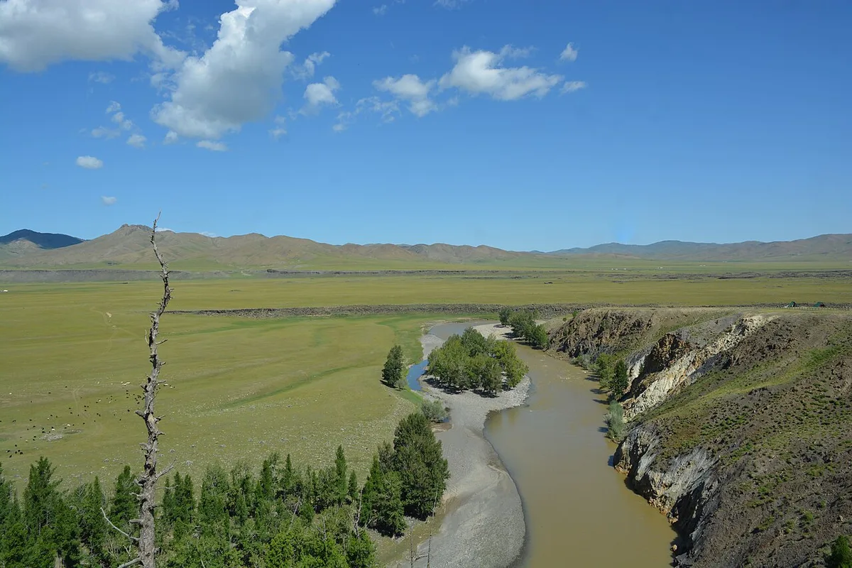
The Orkhon valley in central Mongolia, August 2024. Photograph: Jonashtand, 2024, CC BY-SA 4.0. Ana görsel Yer aldığı yer: Orhun vadisi
-
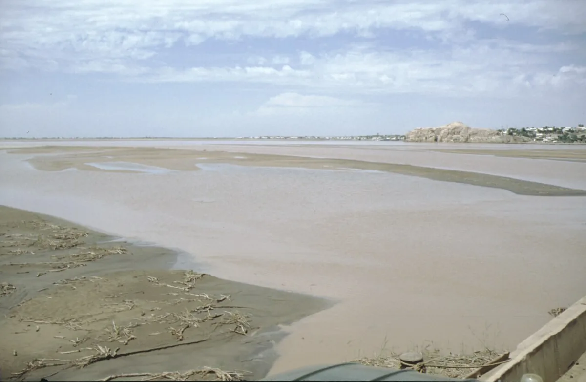
The Amu Darya, the Oxus of the ancient writers, near Kerki in Turkmenistan, 1995. Photograph: Klaus Schönitzer, 1995, CC BY-SA 4.0. Ana görsel Yer aldığı yer: Ceyhun
-
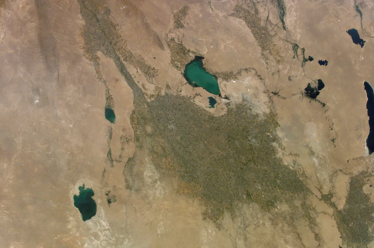
The irrigated oasis of Bukhara at the western end of the Zerafshan valley, surrounded by desert and lakes, photographed from the International Space Station in June 2002. Paikent lay in this oasis at the edge of the desert. Image: NASA. Public domain. Ana görsel Yer aldığı yer: Paykent
-
The excavated ruins of the Sogdian town of Panjikent in the upper Zarafshan valley, Tajikistan, photographed in 2023. Panjikent is the most extensively and continuously excavated town of Central Asia. Image: Richard Mortel, 2023, CC BY 2.0. Ana görsel Yer aldığı yer: Pencikent
-
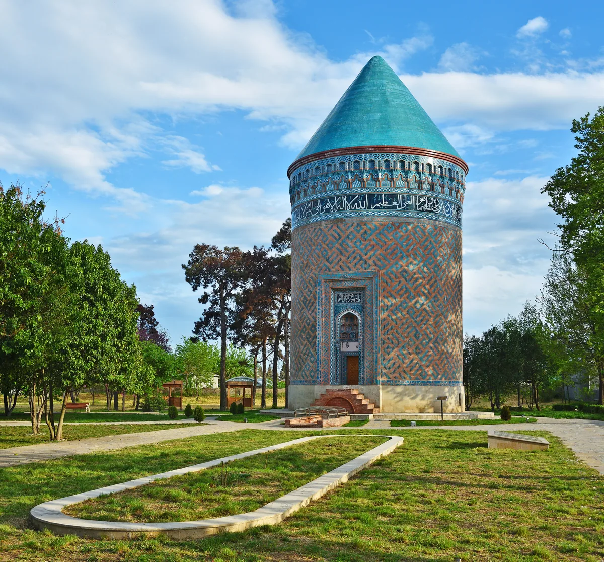
The brick tower mausoleum in the town of Barda in Azerbaijan, photographed in 2019. Partaw, the capital of Caucasian Albania, is identified with the present town of Barda. Image: Ludvig14, CC BY-SA 4.0. Ana görsel Yer aldığı yer: Partav
-
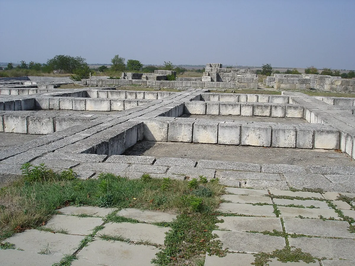
Foundations of the palace complex at Pliska. Photograph: Svilen Enev, 2007, CC BY-SA 3.0. Ana görsel Yer aldığı yer: Pliska
-
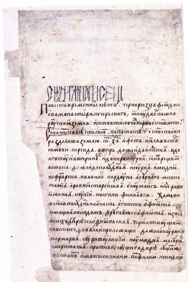
Opening leaf of the Radziwiłł (Königsberg) Chronicle, a fifteenth-century copy of the Rus chronicle. Radziwiłł Chronicle, 15th century, reproduction of the manuscript, public domain. Ana görsel Yer aldığı yer: Russian Primary Chronicle
-
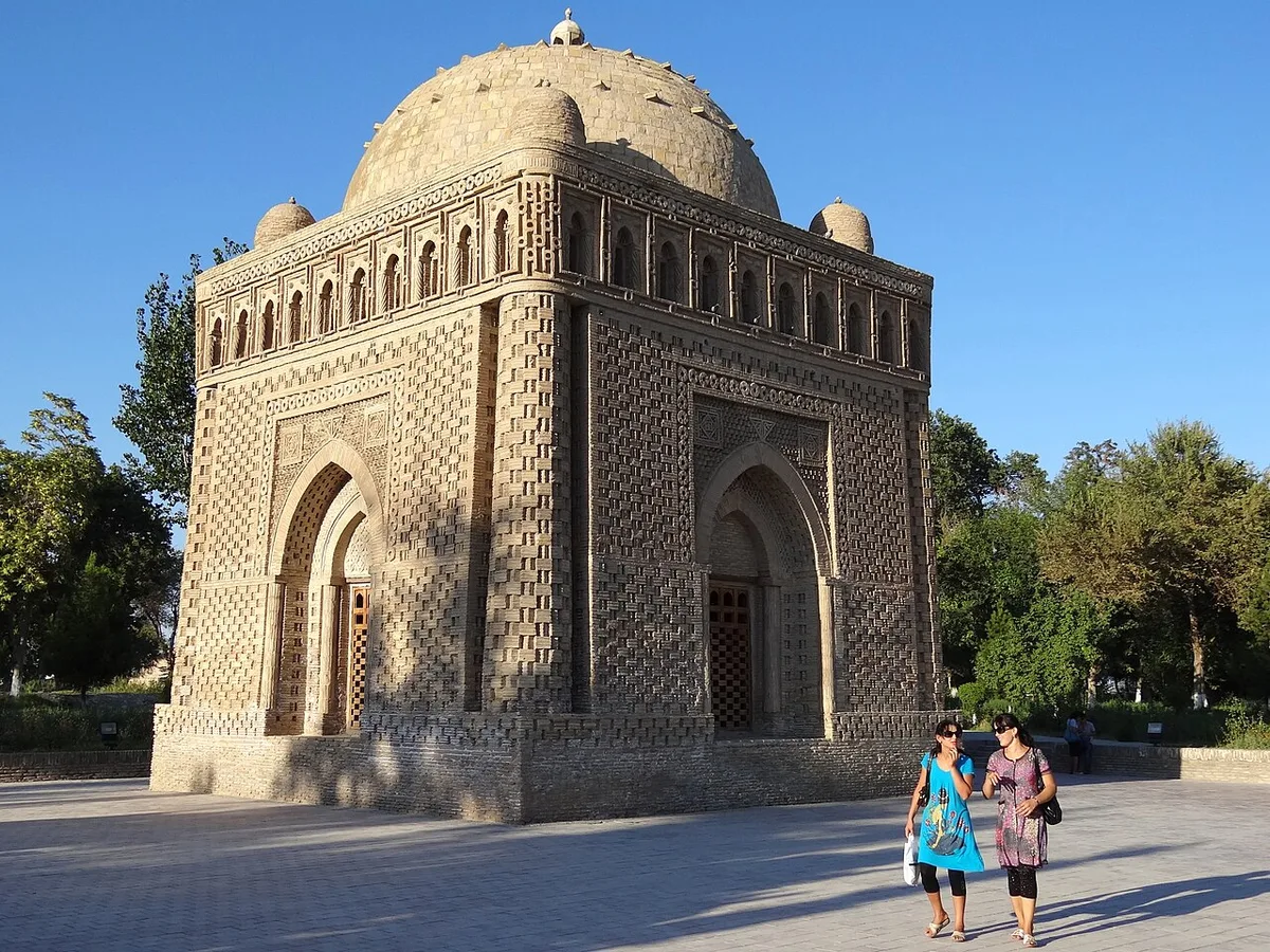
The mausoleum of Ismail Samani at Bukhara, a monument of the Samanid dynasty. Photograph: Adam Jones, 2012, CC BY-SA 2.0. Ana görsel Yer aldığı yer: Samanids
-
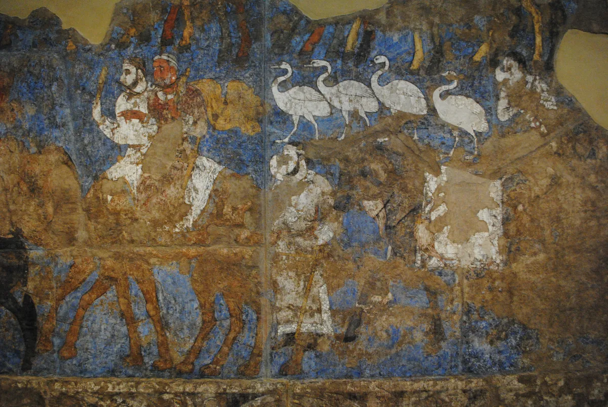
Riders on camels and a line of white birds in a procession from the paintings of the Hall of the Ambassadors at Afrasiab, the old site of Samarkand, seventh century. The paintings left Uzbekistan for the first time in 2022 for an exhibition at the Louvre. Wall painting: Hall of the Ambassadors, Afrasiab (Samarkand), seventh century. Photograph: Carole Raddato, CC BY-SA 2.0. Ana görsel Yer aldığı yer: Semerkant
-
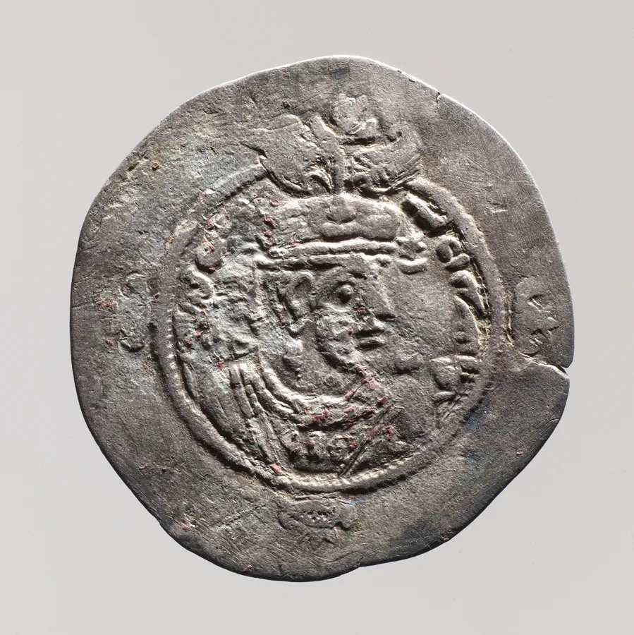
Silver drachm of the Sasanian empire, about 629 CE. The Metropolitan Museum of Art, New York, 36.30.306, Rogers Fund, 1936, Open Access, public domain (CC0). Ana görsel Yer aldığı yer: Sasani İranı
-
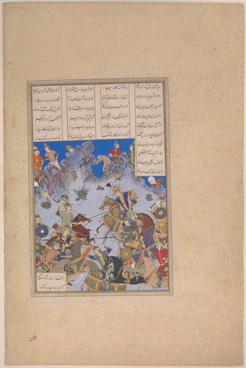
Folio 707v of the Shahnama made for Shah Tahmasp, showing Khusrau Parviz's charge against Bahram Chubina. Painted in Iran, about 1530–35. The Metropolitan Museum of Art, New York, 1970.301.72, Gift of Arthur A. Houghton Jr., 1970, Open Access, public domain (CC0). Ana görsel Yer aldığı yer: Shahnameh
-
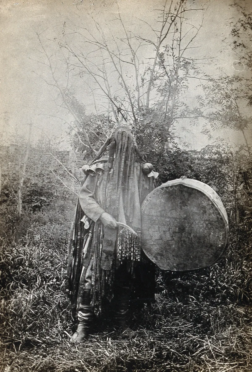
A shaman of the Minusinsk Tatars, the Khakas of the upper Yenisei, in ceremonial dress with his face covered, holding a drum. The printed caption says that his face is covered when he shamanises. Photographer unknown, 1900 to 1915; Wellcome Collection, from the papers of M. A. Czaplicka. Public domain mark. Ana görsel Yer aldığı yer: Şamanizm
-
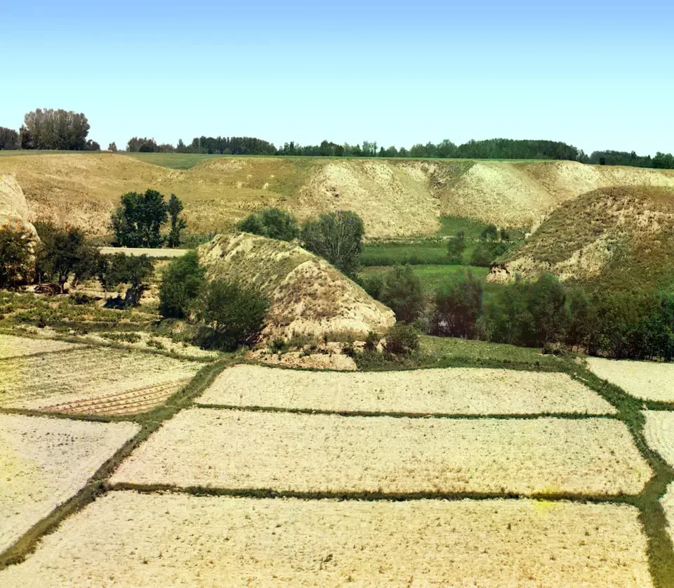
Fields near Samarkand, photographed by Sergei Prokudin-Gorskii between 1905 and 1915. Photograph: Sergei Prokudin-Gorskii; Library of Congress, Prints and Photographs Division. No known restrictions on publication. Ana görsel Yer aldığı yer: Soğdiyana
-
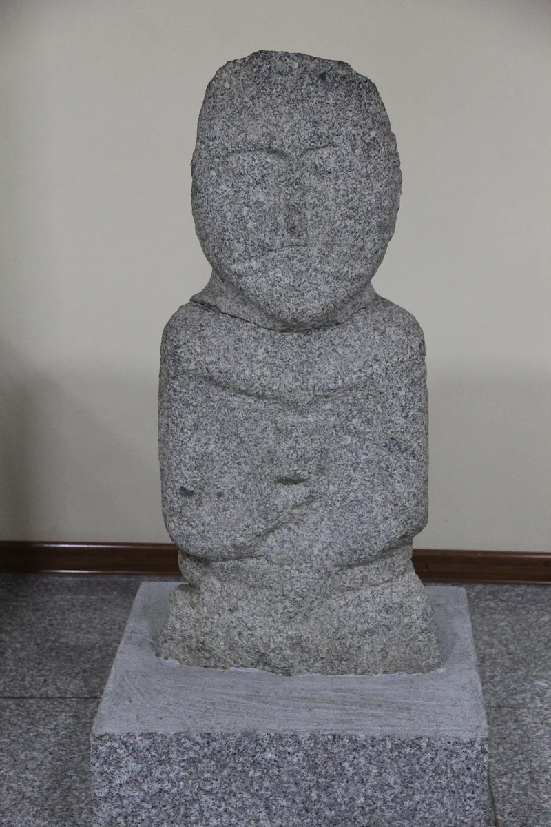
A Turkic stone statue in the Ancient States Gallery of the National Museum of Mongolia, Ulaanbaatar. Photograph: Gary Todd, 2017, CC0. Ana görsel Yer aldığı yer: Taş figürler
-
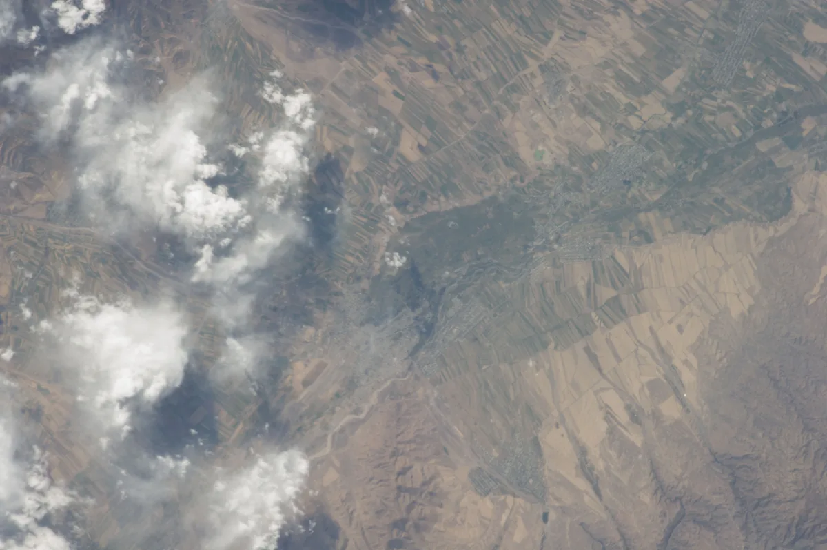
Farmland of the Chu valley around the town of Tokmak in Kyrgyzstan, photographed from the International Space Station in September 2013. Suyab stood on the Chu; its site, known today as Ak-Beshim, lies near Tokmak. Image: NASA. Public domain. Ana görsel Yer aldığı yer: Suyab
-
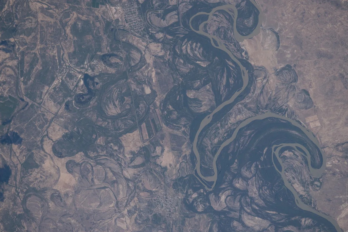
Meanders of the Syr Darya in southern Kazakhstan, astronaut photograph, 2016. Astronaut photograph ISS048-E-12868. NASA, public domain. Ana görsel Yer aldığı yer: Seyhun
-
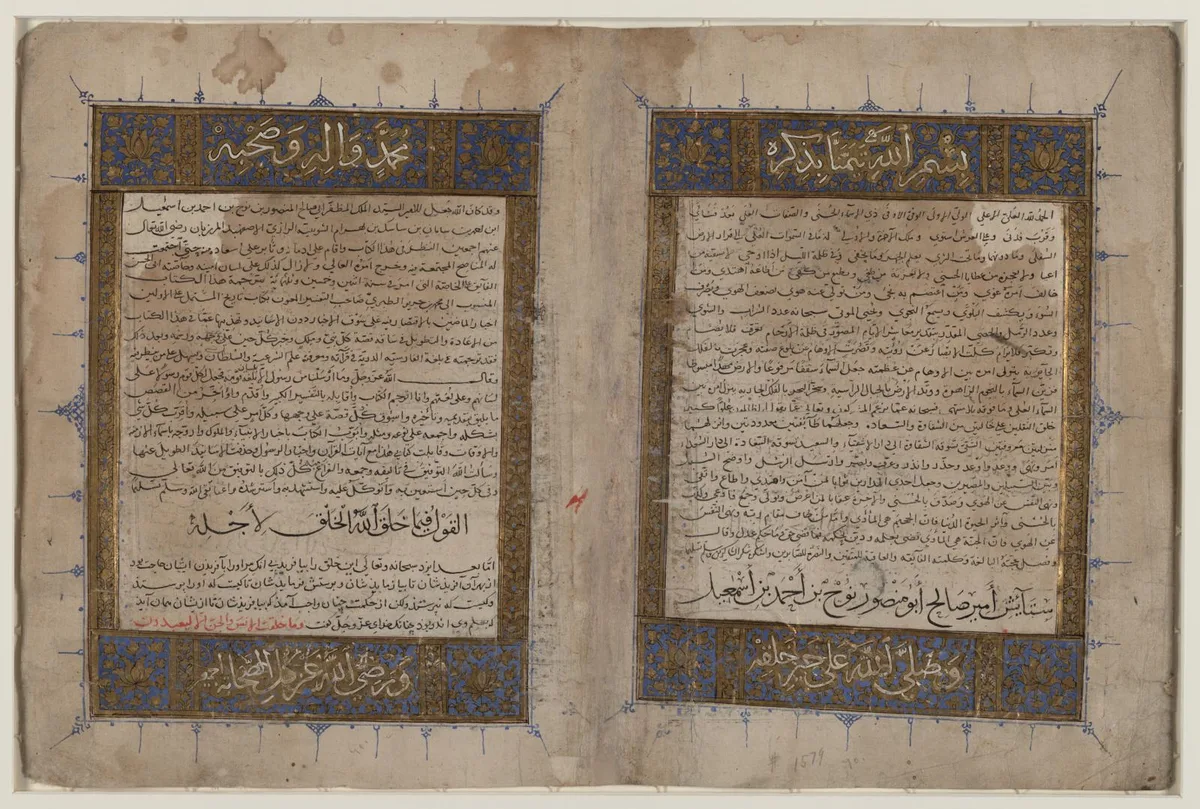
Opening pages of the Persian version of al-Tabari's History by Bal'ami, a manuscript of the Il-Khanid period. Library of Congress, African and Middle East Division, Persian Manuscript Collection, 1-85-154.69, item record, public domain (no known restrictions). Ana görsel Yer aldığı yer: Tabari
-
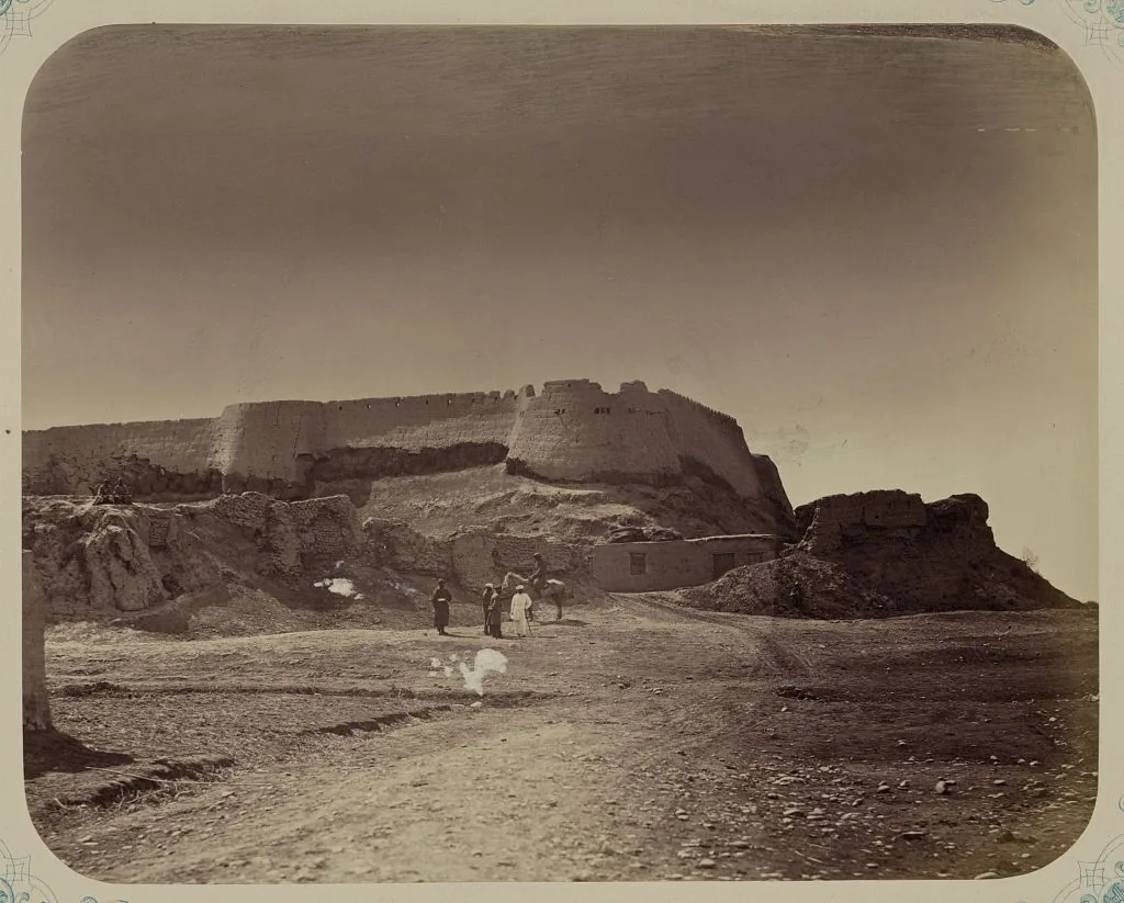
The ruins of the citadel of Aulie-Ata, the modern Taraz, from the Turkestan album of 1865–1872. Photograph: Turkestan album; Library of Congress, Prints and Photographs Division. No known restrictions on publication. Ana görsel Yer aldığı yer: Talas
-
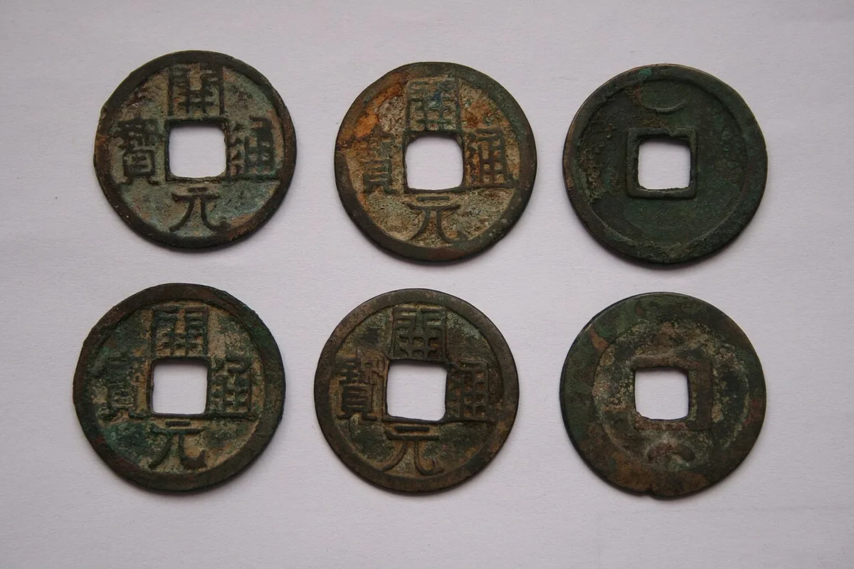
Copper cash coins of the Tang with the legend Kaiyuan tongbao. Photograph: Gary Lee Todd, 2007, CC0. Ana görsel Yer aldığı yer: Tang
-
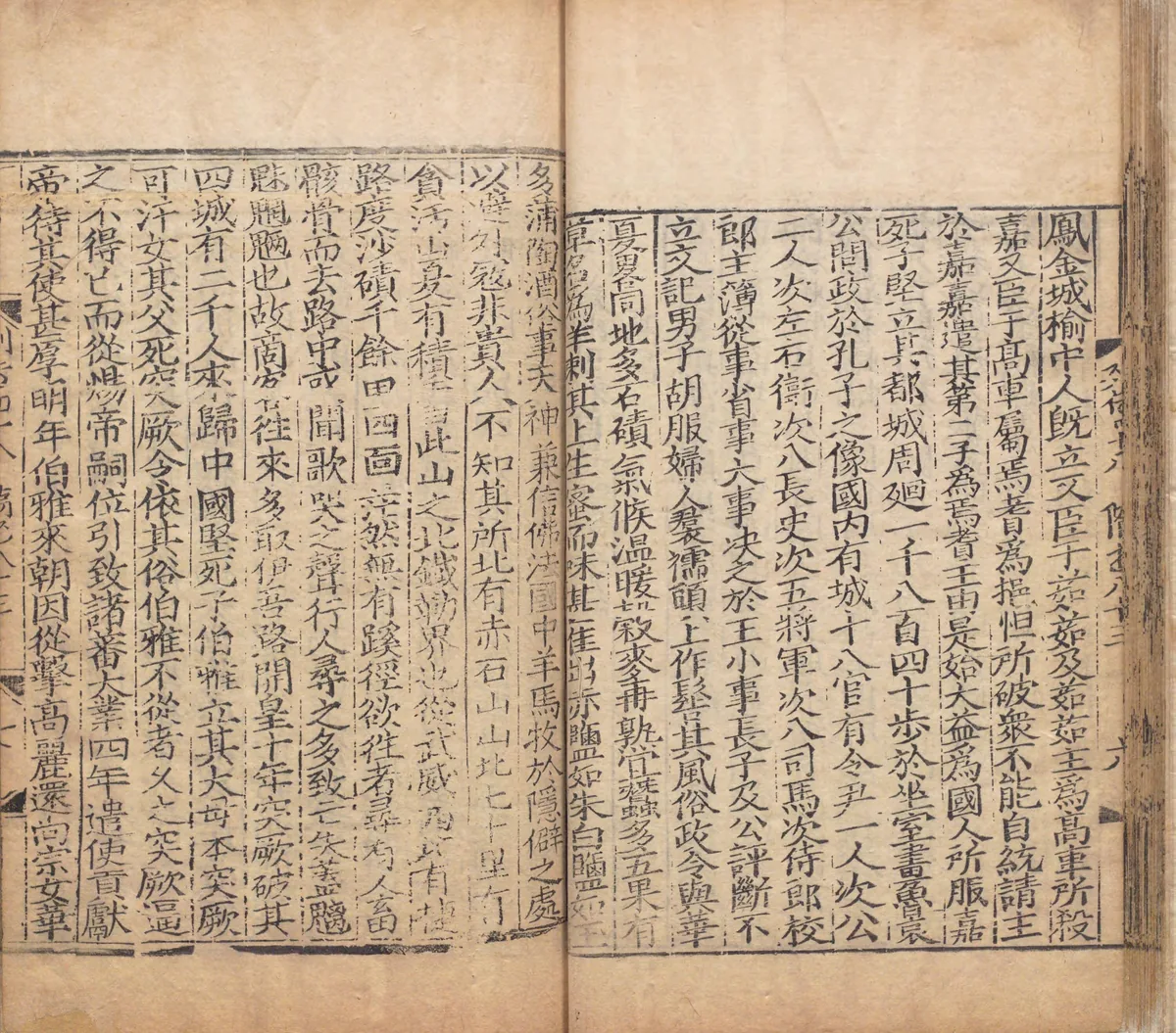
A page of the notice on Gaochang in chapter 83 of the Sui Shu, in a Yuan-period printed edition repaired in 1531, in the National Archives of Japan. On the left-hand page the text names the Red Rock Mountain north of Gaochang and, seventy li beyond it, Tanhan Mountain, printed here with the character that later editors corrected. Image: National Archives of Japan. Public domain. Ana görsel Yer aldığı yer: Tanhan Dağı
-
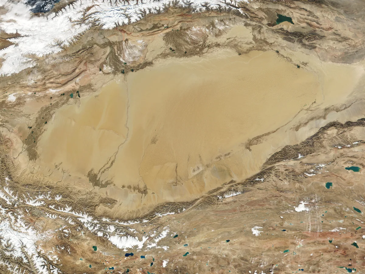
The Taklamakan desert in the Tarim Basin, between the Tian Shan in the north and the Kunlun in the south, in a MODIS satellite image of 2001. Image: Jacques Descloitres, MODIS Land Rapid Response Team. NASA Earth Observatory, public domain. Ana görsel Yer aldığı yer: Tarim Havzası
-
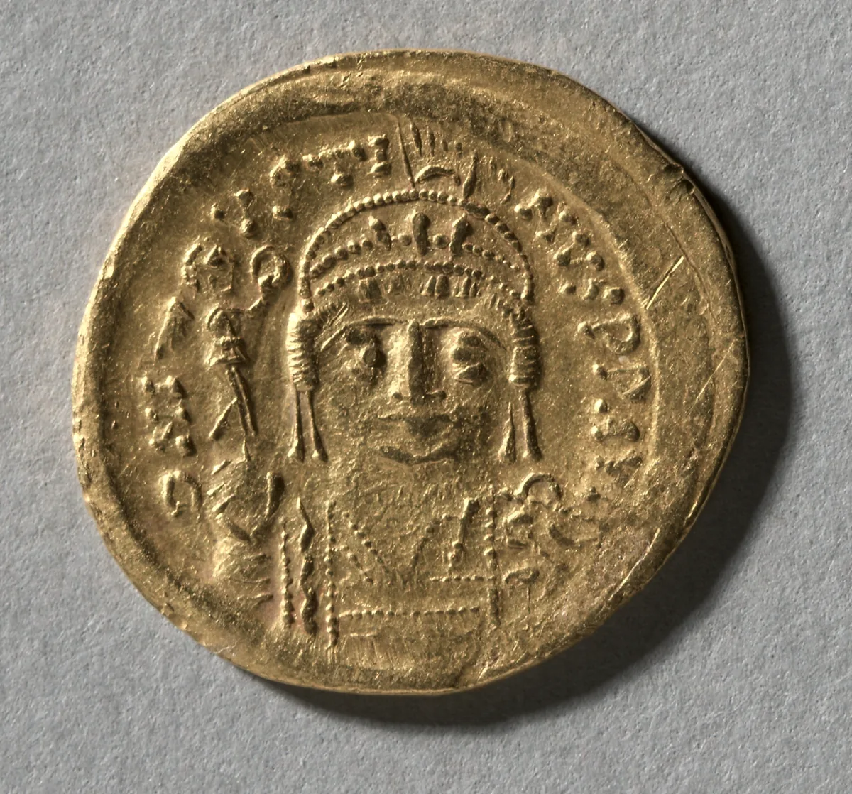
Gold solidus of Justin II, emperor in Constantinople from 565 to 578, in whose fourth year the envoys of Istemi swore the alliance. The Cleveland Museum of Art, 2004.151.a, CC0. Ana görsel Yer aldığı yer: Göktürk-Bizans İttifakı
-
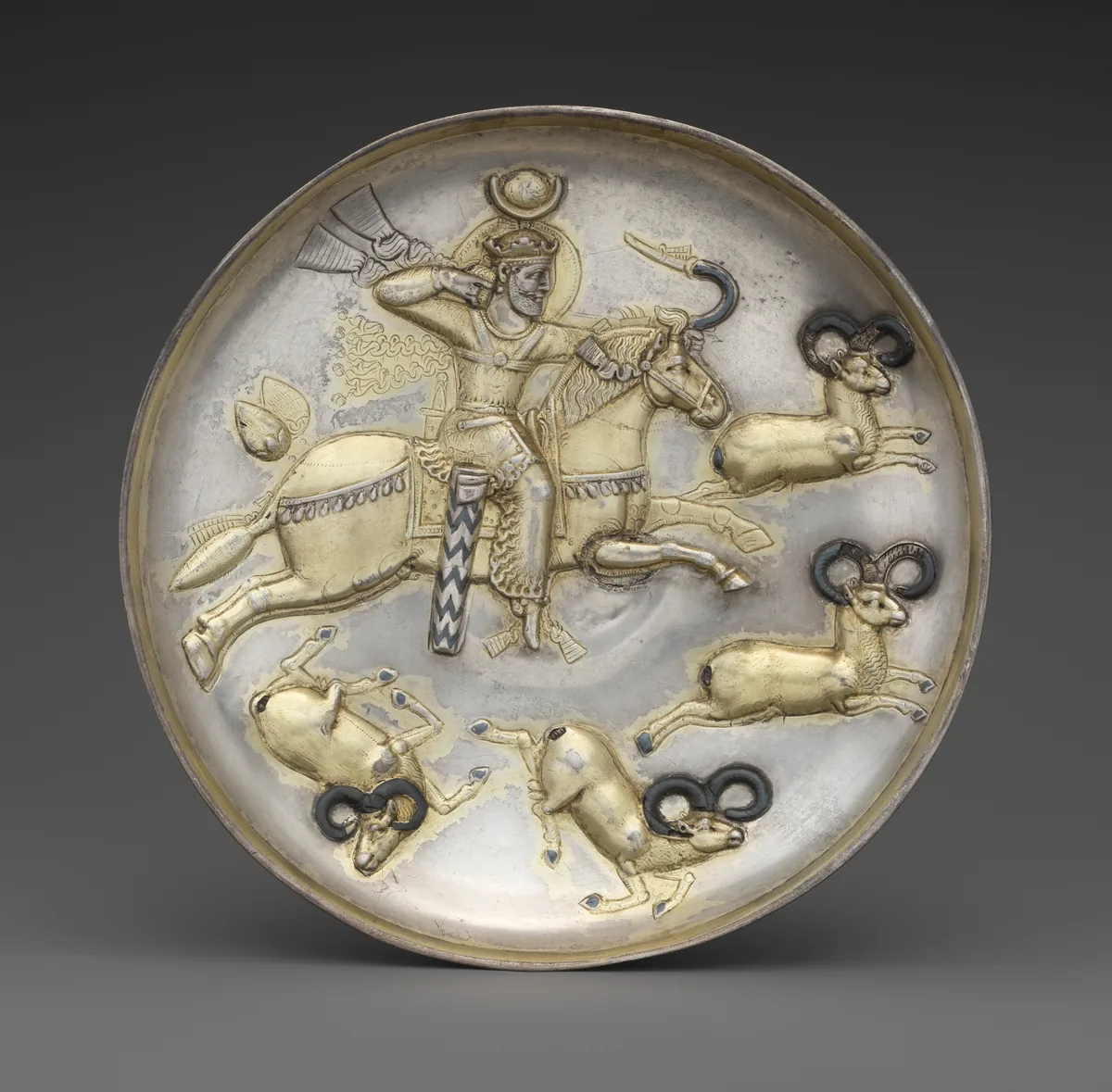
Silver plate with a Sasanian king hunting rams, gilded and inlaid with niello. Iran, middle of the fifth to middle of the sixth century. The Metropolitan Museum of Art, New York, 34.33, CC0. Ana görsel Yer aldığı yer: Göktürk-Sasani Ticaret Çatışması
-
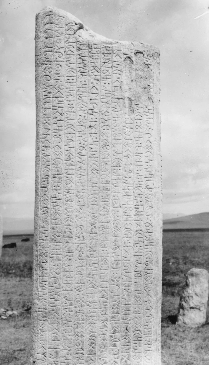
Runiform lines on the south face of the first Tonyukuk stone in the Nalaikh valley, photographed in June 1909. G. J. Ramstedt and Sakari Pälsi, 1909, Finnish Heritage Agency, record, CC BY 4.0. Ana görsel Yer aldığı yer: Eski Türk yazısı
-
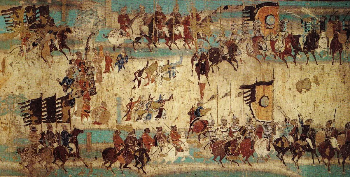
The army of Zhang Yichao on the march, with its banners, its cavalry and dancers between the columns, from the wall painting in Cave 156 at Mogao near Dunhuang. The painting commemorates the rising of 848, in which Zhang Yichao drove the Tibetan garrison out of Dunhuang. Wall painting: unknown painter, late Tang period; Mogao Cave 156, Dunhuang. Public domain. Ana görsel Yer aldığı yer: Tibet İmparatorluğu
-
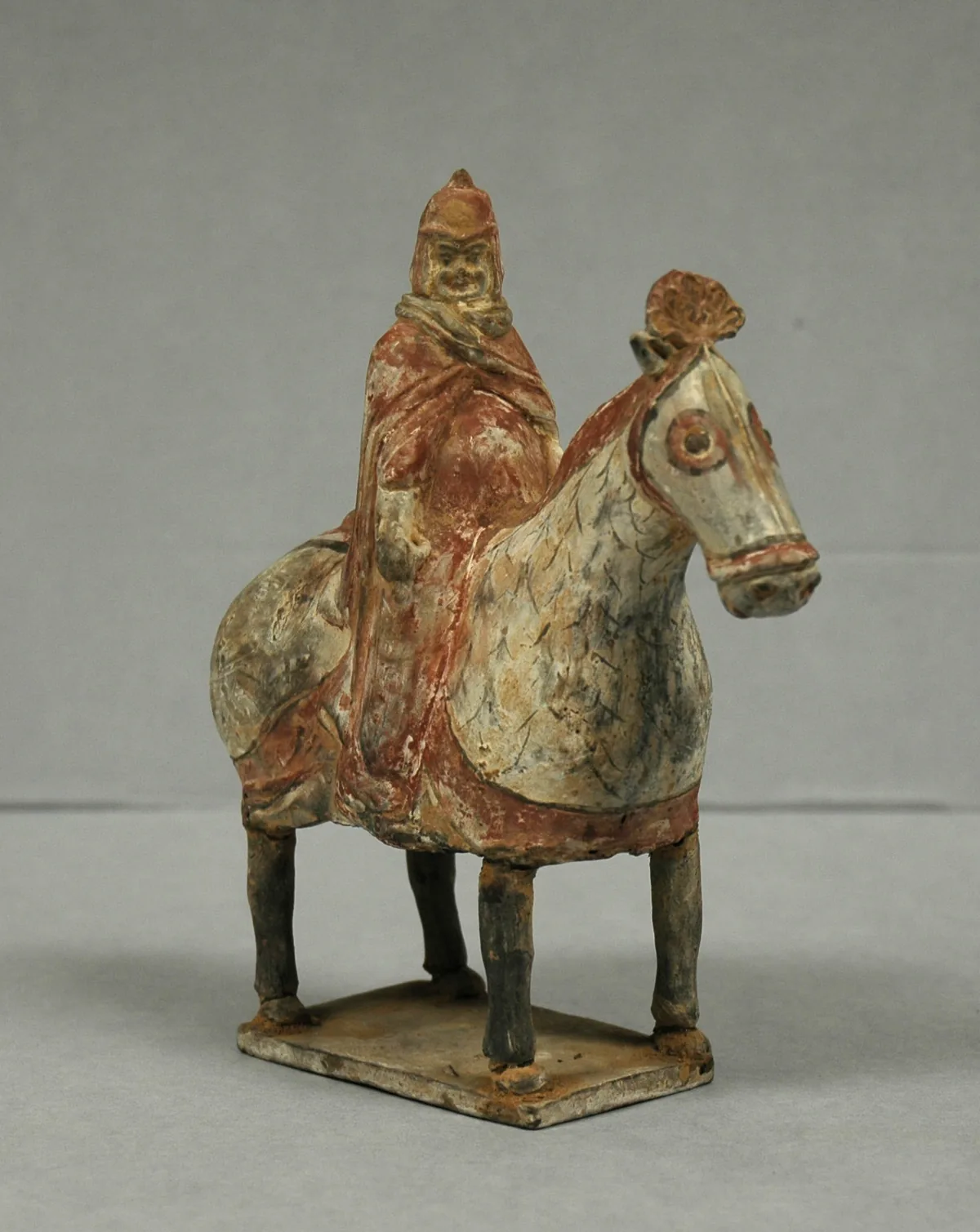
Painted earthenware tomb figure of an armoured horseman, Northern Wei dynasty, sixth century. The Western Wei, one of the two states into which the Northern Wei split in 534, were the Göktürks’ allies against the Rouran. The Metropolitan Museum of Art, New York, 20.39.3, Rogers Fund, 1920. Open Access, public domain (CC0). Ana görsel Yer aldığı yer: Göktürk Bağımsızlık Savaşı
-
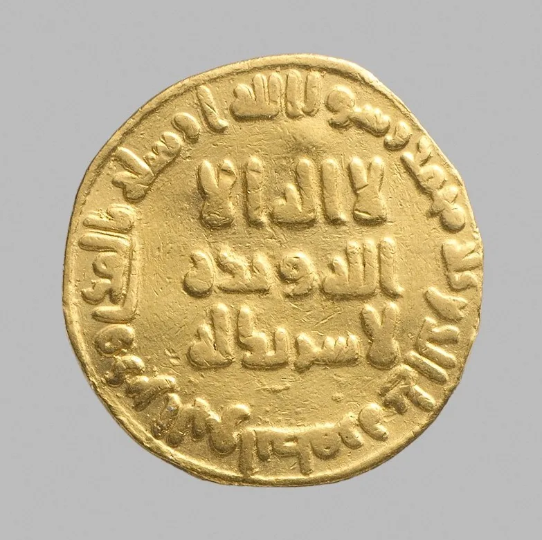
Gold dinar dated 79 AH (698–99 CE), with an Arabic inscription. The Metropolitan Museum of Art, New York, 99.35.2386, Bequest of Joseph H. Durkee, 1898, Open Access, public domain (CC0). Ana görsel Yer aldığı yer: The Umayyad Caliphate
-
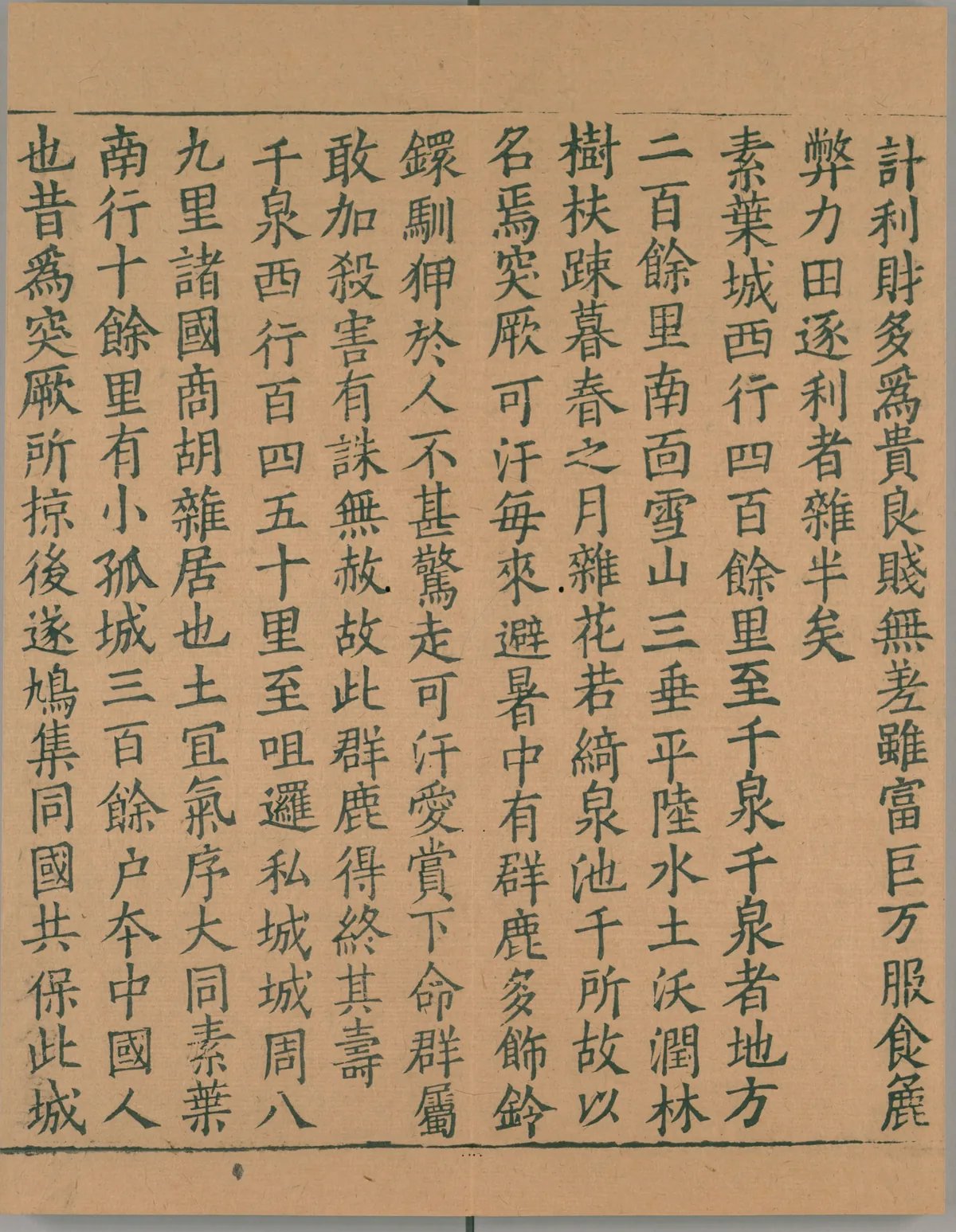
A page from the first book of the Record of the Western Regions, the account of the pilgrim Xuanzang, in a Southern Song print of the Buddhist canon. It describes the Thousand Springs, 千泉, four hundred li west of Suyab, where the Göktürk khan came every year to escape the summer heat. Image: Sixi canon print, Southern Song; scan National Diet Library, Japan. Public domain. Ana görsel Yer aldığı yer: Bin Pınar
-
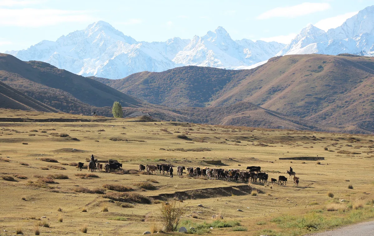
Herds below the snow peaks of the Tian Shan in Kyrgyzstan, 2023. Photograph: Bgag, 2023, CC0. Ana görsel Yer aldığı yer: Tanrı Dağları
-
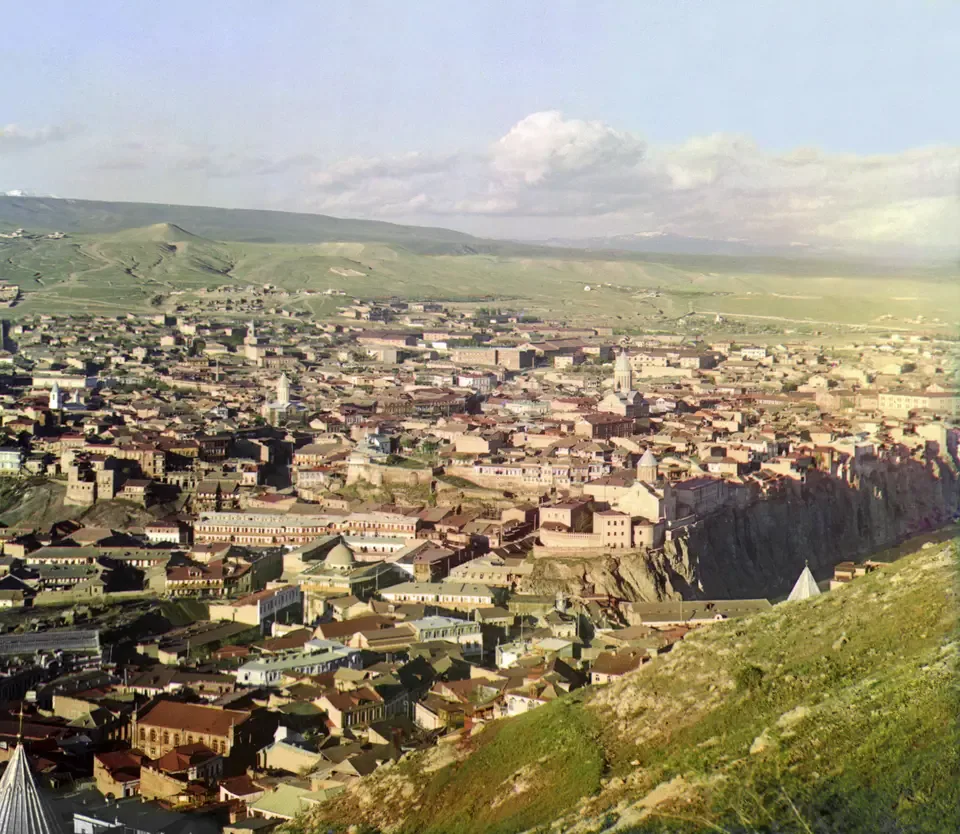
A view over Tiflis, the modern Tbilisi, photographed by Sergei Prokudin-Gorskii between 1905 and 1915. Photograph: Sergei Prokudin-Gorskii; Library of Congress, Prints and Photographs Division. No known restrictions on publication. Ana görsel Yer aldığı yer: Tiflis
-
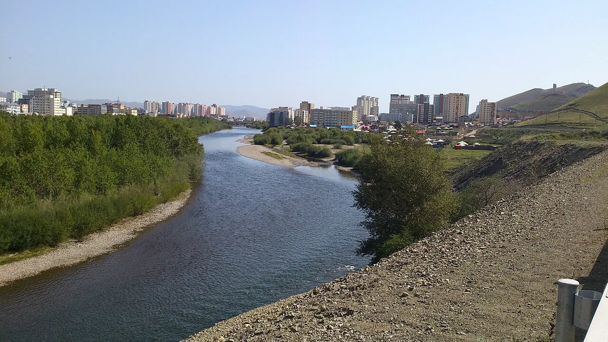
The Tuul river at Ulaanbaatar. Photograph: Römert, 2015, CC BY-SA 4.0. Ana görsel Yer aldığı yer: Tola
-
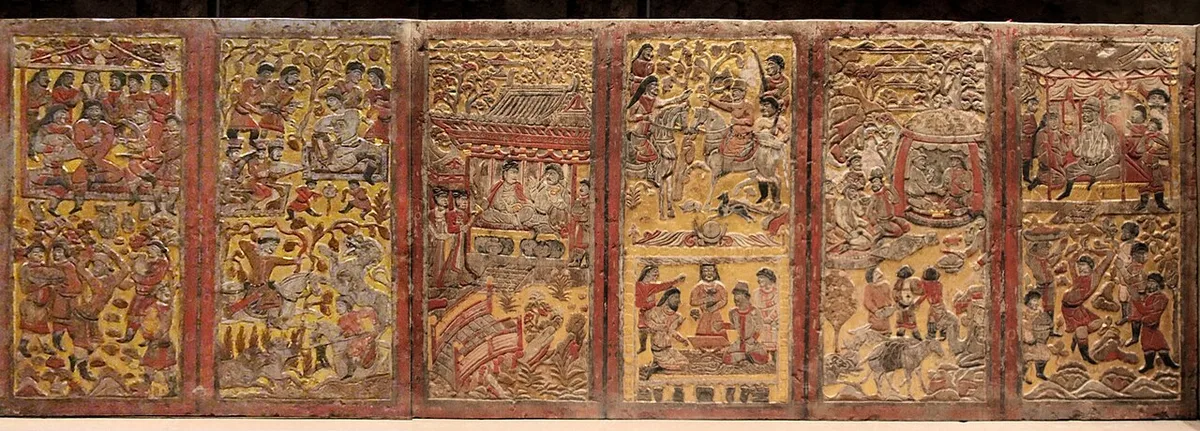
The painted and gilded back panels of the stone funerary couch from the tomb of An Jia at Xi'an, buried in 579. Photograph: Momo and Gary Todd, 2022, file page, CC0. Ana görsel Yer aldığı yer: An Jia Mezarı
-
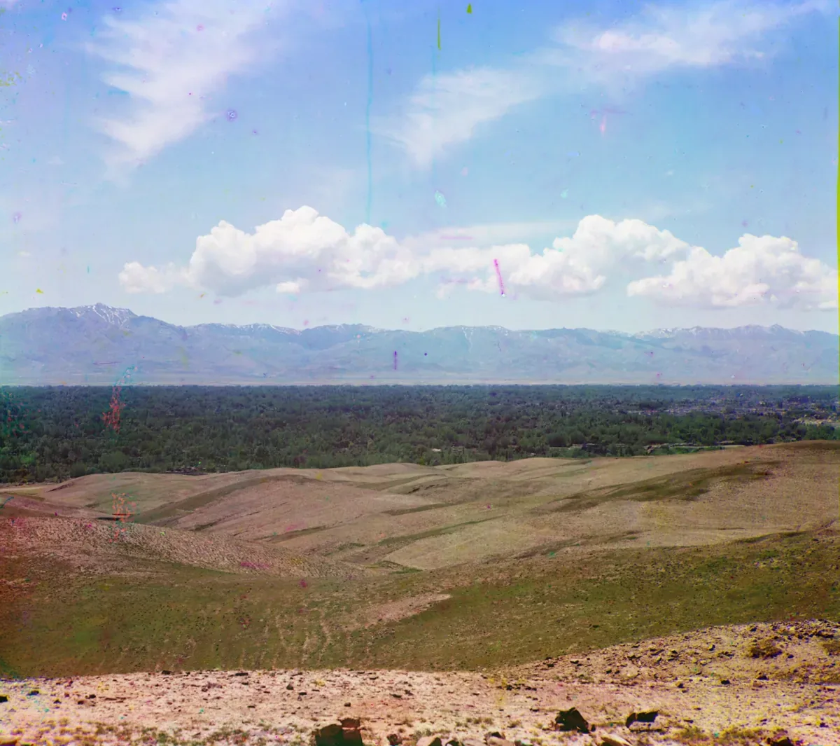
The Zarafshan range seen from the north across the valley of the Zarafshan near Samarkand, in a colour photograph taken between 1905 and 1915. Photograph: Sergei Prokudin-Gorskii, between 1905 and 1915; Library of Congress, no known restrictions. Ana görsel Yer aldığı yer: Maveraünnehir
-
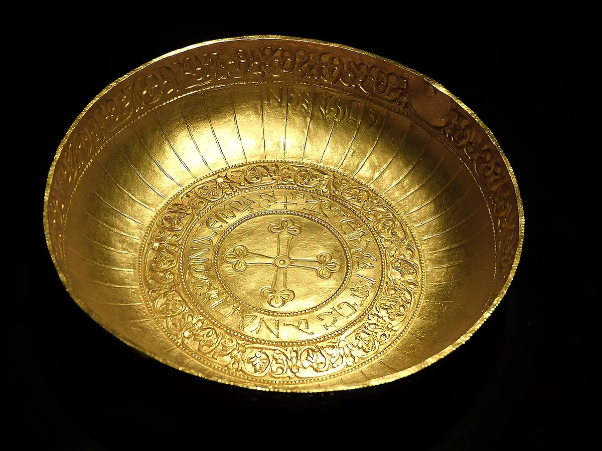
Gold bowl from the Treasure of Nagyszentmiklós, seventh to ninth century, in the Kunsthistorisches Museum, Vienna. Photograph: Wolfgang Sauber, 2015, CC BY-SA 4.0. Ana görsel Yer aldığı yer: Treasure of Nagyszentmiklós
-
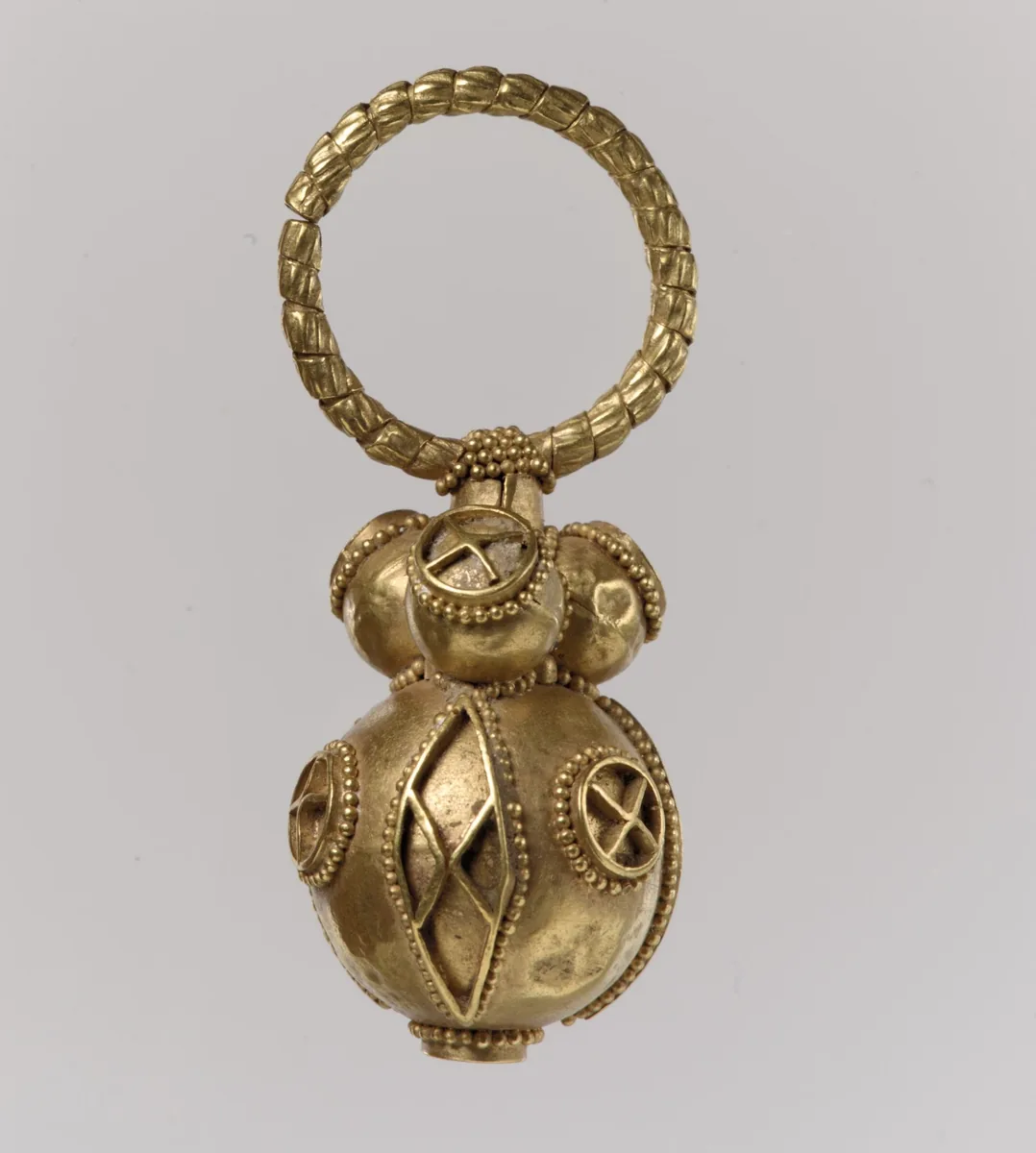
One of a pair of gold earrings, Avar work, 550 to 650. The Metropolitan Museum of Art, New York, 17.191.4, CC0. Ana görsel Yer aldığı yer: Avrupa'daki Türk boyları
-
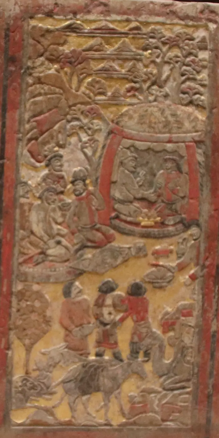
Back panel of the funerary couch of An Jia, a Sogdian sabao at the Zhou court who died in 579. Two men kneel facing each other inside a yurt, a gilded vessel between them; others drink before the tent, and a laden camel and a donkey rest below. The scene is taken to show An Jia at talks with a Göktürk chief. Shaanxi History Museum, Xi’an. Photograph: Gary Todd, 2019, CC0 (detail). Ana görsel Yer aldığı yer: Turkic-Sogdian Synthesis
-
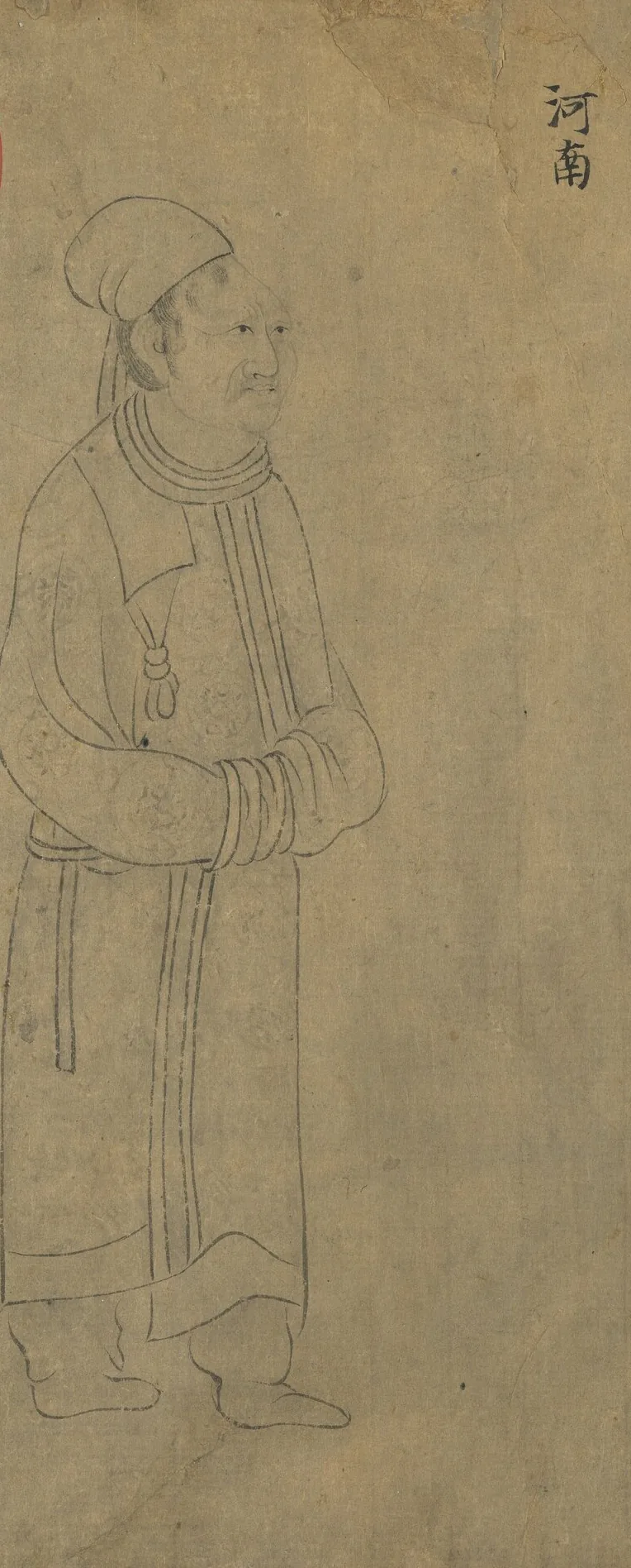
Envoy of the Tuyuhun, labelled 河南, the name under which the southern histories treat their kingdom. From “Foreign Visitors Coming to Court”, a copy after a painting ascribed to Emperor Yuan of Liang (r. 552–555); an inscription of the Song emperor Lizong names Gu Deqian of the Southern Tang as the copyist. Handscroll, ink on paper; National Palace Museum, Taipei, 故畫001389N. Copy of Emperor Yuan of Liang’s “Foreign Visitors Coming to Court”, The National Palace Museum, Taipei, CC BY 4.0 @ www.npm.gov.tw. Ana görsel Yer aldığı yer: Tuyuhun
-
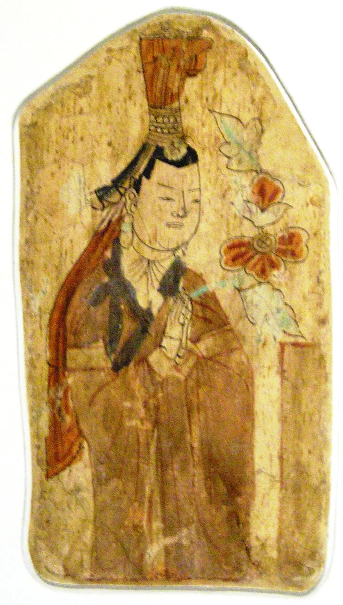
Uyghur donor, wall painting from Cave 17 at Bezeklik, about the tenth to eleventh century, photographed in Berlin in 2006. Photograph: Gryffindor, 2006, public domain. Ana görsel Yer aldığı yer: Koço Uygur Krallığı
-
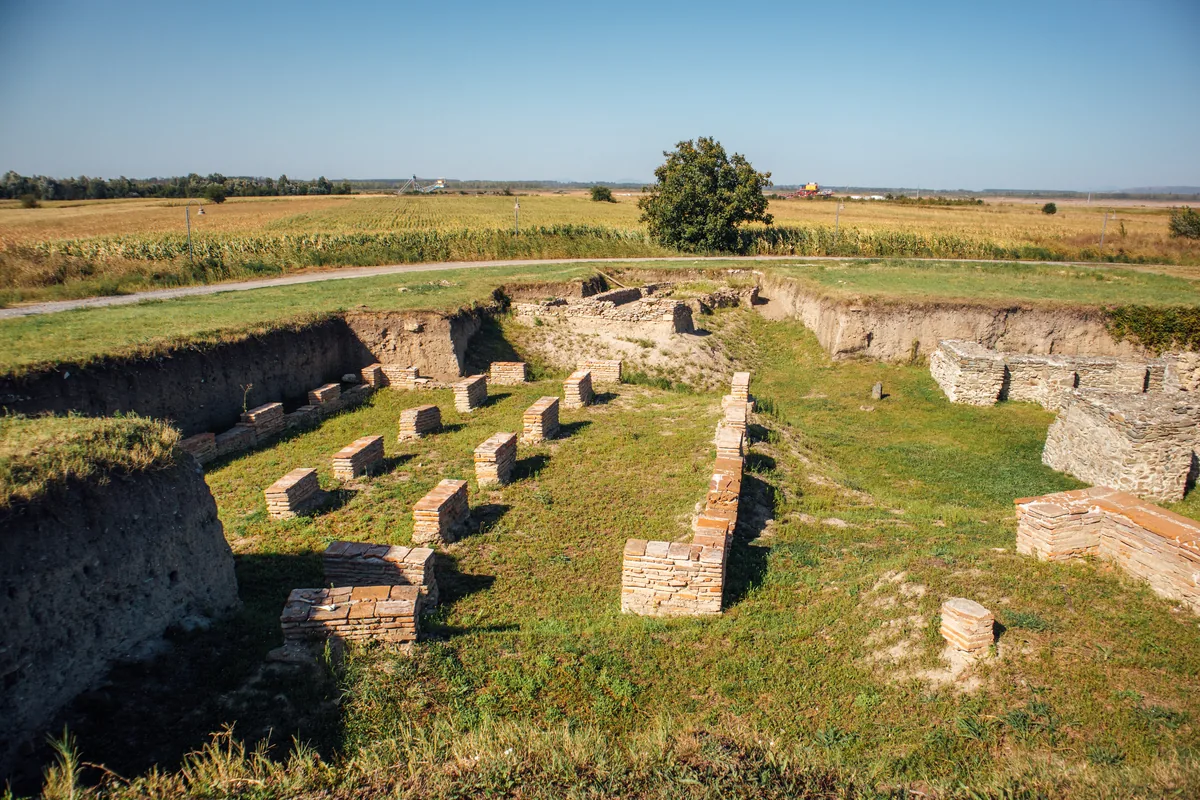
Excavated Roman walls and brick pillars at the archaeological site of Viminacium near Kostolac in eastern Serbia, photographed in 2020. In 441 Viminacium was the first great city that the Huns took in their Balkan wars, and they razed it to the ground. Image: Ivan Radic, CC BY 2.0. Ana görsel Yer aldığı yer: Viminacium
-
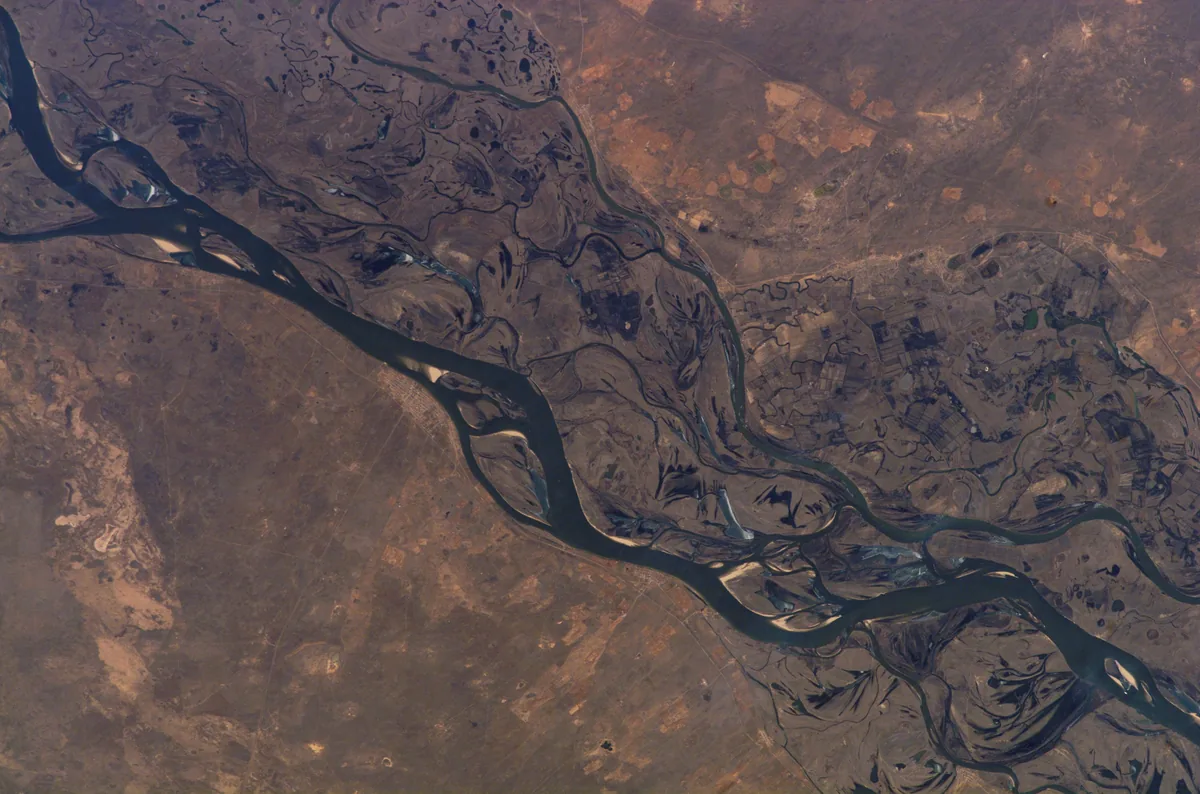
The lower Volga and its wide floodplain between Volgograd and Astrakhan, photographed from the International Space Station on 13 March 2007. Menander calls the river the Attila; the Roman envoy Zemarchos came to it in 571 on his way home from Istemi. Image: NASA. Public domain. Ana görsel Yer aldığı yer: İdil
-
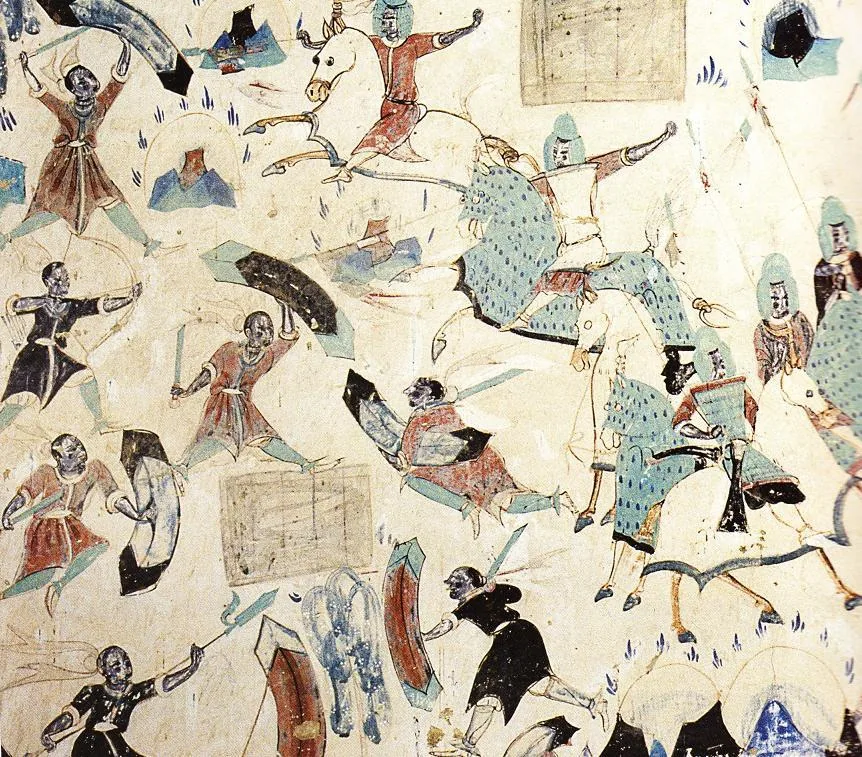
Horsemen in armour on armoured horses ride down robbers on foot in the story of the Five Hundred Robbers, a wall painting in Cave 285 at Mogao near Dunhuang. The cave was painted under the Western Wei and carries dedications of 538 and 539. Wall painting: unknown painter, Western Wei period (535–557); Mogao Cave 285, Dunhuang. Public domain. Ana görsel Yer aldığı yer: Batı Wei
-
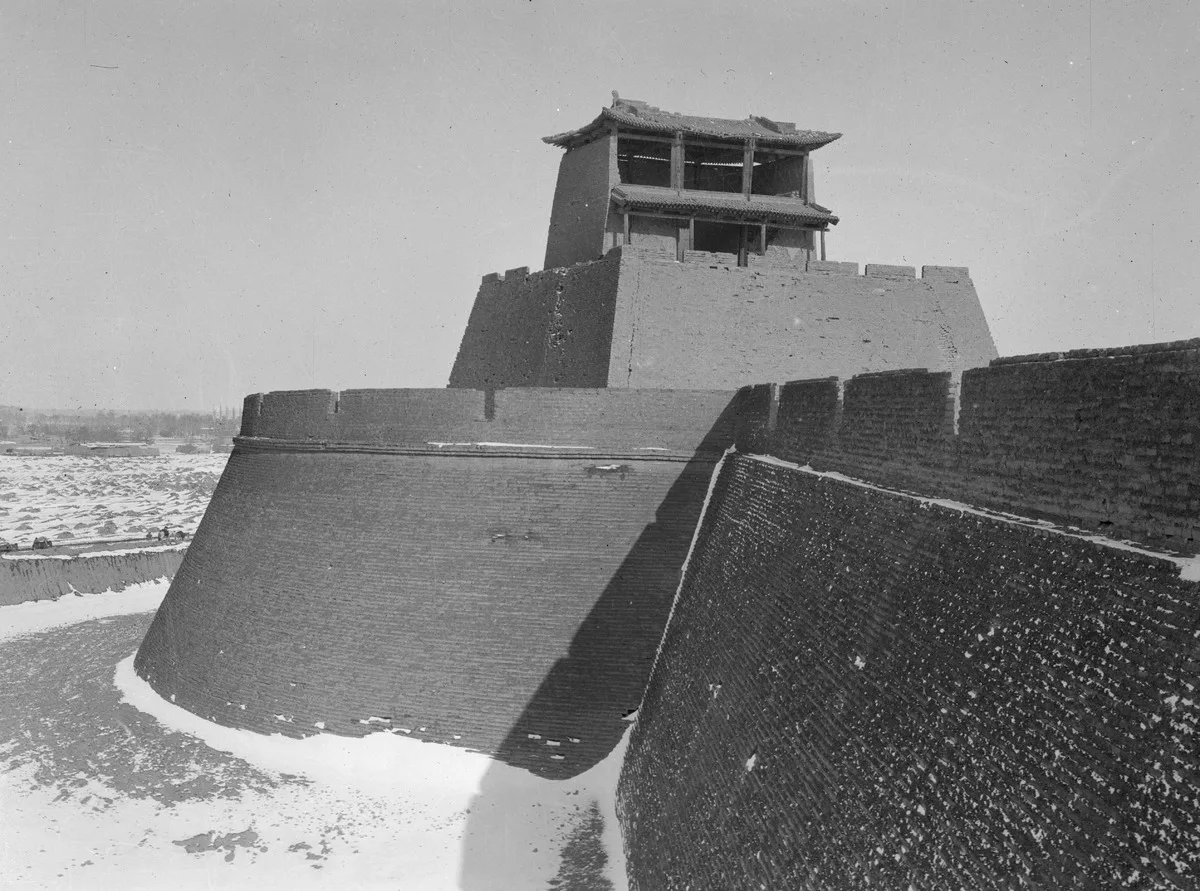
Tower on a bastion of the city wall of Liangzhou, today Wuwei, photographed in 1906. Carl Gustaf Mannerheim, 1906, Finnish Heritage Agency, record, CC BY 4.0. Ana görsel Yer aldığı yer: Wuwei
-
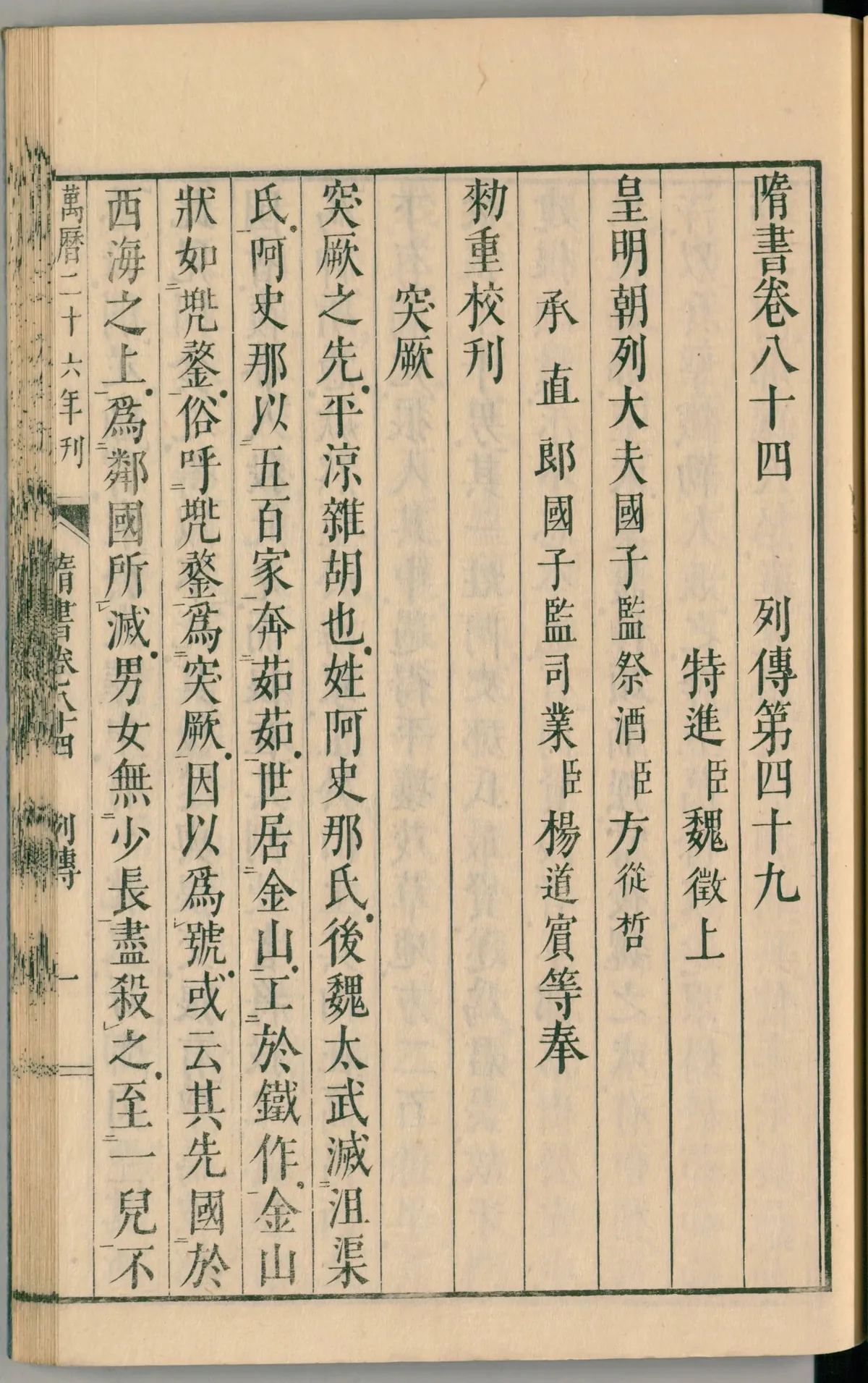
The opening page of book 84 of the Sui Shu, the chapter on the Göktürks, in a Japanese print of 1844. Its first lines give the second account of Göktürk origins, which sets their forebears in a state upon the Western Sea, 西海. Image: Kōdōkan, Takamatsu (print, 1844); scan National Diet Library, Japan. Public domain. Ana görsel Yer aldığı yer: Xihai
-
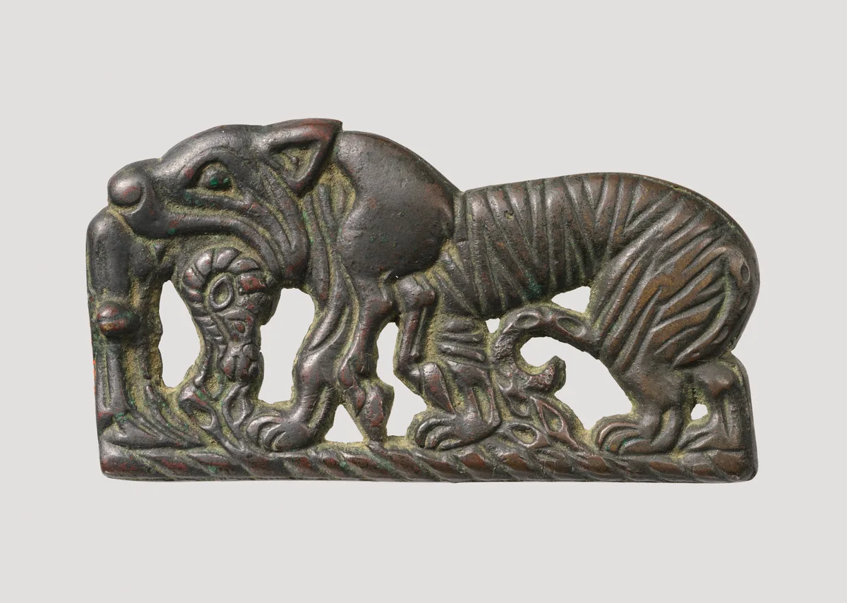
Bronze belt plaque with a tiger devouring a ram, Xiongnu, about second century BC. The Metropolitan Museum of Art, New York, 49.132, Rogers Fund, 1949. Open Access, public domain (CC0). Ana görsel Yer aldığı yer: Asya Hunları (Xiongnu)
-
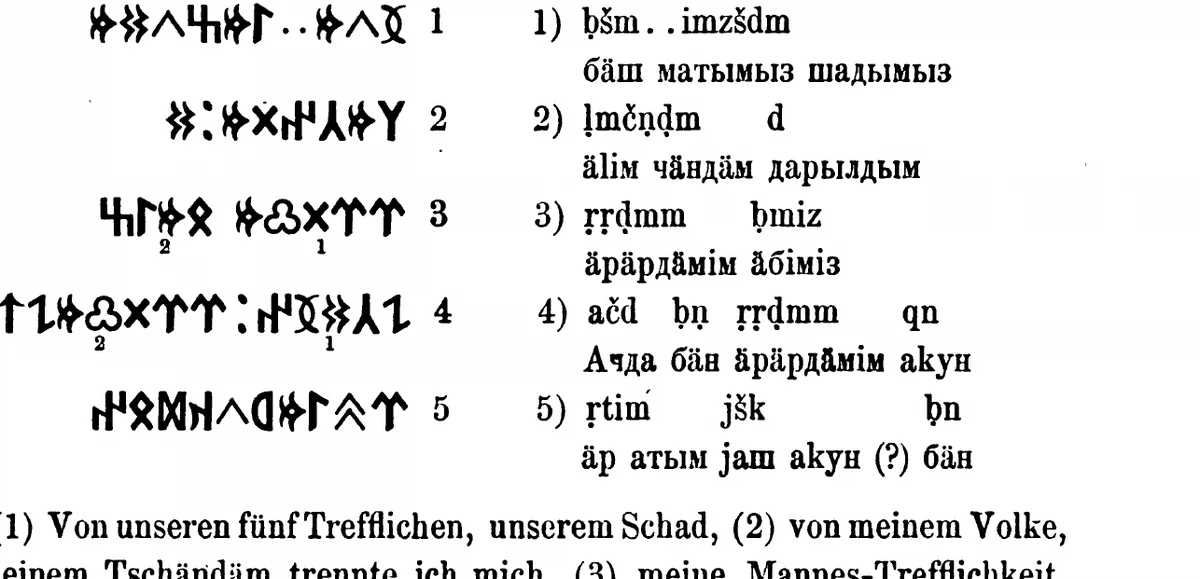
The inscription of Ujuk-Archan on the upper Yenisei, five lines of runiform script with transcription, as Wilhelm Radloff printed it from the squeezes of the Finnish expedition. W. Radloff, Die alttürkischen Inschriften der Mongolei, St Petersburg 1895, p. 305. Public domain. Ana görsel Yer aldığı yer: Yenisei inscriptions
-
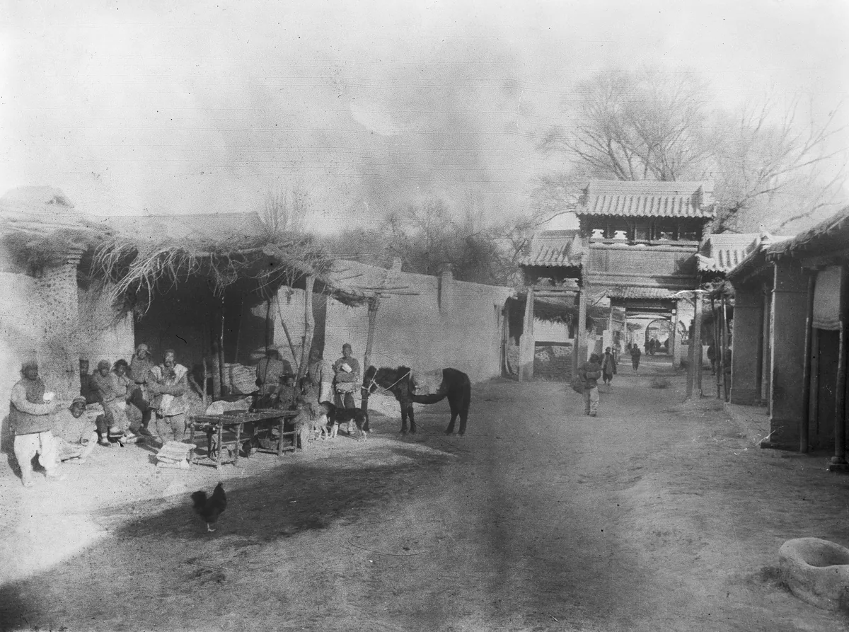
A street with a gateway in Hami, the oasis town identified with Yiwu, photographed by C. G. Mannerheim on his journey through Central Asia and China between 1906 and 1908. Image: C. G. Mannerheim, Finnish Heritage Agency, CC BY 4.0. Ana görsel Yer aldığı yer: Yiwu
-
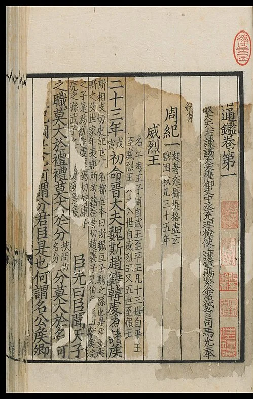
Opening of chapter 1 of the Zizhi tongjian in a printed edition of the Song period. Sima Guang, Zizhi tongjian, Song-period edition, reproduction, public domain. Ana görsel Yer aldığı yer: Zizhi tongjian (Comprehensive Mirror in Aid of Governance)
-
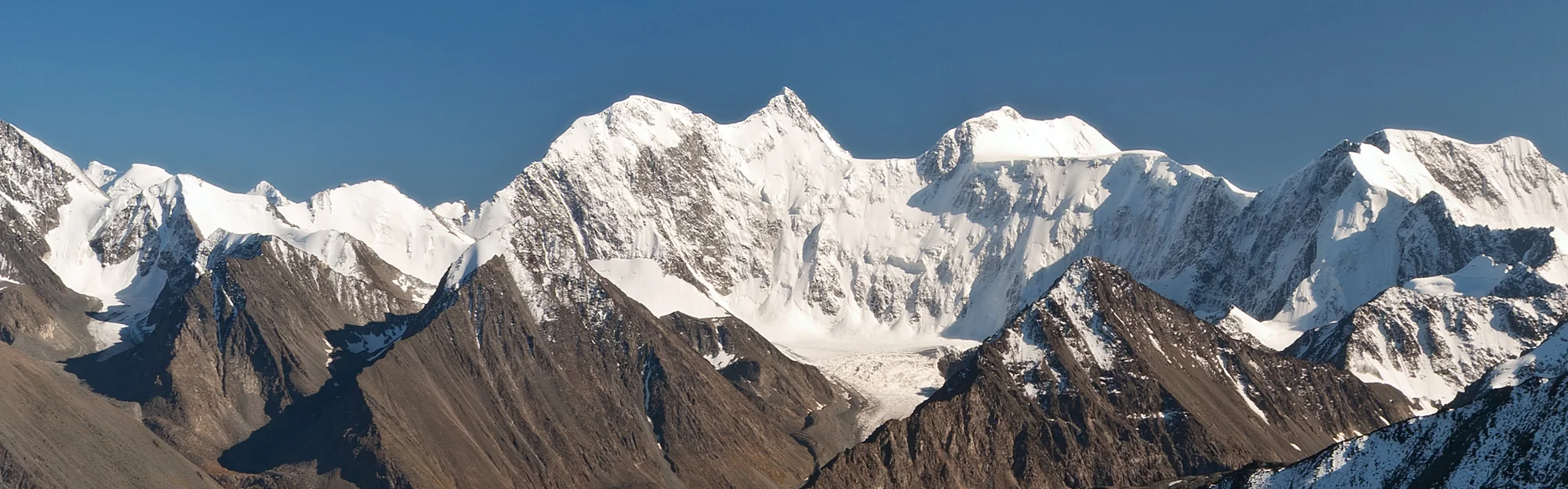
The Katun range from the Kara-Tyurek pass, with Belukha at its centre and the Akkem valley below. Photograph: Александр Лещёнок, CC BY-SA 4.0. Panorama Yer aldığı yer: Altay
-
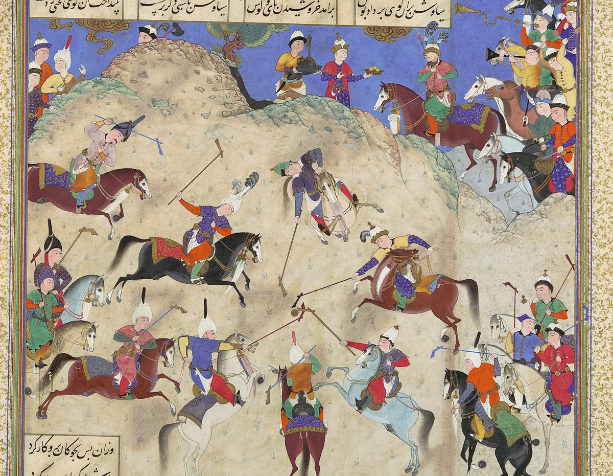
Siyavash plays polo before Afrasiab. A page of the Shahnameh made for Shah Tahmasp at Tabriz, about 1525–30, painting attributed to Qasim ibn ʿAli. The Metropolitan Museum of Art, New York, 1970.301.26, gift of Arthur A. Houghton Jr., 1970; detail. Public domain. Metin içinde Yer aldığı yer: Afrasiyab
-
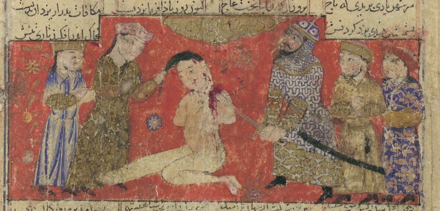
Kay Khosrow puts Afrasiab to death. A page of a Shahnameh, probably from Isfahan, about 1330–40. The Metropolitan Museum of Art, New York, 1974.290.21, bequest of Monroe C. Gutman, 1974; detail. Public domain. Metin içinde Yer aldığı yer: Afrasiyab
-
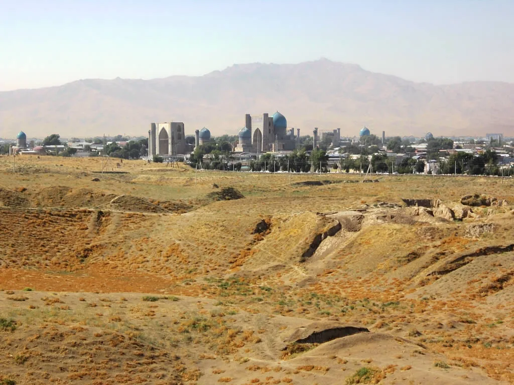
The Afrasiab mound, the site of Samarkand before the Mongol period, with the domes of the later city behind it. Photograph: David Stanley, 2012, CC BY 2.0. Metin içinde Yer aldığı yer: Afrasiyab, Afrasiab paintings
-
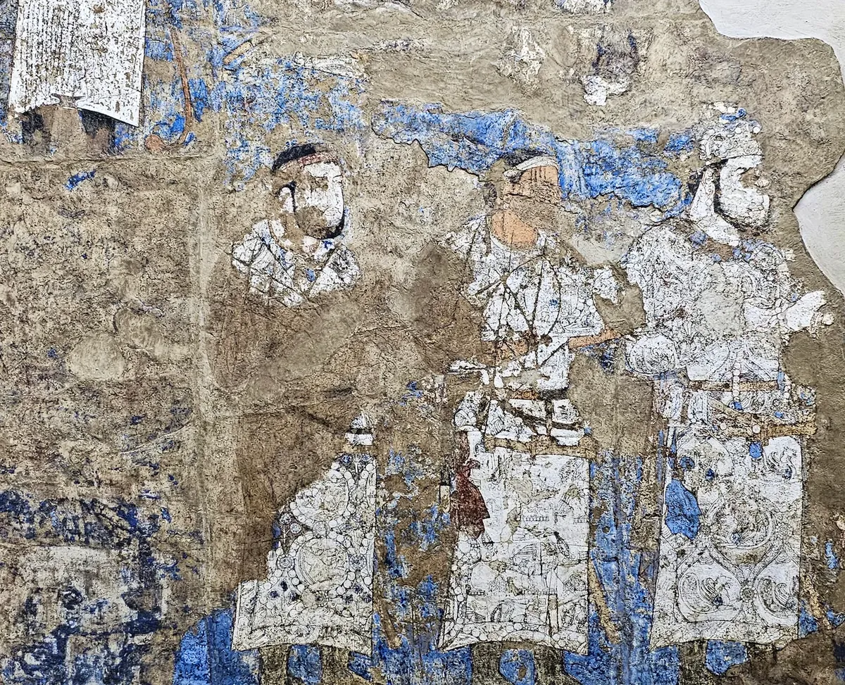
Three figures in white silk caftans with woven roundels, in the lower file on the left half of the west wall. There is more than one view of who they are. Photograph: Richard Mortel, 2023, CC BY 2.0. Metin içinde Yer aldığı yer: Afrasiab paintings
-
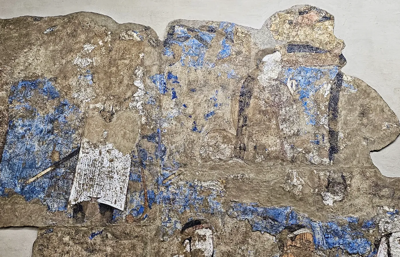
The upper file of the west wall, left half: the white caftan bearing the long Sogdian inscription, and beside it seated figures seen from behind with long plaited hair, the Göktürks of the painting. Photograph: Richard Mortel, 2023, CC BY 2.0. Metin içinde Yer aldığı yer: Afrasiab paintings
-
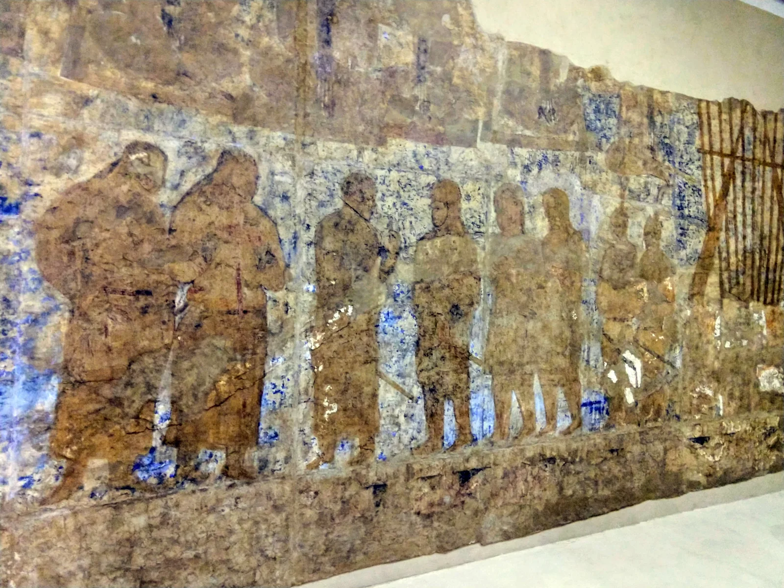
The right half of the west wall. The foreign envoys stand in a row; at the far right, beside a frame of banner poles, stand the two figures in feathered caps. Photograph: amanderson2, 2018, CC BY 2.0. Metin içinde Yer aldığı yer: Afrasiab paintings
-
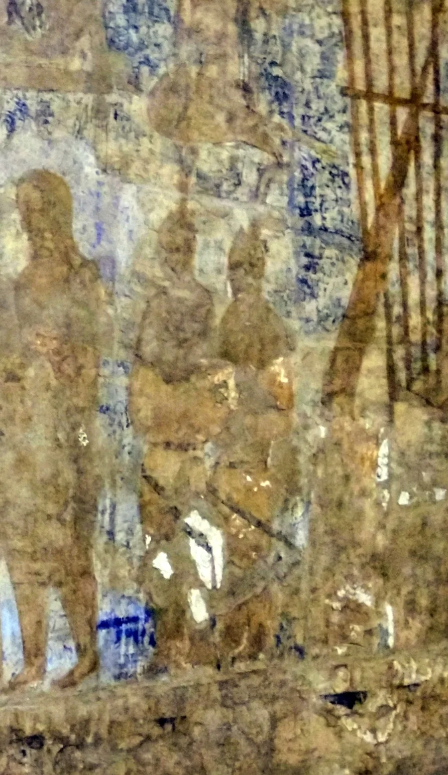
The two figures in feathered caps at the right end of the west wall. Their paint survives almost only as outline. Photograph: amanderson2, 2018, CC BY 2.0; detail. Metin içinde Yer aldığı yer: Afrasiab paintings
-
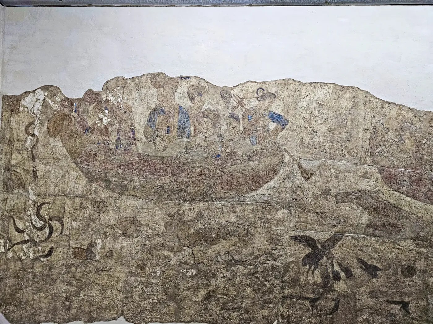
The north wall: a boat with Chinese court ladies on the water, and water creatures beneath it. The tallest figure is taken to be an empress or a princess. Photograph: Richard Mortel, 2023, CC BY 2.0. Metin içinde Yer aldığı yer: Afrasiab paintings
-
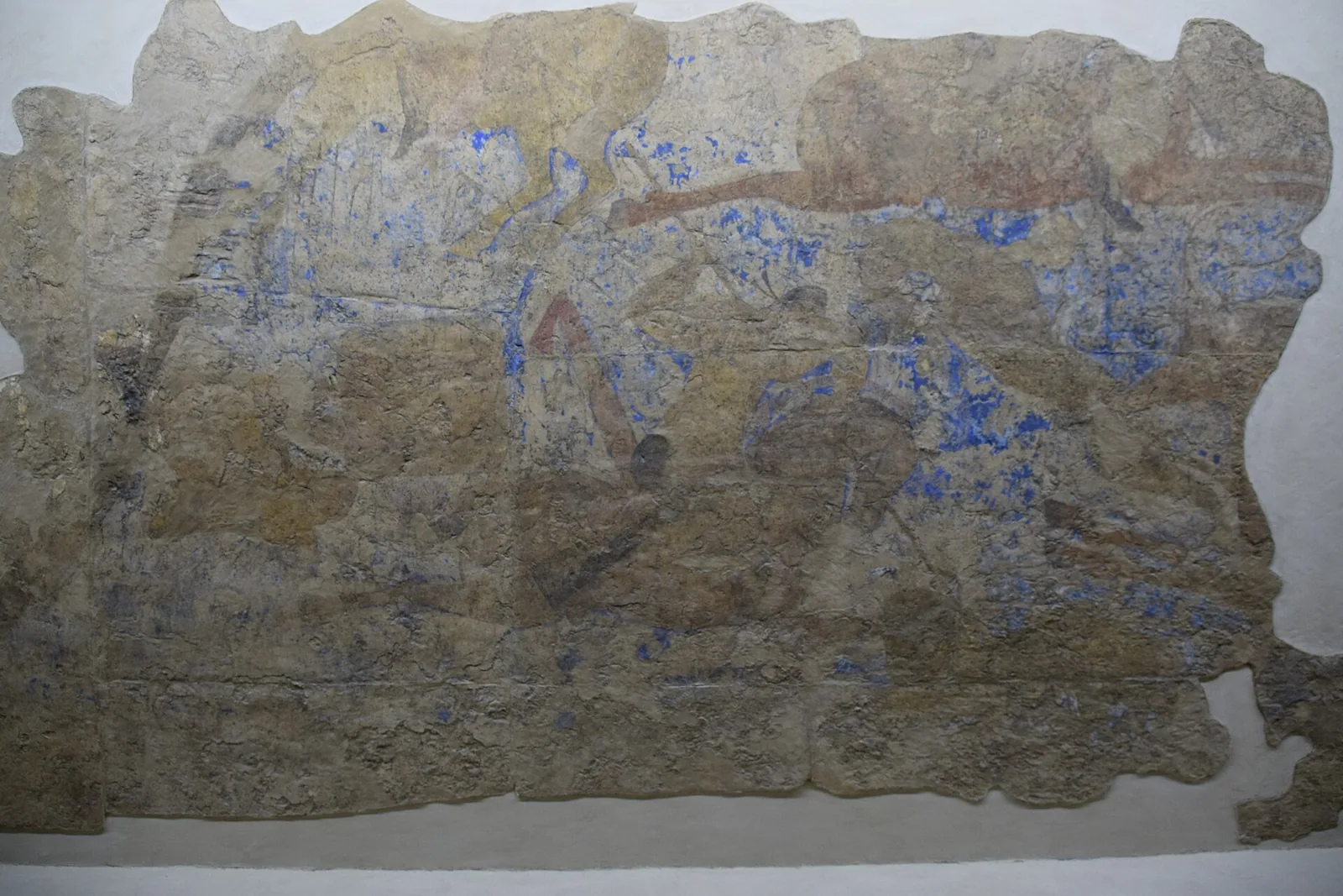
The north wall, right part: riders at a hunt, taken to be the hunt of the Chinese emperor. Little more than the outlines survives. Photograph: Jean Housen, 2023, CC BY-SA 4.0. Metin içinde Yer aldığı yer: Afrasiab paintings
-
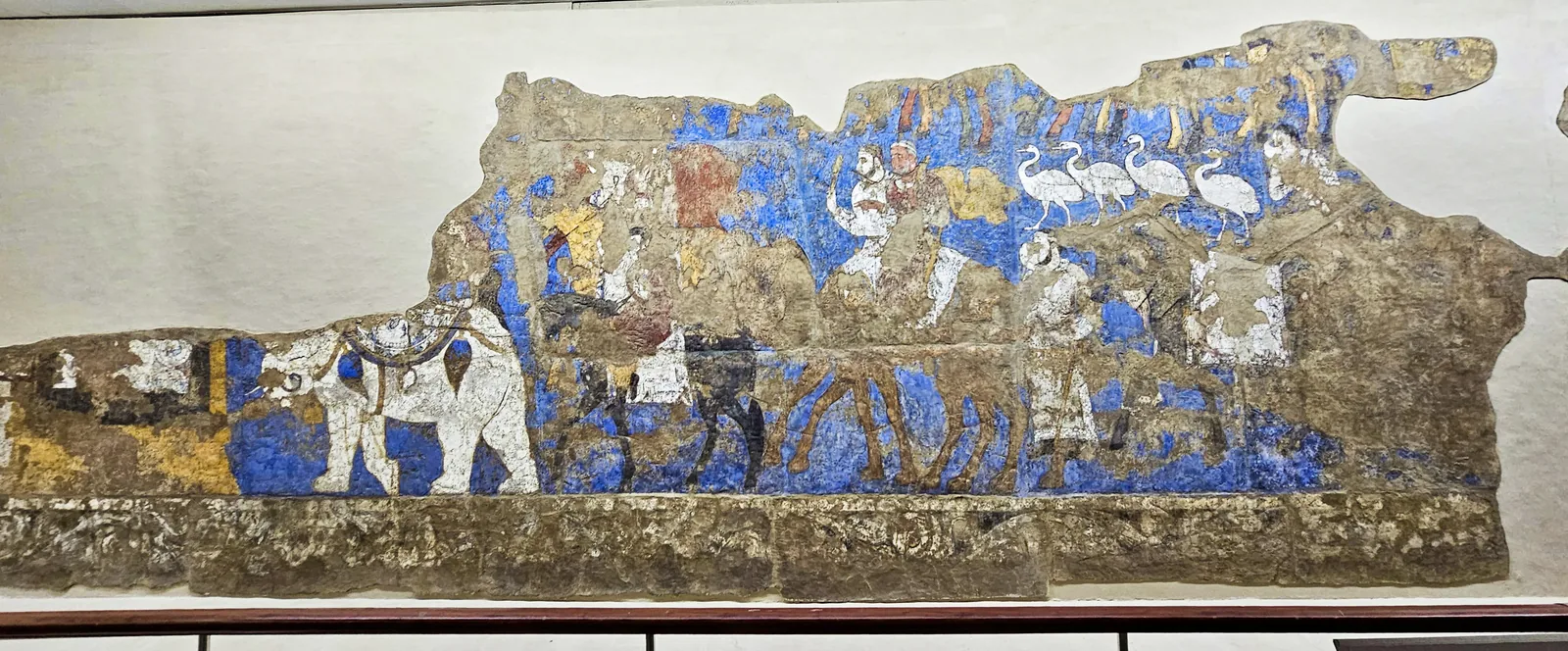
The procession on the south wall, from the white elephant at its head to the riders on camels and the white birds. Photograph: Richard Mortel, 2023, CC BY 2.0. Metin içinde Yer aldığı yer: Afrasiab paintings
-
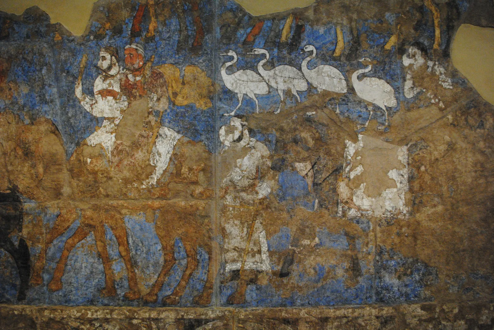
Riders on camels, a line of white birds and a standing man in the procession on the south wall of the Hall of the Ambassadors, seventh century: the painting as it survives, and the same section in an original artistic reconstruction for the atlas, after the photograph. The reconstruction restores the faded colours and fills the losses of plaster. What it paints into the losses, the saddled camel on the right among them, is conjecture. Photograph: Carole Raddato, CC BY-SA 2.0. Reconstruction: original artistic rendering for the atlas after this photograph, 2026, CC BY-SA 2.0. Metin içinde Yer aldığı yer: Afrasiab paintings
-
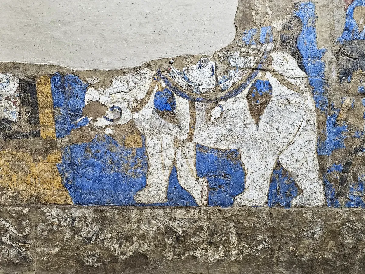
The white elephant at the head of the procession on the south wall. The riders on its back are lost. Photograph: Richard Mortel, 2023, CC BY 2.0. Metin içinde Yer aldığı yer: Afrasiab paintings
-
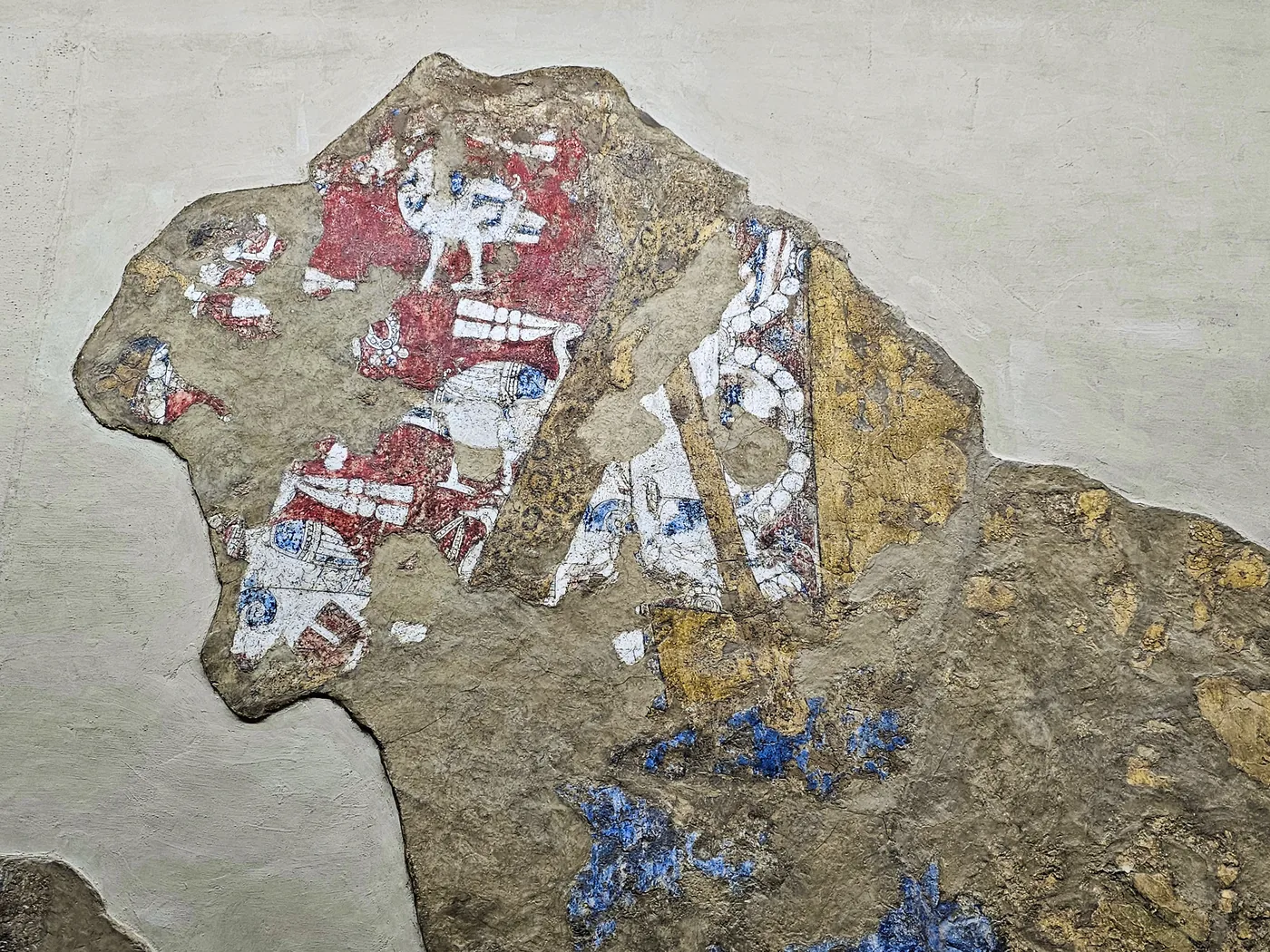
What survives of the outsized rider on the south wall, taken to be Varkhuman: a red silk garment patterned with birds, a golden scabbard and a saddle-cloth bordered with pearl roundels. Photograph: Richard Mortel, 2023, CC BY 2.0. Metin içinde Yer aldığı yer: Afrasiab paintings
-
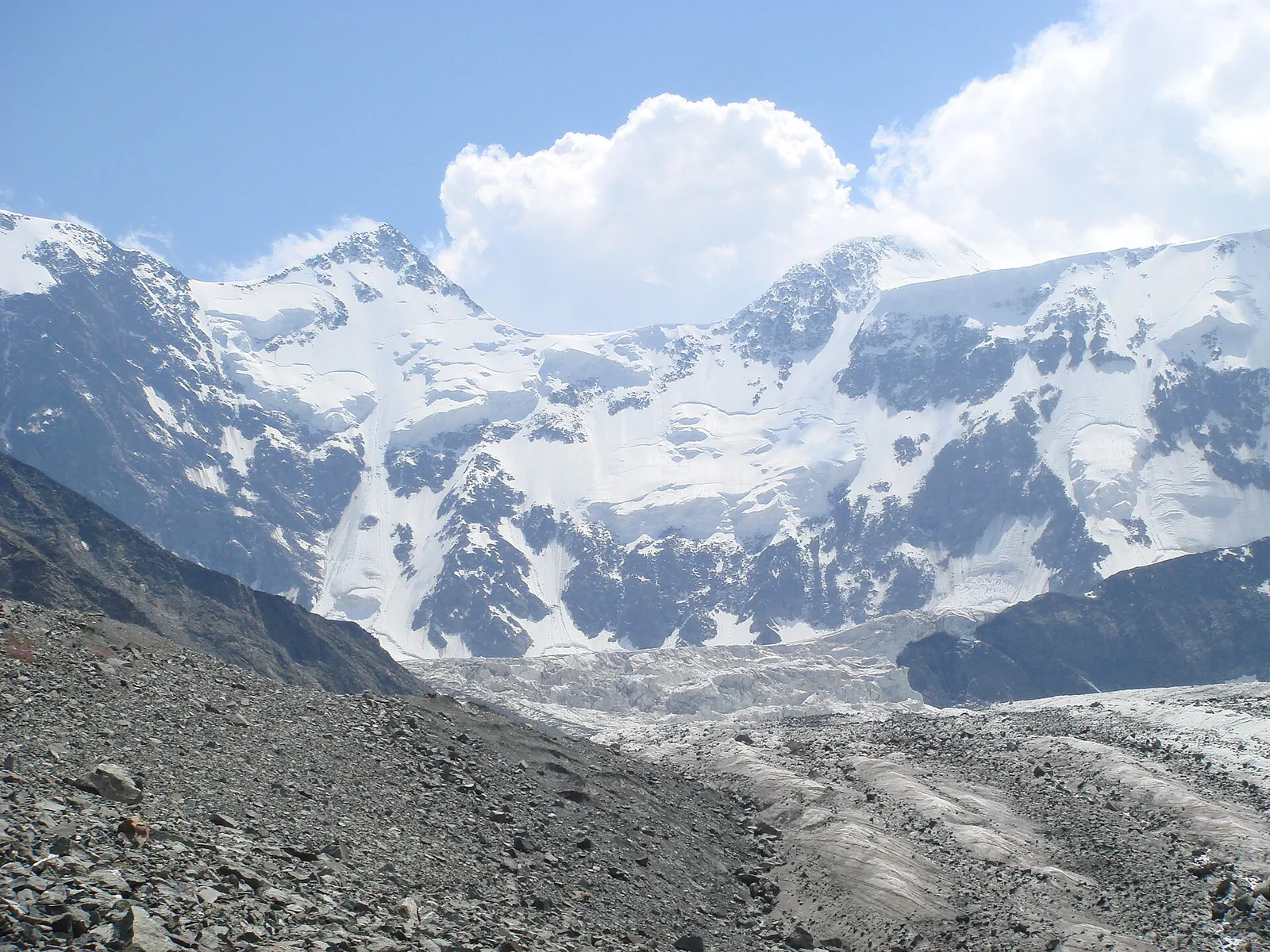
Belukha, at 4 506 metres the highest summit of the range, seen from the Akkem glacier on its northern side. The bare moraine in the foreground and the ice tongue behind it are what the upper Altai looks like above the forest. Photograph: Ondřej Žváček, 2007, CC BY 2.5. Metin içinde Yer aldığı yer: Altay
-
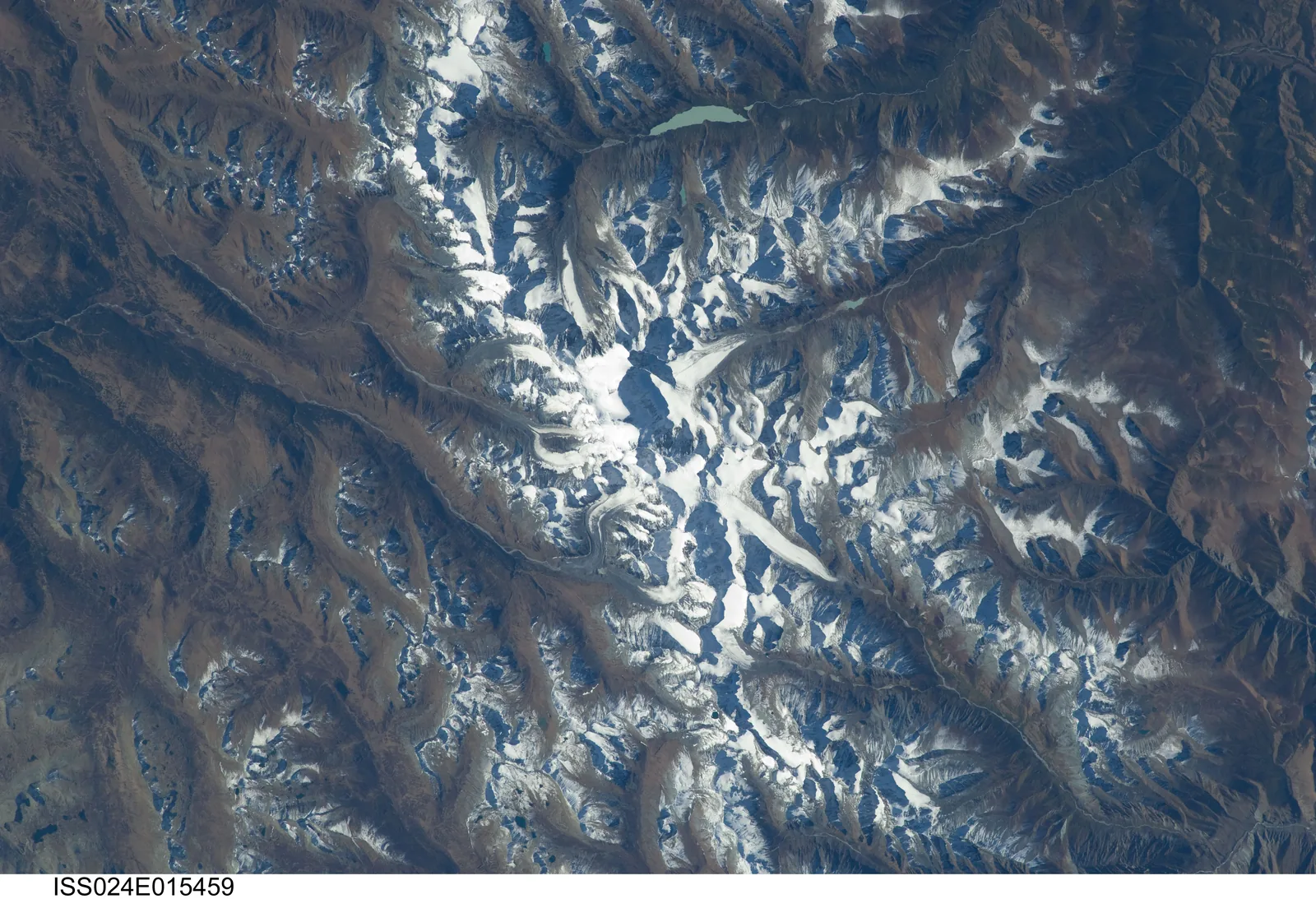
The Belukha massif and the Katun range from the International Space Station, looking straight down. The glaciers run out from the summit block in several directions; the brown ground around them is the treeless upper slope, and the pale lake near the top of the picture is one of the glacier-fed lakes of the Akkem valley. Photograph: NASA, ISS024-E-15459 (2010), public domain. Metin içinde Yer aldığı yer: Altay
-
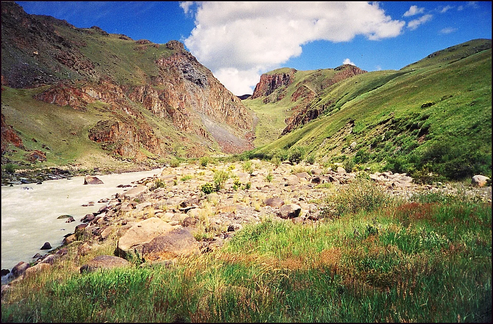
The Ak-Alakha river on the Ukok plateau, in the south of the range, with the channel behind it through which a lake dammed by ice once drained across the ridge into the neighbouring valley. The milky colour of the water is rock flour, ground by the glaciers upstream. Photograph: A. N. Rudoy, 2000, CC BY-SA 3.0. Metin içinde Yer aldığı yer: Altay
-
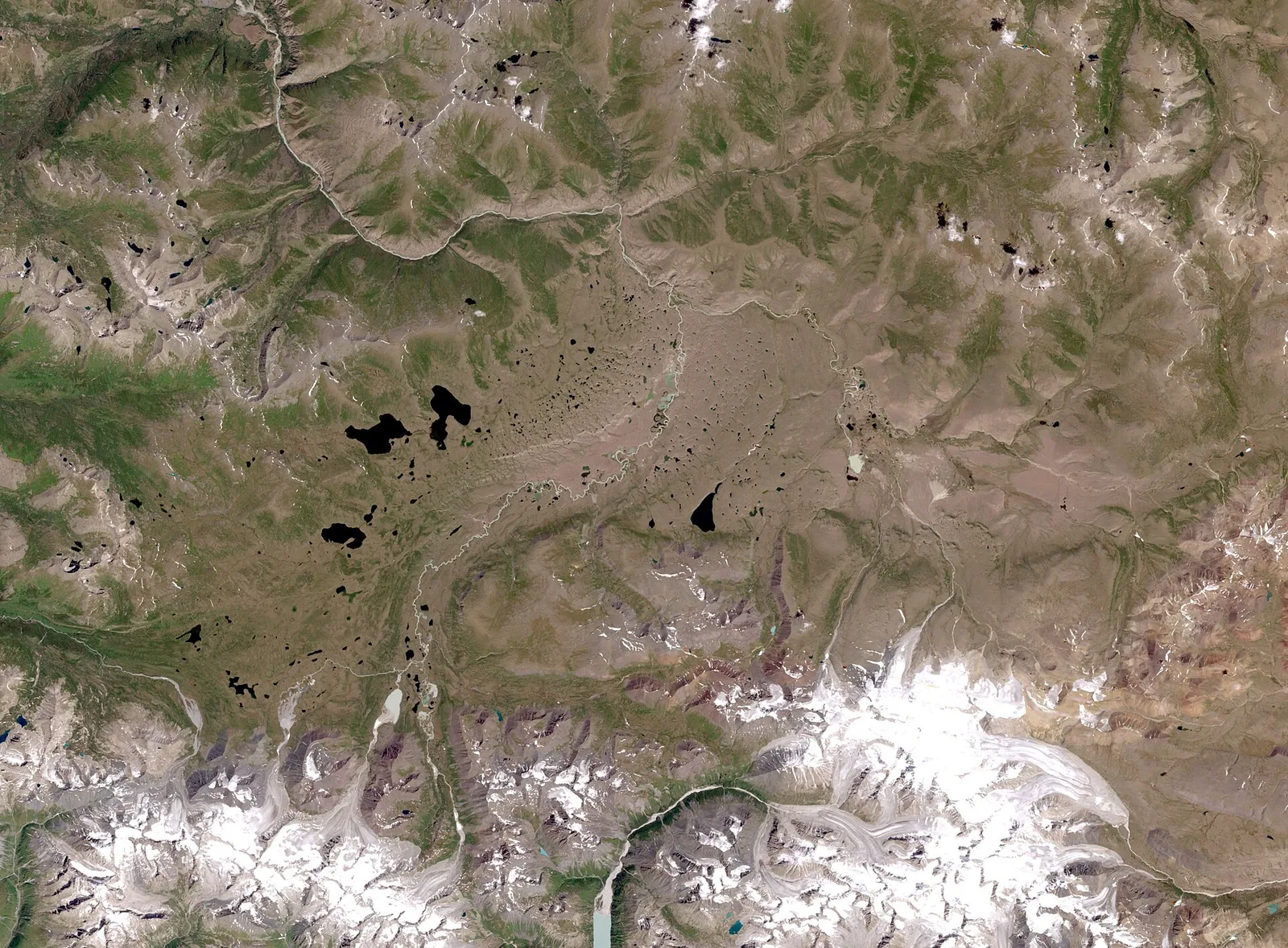
The Ukok plateau in a Landsat 7 image at thirty metres a pixel, near natural colour. The dark spots are lakes in a permafrost basin; the snow along the lower edge is the Tabyn-Bogdo-Ola massif on the Mongolian border. The frozen barrows of the Pazyryk period on this plateau owe their preservation to the ground shown here. Image: NASA, Landsat 7 (2006), public domain. Metin içinde Yer aldığı yer: Altay
-
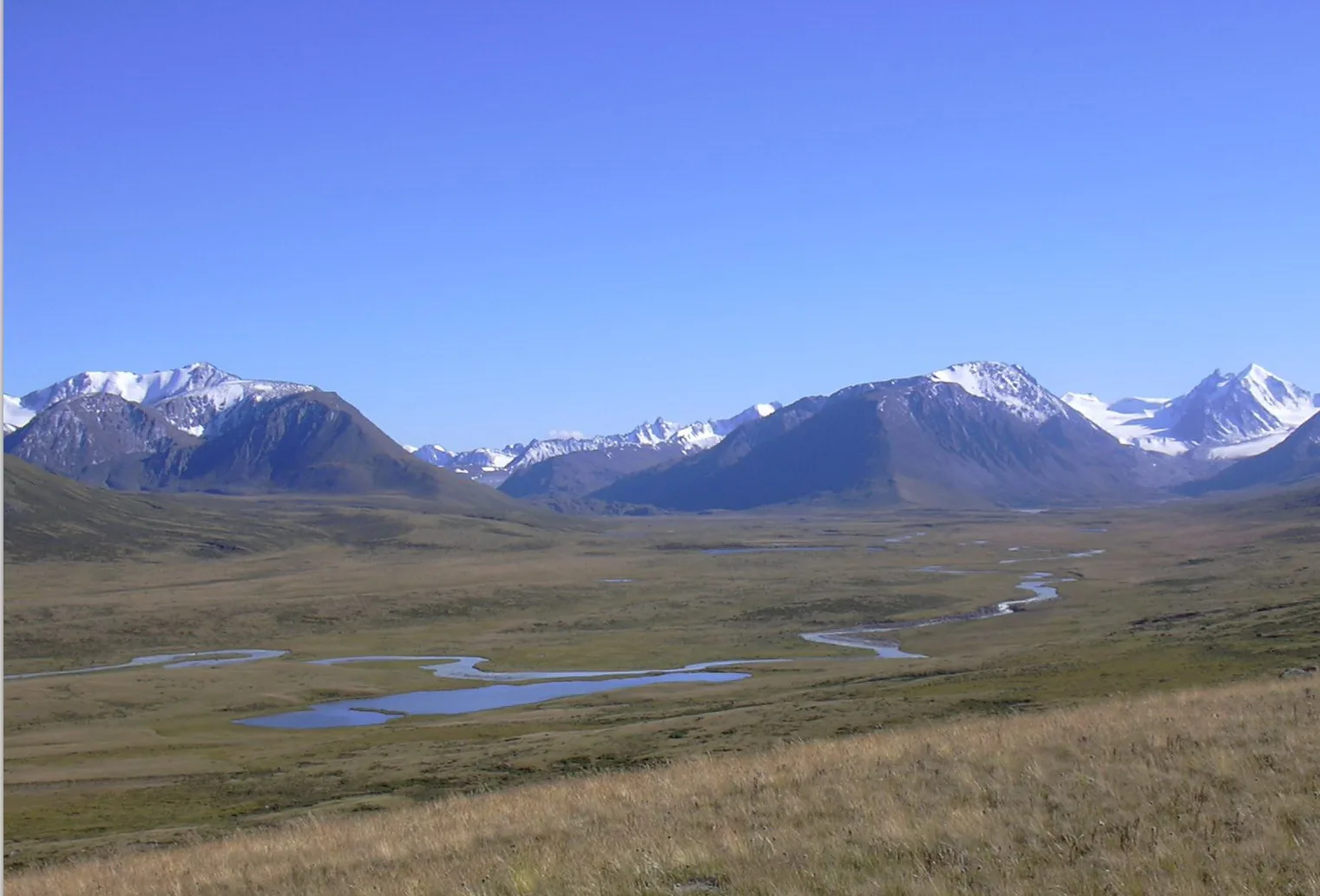
The valley of the Ak-Alakha on the Ukok plateau, one of the places where the frozen barrows of the Pazyryk period lie. The river winds through a basin that is grassland in summer and permafrost underneath. Photograph: Kobsev, 2006, CC BY 2.5. Metin içinde Yer aldığı yer: Altay
-
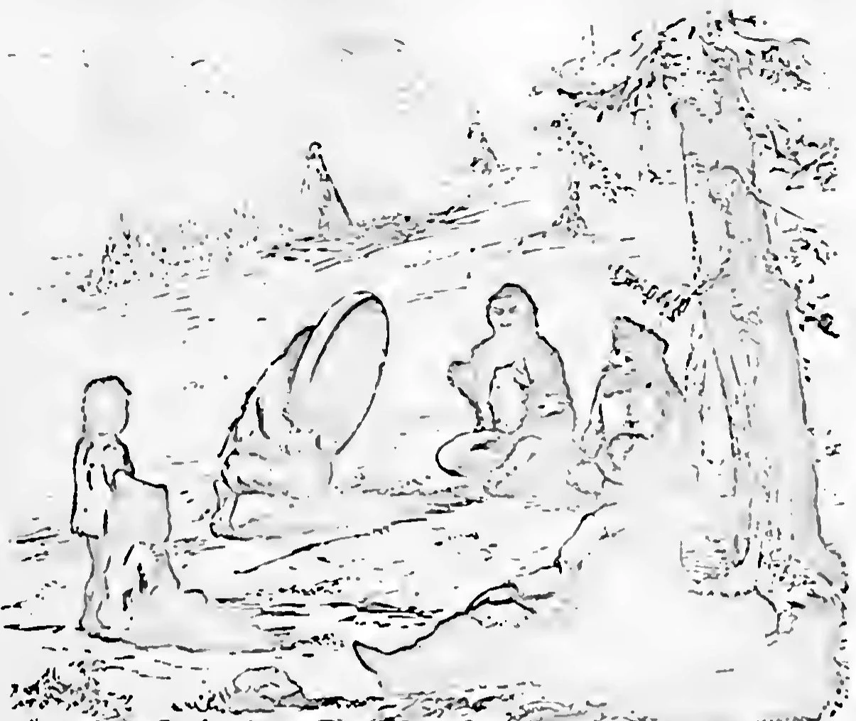
Altaians at the conjuring of spirits by a shaman, in the open beside a tree, with tents behind. Drawing in Radloff’s account of his years in the Altai. W. Radloff, Aus Sibirien, vol. 2, Leipzig 1893, plate 1, Public domain. Metin içinde Yer aldığı yer: Animizm
-
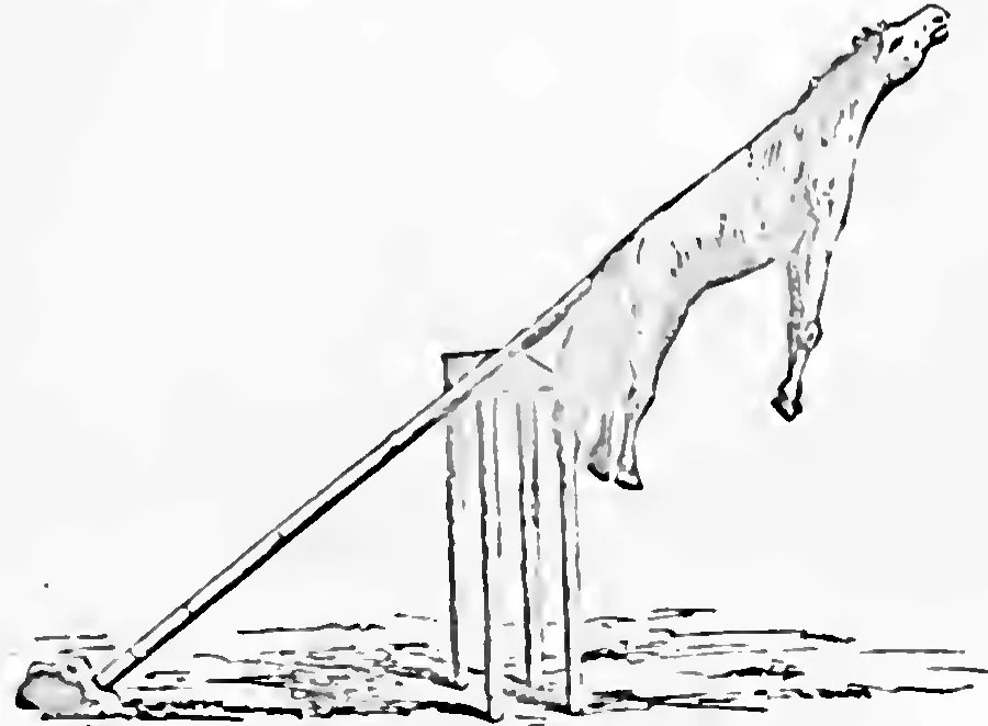
A sacrificial place of the Altaians: the hide of the offered horse hung on a pole above a frame of posts. W. Radloff, Aus Sibirien, vol. 2, Leipzig 1893, plate 1, Public domain. Metin içinde Yer aldığı yer: Animizm
-
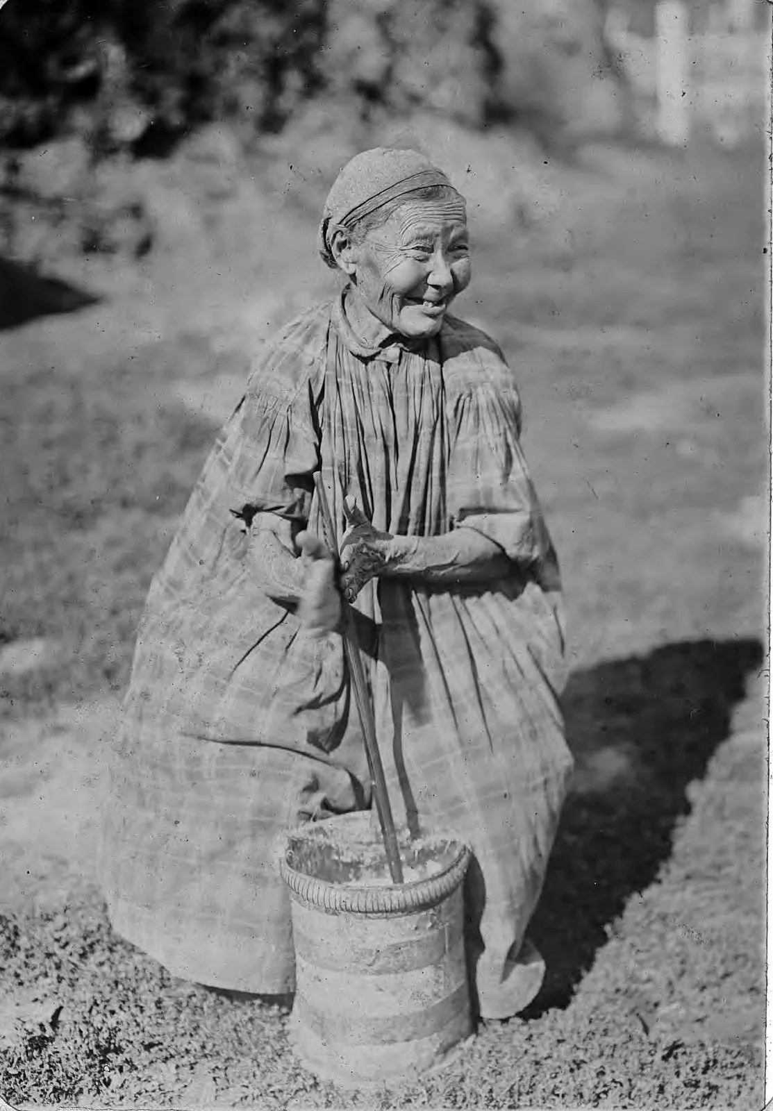
Churning butter with a dasher in a tall churn. The liquid left in the churn when the butter has been lifted out is what Kashgari calls ayran. From an album of views of the Yakutsk region, late nineteenth or early twentieth century. Irkutsk State University. Library of Congress, World Digital Library, free to use. Metin içinde Yer aldığı yer: Ayran
-
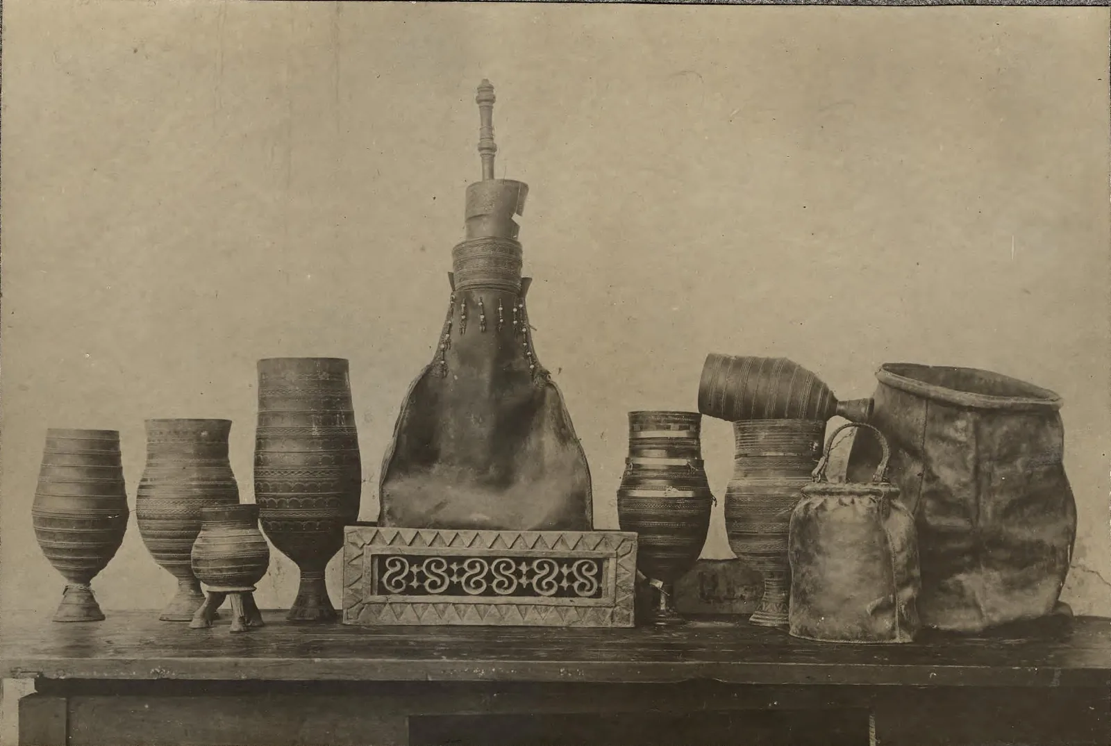
Vessels for kumys among the Yakuts, whose word for milk food is ürüŋ , "white": in the middle a skin bag in which the kumys is made, on the right two skins for keeping it, the others wooden drinking cups. Photograph: L. Veniukov; Novosibirsk State Museum of Regional History. Library of Congress, World Digital Library, free to use. Metin içinde Yer aldığı yer: Ayran
-
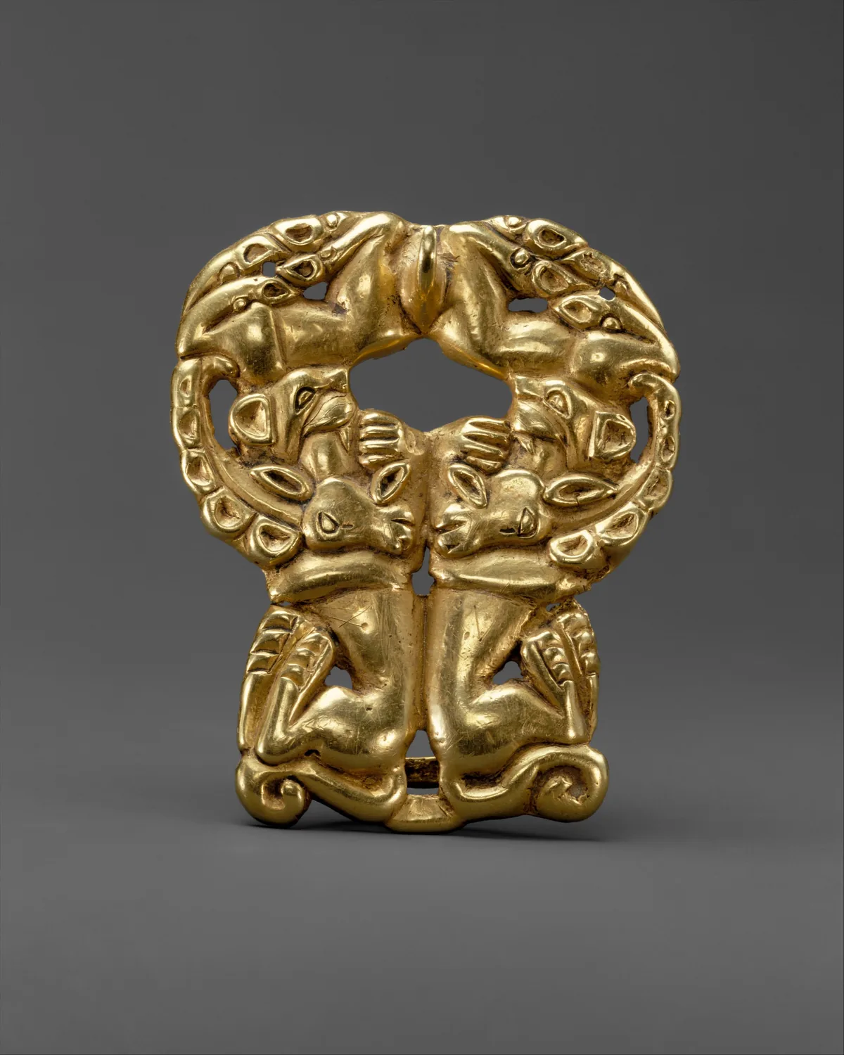
Gold belt buckle with paired felines attacking ibexes, Xiongnu, about third to second century BC, the time of Bagatur. The Metropolitan Museum of Art, New York, 17.190.1672, Gift of J. Pierpont Morgan, 1917. Open Access, public domain (CC0). Metin içinde Yer aldığı yer: Bagatur (Modu Chanyu)
-
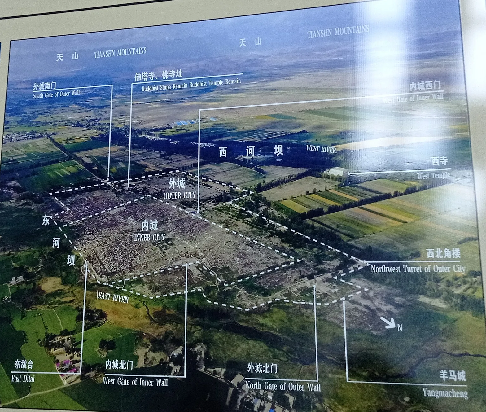
The ruins of Beshbalik from the air, as the information board at the site shows them: the inner city within the outer city, the West Temple beyond the West River, and the Tian Shan on the horizon. The arrow at lower right points north. Photograph of the information board at the Beiting ruins. Metin içinde Yer aldığı yer: Beşbalık
-
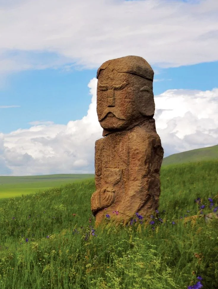
A carved stone figure on the open steppe: the face with brows and moustache, and a vessel held at the chest. It is a figure of the kind that stood at the enclosure, which is often called a balbal. Metin içinde Yer aldığı yer: Gömü ve balbal
-
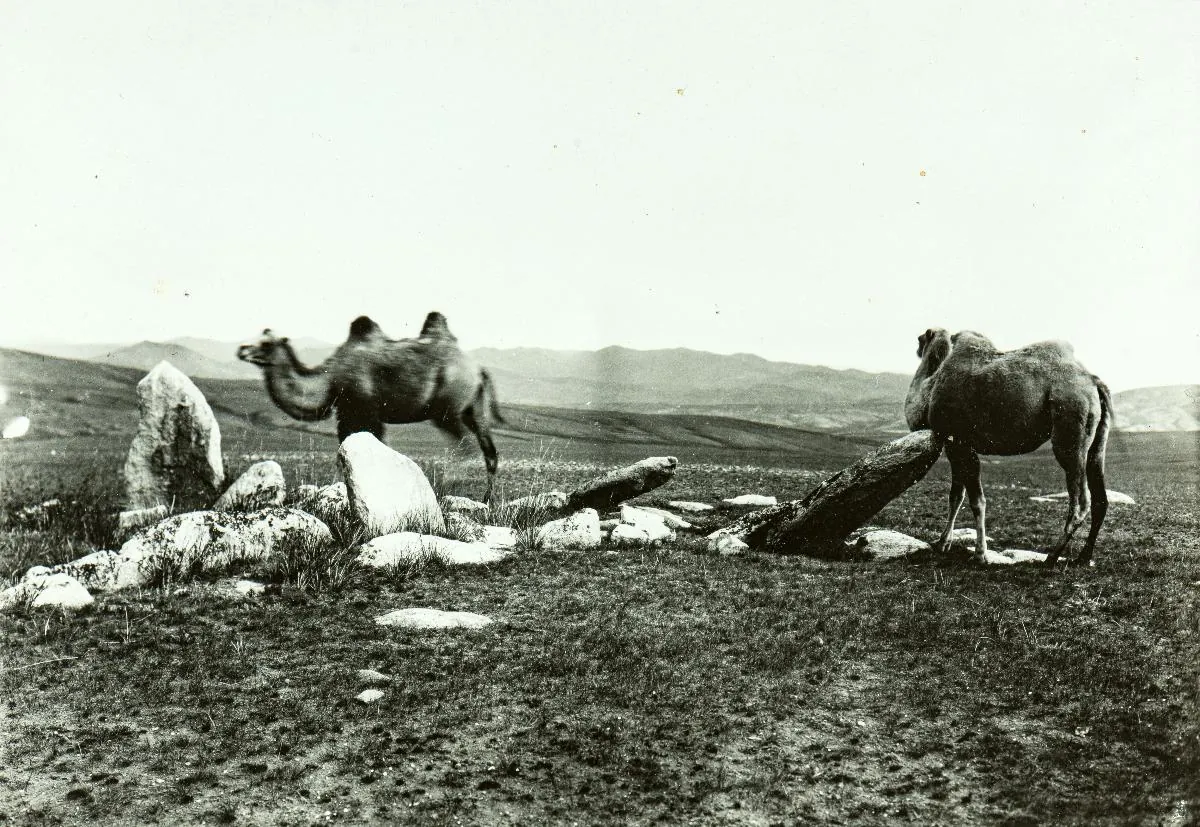
A grave marked by standing stones on the steppe between Schargaldschut and Lake Biir in Mongolia, with two camels, photographed in 1909. The collection does not date the grave itself. Finnish Heritage Agency (Museovirasto), General Ethnographic Photo Collection, VKK156:146. Photograph by Sakari Pälsi, 1909. Finna, CC BY 4.0. Metin içinde Yer aldığı yer: Avrasya Göçebeleri
-
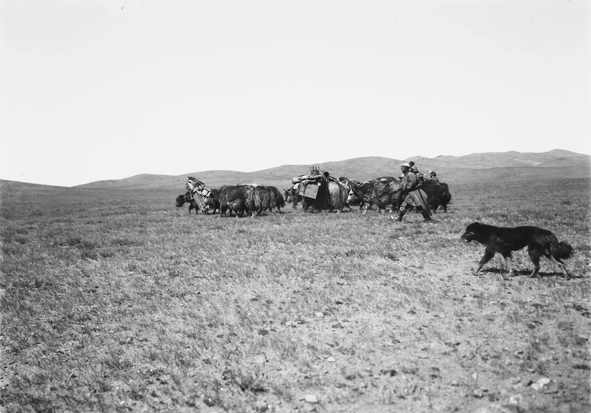
A Mongol family moving across the steppe in 1909, with their goods carried on yaks. Finnish Heritage Agency (Museovirasto), General Ethnographic Photo Collection, VKK156:38. Photograph by Sakari Pälsi, 1909. Finna, CC BY 4.0. Metin içinde Yer aldığı yer: Avrasya Göçebeleri
-
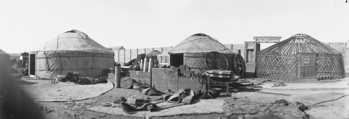
Felt tents standing for sale at Urga, today Ulaanbaatar, in 1909. On the right the lattice frame and roof ring of one tent are still uncovered. Finnish Heritage Agency (Museovirasto), General Ethnographic Photo Collection, VKK156:89. Photograph by Sakari Pälsi, 1909. Finna, CC BY 4.0. Metin içinde Yer aldığı yer: Avrasya Göçebeleri
-
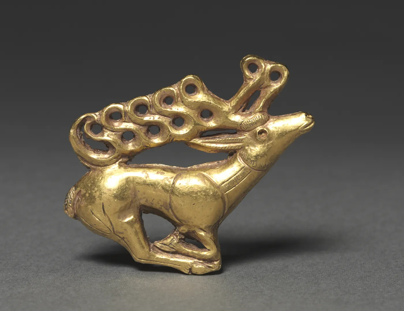
Gold plaque of a stag with antlers drawn out into open loops, Scythian, 400–300 BC. The Cleveland Museum of Art, 1985.77, The Severance and Greta Millikin Purchase Fund. Open Access, public domain (CC0). Metin içinde Yer aldığı yer: Avrasya Göçebeleri, Türk halklarının tarihi
-
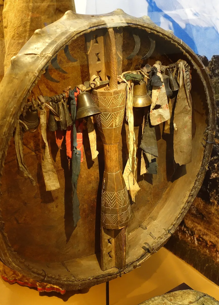
A shaman’s drum from the Altai and Khakassia, collected in 1892, seen from behind: brass bells hang from the crossbar. Drum and bell are the two instruments Menander names at the purification of 569. Etnografiska museet, Stockholm, no. 1892.03.0354. Photograph: Daderot, 2014, CC0. Metin içinde Yer aldığı yer: Kam (Türk şamanı)
-
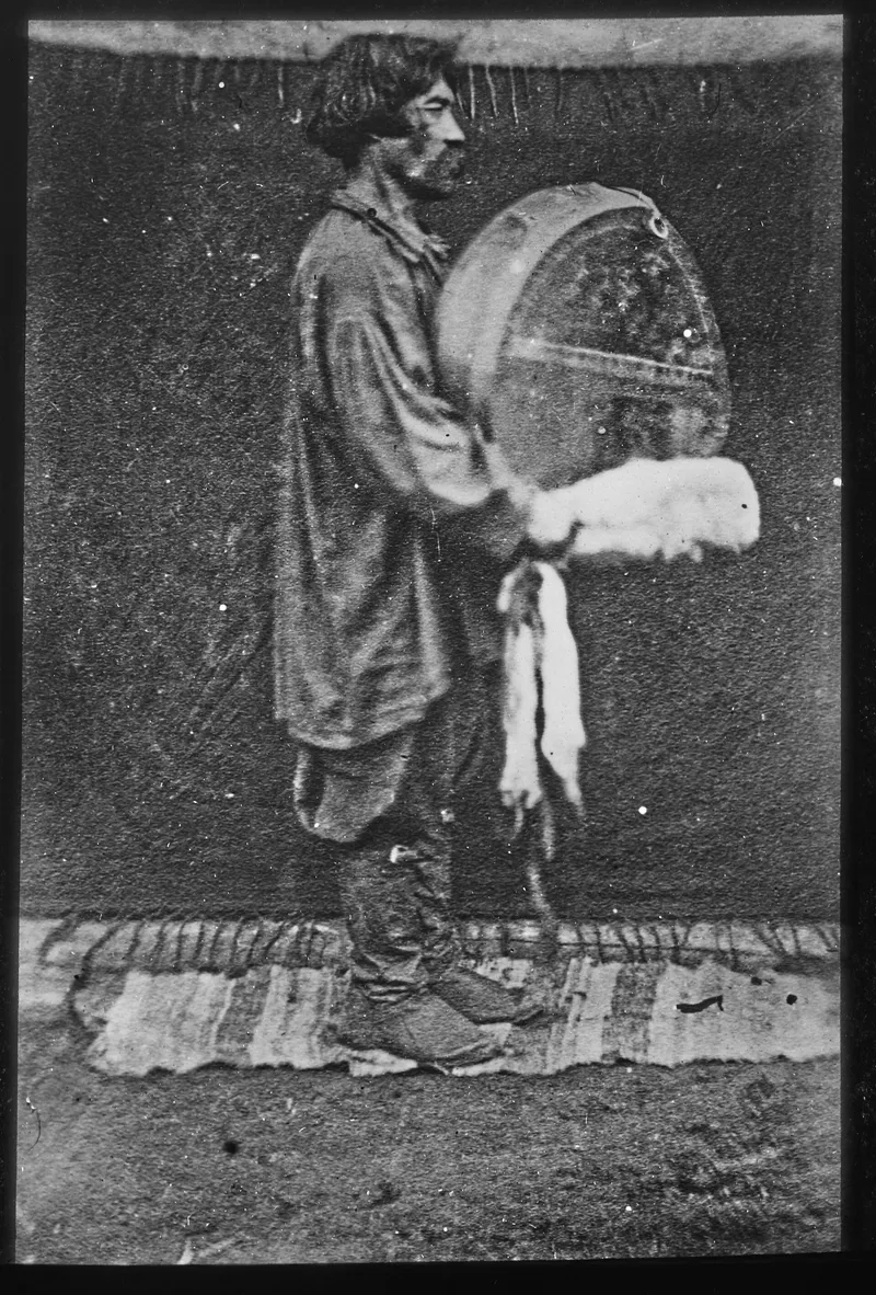
A shaman of the second rank in the Minusinsk district on the upper Yenisei, with his drum, photographed in 1897 on the expedition of Joseph de Baye. Bibliothèque nationale de France, Société de Géographie, SG XCD-199. Public domain. Metin içinde Yer aldığı yer: Kam (Türk şamanı)
-
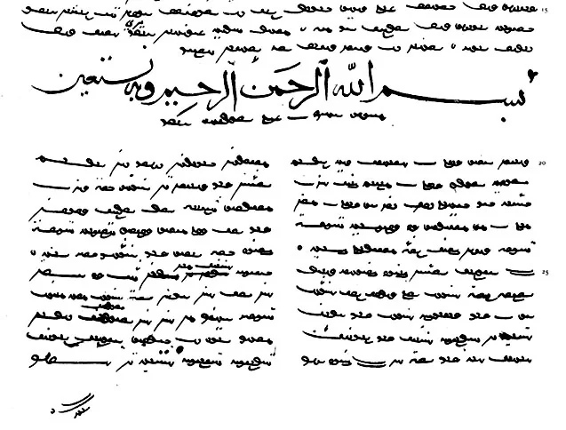
A page of the Vienna manuscript, copied at Herat in 1439 in Uyghur script, with a heading in Arabic letters. Facsimile of the Vienna manuscript, St Petersburg 1890, public domain. Metin içinde Yer aldığı yer: Kutadgu Bilig
-
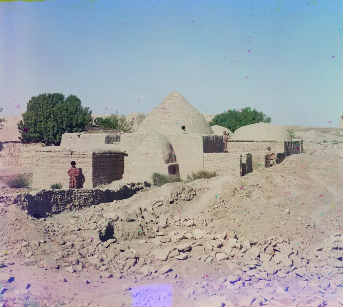
The mausoleum of Akhmed Zamchi in the ruin fields of ancient Merv, between 1905 and 1915. Photograph: Sergei Prokudin-Gorskii, between 1905 and 1915; Library of Congress, no known restrictions. Metin içinde Yer aldığı yer: Merv
-
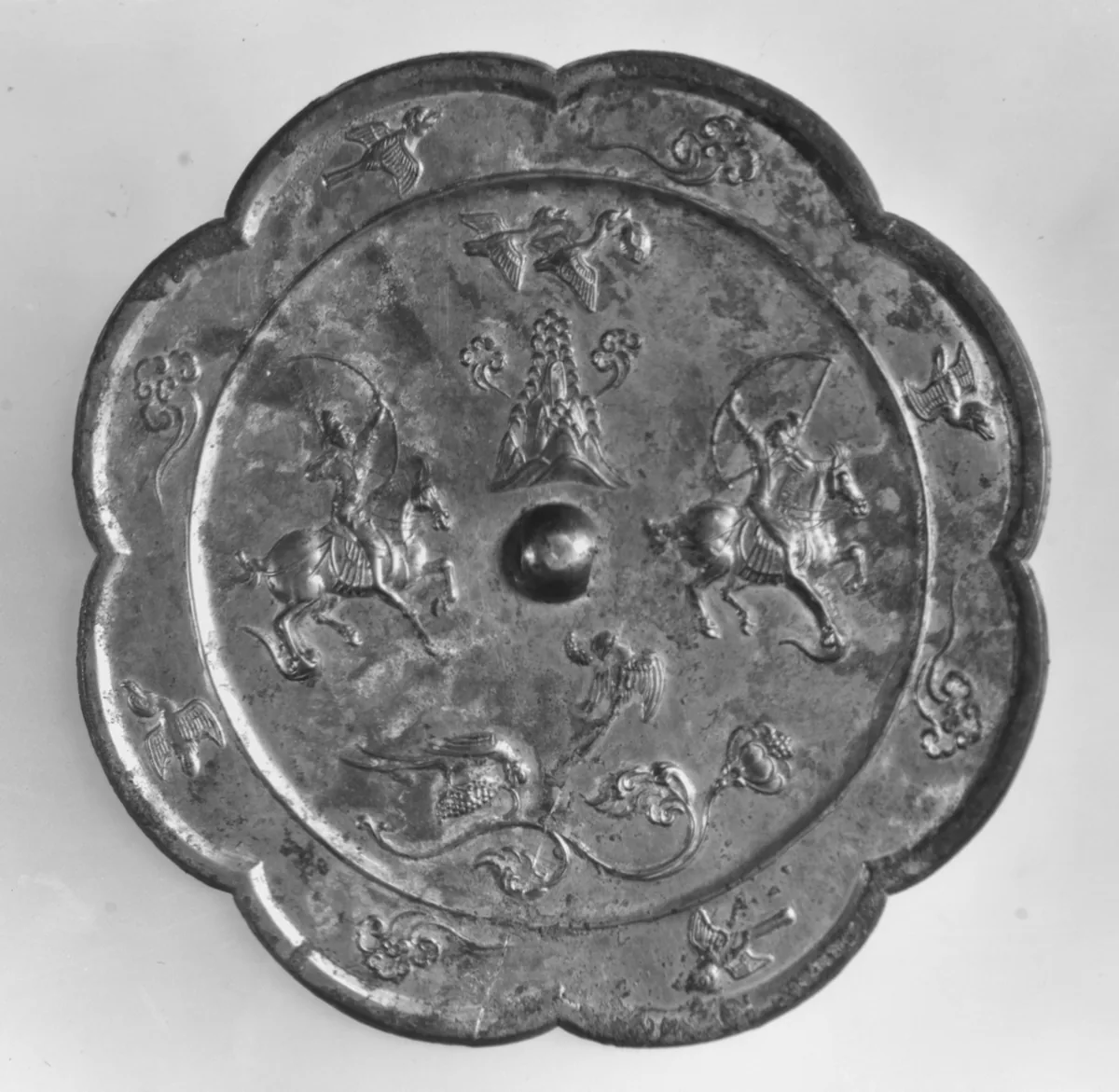
Bronze mirror with a hunting scene, China, Tang dynasty, eighth century. Two horsemen draw their bows at full gallop. The Metropolitan Museum of Art, New York, 25.20.3, Rogers Fund, 1925. Open Access, public domain (CC0). Metin içinde Yer aldığı yer: Atlı Okçuluk
-
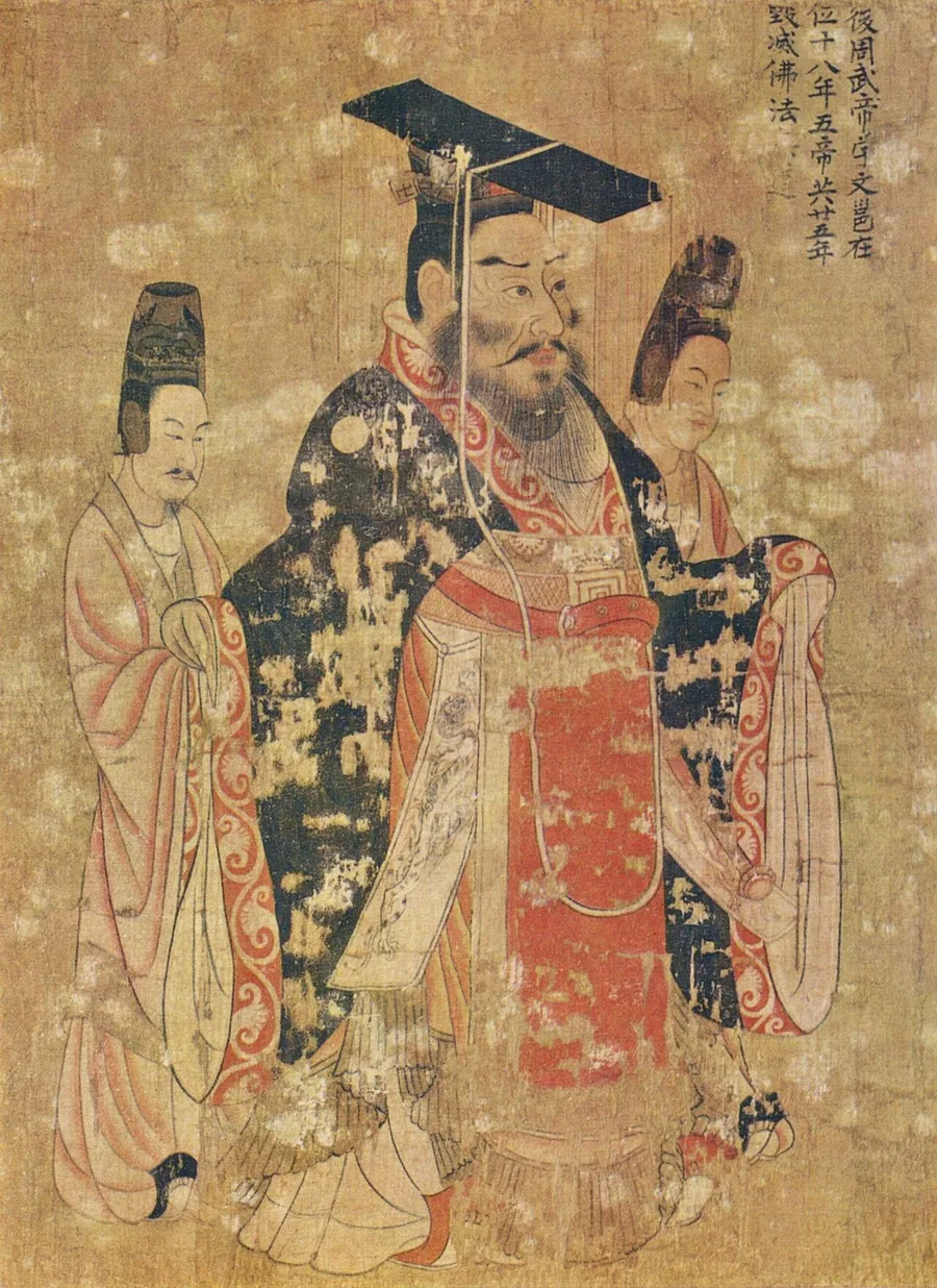
Emperor Wu of the Zhou in the Thirteen Emperors Scroll, a handscroll attributed to the Tang court painter Yan Liben and painted in the seventh century. It is a later depiction, not a portrait from life. The inscription calls him Emperor Wu of the Later Zhou, Yuwen Yong, counts five emperors in twenty-five years, and notes that he destroyed the Buddhist law. Museum of Fine Arts, Boston. Painting attributed to Yan Liben; reproduction from The Yorck Project. Public domain. Metin içinde Yer aldığı yer: Kuzey Zhou
-
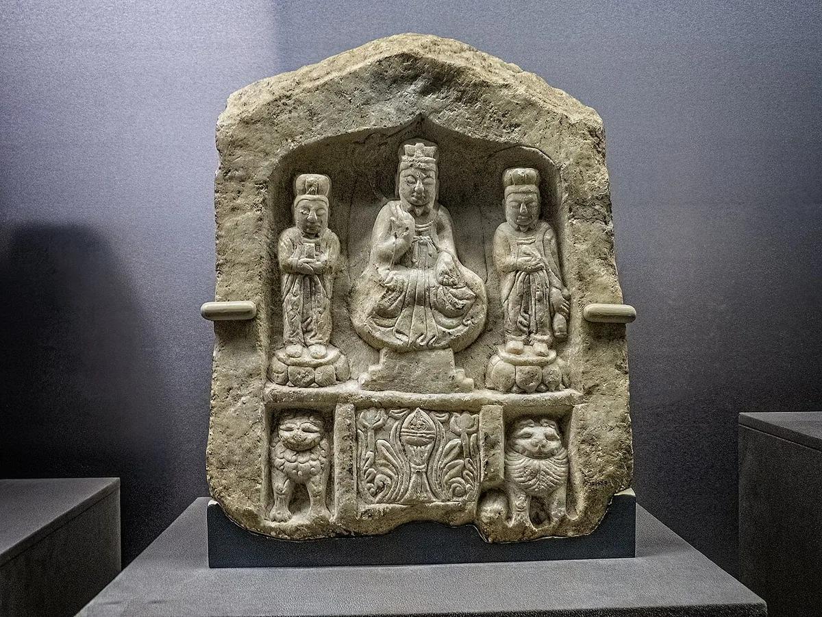
Laozi seated between two attendants, a Daoist stone image from Shaanxi dated 564, ten years before the ban. The figure sits in the posture of a Buddha; lions and an incense burner fill the base. Field Museum, Chicago. Photograph: Mary Harrsch, CC BY-SA 4.0. Metin içinde Yer aldığı yer: Kuzey Zhou
-
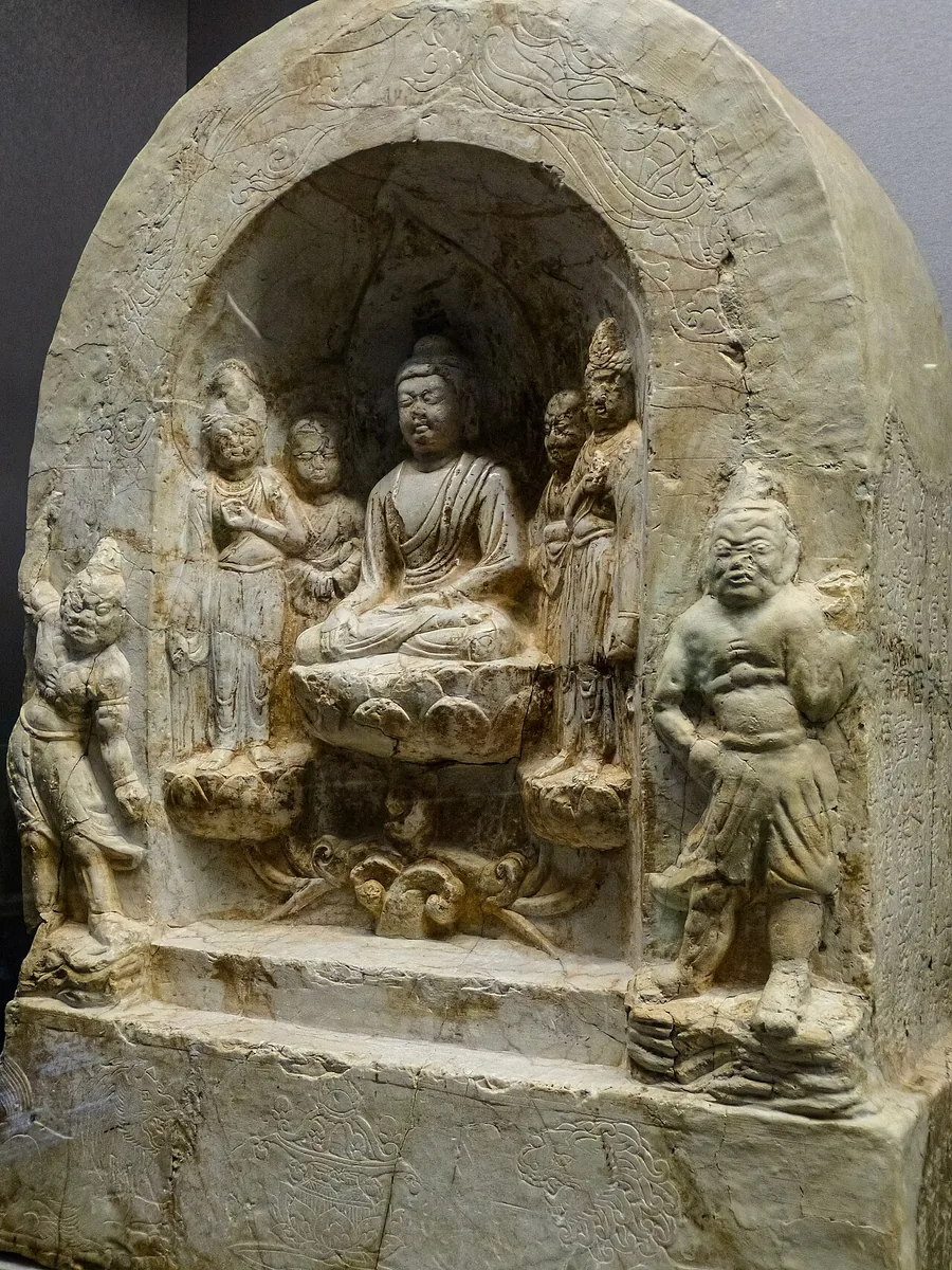
Buddhist stone shrine of the Zhou period from Shaanxi: the Buddha seated on a lotus between disciples and bodhisattvas, with a guardian on either side. Field Museum, Chicago. Photograph: Mary Harrsch, 2016, CC BY-SA 4.0. Metin içinde Yer aldığı yer: Kuzey Zhou
-
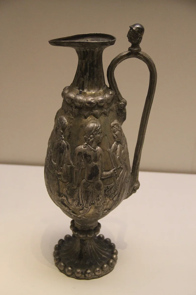
Replica of the gilded silver ewer from the tomb of Li Xian at Guyuan, shown at the National Museum of China in Beijing. The ewer was made in Central Asia; the figures in relief on its body come from Greek myth. Photograph: Gary Todd, 2011, CC0. Metin içinde Yer aldığı yer: Kuzey Zhou
-
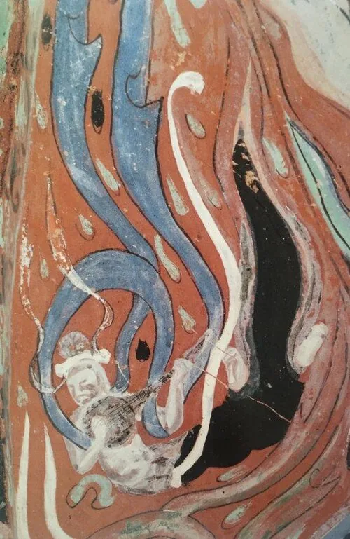
A flying celestial playing a lute, from the wall paintings of cave 301 at Mogao near Dunhuang, of the Zhou period. Wall painting, Mogao cave 301. Public domain. Metin içinde Yer aldığı yer: Kuzey Zhou
-
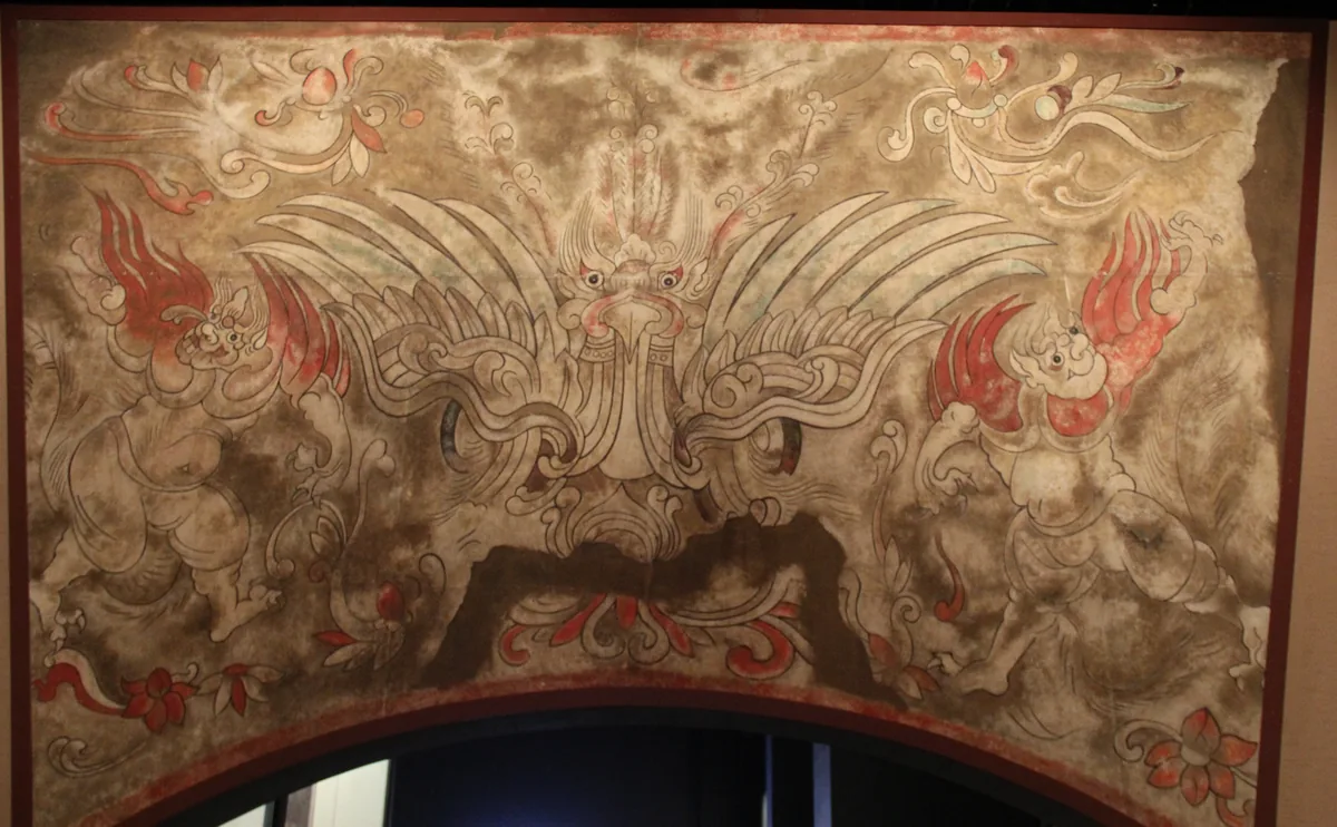
Modern copy of the painting above the gate of her tomb: a monster mask between two winged figures. Hebei Museum. Copy: Hebei Museum. Photograph: Gary Todd, 2014, CC0. Metin içinde Yer aldığı yer: Princess Linhe, Tomb of Princess Linhe
-
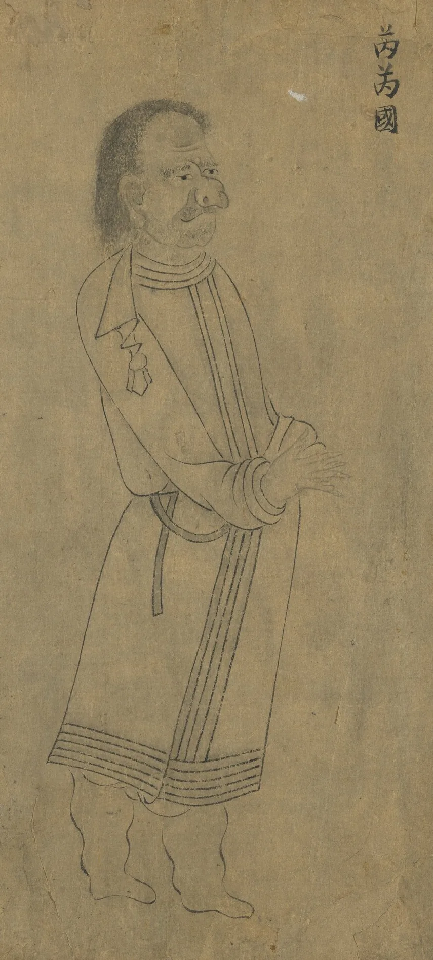
Envoy of the Rouran, labelled 芮芮國, the name the southern courts used for them. From “Foreign Visitors Coming to Court”, a copy after a painting ascribed to Emperor Yuan of Liang (r. 552–555); an inscription of the Song emperor Lizong names Gu Deqian of the Southern Tang as the copyist. Handscroll, ink on paper; National Palace Museum, Taipei, 故畫001389N. Copy of Emperor Yuan of Liang’s “Foreign Visitors Coming to Court”, The National Palace Museum, Taipei, CC BY 4.0 @ www.npm.gov.tw. Metin içinde Yer aldığı yer: Rouran Kağanlığı
-
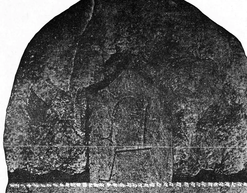
The crown and upper runes of the Kül Tegin stone, photographed by the Finnish expedition of 1890. Photograph: Finnish expedition of 1890, Inscriptions de l’Orkhon recueillies par l’expédition finnoise 1890, Helsingfors 1892, Tab. 2, public domain. Metin içinde Yer aldığı yer: İkinci Göktürk Kağanlığı, Türk halklarının tarihi
-
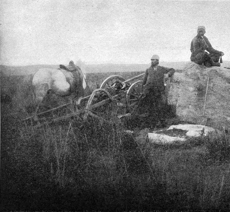
General view of the site of the Bilge Khan monument on the Orkhon, photographed in 1890. Photograph: Finnish expedition of 1890, Inscriptions de l’Orkhon recueillies par l’expédition finnoise 1890, Helsingfors 1892, public domain. Metin içinde Yer aldığı yer: İkinci Göktürk Kağanlığı
-
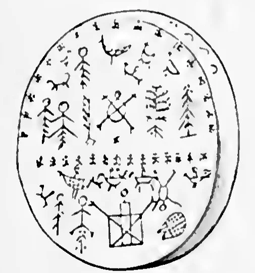
The outer side of an Altaian shaman’s drum: men, animals, birds and trees painted on the skin, above and below a dividing band. W. Radloff, Aus Sibirien, vol. 2, Leipzig 1893, plate 1, Public domain. Metin içinde Yer aldığı yer: Şamanizm
-
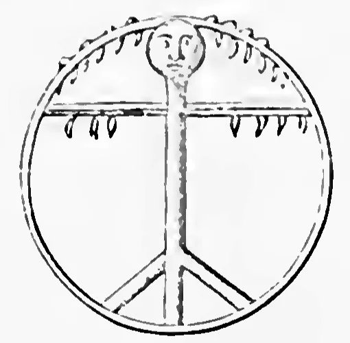
The inside of the same kind of drum: the handle shaped as a figure with a head, and the crossbar hung with pendants. W. Radloff, Aus Sibirien, vol. 2, Leipzig 1893, plate 1, Public domain. Metin içinde Yer aldığı yer: Şamanizm
-
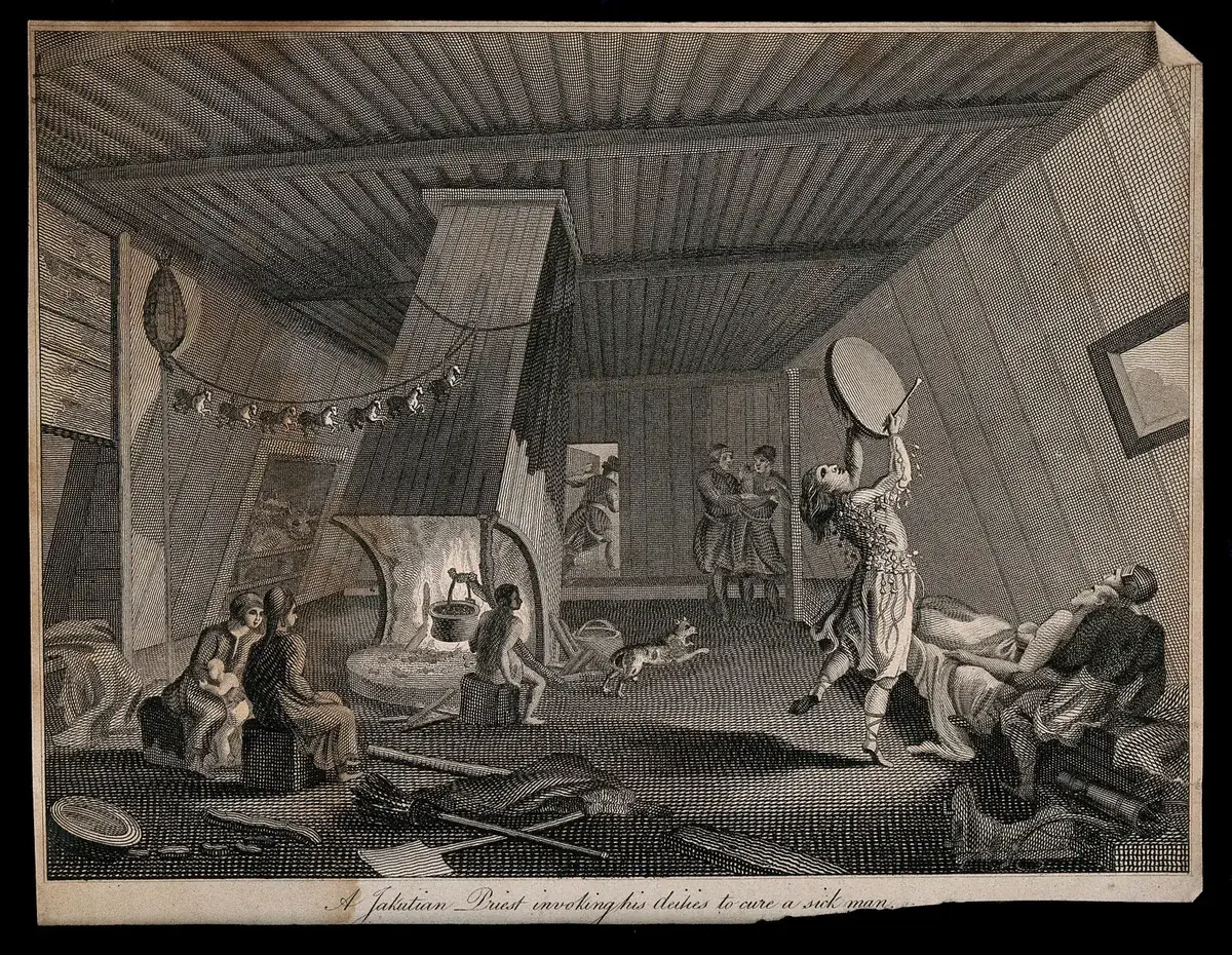
A Yakut shaman invoking his spirits to cure a sick man, an engraving titled "A Jakutian Priest invoking his deities to cure a sick man". The Yakut, who call themselves Sakha, speak a Turkic language. The date of the print is not recorded. Engraving by S. Davenport, date not recorded; Wellcome Collection. Public domain mark. Metin içinde Yer aldığı yer: Şamanizm
-
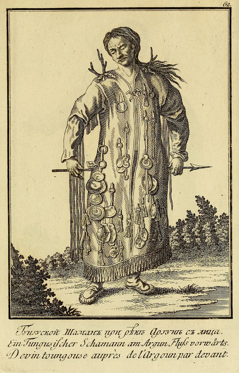
A Tungus shaman on the Argun, seen from the front: a coat hung with iron rings and discs, antler-like prongs at the shoulders, an arrow in the hands. The Tungus speak a Tungusic language. The plate shows the wider Siberian pattern and not the Göktürks. Plate from J. G. Georgi, Description de toutes les nations de l'Empire de Russie, 1776, Boston Public Library copy at the Internet Archive. Public domain. Metin içinde Yer aldığı yer: Şamanizm
-
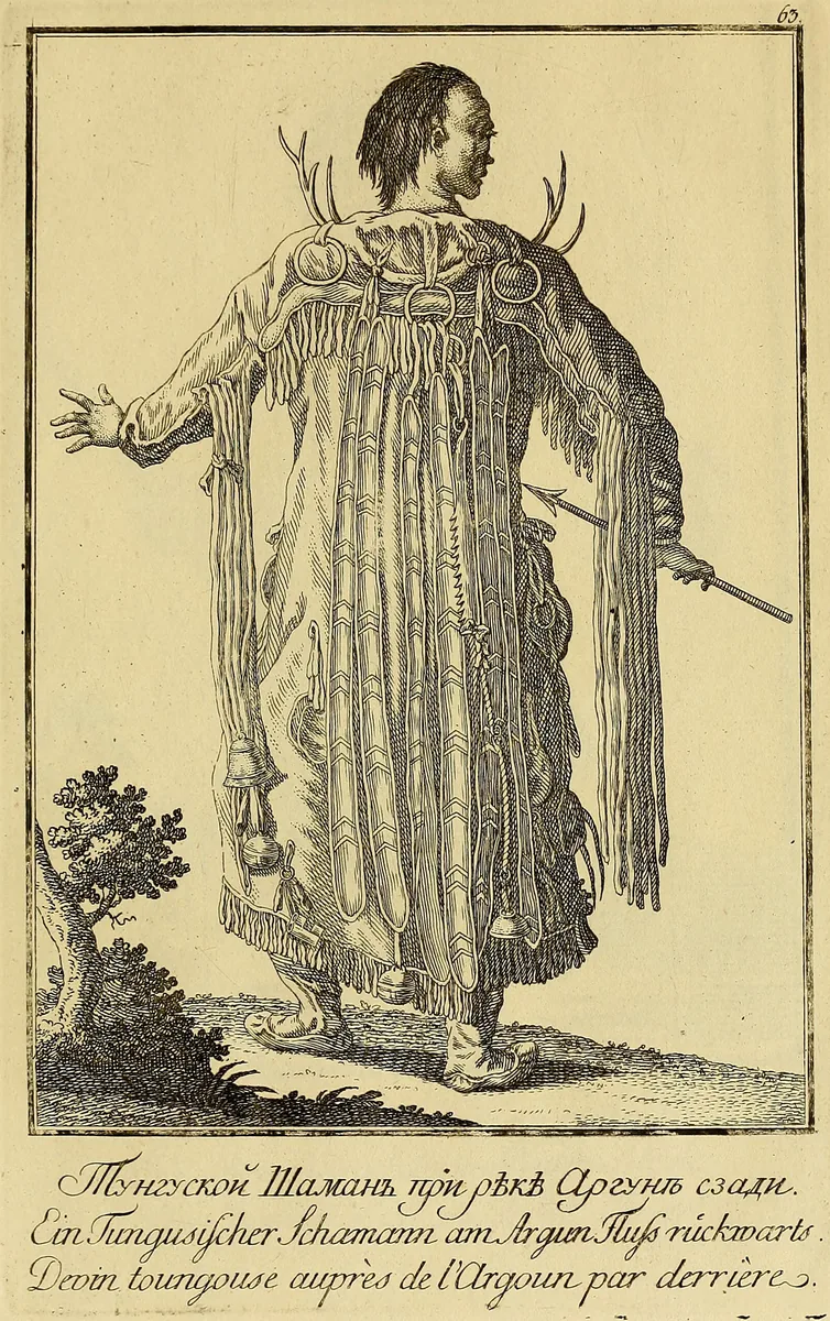
The same Tungus shaman from behind: long strips down the back, iron rings at the collar under the antler-like prongs, and bells at the hem of the coat. Plate from J. G. Georgi, Description de toutes les nations de l'Empire de Russie, 1776, Boston Public Library copy at the Internet Archive. Public domain. Metin içinde Yer aldığı yer: Şamanizm
-
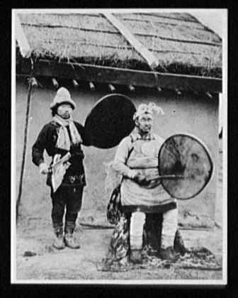
A Nanai shaman priest and his assistant, each with a frame drum, photographed about 1895. The Nanai, called Goldi in the older literature, are a Tungusic people and not a Turkic one. Photograph by William Henry Jackson, about 1895; Library of Congress, Prints and Photographs Division, World's Transportation Commission collection. Public domain. Metin içinde Yer aldığı yer: Şamanizm
-
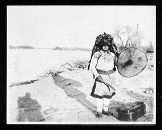
A Nanai shaman in regalia with a frame drum on a river bank, photographed between 1890 and 1900. The shadow of the photographer falls in the foreground. Photograph by William Henry Jackson, 1890 to 1900; Library of Congress, Prints and Photographs Division, World's Transportation Commission collection. Public domain. Metin içinde Yer aldığı yer: Şamanizm
-
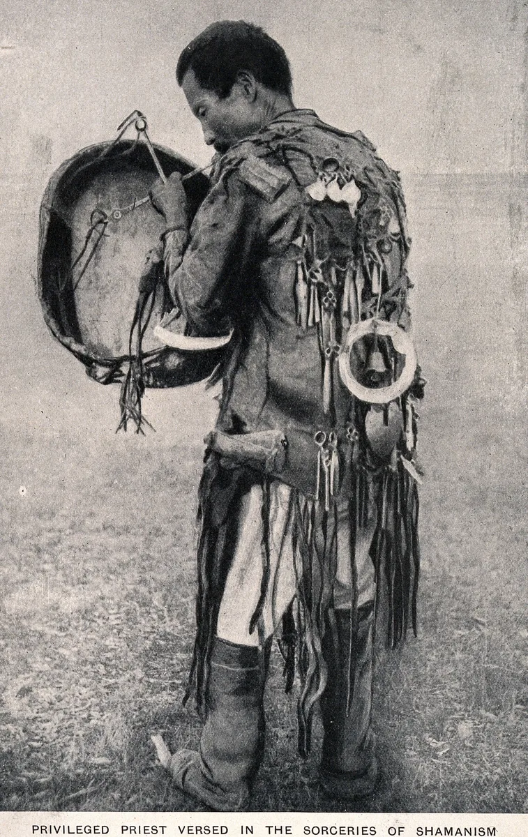
A shaman with a drum in full costume, seen from behind: iron pendants, a large ring with a bell at the back and a long fringe. The printed caption reads "Privileged priest versed in the sorceries of shamanism". The place and date of the photograph are not recorded. Photographer and date not recorded; Wellcome Collection. Public domain mark. Metin içinde Yer aldığı yer: Şamanizm
-
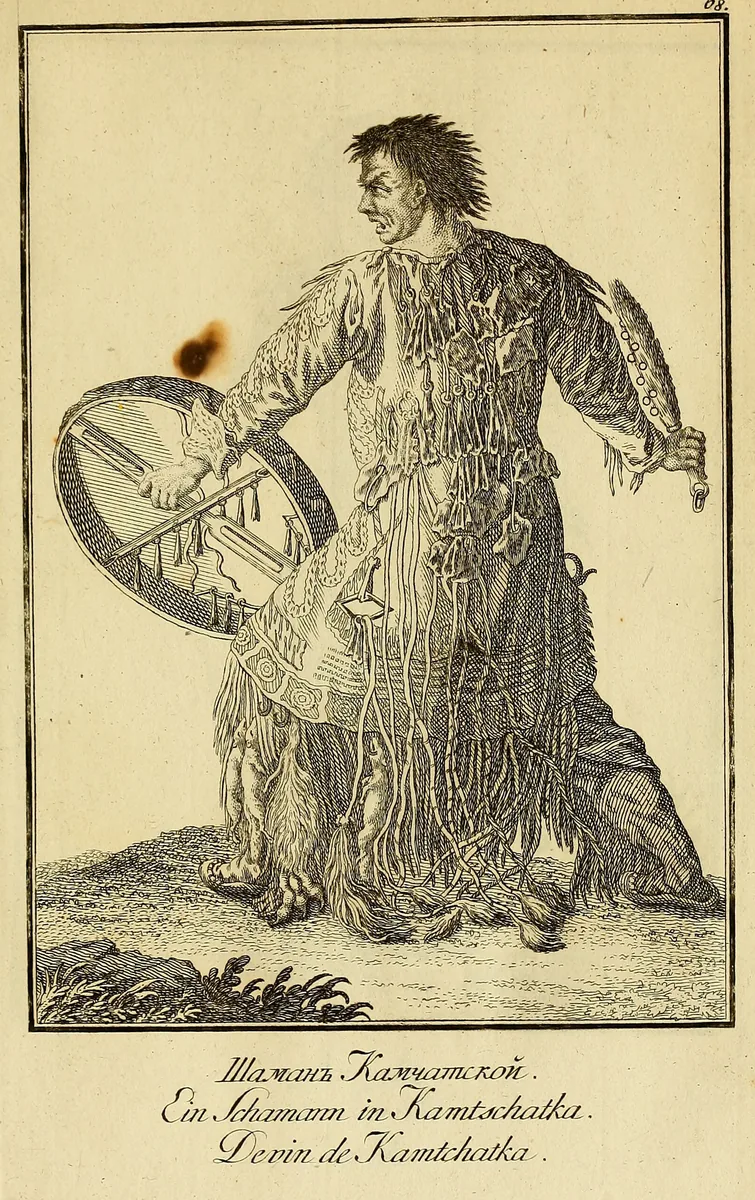
A shaman of Kamchatka with a frame drum, a ringed beater and a coat hung with strips and pendants, a plate titled "Ein Schamann in Kamtschatka". The Kamchadal are not a Turkic people. The plate shows the wider Siberian pattern and not the Göktürks. Plate from J. G. Georgi, Description de toutes les nations de l'Empire de Russie, 1776, Boston Public Library copy at the Internet Archive. Public domain. Metin içinde Yer aldığı yer: Şamanizm
-
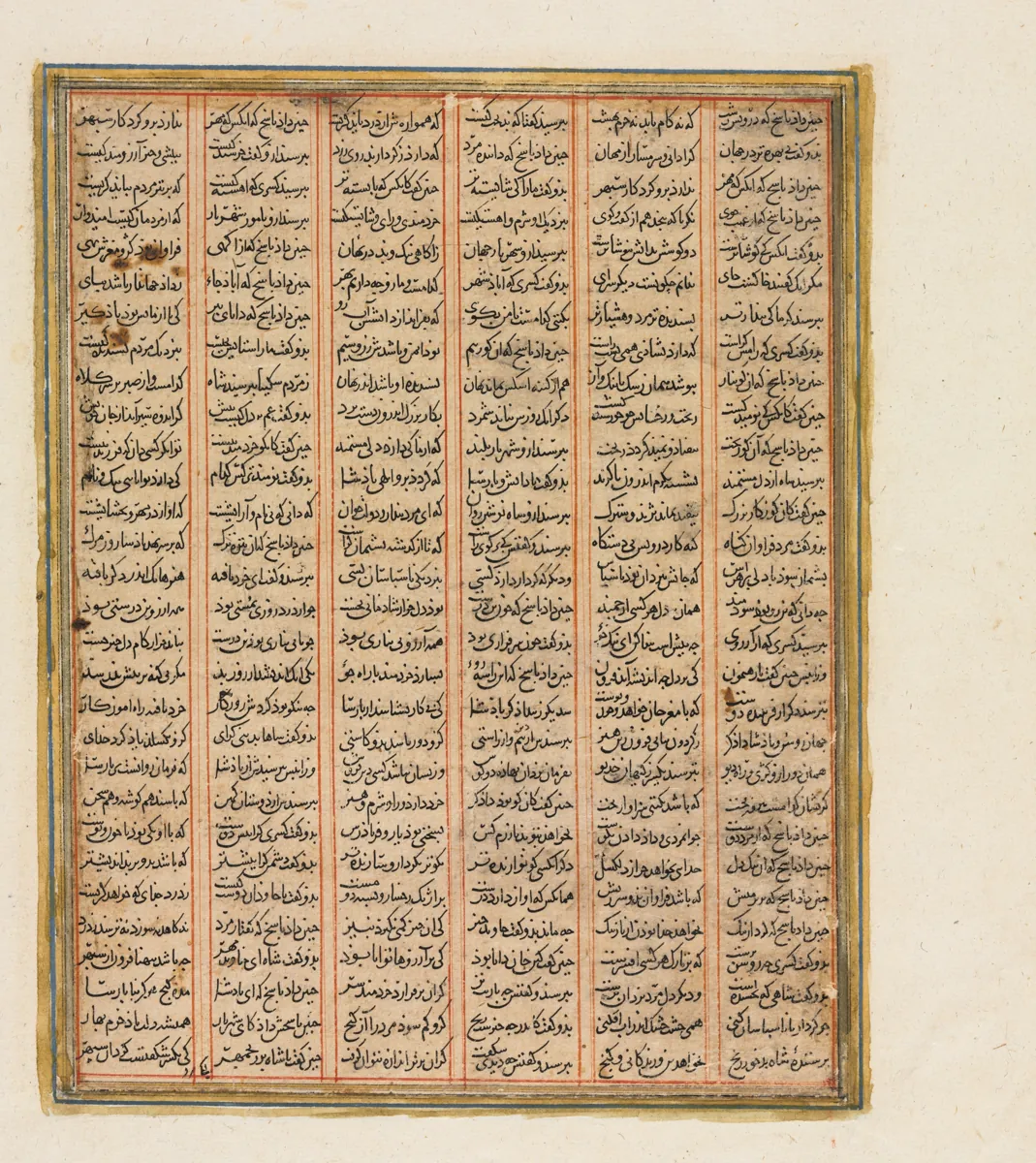
A page of a Shahnama made in Baghdad about 1299, from the reign of Nushirwan (Khosrow I): the war between the Khan of Chin, the khan of the Turks in the Persian epic, and the Haitalians, the Hephthalites. The Cleveland Museum of Art, 1944.480.2.b, CC0. Metin içinde Yer aldığı yer: Göktürk-Eftalit Savaşı, 555–563
-
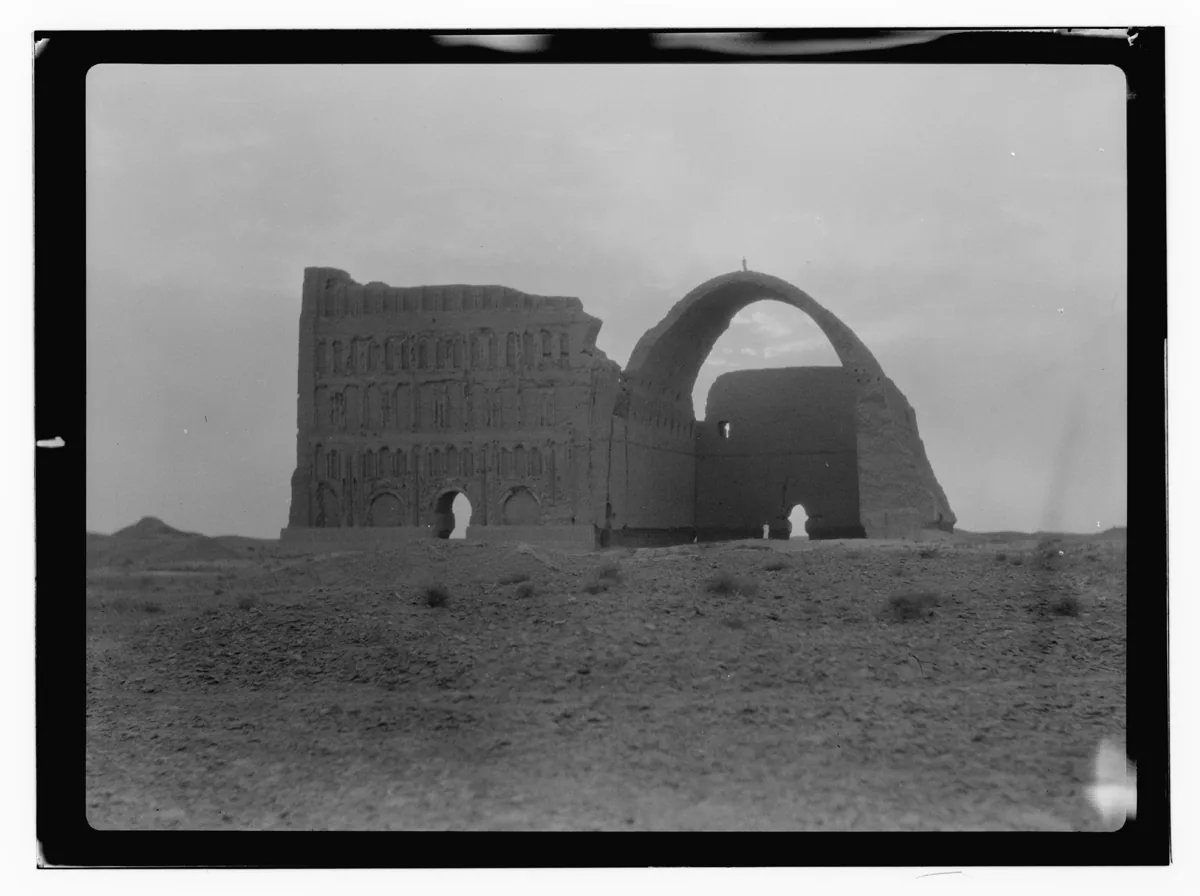
The Taq Kasra at Ctesiphon, the great vaulted hall of the Sasanian palace on the Tigris, photographed in 1932. Photograph: American Colony Photo Department, 1932; Library of Congress, no known restrictions. Metin içinde Yer aldığı yer: Göktürk-Sasani Ticaret Çatışması
-
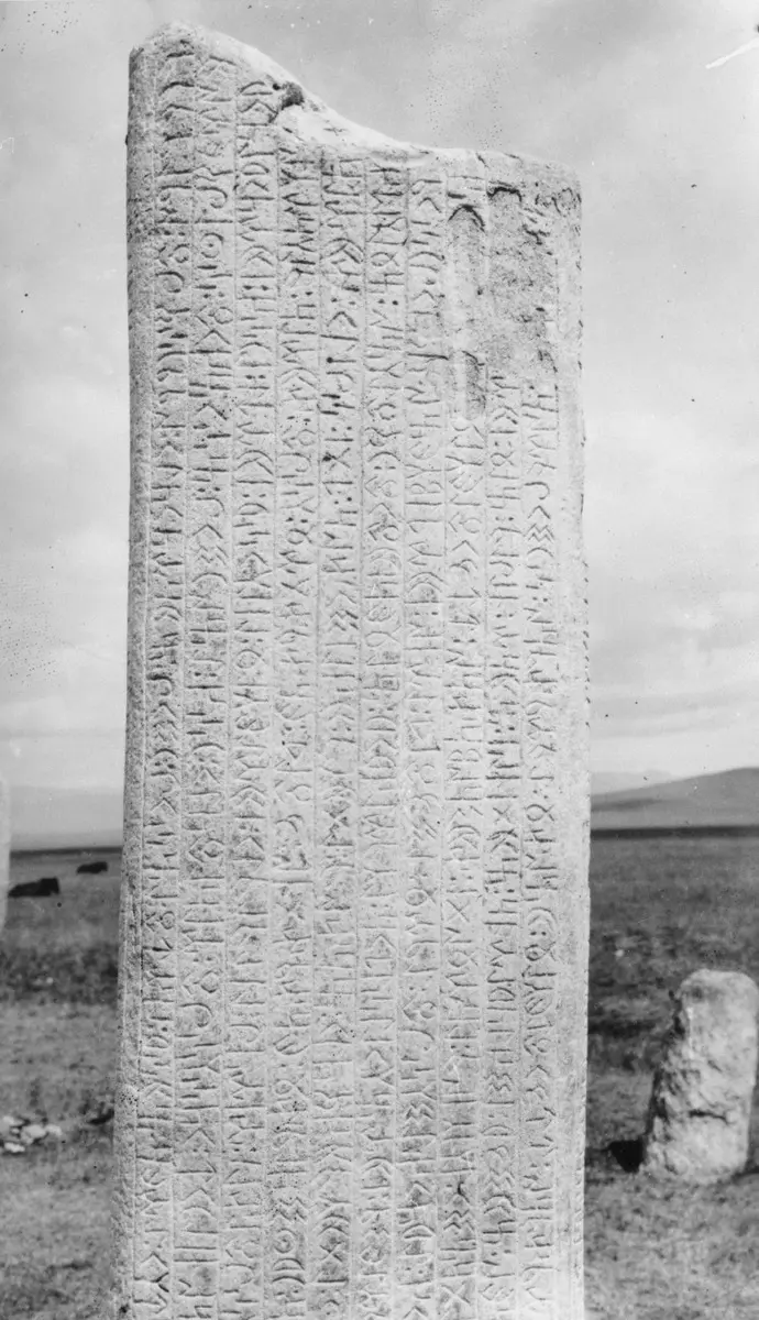
The upper part of the south face of the first Tonyukuk stone in the Nalaikh valley, photographed in June 1909. Photograph: G. J. Ramstedt and Sakari Pälsi, 1909, Finnish Heritage Agency, CC BY 4.0. Metin içinde Yer aldığı yer: Tonyukuk, Tonyukuk Yazıtı
-
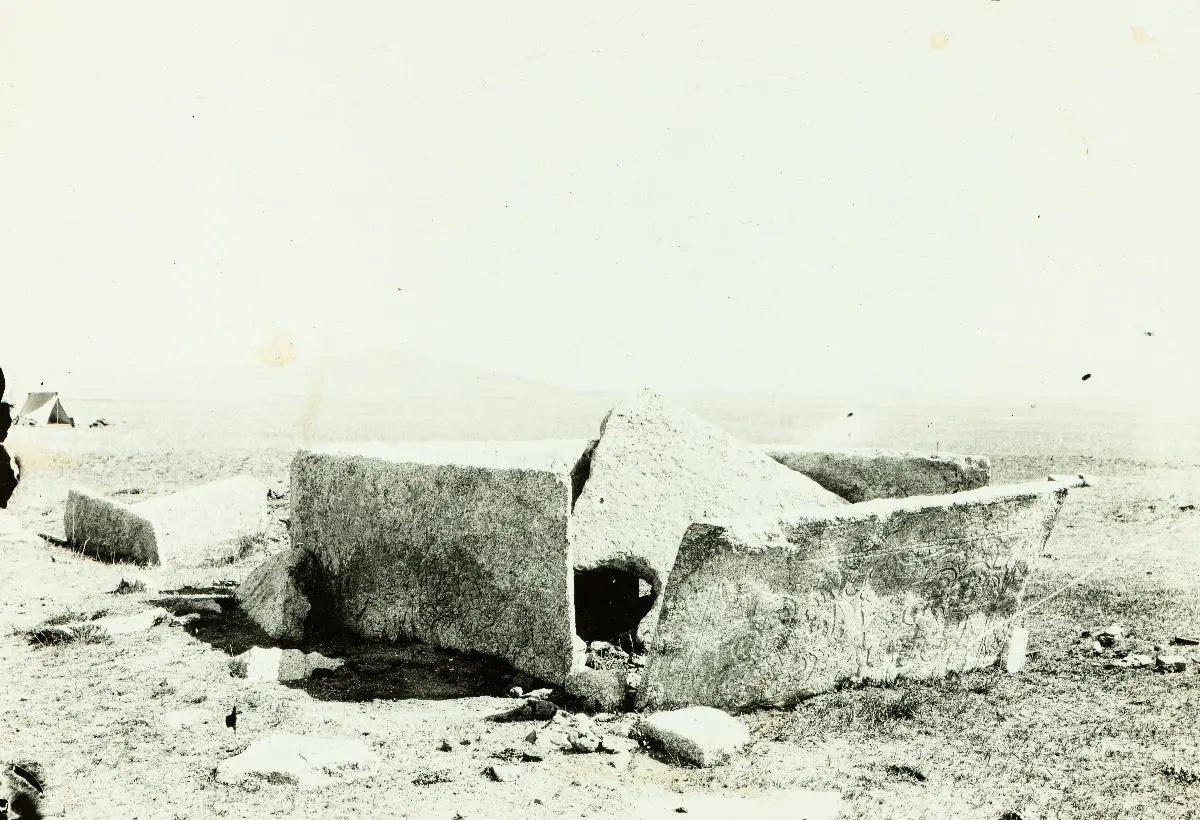
The stone coffin at the Tonyukuk tomb, seen from the southwest, in 1909. Photograph: Sakari Pälsi, 1909, Finnish Heritage Agency, CC BY 4.0. Metin içinde Yer aldığı yer: Tonyukuk, Tonyukuk Yazıtı
-
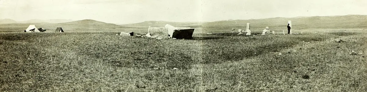
The Tonyukuk tomb, seen from the southwest corner of its earth bank, in 1909. Photograph: Sakari Pälsi, 1909, Finnish Heritage Agency, CC BY 4.0. Metin içinde Yer aldığı yer: Tonyukuk Yazıtı
-
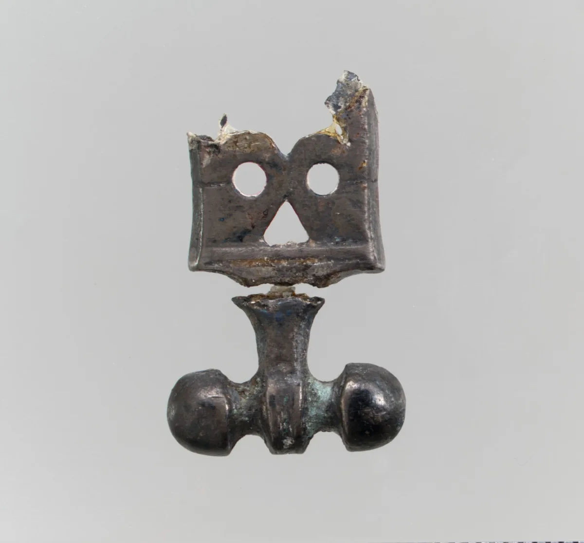
Silver belt ornament, Avar or Byzantine work, about 575. The Metropolitan Museum of Art, New York, 17.191.179, CC0. Metin içinde Yer aldığı yer: Avrupa'daki Türk boyları
-
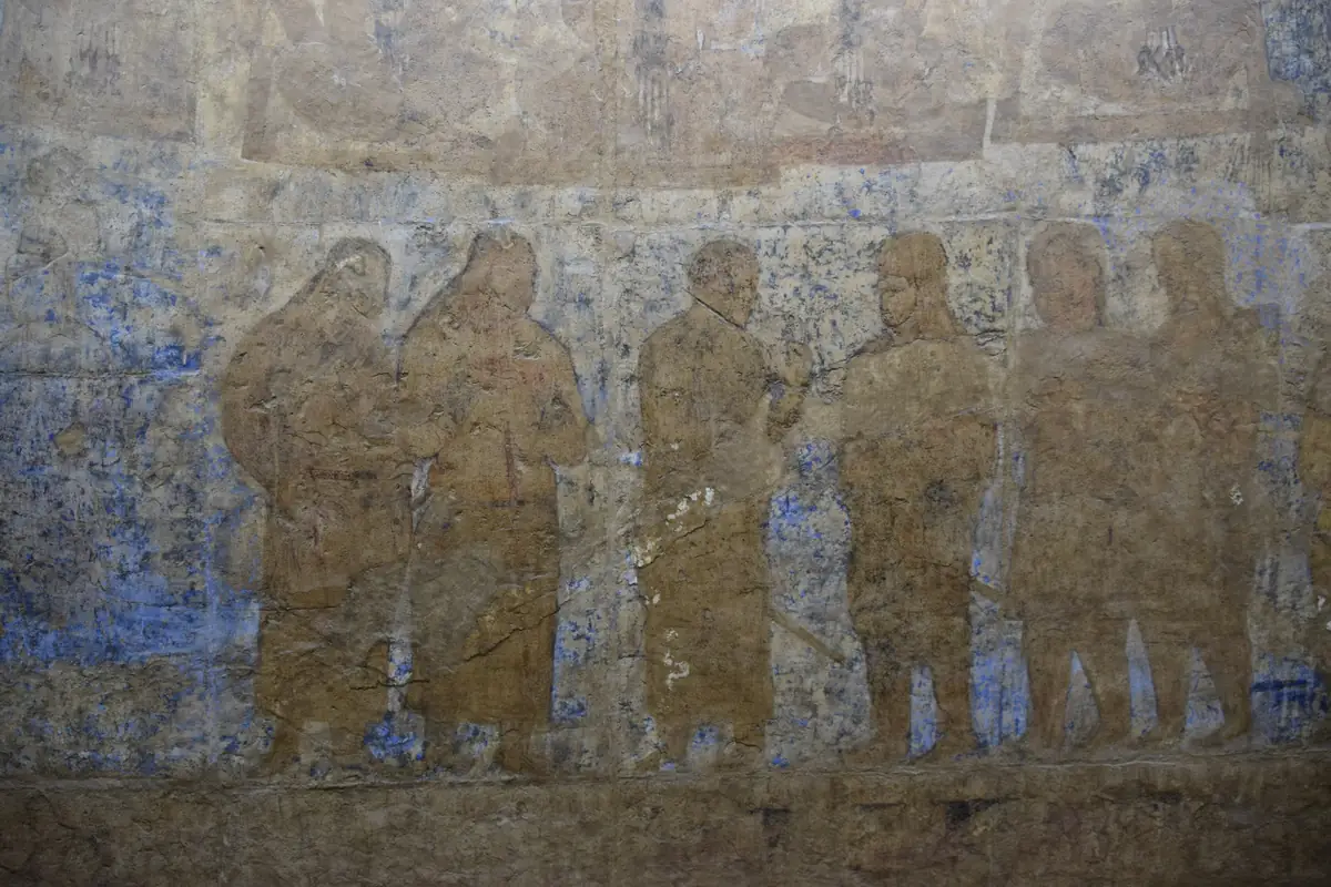
West wall of the Hall of the Ambassadors at Afrasiab, Samarkand, middle of the seventh century: a row of standing figures in long coats. Above them runs the lower edge of the seated figures with long plaits whom the museum’s drawing of the wall marks as Turkic guards. Photograph: Jean Housen, 2023, CC BY-SA 4.0. Metin içinde Yer aldığı yer: Turkic-Sogdian Synthesis
-
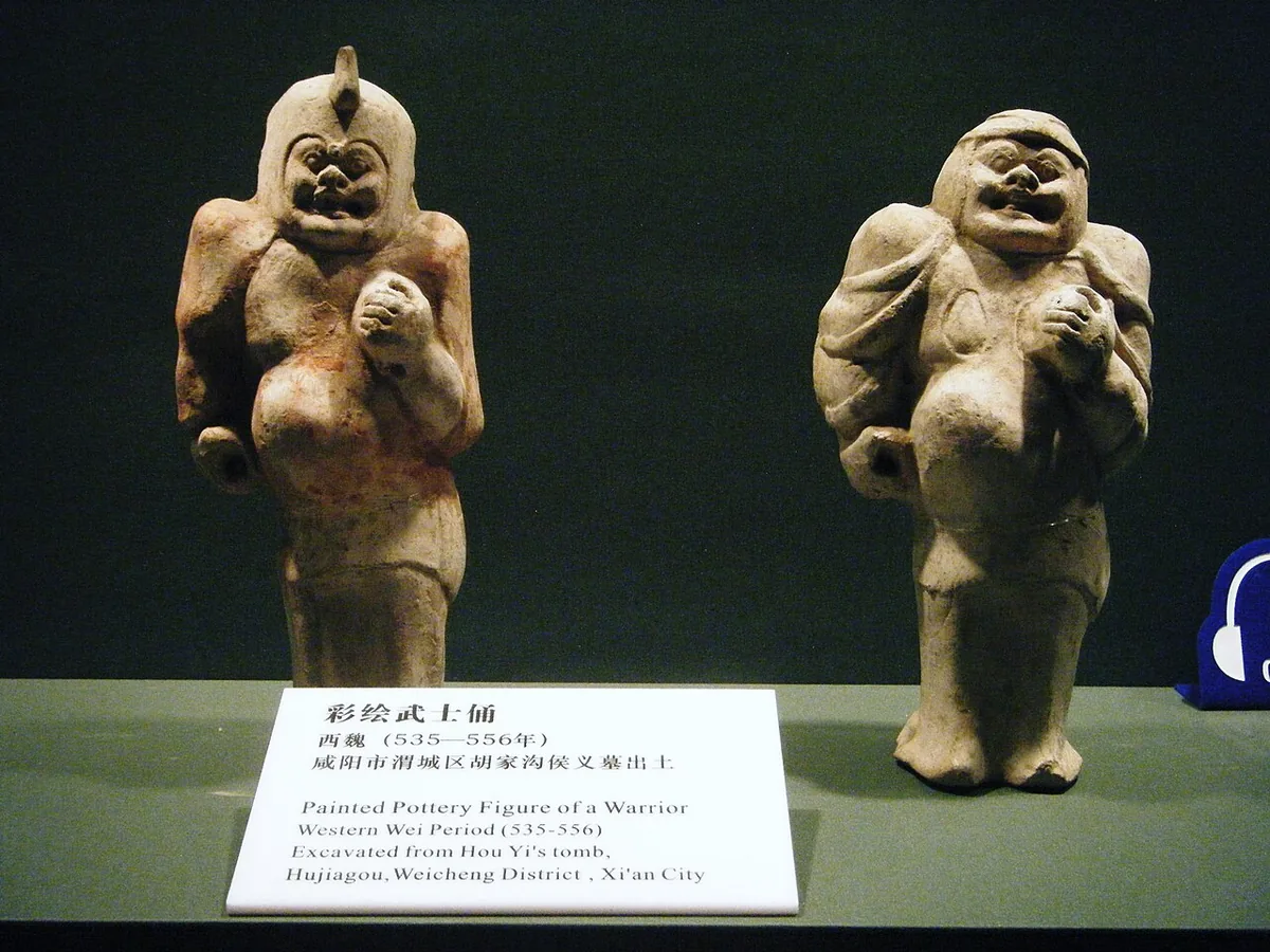
Two painted pottery warriors from the tomb of Hou Yi at Hujiagou in Xianyang, a burial of the Western Wei period in the country round Chang'an, now in the Shaanxi History Museum in Xi'an. Photograph: Hugh Llewelyn, 2009, CC BY-SA 2.0. Metin içinde Yer aldığı yer: Batı Wei
-
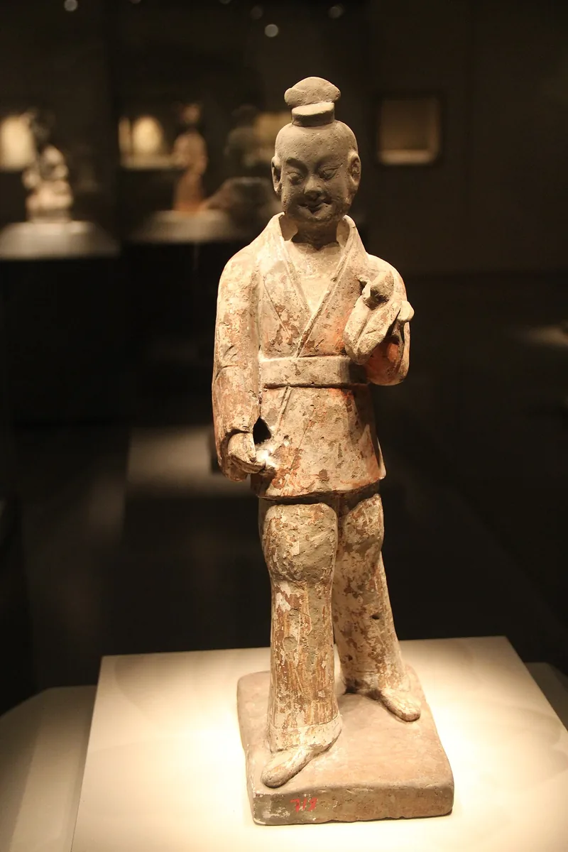
Pottery figure of a military official of the Western Wei period in the National Museum of China, Beijing. Photograph: Gary Todd, 2011, CC0. Metin içinde Yer aldığı yer: Batı Wei
-
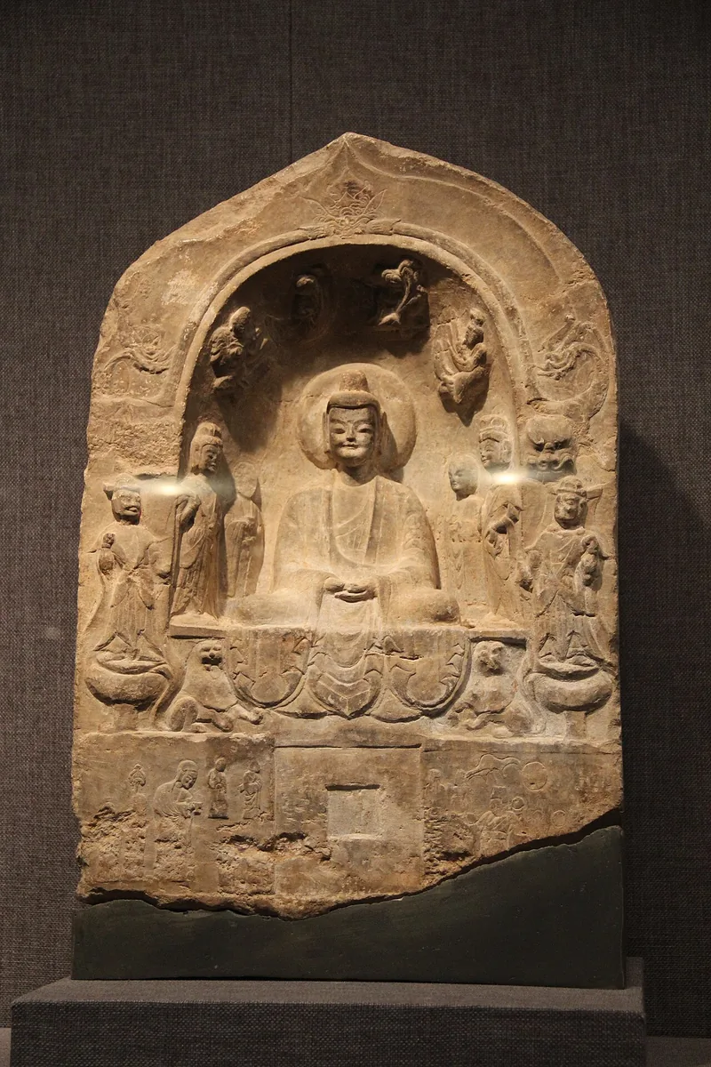
Buddhist stele of the Western Wei period, a seated Buddha between attendants, in the Beilin Museum in Xi'an, the city that was Chang'an. Photograph: Gary Todd, 2011, CC0. Metin içinde Yer aldığı yer: Batı Wei
-
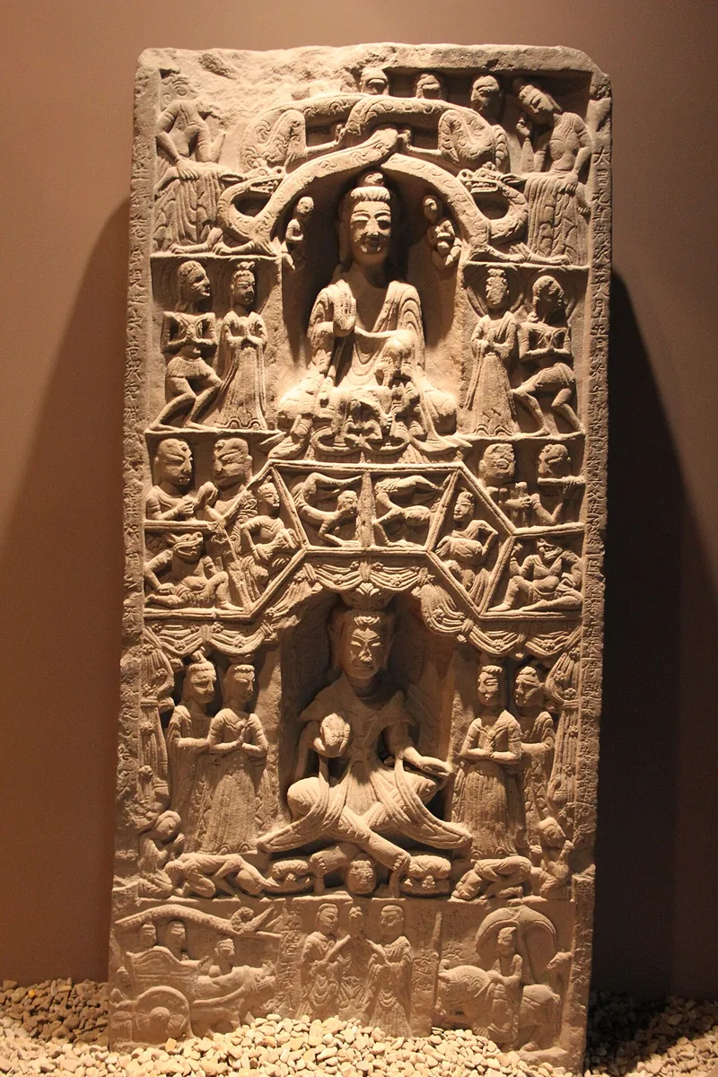
Buddhist stele of the Western Wei period, carved in registers with two seated Buddhas and scenes in relief, in the Xi'an Museum. Photograph: Gary Todd, 2011, CC0. Metin içinde Yer aldığı yer: Batı Wei
-
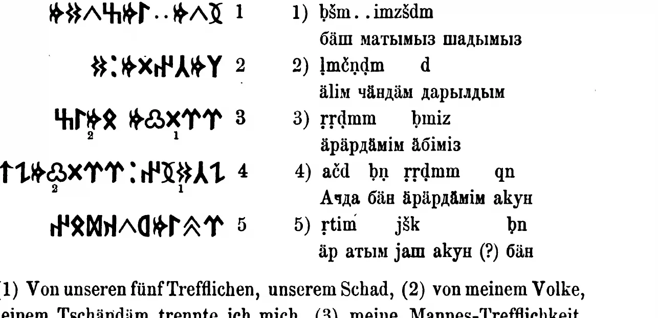
The Ujuk-Archan inscription from the upper Yenisei in runiform script, with transcription, as Wilhelm Radloff printed it in 1895. W. Radloff, Die alttürkischen Inschriften der Mongolei, St Petersburg 1895, p. 305. Public domain. Metin içinde Yer aldığı yer: Yenisey Kırgız Kağanlığı
-
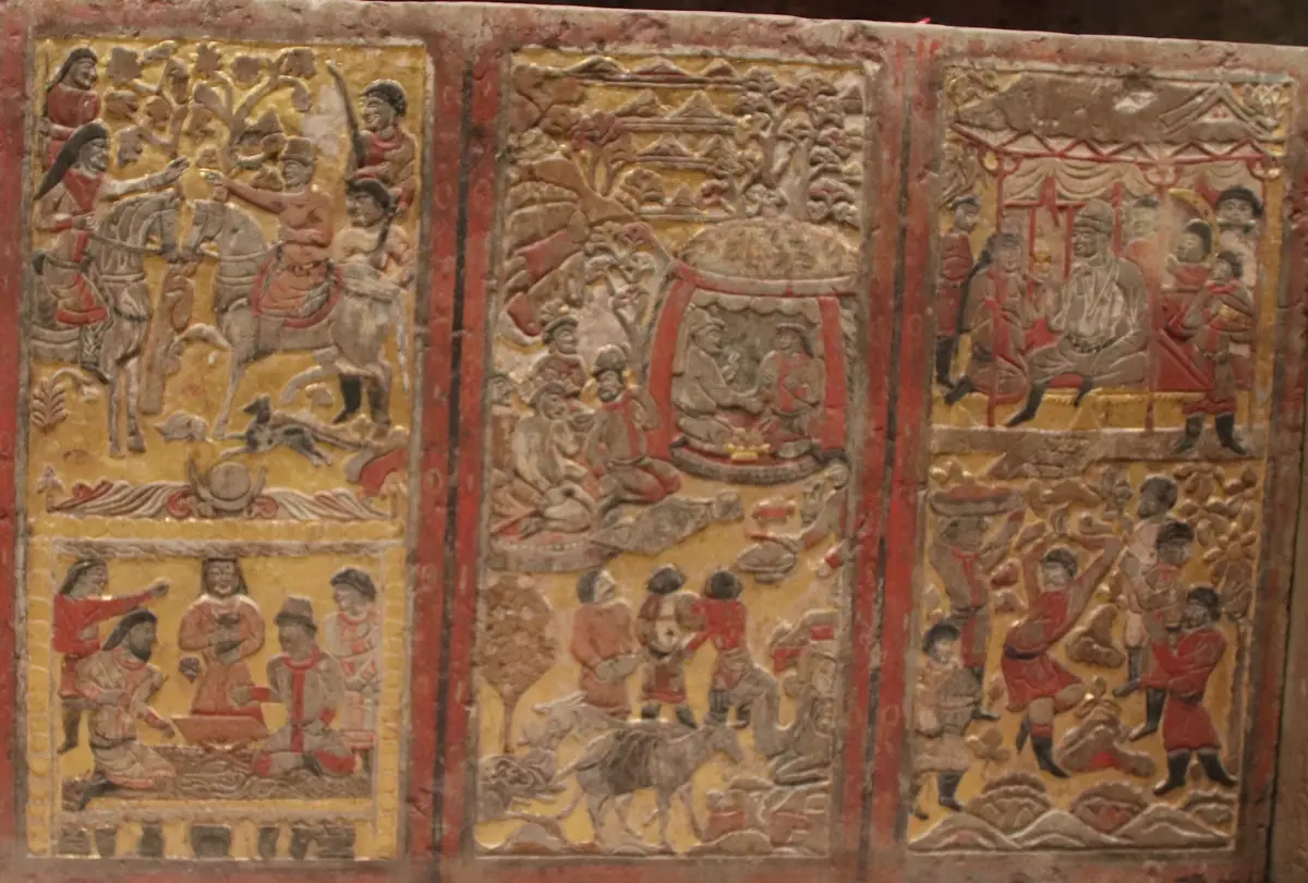
Bir okuma yolunun kapak görseli. Funerary couch of An Jia, a Sogdian sabao at the Zhou court who died in 579, three of its back panels: a meeting of riders and talks at a low table, a feast in a yurt with a laden camel below, a banquet with dancers. Shaanxi History Museum, Xi’an. Photograph: Gary Todd, 2019, CC0. Okuma yolu Yer aldığı yer: İstemi'nin Batı Yolculuğu
-
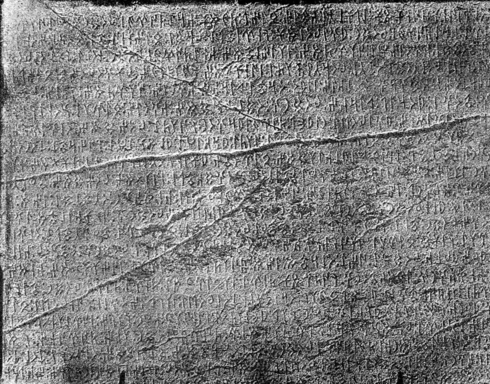
Bir okuma yolunun kapak görseli. Runes on the east face of the Kül Tegin stone, photographed by the Finnish expedition of 1890. Inscriptions de l’Orkhon, Helsingfors 1892, Tab. 4; National Library of Finland, Public domain. Okuma yolu Yer aldığı yer: Adlar, unvanlar ve iddialar
-
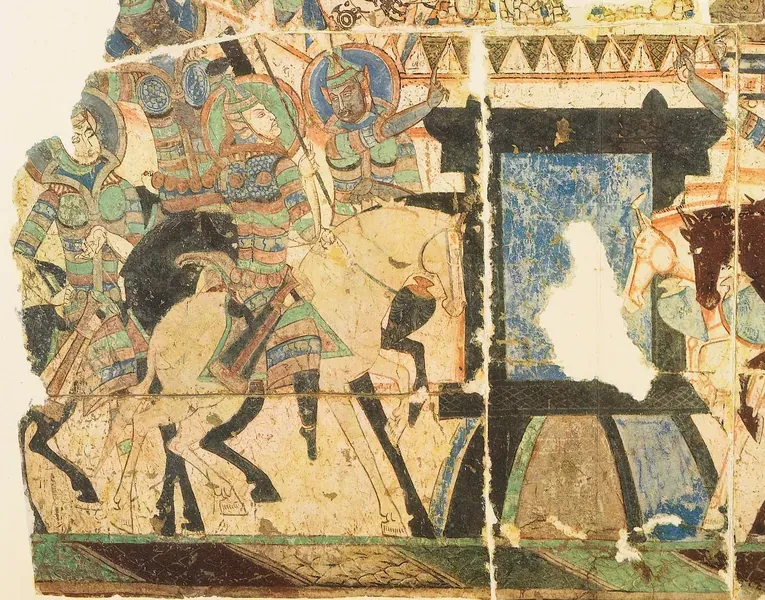
Bir okuma yolunun kapak görseli. Okuma yolu Yer aldığı yer: Birinci Göktürk İmparatorluğu'nun bölünmesi
-
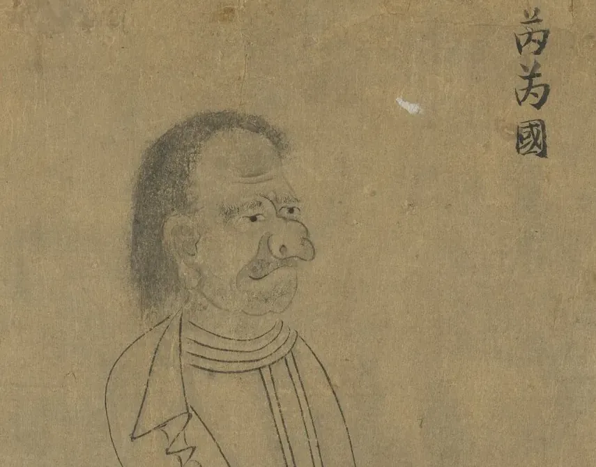
Bir okuma yolunun kapak görseli. Envoy of the Rouran, labelled 芮芮國, from a copy of Emperor Yuan of Liang’s “Foreign Visitors Coming to Court”. National Palace Museum, Taipei, 故畫001389N, CC BY 4.0 @ www.npm.gov.tw. Okuma yolu Yer aldığı yer: Rouran İmparatorluğu'nun yükselişi ve çöküşü
-
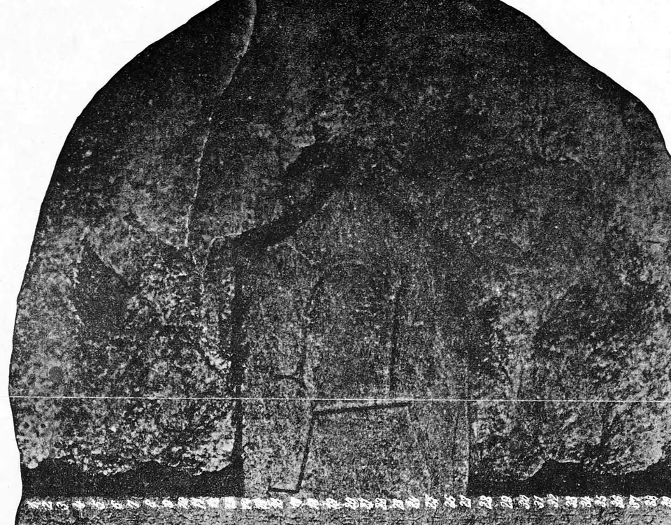
Bir okuma yolunun kapak görseli. Crown and upper runes of the Kül Tegin stone, photographed by the Finnish expedition of 1890. Inscriptions de l’Orkhon, Helsingfors 1892, Tab. 2; National Library of Finland, Public domain. Okuma yolu Yer aldığı yer: Göktürklerin Çöküşü
-
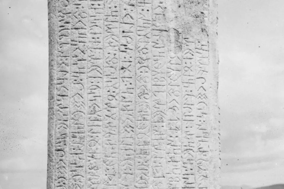
Bir okuma yolunun kapak görseli. Upper part of the south face of the first Tonyukuk stone, photographed in June 1909 by G. J. Ramstedt and Sakari Pälsi (cropped). Finnish Heritage Agency, VKK532:464, CC BY 4.0. Okuma yolu Yer aldığı yer: Göktürklerin Yeniden Doğuşu
-
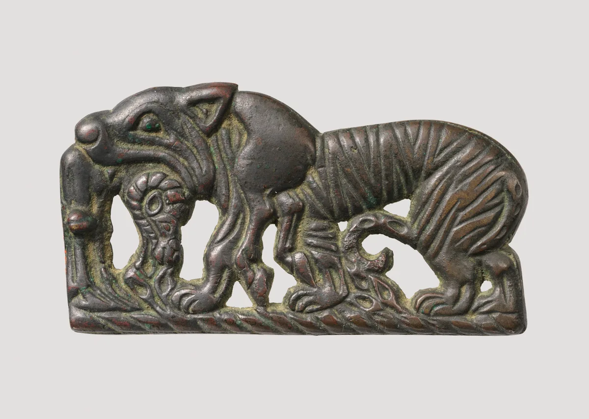
Bir okuma yolunun kapak görseli. The Metropolitan Museum of Art, New York, 49.132, Rogers Fund, 1949. Open Access, public domain (CC0). Okuma yolu Yer aldığı yer: Asya Hunları
-
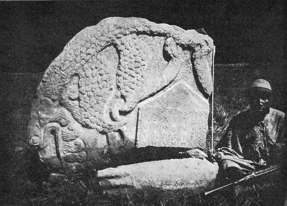
Bir okuma yolunun kapak görseli. Fragment of the dragon crown of the Karabalghasun stone, photographed by the Finnish expedition of 1890. Inscriptions de l’Orkhon, Helsingfors 1892, Tab. 46; National Library of Finland, Public domain. Okuma yolu Yer aldığı yer: Uygurlar ve Kırgızlar
Modern tasvirler
Günümüzün çizimleri, rekonstrüksiyonları ve resimleri.
Ana görsel 64 · Metin içinde 12 · Okuma yolu 6 · Türk Töresi 1 · Sayfa 1
-
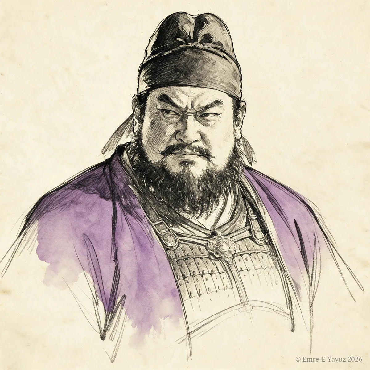
An Lushan in a modern portrait. © Emre-E Yavuz 2026 Ana görsel Yer aldığı yer: An Lushan
-

Anagui in a modern portrait. © Emre-E Yavuz 2026 Ana görsel Yer aldığı yer: Anagui
-
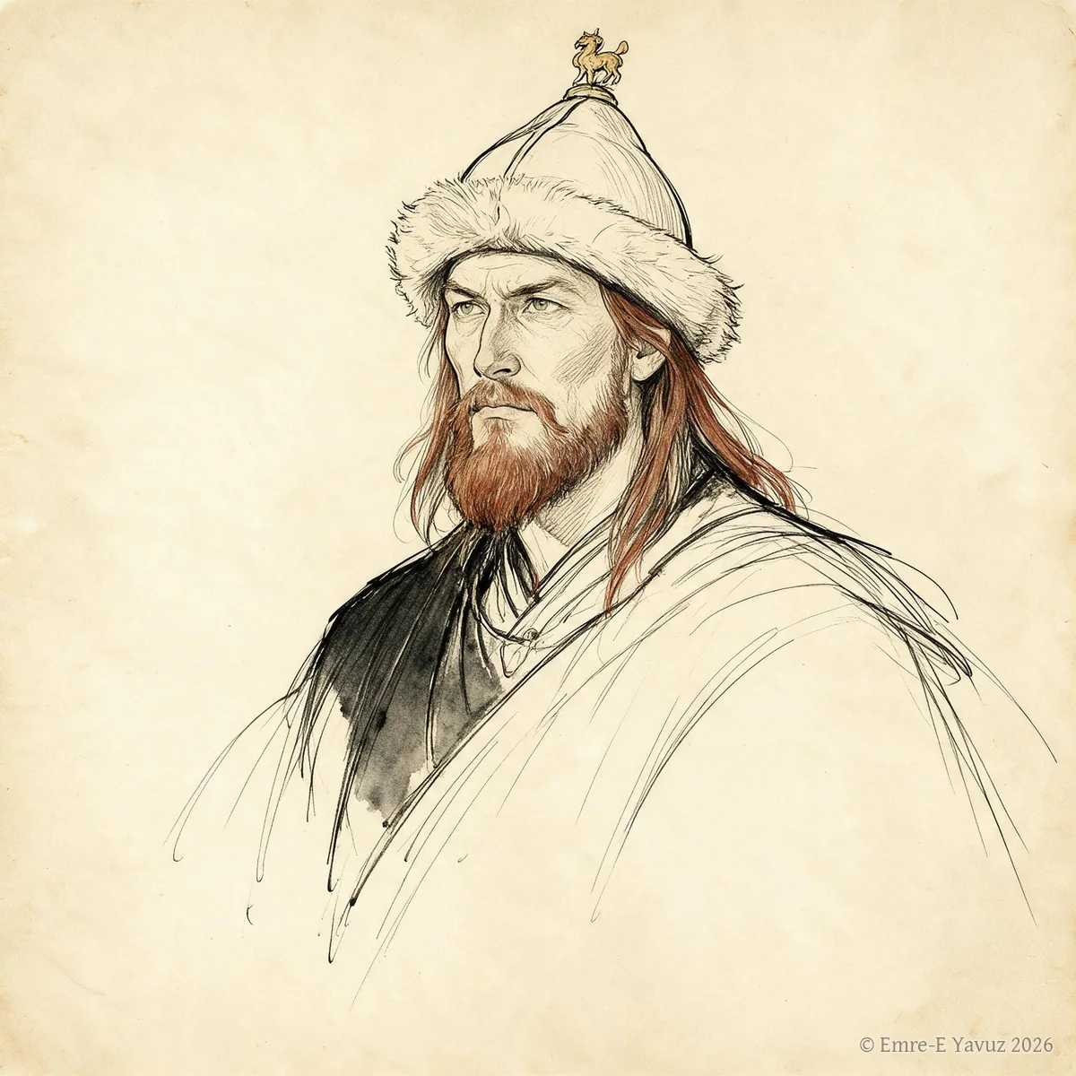
Are Khan in a modern portrait. © Emre-E Yavuz 2026 Ana görsel Yer aldığı yer: Are Kağan
-
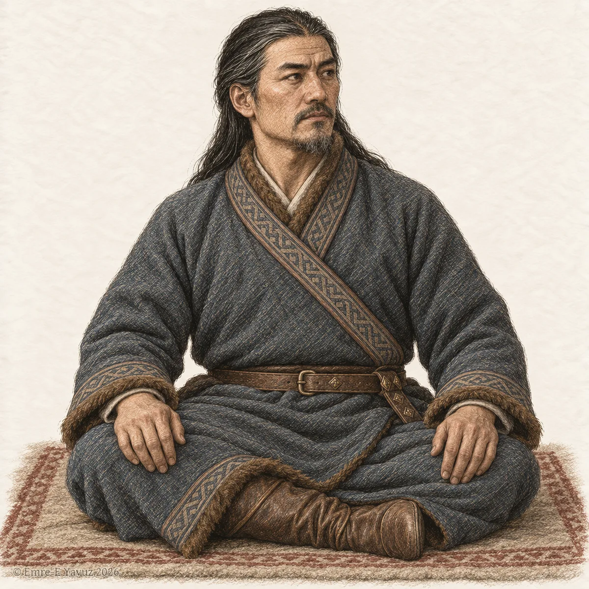
A Göktürk nobleman seated on a felt rug, in a modern drawing. © Emre-E Yavuz 2026 Ana görsel Yer aldığı yer: Bağa
-

Bagatur in a modern portrait. © Emre-E Yavuz 2026 Ana görsel Yer aldığı yer: Bagatur (Modu Chanyu)
-
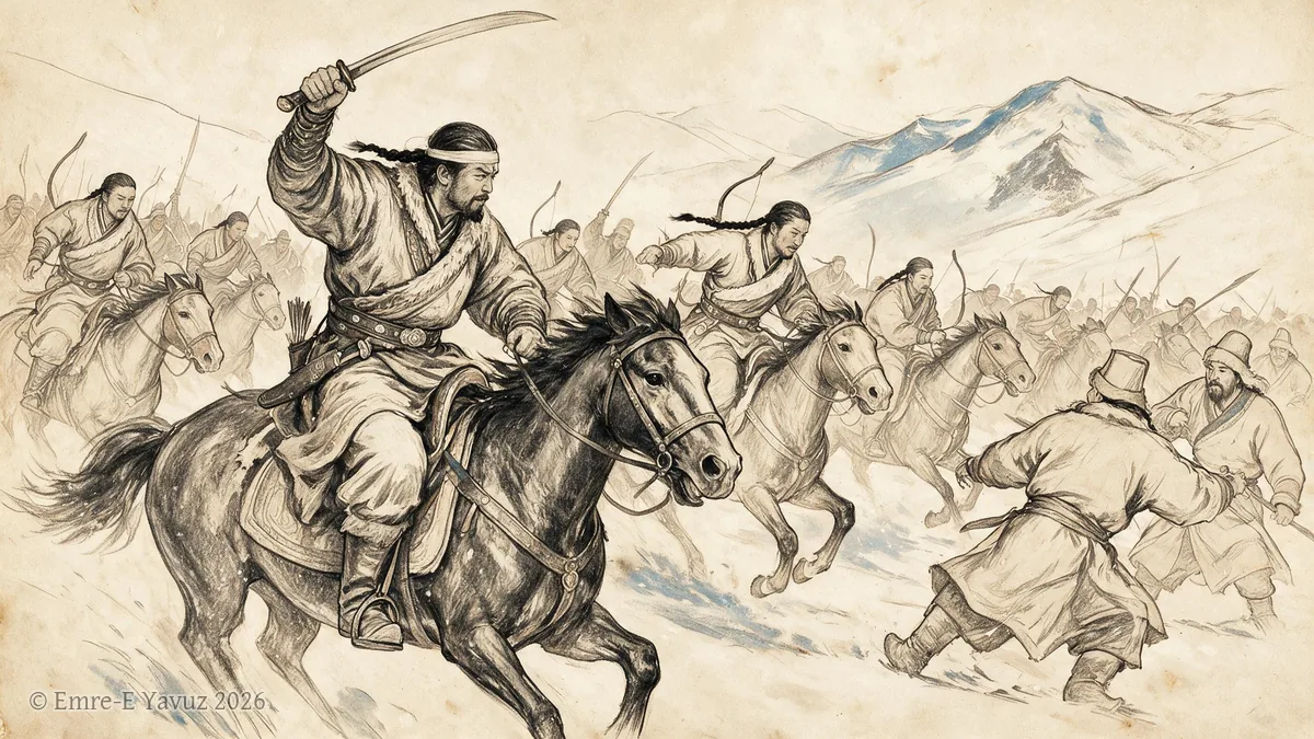
Battle of Dzungaria, 552 in a modern illustration. © Emre-E Yavuz 2026 Ana görsel Yer aldığı yer: Cungarya Muharebesi, 552
-
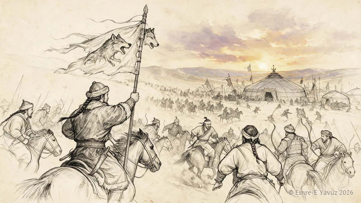
Battle of Huaihuang, 552 in a modern illustration. © Emre-E Yavuz 2026 Ana görsel Yer aldığı yer: Huaihuang Muharebesi, 552
-
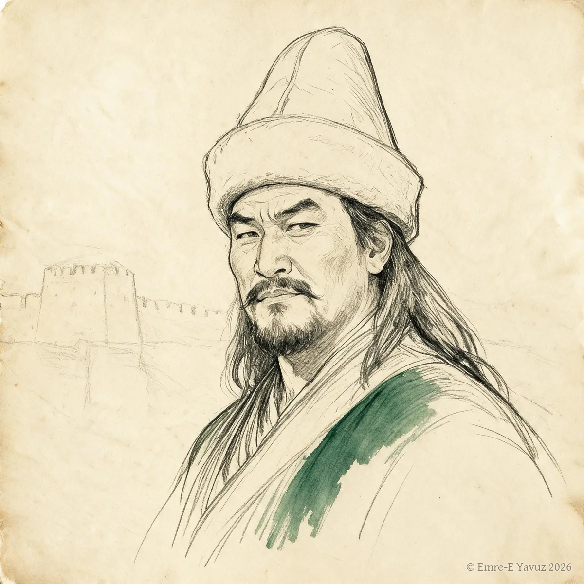
Bayanchur Khan in a modern portrait. © Emre-E Yavuz 2026 Ana görsel Yer aldığı yer: Bayanchur Khan
-
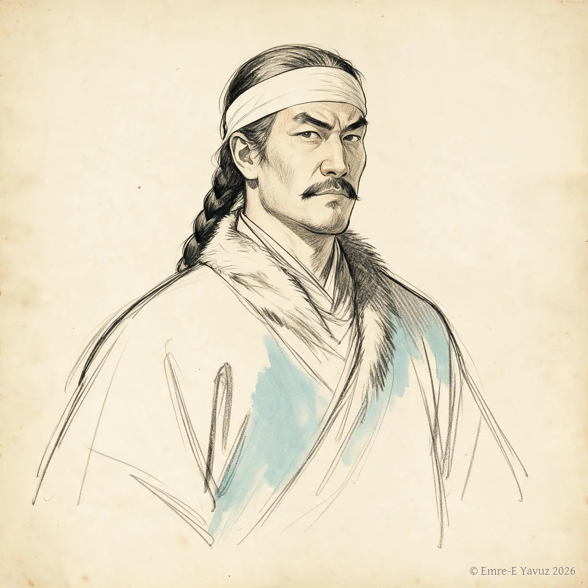
Bilge Khan in a modern drawing. © Emre-E Yavuz 2026 Ana görsel Yer aldığı yer: Bilge Kağan
-

Bumin Khan in a modern portrait. © Emre-E Yavuz 2026 Ana görsel Yer aldığı yer: Bumin Kağan
-
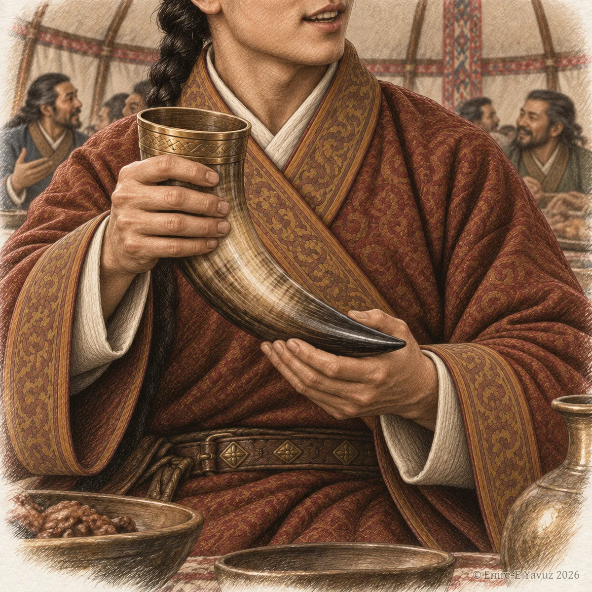
A holder of the title at a feast with a drinking horn, in a modern illustration. © Emre-E Yavuz 2026 Ana görsel Yer aldığı yer: Daluobian
-
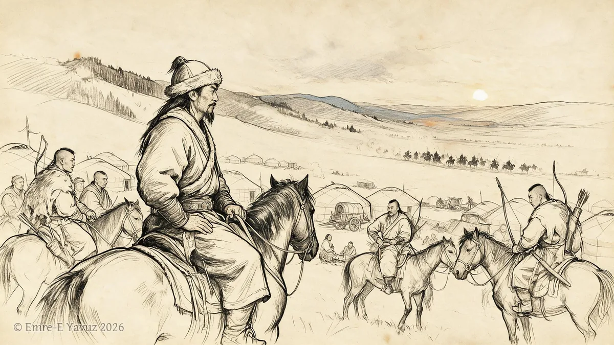
Donghu in a modern illustration. © Emre-E Yavuz 2026 Ana görsel Yer aldığı yer: Donghu
-
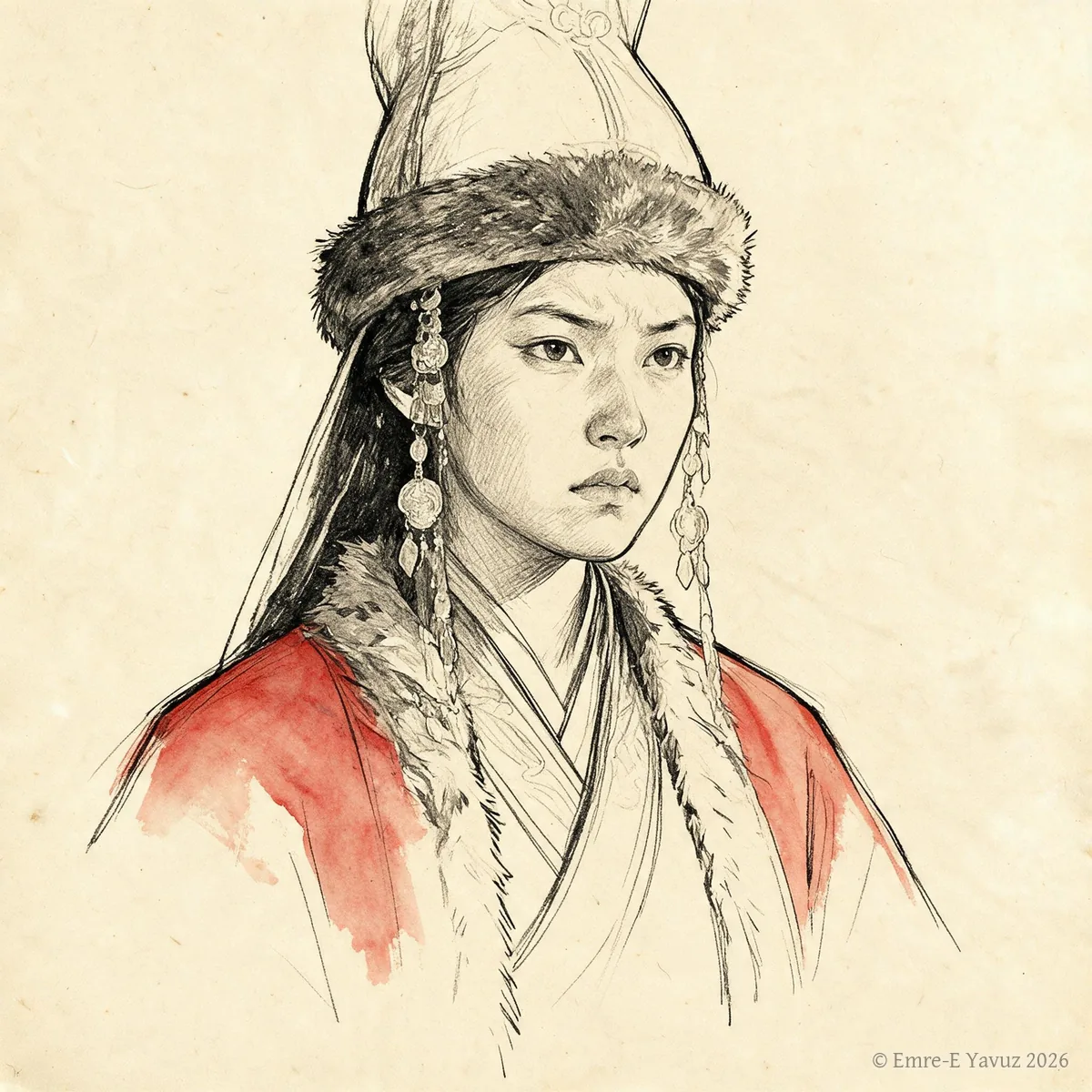
Empress Yujiulü in a modern portrait. © Emre-E Yavuz 2026 Ana görsel Yer aldığı yer: İmparatoriçe Yujiulü
-
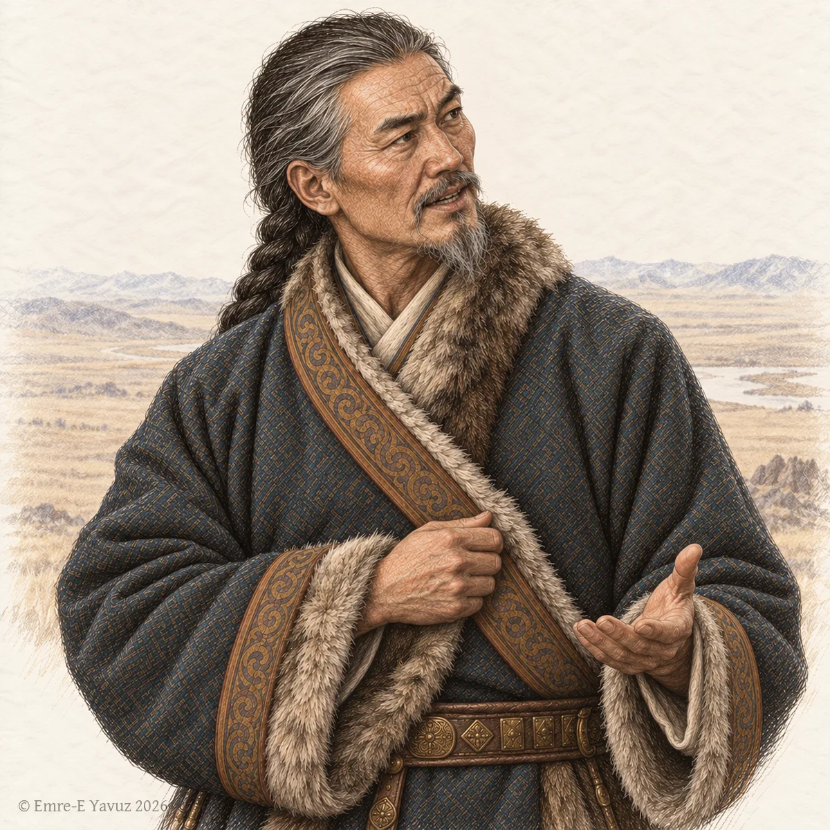
An elder officer of the khaganate in a modern illustration: the age that the title names. © Emre-E Yavuz 2026 Ana görsel Yer aldığı yer: Geli Daguan
-
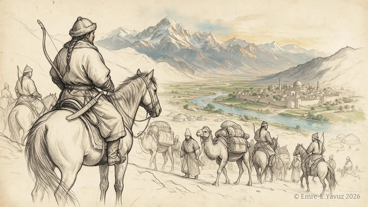
Göktürk Expansion along the Silk Road in a modern illustration. © Emre-E Yavuz 2026 Ana görsel Yer aldığı yer: Göktürklerin İpek Yolu Boyunca Yayılışı
-
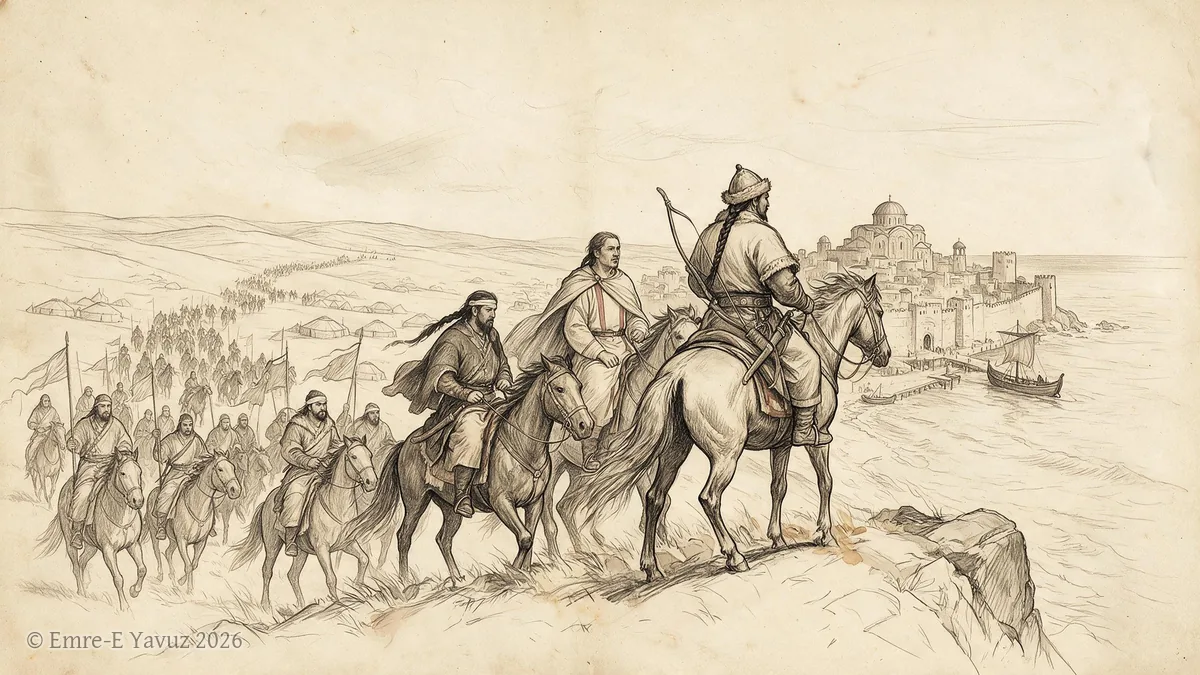
Göktürk Expansion into Europe in a modern illustration. © Emre-E Yavuz 2026 Ana görsel Yer aldığı yer: Göktürklerin Avrupa'ya Yayılışı
-
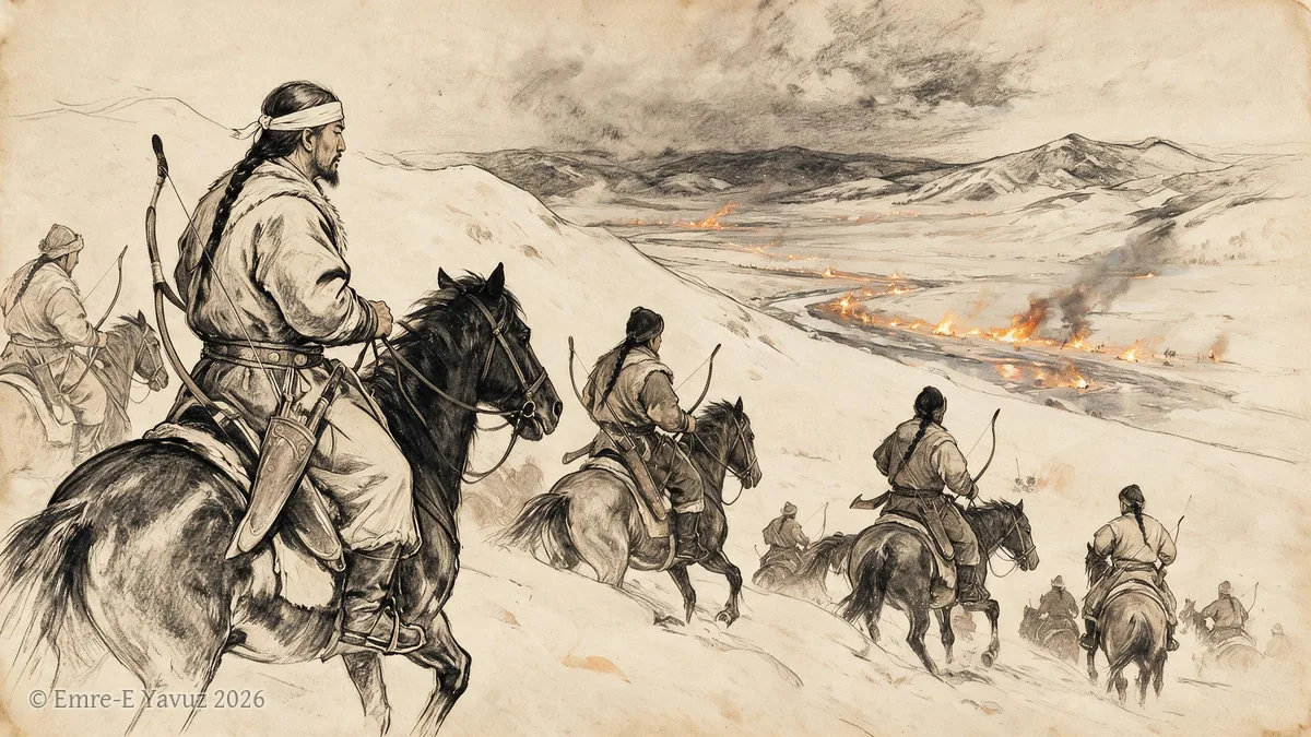
Göktürk raid of 542 in a modern illustration. © Emre-E Yavuz 2026 Ana görsel Yer aldığı yer: 542 Göktürk akını
-
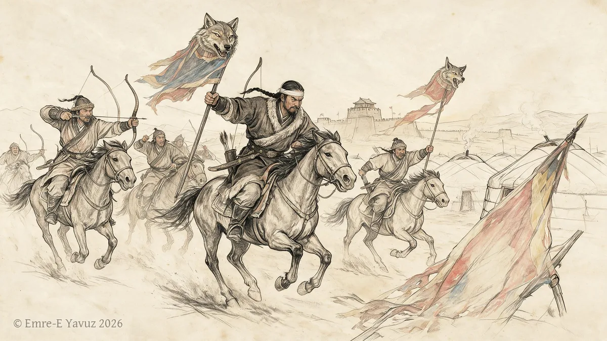
Göktürk war of restoration, 679–687 in a modern illustration. © Emre-E Yavuz 2026 Ana görsel Yer aldığı yer: Göktürk war of restoration, 679–687
-
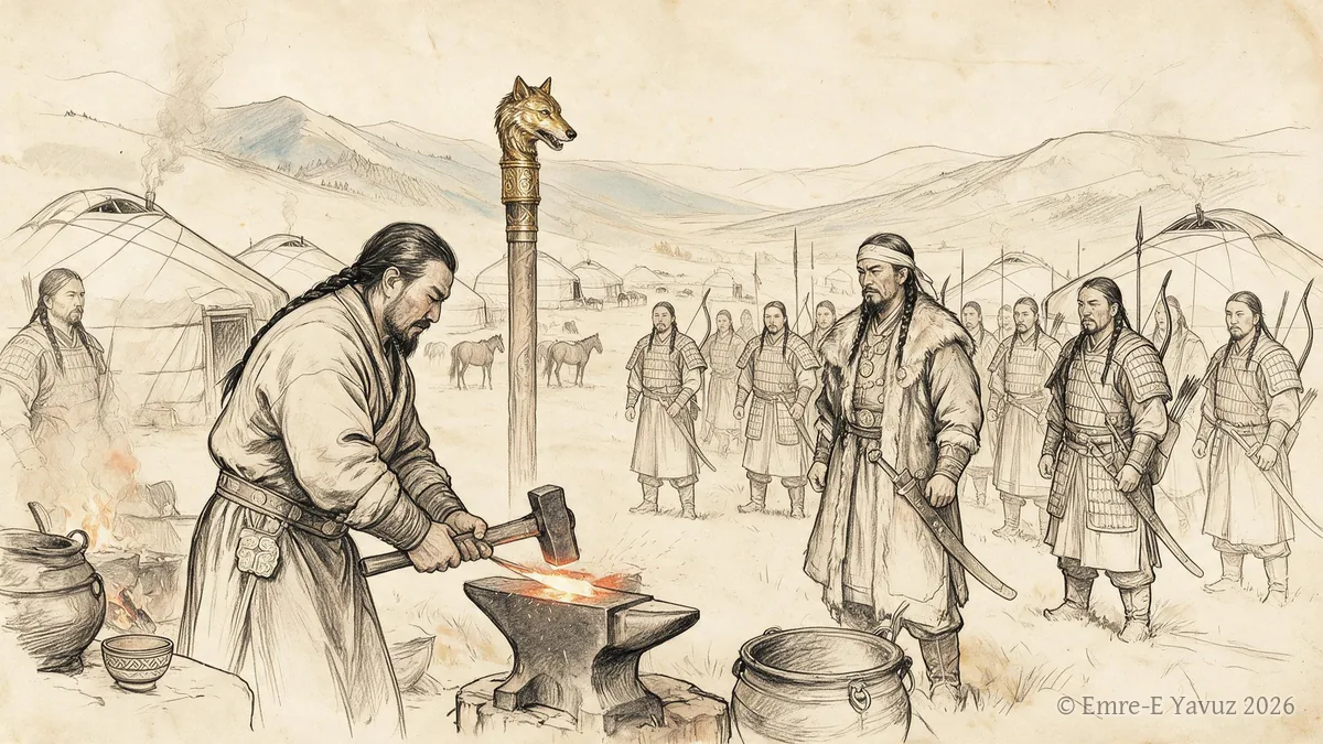
Göktürks in a modern illustration. © Emre-E Yavuz 2026 Ana görsel Yer aldığı yer: Göktürkler
-
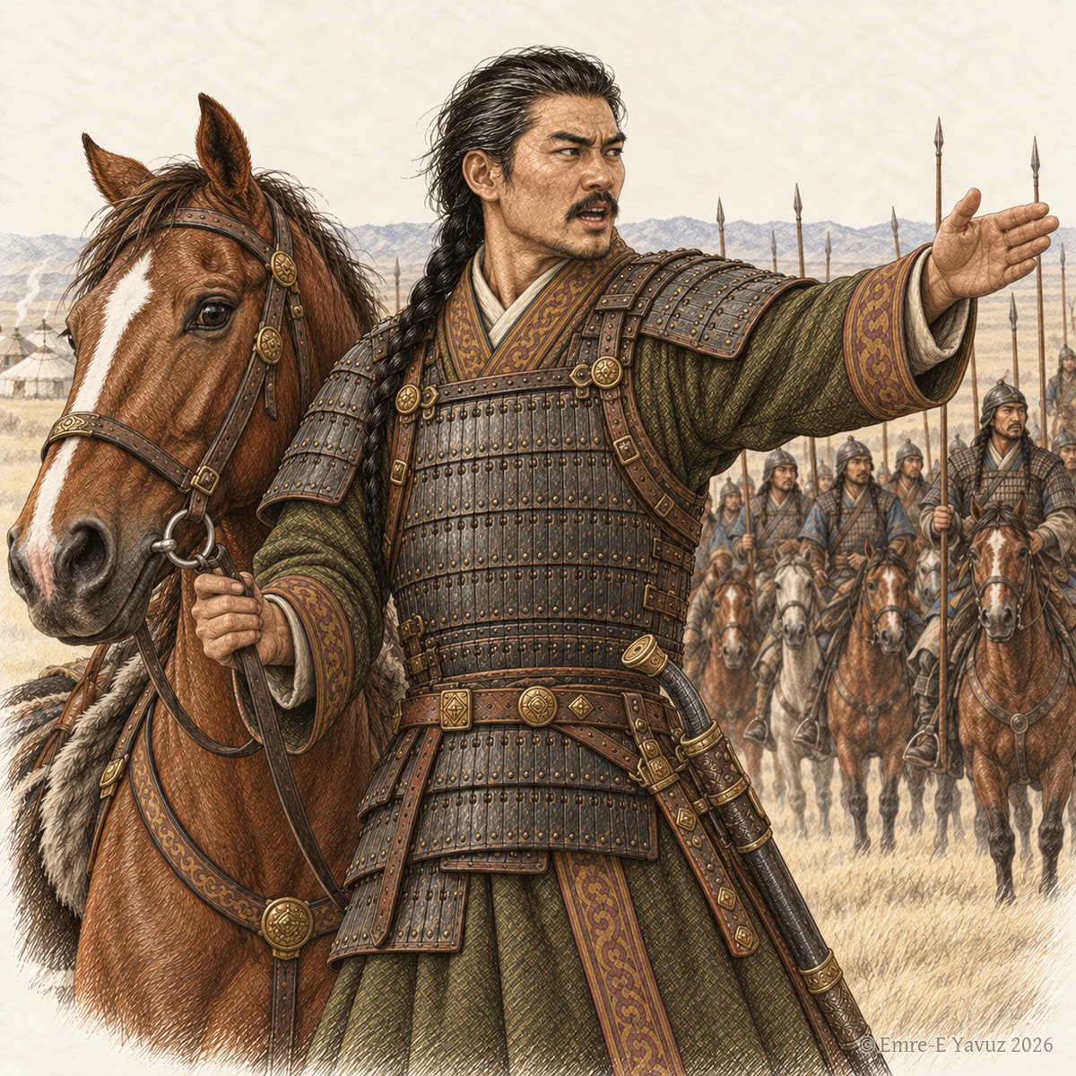
A commander with his horse before his riders, in a modern illustration: the horse and the command that the title names. © Emre-E Yavuz 2026 Ana görsel Yer aldığı yer: Helan Suni Que
-
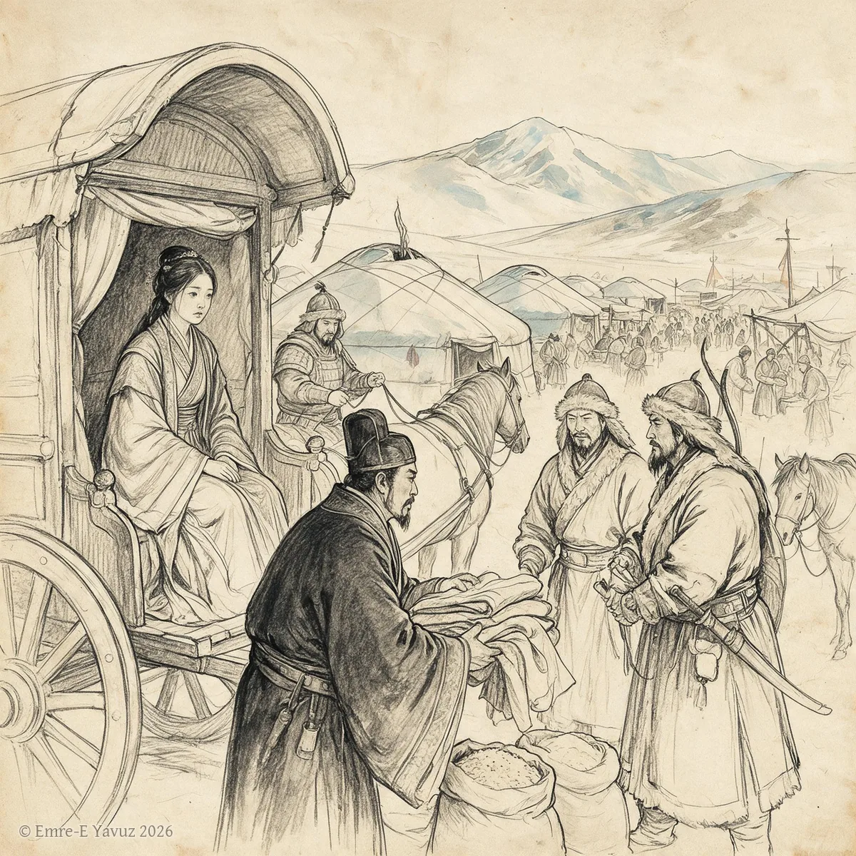
Heqin in a modern illustration. © Emre-E Yavuz 2026 Ana görsel Yer aldığı yer: Heqin
-
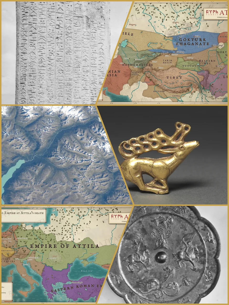
Runes of the Tonyukuk stone, the Göktürk realm in 552, the Altai from space, a Scythian gold stag, the empire of Attila in 453 and riders on a Tang bronze mirror. Photographs: G. J. Ramstedt and Sakari Pälsi, Finnish Heritage Agency (CC BY 4.0); NASA, astronaut photograph iss069e071176 (public domain); The Cleveland Museum of Art, 1985.77 (CC0); The Metropolitan Museum of Art, 25.20.3 (CC0). Maps: © Emre-E Yavuz 2026 Ana görsel Yer aldığı yer: Türk halklarının tarihi
-
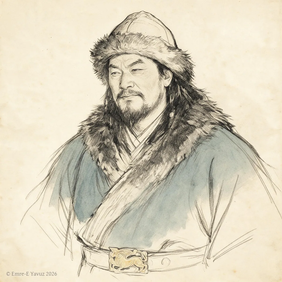
Huhanye Chanyu in a modern portrait. © Emre-E Yavuz 2026 Ana görsel Yer aldığı yer: Huhanye Chanyu
-
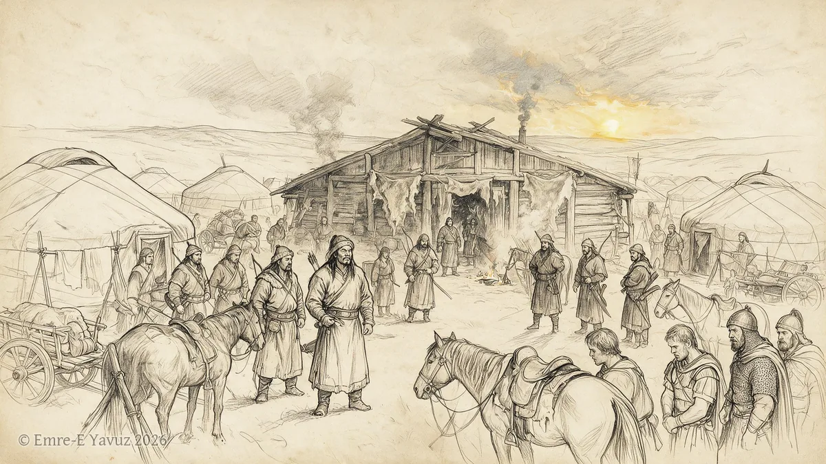
Huns in a modern illustration. © Emre-E Yavuz 2026 Ana görsel Yer aldığı yer: Hunlar
-
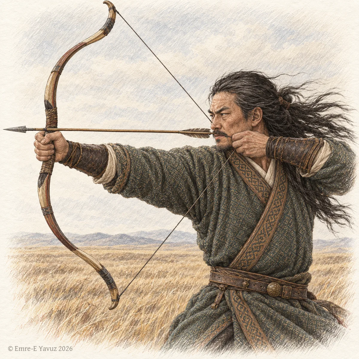
A Göktürk archer in a modern illustration: the strength and courage that the title names. © Emre-E Yavuz 2026 Ana görsel Yer aldığı yer: İşbara (Unvan)
-
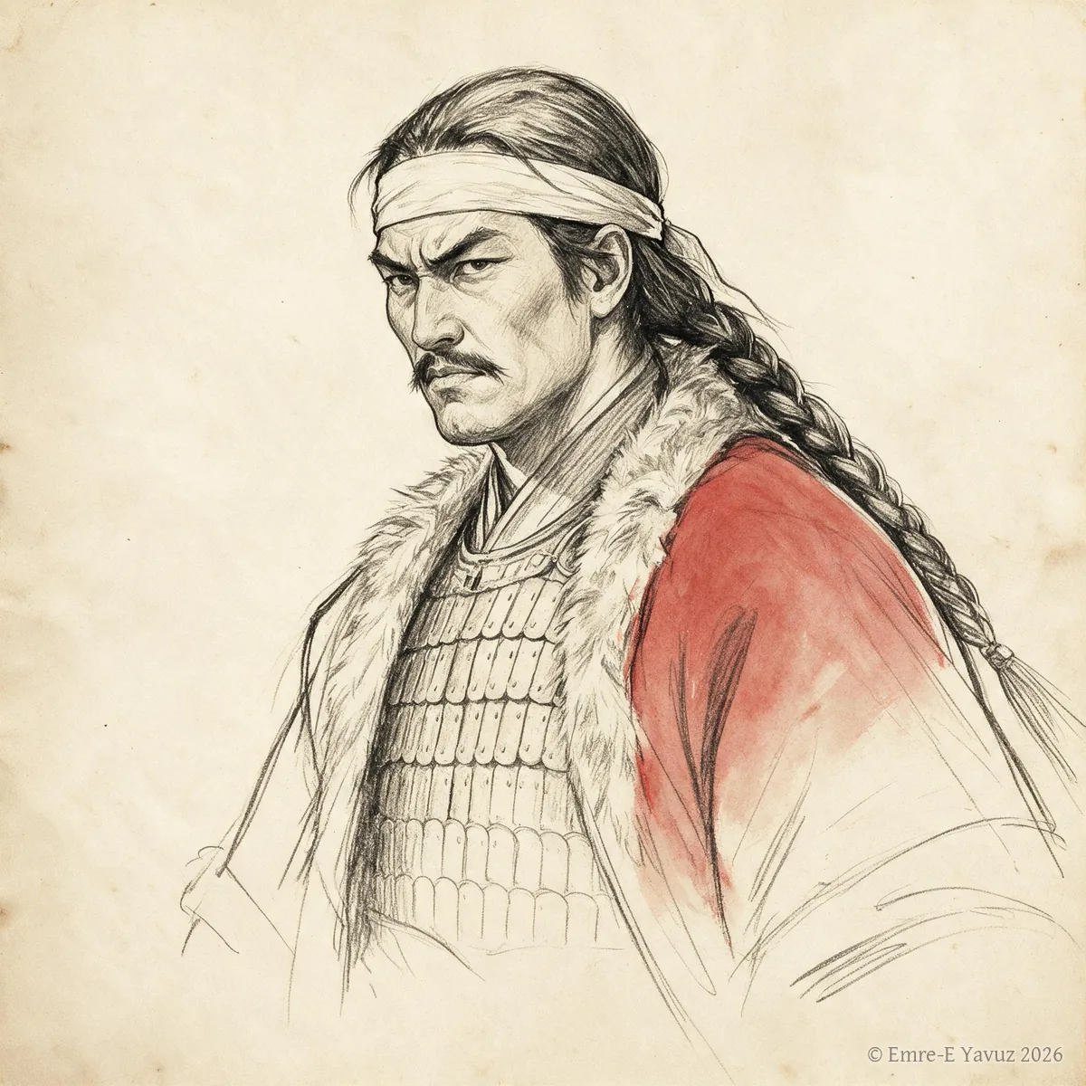
Issik Khan in a modern drawing. © Emre-E Yavuz 2026 Ana görsel Yer aldığı yer: Issık Kağan
-

Istemi in a modern portrait. © Emre-E Yavuz 2026 Ana görsel Yer aldığı yer: İstemi
-
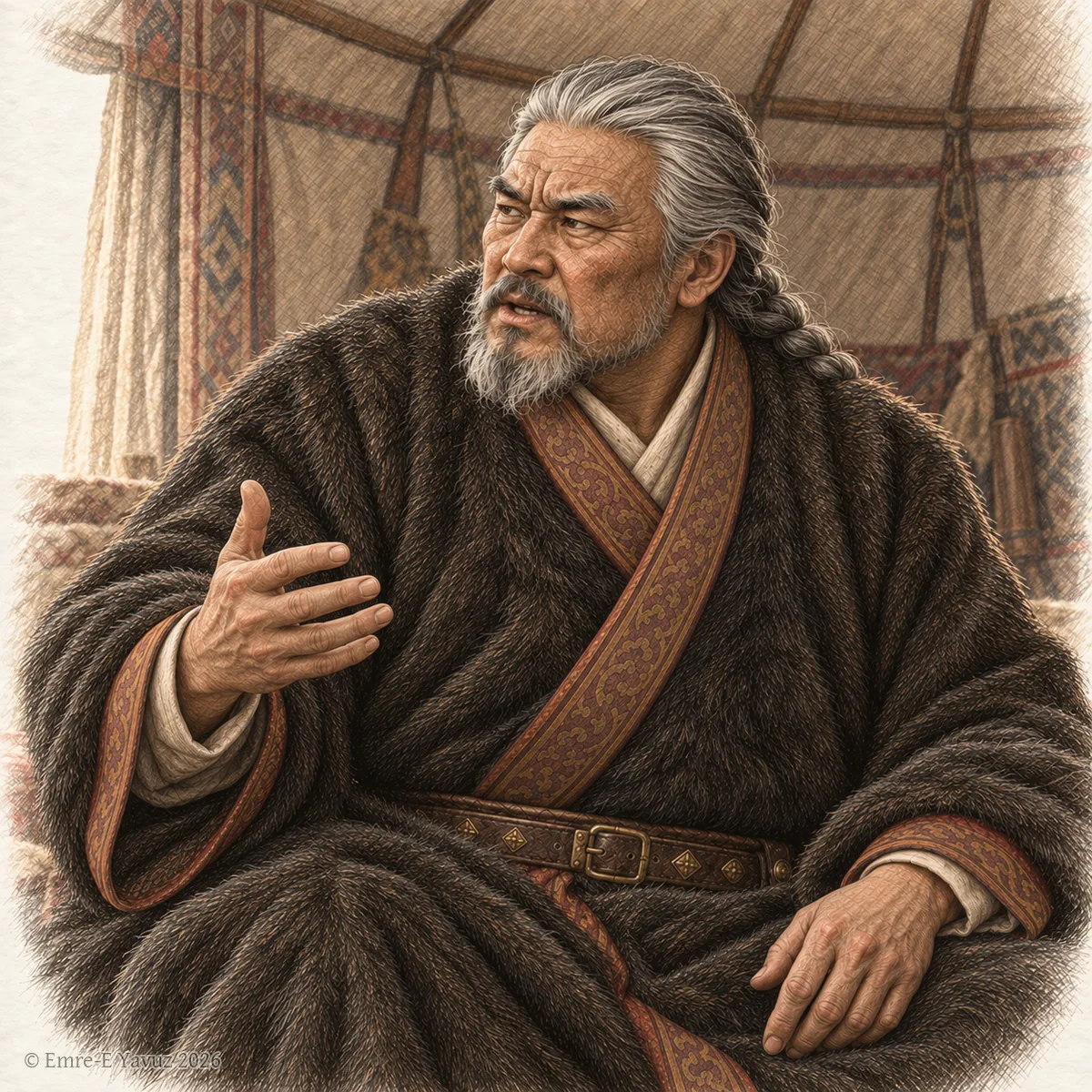
An aged dignitary in a modern illustration: the high office that men of great age held. © Emre-E Yavuz 2026 Ana görsel Yer aldığı yer: Keluo Chuo
-
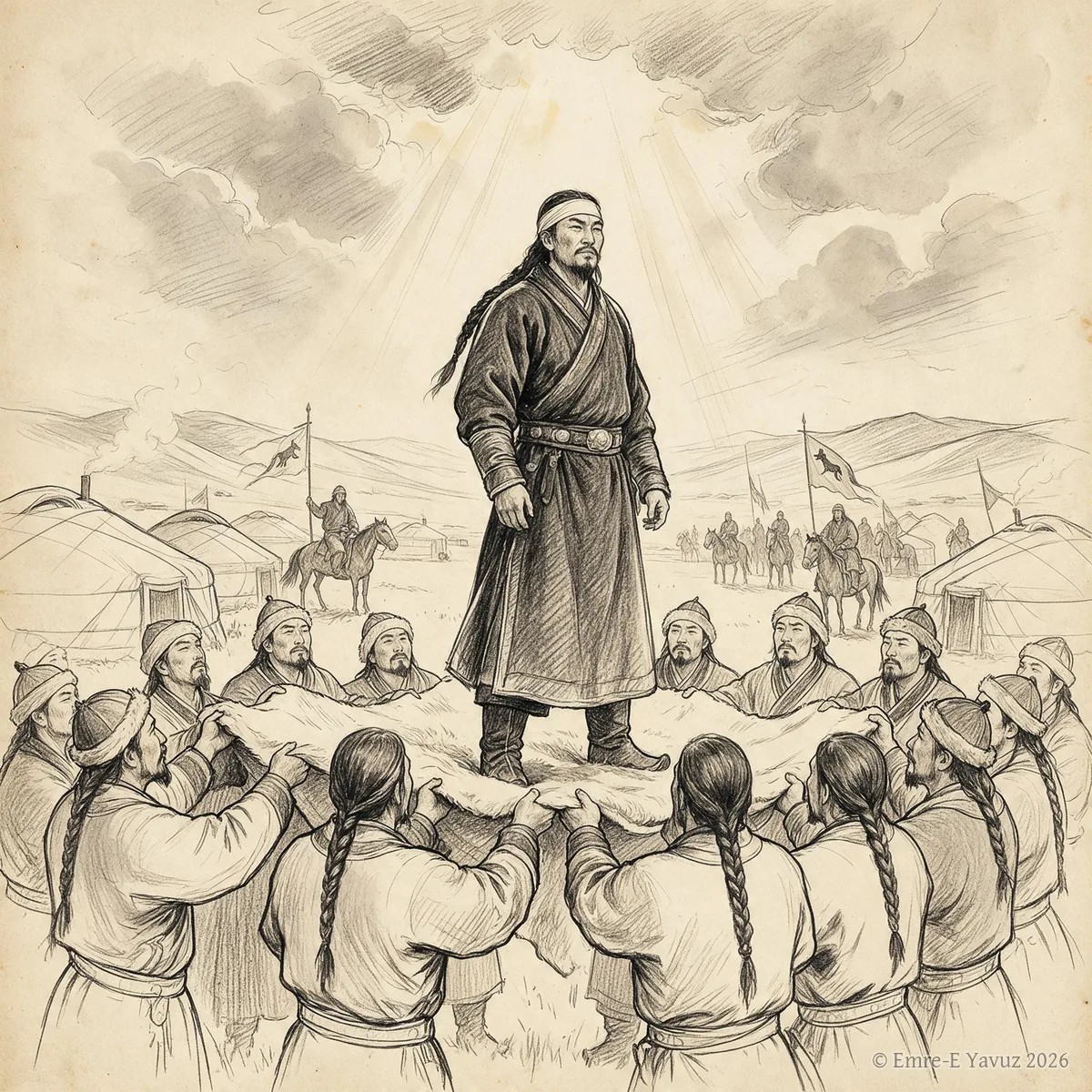
Khan (Khagan) in a modern illustration. © Emre-E Yavuz 2026 Ana görsel Yer aldığı yer: Han (Kağan)
-
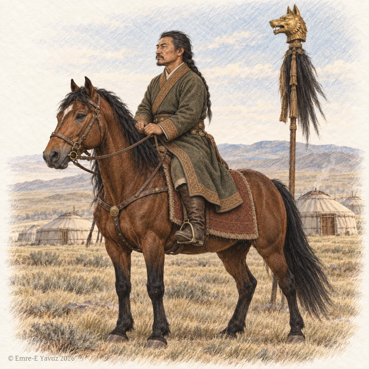
A Göktürk chur on horseback before a camp, with a golden wolf-head standard behind him, in a modern drawing. © Emre-E Yavuz 2026 Ana görsel Yer aldığı yer: Külüg Çor
-
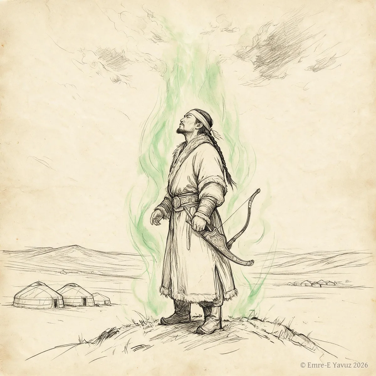
Kut in a modern illustration. © Emre-E Yavuz 2026 Ana görsel Yer aldığı yer: Kut
-
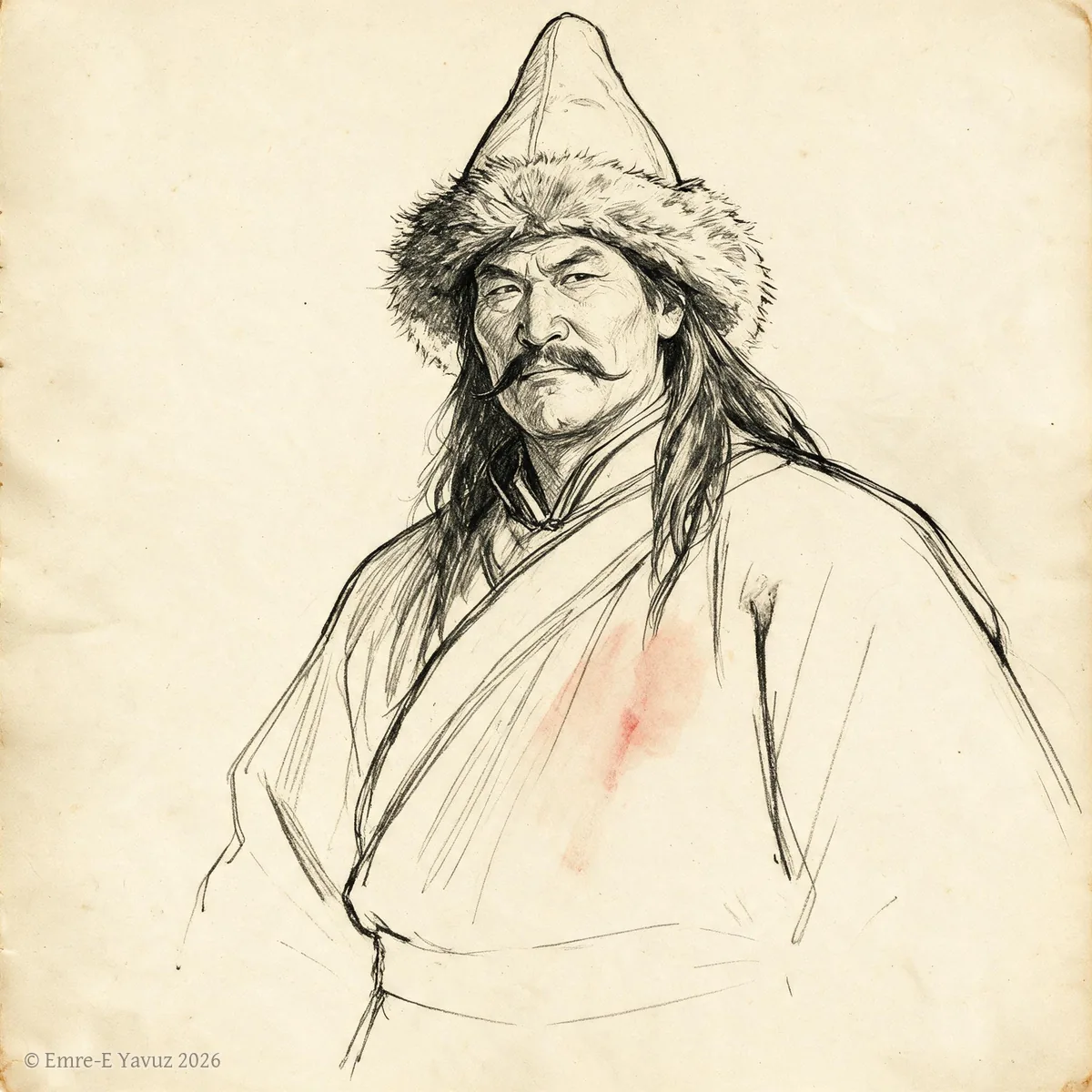
Kutlug Bilge Kül Khan in a modern portrait. © Emre-E Yavuz 2026 Ana görsel Yer aldığı yer: Kutlug Bilge Kül Khan
-
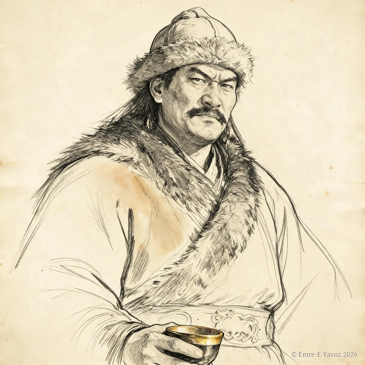
Laoshang Chanyu in a modern portrait. © Emre-E Yavuz 2026 Ana görsel Yer aldığı yer: Laoshang Chanyu
-
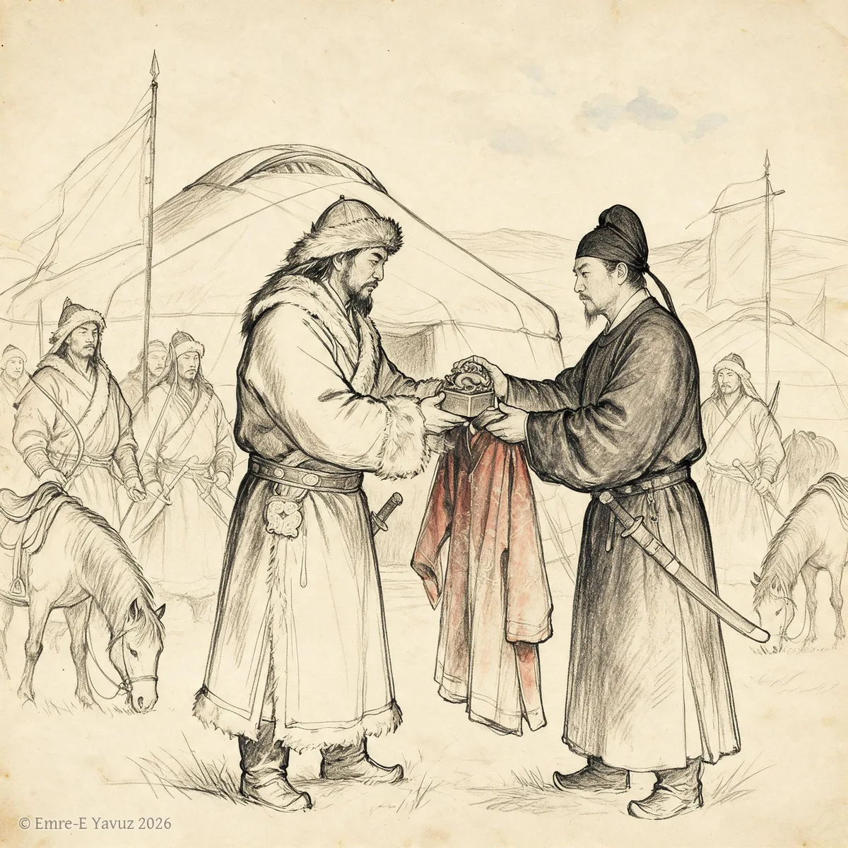
Loose-rein prefectures in a modern illustration. © Emre-E Yavuz 2026 Ana görsel Yer aldığı yer: Loose-rein prefectures
-
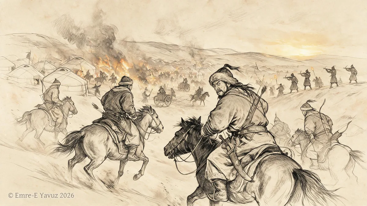
Mobei campaign, 119 BC in a modern illustration. © Emre-E Yavuz 2026 Ana görsel Yer aldığı yer: Mobei seferi, MÖ 119
-
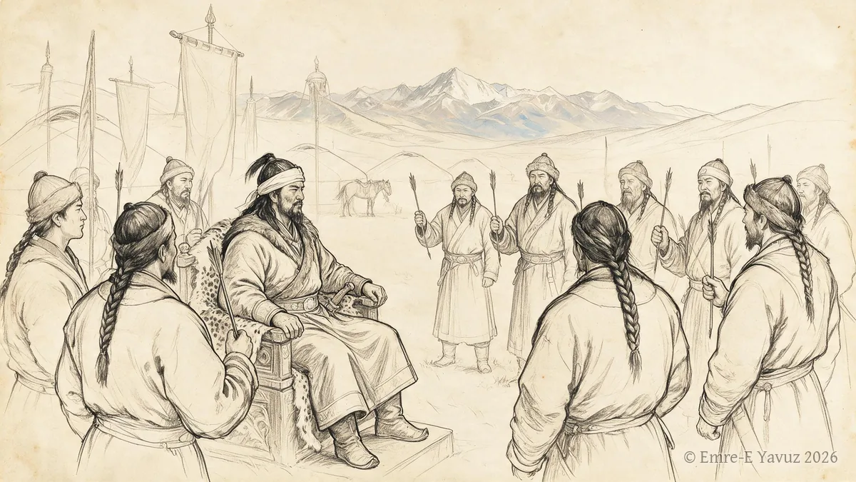
On Oq in a modern illustration. © Emre-E Yavuz 2026 Ana görsel Yer aldığı yer: On Oq
-
Ötüken in a modern illustration: an inscribed stele in the forested upland, with swords set upright in the ground around it. © Emre-E Yavuz 2026 Ana görsel Yer aldığı yer: Ötüken
-

A peri at a spring in a modern illustration: the shape the being takes in later Turkic storytelling, not in any source of the khaganates. © Emre-E Yavuz 2026 Ana görsel Yer aldığı yer: Peri
-
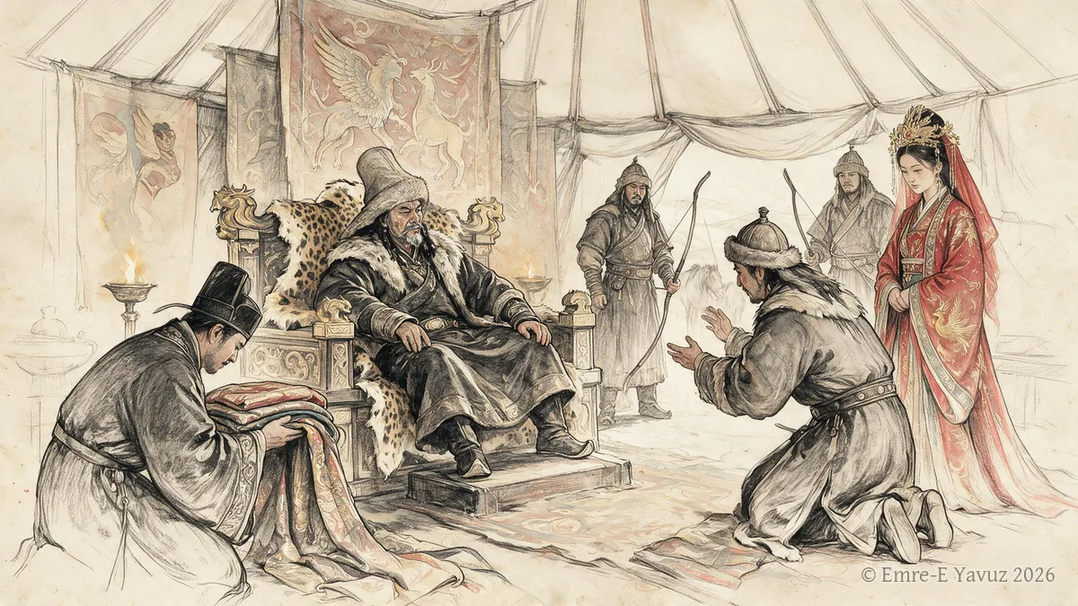
Rise of Anagui Khan in a modern illustration. © Emre-E Yavuz 2026 Ana görsel Yer aldığı yer: Anagui Kağan'ın Yükselişi
-
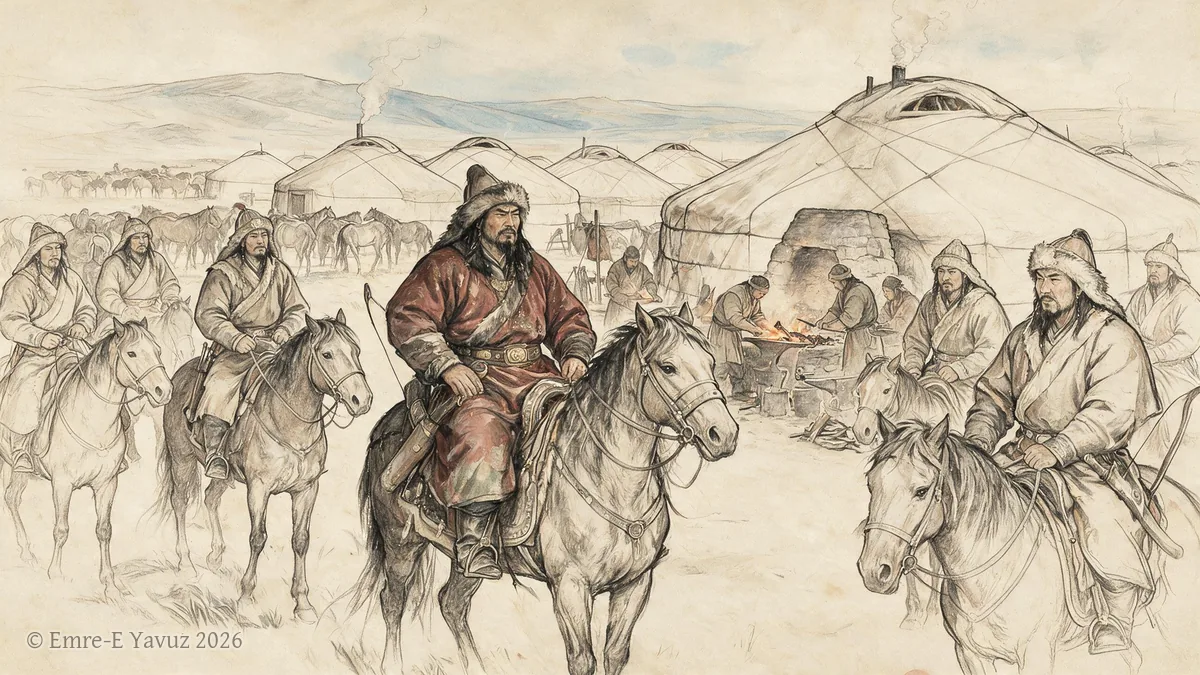
Rouran in a modern illustration. © Emre-E Yavuz 2026 Ana görsel Yer aldığı yer: Rouran
-
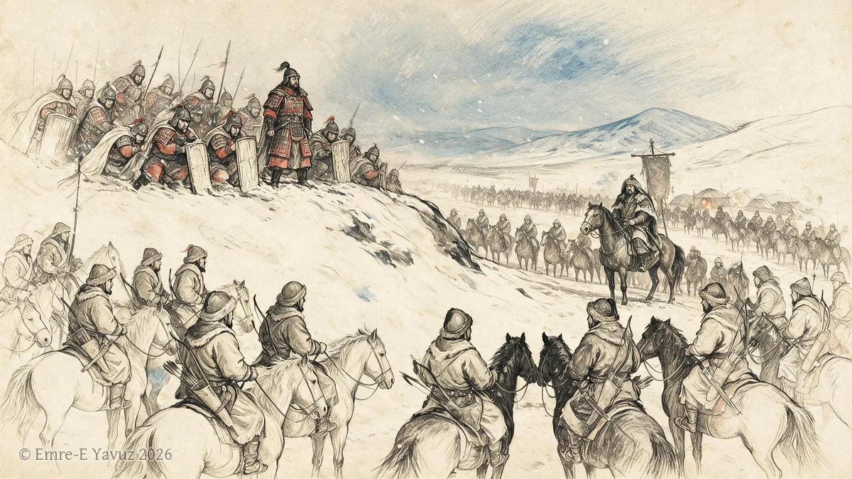
Siege of Baideng in a modern illustration. © Emre-E Yavuz 2026 Ana görsel Yer aldığı yer: Baideng Kuşatması
-
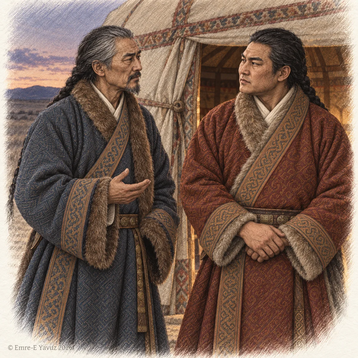
Two Göktürk dignitaries in conversation at the entrance of a felt tent at dusk, in a modern drawing. © Emre-E Yavuz 2026 Ana görsel Yer aldığı yer: Sifa
-
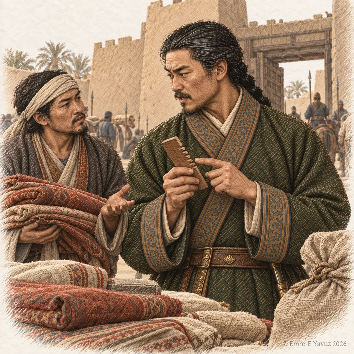
An officer with a comb at a walled market town, in a modern illustration: the hair of the title's name and the office likened to a prefect's. © Emre-E Yavuz 2026 Ana görsel Yer aldığı yer: Suoge Tudun
-
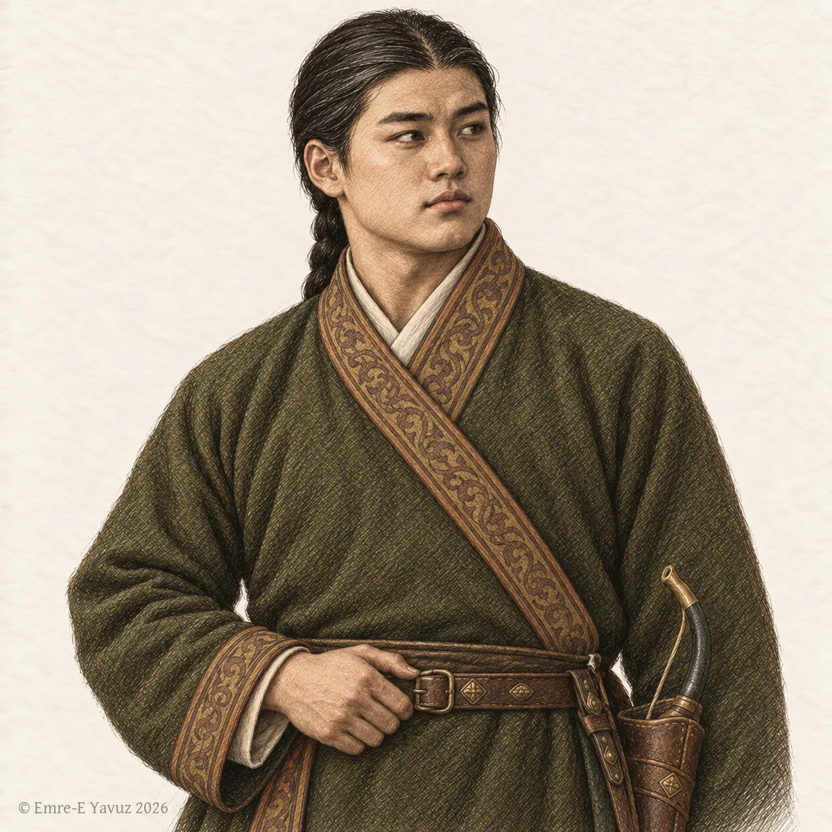
A young Göktürk prince, a tegin, in a modern drawing. © Emre-E Yavuz 2026 Ana görsel Yer aldığı yer: Tegin
-
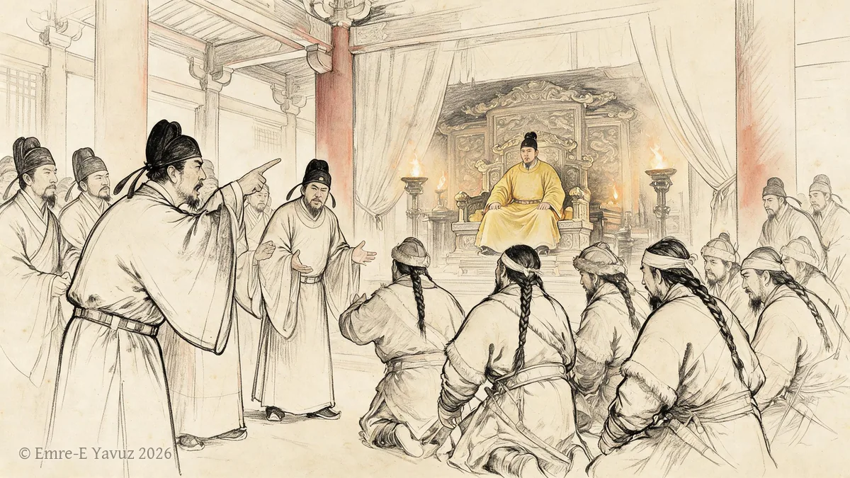
The Court Debate of 630 in a modern illustration. © Emre-E Yavuz 2026 Ana görsel Yer aldığı yer: 630 Saray Tartışması
-
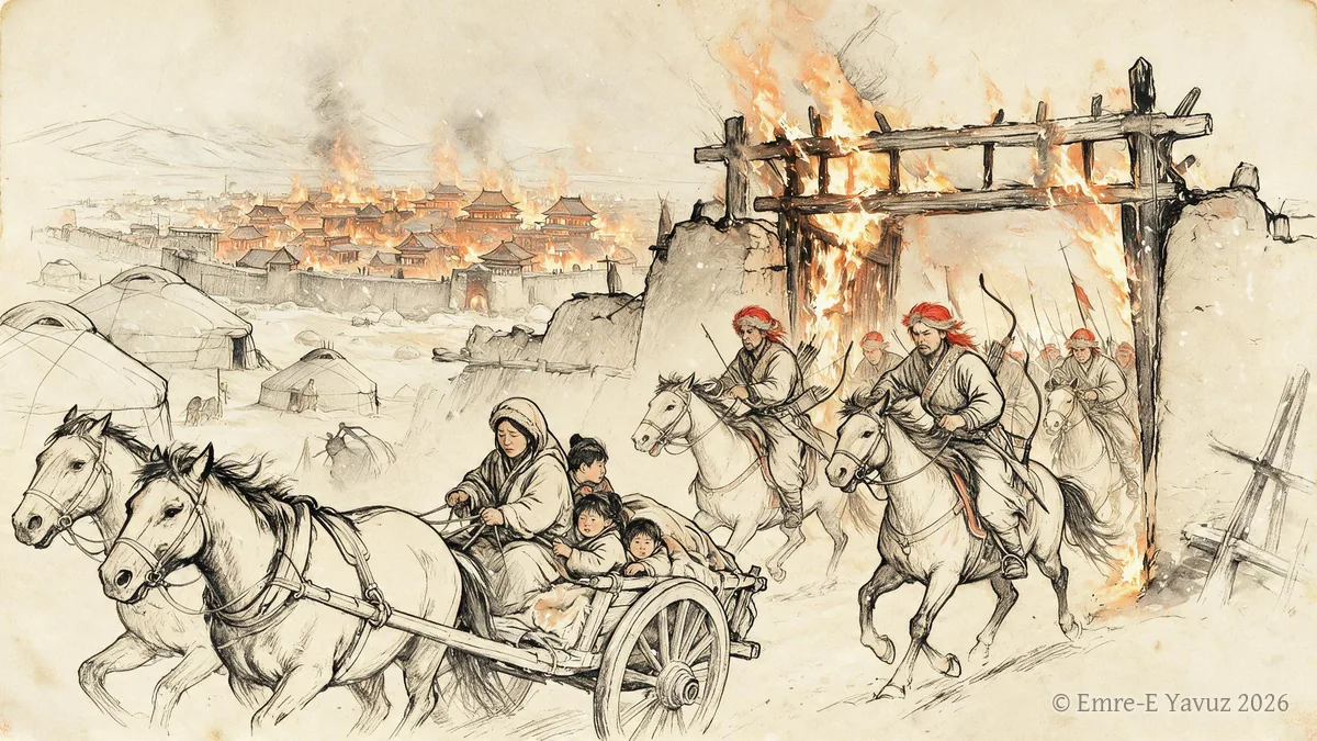
The fall of Ordu-Balık, 840 in a modern illustration. © Emre-E Yavuz 2026 Ana görsel Yer aldığı yer: Ordu-Balık'ın düşüşü, 840
-
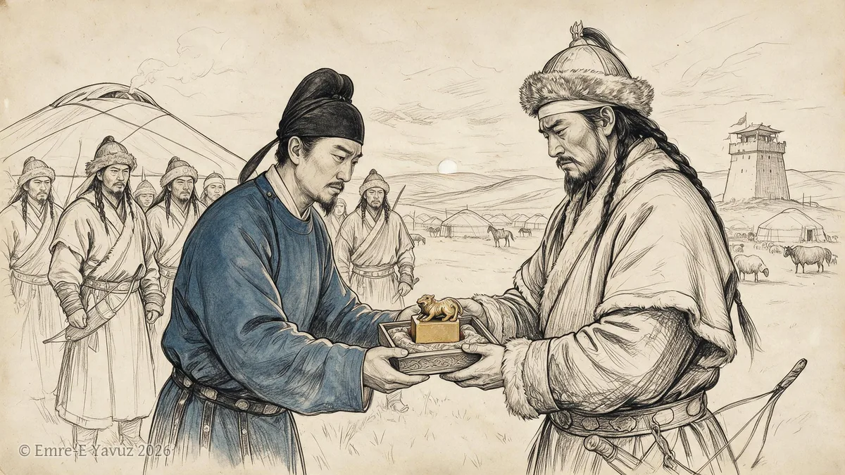
The Göktürk interregnum, 630–682 in a modern illustration. © Emre-E Yavuz 2026 Ana görsel Yer aldığı yer: Göktürk fetret dönemi, 630–682
-
The Huns and the Xiongnu in a modern illustration. © Emre-E Yavuz 2026 Ana görsel Yer aldığı yer: Hunlar ve Asya Hunları
-
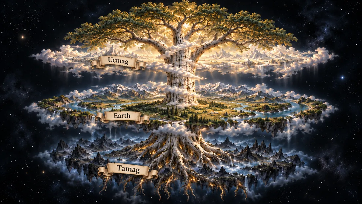
The tiered cosmos in a modern illustration: Uçmag above, the earth in the middle, Tamag below, the world tree through all three. © Emre-E Yavuz 2026 Ana görsel Yer aldığı yer: Üç dünya
-
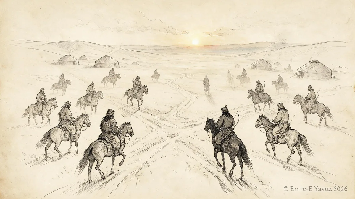
The Turkic ethnogenesis debate in a modern illustration. © Emre-E Yavuz 2026 Ana görsel Yer aldığı yer: Türk etnogenezi tartışması
-
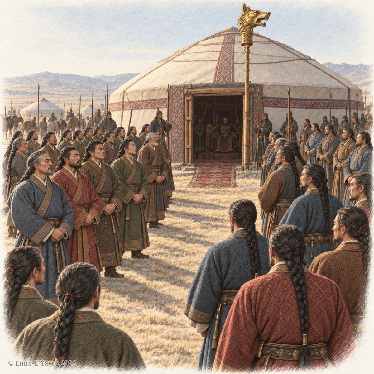
The officers of the khaganate before the khan's tent in a modern illustration, beneath the standard with the golden wolf's head. © Emre-E Yavuz 2026 Ana görsel Yer aldığı yer: Yirmi Sekiz Rütbe
-
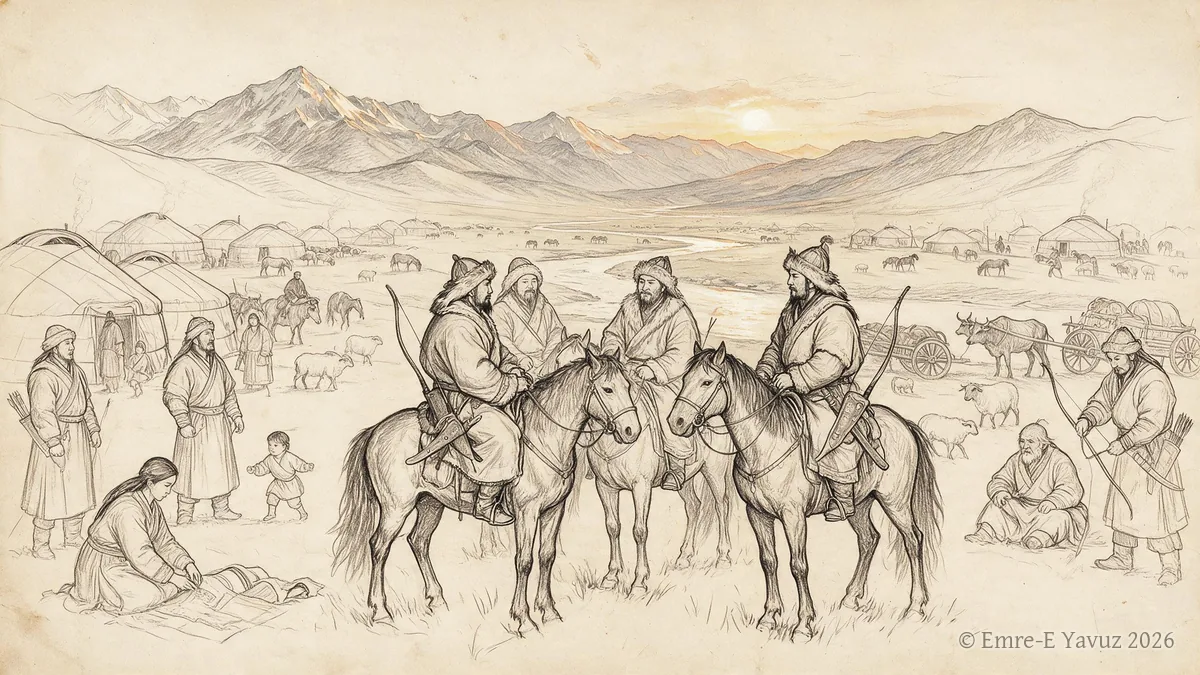
Tiele in a modern illustration. © Emre-E Yavuz 2026 Ana görsel Yer aldığı yer: Tiele
-
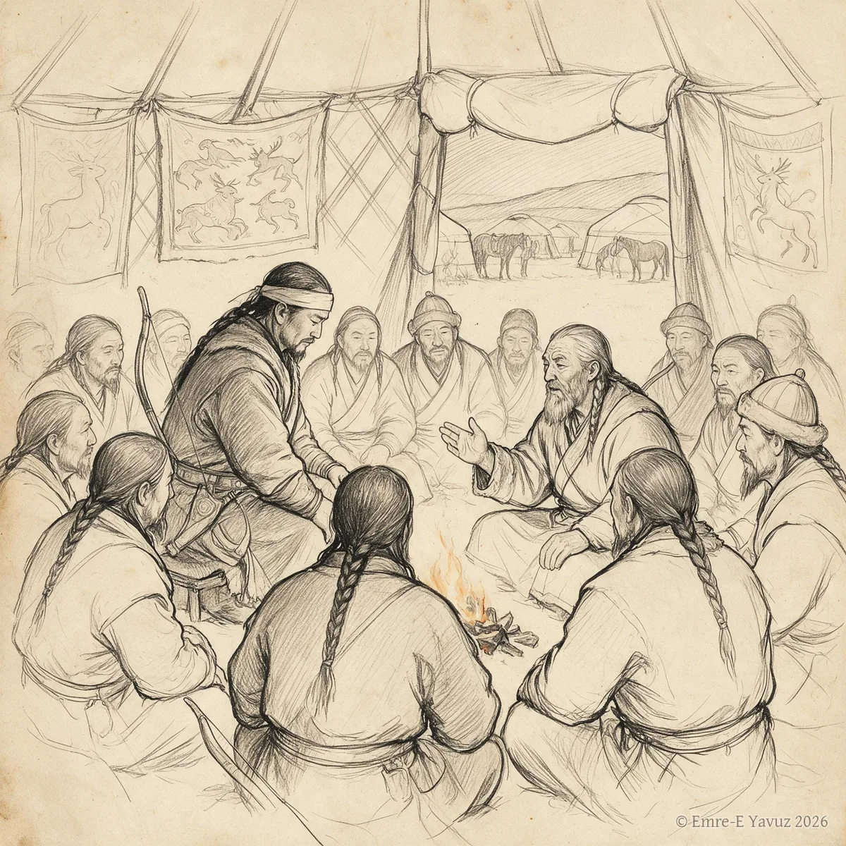
Töre in a modern illustration. © Emre-E Yavuz 2026 Ana görsel Yer aldığı yer: Töre
-
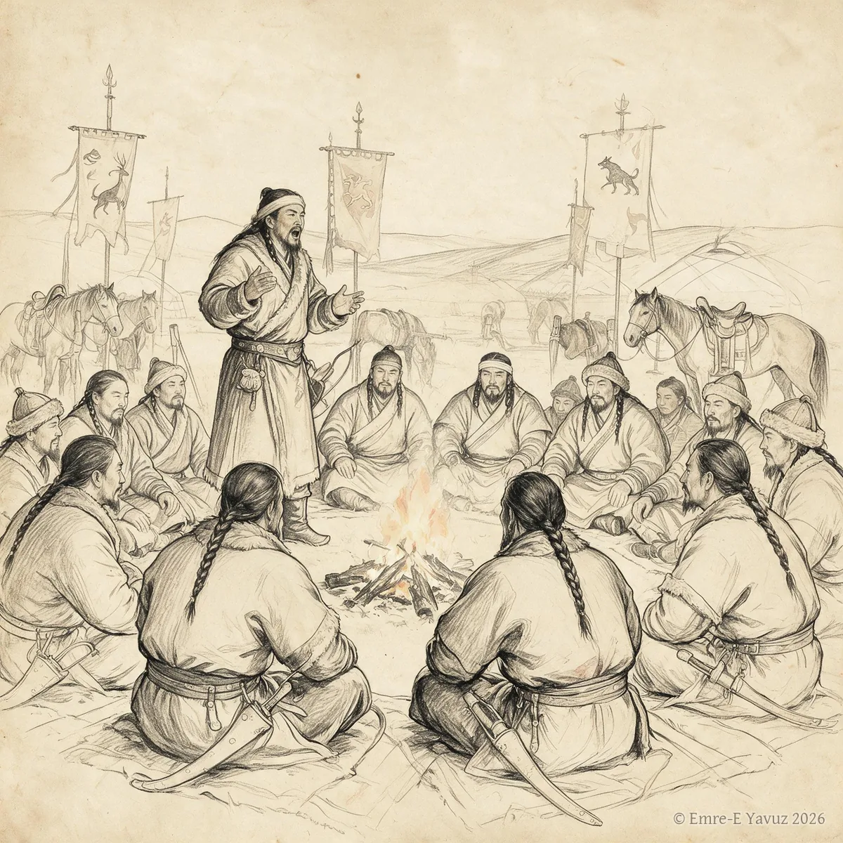
Toy in a modern illustration. © Emre-E Yavuz 2026 Ana görsel Yer aldığı yer: Toy
-

Ulukayın in a modern illustration: the birch at the centre of the world, its crown among the stars. © Emre-E Yavuz 2026 Ana görsel Yer aldığı yer: Ulukayın
-
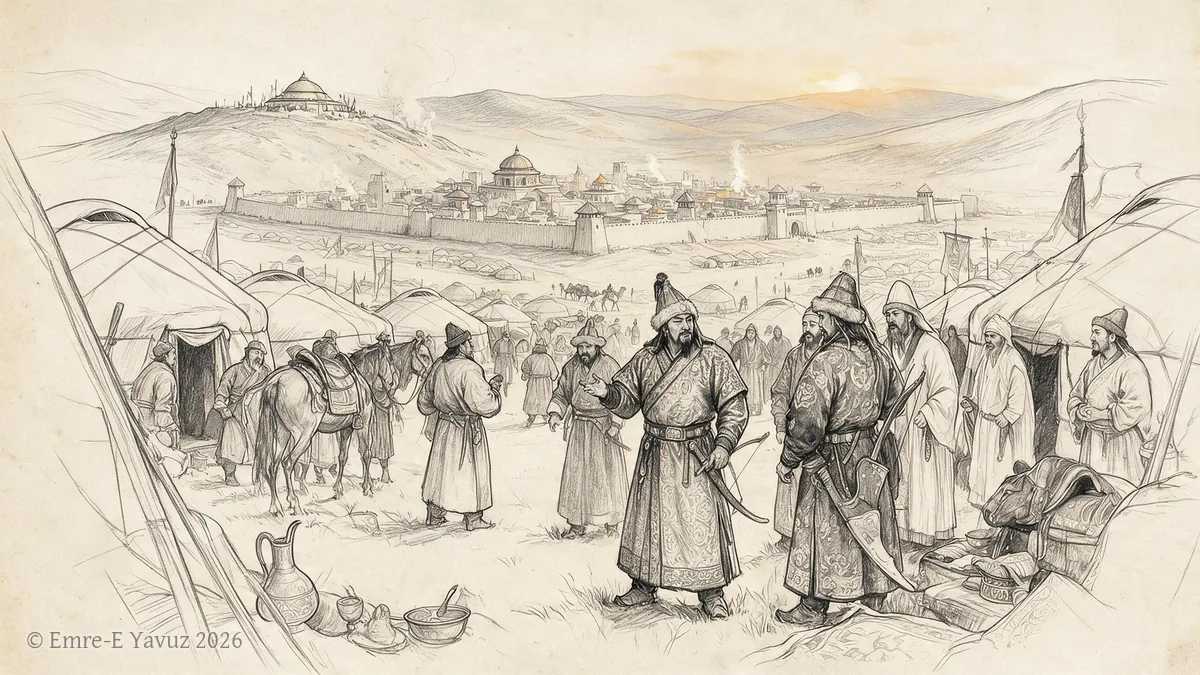
Uyghur Khaganate in a modern illustration. © Emre-E Yavuz 2026 Ana görsel Yer aldığı yer: Uygur Kağanlığı
-
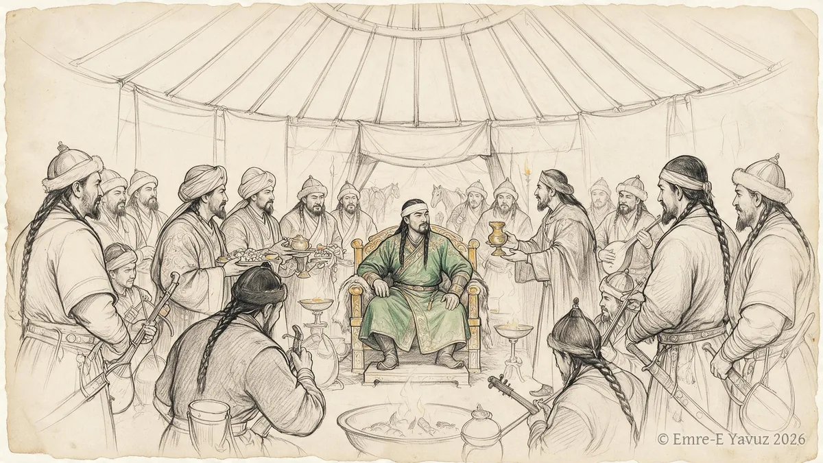
Western Göktürk Khaganate in a modern illustration. © Emre-E Yavuz 2026 Ana görsel Yer aldığı yer: Batı Göktürk Kağanlığı
-
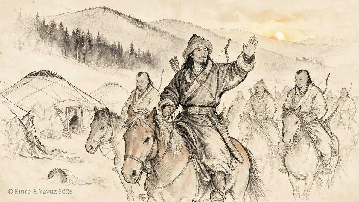
Xianbei in a modern illustration. © Emre-E Yavuz 2026 Ana görsel Yer aldığı yer: Xianbei
-
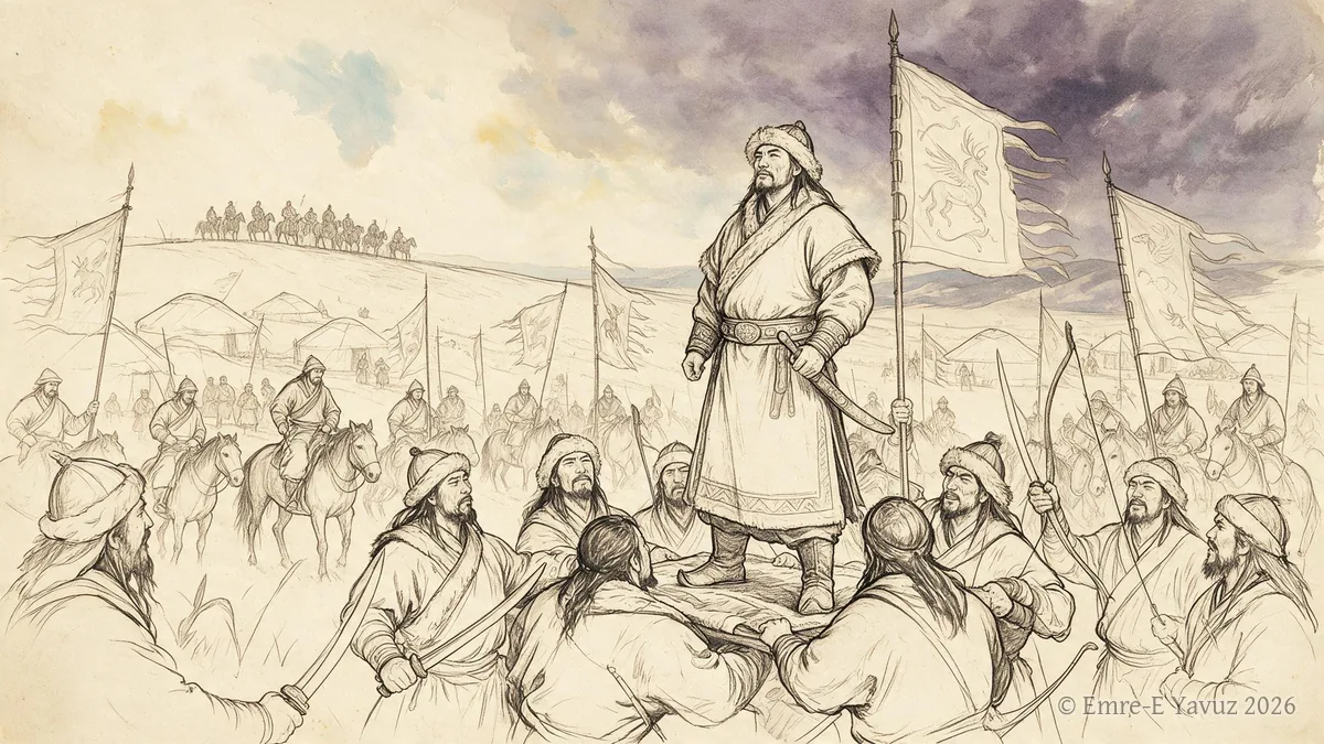
Xiongnu split of 48 in a modern illustration. © Emre-E Yavuz 2026 Ana görsel Yer aldığı yer: Asya Hunlarının bölünmesi, 48
-
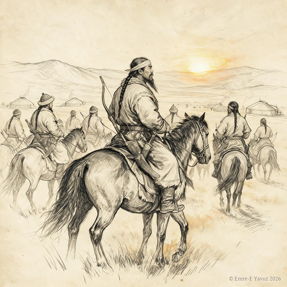
Yabgu in a modern illustration. © Emre-E Yavuz 2026 Ana görsel Yer aldığı yer: Yabgu
-
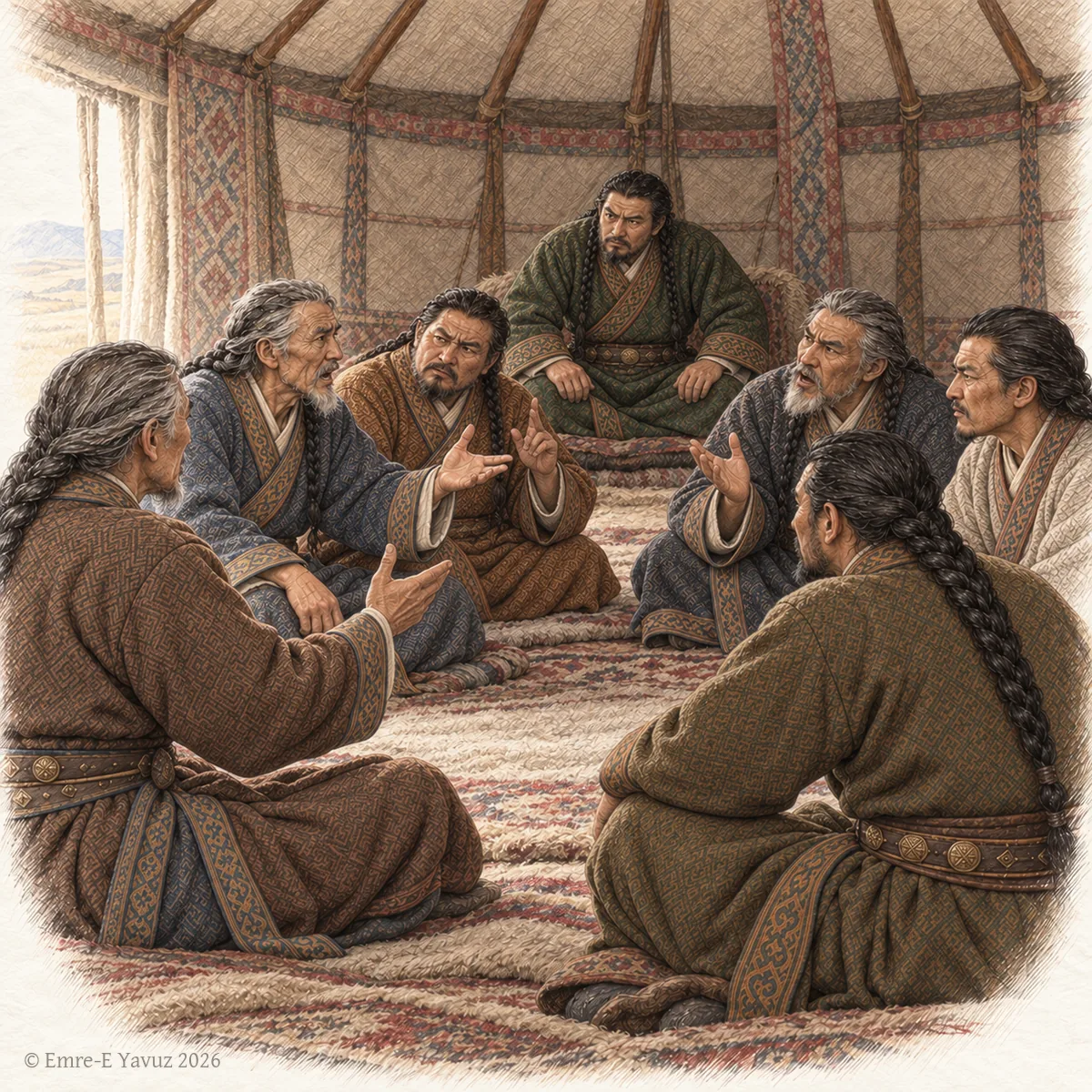
Elders of the western Göktürks in council inside a felt tent, the khan listening at the back, in a modern drawing. © Emre-E Yavuz 2026 Ana görsel Yer aldığı yer: Yanhongda
-
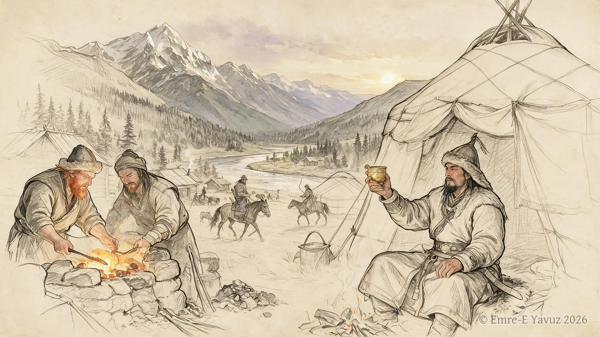
Yenisei Kirghiz in a modern illustration. © Emre-E Yavuz 2026 Ana görsel Yer aldığı yer: Yenisei Kirghiz
-
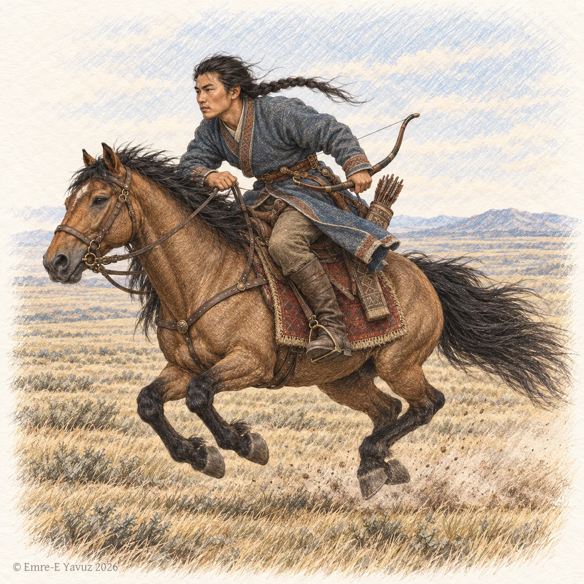
A Göktürk rider at the gallop in a modern illustration: the bravery and strength that the word names. © Emre-E Yavuz 2026 Ana görsel Yer aldığı yer: Yinghefu
-
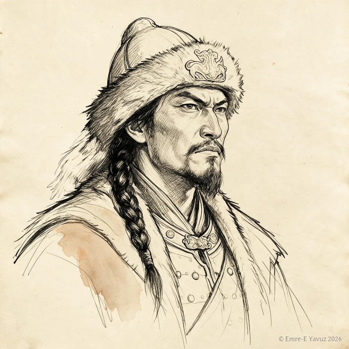
Zhizhi Chanyu in a modern portrait. © Emre-E Yavuz 2026 Ana görsel Yer aldığı yer: Zhizhi Chanyu
-
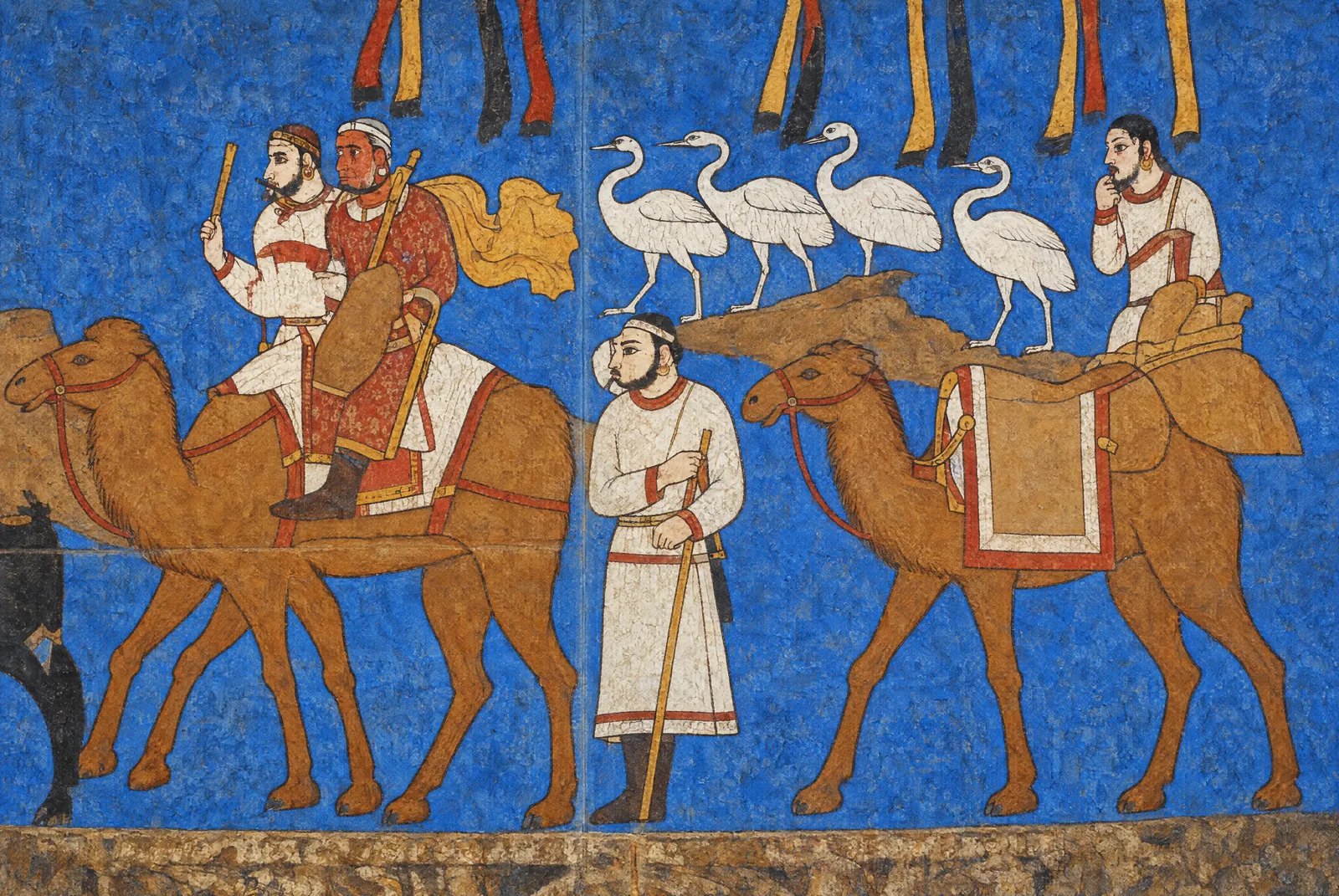
Riders on camels, a line of white birds and a standing man in the procession on the south wall of the Hall of the Ambassadors, seventh century: the painting as it survives, and the same section in an original artistic reconstruction for the atlas, after the photograph. The reconstruction restores the faded colours and fills the losses of plaster. What it paints into the losses, the saddled camel on the right among them, is conjecture. Photograph: Carole Raddato, CC BY-SA 2.0. Reconstruction: original artistic rendering for the atlas after this photograph, 2026, CC BY-SA 2.0. Metin içinde Yer aldığı yer: Afrasiab paintings
-
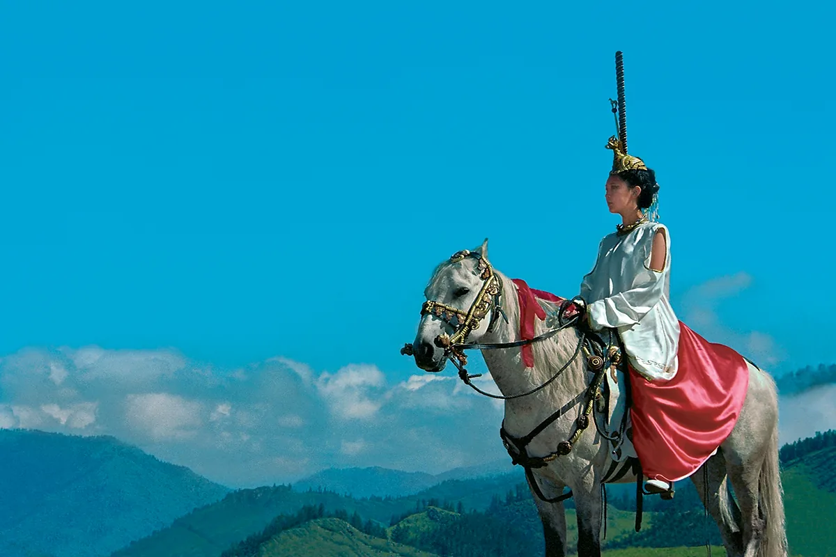
A rider in a modern reconstruction of the dress of the Pazyryk barrows: the tall headdress, the light blouse and the red skirt. A staged photograph of the present day, not a find. Metin içinde Yer aldığı yer: Altay
-
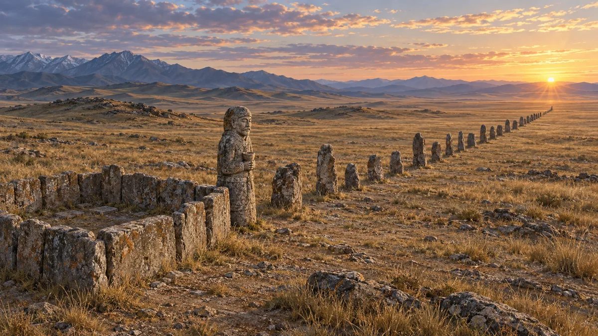
A memorial enclosure in an original artistic rendering for the atlas: the setting of stone slabs, the carved figure with the cup at the chest, and the line of balbals running east toward the sunrise. It shows no particular site. © Emre-E Yavuz 2026 Metin içinde Yer aldığı yer: Gömü ve balbal
-
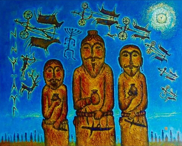
Three carved figures with cups at the chest and daggers at the belt, in a modern painting. Behind them the painter has set chariots, deer and an archer in the manner of steppe rock art, and signs in the manner of Old Turkic runes; a line of stones runs along the horizon. Metin içinde Yer aldığı yer: Gömü ve balbal
-
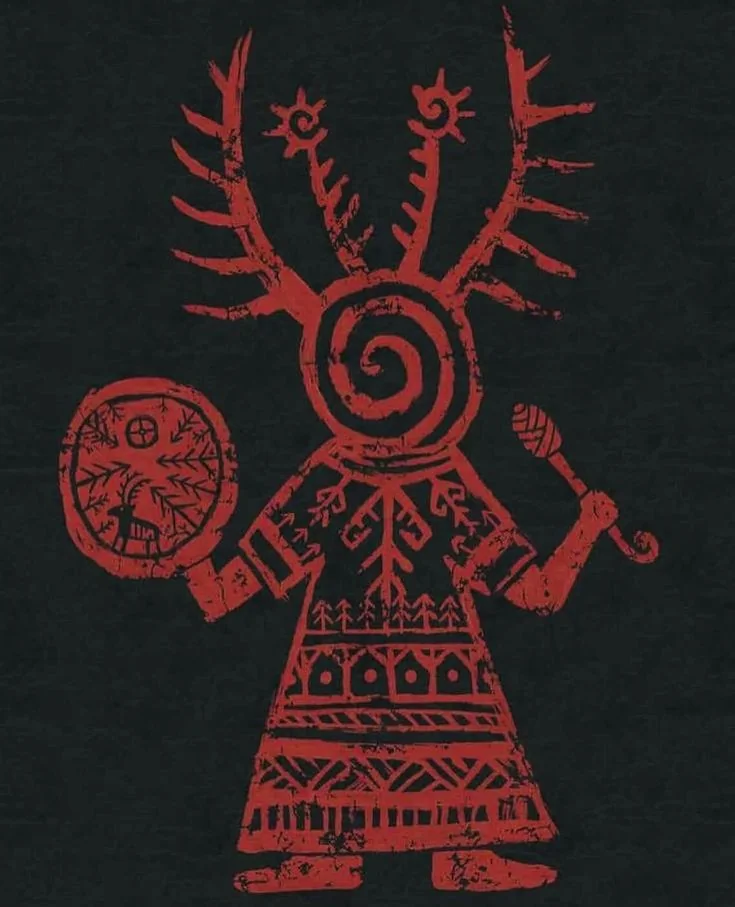
A kam with drum and beater, in a modern graphic in red on black: an antlered headdress, a spiral in place of the face, and a drum marked with a deer and trees. Metin içinde Yer aldığı yer: Kam (Türk şamanı)
-
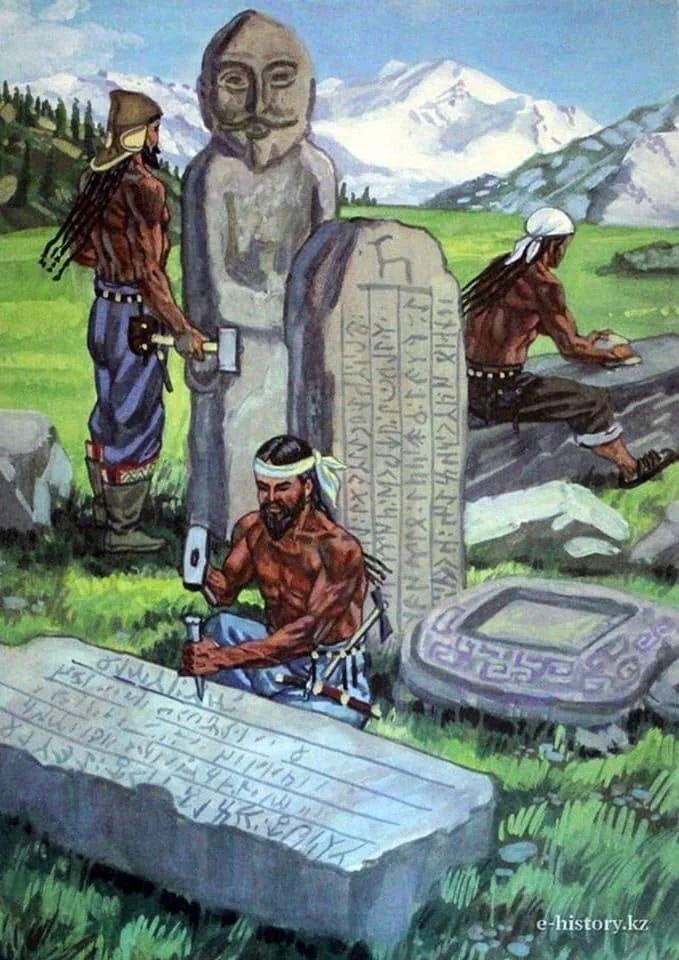
The cutting of runic stones on the steppe, in a modern illustration. The inscription names its makers otherwise: the carvers were sent by the Chinese emperor, and Yollug Tegin wrote the text. Illustration as published by e-history.kz. Metin içinde Yer aldığı yer: Kül Tegin Yazıtı
-
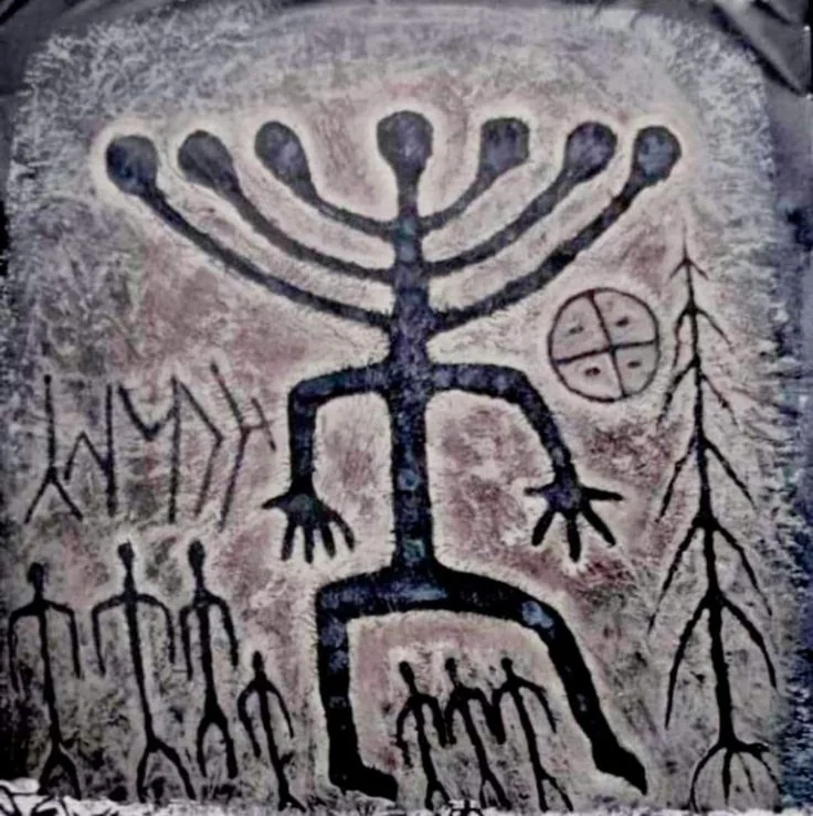
A figure with a rayed head over a row of smaller figures, beside a quartered circle, a tree and signs in the manner of Old Turkic runes: an image in the style of steppe rock art. Metin içinde Yer aldığı yer: Tengri
-
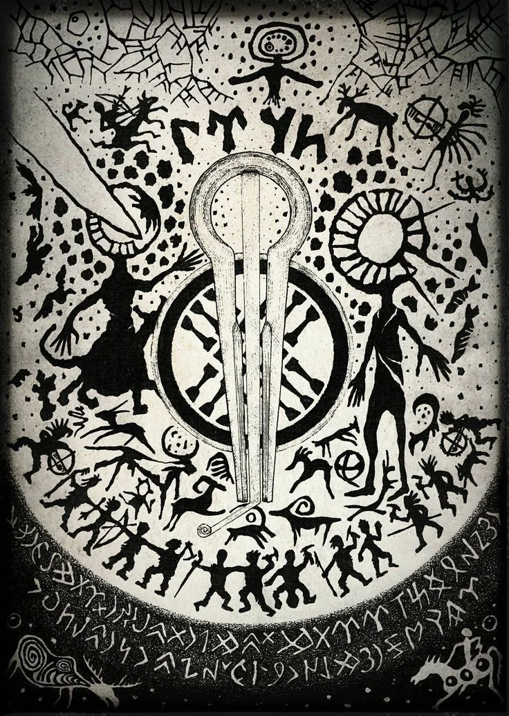
A modern drawing that gathers motifs of present-day Tengrism: a jaw harp over a spoked wheel, figures in the manner of steppe rock art, a figure with a sun for a head, and bands of signs in the manner of Old Turkic runes. It belongs to the modern revival, not to the sixth century. Metin içinde Yer aldığı yer: Tengricilik
-
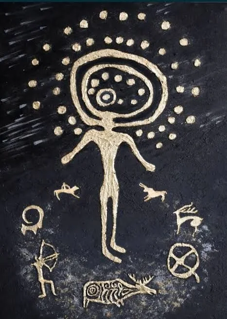
A figure with a rayed head among an archer, deer, an elk and a spoked wheel: a modern rendering in gold on black after the rock art of Kazakhstan. Metin içinde Yer aldığı yer: The steppe before the Xiongnu
-
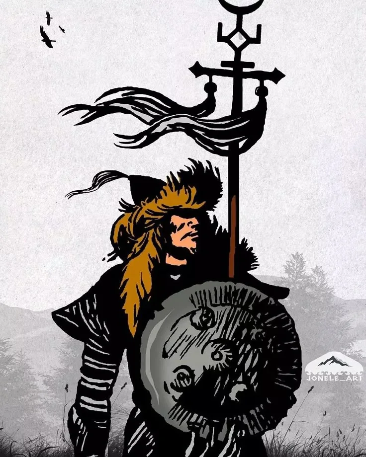
A steppe warrior beneath a standard with a metal finial and long streamers, in a modern drawing. Drawing: signed jonele_art. Metin içinde Yer aldığı yer: Tuğ
-
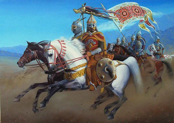
Göktürk riders under a standard with a wolf’s head, in a modern painting. The Zhou Shu reports that a golden wolf’s head was set on the Göktürk standards; the armour, the banner and the scene are the painter’s. Metin içinde Yer aldığı yer: Tuğ
-
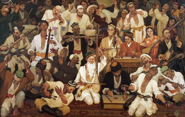
Muqam , a painting of 1984 by the Uyghur painter Ghazi Ehmet: singers and musicians of the Uyghur muqam with long-necked lutes, fiddles, a dulcimer, frame drums and flutes. It shows the Uyghurs of the twentieth century, eleven centuries after the dispersal of 840. Painting: Ghazi Ehmet, 1984. Metin içinde Yer aldığı yer: Uyghurs
-
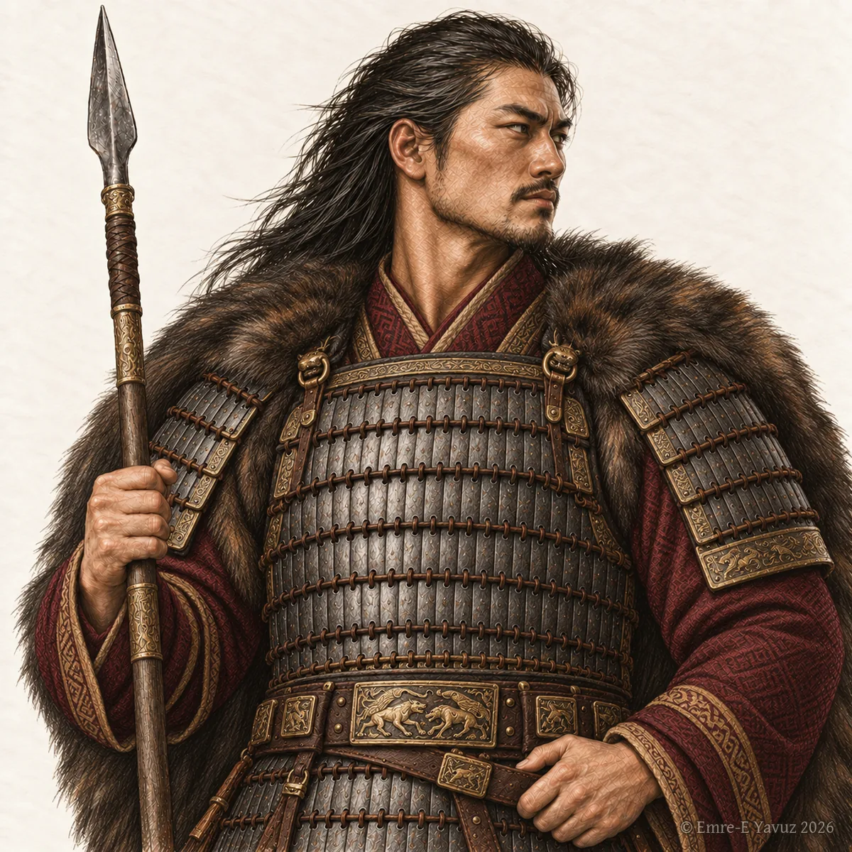
Bir okuma yolunun kapak görseli. Okuma yolu Yer aldığı yer: Asya Hunları ve Hunlar Çağı
-
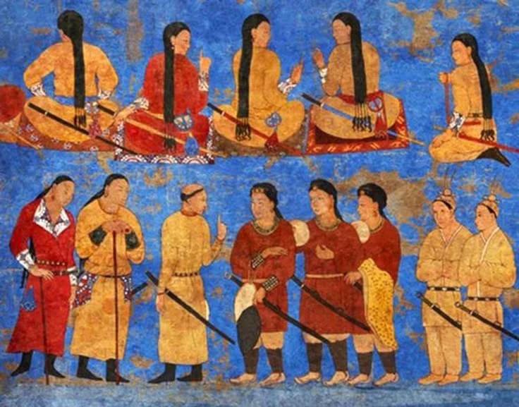
Bir okuma yolunun kapak görseli. Okuma yolu Yer aldığı yer: Aşina Hanedanı
-
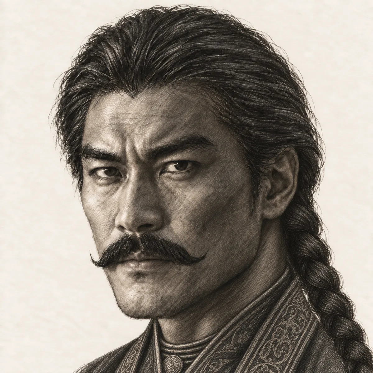
Bir okuma yolunun kapak görseli. Okuma yolu Yer aldığı yer: Göktürklerin Yükselişi
-
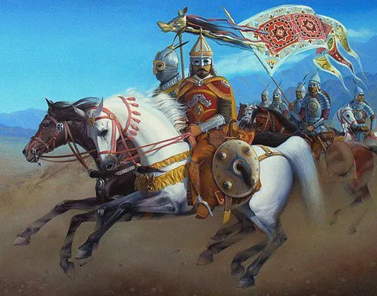
Bir okuma yolunun kapak görseli. Okuma yolu Yer aldığı yer: Göktürk Bağımsızlık Savaşı
-
Bir okuma yolunun kapak görseli. Okuma yolu Yer aldığı yer: Bozkırın Dünyası
-
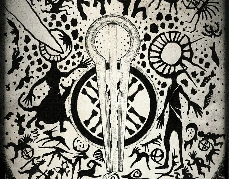
Bir okuma yolunun kapak görseli. Okuma yolu Yer aldığı yer: Türk Kozmolojisi
-
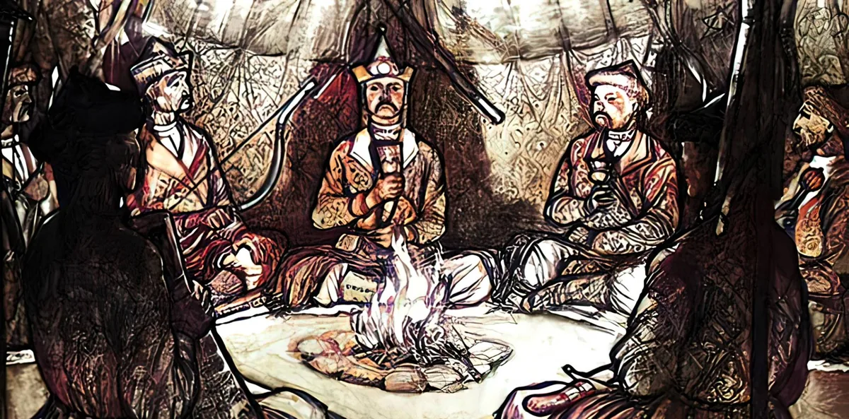
Türk Töresi sayfasındaki bir grubun kapak görseli. Türk Töresi Yer aldığı yer: Töre ve kurultay
-
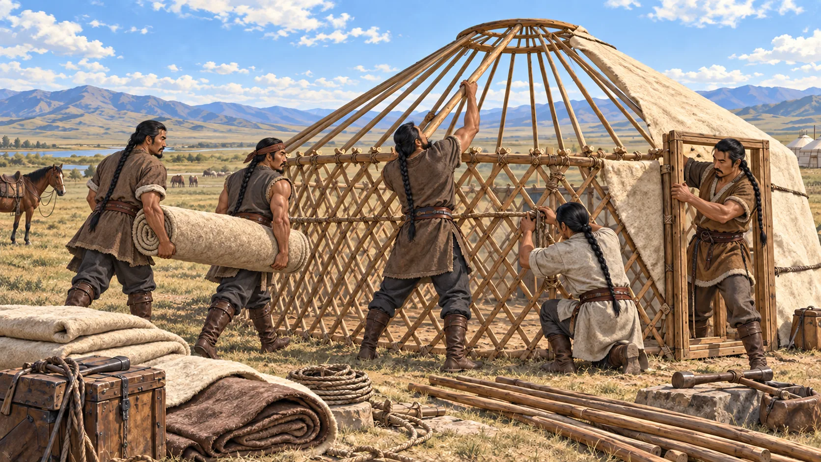
Henüz yazılmamış maddeler için olan sayfanın görseli. Sayfa Yer aldığı yer: Bu madde daha gelecek




